It was into the second summer of being here in Newfoundland when I realized that the highpoint of the island wasn't the famed and well-traveled Gros Morne, but rather the poorly-known Cabox. Having been on an east coast trip where I walked 100 ft into the woods to the highest point of Rhode Island, stopped in suburbia and crossed the street to Delaware's highpoint & walked up a schoolyard hill to Ohio's Campbell Hill; a burgeoning, internal interest in highpoints was growing. Setting out to see state highpoints naturally lead to looking up Canada's provincial highpoints. Looking at the list, you find that 6 wouldn't be hard at all, while the other 7 would be monumental in their required mountaineering skills, financing of float planes and commitment of time & energy. The province of Newfoundland & Labrador's highpoint is Mount Caubvick up in the Torngats of northern Labrador - which I only mention here for educational sake, since getting to the Torngats is a lifetime accomplishment in itself. Forget about then canoeing up a river, hiking a canyon and trying to avoid death from polar bears, sharp cliffs and weather. My casual desires to see the occasional highpoint would instead be more than fulfilled by the Island of Newfoundland's more reasonable peak - the Cabox. |
Nicole & I set off from home at some casual hour, knowing that there was a 30km dirt road to drive down first, but doubting that climbing the Cabox would be all that tricky. I was obviously much wetter behind the ears back then, thinking that because there was a highpoint and reading about some semblance of a trail, that there must be trail markings, a worn path, smooth gravel road and copious amounts of signage. |
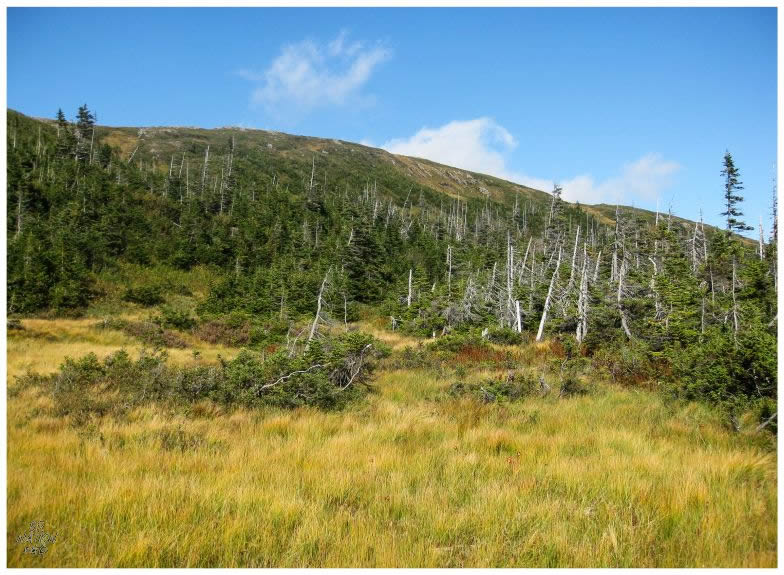
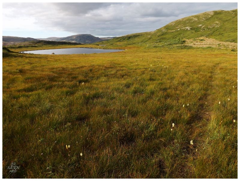
The two of us didn't even make it to the trailhead, diving into the forest and fighting through bogs & thickets, tip-toeing around ponds and trying to move west towards the Lewis Hills where the Cabox laughed at our disorganized attempt. We ended up climbing a hill and rounding around until we ended up back on the road. This is a picture I took as we had started back and had given up, showing what I think to be this pond. The funny thing being that back in 2010, I never realized Nicole & I made it this far. It's only now, 5 years later, that I realize were weren't too far from the proper canyon/route! |
I gave The Cabox another try in the summer of 2011, this time recruiting my friend Jaimie for what I had now researched and knew to be a much more grueling hike. In addition, I had been exploring Newfoundland more & discovering how trails here can be left for you to navigate and figure out on your own. Armed with better directions and the knowledge to drive a bit further up the road, we then made for the woods as Jaimie's dog circled us while we took our time to try & go the right way. |
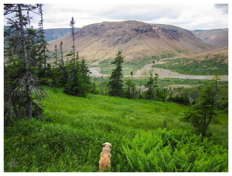
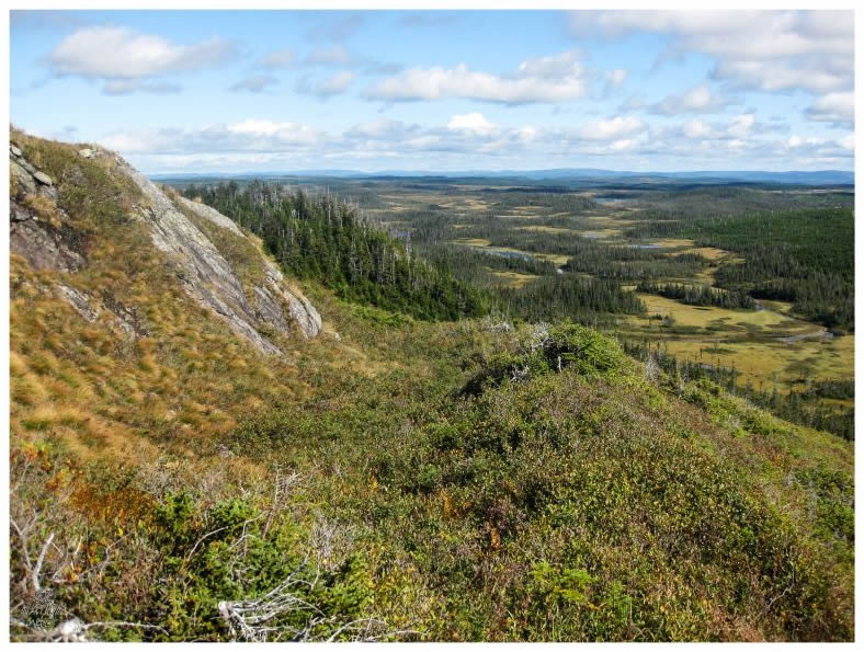
The above picture shows us making better progress, while still a bit south of the conventional route to the summit (that route would be to the right of this picture). The only difference in the routes being that there were a few more trees and drops here, than if one somehow naturally knew to go to the grasslands to our north. It was in the trees and rocky drops that Jaimie landed awkwardly and worried about her foot, but continued onward. |
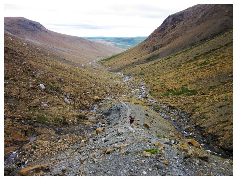
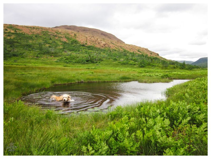
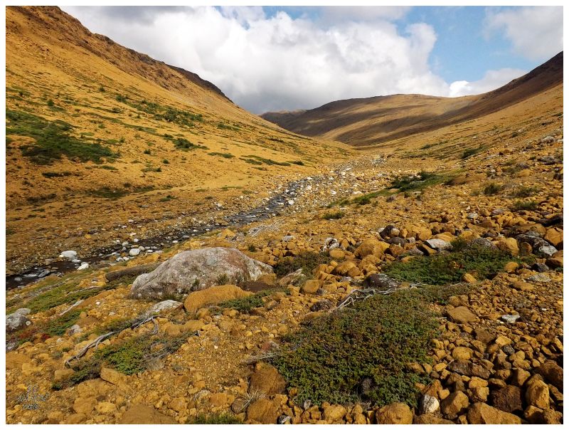
We soon found the banks of the Fox Island River, the water flowing between us and the shrubless canyon that would be much easier to navigate. There's a watering hole right at the base of this canyon & we decided to go for a refreshing dunk of feet and heads, just as a father and son came upon us. These two men were out here prospecting and while I knew that we had left too late and couldn't possibly make it to The Cabox at this late hour, Jaimie would only then learn this when she explained to them what we were out here trying to do. The above shot shows our forward progress, after exhausting ourselves plodding up the hill and attacking the steep angles and loose rock to the top of the canyon. There were flatlands all around us up here, but it was still ~3 km/1.8 mi each way to the Cabox - and that's only if we navigated perfectly without any lost meanderings. It would be a couple of days later that Jaimie texted me & let me know she actually broke her ankle on that fall in the rocky brush. She was battling through the soreness as we hiked up the canyon, but I would never have guessed there was anything broken inside her hiking boot. I suppose it's an extra good thing that we didn't try to continue to the Cabox. |
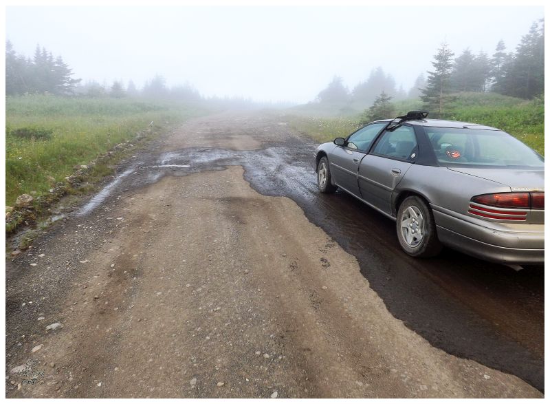
The Cabox would stick in my head like unfulfilled adventures do, but driving 30km/18mi on a rough road (each way) plus hiking 10km/6mi (each way) left it on the back burner for quite some time. Enough winters had snuck up on me that I finally decided to go get it done in the summer of 2014. Waking up early and setting off into the morning fog, I had forgotten the way by now & ended up taking a turn onto a rougher, impassable road. I brought my mountain bike to handle if my car came up a bit short or if I ran into a washout, but I wasn't thinking about 12km short! Bike 12km, then hike 20km, then bike 12km back? I went home. (American: Bike 7.5mi, then hike 12mi, then bike 7.5mi back? I went home.) |
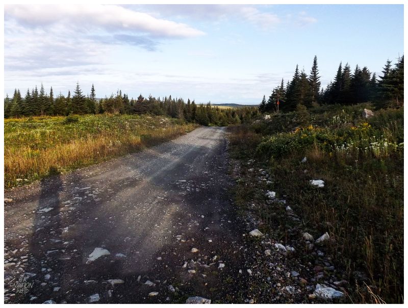
Instead of another handful of years passing by, only a few weeks would pass before I was headed back towards Stephenville, then up towards Cold Brook, then onto the woods access road behind town. I was concerned about the effort this hike required, but the weather was better this morning and things seemed to be going good. I found the correct route and was bumping along in the luxury sedan on the rutted and rocky road. |
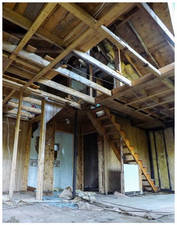
Of course there's always time to stop at the sight of an abandoned cabin though. |
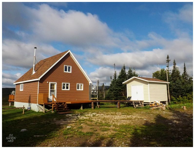
I pulled into the clearing where I remembered parking with Jaimie, but then I took the wrong path into the woods and popped out at someone's cabin instead. It's a good thing I enjoy seeing the beautiful cabins of Newfoundlanders, or else I might've been sour about an extra kilometer or two. |
Returning to the car, I quickly found the proper, marked path an almost comically short distance down the road. Tripping through the rolling trail, I soon spilled out into a land where I could see over all features, as none of the vegetation was higher than my thighs. |
Even though the International Appalachian Trail Network has made advancements and there's small signposts here and there, there still wasn't the type of trail you might picture. The trail split a few times and petered out at others, where I then noticed a bare hill and a path down to the Fox Island River you must cross. It looked like the watering hole was ahead & I knew that to be the correct canyon towards the Cabox. |
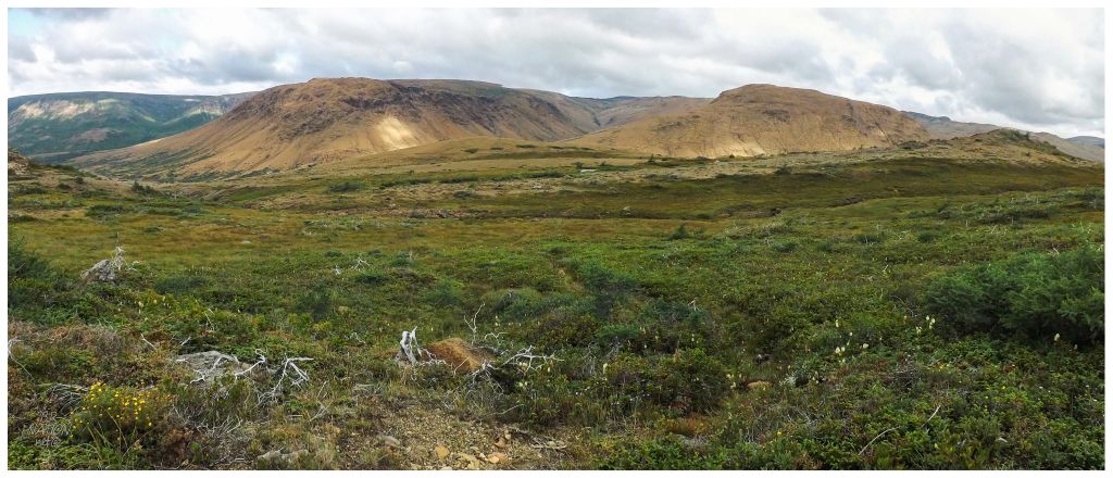
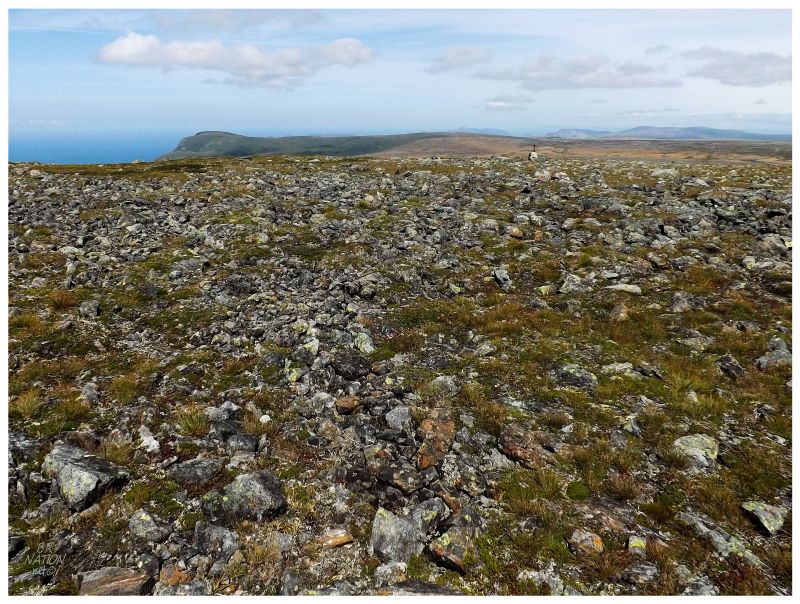
As far back as when James Cook surveyed Newfoundland in 1767, he noted the possibility for minerals and mining in these Lewis Hills. It would be another century and a half before a proper survey was done in the 1930s, but this has never led to any time of mining development here. Relatively narrow and off to the west of Newfoundland's railway line, the only human interaction you would have with the Lewis Hills is the forest access roads which cut around the forests that surrounds these hills, as well as the people who now branch off of those roads to have cabins in this fine landscape. There was copper mining at York Harbour where the Lewis Hills end at the Bay of Islands, but that's 30km north of here and a different Lewis Hill that's bisected by the Serpentine Valley. Without human habitation or workings, the reason a few Newfoundlanders have seen these hills is that they seem quite popular for snowmobiling. About half of the Google Earth pictures in this area have the white stuff instead of the iron-rich orange stuff that you see above. |
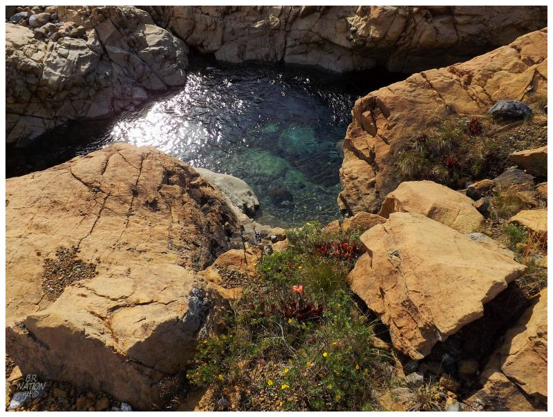
As for my hike, everything was going swimmingly. I was being efficient with my movements, I wasn't sweating very much & it was still relatively early. I would be back for the canyon's swimming hole, but it wasn't necessary now & the thought of it after a long day of hiking was enchanting. |
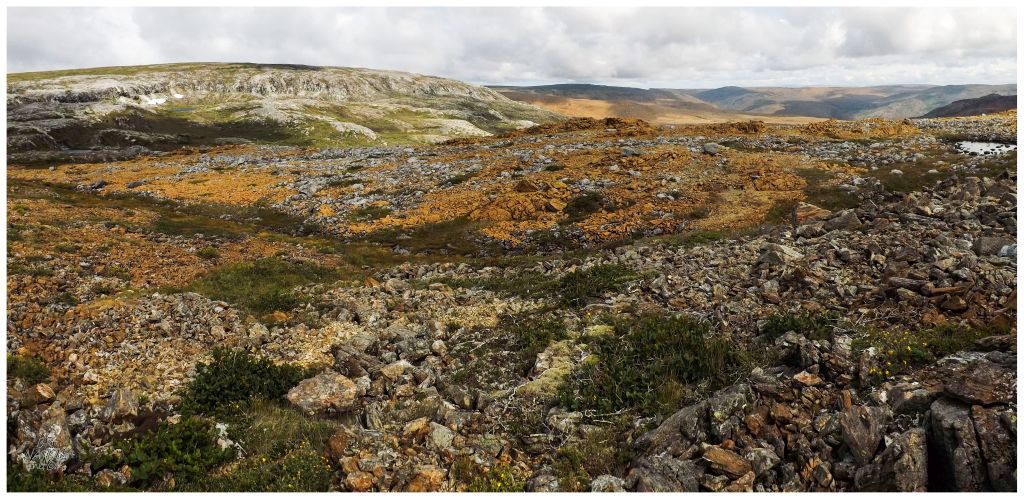
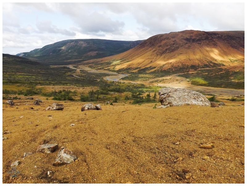
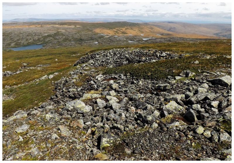
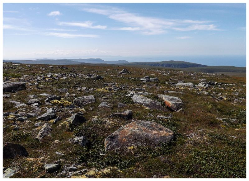
I marched up the canyon, happy with myself that I seemingly was having less trouble 3 years later. Hills and gentle valleys surrounded me, providing a multitude of different directions to hike & explore, but I needed to keep focused on the task at hand. This was now the fourth time I tried for the Cabox & a successful morning didn't guarantee anything this afternoon. I knew the Cabox to be off to the northwest from both my GPS and my knowledge of where I was standing. A big hill was almost directly northwest, one which I decided to skirt to the east, finding myself in a colour palette of orange, grey & green circles in a Geologist's dream. It's here that the Peridotite was more obvious, a rock that starts out as Earth's mantle before it comes to the surface and is weathered into an olive green coloured rock. |
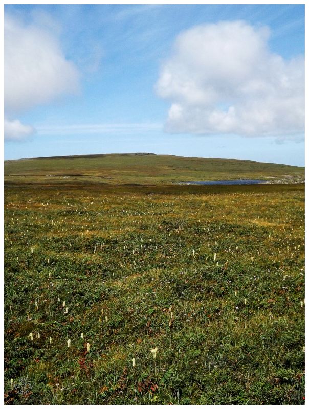
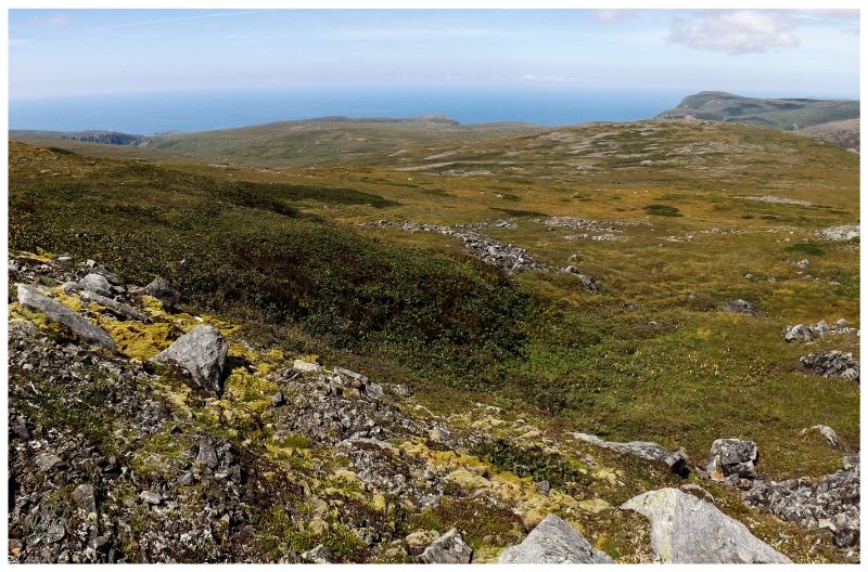
After hiking for another 20 or 30 minutes, I found the wall to my left growing in height and the land of orange, green & greys dipping down. I clearly now needed to climb this looming wall to the west. Pulling myself up the 100 feet in slimy rocks and large boulders, there were points where the angle was steep enough to conjure up thoughts of the fact that I was out here by myself. Moving up the hill and to the drier & shallower portions, it wasn't long before I pulled myself up one last rock and onto a grassy plateau. A land of orange rock so acidic that it grows next to nothing and green rocks with almost nothing besides lichen, had all switched to a soft, flat land with grasses nicer than your average Michigan home. |
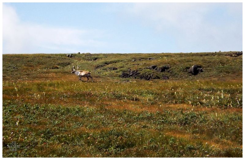
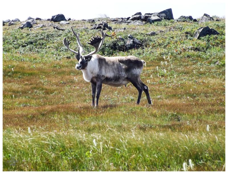
My intrigue with the grasses and this Mongolian landscape was suddenly interrupted by mammals around the same size as myself. The good thing was that these caribou posed little threat & after calmly studying me for a short while, the pair nonchalantly walked off to another end of the grasslands (there were 2 of them in real life, but I photographed the same one twice). |
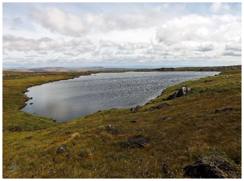
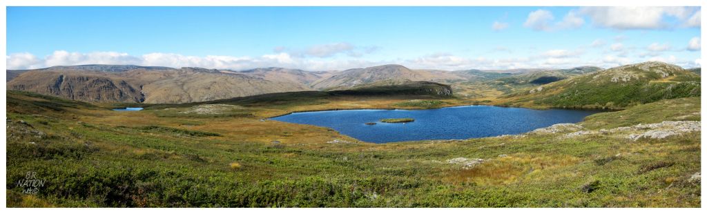
The geography nerd in me was loving all of these obscure, distant land & water features. Of course this lake wouldn't have a name for me to claim though. |
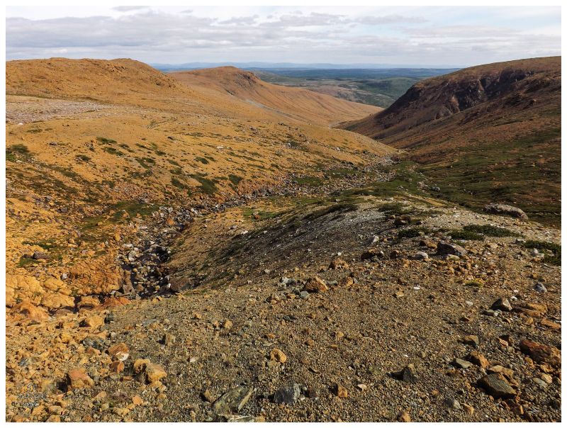
The grassland gained elevation in an almost indiscernible fashion, before a very small hill led to another plateau with an even softer grade. |
Just about there... |
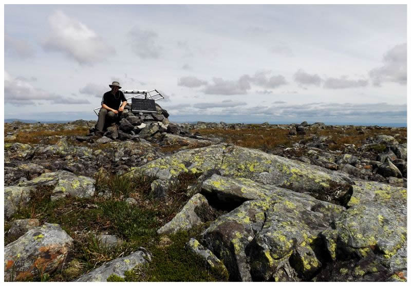
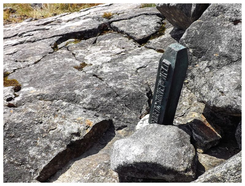
Picking my way around the rock field that surrounds the Cabox, I could see the marble marker up ahead and happily threw down my backpack. Closing in on six years of living on this island & I had finally reached its highpoint, all of 5m/16ft higher than Gros Morne! (The Cabox is 2664 ft vs Gros Morne is only 2648 ft.) |
I've seen a fair number of snowmobile pictures from up here & that seems to be the more popular method of summiting Newfoundland (it's the skidoo'ers that put up the marble plaque & maintain the marker). There are a couple of online blog posts from people hiking up here, but otherwise I remain curious as to how many people make it to the Cabox. Not just along this hiking route, but the entire land appeared quiet and devoid of people. Away from two or three cars I saw within the first 10km/6mi of the woods road out of Cold Brook, I hadn't seen another soul all day - and that's over some wide expanses (I wouldn't see another soul until I returned to Cold Brook either). |
I reached the peak at pretty much high noon, meaning that there weren't any pictures into the sun, but instead everything had the same harsh light. This picture looks to the northeast, where Corner Brook would be about 42km/26mi to the middle, middle-right. |
Through the haze and partly cloudy skies, Port-au-Port's Long Point was the furthest discernable feature. |
Looking east towards Molly Ann Canyon, I longed to set up base camp somehow and spend another day exploring these even harder to reach areas. There is a thru-hike where you go from the Lewis Hills and continue north until you eventually reach the Bay of Islands Highway outside Corner Brook, but it goes slightly inland from the coast shown in the above picture. I couldn't imagine how nice sunrise or sunset must be up here, no matter how hard I tried while sitting here. To watch the last or first light slowly moving over the flat, wide expanse of land features. With the acquiring of gear and experience, backcountry overnight camping trips like this are holding more and more appeal nowadays, although I still haven't completed any without the help of cabins instead of tents. |
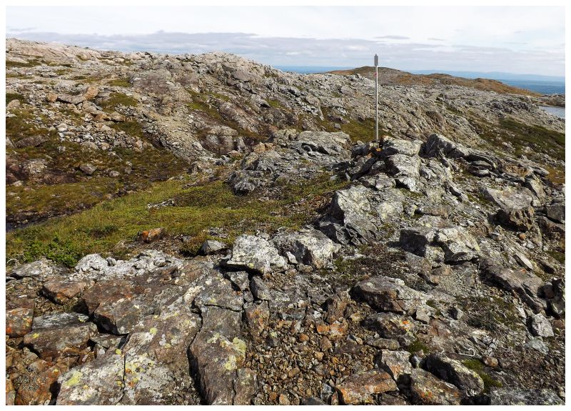
While I relaxed upon The Cabox and ate more of my lunch, I noticed trail signposts like those back in the initial grasslands, but now leading off to the north, going around the hill and towards the opposite way that I had come. I imagined that following these signposts might keep one from climbing a slippery 100 ft hill. Before setting off to follow these signposts, the last bit of business on Newfoundland's highpoint was to look for the cap box, but unfortunately the namesake box of hunter's bullets was long gone. |
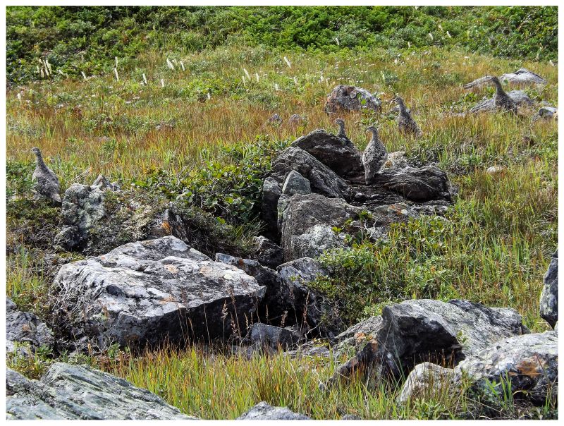
Following the trail markers to the north, I didn't run back into my furry caribou pals, but rather this covey of ptarmigans. They were lucky I wasn't a hunter, because I was truly unimpressed with their lack of flight from the danger I could have presented. |
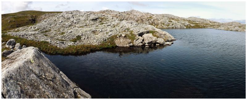
Heading back, the IATNL trail brought me to even ground and a new landscape of this granite-lined lake. |
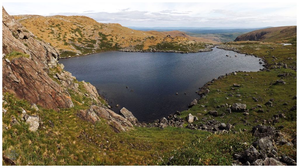
I could only manage to follow the spaced signposts for so long, finding myself atop this hill after a couple of kilometers of hiking from the Cabox. The valley I needed to go down was just ahead of that lake, so without signposts, down the hill I went. The hill would end up being steeper, more slippery and looser than I imagined, where I fell and tumbled a few feet at one point. By now I was pushing forward and dreaming about that watering hole, so maybe my body just wanted to throw itself quickly down towards the cool waters. |
If one wasn't such a weirdo obsessed with geographic feature names on a map, I think the scenery anywhere in the Lewis Hills would make any meander, and maybe a shorter meander, worthwhile. |
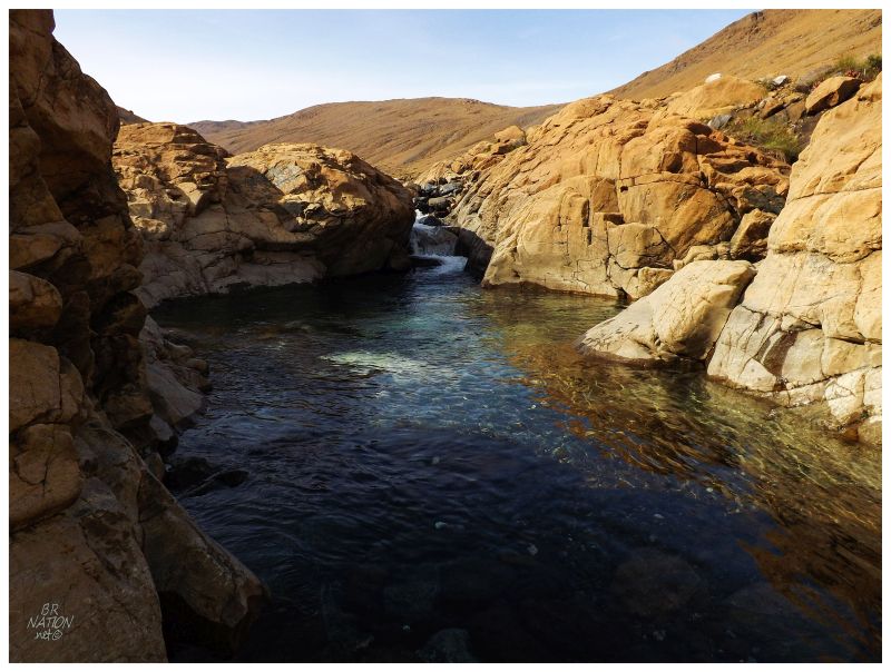
Dipping into a chilly pool after hiking 18km/11mi of your allotted 20km/12mi has to be one of the sweeter joys in life. It wasn't that deep and there were a few small Newfoundland spiders, but none of that mattered. I was also happy that the prospector duo was nowhere to be seen today, as this might've been one of my rare non-Lake Erie clothing optional dips. |
Of course, as these things tend to go, I would find a better grasslands trail on the final stretch back to the car. There was still the stress of maneuvering my car over the rough road back to pavement, but once there, it was time to fill up on food, shower and savour that I finally checked this one off. |