Croque, Newfoundland
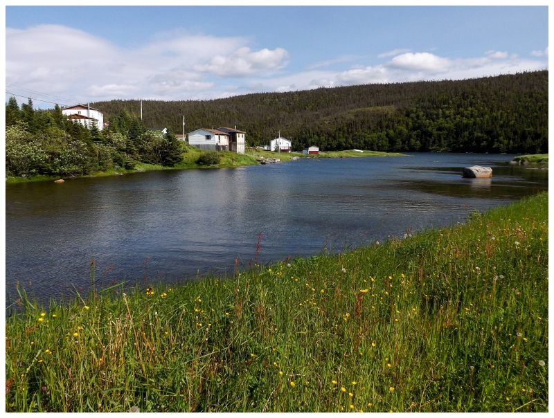
There aren't many settlements on the eastern side of Newfoundland's Northern Peninsula. Covering 100 miles of sparsely populated coast, there only Jackson's Arm to the south, a few resettled places, then Englee, Conche, Croque & Grandois (before reaching Hare Bay & the St. Anthony area). Conche & Croque/Grandois are especially isolated over here, being small villages at the end of 20-30km (12-18mi) gravel or half-gravel roads. I'd returned to Conche when I left its harbour for the Grey Islands in 2012, but Croque and Grandois remained as places I had only visited once, way back in 2010. |
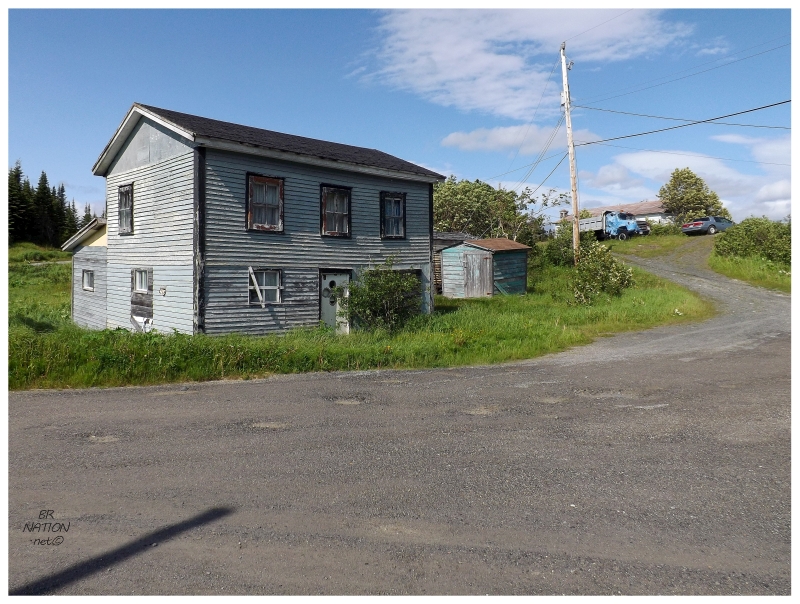
Now that I've been to every village on the island, I've moved on to appreciating the places I've only seen one time or didn't give a fair shake in the first place. Croque would be one of those places, so I went for a spin around town and purposely drove down the 3 miniscule laneways which I didn't drive down previously. The Northern Peninsula is a remote place & then you're taking it up a notch when you seek out the remote places up here. Croque is an example of this remoteness & I was loving the peacefulness & how infrequently this place is visited. |
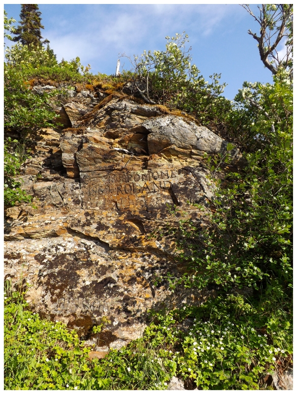
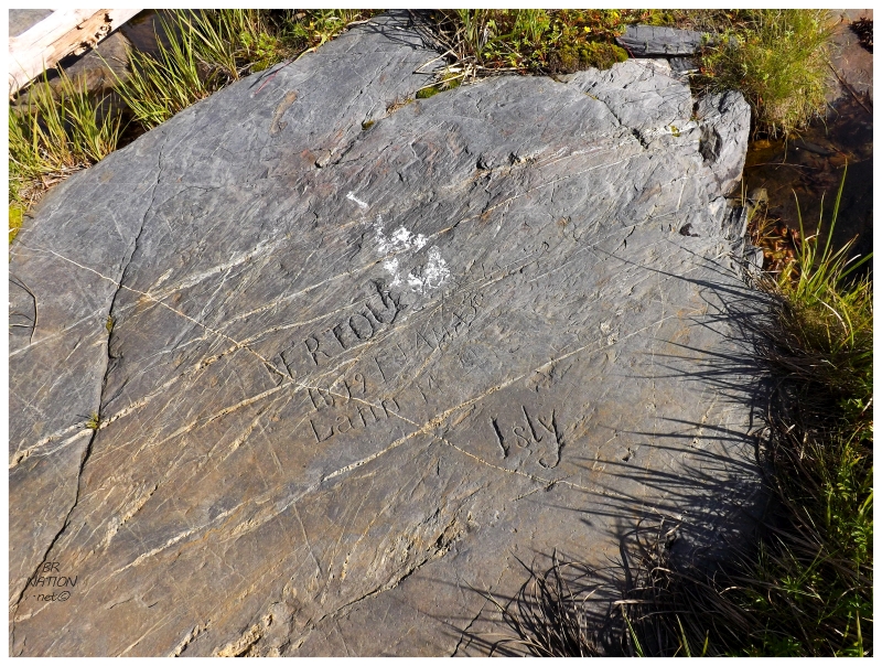
"1868 POMONE, 1862 ROLAND, 1871 CHATEA (?) RENA"
Pulling onto the 10km (6mi) road from Croque to Grandois, we were barely out of Croque when we had reached the next cove and the starting point for the shoreline Epine Cadoret Trail. Of all the trails in this province, this one has been on my short list for a long time because of the pronounced 19th-century carvings you find at the end. These carvings came from French sailors as this was the coast of Newfoundland where the French had fishing rights & Croque was the regional centre for boat registration. From here, the sailors would sail off to whatever grounds and harbours they intended to fish. (And I guess some of them were bored with the time it took to register, so they lounged about & graffiti'ed these rocks at Le Fond with their ship names, haha.) If you want an idea of how many French fishing stations were up here, long ago I found a research project involving academics going to so many long gone old settlements up here. This of course invoked intense jealousy. |
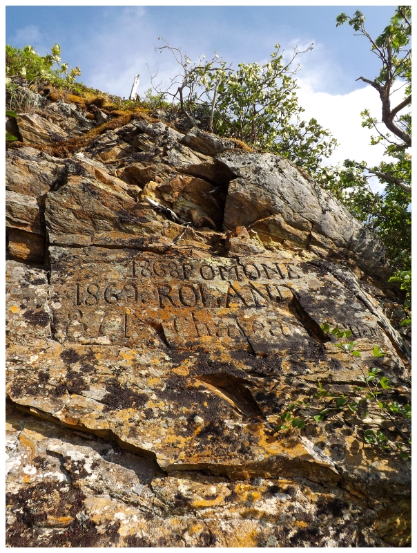
There was a sailboat moored deep in this cove and we had walked far enough out to now see the backside of Croque, but otherwise it was humbling and invigorating to have a panorama of empty, sunny forests and shimmering water, with this remnant of those who would been here 148 years ago. I know people usually get this feeling with headstones and death years, but I found these carvings brought about thoughts of long gone people much more. I couldn't help but think of French sailors lazing about here, then eventually some hot shot leaving his mark for a guy in 2015 to see. Also, how odd is it that this place is rarely visited or photographed? Although, I suppose that speaks to the effort in driving up all this way. |
The beautiful scenery helped me discover another thing, that the rock face isn't the only carved rock out here. As I walked closer to the lapping and enticing water, I noticed names & words had been scraped into the shoreline rock as well. It felt as if one were to set-up camp out here, that you'd find new carvings with every single move. |
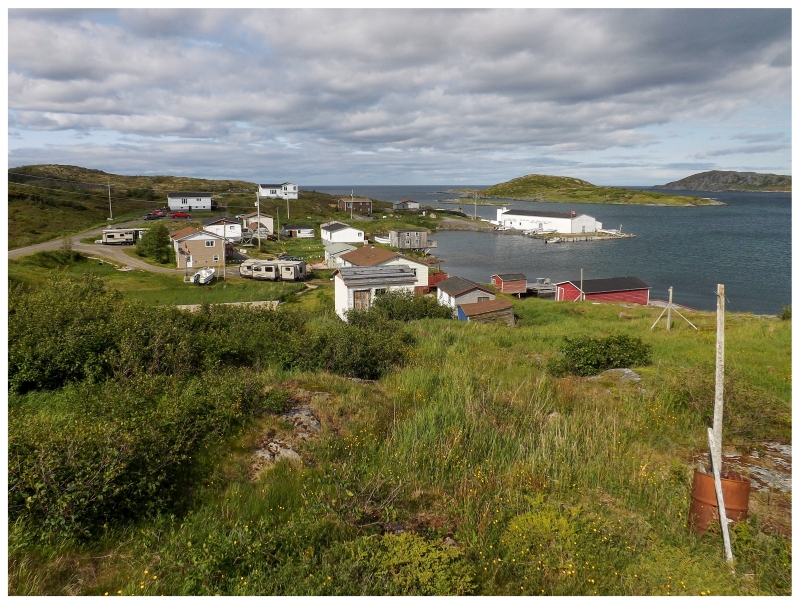
There were a couple of tent platforms on the Epine Cadoret Trail (although one of them had been crushed by a tree), but I had a better site in mind. After using a roadside gazebo as a dining room to cook suppertime sausages, we drove the last bit of road into Grandois. I always wondered if Grandois looked nice because of the pleasant early spring day that I found it the first time, but it was just as pleasing today. |
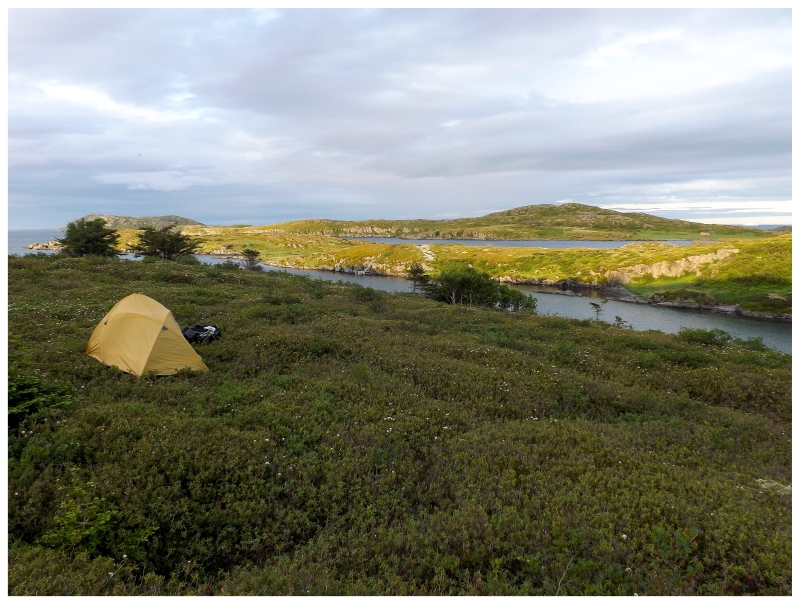
Knowing about the trail to Grand St. Julien on the south side of Grandois, we parked the truck and gathered as much of our camping stuff as we could - lazily bear-hugging the tent, sweaters and other supplies, instead of neatly packing everything into 70L packs. It was no big deal really, since the camping spot would only be a short walk out of town, just enough to get up over the nearby ridge & out of sight. |
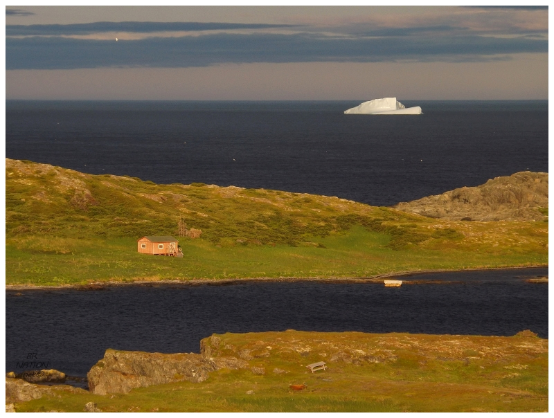
I thought tomorrow morning's hike to Grand St. Julien would be the highlight of this trip, but boy was I ever wrong. This evening was something out of a tourism commercial, with a pleasant opening act of a merlin flying low over these hills and landing on one of the nearby sparse trees. This was set upon a background with a large iceberg framed by a valley on the Grand St. Julien finger of land. And then lastly, the golden hour was doing its thing & we were actually early for once; there was a glut of time to sit and enjoy each cove, cape and hill painted with yellow light. I half thought I was going to have to close one of those 'Newwwwfoundland & Laaaaabrador' advertisements with a blowing pitcher plant any second. |
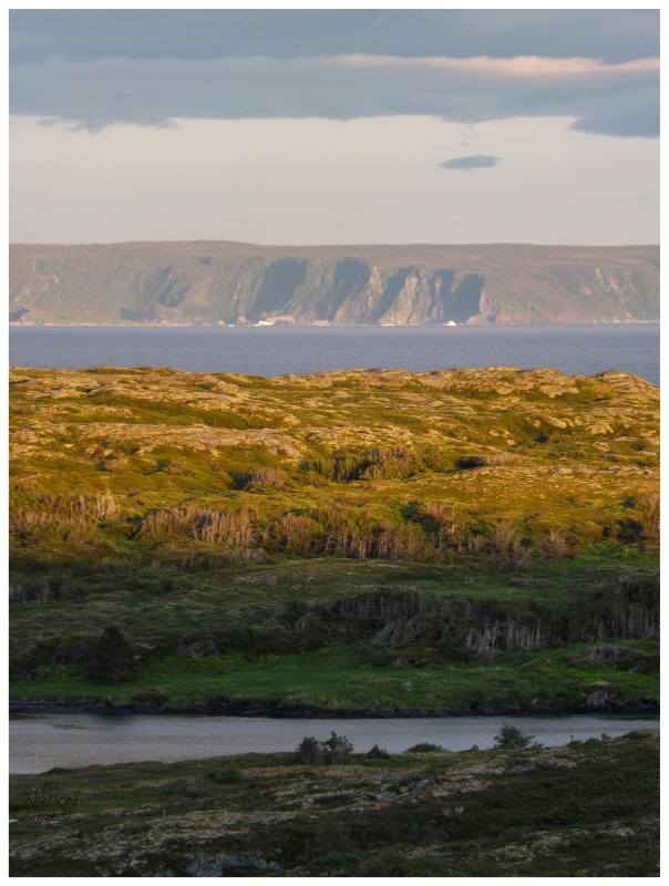
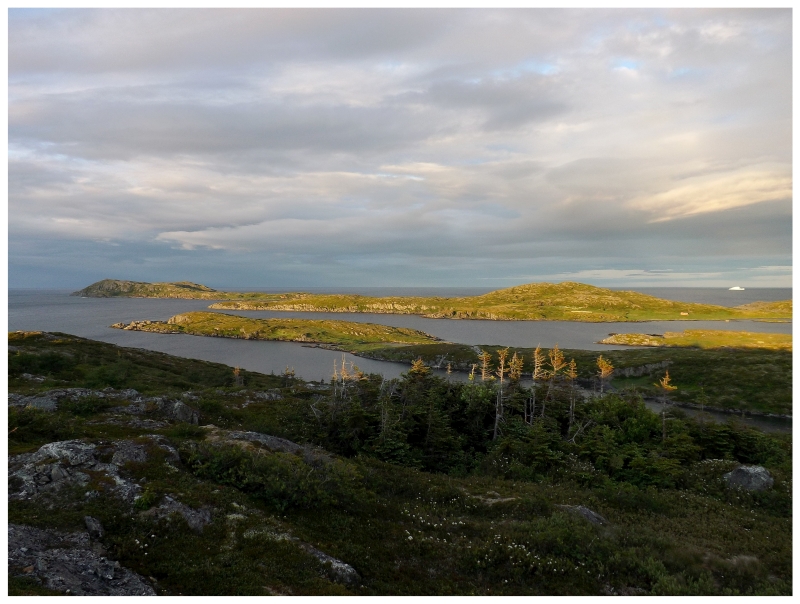
The cliffs of Groais Island shine in the distance .
One thing I didn't foresee was the spectacular view of the Grey Islands from up here. There's two main Grey Islands and we stayed on the southern one, but obviously with myself taking a non-government boat to an irregular place, I'd studied maps & read up on all of the nearby named features (like the northern Grey Island - Groais Island). I distinctly remember asking our captain on the way to the Grey Islands about the claim that you can't land on Groais Island. I found this claim strange even with my minimal seafaring knowledge & sure enough he replied with the old "you can land on anything," along with that there is a decent cove and gentler area to land. For how I was reassured that you can land on Groais Island, I laughed at how intimidating it looked this evening. There's clearly parts of the island where you can't land. |
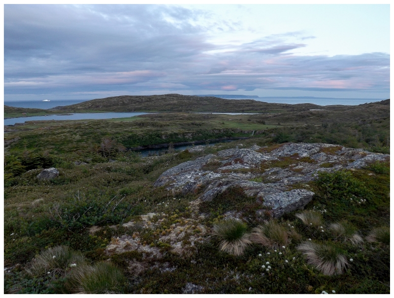
As the sun continued to set, we moved uphill just a bit more in search of better views. Stepping over a dangerous crevasse, I knew we weren't going to stay up here for long, as I wasn't about to have more beer with such a big rock gap between myself & the tent. Thankfully the mosquitoes would lend a helping hand here, bringing about an abrupt turn from the loveliness of this scene. At first it was a matter of tightening velcro around the wrists and pulling hoodie strings, but then it became unbearable at an unbelievable rate. In what felt like 30 seconds, the mosquitoes showed up and we had to scramble for the tent. Even finding ourselves back inside, there was a buzzing from outside of a few dozen mosquitoes right on the tent, trying to fight their way through the transparent fabric towards the carbon dioxide I was exhaling. So that was that for being outside tonight. |
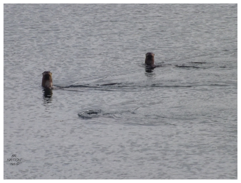
I didn't get up as early as I would have liked, so this morning was a bit of a rush to get around the inlet and over to the Grand St. Julien site. The only thing that stopped me was my first ever otter sighting! There at the greatest indentation of Little St. Julien's Harbour, three otters played and popped out their heads to check me out at different intervals. |
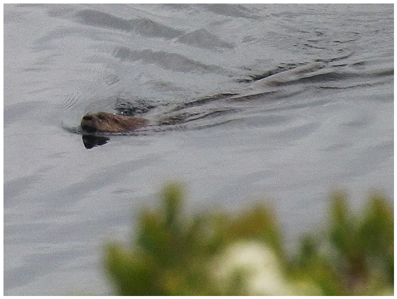
At first I rushed to get a picture, then realized they were in no hurry to get away from me. They slowly meandered away, but I don't know if the cheeky little buggers were moving away at any greater rate than they would have moved north anyway. While any animal encounter can be special, it's great when the animal feels that it is at a safe distance, affording you with an elongated observation. |
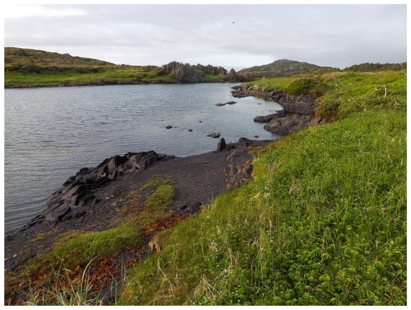
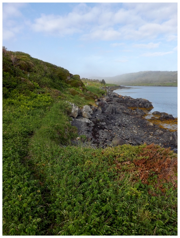
Even if there wasn't much of a path & I questioned whether I'd make it to the resettled site of Grand St. Julien, this morning I was still walking a part of the Newfoundland coast that I love. I happily scurried along, while the sun intermittently broke through and illuminated nearby hills and portions of the bay. |
In the end, I moved fast enough to make it to Grand St. Julien, finding a cabin that must've been built for this trail some time ago. I very much wanted to return with my large backpack & spend the night out here. |
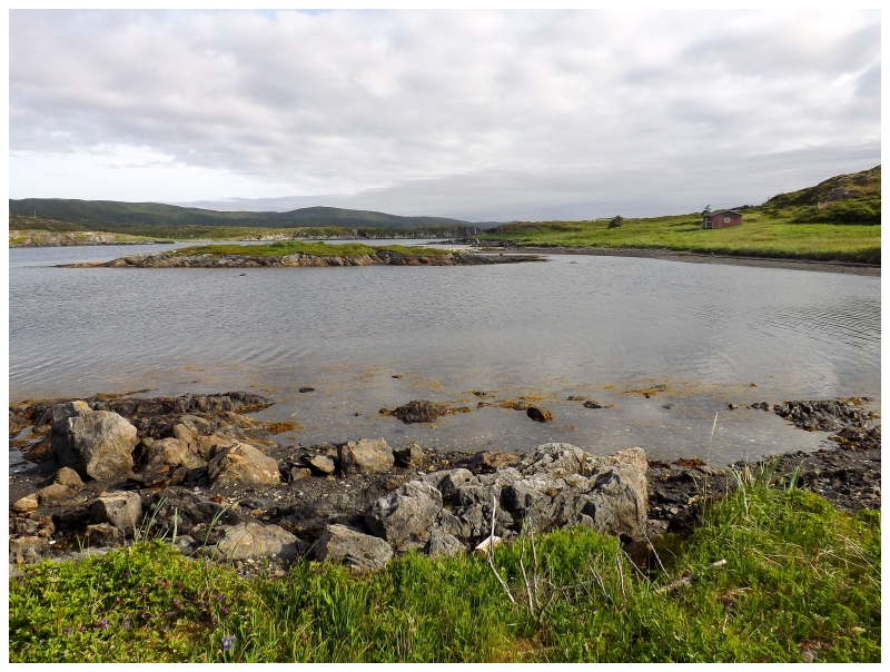
The red cabin is the 'trail cabin' at Grand St. Julien.
St. Julien's Island, just off of here, is an island that appears on some of the earliest maps of Newfoundland. The French were known to fish this area since the 1500s and by 1822, this was one of the places where France hired a caretaker, here named George McGrath, to live at Grandois/St. Julien's year-round and keep the place safe from scavengers. By 1857, other settlers would come to St. Julien's (both Grand St. Julien and Little St. Julien). As the French would abandon this area and move north in 1874, these settlers are the reason that these villages continued to exist afterwards. Grand St. Julien would never grow very big by not going over 150 people ever (and that's counting Grand St. Julien + nearby Grandois population). The Encyclopedia of Newfoundland has Grand St. Julien's population at 25 people in 1966, and then it would be abandoned/resettled in the late 1960s. By 1981, all nearby settlements would completely move to Grandois, probably appreciating the road which was put through in only 1980. |
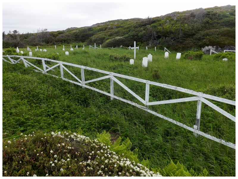
A testament to the longevity and size of Grand St. Julien is their two substantial cemeteries, each of them being home to approximately 25 headstones. Uphill and closer to the ridge behind the village is the English graveyard, with both English & Irish names. |
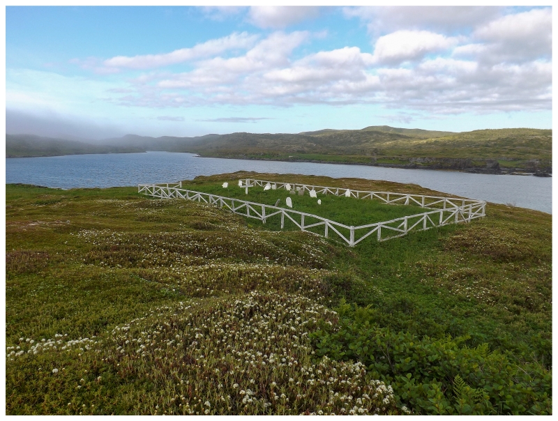
Closer to the shore is the French (possibly Roman Catholic) graveyard. Without much time to dawdle, the French cemetery is the one I chose to explore (there was a bit more of a path and the English cemetery was more boggy.) Although when I say there was more of a path, I wonder if more than one single other person came here this year. There was only a very faint path, where who even knows if it was from previous years instead of 2015. |

'SACRED TO THE MEMORY OF JAMES KOUGH (Keough is a popular last name in Newfoundland and Keoughs are listed at St. Julien's in the Encyclopedia of Newfoundland, but it looks like Kough in the photos I took. I'm only trying to transcribe my photos.) I had to turn back towards our campsite after this, leaving behind Grand St. Julien exploration as I hurried along the coastline. I could have easily spent a week out here at the trail cabin and even without the resettled place, I simply wanted to climb these barren hills so emblematic of the Northern Peninsula. This whole area reminded me of the Grey Islands and how I could easily spring off towards a nearby peak for a better view over everything. |
Arriving back at the campsite, I was saddened to learn that Shelloo hadn't seen the otters, although she had heard a few strange noises. Packing up quickly and heading back down the NL-438, I made some road PB&Js for breakfast. I made Shelloo one from the end of the loaf - Newfoundlanders call it the heel - because I can be a joker at times, but after a good laugh at the preposterousness of eating the end/heel, I threw it out of the window for the moose to eat. Anyway, another good visit up the Northern Peninsula & a decent amount of adventure for two small villages. Maybe one day I'll be back for a better look at Grand St. Julien. |