Newfoundland (Island) Towns, Villages & Hamlets.
400-Series | 300-Series | 200-Series | 100-Series
400-Series Highways (Western Newfoundland/Great Northern Peninsula)
Clockwise From The Ferry:
- Route 470: Rose Blanche Highway
(40.8 km/25.4 mi)
- Margaree, Fox Roost: I went to Margaree and Fox Roost to eat with my friend Johan, but never wrote about it or included it in the update. In February of 2015 I returned, snapping a picture of the church in Fox Roost.
- Isle aux Morts: I was really excited to finally get back inside a big abandoned building when I found their fish plant in 2009. That's probably why I posted 10 pictures. I went back in 2010. In November of 2012 I stopped in Isle aux Morts to take photographs from their wharf, then stopped again on the way back from Rose Blanche to photograph the Orangeman's Lodge. In November of 2020, I excitedly discovered their skatepark.
- Burnt Islands: I drove throughout Burnt Islands in February of 2010, scouting how far the Colombier Islands Lighthouse sits offshore & how ridiculous any fisherman would think I was for asking to go land on a rock for a modern skeletal tower. In February of 2015 I sized up their lighthouse yet again. In November of 2019, I returned to Burnt Islands to hike their Harvey Trail, based on a recommendation from my friend Kim.
- Diamond Cove: I went to Diamond Cove in 2010, but never made an update for that trip. In February of 2015 I went to Diamond Cove again, posting a street scene from down near the water.
- Harbour Le Cou: I pulled into Harbour Le Cou when looking for a boat with my friend Johan, but never stopped to take a picture. In February of 2015 I returned and appreciated how close the old houses are to the road.
- Rose Blanche: I drove down to Rose Blanche to see their lighthouse and go inside in 2009. We also stopped at Barachois Falls outside town. In August of 2011 I sailed around Rose Blanche's headland to go to La Poile. In February of 2015 I walked out to the lighthouse in the whipping wind and cold.
- Ferry
(La Poile: 1hr, 30m)
- La Poile: In 2011 I went to La Poile simply because it was there. I ended up meeting a good friend, being invited into a home for drinks/dip/songs, as well as managing to spend an extra 1.5 days when I planned to go back the next day. It was amazing. In July of 2012, when I heard my friend was going back to La Poile, it was such an easy decision to accompany him. We went out in a boat to North Bay & Northeast Arm, the memories from that day being some of the best I have from Newfoundland. In May of 2015 I would return for an evening, remarking on how a sky blue house I photographed was now a pile of destroyed lumber.
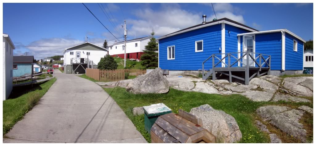
La Poile, 2011.
- Trans Canada Highway
- Channel-Port-Aux-Basques: I stopped at the Welcome to NL sign when I came here in 2008. I drove 2 hours down to the PAB to ride their snow-free skatepark while CB was ridden with snow in November of 2009. I ate at the Tai Hong in October of 2010. I photographed one of their 3-3-3-3 cabs in June of 2011. I returned in August of 2011 and a friendly man rowed me over to see the island lighthouse. In April of 2012 I tried to beat winter by driving to the snowless PAB, but it was still cold and their skatepark had lost even more ramps (I included a picture from the hill on Stadium Road overlooking Port-Aux-Basques). In February of 2015 I spent the night at the Shark Cove Suites and snapped my last picture of a nice old house along the road that would soon be demolished. In December of 2017, I mentioned stopped at a few bars in the PAB and a picture of us sailing away on Marine Atlantic. In December of 2019, I spoke of how I like getting to The PAB early so I can walk around town instead of the ferry terminal. In November of 2020, I noticed that their Tim Horton's speaker had extra support against the wind. In April of 2021, I photographed the Port Club, the old arena site, laughed at how someone cut down their skatepark rail, and rode the local College of the North Atlantic. In June of 2021, I left from the PAB to head to Nova Scotia.
- Grand Bay East: I've driven and walked through, but never made an update.
- Grand Bay West: I keep intending to walk Grand Bay West's beachside trails, but haven't got around to it yet. In April of 2021, I'd finally walk a good portion of this trail.
- Cape Ray: I drove through Cape Ray to go visit their lighthouse in 2009.
- Route 407: St. Andrew's-Searston Road
(15.4 km/9.6 mi)
- St. Andrew's: I explored an old house in St. Andrew's in June of 2012. I returned in May of 2015 to find the house had developed a dangerous lean.
- Searston: I biked through Searston to The Block in June of 2011; stopping to photograph a falling down house in The Block. In June of 2012 I might've found a stealth camping spot in a field near Searston.
- Tompkins: I've been through Tompkins to visit the Codroy Valley & Saint Andrew's more specifically, but I've never stopped to take photos or find adventure in Tompkins.
- Route 406: Codroy Road (20.8 km/12.3 mi)
- Codroy: I drove through Codroy to visit the Cape Anguille Lighthouse at sunset in 2009. I drove through again in October of 2010, photographing a Wildberry Pearlcoat Intrepid that isn't there anymore. Later in October of 2010, I stopped at the lighthouse at sunset yet again as Nicole hadn't seen it before. In June of 2011, I went there at sunset two more times while staying in the Codroy Valley. I set out to explore Codroy Island in June of 2012, but didn't foresee the Black-backed Gulls who wouldn't have me checking out their navigational markers.
- Woodville: I've been through Woodville multiple times en route to Codroy as you can see above, but none of the pictures I've taken in Woodville have made it into an update.
- Millville: I explored Brooms Brook outside of Millville in June of 2011, but I've never posted a picture from actual Millville.
- Great Codroy: I photographed a Gray Catbird in a tree besides the cabin I was staying in, in Great Codroy. June of 2011.
- O'Regan's: I cycled to the end of the road in O'Regan's when I went to The Block in June of 2011, but didn't mention it or include a picture.
- Upper Ferry: I've been through Upper Ferry a few times while exploring the Codroy Valley. I've stopped to look for birds at the Interpretation Centre, I've sized up the handrail at Belanger Memorial School & I've ate at the gas station across the street, but I've never included any of this in an update.
- Trans Canada Highway
- Doyles: I ate at the Wreckhouse Haven Cafe that used to be kitty-corner from the Esso, and I've driven the main road back towards the quarry, but neither of these things made it into an update.
- Benoits Siding: Driving along the TCH, you see enough of Benoits Siding for it to count. I've never stopped in Benoits Siding to take a picture or find adventure.
- South Branch: There's too much off of the TCH to count it only after driving through. I have left the TCH and drove the main road in South Branch, but never made an update. I did stop and photograph the Mollychignick Cabins in August of 2011. In April of 2021, I hiked the John Falls Trail in South Branch.
- Coal Brook: You drive through enough of Coal Brook on the TCH for it to "count", but there's a waterfall in Coal Brook, there's mining history, there's more that I want to explore there. I was close to stopping my last time through, I can't imagine I'll drive right through many more times.
- Route 405: Highlands Road
(16.6 km/10.3 mi)
- Route 405-11 (5.1 km/3.2 mi)
- St. David's: In April of 2012 I climbed Crabbes Hill overlooking St. David's. In April of 2015 I photographed St. David's Anglican church and went inside.
- St. Fintan's: I stopped to photograph an old home with green trim on my first spin through this area in October of 2010.
- Loch Leven: I've been through Loch Leven three times now, but I've never included a picture. On a more recent trip I went out of my way to drive Loch Leven's main road, so we'll see if I include a picture.
- Highlands: In April of 2012, I drove past Highlands in search of their sea stacks, only finding an abandoned culvert. I also explored an abandoned house in Highlands on the way back through town. In May of 2015 I returned and camped at the sea stack. In April of 2021, I returned to the sea stacks once again.
- Maidstone: In April of 2012 I stopped to photograph the homestead in Maidstone. In April of 2015, I returned to photograph the same homestead.
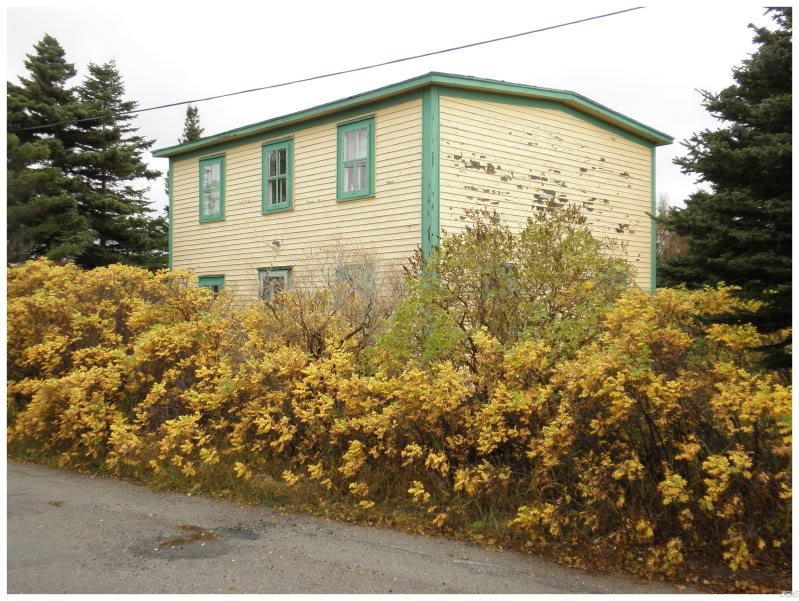
Cartyville, 2010.
- Route 404: Robinsons Road
(15.6 km/9.7 mi)
- Jeffrey's: I've been through Jeffrey's both times I've been in this area, but never included a picture. In April of 2015 I photographed the Hulan House.
- McKay's: The barn photo I included in April of 2012...I believe it was in McKay's. If not, I've been around McKay's while exploring the NL-404 and NL-405.
- Cartyville: I stopped to photograph an old yellow home in Cartyville in October of 2010. Driving by in 2015, I noticed that it wasn't there anymore. (June 2013 Google StreetView shows it missing even back in 2013.)
- Robinsons: Photographed a well-maintained, nice old home in Robinsons in October of 2010. In April of 2012 I returned to climb around the farmland and hills about Robinsons Head. Nearly a decade later, in April of 2021, I returned to walk to the Robinsons River West Trestle, check out their Anglican church, rent a cabin down by the shore and walk said shore.
- Heatherton: In Heatherton I photographed the exterior of one of the most dilapidated homes I've ever seen. October of 2010. I believe it was gone by the time I drove through again in 2012. In April of 2015, I explored another rundown old home & remarked on the shoreline's lack of a harbour.
- Fischells: I loved Fischells when I drove there in October of 2010, but held off on including pictures because I wanted to go back for better ones. In May of 2015 I returned, happy with the pictures from that day.
- Route 403: Flat Bay Road
(20.4 km/12.7 mi)
- Joyce: I went back to this area for miniscule Joyce in 2012. I left from Joyce to cycle on the T'Railway to the Fischells River in the summer of 2017.
- Flat Bay: I turned into Flat Bay and drove around during my 2009 trip, but never posted a picture in the update.
- Flat Bay West: On my 2009 trip I snapped a picture of the spit of land extending from Flat Bay West out to Sandy Point. In August of 2009, I hiked the 26km/18mi out to Sandy Point at low and mid tide.
- Journois: I explored an abandoned cabin near or in Journois in 2009.
- St. Teresa: I went back for tiny St. Teresa in 2012. I cycled through the town en route to the Fischells River in the summer of 2017.
- Route 461: St. George's Highway (13.4 km/8.3 mi)
- St. George's: Photographed their handful of awesome old houses in 2009. In November of 2013, I photographed the exterior of another awesome house, a house that I love.
- Barachois Bank/Seal Rocks: You go through both of these places when going to St. George's from Stephenville. I've never taken a picture in Barachois Bank or Seal Rocks.
- Shallop Cove: I went past St. George's and into Shallop Cove on my trip in 2009 and on various other trips to the area. I've never posted a picture from Shallop Cove.
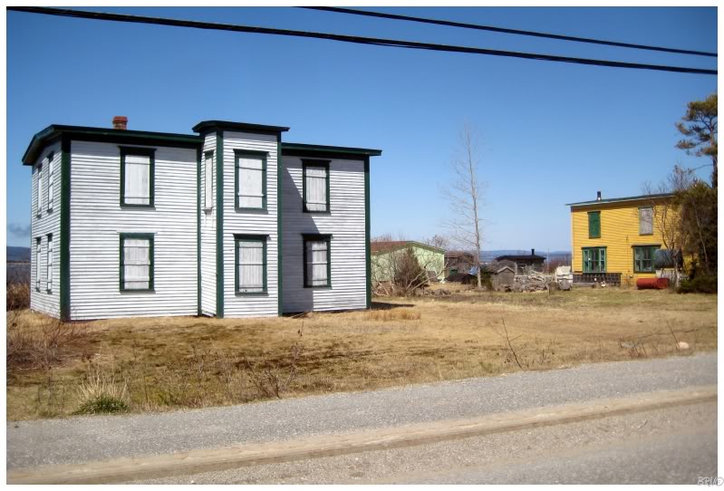
St. George's, 2009.
- Route 480: Burgeo Highway
- Burgeo: I left Burgeo on a ferry in May of 2010. In August of 2010, I went on a boat out to the lighthouse at Boar Island, swam at Sandbanks, hiked to the old Sandbanks Anglican Cemetery & photographed some old Intrepids at the fish plant. In September of 2011, I made it to Sandbanks on the last camping weekend of the year, photographing the scene at sunset, beer at the hardware store, the demise of their old cottage hospital & the old tomato greenhouse that isn't there anymore. In July of 2013 I went with friends on Canada Day weekend, ignoring the rainy forecast and getting a full weekend of fog and drizzle camping. It was fun regardless. In June of 2016 I camped at Sandbanks and went to Ramea the next day.
- Ferry
- Ramea: After coming back from Francois in an undersized boat on a rough day that was close to too stormy to sail, I appreciated that Nicole said she would go to Ramea as well. It was a foggy and dreary day in May of 2010, but I still photographed their 1902 lighthouse, public pool, A-frame house, old fish plant and Man-o-War Hill. I returned in July of 2013 on another foggy & dreary day. One day I will visit Ramea when the weather is exquisite. In June of 2016 I finally returned on a sunny day.
- Grey River: I first saw Grey River in May 2010 while stopping to drop off supplies as we were headed to Francois. I returned in July of 2013, spending the night outside the tungsten mine, hiking up into the barrens & having a beautiful morning to explore.
- Francois: My big trip to Francois was in May of 2010. I spent 3 days and 2 nights there, boarding with a local couple and taking so many pictures. The highlight of it all was hiking 5+ km through overgrown paths and trying to follow inukshuks to reach Fort Point Lighthouse. At the lighthouse, the historic structure was open & so was the keepers house (the keepers house was demolished in late 2014/early 2015). Francois is a special place and you should work hard to go there. I returned in the summer of 2014 with a group of friends. We camped behind the Anglican church and hiked towards The Friar after having a lovely day on the ferry the evening before.
- Route 490: Stephenville Crossing Highway (18.1 km/11.2 mi)
- Stephenville Crossing: I can't believe I don't have any updates or pictures from Stephenville Crossing, but here we are. Stephenville Crossing is actually a neat, interesting little place, but I've simply never found enough adventure there to make an update.
- Route 461-10: Mattis Point Road (2.2 km/1.4 mi)
- Mattis Point: I could have swore I made an update when I drove to Mattis Point, but I guess not. I was pretty excited to be able to explore a new village so close to Corner Brook, so I drove in to Mattis Point in 2011.
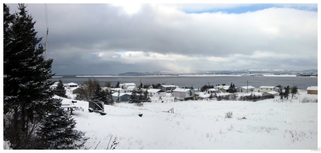
Mattis Point, 2011.
- Route 460: Port au Port Highway
(87.4 km/54.3 mi)
- Black Duck Siding: You go right through Black Duck Siding when driving to Stephenville. I've turned off onto one of the residential roads as well, and while there is handsome little homes to photograph, I've yet to manage to do so.
- Noels Pond: You drive through Noels Pond when driving to Stephenville. I've stopped to look at Wheeler's Steakhouse and take a spin around town, but never posted a picture in an update.
- Route 460-11: Cold Brook Road
- Cold Brook: I've been through & around Cold Brook 3 times now. I know you don't need to go into Cold Brook to take the Cold Brook woods road to The Cabox, but I checked out the scene in Cold Brook twice before Cabox attempts, even if I didn't include a picture from the village. I also went through in May of 2016 since I wasn't sure if Shelloo had seen it.
- Stephenville: I went to two of the old base buildings in December of 2008. I checked out some of their old ammunition bunkers in May of 2009. I went into the base chapel in 2009. I went into another old base building in June of 2009. I went back to the hangar buildings in February of 2010. I went to the other ammunition bunkers in October of 2010. In November 2017, I posted a photo from their skatepark. In September of 2020, my friends and I played frolf in Blanche Brook Park. In December of 2020, I hit another couple of abandoned buildings in Stephenville.
- Kippens: You drive right down the main street of Kippens when you go out to the Port au Port Peninsula. I've never found adventure in Kippens.
- Romaines: Romaines has a great, old house, used to have an old bridge & still has some white cliffs. Have I stopped to take a picture of any of this? No. I've driven on the one loop road that adds to Romaines, not all the way around it, but enough to say I've seen Romaines. I'll stop to explore more of Romaines soon.
- Port au Port: There are some intriguing and photogenic houses here, but I've only ever stopped for gas in Port au Port. I took a picture of the yellow house behind the gas station, but it never made it into an update.
- Route 462: Fox Island River Road
(18.1 km/11.2 mi)
- Fox Island River: I drove to Fox Island River and noted the wintry road absent of a guardrail in 2008. I returned in 2009, happy that I didn't lump the PineTree hike with the lighthouse hike together. In May of 2010, I finally set out to bushwhack to their lighthouse - and after wading through the Fox Island River, navigating around abandoned cabins & slogging through muddy tracks, I was confused as to where the damn lighthouse was. Returning in September of 2010, we were going to bushwhack and ford rivers in search of the lighthouse again, but thankfully I noticed a strange structure in a yard along the way. And so, I visited and photographed the relocated Broad Cove Range Front Lighthouse in Fox Island River, sad about the Range Rear being destroyed.
- Point au Mal: Driving to Fox Island River, I went through Point au Mal, posting a picture of the Table Mountains behind homes in 2008. In December of 2020 I walked the beach where the provincial natural area used to be.
- Route 460: Port au Port Highway (Cont.)
- Route 460-13: Aguathuna Road
(6.8 km/4.2 mi)
- Boswarlos: Photographed a beautiful old abandoned home in Boswarlos in 2008. It was unfortunately torn down in 2014.
- Aguathuna: I went through Aguathuna to get to Boswarlos obviously, but I've also been back and turned down the side road that shows more of Aguathuna. I've never posted a picture from Aguathuna.
- Port au Port West: I've parked in Port au Port West and hiked the seaside trail, but never posted a picture from that day or any other day in Port au Port West.
- Felix Cove/Man of War Cove/Campbells Cove/Abrahams Cove/Ship Cove/Lower Cove/Sheaves Cove/Marches Point/Petit Jardin: I count all of these communities by driving the main highway around the Port au Port. I've stopped to take pictures here & there, but never included any of those pictures in updates. I photographed an abandoned auto shop along here somewhere in November of 2008, but even after searching StreetView, I can't figure out where that auto shop was located. There's nice views and nice towns along here, but I made the Port au Port update so long ago, that it was before I tried to include pictures from a variety of towns (and before I included so many pictures in each update).
- Jerry's Nose: Jerry's Nose is the one community I'd say you don't see enough of by driving the NL-460. I turned down the road and visited more of Jerry's Nose in 2011, but didn't make an update from this otherwise mundane day.
- Red Brook: In July of 2020, I mention riding from Point A to Red Brook.
- De Grau: In July of 2020, I posted a picture from their wharf after mountain biking out there.
- Grand Jardin: In July of 2020, I saw some grackles in Grand Jardin, even though I didn't post a picture.
- Cap St-George: I drove through Cap St-George to grow amazed at the physical feature of Cape St. George. I also loved the small ruins of a 1930s lighthouse that stood marking the same cape. This was in May of 2011. In July of 2020, I lamented that their Freshramps weren't fully assembled.
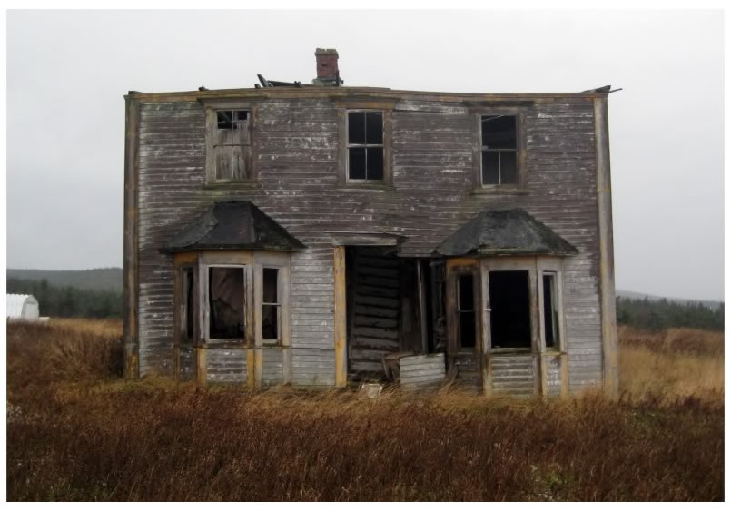
Boswarlos, 2008.
- Route 463: Lourdes Highway
(You have your 2008 update...)
- Mainland/Three Rock Cove/Salmon Cove/West Bay/Piccadilly: It was a crappy day when I went through here in 2008 and there was nothing good enough to get out in the rain & wind. On other Port au Port trips, I didn't make updates for those trips because they were just casual Saturday drives. I've since been back & saw something cool in Mainland, photographed an old house in Lourdes & Piccadilly. It might've been a good enough day for a future update. Anyway, I believe you go through enough of these towns/villages on the road for it to count regardless.
- Piccadilly Slant: In July of 2020, I rode my bike behind their old fish plant.
- West Bay Centre : In July of 2020, I mentioned turning around in West Bay Centre on my bike ride and having some old timer break my balls.
- Lourdes: In July of 2020, I posted a picture of Drake's Service Station, before wishing they were still around to pump up my tire.
- Route 463-11: Blue Beach Road
- Blue Beach: I was amazed with the intense waves of November 2008 in Blue Beach, where I also explored a few dollhouse'd fishing shacks. In August of 2010, I drove past Blue Beach to get out to the tip of Long Point. In September of 2020, I finally returned to Blue Beach, this time with Rosie & Shelloo.
- Winterhouse: In July of 2020, I photographed their old one-room schoolhouse, although I didn't go inside.
- Black Duck Brook/L'Anse-aux-Canards: In July of 2020, I stopped at an abandoned house in Black Duck Brook.
- Route 402: Gallants Road (16.8 km/10.4 mi)
- Gallants I've been here but never created an update. Think about how close it is. Think about the hundreds of times I've driven to Stephenville. Trust me, I've been to Gallants.
- Spruce Brook: I rode my bike in November from Mount Moriah to Spruce Brook over the old Trailway. There's neat history, funny tales of running into residents, pictures with wet snow - but then, I lost my camera! I've searched high & low about 5 times now, unsure of where it went. This bothers me enough that I'll probably cycle from Mount Moriah to Spruce Brook again in the future sometime.
- TCH
- Massey Drive: I snowshoed to Breeches Pond in January of 2013. I climbed to Duncan's Rock in November of 2013. I've also been to Tippings Pond about 15 times.
- Corner Brook: I tried to shake the winter funk by walking around and posting pictures - including one of The Majestic Theatre - in January of 2009. I walked around Corner Brook documenting snow levels in March of 2009. I checked out the popular cave system in June of 2009. I mused about the lovely pedestrian tunnels in September of 2009. In October of 2010, I included photographs of West Street & the Glynmill Inn. In November of 2010 I photographed the Humber Road United Church Cemetery and the oil dock halfway to Curling. Later in November of 2010, I took a tour inside the paper mill. In April of 2011 I wrote about why the winter in Corner Brook isn't for me. In April of 2012 I included a picture of the amazing wood ramps in Corner Brook. In March of 2013 I snowshoed up Third Pond Hill over by the water supply road. In December of 2013 I photographed the exterior of St. John the Evangelist Anglican. In June of 2014 I photographed the exterior of the vacant Seven Seas Restaurant at night. Over the winter of 2014-15, I documented shovelling over 18 feet of snow off of the skatepark. Over the winter of 2016-17, I talked about shovelling the skatepark snow again. In April of 2017 I documented the United Church manse before it was taken down. In July of 2018 we purchased supplies in CB and had patio beers in CB. In July of 2019, I was very excited with the installation of flat bar at the skatepark. In November of 2019, I showed why I love to get out of Stultifying Brook in early November. In December of 2019, I celebrated living close to Star Taxi, which provided me an out. During the winter of 2019-20, I watched a building get demolished on Brook Street, kept shovelling the skatepark, and remarked on the easy winter. In September of 2020, we visited the Cloud 9 Lounge. In December of 2020, I included a photo of the closest thing CB has to a dying mall. For the winter of 2020-21, I recounted my fight against winter.
- Route 450: South Shore Highway
(54.8 km/34.1 mi)
- Curling: I commonly cycle through Curling when I'm out and about, so I've taken nice pictures there, but as I haven't made another "fall potpourri" type of update since 2010 I don't have any pictures of Curling on my website. I also weighed here whether Petries counted as a separate village because I don't like municipalities, but it was taken into Curling in 1945 and the lines have completely blurred since then. For this exercise, I guess I shouldn't count places like Petries. In November of 2017, I finally went and photographed the old POW walls.
- Mount Moriah: I've cycled around Mount Moriah, I've ridden on the trailway from Mount Moriah to Spruce Brook & I've had delicious poutine at their C&E takeout. None of this has ever made it into an update unfortunately.
- Halfway Point: I've cycled around in Halfway Point and I've had the double-dipped wings, but I've never posted a picture from Halfway Point.
- Benoit's Cove: I've driven out to ride their skatepark a few times, but it can be frustrating to drive all the way out to Benoit's Cove, only to see the skatepark overrun with kids playing tag or using the ramps as monkey bars. I'm not going to tell them to move, so turning around, I just wasted my time & gas. During the winter of 2019-20, I drove out to Benoit's Cove to shovel the skatepark but decided it wasn't worth it.
- John's Beach: I've never stopped to take pictures or find adventure in John's Beach. I've been through many times though & one of these days I'll stop at their falls.
- Voy's Beach: I've stopped to photograph their beautiful St. Ambrose Anglican Church, but as it wasn't the nicest day, I always planned on stopping again on the finest day at the perfect time - but that remains as plans instead of executed activities.
- Frenchman's Cove: I sailed out of Frenchman's Cove when I went to Woods Island in 2009. I've never posted a picture from actual Frenchman's Cove, but I have left the NL-450 and drove down by the shore amongst the houses as well. In May of 2016 I hiked out to Frenchman's Head, but still didn't post a picture that proved I was in Frenchman's Cove.
- York Harbour: I've never posted a picture from actual York Harbour, but I tried to hike to The Rattler waterfall in April of 2012. I've driven on the side streets and all over York Harbour. My friend's mother-in-law & father-in-law have a place in York Harbour so I've even been in a non-abandoned house in York Harbour! In July of 2018, we rented a cabin in York Harbour to explore the nearby area.
- Lark Harbour: I stopped and checked out the Governor's Staircase in May of 2010. From 2009 to July of 2011, I tried to hike out to South Head Lighthouse 7 times. A couple of these departed from the end of the town of Lark Harbour. In January of 2014 I hiked the trail up to Tortoise Mountain in Blow Me Down Provincial Park. In July of 2018 we hiked the new South Head Lighthouse Trail that goes to the South Head Light Pole.
- Little Port: I hiked to Cedar Cove in October of 2010. I was in the vicinity of Little Port when I hiked to the Bottle Cove sea cave in June of 2014. I hiked the Little Port Head Trail in July of 2014.
- Route 440: Admiral Palliser's Trail
(39 km/24.2 mi)
- Hughes Brook: I drove on Hughes Brook Road in 2009 while looking for Goose Arm & then again when I made it to Goose Arm in September of 2013. Back in 2009 I went through the town a bit too, intrigued by the (rare to Newfoundland) farm & looking for the possibility of a better signed road to Goose Arm (I was wet behind the ears in 2009). I've also been up to the old Valmont Drive-In, although I never posted a picture.
- Irishtown/Summerside: I've cycled and driven around both Irishtown & Summerside, but never did anything worthy an update.
- Meadows: I stopped to photograph an old, falling down house in Meadows recently. Maybe it'll make it into a future update.
- Gillams: Gillams initially intrigued me because it was more than just one main road & it had that abandoned (at the time) Templeton Academy. I never posted a picture from these wanderings around Gillams & I haven't posted any since. I've always meant to stop at their waterfall as well.
- McIver's: I finally stopped at The Rattler waterfall in McIver's recently. It should make it into a future update. I also took a nice picture over on Lower Cove Road (which might also make it into an update).
- Cox's Cove: I drove to Cox's Cove and thought I was going to snowshoe to Goose Arm in 2009. I also photographed the beautiful view over the Bay of Islands from Cox's Cove.
I made it to Goose Arm in September of 2013. In August of 2019, I finally made it to nearby Brakes Cove.
- TCH
- Steady Brook: I climbed Marble Mountain and Mt. Musgrave in late November of 2010. It was gloriously free of snow.
- Little Rapids: Little Rapids is like a neat little neighbourhood fixed to the side of the TCH. I've stopped and drove around Little Rapids, but didn't post a picture.
- Humber Village: I have a friend who lives in Humber Village and I've been over there for chili, frisbee and also snowshoeing, but I never posted a picture. There were some nice pictures from that snowshoe too - I'm not sure why I didn't post any of them.
- South Brook: South Brook would be where the skatepark and some of the churches in Pasadena are. I've driven around here and rode the Pasadena skatepark, but I never posted any pictures. I'm not sure if South Brook should really count as a community either.
- Pasadena: I explored the Pasadena Motel in November of 2010 before it was demolished in early 2011. I took some exterior photos of the recreation centre in August of 2015 before it was destroyed soon after. I photographed and chronicled riding through the winter of 2016-17 at the Silver Birches Church Camp outside town before it was demolished the next year.
- Pynn's Brook: I've driven around some of the dirt roads of Pynn's Brook, as it is now mostly a cabin community. I've never posted a picture from Pynn's Brook.
- Little Harbour: Little Harbour is a neat little place & I've driven around, but I never made an update including Little Harbour.
- St. Jude's: I drove down into St. Jude's one time to eat a sub and look out on Deer Lake. I've never taken a picture or found any non-sub eating adventure in St. Jude's.
- TCH-Nicholsville Road (2.9 km/1.8 mi)
- Nicholsville: In 2009 I noticed a sign saying they were demolishing the old bridge across the Old Humber. I climbed down on the frozen river and took some pictures, before having a nice conversation with a man who told me about the British building it, growing up and crossing the river before the bridge & how he was there before & he'll be there after the bridge.
- Deer Lake: I wondered about exploring their abandoned school but found 4 feet of snow against a boarded door with 25 screws holding on the board. 2009. In July of 2010, I had a poutine at their Canton Chinese restaurant. In August of 2015, I explored Island Aggregates right before it was torn down - berating myself for not finding the ramps inside sooner. They would have made my life so much better. Following the winter of 2019-20, I rode my bike up Glode Lake Road and explored a nearby abandoned house. In October of 2020, I rode around town and drank at the Rockwood.
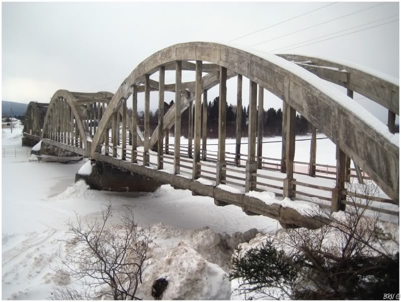
Nicholsville, 2009.
The Northern Peninsula:
- Route 430: Viking Trail (413 km/257 mi)
- Reidville Road
(4.4 km/2.7 mi)
- Reidville: I once went into an abandoned house in Reidville, only to find it burnt out. August of 2011.
- Route 422: Cormack Road (32.9 km/20.4 mi)
- Cormack: I drove the entirety of the NL-422, clean through Cormack, Sir Richard Squires Park and back to the TCH - but misplaced the pictures somehow. In September of 2016, I drove on to Wights River Road and camped on a ridge with the ruins of an old shack. It was one of my favourite campsites on the island.
- Jack Ladder: I've stopped for gas in Jack Ladder, but that's about it for Jack Ladder activities.
- Route 431: Bonne Bay Road (50.3 km/31.3 mi)
- Wiltondale: I've stopped to check out the small church in Wiltondale, but didn't post a picture. I guess I would have went through Wiltondale when I left at 1230 at night to hike Gros Morne for sunrise in 2009 (humblebrag).
- Glenburnie: I've stopped at the swimming hole in Glenburnie, but never posted any pictures.
- Birchy Head/Shoal Brook: You drive through these two places to get to Woody Point. I've never posted a picture from Birchy Head or Shoal Brook.
- Woody Point: I visited Woody Point for the first time in 2009, checking out their lighthouse & St. Patrick's Church. I would sleep in St. Patrick's Church shortly after. I took a spin through Woody Point before hiking the Tablelands in November of 2010 - a fantastic time to do the Tablelands because no one else is there & it's incredibly heartwarming for the snow to relent from crushing your soul at a time when it usually does. It July of 2016, my friend showed me the "big lookout" trail behind town, which we hiked across a weird bridge to access.
- Route 431-11: Woody Point Road (1.7 km/1.1 mi)
- Curzon Village: I've explored Curzon Village while meandering about Woody Point several times, but never posted a picture.
- Trout River: I drove through Trout River to go cycle to Chimney Cove in 2011 and in 2014. I've wandered about Trout River more than just turning to Chimney Cove, but didn't post any pictures.
- Route 430: Viking Trail (Cont.)
- Route 430-15: Norris Point Road (8.6 km/5.3 mi)
- Norris Point: I've been to Norris Point twice now, one time while taking lots of pictures, but never made an update including either of these visits.
- Neddy Harbour: I later went back to see Neddy Harbour after I missed it the first time, but I didn't included this in an update? I guess not.
- Rocky Harbour: I've never posted a picture from Rocky Harbour but I've been there plenty of times. An example is when I went to Lobster Cove Head Lighthouse in January of 2010 or when I snowshoed to Bakers Brook Cabin in February of 2014.
- Green Point: I drove into the 10 shacks by the ocean that is Green Point one time, but as people stared, I left without taking a picture.
- Sally's Cove: Sally's Cove has some photogenic fishing shacks down by the water & an old graveyard in grassy meadows, but I've never stopped to take a picture of any of this. I stealth camped along the beach one night north of town, but didn't want to out the spot so I never made an update.
- St. Paul's: Photographed their Our Lady Of The Coast Church in 2008. The next weekend I laughed at the beer kept with the vegetables at their grocery store. In March of 2014 I photographed the open water below their bridge as it pointed to winter finally ending.
- Cow Head: I stopped to visit Cow Head's lighthouse in 2008. My first Newfoundland lighthouse! And again in 2009. In July of 2016, I stayed at the Shallow Bay campground north of town and swam along that gorgeous beach there. Also in July of 2016, I stopped in Cow Head for a poutine, but they forgot the curds and gravy.
- Three Mile Rock: Requires you to pull off the highway, but it's only a small street of houses where I'm not sure I took a picture. You have my word that I visited though. In July of 2021, I went out of my way to fill this gap by driving through town and down a rough gravel road to their harbour.
- Parson's Pond: I stopped to photographed some aging boats along Parson's Pond in 2009. In January of 2014 I stopped outside town to photograph the wreck of the Atlantic Endeavour.
- Portland Creek: I pulled off the NL-430 to see Portland Creek in June of 2011, obviously photographing the impressive home at the end of town and also, the Pussy Palace trailer back in town. It was good of them to erect a trailer in recognition of my accomplishments.
- Daniel's Harbour: Photographed the long-gone Humber's Garage in 2008. I found the whole backstory about the eroding coastline interesting. In July of 2021, I took some pictures of their old arena and explored a portion of the old highway that's half washed away..
- Bellburns: Photographed the town from the lookout and an abandoned homestead with two houses in 2008. The one house was destroyed by the time I went back in June of 2011. In October of 2020, I stopped at and was impressed with Bellburns' Anglican church.
- River of Ponds: I went to Spirity Cove just north of town in June of 2011, although I haven't posted a picture from actual River of Ponds. I've been down to the wharf and beach, just never posted a picture. I always meant to stop at that glaringly open abandoned house at the southern end of town, but River of Ponds finally tore it down in 2014. In October of 2020, I cycled out of town on the NL-430 and tried to check our their Anglican church.
- Hawke's Bay: I explored their lumber mill building turned arena in 2009, before it was eventually torn down in 2011 or 2012.
- Route 430-28: Port au Choix Road (12.8 km/8 mi)
- Port Saunders: I went out on a boat to Keppel Island in July of 2010. Newfoundland lighthouses #44 and #45!
- Gargamelle: Gargamelle would be the collection of houses just before Port au Choix that have sort of grown into intertwining with PAC. I've been through here to visit PAC. I guess the Port au Choix Airstrip would be closer to Gargamelle and I drove on the airstrip in July of 2010.
- Port au Choix: I stopped to eat at Wu's Restaurant and visit their lighthouse in June of 2009. I stopped to use the WiFi and participate in a fantasy baseball draft in PAC in April of 2010. I visited the lighthouse afterwards. In March of 2014 I went for a walk around town, photographing John Farwell's Store and walking across the frozen port.
- Eddies Cove West: I've turned into Eddies Cove West and photographed those weathered buildings down by the sea, along with a Greater Yellowlegs, but none of these pictures made it into an update. In August of 2018, I finally stopped in Eddies Cove West to photograph this abandoned house I've seen pretty much since I moved here. In July of 2021 I camped north of town near some cabins off an unmaintained road.
- Barr'd Harbour: I stopped in Barr'd Harbour at sunset one day in June of 2011. What a fantastic, tiny little place!
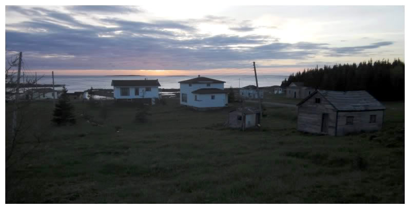
Barr'd Harbour, 2011.
- Route 430: Viking Trail (Cont.)
- Castors River: On the day I went to Eddies Cove West, I also went to Castors River. If that update didn't already have so many pictures, some pictures from these places would remove some of your doubt. I can't remember taking a picture in Castors River anyway.
- Route 430-32: Bartletts Harbour Road (5.3 km/3.3 mi)
- Castors River North: I thought it was neat to visit Castors River, then get on the highway & look back at Castors River from Castors River North. I took a picture of this, but didn't include it in any update.
- Bartletts Harbour: Bartletts Harbour was a place I liked enough to photograph, but I was in a bit of a hurry once I had stopped at a few other places. I'll be back.
- Route 430-36: New Ferolle Road (14.1 km/8.8 mi)
- Shoal Cove West : You drive through Shoal Cove to get to New Ferolle. I've stopped there to take pictures another time, but never posted these pictures.
- Reefs Harbour: I stopped at an abandoned school in Reefs Harbour in 2009, but I soon discovered it is now a storage locker for fishing supplies.
- New Ferolle: I drove the short gravel road from the town of New Ferolle out to their lighthouse in 2009 at sunset. New Ferolle's fantastic lighthouse is criminally unknown. In July of 2010, I made sure that Nicole visited said lighthouse & was ecstatic to catch a lightkeeper there who brought us up into the lighthouse!
- Plum Point: I've stayed at the Plum Point Motel a few times now. I walked from Blue Cove to Plum Point in March of 2014, but didn't include any Plum Point pictures. I've also went for an afternoon walk from Plum Point to Brig Bay, but never made an update out of it. In July of 2017 I stayed at the Genevieve Bay Inn, which was the old elementary school that served the area. In July of 2021, I checked out an old garage out by the highway, plus their St. Mary's Anglican Church. Also in July of 2021, I explored a strange water reservoir(?) that was made to look like an old Newfoundland house?
- Route 430-37/46 (4.7 km/2.9 mi)
- Brig Bay: I walked to Brig Bay one day from Plum Point, following the western edge of Brig Bay up to Graves Point and Woody Hill. The abandoned camper I found wasn't enough to make an update out of the excursion.
- Bird Cove: I've been to Bird Cove a couple of times now in hopes to hike out on the Dog Peninsula. This looks like a fun hike, but I've either been unable to find the trail or conditions weren't the best. One of these years I'll hike out there. In July of 2021 I finally made it happen.
- Blue Cove: You need to turn off of the NL-430 and go slightly down the road to see Blue Cove, something I had previously done, but I also walked into Blue Cove on my way from Pond Cove to Plum Point in March of 2014.
- Route 430-49: Pond Cove Road (1.8 km/1.1 mi)
- Pond Cove: I had my friend drop me off at the end of Pond Cove in March of 2014. This was the start of trying to walk in more of these communities & I greatly enjoyed walking back to Plum Point.
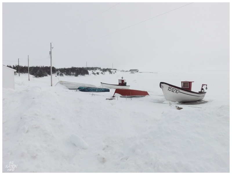
Pond Cove, 2014.
- Route 430-52: Black Duck Cove Road (4.8 km/3.0 mi)
- Forresters Point/Black Duck Cove: Noticing that you can drive the NL-430-52 back to the highway instead of going to the TCH at St. Barbe, I did this in 2010. I also explored the roads and coves of Forresters Point/Black Duck Cove to a greater extent at a later point, but didn't take any pictures. I've since been back a third time, but I'm still not sure if I'm going to post any pictures from Forresters Point or Black Duck Cove. In July of 2018, I walked out Pigeon Cove towards Black Duck Cove, but not into Black Duck Cove.
- Pigeon Cove: In January of 2014 I had Pigeon Cove left on the to-visit list, so spending the night in St. Barbe, I walked into the eye-watering wind to see the ~20 houses of Pigeon Cove. It was pretty neat to be able to walk into one of the last 5 places I had to see here. I'd return in July of 2018 to walk a quad trail out of town towards Black Duck Cove.
- St. Barbe: Deciding that their motel didn't look like a $120+tax motel, I slept in my car in the ferry terminal parking lot in 2009. Sleeping uncomfortably, I woke up and snapped early morning pictures of the Labrador ferry, the terminal & the St. Barbe Arena. In August of 2010, I planned ahead and had a tent to sleep behind the arena while waiting for the ferry. The arena was open for some reason, so I helped myself to a brief look around as well. In July of 2018, I mention switching cars in St. Barbe so I could get back to CB.
- Anchor Point: I went for a spin through Anchor Point on one of my Northern Peninsula trips, but never stopped to take any pictures.
- Deadmans Cove: I stopped to appreciate the fine day with a picture of Deadmans Cove in January of 2014. I then stopped the next day to photograph an ugly day in Deadmans Cove (the snow ghosts were heading north).
- Bear Cove: The highway goes right through Bear Cove, but the interesting thing is that it has a crazy turn because of this one old house. A couple of years ago I noticed the house was wide open & really wanted to stop, but couldn't at the time. Fast forward a year and the next time through Bear Cove? Yep, the old house was gone. I have a hard time believing I didn't even stop once to take an exterior? Maybe I did? I'd have to go back & look through folders, but regardless, I've never posted a picture from Bear Cove.
- Flower's Cove: I drove up to Flower's Cove to walk on sea ice out to their lighthouse in 2009. I walked back to the lighthouse the second day after being unimpressed with my photography. I stopped to check out the summertime scene in June of 2009. In January of 2014 I wandered about Flower's Cove, checking out the winter scene and the differences from 2009. In March of 2014 I drove around Flower's Cove to appreciate the insane amount of snow they had from a recent snowstorm. They had a building eater out trying to widen one of their main roads. In July of 2016 I snapped a picture of their lighthouse from the highway after having dinner at L&E. In July of 2018, I posted a picture of brunch at the L&E.
- Nameless Cove: I left land behind at Nameless Cove to walk on the sea ice out to Flowers Island Lighthouse in 2009. In July of 2010, I stopped in Nameless Cove to photograph the Nameless Point Lighthouse, which has since been replaced. In July of 2018 I posted a picture of said replaced lighthouse.
- Savage Cove: Savage Cove was one of the last places I hadn't turned off the highway to see enough to count it. The thing is, I went and did that, but forgot why I took so many pictures of Savage Cove when I went to make an update - so I didn't post any Savage Cove pictures! In August of 2018 I stopped to photograph their abandoned chip shack/video store out by the main road.
- Sandy Cove: I usually stop for gas in Sandy Cove as I like that old, green Western Petroleum building, but I've never posted any pictures from Sandy Cove. In August of 2018 I stopped to photograph their fish plant that would be torn down soon after.
- Shoal Cove: I've stopped at Shoal Cove on an absurdly windy winter's day, but didn't post any pictures.
- Pines Cove: I have a picture of myself standing on a stop sign because of the snow in Pines Cove. I didn't think to include this picture in the update about their snow amounts up here in March of 2014.
- Green Island Cove: I've turned off the road and went for a spin through Green Island Cove, but never posted any of the pictures.
- Lower Cove: I saw my first Short-eared Owl perched on a speed limit sign at Lower Cove, where it stayed there long enough for me to take a nice picture. As I never made an update for this trip, this picture never ended up on my website.
- Green Island Brook: Green Island Brook is right up against the NL-430 and you would see it by driving through. I've driven down their one road as well, but never posted any pictures.
- Eddies Cove: You go right through Eddies Cove on the NL-430. I've never stopped to take any pictures or find any adventure in Eddies Cove. In August of 2018 I finally drove down by the shore and found the road to Watts Pt/Big Brook, continuing on this road until we found a suitable spot to camp.
- St. Anthony: I stayed at the old Vinland Motel in 2009, eating Far East chop suey and watching a documentary on the wreck of the Edmund Fitzgerald. I stayed at the Vinland again in June of 2009, watching Lethal Weapon and eating a tater poutine. During this June 2009 visit, I saw my first iceberg in the St. Anthony Harbour, went into their Fox Point Lighthouse, visited their PineTree Line radar ruins and photographed the interior of the old St. Anthony Olympia arena. In April of 2010 I went back and attended an open skate at their St. Anthony Olympia, posting 6 pictures of a great old barn that has since been replaced by a "Polar Centre". I also visited the PineTree ruins again. In May of 2015, I photographed a bergy bit in the harbour, the lighthouse and some flurries from my St. Anthony accommodations. In July of 2015, I returned to experience single digit temperatures on the rocks in front of the lighthouse, icebergs at the end of quiet side streets, the city hall stuffed polar bear & the Grenfell House. In July of 2016 I returned to check out their new skatepark. In July of 2018 I mocked tourists watching a whale off of Fox Point, and then was shown the business. In July of 2021, I found myself in St. Anthony and went for a walk by their Anglican Church and finally checked out their quonset hut Sally Anne.
- Route 430-80 St. Carols Road (3.7 km/2.3 km)
- St. Carols: I visited St. Carols in April of 2010, photographing a dog escaping the snow, an old snowmobile & a sweet camouflage pickup truck. I returned in the summer of 2017 to photograph an absurd scene of whales, ospreys, rainbows and an iceberg.
- Route 430-76 Great Brehat Road (5.6 km/3.5 mi)
- Great Brehat: I visited Great Brehat when I visited St. Carols in April of 2010 but I never posted a picture of Great Brehat. I was saddened by the overturned Intrepid by the sea lookout. In July of 2018 I posted a picture of a barn I liked in Great Brehat.
- Route 430-75 St. Anthony Bight (4.4 km/2.7 mi)
- St. Anthony Bight: I visited St. Anthony Bight when I visited St. Carols in April of 2010. I never posted a picture from St. Anthony Bight.
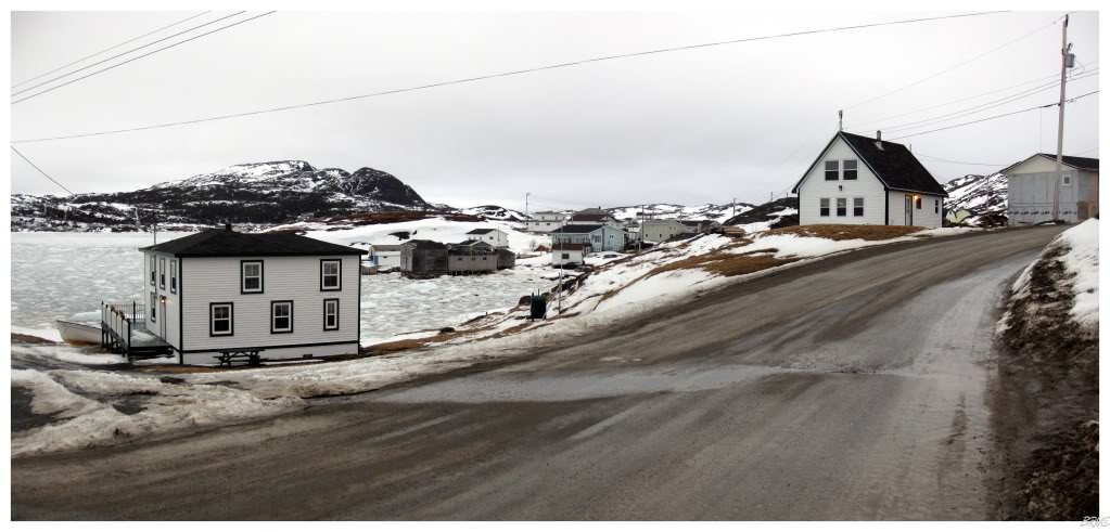
- Goose Cove: Arriving in St. Anthony early one day, I drove the 6km out to Goose Cove in April of 2010. It was a nice, scenic little community. In July of 2015, I hiked a bit of the worthwhile trail at the end of town (the Pumley Cove Trail). Returned again in July of 2018 to hike the same trail, but also look out at Mouse Island.
Goose Cove, 2010.
- Route 436: L'Anse aux Meadows Road (29 km/18 mi)
- St. Lunaire: I've stopped at the Esso and I've ate in St. Lunaire, but I don't know if I've taken too many pictures. In May of 2015, I stopped halfway between St Lunaire and Griquet, but probably closer to St. Lunaire. There's a coming update that'll show St. Lunaire.
- Griquet: As you can catch a glimpse of a modern navigational marker from the highway, that was my initial reason I turned into Griquet long ago, maybe in 2009. I went back in 2014 while killing time, photographing the nice old church/hall at the top of the hill & the Dark Tickle Bridge en route to Griquet.
- Noddy Bay: You need to turn off of NL-436 into Noddy Bay to see enough of it. I did this on a fine January evening in 2014.
- Spillars Cove: Seeing Noddy Bay at sunset meant seeing Spillars Cove just after. Although, Spillars Cove looked really neat with the ice patterns at last light of day. January of 2014.
- Gunners Cove: Finally stopped and pulled down the one Gunners Cove road in July of 2016.
- Hay Cove: I drove into Hay Cove by accident on my first trip to L'Anse aux Meadows way back in 2008. It took me until 2015 to return, when I stopped for coffee a few months ago.
I'd really like to climb the hill on the south side of the cove, but so far I haven't got around to it. I got around to that Cape Raven Trail in July of 2016.
- L'Anse aux Meadows: In November of 2008, I drove all the way up the Northern Peninsula in a 24-hour day to first visit the UNESCO site where the Norseman landed around the year 1000. I always went into the Norse village by parking amongst the houses and walking over, so this is how I saw the modern-day village of L'Anse aux Meadows. I visited again in June of 2009. Again in April of 2010, visiting and photographing the last house at the end of L'Anse aux Meadows. I couldn't believe said house is still standing in July of 2015. In July of 2018 I think I finally saw that said house was torn down, while watching the sun set. In August of 2018 I finally went into the Parks Canada visitors centre and it was worthwhile.
- Route 436-11: Quirpon Road (2.4 km/1.5 mi)
- Quirpon: I posted a picture of their abandoned Salvation Army Church in 2009. In July of 2010 I left Quirpon by boat to go stay at the Quirpon Island Inn Lighthouse for the night - this meant passing right through the Quirpon Harbour the next morning as well (we came back on the eastern side of Quirpon Island). I visited again in July of 2016 at sunset. In August of 2018 I camped in the nearby resettled community of Fortune.
- Route 437: Cape Onion Road (23 km/14.3 mi)
- Raleigh: Raleigh has such a harsh wikipedia description that I was surprised to find a relatively healthy community when I visited in April of 2010. Returned in July of 2016 to photograph a funky house, some whimbrels, grouse chicks and the sea cave of Burnt Cape.
- Ship Cove: You drive through a portion of Ship Cove to get to Cape Onion. On an exploratory April 2010 trip I went for a spin around Ship Cove, but didn't take any pictures. In July of 2021, I hiked Treena's Trail, which included walking thru Ship Cove and on to another trail with some cool houses.
- Cape Onion: I photographed the fantastic Adams House in April of 2010, longing to stay there. Cape Onion is a great little isolated spot, but sadly the Tickle Inn (Adams House) closed in September of 2015. In July of 2021, I was happy to see the Adams House still in good shape.
- Route 435: Cook's Harbour Road (33.8 km/21.0 mi)
- Cook's Harbour: You need to turn off of the NL-435 to visit Cook's Harbour. If I didn't do it that North Boat Harbour morning in 2009, I have been back since.
- Wild Bight: I stopped at Cape Norman during that 2009 winter morning adventure but didn't post a picture of actual Wild Bight. I stopped again at Cape Norman in April of 2010. In July of 2021, I hiked the Whale Point Trail.
- North Boat Harbour: I woke up early in St. Anthony to go watch the sunrise in North Boat Harbour during the winter of March 2009. It was splendid and a top 5 NF experience. I went back in April of 2010, but didn't post any pictures.
- Route 432: Main Point Highway (110 km/68.4 mi)
- Main Brook: Kristen & I decided to take the NL-432 back from St. Anthony in June of 2009. I tried to go into the general store in Main Brook to use the washroom, but they didn't have one. I included one picture of a weather-beaten & homemade speed limit sign in Main Brook.
- Burnt Village: I made sure to take the NL-432 back from St. Anthony one time so that I could see the village of Burnt Village, but I guess I didn't post any pictures? I enjoyed the tiny place with 15 houses and even snapped a few nice shots, so this surprises me. Sometimes things slip through the cracks as well. Anyway, I drove the 500m of street there is in Burnt Village.
- Route 438: Croque Road (28 km/17.4 mi)
- Croque: I visited Grandois in April of 2010, but didn't take any pictures when I checked out Croque along the way. In July of 2015 I would return to Croque, checking out their meadowy harbour, an old home and the old French sailors carvings outside town.
- Grandois: I was excited to visit Grandois after watching the Land & Sea special about the 1 kid left in the whole town. It was a nice, calm winter's day in April of 2010 when I snapped a picture over the community. In July of 2015 I would return to camp just outside town, having an absurd evening of icebergs, golden hour sunsets and spectacular scenery. I hiked to St. Julien's the next day.
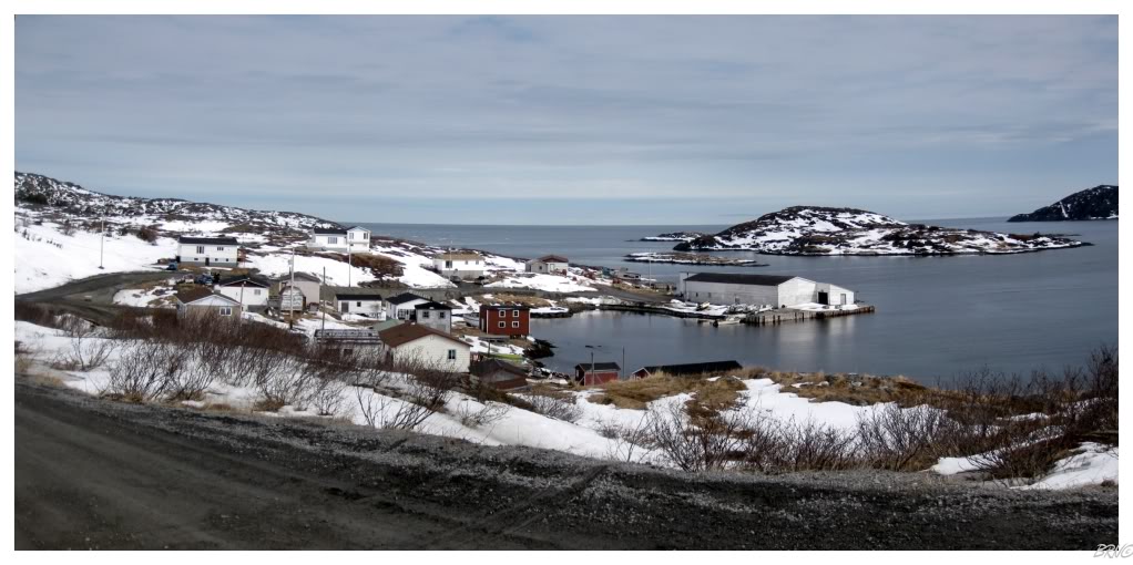
Grandois, 2010.
- Route 433: Englee Highway (36.9 km/22.9 mi)
- Roddickton: I stopped at the old NL Hydro Plant in April of 2010. I photographed the interior of the particle board factory that isn't there anymore as well. In July of 2017, I finally stopped to photograph the underground salmon river.
- Englee: Visited Englee in April of 2010, finding it to be one of the most beautiful communities on the island. A village that spreads out over three connected islands, we also had one of those fine April days where it's just starting to get sunny and a tad bit warm. We climbed the stairs to the viewpoint atop Barred Island & also photographed the Apostolic Faith Church.
- Bide Arm: I checked out Bide Arm while waiting for others to meet me in Conche. Having missed the town on my previous drive to Englee in 2010, I was happy to check it out in August of 2012.
- Route 434: Conche Road (23.3 km/14.5 mi)
- Conche: Conche is home to a lighthouse, so I obviously made sure to get to Conche ASAP (April of 2010). I was almost more impressed with the gravel road leading to Conche, where it goes through the boglands and forests of the Northern Peninsula then dramatically drops to this tiny town along the shore. I returned to Conche in August of 2012 to visit the Grey Islands, which would be in contention for my favourite adventure during all of my time spent in Newfoundland.
- Route 401: Howley Road (14.3 km/8.9 mi)
- Howley: I first went to Howley on a lovely winter day in January of 2009. I had a nice poutine & Dominion at their Trapper's Lounge. In July of 2010, I drove into the heart of Howley and out to Hinds Lake Dam. In September of 2014 I passed through Howley while cycling the T'Railway from Badger to Deer Lake. In April of 2021, a whole gang of us went and walked the frozen beaches of Howley.
- Route 420: White Bay South Highway
(68 km/43 mi)
- Jackson's Arm: Photographed an old fishing stage at the end of this highway during my first Newfoundland adventure in October of 2008. In July of 2016, I drove the Coney Arm Resource Road, stopping in Coney Arm and photographing the impressive dam.
- Sop's Arm: Explored their bridge over Main River, along with the foundation ruins of an old gas/grocery store in 2008.
- Pollards Point: In 2008 I explored an abandoned school in Pollards Point. It was great & I often think of going back.
- Route 421: Hampden Road
(15.7 km/9.8 mi)
- Hampden: Photographed the wintry bay and their forgotten zamboni in January of 2009.
- The Beaches: The Beaches was a neat little community at the end of a road superimposed along the side of White Bay. Visited in January of 2009.
- Bayside: To reach Hampden & The Beaches, you go through Bayside. I didn't take any pictures of Bayside.
The Baie Verte Peninsula:
- Route 411: Westport Road
(27.2 km/16.9 mi)
- Westport: On my first trip to the Baie Verte Peninsula I went to Westport to see their lighthouse. February 2010. In November of 2014 I would return to photograph the lighthouse at sunset. I would return to check out their lighthouse again in October of 2017.
- Purbeck's Cove: I couldn't resist driving the 6 km to go check out Purbeck's Cove; photographing a cat on an excavator tire & St. George's Elementary. February 2010.
- Route 411-11: Bear Cove Road (12.4 km/7.7 mi)
- Bear Cove: I had Bear Cove and Back Cove both listed as towns on this list from topo maps and Google Earth, but when going there, I discovered that it's actually pushing it for either of them to count. The sign to Bear Cove is brown, so I guess it's an inhabited cabin community, but I still counted it. Bear Cove ended up being totally worthwhile & awesome when I visited in August of 2012.
- Route 412: Seal Cove Road
(13.4 km/8.3 mi)
- Seal Cove: I visited Seal Cove in February of 2010, enjoying the view when coming down from Seal Cove Road, along with their old post office and church.
- Route 419: Wild Cove Road
(11.2 km/7.0 mi)
- Wild Cove: Wild Cove Road leads off from Seal Cove Road & therefore I visited Wild Cove in February of 2010 as well. I photographed a peach house.
- Route 410: Dorset Trail
(89.1 km/55.4 mi)
- Baie Verte: I photographed their arena and skatepark in June of 2009. In November of 2014 I stayed at the Baie Vista Inn again & included it in an update this time.
- Fleur de Lys: I hiked their Ocean View Trail in light drizzle in June of 2009. It was nice despite the rain. I went back in February 2010 and liked seeing their iconic abandoned fishing stage in the winter. In November of 2014 I brought some friends to hike the Ocean View Trail under snow's cover; then walked around town for a minute.
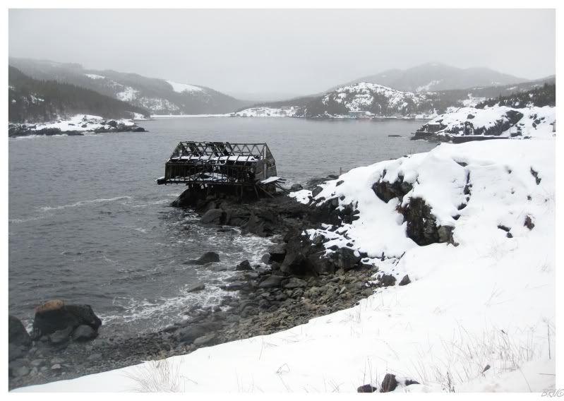
Fleur de Lys, 2010.
- Route 410-10: Coachman's Cove Road (2.7 km/1.7 mi)
- Coachman's Cove: I turned off of the NL-410 to see Coachman's Cove in June of 2009. I wanted to hike the French Island trail, but going through a grassy meadow and squishing snails, I turned back instead of having them die just so I could go for a hike. I returned in October of 2017 to camp on that French Island Trail, but instead stayed in the local day park.
- Route 418: Ming's Bight Road
(10.4 km/6.5 mi)
- Ming's Bight: I drove into Ming's Bight on my first trip to the Baie Verte Peninsula, but never posted a picture. My main travelling partner hasn't been there yet, so I'll have to go back in the future. I returned with my main NL travelling partner in May of 2016.
- South Brook: Despite trying my best to make this list of NL towns accurate, South Brook seemed like more of a town on the ground than on the road map/Panoramio/Google Earth/Google Maps. I drove there in May of 2016, although I can't remember if Nicole & I already had did it back in the day.
- Route 417: Pacquet Road
(9.9 km/6.2 mi)
- Woodstock: I drove the entirety of the NL-417 on my first trip to the Baie Verte Peninsula. I got a picture of me airing some homemade ramps in Woodstock, but this picture never made it into an update.
- Pacquet: Pacquet is a scenic little community where I'm sure I took a picture, although I didn't include said picture in the first Baie Verte update. In May of 2016, I returned and hiked their community trail out to an impressive sea cave.
- Route 414: La Scie Highway
(52.5 km/32.6 mi)
- Route 414-11: Harbour Round Road (1.6 km/1.0 mi)
- Harbour Round: I mentioned visiting Harbour Round in June of 2010, but didn't include any pictures.
- Route 414-10: Brent's Cove Road (3.4 km/2.1 mi)
- La Scie: After driving all of the highways on the west side of the Baie Verte Peninsula, it was time to see the eastern side in June of 2010. I tried to drive to some radar ruins in La Scie, but instead ended up at their lookout, seeing the nasty rocks that make sense of why this place translates to 'The Saw'. I also rented the ice & played some hockey there for my bday (November of 2010). In October of 2017, I'd return to walk some of the town's trails and look out at the Horse Islands.
- Route 414-13: Shoe Cove Road
(4 km/2.5 mi)
- Shoe Cove: Stopped in Shoe Cove after La Scie in June of 2010. It was a beautiful day to meander about the wharf and town cemetery. In February of 2012, I climbed into the crawlspace beneath an old house in the dead of winter, only to find no way up into the abandoned space. In October of 2016, I hiked over and camped in Shoe Cove Bight.
- Route 414-12: Tilt Cove Road (5.7 km/3.5 mi)
- Tilt Cove: Tilt Cove was an interesting place to happen to pull into in June of 2010 simply because it was on the map. An old mining community, there's only 6 people there nowadays & back in 2010, the runoff was more orange, there was more demolition shrapnel about & less protective fences. We also wandered into the cemetery, checked out the Queen of Swansea memorial and Tamarack Village Park. The next BRN post would come in October of 2017, when I returned to check out a prominent abandoned house (and the cemetery again).
- Route 416: Round Harbour Road
(8.7 km/5.4 mi)
- Round Harbour: Drove to Round Harbour while exploring the Baie Verte in June of 2010. Walked the north side boardwalk and wandered into an abandoned home. A beautiful place where I wondered how many other places without roads I miss because of my propensity towards driving.
- Snooks Arm: Visited Snooks Arm in June of 2010, spinning the tires up the hill trying to get out of town on that crazy hill. I didn't post any pictures. I would return a handful of times from 2011-2015, trying to get to nearby Indian Burying Place.
- Route 415: Nippers Harbour Road
(17.7 km/11 mi)
- Nippers Harbour: In October of 2010 I drove to Nippers Harbour, photographing their old Orangeman's lodge and meeting a nice man who showed us the interior of St. Mark's Anglican. Nippers Harbour is worth the 17 km gravel road to get there. In November of 2014 I returned for my birthday, spoiling myself by allowing a drive to see this place that might resettle one of these years. In September of 2020, I photographed Nipper's Harbour from across the bay in King's Cove.
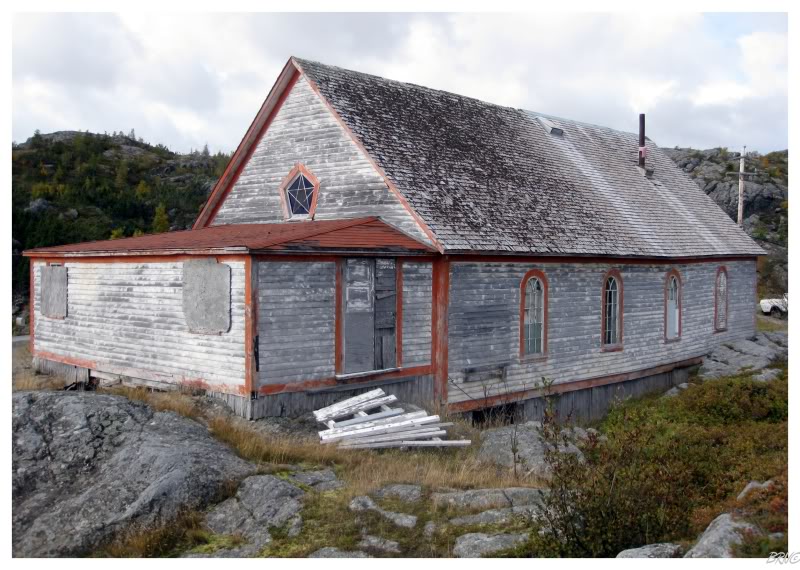
Nippers Harbour, 2010.
- Route 413: Burlington Road
(31.3 km/19.4 mi)
- Middle Arm: Exploring the Baie Verte in June of 2010, I drove to the end of the NL-413 and photographed the shipwreck in Middle Arm. I'd like to go back and hike the trail to Middle Arm's fire lookout.
- Burlington: By driving to Middle Arm like I did in June of 2010 you go through Burlington. I didn't post any pictures from Burlington.
- Route 413-10: Smith's Harbour Road (3.7 km/2.3 mi)
- Smith's Harbour: I drove to Smith's Harbour to check it out, but didn't end up posting any pictures.
- Trans Canada Highway:
- Sheppardville: One day I turned into Sheppardville and drove their four streets, but didn't make an update about it. I was talking to someone from Sheppardville later & they said the old highway still extends from one of their streets, so I'll probably stop to check that out one day.


