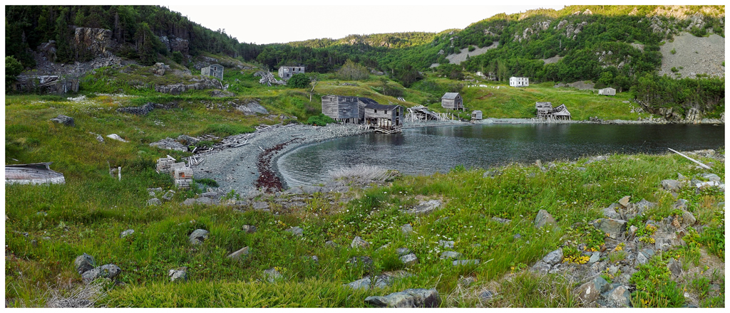
When you first hear about Newfoundland and Labrador's resettlement program and the associated lengthy list of abandoned communities, you picture dozens of worn, ramshackle homes set upon scenic coves. Having been to a few dozen of these places and researched a hundred more, I've seen that almost all of them have fallen in the face of weather, scavengers and the passage of time. They almost all exist today only as a few overgrown headstones and stray piles of clapboard. Indian Burying Place is one of the few resettled communities that looks like how you imagine a Newfoundland ghost town to look. Stately two-story homes still face the sea on an angled meadow shoehorned between two cliff-lined foothills. Soon after moving to Newfoundland & finding pictures of Indian Burying Place online, I knew that this was a place I needed to visit. (If you want to skip the failed attempts & get right to the meat and potatoes, click here.) |
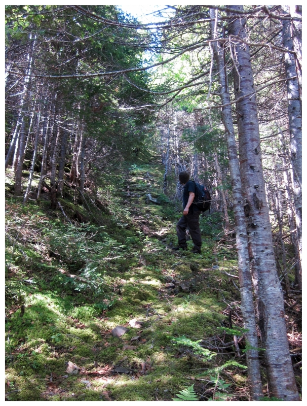
Reading that reaching Indian Burying Place was as easy as following an old trail from the town of Snooks Arm, I didn't rush out to the Baie Verte Peninsula with any alacrity. Finally on a random, hot August weekend after living here for 3 years, I decided to conquer what I figured to only be about an hour's hike at my pace. The same website that said there was an old trail, showed an older crew taking about 2.5 hours to get out there. The trail wasn't obvious once in Snooks Arm. Obviously I knew what compass direction it was to get to Indian Burying Place, but walking the southern streets, there wasn't a trail sign and/or a worn path like I was expecting. (My God was I wet behind the ears back then.) Of course there wouldn't be anyone around to ask about the trail, so walking back into the main cluster of houses in Snooks Arm, I finally spotted a woman going into her house & closing the door. Upon knocking on her door, she asked her husband who said you simply go to the end of the street and continue up the hill. "You'll meet up with the path" he assured me. We found a bit of a path, but having gone down into Snooks Arm, the start of this was entirely a very steep uphill with slight switchbacks to combat the angle. In addition, this was one of those days where you amazingly remember Newfoundland can actually get muggy, and without any wind here in the forest, it was a slog up the hill. |
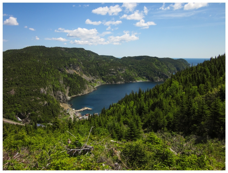
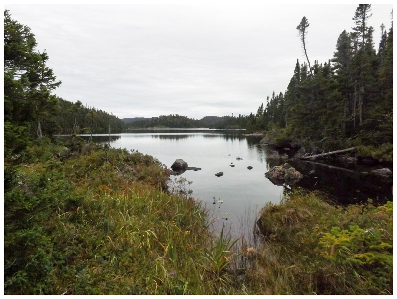
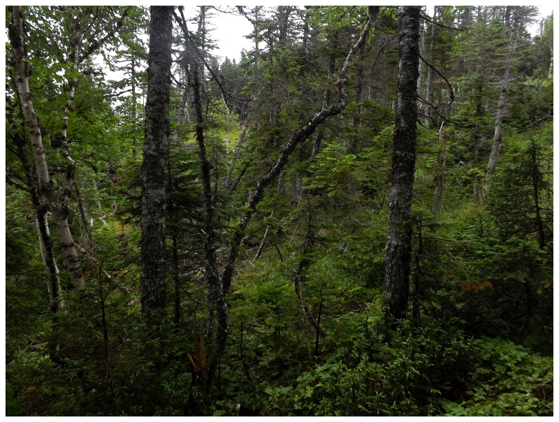
Looking back at Snooks Arm.
Shelloo had enough after about 10 minutes & my encouragement into only needing to get atop this hill was met with astute, overheated refusal. She sat down about 2/3rds of the way up the hill & said that she'd wait for me to go & come back. I paused for a second and pondered this, her sitting here while I rushed for the next hour, rushed through an hour of exploring and then rushed back in a third hour. She was insistent though, so I shrugged my shoulders and gave her the car keys, before running up the hill and across bogs until I was startled by a territorial grouse. The grouse only appeared after about 10 minutes, a short time where I continuously thought about how this wasn't going to work today. I conquered the small hill and looked back over Snooks Arm on this 2011 day. A sea of forests, ponds and oceans were at my back, with some indent of the coast somewhere out there indicating Indian Burying Place. We needed to return better prepared on a cooler day. |
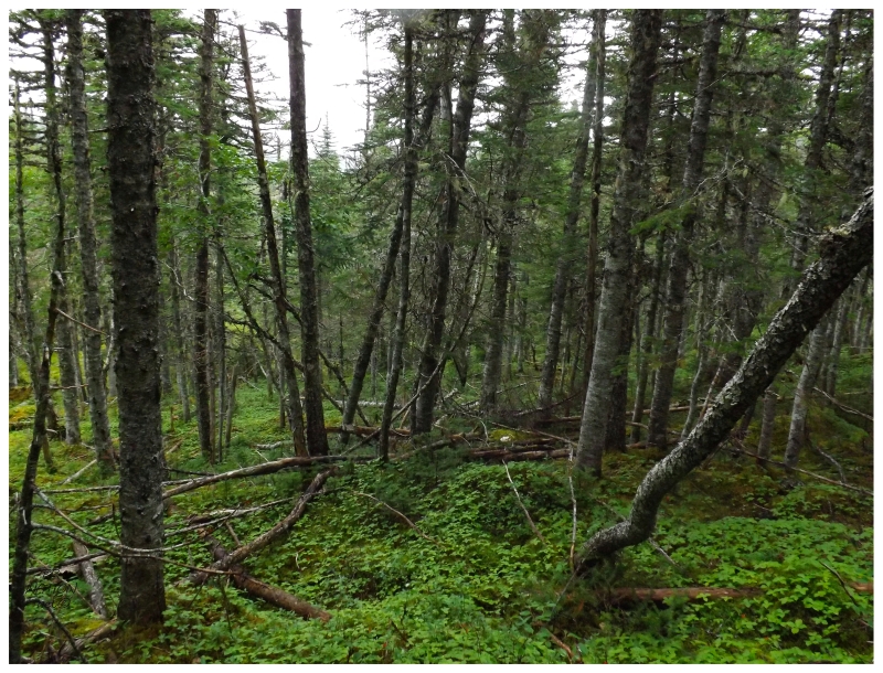
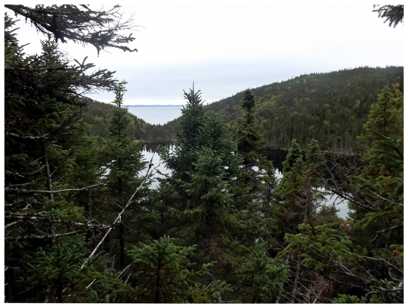
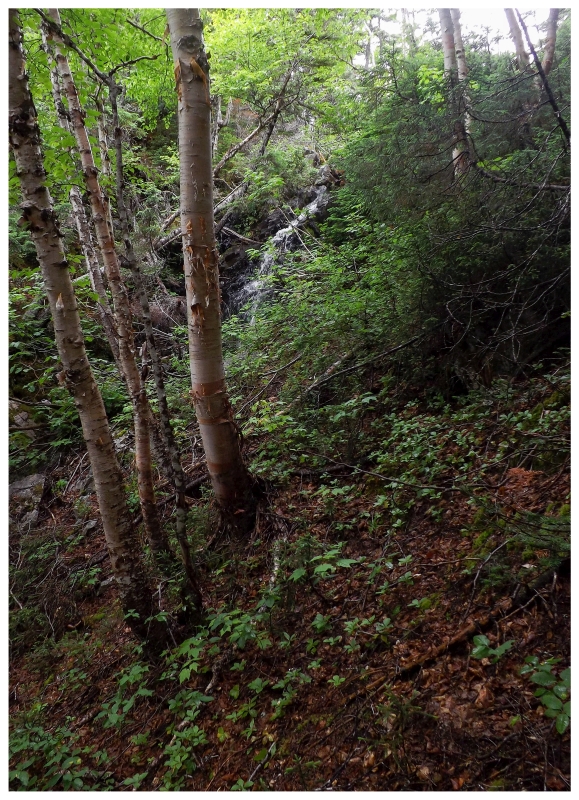
Trees outside the blowdown, September 2012.
The path near Snooks Arm tapered out in those minutes between when I left Shelloo behind and when I encountered the grouse. This left me without much faith in it existing all the way to Indian Burying Place, so I instead looked at a map and decided on a shorter path that started at a higher elevation - meaning that the hike wouldn't start with a trying climb out of Snooks Arm. Returning in September of 2012, things were moving along nicely, even as I discovered that blowdowns aren't as conducive to bushwhacking as I imagined. Trying to climb and crawl around entangled, broken trees at knee's height with a heavy backpack is an incredible pain. I'm now of the opinion that I'd rather have an undisturbed forest & that blowdowns are only good for assessing your surroundings. |
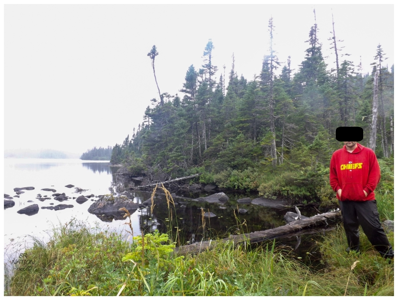
This was also the day that I learned a car GPS is terrible for navigating in the woods on foot. Where your car is facing one way and the GPS is moving with it, it can point you in the right direction...but when you pull out a car GPS and look at your destination on foot in the forest, it can lead you a little to the left or a little to the right, which, if you keep following it a little to the right, you astonishingly end up back in the same blowdown on...y'know...some hypothetical rainy September afternoon in 2012. The worst part was that here I had messed up when Shelloo had brought her A game. I felt so embarrassed and disappointed in leading us astray when she had done her part in handling her business. Returning to near the start of our bushwhacking portion of the hike, there was an unnamed lake that would become familiar. On this the first return passing of this lake, I stood there dejectedly for a picture. |
In September of 2013 we would return and again choose the shorter, no trail, bushwhacking route. After the debacle of 2012, I had received a hiking GPS for Christmas and was much better equipped to be out here than carrying my Garmin car unit. (I also since learned how to use that car unit more appropriately, but that's neither here, nor there.) So we popped through the familiar small first bog, larger second bog, passed by the unnamed lake, up the big hill, alongside the blowdown edge & down the hill into the forest. Things were going good, but with a late start and shorter September days, there were already concerns about remaining daylight hours. |
The unfamiliar parts would bring about hill climbs and boggy bushwhacks that consumed even more time. Just as thoughts had to go towards turning around, we found ourselves atop a small cliff angling down to a lake, but with a window out to the ocean. Indian Burying Ground Cove was right there, but it also wasn't. This was about a kilometer away & there was no easy way forward. Even if things got easier ahead, it would take us the better part of an hour to get down from here & over to the other side of this lake. As much as it killed me, this was the turning point of getting close, but having to turn around after a third failed attempt. For good measure, I put away the GPS on the way back, then led us to the whole other side of that unnamed lake. Both of us tired and hungry - and me with my bravado about always being the navigator - we were now both upset, but also concerned with the dying light. Thankfully the southside of this lake is the only bit of easily traversable forest out here, bringing us back to that same unnamed lake point that marks this bushwhacking route. I couldn't help but think of whether those meandering hours could have been better spent getting to IBP instead of getting lost. I have yet another picture of me tired in front of the unnamed lake, this time wearing a hunter's orange blazer because it was now hunting season. For how much this lake came to have meaning, I wish it had a proper name and I figure I should be able to name it. (Although it's not like I can call it Navigator Lake, now can I?) |
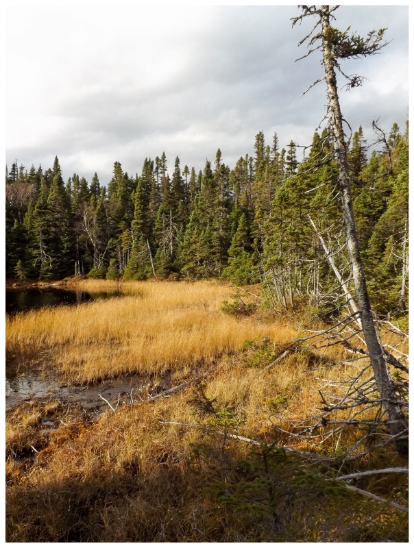
I gave it one more, very half-assed attempt in October 2013, while battling with wanting to see it this year, but also being tired and not feeling like hiking out to IBP alone (Shelloo sat this attempt out). So I arrived late on an even shorter day, pretty much accepting that I wasn't going to make it as I arrived in Snooks Arm. I was simply going into the woods to gather intel and increase my knowledge of the area. In the end, there were worse endings that could've happened as I ended up at a pleasant pond in late fall light with my beloved yellow grasses (located @ 49.84454, -55.71209). You can see that I was going the right way, but just a little off path. |
This day I took the Snooks Arm route, but found what I suspected on that first trip with Shelloo - that the trail peters out quickly. From the point where I didn't see anymore trail I bushwhacked in the direction of IBP, finding new cliff faces, drops, rocky creeks and high-canopy forests until I ended up at that lake. On the way back, I would track a little south of Snooks Arm thinking the rock walls, overhangs and slots were really neat, before realizing that I was going to end up in an isolated, seaside cove south of Snooks Arm if I kept going. Climbing halfway back up and scrambling sideways along the steep embankment, soon enough I popped out in some random Snooks Arm yard. I was sure seeing my fair share of this country. |
Taking a year off, I would return in 2015. Shelloo was busy and having read that there's a cabin that's "maintained for visitors (barely)", I was now setting out with my 70L pack and everything I needed to get to, and sleep at, Indian Burying Place. (I didn't know what "maintained for visitors (barely)" meant or how the cabin had held up in recent years, so my 70L pack had everything I'd need even if I had to sleep outside. Upon return, Shelloo was amazed at the weight of the thing & that I'd set out to IBP with it.) It had been a rainy and cool summer, so the first bog was wet like I figured, but having planned this weekend for a while, I was going to work with the wet bogs instead of staying home. I had a change of socks in my hefty pack. |
Of course there was nervousness about being out here alone and that wasn't helped by the dreary, cool day in the dark forest. I simply kept moving forward through these familiar bogs and hills, really moving along at a nice clip into the more unfamiliar land in no time. Bogs, creeks, boulders. I tip-toed and clambered around, all the while keeping my bearings and watching the distance to IBP tick down on my GPS. I felt a mix of excitement and fear in these further places, no longer being able to retreat to the road so easily, like if I messed up back at the unnamed lake or in the blowdown. I had everything I needed though, this heavy load on my back full of water, powerade, shelter, food and dry clothes. |
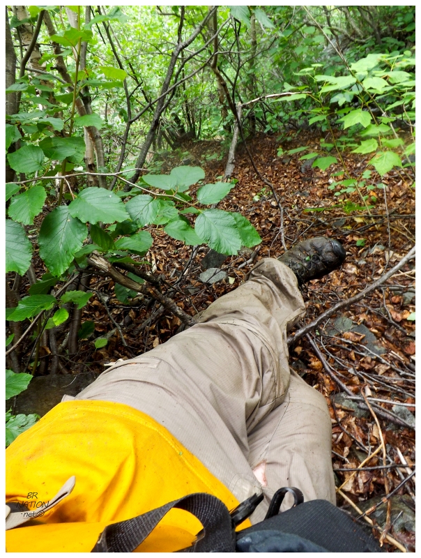
I could have actually used more of that water, but the sheer amount of mosquitoes and blackflies kept me from hydrating to the level I would have liked. It was so bad that at parts where I would get tangled in trees or have branches snag my pack, the biting flies would be there in the 10 or 15 seconds I was trapped. I had to keep moving, this swarm of annoyances following close behind and testing my resolve. The blackflies also came into play as I happened upon a small waterfall. Being the geography and exploring nerd I am, I instantly thought about how far I was from the road and how few people have probably ever stood before this waterfall. There were 100 or 150 people in Indian Burying Place at its peak? And only Bobby Cove and Betts Cove anywhere closeby? I couldn't imagine why I'd be amongst any more than a small group of people who've ever seen this waterfall before. I threw down my pack in excitement, but within only 5 feet, blackflies were already swarming me as I tried to take pictures. I went so far as to ignore them to be able to take a couple more while feeling them bite me as I swore at the camera to focus, but there was no way I was going to be able to get down into these tangled shrubs and closer to the waterfall. I had to keep moving. Where I had awoken to blowing drizzle outside La Scie's Cape Motel this morning, I half wished that drizzle back to get relief from these annoying buggers. |
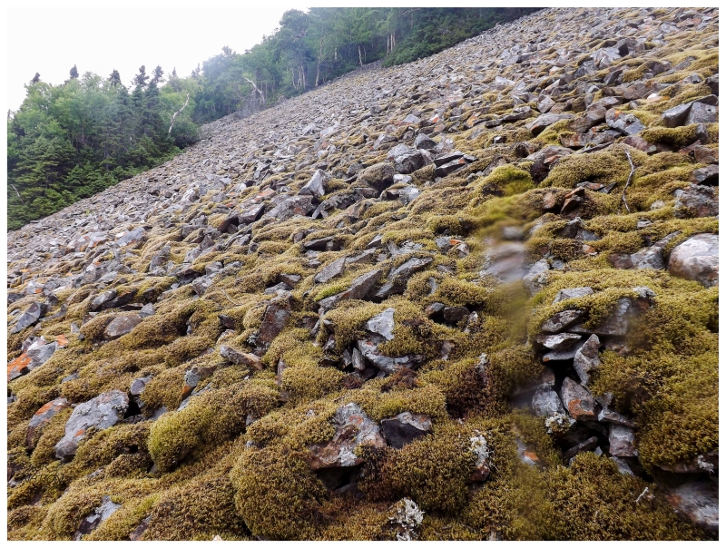
In only a short distance, that waterfall's creek had emptied into a small lake at the base of a sizable hill. I kept about halfway up the hill, unsure if there was even a lakeshore to walk, with the trees and rocks below me obscuring the edge of the lake. Regardless, I needed to cut west shortly, which is why I kept trying to move along halfway up this hill, hoping that nearby was a less formidable hilltop to climb over. A small break in the trees would come before the large, mossy scree slope you see above. I was already near the bottom of this rockfall slope, so I continued to work angularly across it, avoiding the collection of rocks or open pathway straight into the lake at the bottom, but not moving uphill in case any of the rocks underfoot gave way. Carefully testing each step forward while also testing my core strength with balancing this giant pack, I only ended up dislodging 2 or 3 rocks before making it to the other side surprised with the scree slope's stability. |
The rockfall slope would spit me into a somewhat walkable forest, before having to navigate a creek, then more thick woods as I fought my way uphill. By now I was headed south of IBP to the coast below, and knowing the sawtooth, daunting coasts of the Baie Verte Peninsula, I didn't want to find myself in the next cove over with some incredible hill separating me from Indian Burying Place. The hill here was steep and just as I was happy to reach the rounded top, I found trees so thick that they held me where I could have slept at this 30° forward angle. As much as I imagined a smooth walk along the top of this hill, the going was so tough that I suspect my chosen route was easier. I was so close that I kept mashing forward, until I got to the point that I wondered if I was going to fall off a cliff and land on Indian Burying Place. It's around here that I found a sharp downhill slope, where I picked my way down a dry creek and through a few more smaller rock slopes. (I lost my Detroit liquor store, Olde English 'D' toque here, which is a really funny thing to leave behind in such a place.) |
About halfway down the hill, I would look up and see the first building of Indian Burying Place through a crack in the trees. It was hard to believe after all of the failed attempts and today's exhausting hike, that finally I stood before this place. I ended up coming down the hill into the less familiar part of town where there's more modest, more dilapidated homes. For the bits of coverage I've seen of IBP, you always get pictures and video of the homes to the right of the above picture (the more impressive homes, plus the fishing stages/sheds.) It's with that, that it was a bit weird to come down this way into houses I didn't really know were in Indian Burying Place. For all of the years of studying satellite imagery, elevation charts & topographic maps, I always imagined walking upon IBP from the standard route (which would be the valley in the middle of the above picture). (With coming down the hill to the east, this also means that the waterfall is even more remote than I initially imagined. It wasn't even on the standard IBP route & you'd have to go over to the next cove if you were going to take a sensible way there. Cool!) |
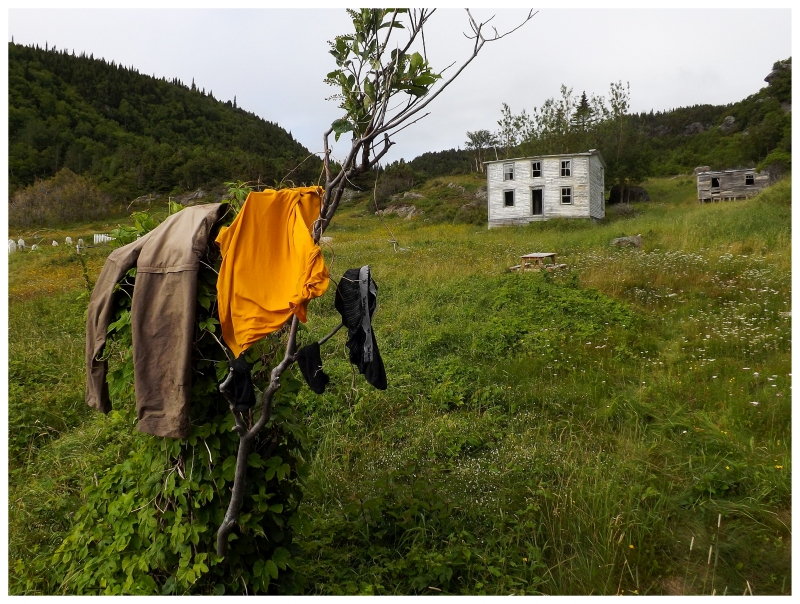
The dewy vegetation combined with sweat to ensure that my clothes were soaked thoroughly. About the only thing that was dry was my thigh and groin area, where even my pant bottoms met bog muck and water during the hike. Hiking across town, I found a convenient tree near where I planned to sleep tonight. It felt fantastic to strip off the wet stuff and slip into dry, warmer clothes. It wasn't a cold day, but anyone who's bushwhacked or got caught in the rain, knows the beautiful feeling of dry clothes afterward. |
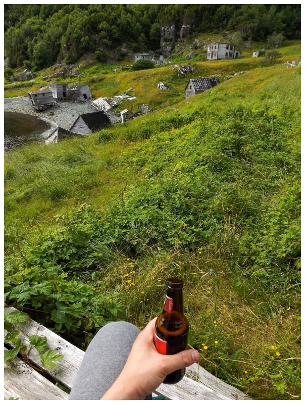
I'd brought one beer along with me to celebrate, since if I was going to be staying here overnight, I could have it instead of the Snickers I would have if I was heading back today. Now that I had a chance to free myself from my large pack, wet clothes and the worry about where I was going to sleep, there was a moment to relax and reflect before the blackflies would discover me (it took them about 2 minutes). As for where I was going to sleep tonight, the "maintained for visitors (barely)" cabin turned out to be just fine. I slammed the door on the blackflies and savoured eating my trail mix. As I sat there in a great, old, wooden kitchen chair, my sore shoulders thanked me for getting rid of the trail mix weight (they also thanked me for drinking the stupid, heavy bottle of Rickard's, haha). |

The cabin walls were covered with roll calls of different groups who had visited recently. (It seemed like people might've subtly wrote their names in pencil back in 2010, but now there's a marker and so many recent, apparent tags.) The names were plentiful and so tagged with "2015" that it made me worry that someone might show up on this Friday afternoon. I thought of their insistence on bringing me back by boat and whether I'd be able to turn down a relaxing, easy boat ride back to Snooks Arm before properly exploring this community. With those worries about time and intrusion, I set my sights towards the most impressive house left at Indian Burying Place, which was located just up the hill from the cabin. |
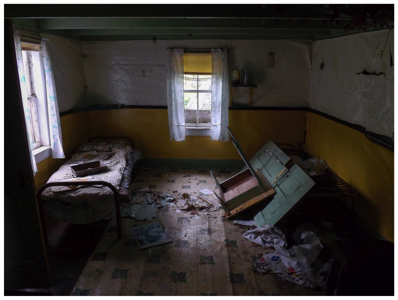
Inside, I was amazed at the condition in which the house remained. This would partly have to do with craftsmanship, but also in Scott Walden's Places Lost: In Search of Newfoundland's Resettled Communities, he mentions that a few of the homes here were still occupied in the summer or as weekend cabins for many post-resettlement years. People continued to fish out of here or simply enjoy the IBP scenery, resulting in some homes that are piles of lumber and some homes like this one, where with a little elbow grease you'd have yourself a fine outport home once again. (Scott's book also has an amazing old photo of Indian Burying Place where there has to be about 4 or 5x the number of houses and buildings that there are today.) |
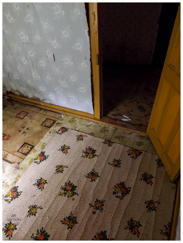
This house had all of the typical features of an old Newfoundland home - low upstairs ceilings, colourful paint choices, cool wallpaper and cooler linoleum floor patterns. I absolutely loved every last bit of it. |
This house made me wonder about the "last standing" houses of other resettled places I've been to from the 1960s. Clearly this house is a contender to be the last house standing at Indian Burying Place & it's likely because someone still came out here into the 1990s or even the early 2000s. In cases of other resettled places, continued occupancy likely plays a role in why you have that one last house left in the end (in addition to craftsmanship, initial size and random luck). |
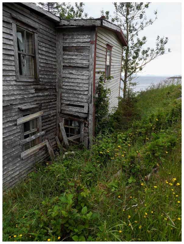
'First house'. Side view.
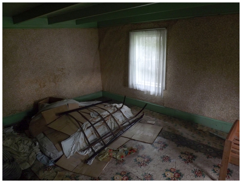
There's another house nearby that's also in decent shape, but just a little bit more rundown. Inside, I found a map showing mobile telephone coverage from 1989, meaning the house could have been completely abandoned sometime in the 90's. Judging from deterioration, this first house saw some semblance of occupancy/maintenance for a few additional years after the second house. (Scott Walden came here in 1998 and found Indian Burying Place empty.) |
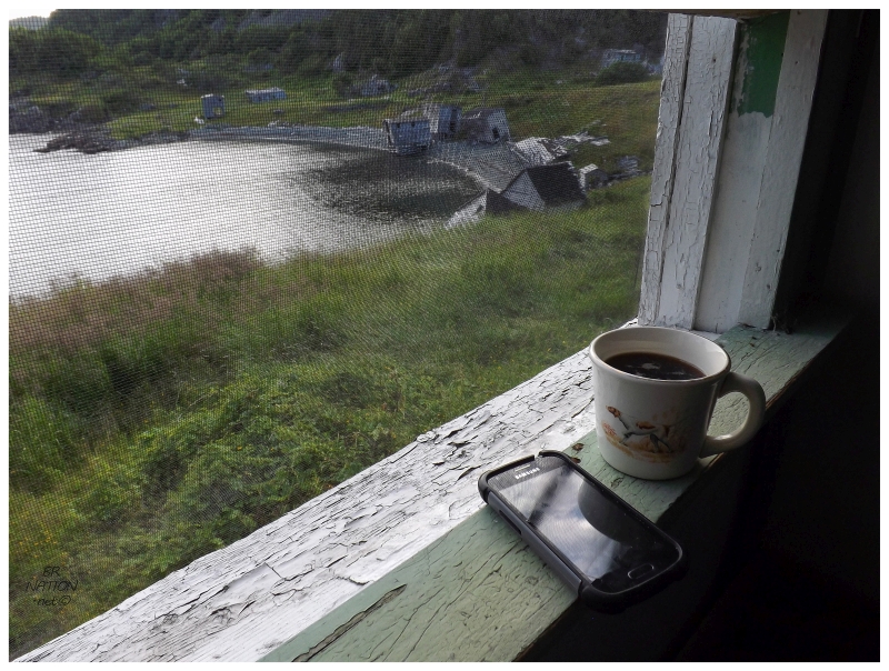
I explored that other house, but as this update is getting a bit long, I'll save those pictures for another part of this update series. After exploring those two houses, no one had come around and the advancing hour and dreary day made me think I might have Indian Burying Place to myself from here on out. I examined some of the headstones in the middle of town for a few minutes, before the relentless mosquitoes and blackflies chased me back into the tranquility of the cabin. There was no rush to check out the other houses now, so I slowly went about organizing dinner and relaxing for a few minutes out here on Notre Dame Bay. Pulling my turquoise chair up to window in the main room of the cabin, this wasn't bad at all. Continue to Part 2... |