I must've driven the NL-414 across the Baie Verte Peninsula ten times by now. Through all of those trips, I've always craned my neck and thought about stopping at the sight of the old Rambler Mine sign, but never actually made it further than the gate. After checking off more and more Baie Verte throughout the years, and also being tired of driving by the Rambler every time, Shelloo and I would finally go for a stroll to see what was back at the old mine site. This was the first camping trip of 2016. |
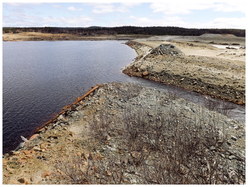
The key would have been coming back here when I could see abandoned buildings back in 2008 or 2009; or even when there were still a few buildings in 2010 or 2011. This copper mine shut down in 1982, back when there weren't regulations stating that they had to tear down the buildings or remediate the site. It's only after studies and government spending that the province came and tore down the buildings, removed hazardous waste and installed protective dykes between 2009 and 2012. Finally walking back here in 2016, it was nothing but a cumin-coloured, rocky wasteland devoid of any buildings. I laughed at all of the times I decided against stopping, where I'd then beat myself up on the drive back to Corner Brook. There was nothing to see back here the whole time, haha. |
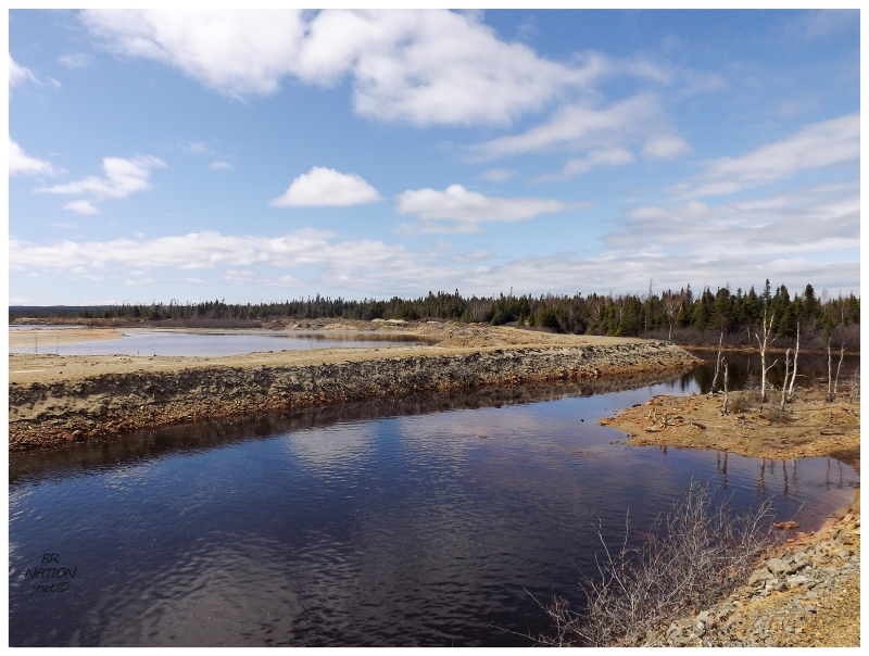
After the Rambler mine, we headed up to Ming's Bight as Shelloo had never been there before. By now, her own list of unseen Newfoundland towns was getting pretty slim. Pulling into town and exploring more of the roads as I'd only been here once before, we found a seaside road that led to the village of South Brook. I couldn't recall Nicole & I taking this road back on my only previous trip to Ming's Bight, but I can assure you that I tried my hardest to make sure I'd been to every community in Newfoundland. Referring to my page of Newfoundland towns, I don't have South Brook listed, so from maps and Panoramio, I guess it didn't seem like enough of a community for it to count. On the ground however, I would count it as a separate place. The above picture shows a dock across the way which is the official Ming's Bight community wharf; where South Brook is that collection of houses just off to the left. It's a really close call whether this counts as a separate community. The road that separates the two communities is only about 400 meters (1300 feet) long. In my completely arbitrary judgment, I'm going to add South Brook to the community list. Therefore, woot, I've now seen 793 Newfoundland communities! |
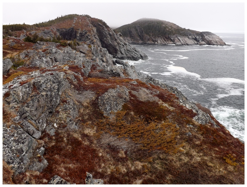
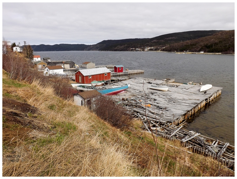
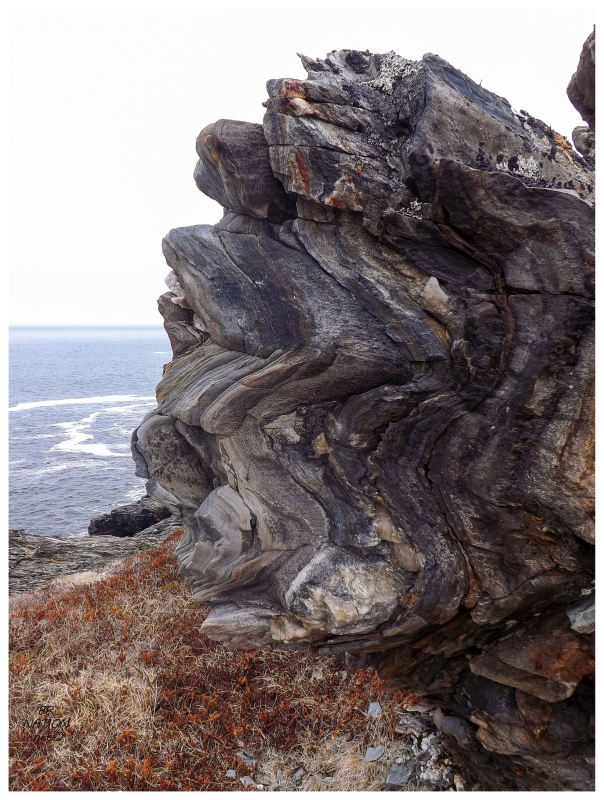
From South Brook we headed up the next highway to Pacquet & Woodstock, another pair of communities that Shelloo had never seen. It was nice to see the tiny box jump I hit was still in Woodstock and also see that their abandoned elementary school still didn't have any glaring openings. Deciding to get out of the car and hike the community trail in Pacquet, we were impressed with the first little cove - and dreamed of camping opportunities - before heading out to the Atlantic-facing coast where we found immense and towering cliffs. |
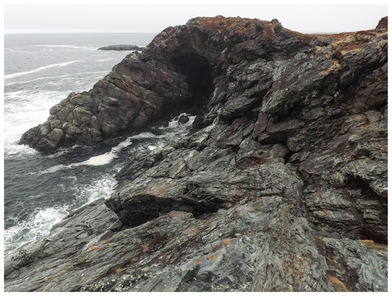
And a sea cave. And while I'm not an oceanic guy, there is something special about sea caves. I can only relate a bit to people's love of lapping salty water upon dangerous shores, but whenever there's a sea cave, I get more of that feeling of humility. As I got down and close to the sea cave, it's some of the most alive I felt in a long time. One small misstep or trip to the left and that's that - the frigid waters and my lack of swimming skills would spell certain doom. So I leaned against some rocks and watched the chamber 10 times the height of me, fill with water and empty its water. The great space, loud boom and waves flowing away. It's a time to be incredibly careful, but also to savour how small you feel. |

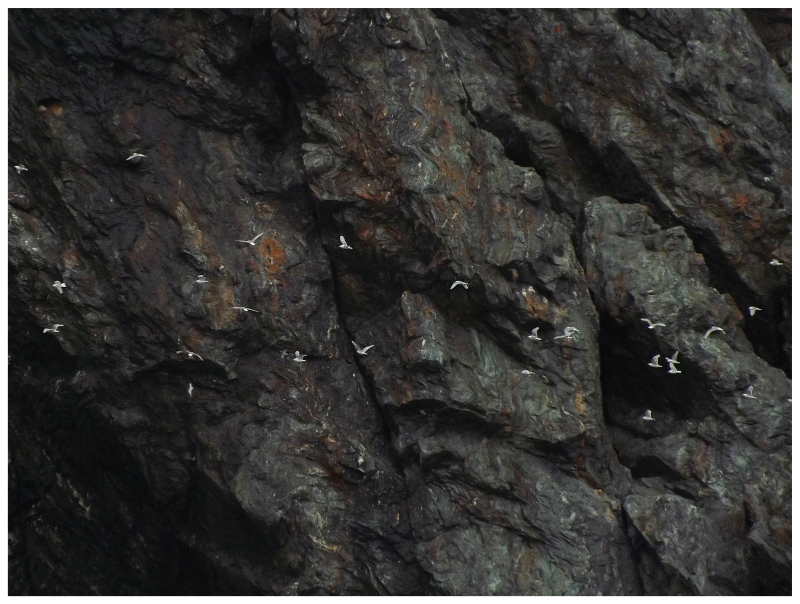
Leaving the sea cave behind, I could see a lot of gulls ahead but didn't think much of it. That is until Shelloo told me they were actually Kittiwakes, not the ho-hum Herring Gulls and Black-backed Gulls you see all over Corner Brook. |
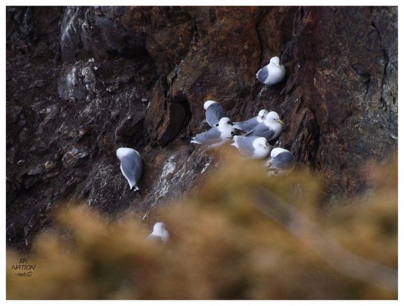
There was a Kittiwake colony here at Pacquet, and while not as impressive as say the Northern Gannet colony at Cape St. Mary's, it was still pretty neat and humourous to sit on the grass and watch the salty gulls jockey for position on the steep cliffs. |
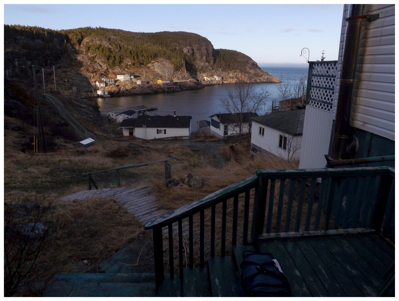
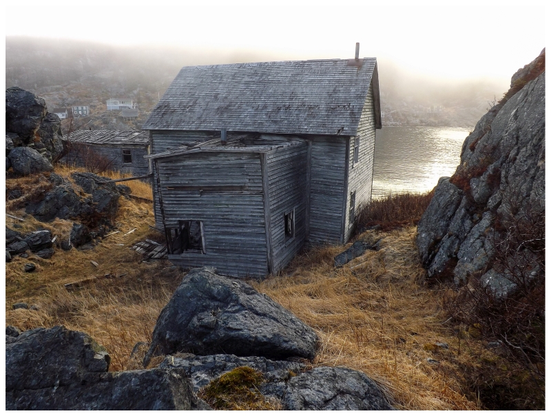
The view from our 'stealth' campsite.
The days of May still being somewhat short and with an interesting camping site in mind, we headed east after Pacquet, ready to set up the tent for the night. |
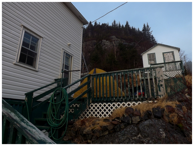
The thought had occurred to me to camp at the mostly abandoned ghost town up here on the Baie Verte, but it was Shelloo that really pushed for it. I initially thought of camping near the ruins of their fish plant that burned down, but once we were actually here, I changed my mind to somewhere up the hill since it would provide a better view over everything. Setting up the tent on someone's side deck, I'd never seen anyone at this house during multiple visits so I figured it would be okay. And so, we had some chairs via the benches on the deck. Sitting in the shade as the sun was already behind the hills for us, the sun lingered on the northern side of the harbour. We were bundled up against the cold, and on this cloudless day that wouldn't bring a spectacular sunset, it was still exhilarating to sit here and watch the empty town slowly descend into darkness. I had some fears that someone who owned property here would show up & grow angry with our flippant camping, but over the 4 or 5 hours before bed there wasn't another soul. |
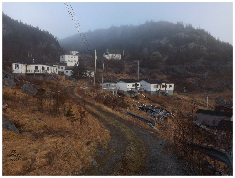
The cold fog that would drive me into the tent early in the night, also helped me get up around sunrise the next morning. The village was already illuminated to a degree, while the fog was hanging around and filtering the morning light. |
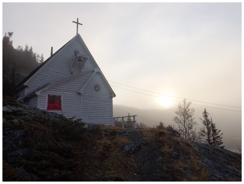
Up by the village church you could see the sun finally starting to crest the northeastern hills and shine light further into the village. I wandered the ghost town alone, (maybe) going past the new No Trespassing signs on the one side of the community, out to the point of land with the two most rundown houses - which are also some of the nicest, most stereotypically Newfoundland houses in the community. I approached the hill on that end of town with thoughts of climbing it, but the steep rock walls and thick trees soon squashed my plans of a picture back towards the village. |
Instead I walked into the backyard of the two rundown homes, stepping over the yellow grasses towards the other side of the headland that looks down towards Snooks Arm and Indian Burying Place. There were already icebergs out in the harbour after our mild winter, sitting far out there by Little Bay Islands and Long Island. Walking back to the tent, I then went back to sleep for a couple hours. We went to Shoe Cove and hiked their trail this morning, but as I went back there later in the year on a nicer day, I'll save pictures of that for an update in the future. I sometimes feel like I've seen everything on the Baie Verte Peninsula, but this short trip was worthwhile & it showed me there's more to see. I would now recommend the trail outside Pacquet within my first Baie Verte recommendations. |