After all of that waiting on the tarmac yesterday, I was ready for bed and therefore it wasn't any trouble getting up early. We even had time for a sit-down breakfast on our way to catch the 930am bus. Entering a bright cafe in a gorgeous stone building that punctuated a triangular lot with its turret, a man who didn't speak much English indicated it was mostly coffee at this hour, but he then smiled and told us he'd whip us up some sandwiches. |

Still too early for the bus after breakfast, we walked the shoreline road knowing the bus had multiple stops and we could move from stop to stop on its route. The weather was perfect and the land flat. It was casual, pleasant walking and my head still spun at the fact that I was in a totally different country now. |
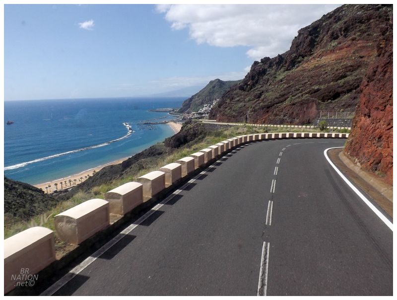
Nervous that we'd get caught between bus stops, we finally stopped at a pharmacy where Isy had to pick up something or other. Catching our ride soon after, we passed more housing blocks and ground-floor retail, while shipping yards and warehouses lined the shore to the right. That is until we passed a pleasant beach and the road then shot up into the hills and away from the shore. No longer was this a peaceful seaside road as we climbed hills I'd never experienced in a bus, sitting up high and looking straight down to the sea. This was like being in a Lexus commercial, except the camera pans out and shows two people wide-eyed, riding in the big old rectangle of a city bus. |
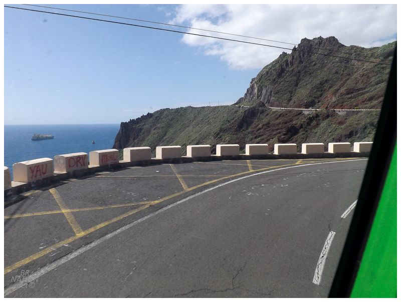
We curved through hairpin turns, gained speed as we pushed up next to the sea, then slowed down as yet another curve would come and shoot us northwest back into the hills, past the next river and subsequent beach. I know the bus driver does this route everyday, but my discomfort with being on this road in such a big, cumbersome vehicle was relaxed a bit by how smoothly and casually she was taking all of these crazy turns. I've driven on roads like this in Colorado and California in a friend's car, yet now I was doing something similar while seated in hard plastic seats without seatbelts. |
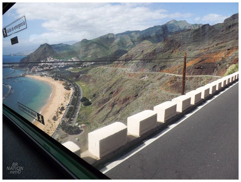
The 35 minute ride out to the village of Igueste was so daunting and impressive that I'd have a hard time not recommending it to someone visiting the Canary Islands. Especially someone without a rental car. I totally didn't expect all this excitement and adrenaline while looking at the schedule for the Intercambiador Santa Cruz (Transit Exchange Santa Cruz) back in Newfoundland. |
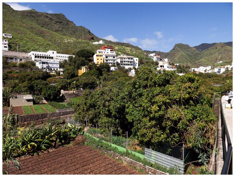
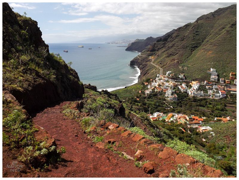
The bus route terminates in Igueste, which was the jump-off point for this morning's hike. While we were surprised by the bus ride, this handsome town and its gorgeous valley setting was yet another pleasant surprise. The bus dropped us off and walking to the southern end of town for the trailhead, I couldn't shut up about how cool the village of Igueste was. If only we had more days, or if I'm ever lucky enough to return to the Canary Islands, I'd love to rent a little villa here. |
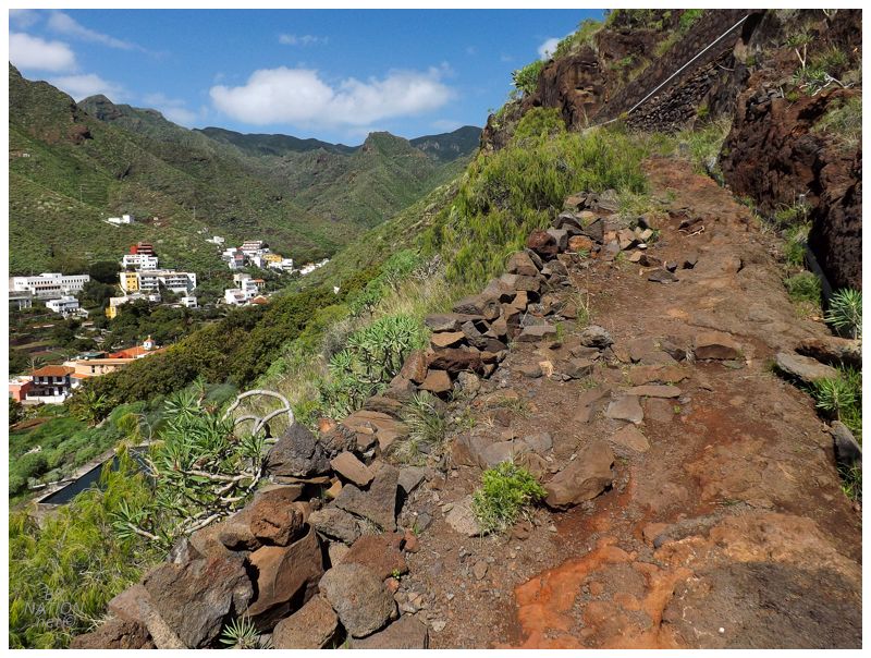
We had either two, four or seven hours before our bus would return, so with a trail ahead of us described as "difficulty: low" and only 4.4 km round trip, we set off on the rocky path and would be back in the major city of Santa Cruz de Tenerife by midday. |
Hell, if we banged out this trail quick enough, there might even be some extra time for a refreshing cold one or some lunch in perfect Igueste. God I loved this little village! |

The trail was challenging enough that we laughed at the idea that it was "Degree of Difficulty: Low" and apparently should only take an hour. Those numbers and assessments were some damn Spanish standards, haha. With 355m (1165ft) in elevation gain, this was like walking from the shore in Corner Brook up to the Ring Road one and a half times. Nothing that should take hours normally, but it was a hot February day and we only had 1.1km each way to gain that elevation. The trail was steep with switchbacks towards the top, slowing us down and making us really dip into our water reserves. |
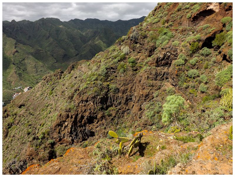
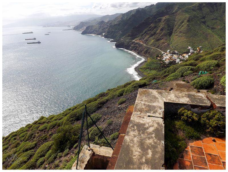
The island of Tenerife started out as three separate volcanic isles emerging from the sea as shield volcanoes around 7 million years ago. These isles now make up the southernmost, northwestern and northeastern parts of the island. This volcanic activity went dormant for 3 million years, before the underlying magma became focused on a central volcano called Las Cañadas. Las Cañadas possibly reached 40km in diameter and 14,800ft in height, spreading out enough to connect the three preexisting volcanic isles. (This main volcano eventually collapsed, leaving Tenerife (and Spain's) highpoint at 12,198 ft. Nearly the same height as the highpoint of Arizona.) The area where we were hiking was one of the three original volcanic isles, this one known as Anaga (we were hiking in the Macizo de Anaga mountain range). As you'll see later, the majority of Tenerife isn't nearly as rugged as the jagged cliffs and valleys of this northwestern area. |
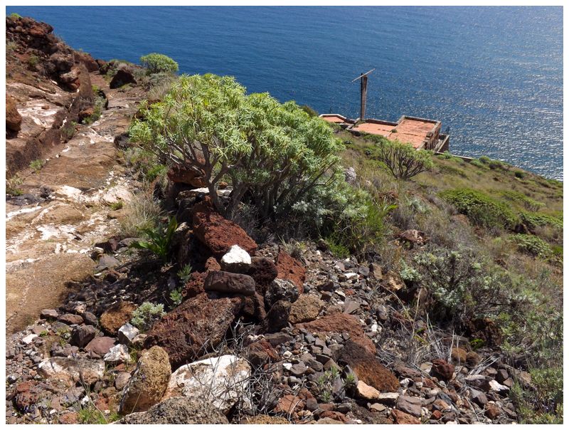
The steep, hot trail left us at the crest of its ridge, contemplating how much we wanted to add uphill hiking by descending to the main feature of this trail - except the whole point of this trail was just so cool that this wasn't even a question. |
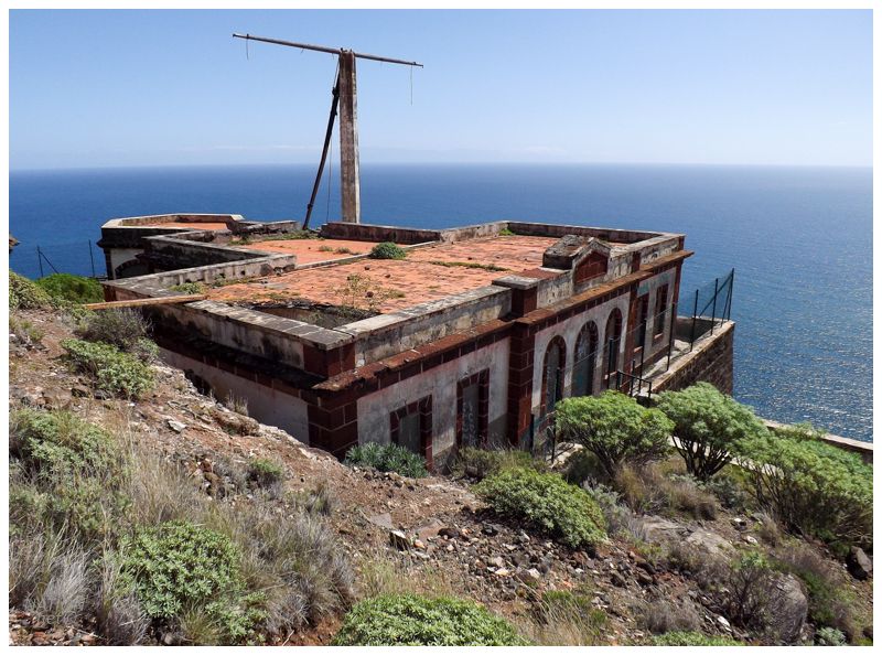
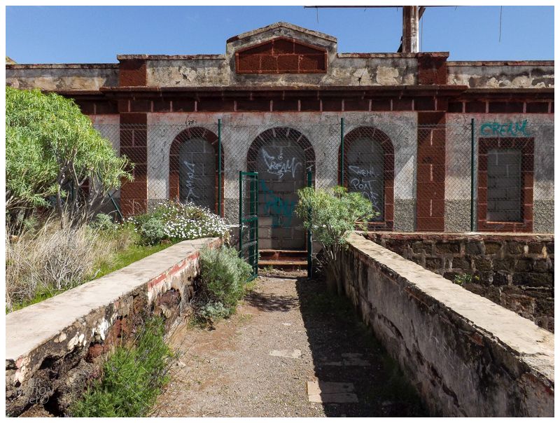
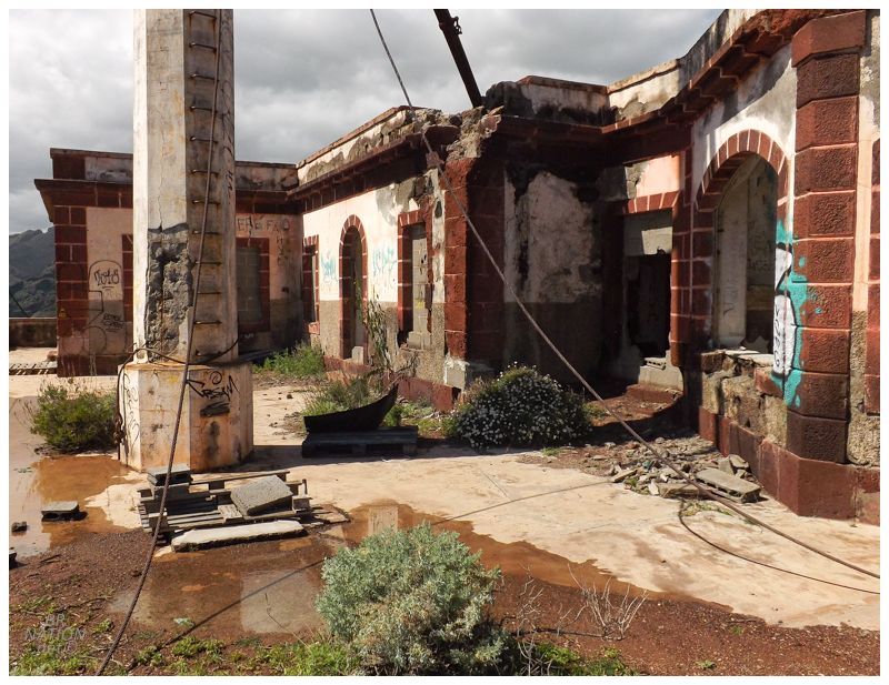
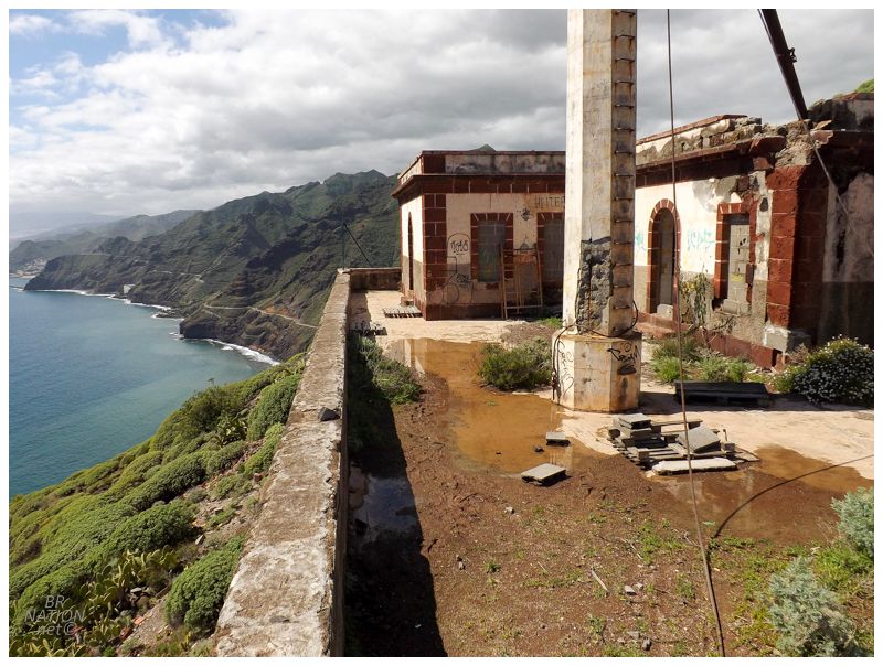
The Semáforo de Anaga! Built between 1880 and 1895, this isn't an old lighthouse like you might expect, but rather a maritime signaling station where the personnel here would raise flags or panels to indicate to the main Santa Cruz de Tenerife harbour which seafaring vessels were coming and what docking resources they would need. |
This semaforo remained in use until 1971, long after I would have imagined there would be better technologies to communicate between ships at sea and the harbour authorities. |
The signal post was still here and the iron ladder rungs were in great shape. I climbed about half of them, but then a father and daughter joined us & I didn't really want a tongue lashing about being reckless. (I may have also reached just about my climbing limit of an old concrete signal post without an enclosed ladder, haha.) |
This was such an incredible reward for just a light amount of exercise and logistics. An impressive number of hiking trails exist in this northwest corner of Tenerife, and while not all of them end in spectacular ruins, they do things like connect villages by bringing you through lush valleys and over rugged hills. As I sat here, I wanted to hike all of these trails and spend a couple of weeks grimily backpacking these Anaga Mountains, but alas, I was only here for a good time, not a long time. |

Isy was very much ready for the celebratory beers we happily thought to bring, but the interior needed to be explored first. |
There were signs of reinforcement and possible renovation, but it also looked more like patchwork preservation efforts. It's funny the difference between North America and the rest of the World here, where lots of Google Reviews and blogs lament that this place should be renovated and preserved, while it's not hard to imagine this place being called a dangerous eyesore back home. |
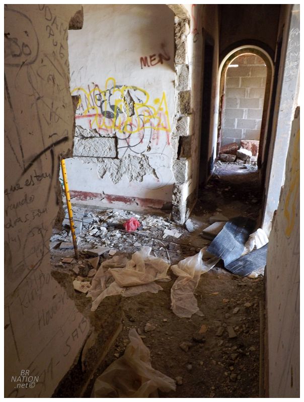
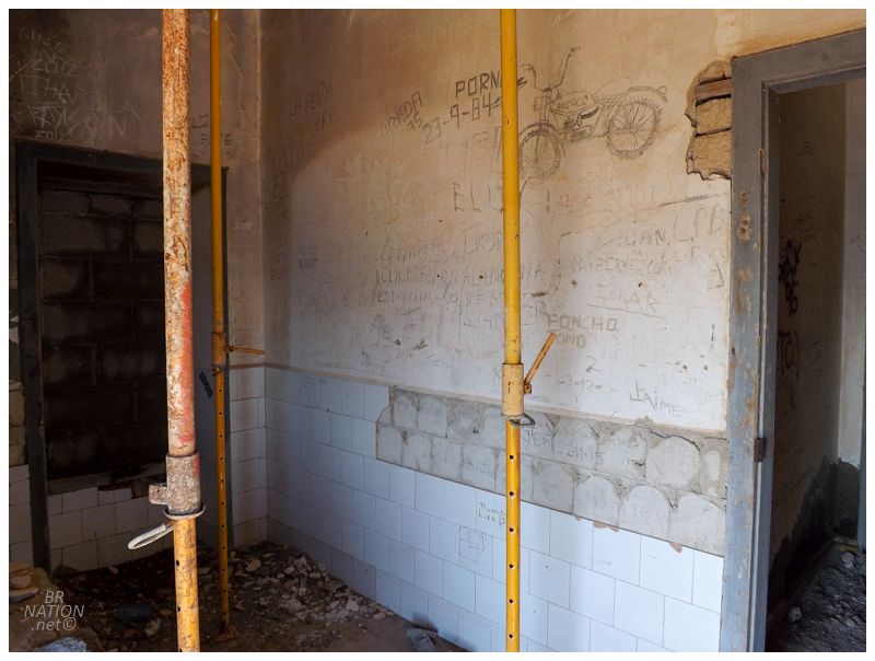
There wasn't a whole lot left to the interior and nothing in terms of devices or machines from the marine traffic light days. |
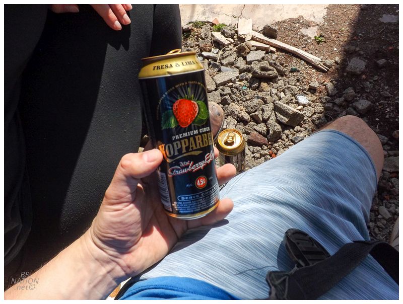
Okay, time for that celebratory beer...which for some reason was a 4.5% strawberry cider? Whatever, the weather was immaculate, these ruins were awesome and I was chilling here with my girl enjoying a drink and the ambiance. This could have been a sickly pumpkin spiced latte and I'd still have been on cloud nine. |
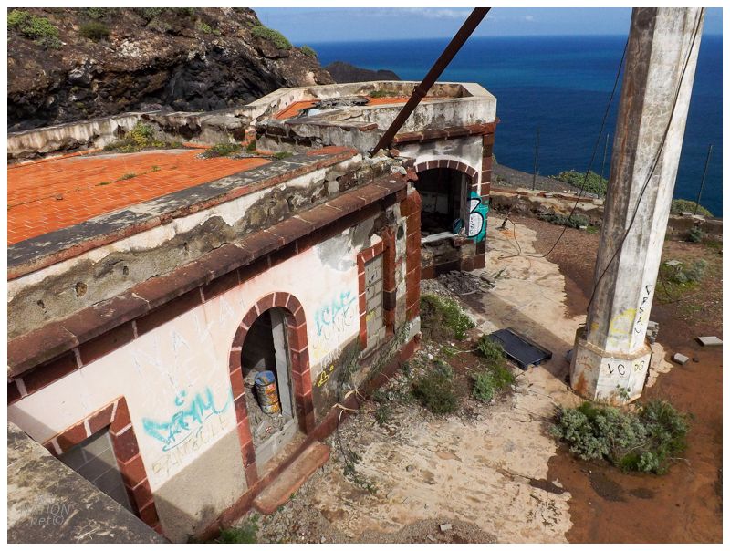
Finishing up that strawberry cider, it was time to hit the roof of this cliffside ruin. While the roof itself had holes big enough for trees to grow through, the edge was lined with thick blocks of stone that didn't look like they'd move even if I tried. |
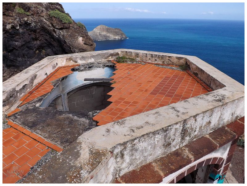
Looking out towards Punta de Tierras Caidas (Tierras Caidas Peninsula), where the marvelous Playa de Antequarra (Antequarra Beach) is just around the other side. Taking the whole day to hike the seven hours from Igueste to this hidden beach would be on the short list of things I'd want to do if I'm ever lucky enough to return to the Canaries. The Tenerife adventure and hiking possibilities really are just endless. |
The ruins weren't all that far down the hillside, so obviously the hike back was easier. Once back at the top of the ridge, the only problem was wear on the knees and ankles as we fought against breaking into a downhill run. Back in Igueste, I hoped there was enough time to get across the river to the tiny, enticing restaurant that we saw at the start of town, but Isy was probably right in that we didn't want to miss our bus. |
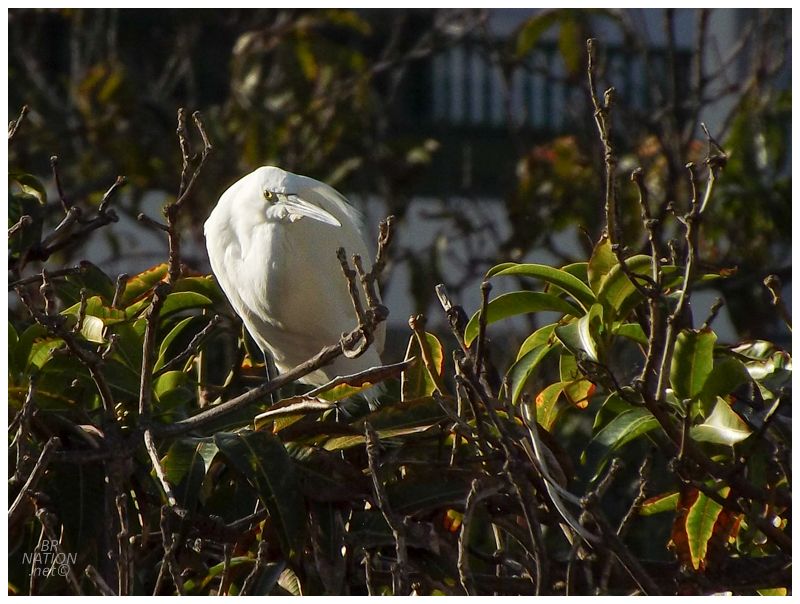
So we hung around the bus stop, where I soon forgot about the restaurant because of all the bird life in the creek below. This is a Little Egret, a bird which I've seen as a rare vagrant in Fair Haven, NL. |
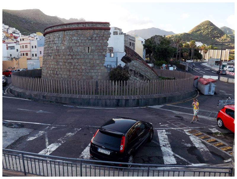
The bus ride back went to a couple of different stops, including pulling into view of this collapsed martello tower? Turns out this is actually Castillo de San Andrés (San Andrés Castle), built in 1769 to protect this valuable area from pirate attacks. It was cracked in half during floods in 1895. |

We stopped along the way at a beach because Isy wanted to jump in the warm waters on this side of the Atlantic. I waded in myself as well and it wasn't the worst thing, haha. Back at the hotel, it was getting into the night by the time we washed up, but there was a nearby Italian restaurant that had good enough ratings. And since I'd been on a Masterchef and Kitchen Nightmares kick witnessing a thousand risottos being made, I figured it was time to finally try risotto myself. And oh boy would I like a risotto right now as I write this in real life. Instead I'm off to Boston Pizza. |