"Man what did you do there? You didn't do anything."
There's now a few days like this one, that make it seem like I didn't do anything while in New Zealand. While I was happy to see Cape Reinga and visiting said cape was a priority, there's some notion that one visits New Zealand and automatically goes on 10 hour hikes and visits insane fjords (even if they only have 4.5 days...right?)
Indeed some of the blame is rightly placed though. I botched my time management to a notable extent.
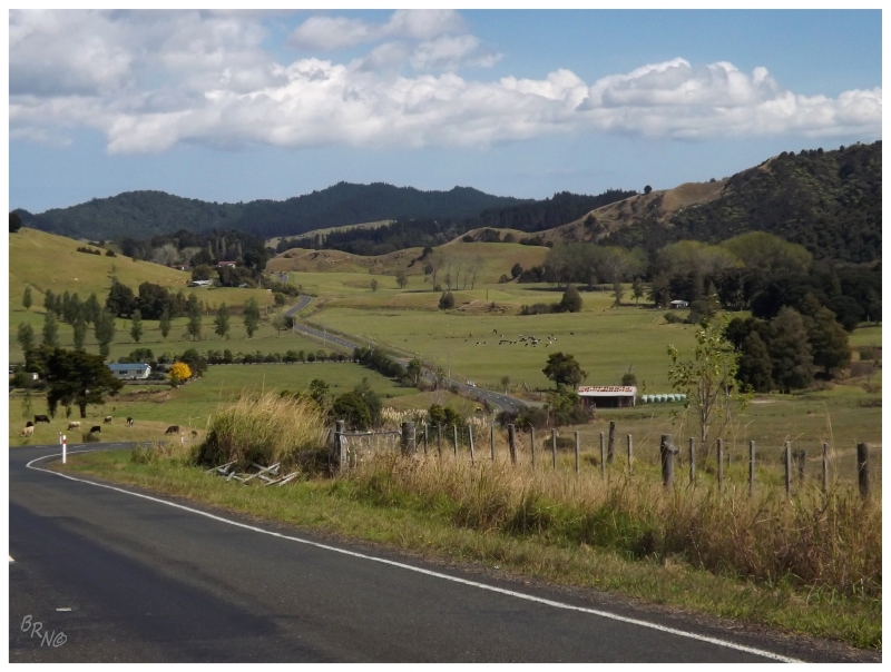
Right now, using Google Maps at home, I see that there is a road which moves over to State Highway 1 quicker than the route I took on day 2. But waking up this day, I simply had a basic map and noticed that State Highway 12 eventually curved upwards towards State Highway 1. I underestimated the difference between the #1 highway and any other, as State Highway 12 brought me along twisty roads that exhausted me as I moved through the Waipoua Forest Reserve towards the north.
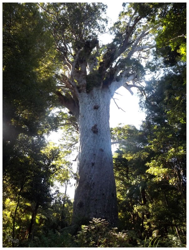
Needing a break, I hiked the half kilometer (3/10 mile) to Tane Mahuta, the largest kauri tree in New Zealand. Not much of an arborphile, I wasn't over the moon, but now I find it much more neat since I found out that the lighthouse from day 1 - one of my top 5 favorite lighthouses I've visited - was built to guide ships into the harbour because of the kauri tree industry.
(Obviously the lighthouse was built to help harvest this resource that the reserve was created to protect.)
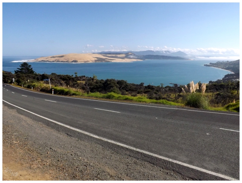
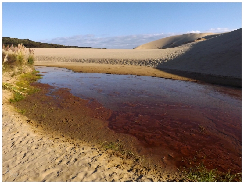
I was spit out of the Waipoua Forest Reserve at Hokianga Harbour, with this spectacular view over a point of land composed of a giant sand dune. I thought about enjoying my lunch here, but there were two attractive German girls eating goods out of the back of their Volkswagen - so I quickly snapped a picture before clumsily hurrying along.
Taking State Highway 12 might have added driving time, but it also provided me with the above landscape and a drive through the enjoyable seaside towns of Omapere & Opononi. Omapere had a skatepark I briefly considered stopping at, but it was packed with people and looked like a slightly better version of the mediocre skatepark in Blenheim. I kept going.
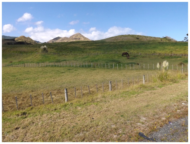
State Highway 12 would cut inland at Opononi, pushing up and down rolling farmland, with lush jungles flanking the fields; the lush jungles at such an angle that I wondered if any of the people who lived in these houses, ever wandered very far into them. They looked impenetrable. They made me wonder about what was inside of them & what was behind them.
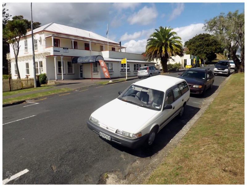
It wasn't long before I was in Rawene, a town of 412 people at the point of a peninsula. From here, there's a ferry across the Hokianga Harbour, but it would still be a while, as I could see the ferry docked across the harbour at Kohukohu.
I didn't even get in line initially as I was going to go to the above tavern for lunch, but apparently it was off-season.
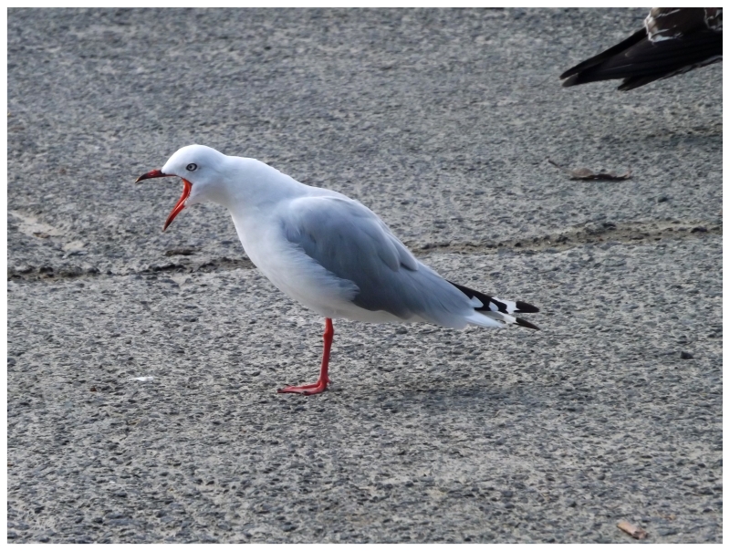
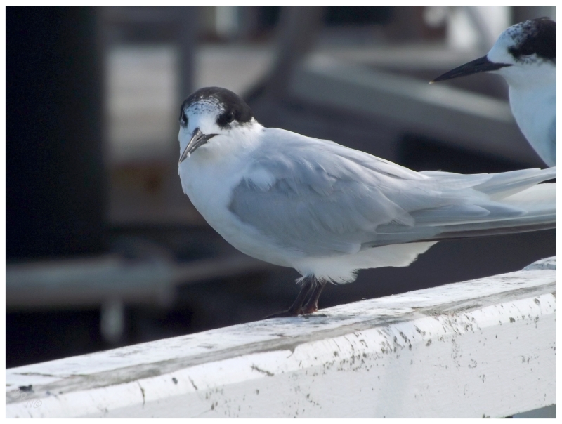
So I walked around and checked out the various streets and birds of this Rawene town.
The above gull is a Red-billed Gull and the tern is a White-fronted Tern.
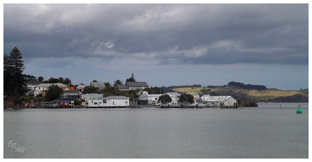
^Looking back at Rawene halfway through the ferry crossing.
As I neared my car, I noticed that those German girls were in the car queue to cross the harbour.
I wondered to myself if I was actually on the tourist trail, even though it felt like I wasn't.
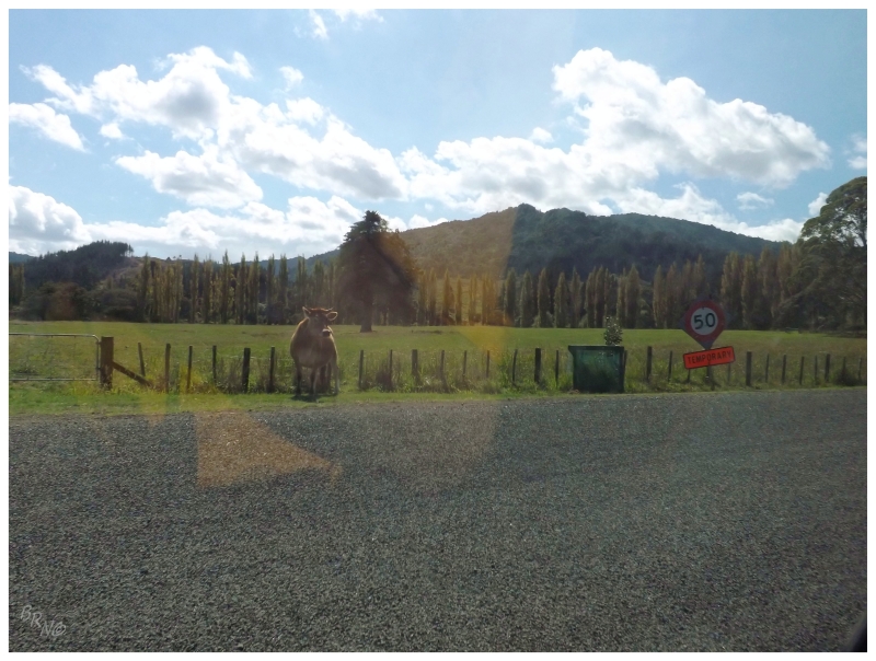
Once across the harbour, there were a few villages on this stretch of road, but they were the type of communities where you need to wait for wild cows to cross the road.
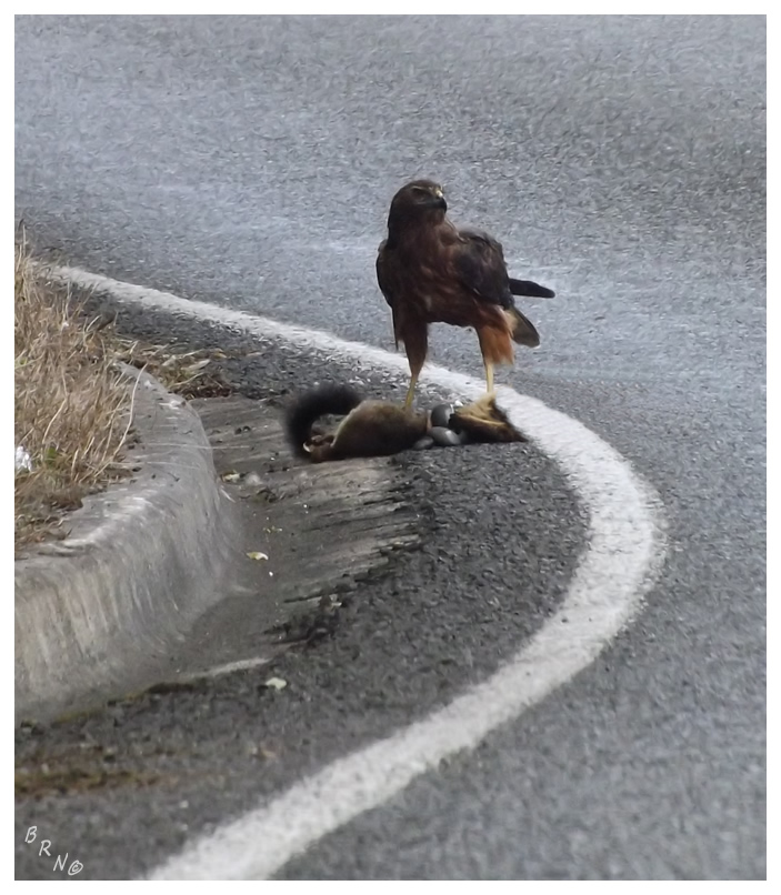
Back on day 1 on Poutu Road, I had seen hawks flying from the guardrails and leaving as I showed up almost a dozen times. This infuriated me as I badly wanted a picture, so I was ecstatic that this Swamp Harrier actually hung out long enough for a picture since it didn't want to leave its meal behind.
(I poorly clone-stamped out the meal's head for y'all sensitive types.)
I would merge onto State Highway 1 soon after the Swamp Harrier and have only 2 hours remaining until Cape Reinga.
It wasn't long before I arrived in the large-ish town of Kaitaia; large enough to brew nervousness due to my still inexperienced left side driving.
The humourous thing of Kaitaia was that after such rural country where there was only talk radio and NZ folk music to be heard, I had turned down the radio slightly, only to realize while sitting in the grocery store parking lot, that I suddenly had a station playing the Welcome to My Hood Remix with T-Pain, DJ Khaled, Birdman & Jadakiss. Much better, haha!
There isn't a whole lot after Kaitaia because you're finally onto the thin handle portion of the pork chop-shaped North Island of New Zealand.
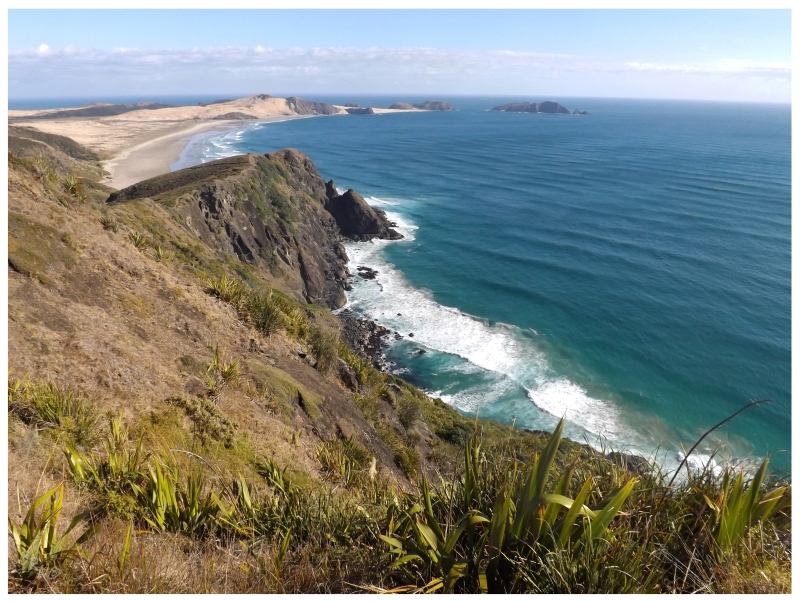
I did stop at some communal hippie thing to use the internet, but in all honesty, I was at Cape Reinga before I knew it. This road was much straighter and the vistas much more sprawling.
The above view is looking south as you walk out to the lighthouse. There are trails which traverse all over this beautiful cape, but as it was already evening, I wouldn't actually be able to descend to any of these beaches and coves. I guess the friend who I quoted at the start of this piece, would have liked to see me push it here.
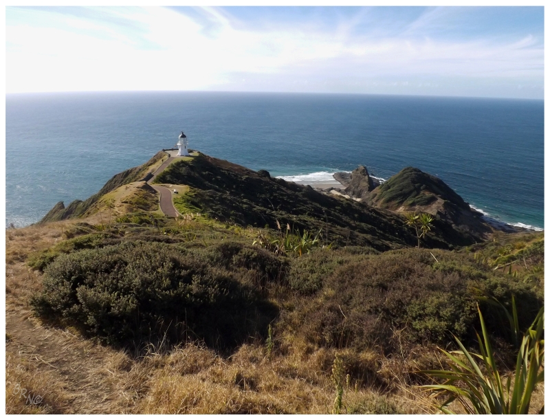
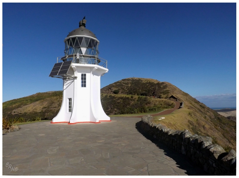
I was ecstatic to see Cape Reinga though. Knowing I would go on this trip at the end of winter back home, I had long ago set a picture of this lighthouse as my computer background to motivate through those hellacious winter's days.
Anyway, this isn't the northernmost point of New Zealand, but it's very close. There may be the islands of the South Pacific and Australia off somewhere to the west, but as far as New Zealand, this felt like a corner of the country.
It is said that one of the best features of visiting Cape Reinga is seeing where the Tasman Sea moshs with the Pacific Ocean.
(I thought it was neat enough to do things involving the Tasman Sea.)
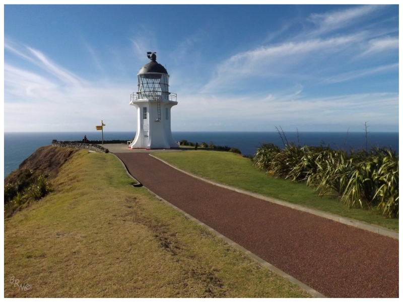
A stunning lighthouse set upon steep, high cliffs in an isolated area. I doubt there's any question as to why I marked this as a must see.
The point of land here was where the native Mauri of New Zealand believed their departed souls went towards the Bay of Spirits and into the afterlife. Te Reinga means the leaping place of souls.
There was originally a lighthouse on Motuopao Island, off to the southwest of nearby Cape Maria Van Diemen. That lighthouse always had accessibility issues, so Cape Reinga was completed in 1941 as the last manned lighthouse in New Zealand.
I rounded around the back of Cape Reinga to walk a short track facing Cape Maria Van Diemen on the way back. Here I noticed those German girls again, sitting in the meadow to watch the sun set into the ocean somewhere over out-of-sight Australia. I thought this was a lovely idea, but I couldn't do it now obviously. I returned to the car and weighed sleeping in my car out here at Cape Reinga to save money, but instead pulled ahead and left the cape behind.
I wouldn't see those German girls again. Finally I got away! Ha!
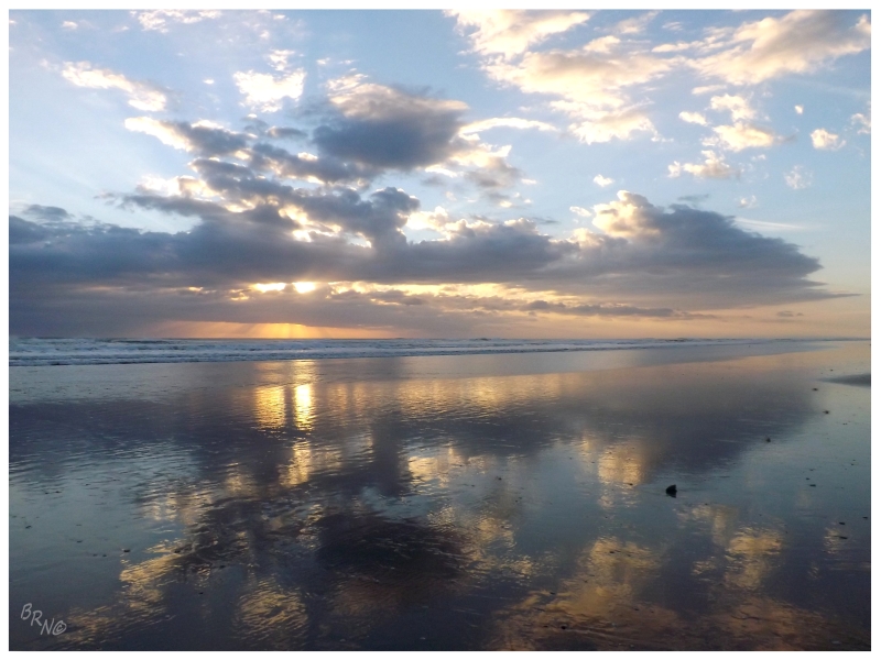
I didn't feel like I had did enough today, so I made sure to use the last light of day to drive a dirt road lined with giant trees, out from Kaitaia to their portion of 90 Mile Beach, to watch the sunset.
Walking onto the beach, I would notice an out-of-place Texas flag along the bay (which made me happy). Eventually the American would walk by and exchange that she lived in Washington but stayed in NZ a couple of months a year. Not a bad racket I must say.
There was a motel in Kaitaia made up to look like it should be in Odessa or Tucumcari, but shockingly it was 120 New Zealand Dollars. As much as I wanted to stay in said motel, I couldn't reason that for a night where I really should be sleeping in my car. I stayed at a sprawling, reasonably-priced hotel across the street, with the dated interior only having 3 guests amongst the 120 rooms.
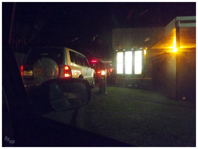
Going into Kaitaia for food, I was excited about a take-out Indian spot, but of course my credit card didn't work minutes after I just bought beer with it 5 minutes earlier. WTF was going on with this shit?!? So I grew angry and simply went to KFC, which was awful, but added a small amount of value in that I went through a mirrored, right-sided drive-thru.
I would do some laundry and watch the Spurs/Lakers until I accidentally locked myself out of my room in this desolate hotel. I envisioned sleeping in the hallway in my socks, but thankfully the hotel proprietor had only closed up for the night so that he could drink in one of the rooms.
I put my bike together in my motel room and resolved not to skip skateparks tomorrow. I was ready to spend less of my days behind the wheel of my Toyota Corolla.
Continue to Days 3, 4 and 5...