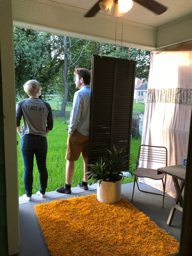
We weren't in the Mississippi Delta long before we started heading past places familiar to Rosie, as this is where she had been spending last week at her uncle's. (This is also where she knew a restaurant that had amazing fried okra, but I passed on it because we just had Waffle House. Something I regret to this day.) |
We stopped at her uncle's and I was loving how Mississippi this was. There was Mississippi State gear, stories of kids finding snakes in the nearby creek, and everyone being cordial in that lovely, southern way. I also appreciated Rosie showing us trees and wagons that held a lot of personal importance to her. Driving out here, it may have felt like we were in the middle of nowhere, but now it was clear that we were somewhere with a lot of life lived. |

Rosie's picture.
The fun ramped up when her uncle offered to take each of us out for a tractor ride on his country road. And not just for a ride as a passenger, we were going to actually drive the tractor! Now I'd already listened to Rosie's stories about how her relatives are good, church-going folk who never swear or make crass comments. So I was trying to be on my best behaviour as a result, but as I jolted the tractor forward towards a ditch with fast approaching traffic behind me, I couldn't help but let out a loud "shit!" before covering my mouth and then apologizing. Rosie's uncle just laughed and with a wave of the hand said it wasn't that big of deal. We then talked about how cold it is in Newfoundland for the remainder of the time. |

Soon enough we had to get going as there was still two stops and six hours of driving to cover today. (And this is after we already ate up valuable time at that unhurried West Memphis Waffle House.) So it was back into the stark Delta, the landscape and setting that I was loving by this point. It was so flat and so sparsely vegetated, with the sparse house clad in weathered, sunbeaten siding. I could've went for passing through more towns along this Highway 61, but you obviously can't have it all and I was still enjoying things. |
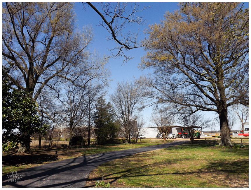
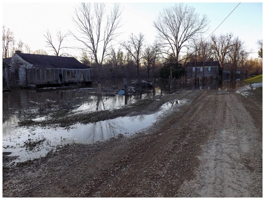
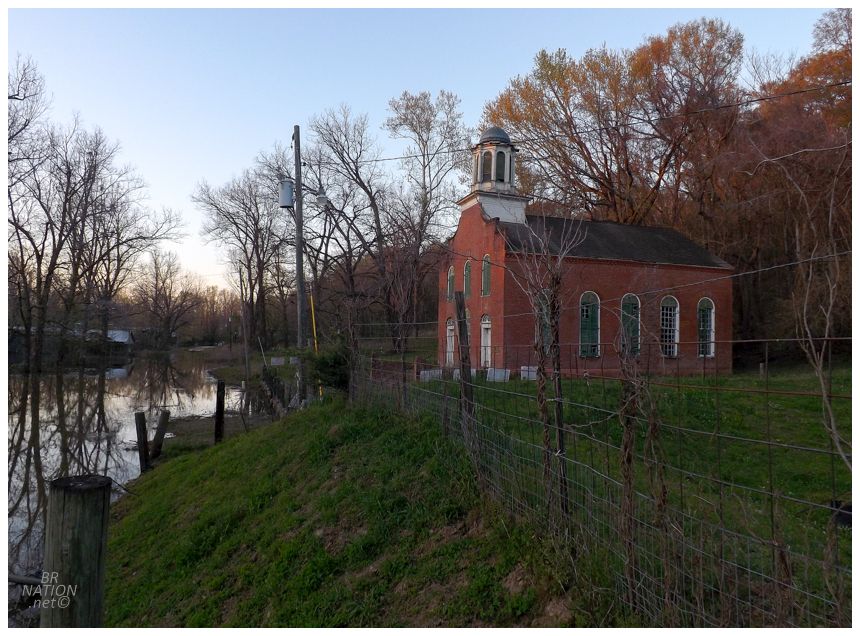
Past the TJ-Beall Wildwood Cotton Mill, looking towards the house at 33.605600, -90.260811.
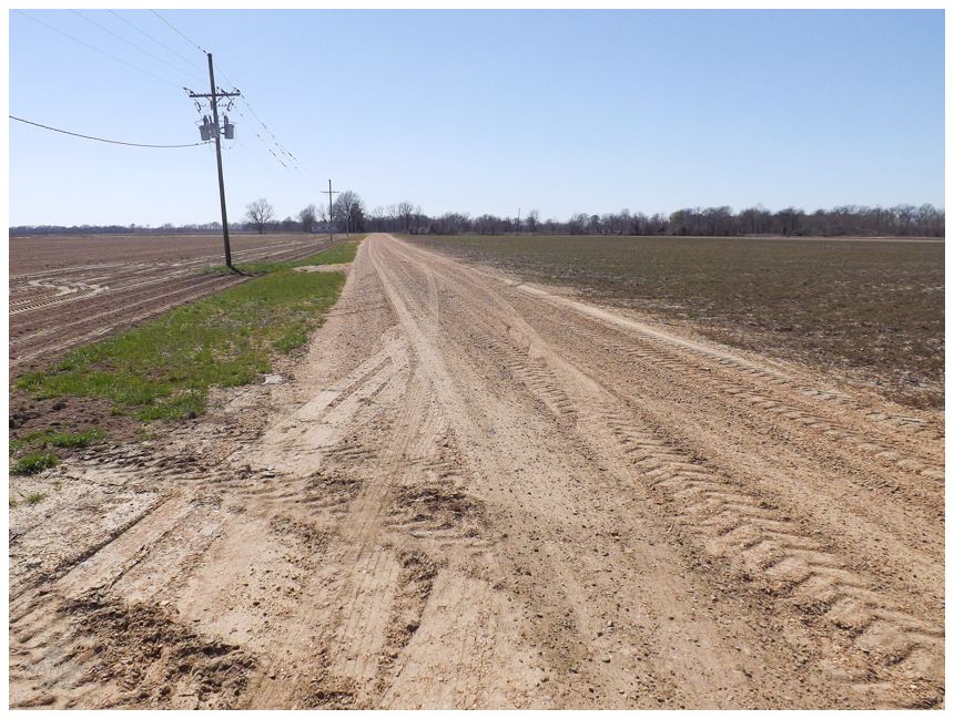
This is where we'd make a turn after Clarksdale and head towards Money. After our time there, I followed my car GPS and its 8-year-old maps through town and onto a rural dirt road that looked like the least travelled backroads of back home in Southwestern Ontario. This didn't seem quite right, but a fun dirt road could only end up bringing us to greater backwaters of the Delta. I was sure the road would spit us out somewhere and this would be an awesome adventure. We followed along the brush surrounding the Little Tallahatchie River for a short while, before curving into an expanse where the road was the only thing besides fields of dirt. This led us to the tiny hamlet of Wildwood, with three homes and a couple of abandoned businesses. Seeing as we were driving through some type of community now, I figured we were on the correct, well-travelled track out of Money and there was no need to stop and photograph these presumably popular buildings. It's when we left Wildwood 1000 feet later, that all three of us started to question where the GPS was taking us. The road cut directly through the TJ Beall-Wildwood Cotton Mill, with a warehouse to our left and a processing plant to our right, separated by all of 50 feet. It felt like somehow we didn't notice security as we blazed through this factory yard, while workers twisted their necks at our measly, cosmopolitan rental car and unfamiliar faces. |

Shellmound Bridge. Photo from The Greenwood Commonwealth: April 30 1985. Compliments of BridgeHunter.com
Hurrying through the cotton mill, it was only another minute before Wildwood Road curved and the road ahead was a tangled, uncleared mess of vines and shrubs. It started to occur to us that maybe this GPS bridge didn't exist. I briefly entertained the idea of rumbling the rental car onto the rutted and overgrown track, but it was so rough that I didn't see any possible outcome besides us getting stuck. Consulting the invaluable BridgeHunter.com, I now see that we were trying to take the Shellmound Bridge. Their 1984 article from The Greenwood Commonwealth shows that it was already closed back then(!), stating, "the bridge, which may have once held many a buggy, is now closed to traffic." And while the bridge is still standing in the 1996 Google Earth aerial imagery, it is gone by 2004. Oh blessed Garmin GPS Corp and their up-to-date information, haha. On the other hand, we were in such a remote area that mapping corporations didn't have updates since the 80s. I have to think about how few people outside LeFlore County ever end up on this road, a pleasing fact when I can now add Rosie, Shelloo and myself to that exclusive list. One last fun fact about this Shellmound Bridge is that it connected the community of Shellmound with the nearby Wildwood Plantation, the plantation whose commissary buildings were the abandoned ones we drove by earlier. The application for the National Register of Historic Places includes some pictures of these buildings. |
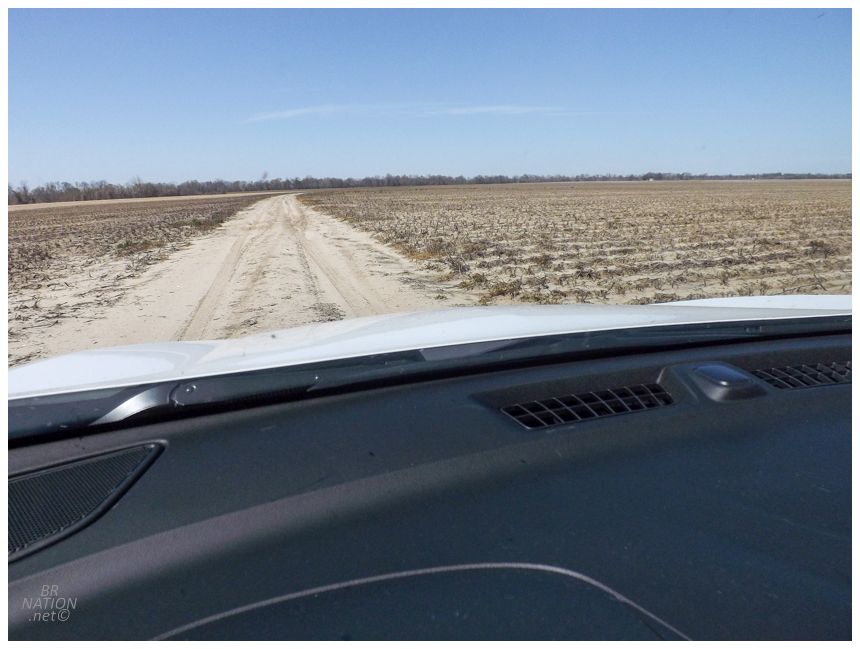
As we had already cleared all of this distance along Wildwood Road, I didn't really want to backtrack to Money. So I insisted that the next turn must go somewhere & then made a right on to Leflore County Road 94. After another minute or two of driving in cotton fields, I started to hear the gentle appeals of "this is ridiculous" coming from the car and accepted that we should probably backtrack. The good thing was that it was March, so it was only 80° if we would have got stuck out here. The cotton mill workers would give us another confused glance upon our return trip through their yard. |
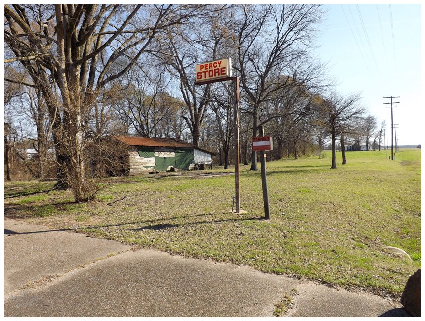
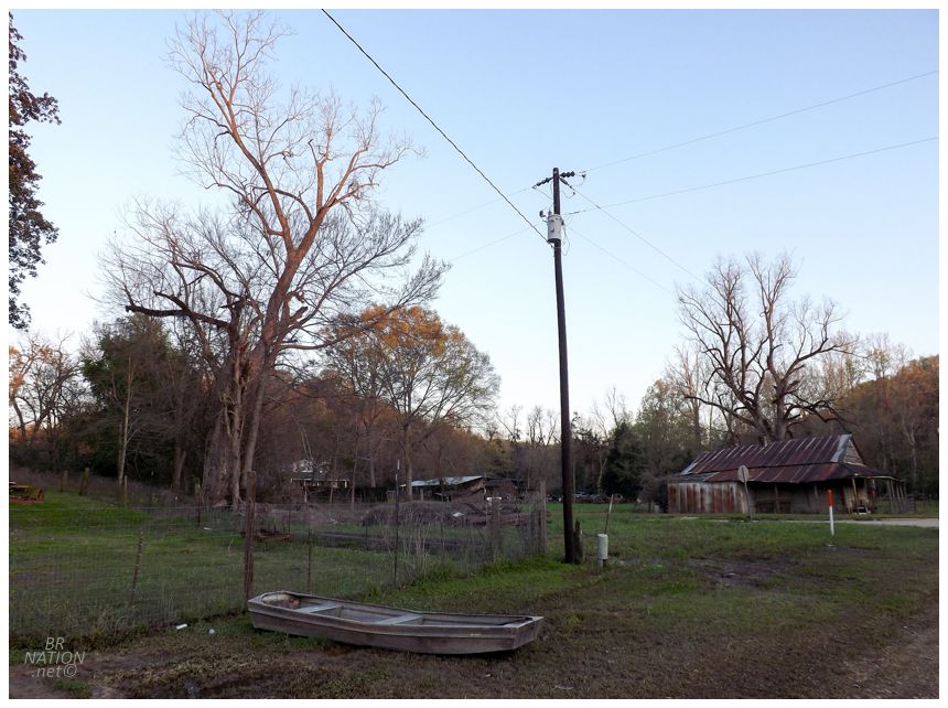
Percy, Mississippi
Lunch was at Sonic in Greenwood and marked the first time Rosie & Shelloo had ever had the American fast food chain. They were both left apathetic with the experience. Afterwards we really started to get moving through the Delta while the afternoon hours continued to tick away. Passing too many photogenic views and interesting little villages at 70mph, I abruptly brought the car to a halt as Rosie was on the phone and growing confused. I could see ahead that there was a tiny hamlet and with the need to brake early while going this speed, I gambled on stopping for some pictures in whatever this village may be. |
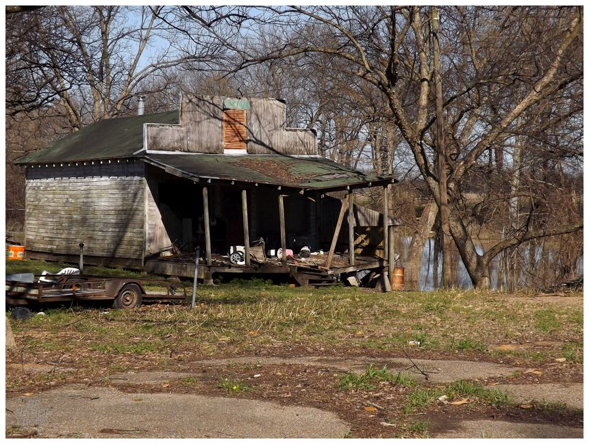
We'd either pass by or through about 15 communities this afternoon and Panther Burn might've had a cooler name, Nitta Yuma might've had cooler buildings and Valley Park might've had a prettier setting; but I loved Percy in how it was a tight, encapsulated village on the map and on the landscape. There was no sprawl or confusion about where Percy started and ended, and while parking at the Percy Store to take pictures, I could shoot everywhere from the northern end of town to the southern end of town right here. As I love provinces and states with defined, named villages that aren't all amalgamated, this part of Mississippi was quenching my thirst and I wanted to take days to slowly explore all of these areas. Unfortunately, we just couldn't be stopping from 70mph every 10 minutes. |

Although we still had time to stop for some much needed Rap Snacks! Yeah, yeah, Lil Boat! |
About 90 minutes from Percy is the city of Port Gibson, reputed for being so nice that Ulysses S. Grant declared it too beautiful to burn (the town's actual motto is "Too beautiful to burn"). Seeing as we needed to cut through, I figured I'd get my We found ourselves here because of two nearby abandoned locations. With time running out though, I made the executive decision to only visit one of them, the Windsor Ruins. Driving out of town, there was a sign about flooding up ahead but I played it cool. And then about a kilometer later, there was no playing it cool as the road was completely flooded and blocked with those sawhorse-like barricades. We'd later learn that historic flooding had been hitting the area and water was at 49.9ft in nearby Vicksburg, which is only 7 feet shy of the all-time record set in 2011. Anything above 43ft is considered in the "flooding stage". |
Backtracking to Port Gibson, we raced down the Natchez Trace Parkway to another county road that would cut west towards our backup destination. There were two roads that went to our ghost town and we arbitrarily picked the first one to avoid driving through Alcorn State University and their gated road. We had about 10 kilometers1 to go on "Firetower Road" and then "Rodney Road" and these roads didn't seem like the type that would have barricades and signs informing us of flooding. They also seemed to be higher and drier than other roads we'd been driving on. Through bluff cuts and past very few houses, we sped through the enveloping Mississippi forest and hoped the road wouldn't end before Rodney. We only stopped for one thing along the way & that was a possum, since Shelloo was so excited at seeing her first. Finally cresting one last hill, it was a bayou down below, but also the ghost town of Rodney within that marshy setting. The intersection of Muddy Bayou Road and Rodney Road wasn't flooded and we were able to drive down and park the car. |

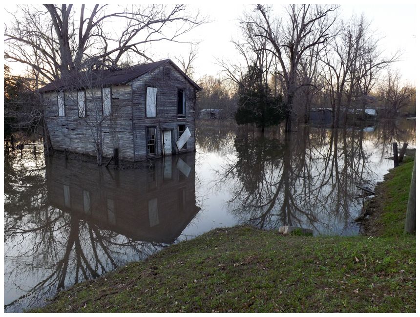
The most arresting scene in Rodney was easily the Baptist Church perfectly reflected in the calm flood waters. The three of us took plenty of shots and returned from little jaunts to continue taking more, all the while not getting too close to the waters. Someone later asked me if we waded through the water to check out the church. Down in Mississippi snake country? Yeah, that's a no. |
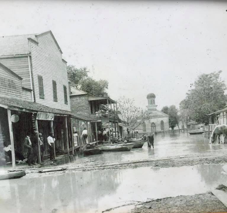
Photo posted on the Rodney History and Preservation Society facebook page. Photo was
purchased from a yard sale & the year/photographer is unknown. The brick building with the two-story
balcony was only demolished one year before we got here, in 2017.
Founded in 1828, Rodney grew to prominence in the 1840s and 1850s with the cotton industry and steamboats arriving here on the Mississippi River. It's often quoted in accounts of Rodney that the town was the busiest port between New Orleans and St. Louis, but I just can't fathom how it was busier than Memphis and its 22,000 people. Regardless, Rodney had 500 residents, newspapers, banks, 25 stores, 3 churches and a masonic lodge. It was important enough that the Union Navy's USS Rattler, a wooden, paddleboat steamer/gunboat, guarded its harbour during the Civil War and protected Rodney's well-used Mississippi River crossing. Of course ghost towns eventually suffer some tragedy. 1869 brought a fire that levelled the north end of town and in 1880 the railroad was put through Fayette Mississippi instead. The greatest blow though would come when the Mississippi River started to deposit silt in Rodney's harbour and change its course, cutting off river traffic and almost all business in Rodney. |
The Governor would abolished the town in 1930, but the Jackson Clarion-Ledger states that 8 people still called Rodney home in 2019. In the above picture you can see one of those homes in the trees near centre, while the Alston General Store, built in 1840, sits to the right. |
Amazingly all three of Rodney's churches still stand today, although the Baptist Church is clearly struggling with flooding (and preservationists being unable to sort out the deed holder). Rodney Presbyterian is doing much better. Built in 1842, the local Rodney History and Preservation Society has managed to get metal beams up for emergency structural support, while they work on permanent structural support for the northern wall of the building. The preservation group also trims the thick vegetation from the awe-inspiring Rodney Cemetery, which I kicked myself for forgetting about during my time here. Then again, I couldn't get around the fence to get closer to the Presbyterian Church, so I don't know how I imagined I was going to get behind the church to climb the hill to the cemetery. (And that's not to mention the warnings of ticks, chiggers and snakes up there.) Some fantastic pictures of the cemetery are available here. |
You may be savvy enough to notice that I've only shown photos of two churches. That's because Rodney's incredible, carpenter gothic Catholic church was rescued in 1983. It now stands at the Grand Gulf State Park, about 10km northwest of Port Gibson. A picture is available here. The above picture shows the Masonic Lodge. Another building I would have liked to explore, but today that wasn't happening without a raft. The three of us met back at the Baptist Church just as the sun was disappearing. We took a quick stroll south on Rodney Road and noticed a couple more abandoned houses in the woods, but they didn't look worth the trouble of diving into the vegetation to fight our way inside. |
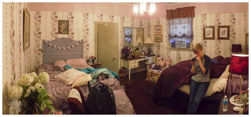
It was already pretty dark as we slipped back into the forest and out of Rodney, yet we still had about an hour before we'd get to tonight's accommodations in Natchez. Rosie picked tonight's spot and boy did she find a place for us on AirBNB, haha. I loved the modest, southern, one-story exterior along the main riverfront street, but the interior was just hilarious. So many frills, so much lilac, so busy. |
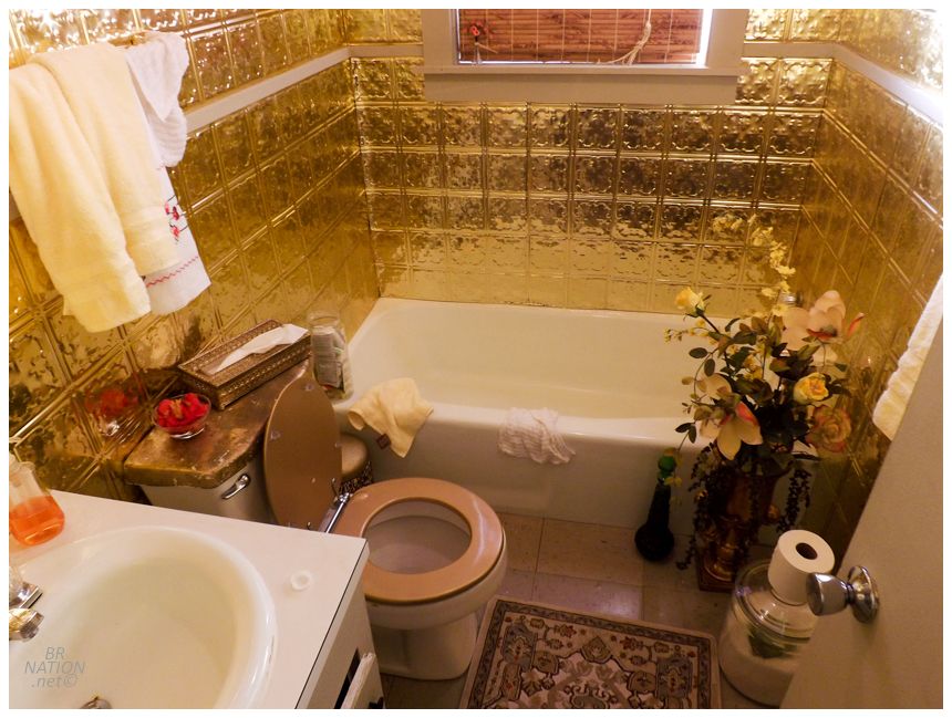
The bathroom was also something. Definitely Trinidad James and Goldmember approved! |
Bullshittin' on the back porch in Natchez. Shelloo's pic.
Cleaning ourselves up, we headed out into the Natchez night where there wasn't a whole lot of dining options still open at this late, weekday hour. In such a historic town we really didn't want to go to Popeye's or Pizza Hut out in the sprawl by the highway, so thankfully we found a restaurant called The Camp down a steep, dark street in the Under-The-Hill neighbourhood. This area was one of the first ports in Natchez and home to some of the oldest buildings. The Camp had good food, the waiter was incredibly friendly even though we showed up close to closing, and the selection of local beers was plentiful. After initially settling on going to The Camp, dinner turned out quite well. |
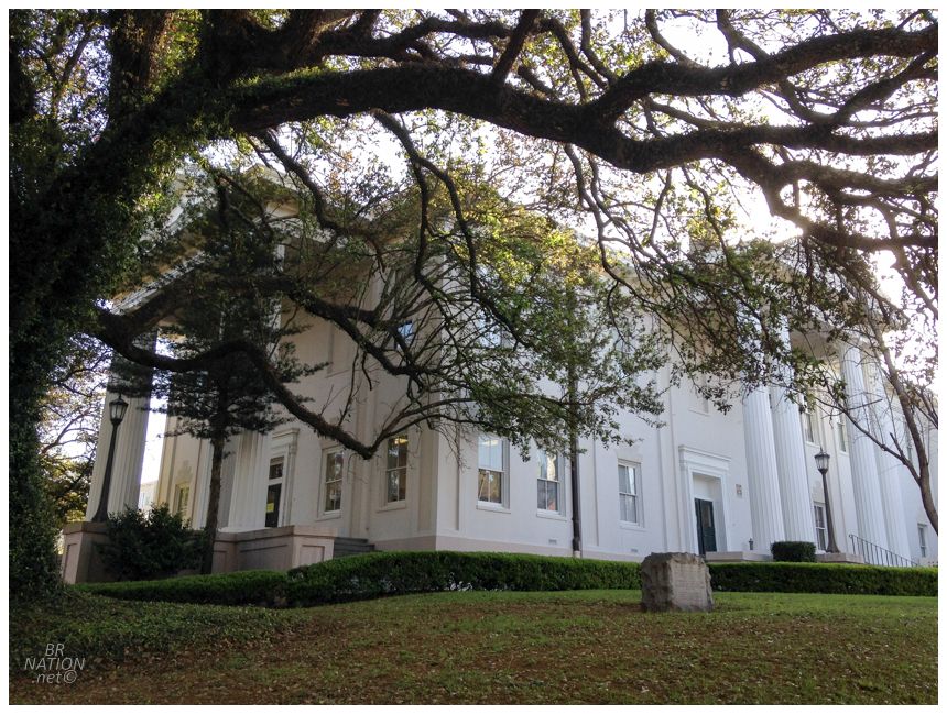
The next morning we grabbed coffees and went for a lovely jaunt around downtown Natchez. With its pre-Civil War wealth and pleasant location along the Mississippi, Natchez isn't just some obscure town that I like because I seem to like the top 10 towns in every state, it's actually a destination for people who enjoy visiting historic downtowns and impressive mansions. The above building in Natchez's city hall. |
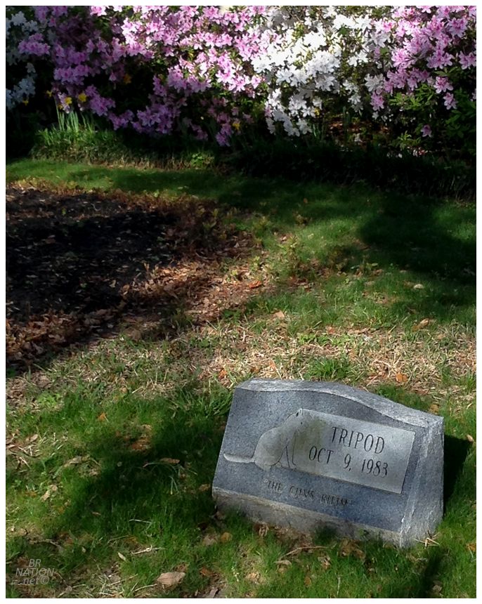
Noticing a headstone on the grounds, I was surprised when I noticed that it was for a cat. Looking into it, Tripod was three-legged furry buddy with missing teeth that happened to stop by one day. As workers started to feed him scraps, he was eventually let inside city hall, given a bed, litter box and actual cat food. Everyone loved Tripod except alderman Hall Wilson, who was allergic to cats (pfft). In one of the great heartwarming stories of the 20th century, Wilson brought about a vote to remove the cat, but no one would second the motion. Next up, alderman Al Graning made a motion to remove Wilson from city hall instead. This vote went to a 6-6 tie and the mayor made a merciful tiebreaking vote to let Wilson stay on as an alderman. Hilariously enough, Wilson would soften up during a freak snowstorm where he was the only city hall employee living close enough to go check up on Tripod. Stopping in to feed the cat, they would become buddies from that point forward. Sadly, Tripod only spent four years at the Natchez City Hall before dying from an illness in 1983. A stone marker with his name, the inscription "The City's Kitty" and an image showing his missing front leg, now sits on the western side of the city hall lawn. |
We also walked by the Adams County Courthouse, the oldest county courthouse in Mississippi (built in 1818). Of the 92 county seats in Mississippi, there are only 5 antebellum courthouses still standing and we just happened to visit 2 of them by virtue of Natchez and Port Gibson. Maybe I'm due for some stinkers when I visit the other 89. (It's 89 and not 90 because I visited the county courthouse in Pascagoula back in 2012). |
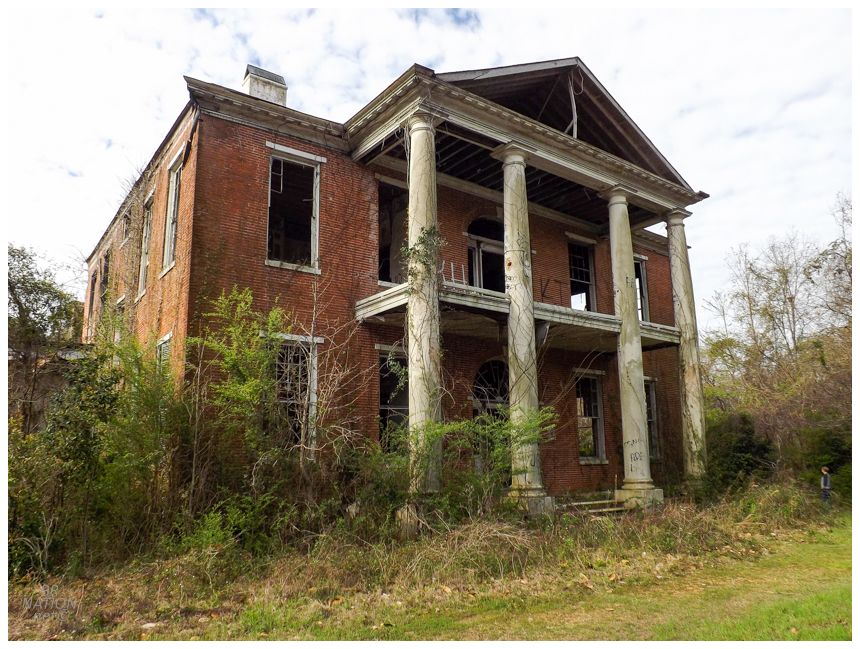
Before leaving town, we needed to see one of the elaborate antebellum homes that puts Natchez on the map. While Longwood is the best known, looks breathtaking in photos, and I would have loved giving Shelloo a hard time as it was used in her corny TV series True Blood; we instead pulled into Monmouth and hung out in their long drive, listening to birdsong and photographing the Spanish moss. Following that it was on to the Arlington Plantation. Built in the early 1800s, Arlington was growing rundown by the 1990s, but the Historic Natchez Foundation worked with the family and volunteered time and money to fix it up. That work became all for naught on September 17th 2002, when an electrical fire brought the house to ruin. A post-fire picture is available here. |
The Historic Natchez Foundation wasn't deterred though, and soon after the fire had a new roof installed to aid Arlington back to its former glory. Except that hasn't really happened. The absentee owner has failed to secure the building and Arlington is now home to broken windows, graffiti, damaged woodwork and trespassing miscreants. In 2009, the owner was successfully fined for demolition by neglect for a whopping total of $259. In a place like Natchez that so desperately survives on its historic building stock, it's good to see that their fines have such teeth [/sarcasm]. |

Sometime in the 2010s, the demolition by neglect laws here seemed to have improved. In 2018, the City of Natchez gave the owner notice that he had 30 days to repair and clean up the property according to a city-created checklist. After the current owner did nothing with that 30-day letter, he was then given another 30 days to attend a preservation meeting. After the owner also ignored that request, the city is now weighing the hiring of a professional engineer to assess structural repairs and applying that engineer's cost to the owner in tax liens and fines. |
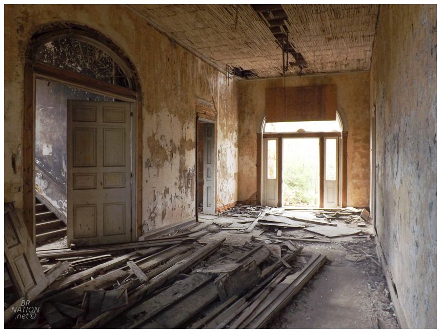
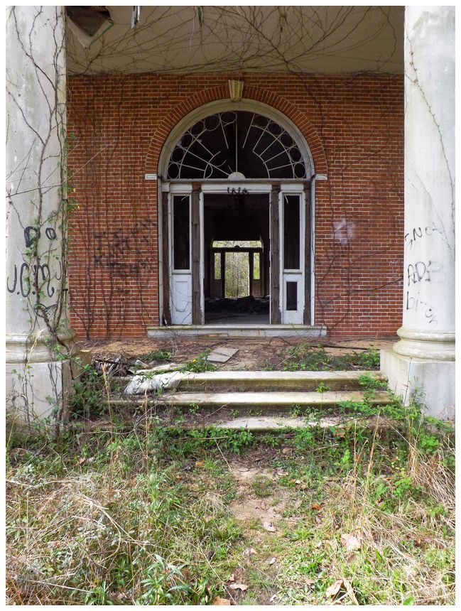
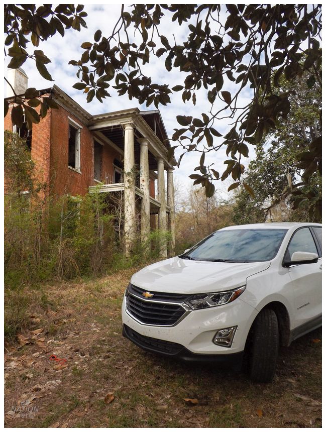
Walking through the front door, the grandeur of this place was evident even after 16 years of looting and vandalism. It also speaks to how much Natchez residents value these places, when Arlington is still seen as a building where preservation is possible and not as a place that's "too far gone".1 |
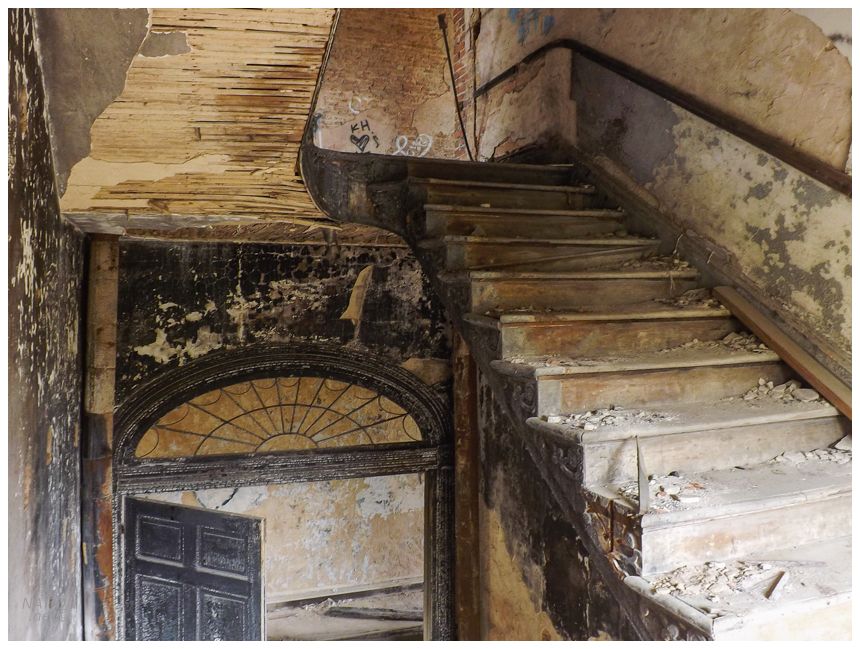
The stairs leading up were rickety and the second floor was another collection of similar rooms. That being said, I loved standing on the outdoor balcony and surveying all of the lush vegetation while the stone columns gave me a handhold in lieu of a railing. If you want to see what Arlington looked like in its glory, click here. |
Heading back downstairs, it was time for us to roll. After grabbing some Taco Bell on US-61, we then bid Natchez (and soon Mississippi) adieu. Continue to the next update. |