The overnight layover in Halifax was easy. I knew that there was only one American flight that arrived after 10pm, so finding four seats without armrests outside the American arrival gate, I laid out my backpack of clothes and would only have to sleep through the arrival of about 50 people coming from Newark at 23:15. Before I knew it, it was time for my 5:25am flight to Toronto and another 9-hour layover. Now whenever I have a long Toronto layover, I ponder leaving the airport and picking up one of the lighthouses located in the city. I tried to get the lighthouse on the Toronto Islands before, but this was a while ago when you still had to take a long bus out to the start of the subway line, and then spend even more time on the subway just to get downtown. Nowadays there's the UP Express train, which goes right from the airport to downtown in 25 minutes. |

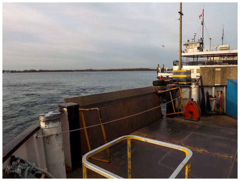
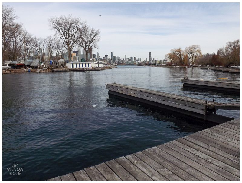
The wind tunnels of the Toronto skyscrapers were in full effect this morning. Walking from Union Station down to the ferry terminal at the foot of Bay Street, I entertained the idea of simply leaving the islands for another day because of the cold temps. Where I didn't need much late winter or early spring gear for my upcoming destination, I specifically brought a flannel shirt and facemask for this layover. And boy were these items needed down in the Financial District. Clicking through the turnstiles and walking aboard, the ferry wasn't as big as I expected and actually reminded me of some of the smaller ferries in Newfoundland, like the ones that go to Long Island or South East Bight. It was strange to escape Toronto's dense urban core and head out into Lake Ontario on such a boat. Not to mention that most of the people were residents who headed into the warmed interior, leaving me isolated on the deck like so many of the ferries in NL. |
The Toronto Islands area was home to many native groups before the white man, including the Mississaugas, who believed this area was a place of recovery to bring their sick. The islands were still a peninsula at that time, created by the currents of Lake Ontario eroding the Scarborough Bluffs and depositing the sand and stone into long bars hemming in the lower Don River. York, as Toronto was then known, was established in 1793. Into the 1800s, a carriage path extended from the settlement of York, down to Gibraltar Point at the southwestern point of this peninsula. For years, storms would work to separate the sandbar from the mainland and create an island cluster, but the channel was always refilled and the road reopened. That is until 1858, when a storm was so intense that the 500 foot channel it created, also permanently created the Toronto Islands. |
The isolation of these islands did little to curb people's love for them as a place to escape the bustle, grime and heat of the city. Toronto's wealthiest families would build homes all along the main, central street; with summer cottages, amusement parks and hotels filling in all of the other areas. Toronto's main ballpark was on these islands, a 10000-seat stadium where Babe Ruth hit his first professional home run into Lake Ontario as a member of the Providence Grays. (That stadium was demolished in 1927, the grounds were still used for baseball/lacrosse until 1937, and now the area is part of Toronto City Airport.) |
Manitou Road
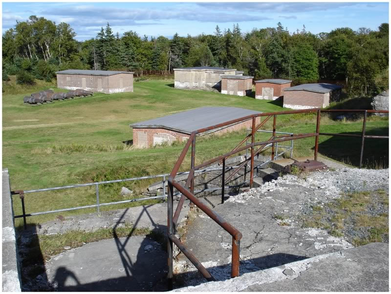
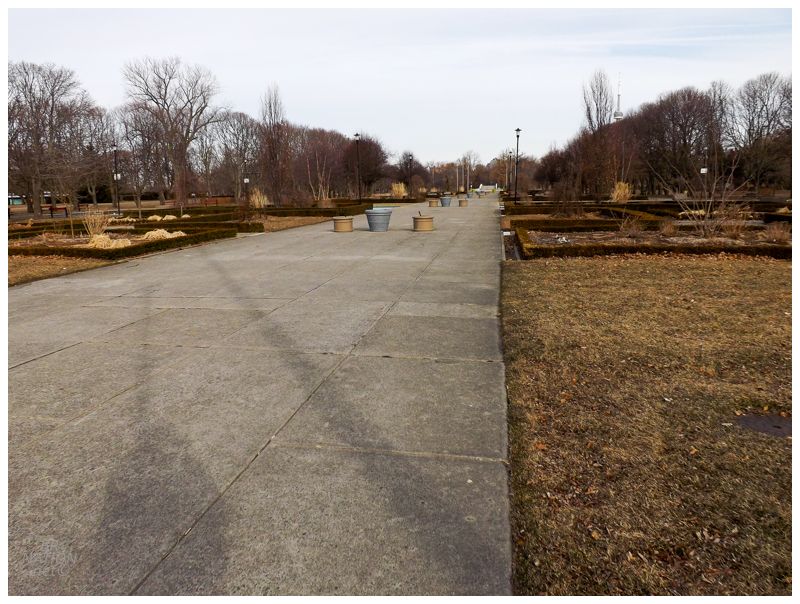
As the number of houses and the population of the Toronto Islands grew, so did the need for services. A main street similar to any other small town popped up, with Manitou Road being home to "a general store, a butcher shop, a dairy, a boathouse, laundries, and several hotels. Manitou Road also became an entertainment hub with facilities that included a casino, a bowling alley, and a movie theatre." according to the Toronto historical plaque that stands there today. Then in 1956, the City of Toronto seized Centre Island for the creation of an urban park known as the Toronto Island Park. The city worked to demolish homes from west to east, starting with the village near Hanlan's Point. As they were met with resistance, the decision to flatten Manitou Road was made, thinking that without the services provided by the main street, residents wouldn't want to live on the Toronto Islands any longer. Protests and court cases would stop the demolition about 75% of the way across the island, saving the villages on Algonquin and Ward's Island that still stand today. Residents learned to live without the amenities of a main street and even now, there's only about 1-3 homes transferred on the island each year. |
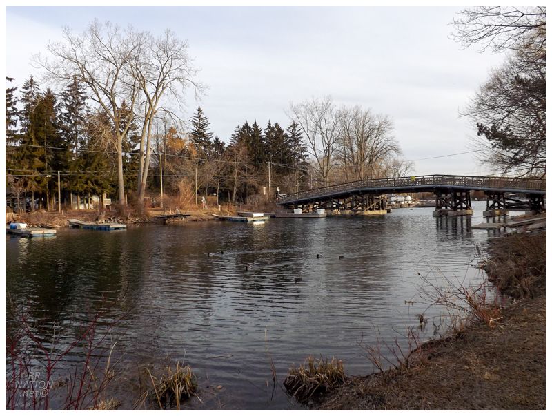
Bridge to Algonquin Island
Landing at Ward's Island, it wasn't a far reach to think that these low-lying slabs of land out in Lake Ontario would be even colder, but I was surprised with light winds and even a bit of sunshine. Packing up my winter facemask, the day was turning into one that would feature a pleasant, sunny spring jaunt of exploration. |

Walking over the bridge to Snake Island, there was a beachfront with shallow water, a picnic table and beautiful views over the city. I couldn't help but think about how great it would be to have some drinks here while Steve fished. Or to camp out here sometime? What an incredible spot. |
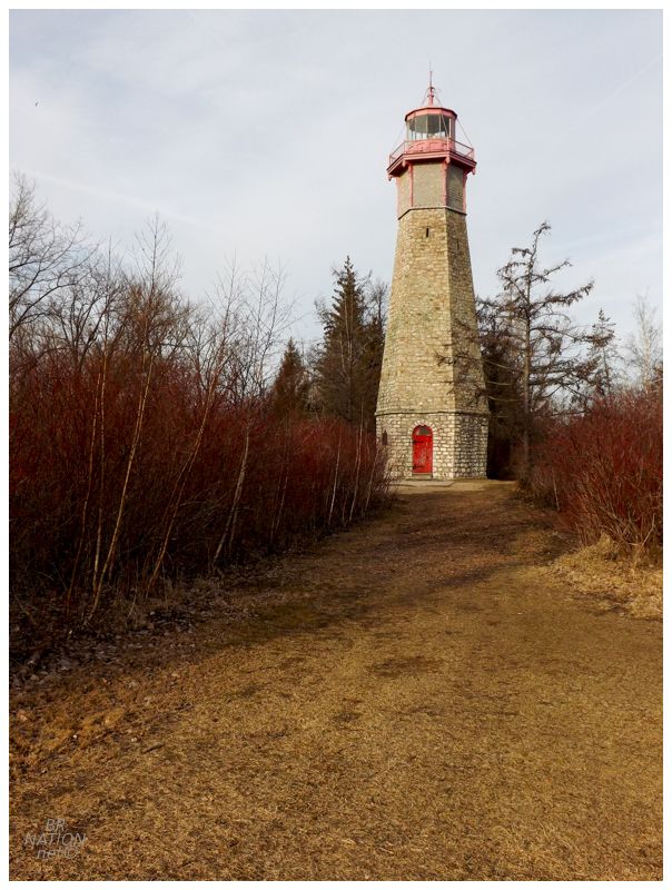
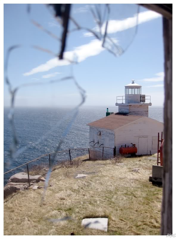
While normally there's 3 ferries running to the islands and you can pick ones closer to your destination, I had a bit of walking today as only the Ward's Island ferry was running and that left me with about a 40 minute stroll. But after all that complaining about the cold weather, I made it to the Gibraltar Point Lighthouse just fine. This was my favourite type of lighthouse adventure - a quiet hike with no one around ending at a substantial structure. Where it looks like Toronto Islands are quite busy in the summer with people out here escaping the city, I think March has to be the perfect time to head out and see this lighthouse. |

With York (Toronto) as the capital of Upper Canada, it's obvious why this would have been one of the first places to build a lighthouse on the Great Lakes. Constructed in 1808, this lighthouse is truly not just another one for me to check off the list: it's the second oldest lighthouse in Canada (after Halifax's Sambro Island), the oldest lighthouse in Ontario, the fourth oldest building in Toronto and the oldest lighthouse on the Great Lakes (take that, Fort Gratiot Lighthouse!) It's also my 10th Ontario lighthouse visited :) |

|
Heading back to the ferry, there was a tiny piece of land between the road and the beach and wandering over there, I loved how much this reminded me of home and the beaches back on Lake Erie & Lake St. Clair. This would be a lifesaver for those living in Toronto who don't belong there. Just a short ferry ride away and there's the calm tranquility of a quiet Great Lake, plus it's a whole 180° turn from digital ads being on every surface, people upselling you 3 times and whiny herbs bitching because Toronto doesn't have Venmo. |
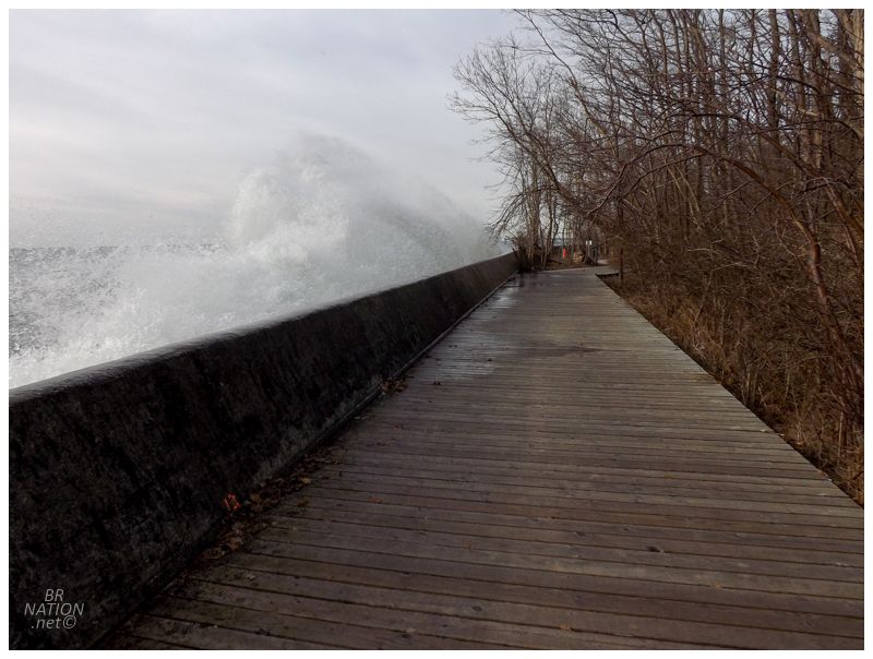
I continued along the lakeside boardwalk on my way back, thinking about riding this slanted wall when suddenly I was startled by crashing waves. I don't know as much about geomorphology involving sand spit islands as I should, but they say these islands would disappear if it wasn't for these breakwalls saving the shores from this intense wave action. |

In addition to the four domestic streets on Algonquin Island, there is also a small village on Ward's Island, located to the north of where the ferry docks. I didn't have any plans to explore this area, but seeing as I was early for the ferry, I figured I could kill some time by following the 30 Red-winged Blackbirds on over. |
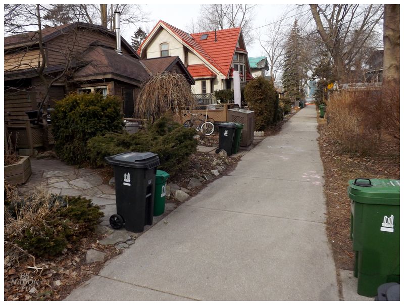
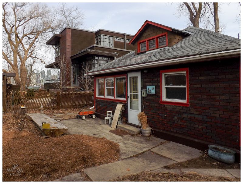
For not initially planning on walking over here, I loved the village on Ward's Island. It must have had to do with how houses are only sold to a waiting list and at a set price, so there were very few-to-no gaudy mini-McMansions splashed in amongst the modest houses. There's also a constant push to renovate and add to the existing houses, making for more vernacular architecture than prefab, cookie-cut stuff. When you also add in that there's only little walkways for each street on the carless island, then you really start to get a unique spot. And this is only 1500 yards away from the multi-million dollar condos on the Toronto city shore. |
Boarding the ferry, even though I'd now seen the lighthouse I figured I'd be back on the Toronto Islands at some point since I liked the area so much. Back on the mainland, I walked and walked looking for some non-chain exciting food choice, until I was so tired that I almost tried that unappealing Potbelly sandwich shop for the first time. That's is until I noticed a Moroccan place across the street, and seeing as I've been to Morocco now, of course I should be eating the "12:10 to Marrakech" flatbread for lunch, lol. I really want to be a sanctimonious jackass here, but Plancha was actually quite good. Anyway, soon enough I was back at Pearson Airport into that rundown, narrow area where Toronto flights head off to secondary American destinations. Continue to the next update... |