The Mother Road, Route 66: Day 3 (Map)
St. Clair, MO to Bentonville, AR (via Cuba, MO & Mt.Magazine, AR) - 636 km
Summer 2010.
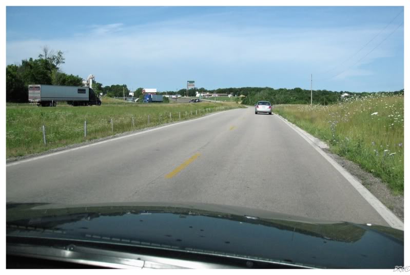
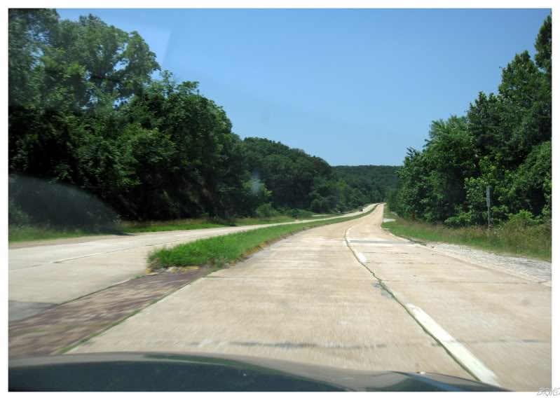
Yesterday, my first taste of Route 66 was driving a secondary road which crisscrossed and passed over the interstate over & over.
This day would start with driving a secondary road right next to the interstate!
Although U.J. was driving approximately 50mph on the secondary road, it was still humourous to look over and see parallel interstate traffic driving 70mph.
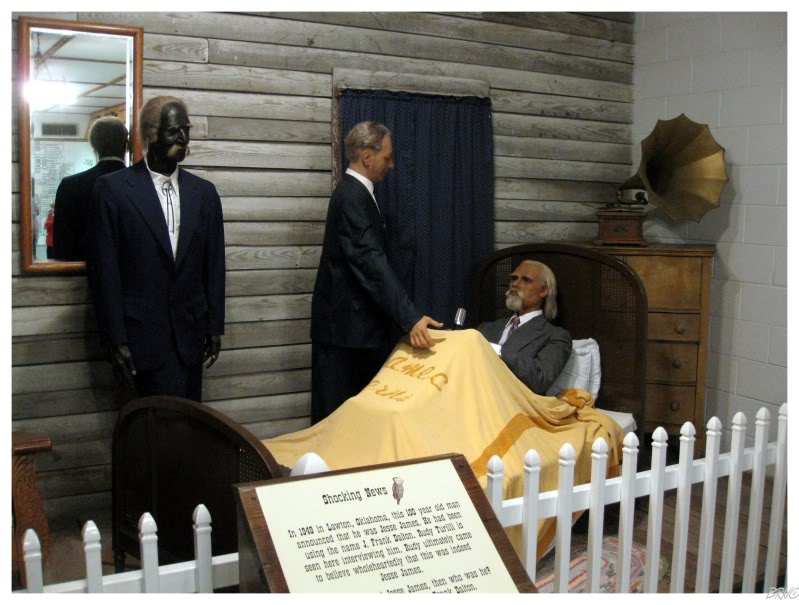
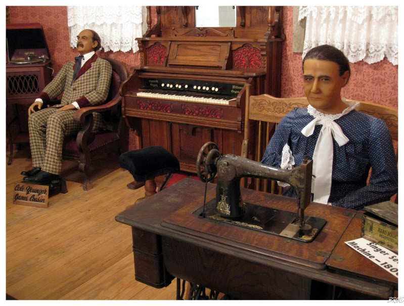
One of U.J.'s 'must stops' - the Jesse James Museum - was only 30 minutes away from where we slept in St. Clair, MO.
The museum was all about how Jesse James' death was faked and he actually lived to 102. This claim was based on recordings with some guy in an old-age home at the age of 95 or something.
This kind of stuff doesn't interest me, but I was making U.J. go to baseball, so I could tolerate with some outlaw history in return. In addition, the $8 was worth it to laugh at the terrible negro wax figure & also to check out the awesome weaponry room (chain mail, bear gloves, iron knuckles, &c.).
Jesse James' wax mother didn't appreciate my mockery.
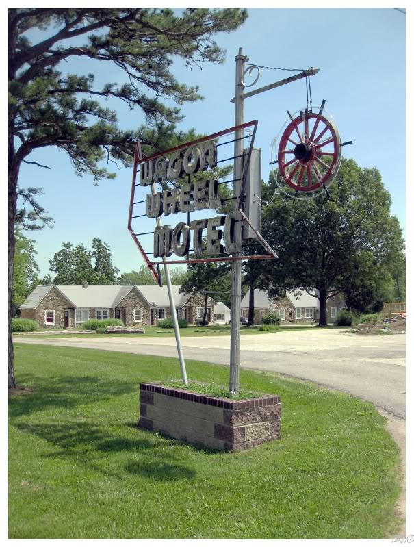
One of the Route 66 features I was actually excited for, was all of the old neon signs used to attract drivers of the past. As this route became popular with people heading westward, many unique hotels, gas stations & attractions popped up along Route 66 and defined the road's identity.
One of these iconic motels is the Wagon Wheel Inn. This was another 'must stop', although I wasn't mocking this one.
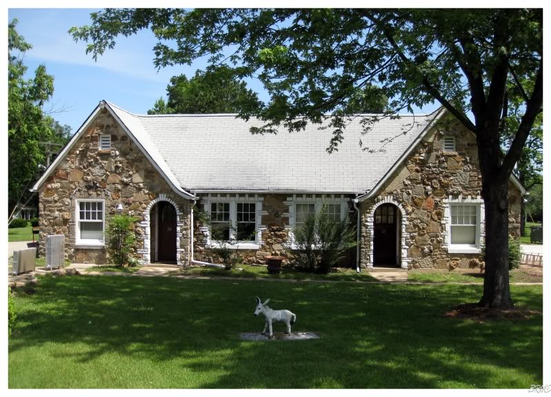
It was a shame that we had to stay at some bland & forgettable motel on the interstate, instead of making it to this Route 66 classic.
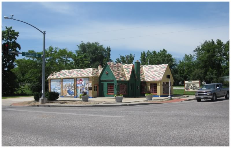
The Wagon Wheel Inn was in Cuba, Missouri & we also noticed this fantastically restored Phillips 66 gas station nearby.
While snapping pictures of the gas station, U.J. had a good laugh at me as I felt a spider crawling up my leg & then proceeded to jump 360s as I flailed my legs in an attempt to get the thing off of me.
It ended up being a harmless daddy long legs.
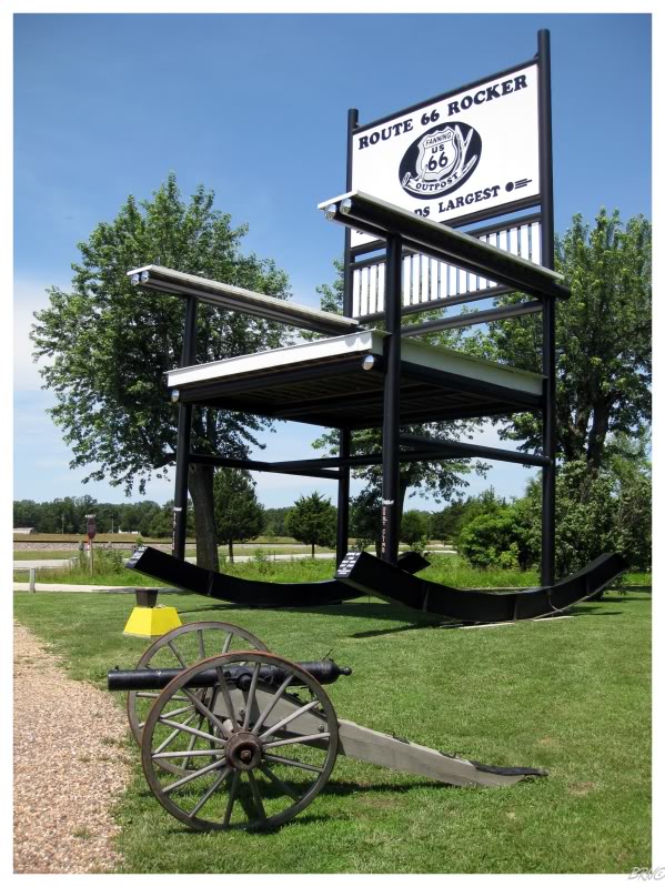
We had to stop yet again as we noticed the World's Largest Rocking Chair in the tiny settlement of Fanning, Missouri (4 miles from Cuba).
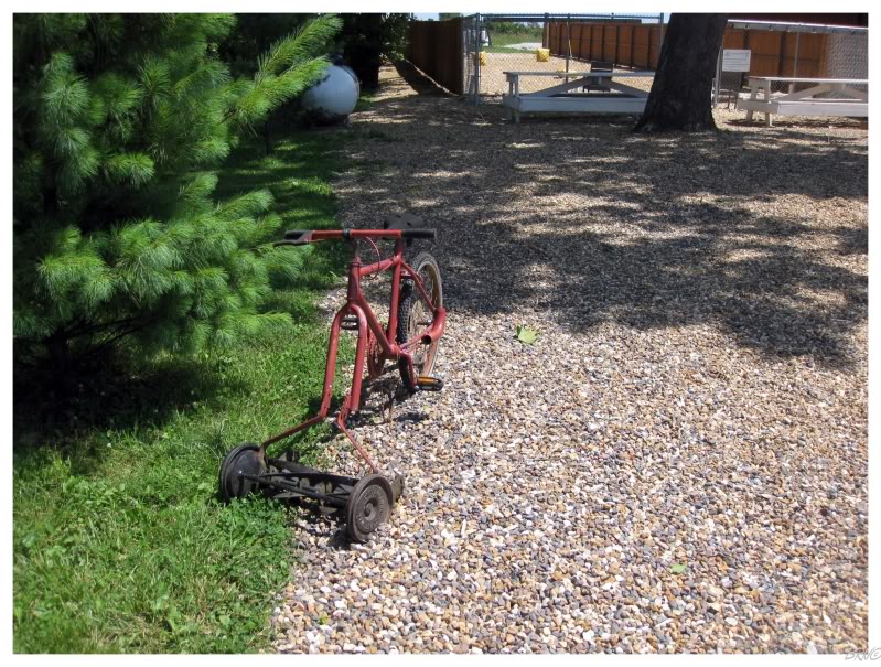
They had the sweetest lawnmower I've ever seen.
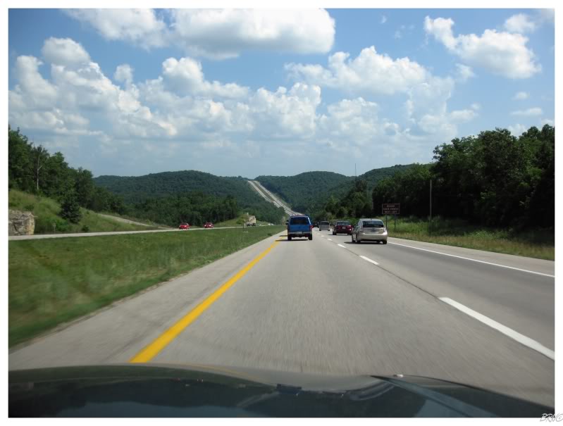
Shortly after Cuba, we would join a 4-lane section of the old Route 66.
Instead of feeling like we were driving on some random secondary road, this suddenly felt like we were taking the old road which was replaced by the Interstate System.
A lot of memorable moments were had on this trip, but this is one I remember. The landscape was changing with greater variance in elevation and more trees; in addition to having this 4-lane highway (pretty much) to ourselves. It was beginning to feel more & more like we were driving the Route 66 towards California (versus just cruising around the midwest).
When we reached Springfield we had covered approximately 350 km of the 510 Missouri kilometres of Route 66.
At this point it was time for Side Trip #1. Seeing as Route 66 doesn't require 17 days, I had shoehorned some side trips into the plans & we were about to leave Route 66 until tomorrow!
For the next hour we drove south and laughed at the ridiculous billboards advertising Branson, Missouri.
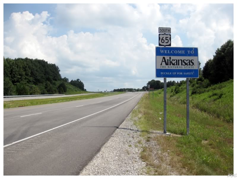
Rest easy though, I'm not 75 and we weren't headed to Branson, Missouri...we were headed to Arkansas!
State #37!
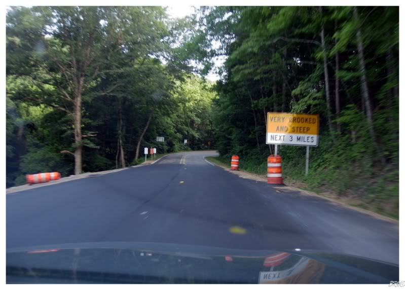
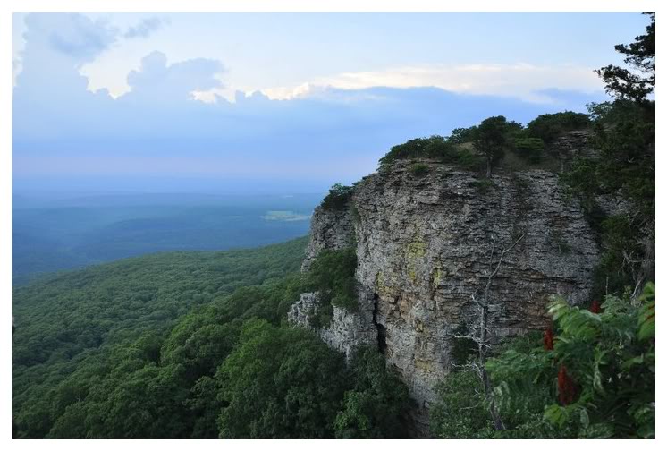
Our Arkansas goal for this evening was to reach the highpoint of the state. I had previously looked up attractions along the way, but realized why there weren't any while we were driving: the path was mostly through the Ozark National Forest.
Another point is that the above picture doesn't even begin to display the hindrance that the Ozark Forest provided. While a few places had nice scenic outlooks, the majority of our time in the Ozark Forest was spent in forests, dealing with hairpin turns and ridiculous 10mph curves - our GPS looked like it was showing a seismograph line instead of a road.
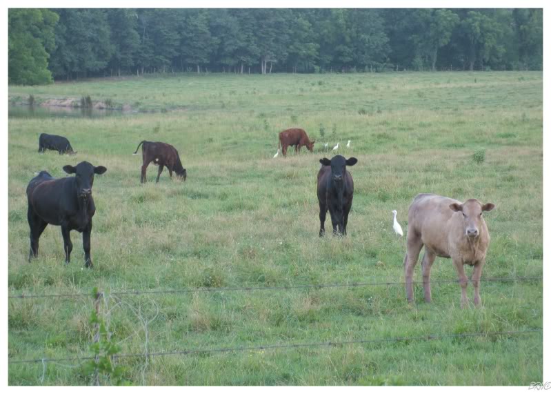
After the forest, we passed through some stunning land with curvy roads and rolling farmland.
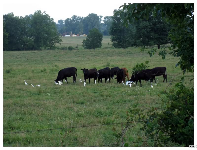
It was here that I noticed flocks of white birds hanging around every cow pasture very near to the cows themselves...so I asked U.J. to stop so I could take a proper picture of the bird-cow interaction.
...and was given a proper Arkansas mean mugging as a result.
U.J. couldn't stop laughing at how angry the cows looked that I scared away their white birds.
I would later learn that these 'white birds' were Cattle Egrets and have been given their name because of their behaviour:
"Every day, the Cattle Egret flies to a cattle herd, and spends the day feeding on bugs, spiders and other small animals that have been aroused by the large mammals. The birds also sometimes sit on the animal’s back and look around for possible prey, or pick off ticks from its back." 0
Loving birds & cattle, I was thoroughly amused and enthralled with watching this bird-cow interaction. I could have stood there all day, but we had state highpoints to reach!
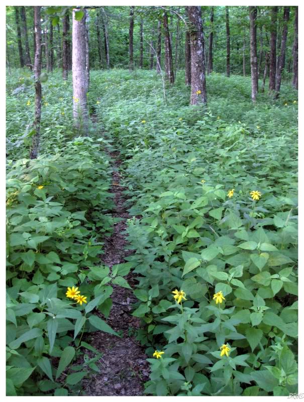
When we re-entered the Ozark National Forest to the south, we quickly reached the parking near the 1-mile long highpoint summit trail.
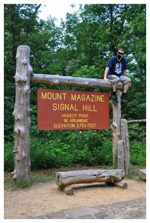
Mt. Magazine is a difficulty 2 highpoint, meaning that it is slightly more difficult than a drive-up highpoint; likely involving a short walk or hike - i.e. nothing that we couldn't make short work of, even though the daylight was fading.
Although I was a bit worried about snakes & critters here in the south, we decided to take the longer trail & I was happy that we did. Very nice Arkansas!
U.J.'s photo
The highpoint is neat in that there is a giant stone map of Arkansas, a sizable highpoint sign & a geodesic marker.
The highpoint isn't that neat because you're surrounded by forest. Even as I climbed atop the sign, I couldn't see past the trees surrounding us.
Anyway, state highpoint #6!
U.J.'s photo
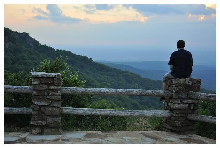
We didn't spend much time at the highpoint because we noticed an amazing scenic lookout while looking for the highpoint. Instead of having the sun set while in a forest without a horizon, we hurried back to the car and over to the outlook for the sunset.
I always enjoy highpoints, but this outlook was the highlight of the Ozark National Forest (and of Arkansas) for me. It had to be about 80°, calm & partly cloudy. We artfagged the horizon and the setting sun...
U.J.'s photo
...before simply relaxing and taking it all in.
Looking to our right, a roofless gazebo seemed to be more popular than the place where we were sitting, and I had no problem with that. U.J. proposed that we crack a Joose & I surprisingly had no problem with that either.
I was a bit concerned with drinking around all of these straights...until I noticed some middle-aged broad get out of an SUV with a glass of white wine - Arkansas kept racking up the points.
The sunset wasn't anything spectacular with the rain clouds blocking our view - we ended up seeing the sun fall for a grand total of 30 seconds, as it slipped from behind one cloud & into another.
The rain clouds meant that we didn't dawdle with our Joose.
The exit from the state highpoint included more ridiculous roads and U.J. was growing frustrated (especially seeing as there was complete darkness now). If you don't believe me, check out the map from the mountain to where we would rest our head for the night - Booneville, Arkansas.
By the time we reached Booneville, it was a full-on thunder storm. Just a week earlier, several campers had died in a flash flood at a campground very near here - which we could now completely understand after seeing the intensity of this storm which seemed to pop up out of nowhere.
The first order of business in Booneville was a run around the local sanitarium that we needed to scope out. I'm not one to get creeped out easily, but driving around that campus in the pouring rain, through antiquated gates, only occasionally seeing the buildings with each lightning illumination and having the 'emergency broadcast system' take over the radio was enough to creep me out a bit.
Of course, like always, there weren't any murderers or ghosts about; so U.J. and I had a laugh at the stereotypically creepy scene, which I'd say was movie-like in its authenticity.
Returning to town, our only dining options were McDonald's or a Chinese joint called the Lin Buffet. We opted for the Lin Buffet and it might have been the most bland, tasteless Chinese I've ever had...but that's about what I expected in rural Arkansas at 10:30 on a Saturday night.
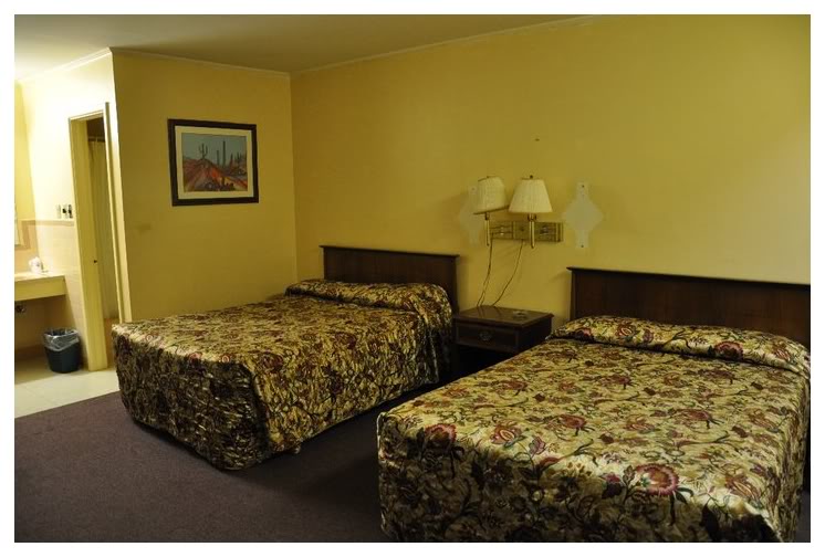
Anyway, next up was finding sleeping accommodations for the night - which we found at the Holiday Capri Motel ($40/night!). The parking lot was filled with pickups of men who you imagine were running through prostitutes, but otherwise it didn't look THAT bad - it actually looked like the motel from No Country For Old Men where the woman wants to have beers with Llewellyn.
After the aloof owner showed me my room (and blindly knocked a nasty spider in the room), I took the room and the spider's life.1
I wrapped a t-shirt around my head so critters couldn't crawl in my ears, installing cleanliness confidence in U.J., before throwing my head into the pillow for the next 8 hours.
Onto Day 4.
| Day 1 Windsor,ON to Mooseheart,IL via. Michigan City,IN |
Day 2 |
Day 3 St.Clair,MO to Bentonville,AR via. Cuba,MO & Mt.Magazine,AR |
||||
Day 4 |
Day 5 |
Day 6 Conway,TX to Albuquerque,NM via. Armadillo,TX & Tucumcari,NM |
Day 7 Albuquerque,NM to Williams,AZ via. Flagstaff,AZ & Winslow,AZ |
Day 8 Williams,AZ to Rialto,CA via. Oatman,AZ & Needles,CA |
Day 9 Rialto,CA to Pasadena,CA via. Salton Sea,CA & Mexicali,Mexico |
Day 10 |
| Day 11 Oxnard,CA to San Jose,CA via. Big Sur,CA & Monterey,CA |
Day 12 San Jose,CA to San Francisco,CA via. Lick Observatory,CA |
Day 13 San Francisco,CA to Hickison Petroglyphs, NV via. Sacramento,CA & Carson City,NV |
Day 14 Hickison Petroglyphs,NV to Casper,WY via. Leamington, UT |
Day 15 Casper,WY to Winner,SD via. Keystone,SD & Oral,SD |
Day 16 |
Day 17 |
Go Back to the Main Page of this Website