Black River
It was still early enough in the year that if I was driving across the island, there would be additional daylight outside of the 7 hours it takes to cross from Corner Brook to St. John's.
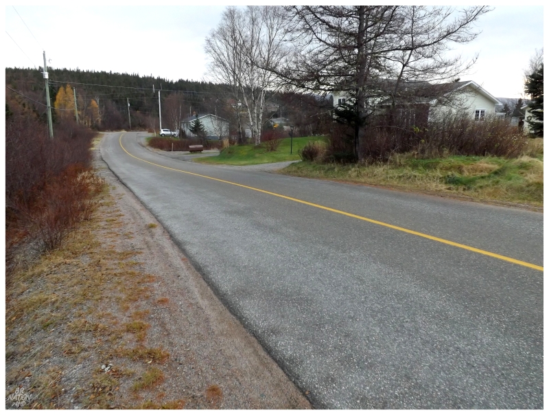
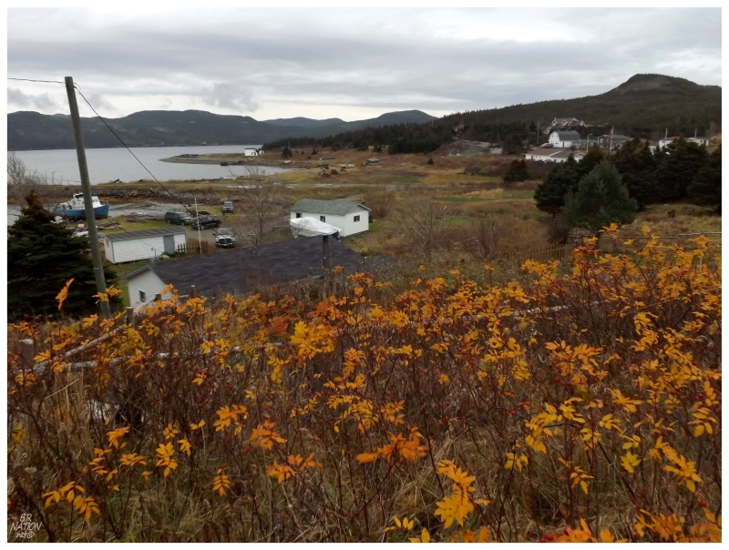
Having never taken the time to stop at this one cluster of communities near the Burin turnoff, I'd use my time today to drive 18km (11.5mi) on the Burin highway, just to reach the green sign indicating a turn for Garden Cove. Following the 5km (~3mi) NL 210-13 tertiary highway, you lazily coast past Black River and into Garden Cove.
Today, Black River is little more than a collection of spread out houses along the roadway, while Garden Cove is the greater of the two settlements. Sure enough, Garden Cove has a more lengthy and detailed history, whereas Black River was the site of a pulp mill from the 1890s to 1903, but outside of that time, it was never more than a small settlement. Black River's population in the 2011 census was recorded as 31 people.
As for Garden Cove, it doesn't have the centuries of history like some places in Newfoundland, but its history still dates back to the late 1800s, when families from nearby islands would come here to cut wood and search for caribou up Pipers Hole River. Now Garden Cove might have been a more resource rich area than their islands, but this area still has high hills of barren rock and angled, thick forest. There was only so much arable land here and that limited the population growth.
That growth would only flare up with the construction of the Jamieson herring factory in the 1890s, allowing people from neighbouring islands to stay here to work during the winter. These people would only come for the winter though, leaving Garden Cove lumped in with Sound Island during census counts into the early 1900s.
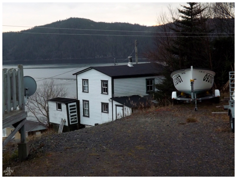
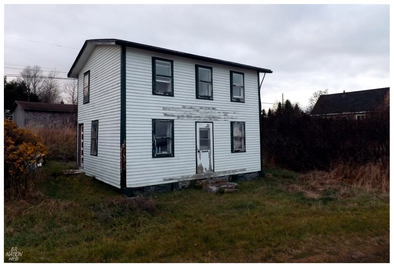
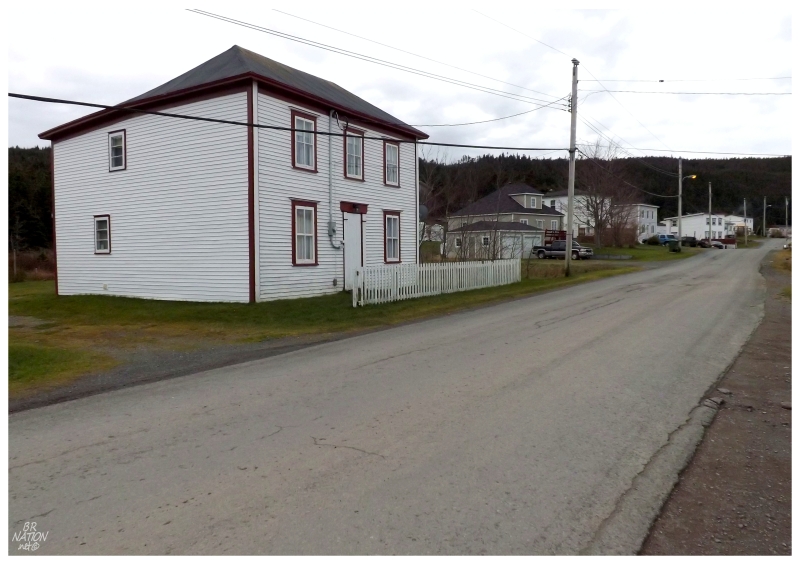
Of course Black River's pulp mill would close due to a lack of water and Jamieson's herring factory would close due to a lack of fish, but Garden Cove grew in the same way that nearby Arnold's Cove had - through resettlement of other places. A mere kilometer out from Garden Cove lies Sound Island, where 108 people took the resettlement money between 1951 and 1956, some of them choosing nearby Garden Cove, with the community recently being connected to the main road network. In addition, nearby Woody Island would also partially resettle through to 1981, further contributing people and resources to Garden Cove. I say resources here, because you have facts like the church on Sound Island being dismantled and reconstructed at Garden Cove - which, had I researched this before going to Garden Cove, I might have taken a picture of the church instead of this older house.
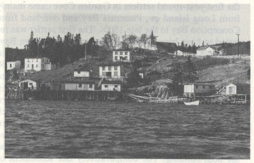
At least with taking a picture of the old house, I can relate it to this old shot from the Encyclopedia of Newfoundland. My old house is the one you see just below the church, at center.
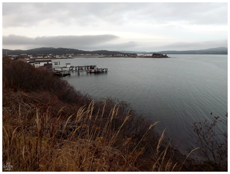
Observing my surroundings, it was an amazing thing to go to a place like Garden Cove and see that they have tours to Woody Island, they have fishing activity & they have some newer houses; but then still see the same Newfoundland decline in the census - 109 people in 2001, 95 people in 2006, then only 86 people counted in the 2011 census.
I'll have to return one day to do Garden Cove a better service than a couple of snapshots under overcast skies.
On the other side of this small peninsula, you'll find the communities of Goose Cove and North Harbour.
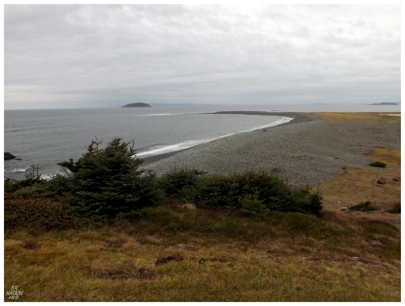
Driving along the short NL 210-11, you'll first come to Goose Cove on your map, even though there isn't any signage to realize you're there. It's only that there's a cove formed in part by the extended piece of land you see in the above picture, that you can delineate Goose Cove. Nowadays the community is merged into North Harbour and the populations are listed together in the census, where you'll find an incredible 23% loss of people between 2006 and 2011. 270 people lived in North Harbour/Goose Cove in 2006, down to 208 people in 2011.
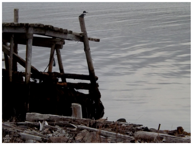
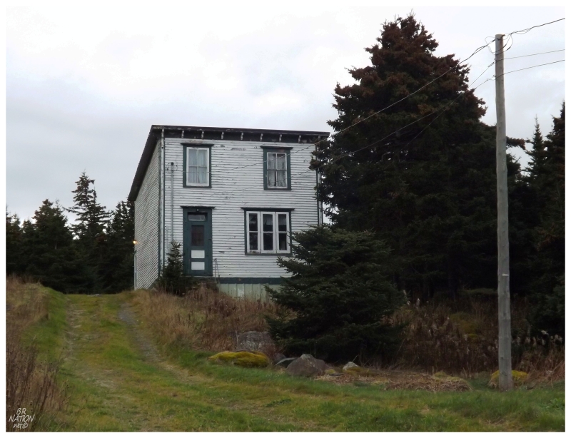
A kingfisher at the end of North Harbour and Llewellyn's house nearby. I knew it was Llewellyn's house not
because I had time to stop & explore, but because there was an office-like sign on the front door.
With light fading it was then back to the Trans-Canada Highway to get down to my reserved room at the Harold Hotel in Placentia. The thing of note at the Harold, was the weird television that looked like an old Canadian film or Coronation Street. Apparently this is hi-def or something? And y'all people can't live without it? I don't know, it made Wedding Crashers look really strange to me.
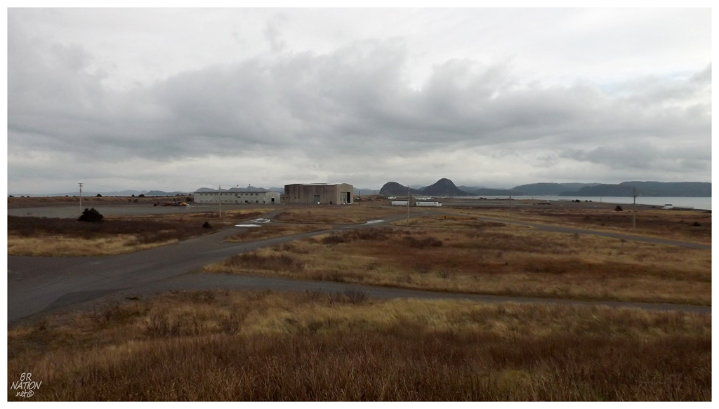
The next morning I wanted to wander about over at the old American air force base at Argentia, seeing if there was anything worth biking, while also checking out any new developments since Husky Energy bought this land.
As for the portion of land that sticks out into the harbour, it seemed a little less inviting than its usual quiet self, but it wasn't a hotbed of activity either.
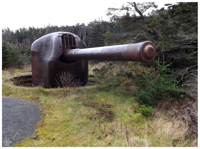
Recently finding some pictures of big guns leftover closer to Placentia, as well as talking to someone from Placentia who told me there was plenty I hadn't seen, I parked the car and took the time to walk over to Battery 282, near Cummings Pond.
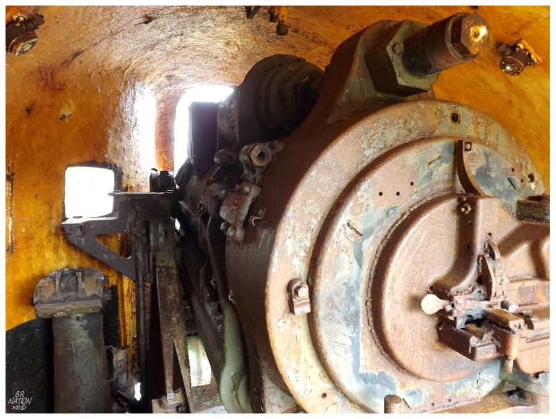
These are 6" rapid fire guns, where two of them would be built on each side of a support structure, to protect the shores with 105 pound bullets that could reach 15 miles and be delivered every 12 seconds.
Constructed to replace Endicott Period batteries, there were plans for 87 of these guns to be built, but only 45 were completed before the war ended. Amazingly, of these 45 guns, only six remain worldwide - two here at Argentia, two at the Columbia River entrance (Oregon) and two along the Gulf Islands National Seashore in Pensacola.
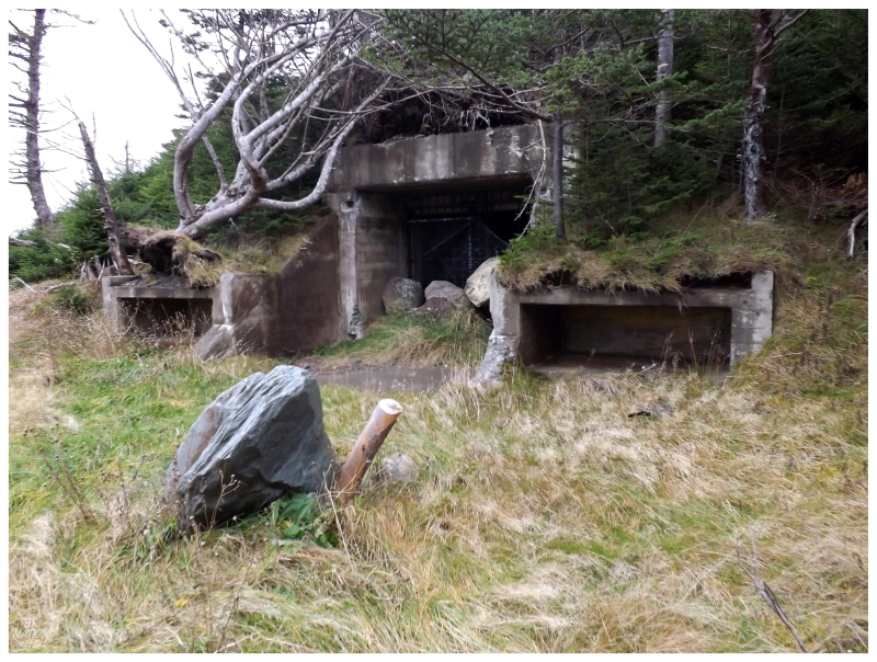
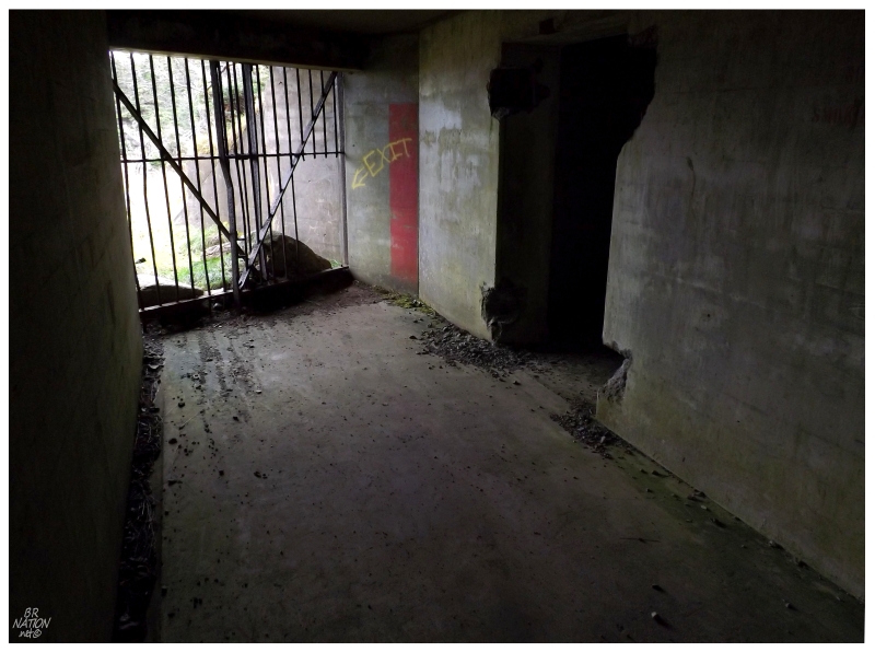
The underground support structure between the two guns.
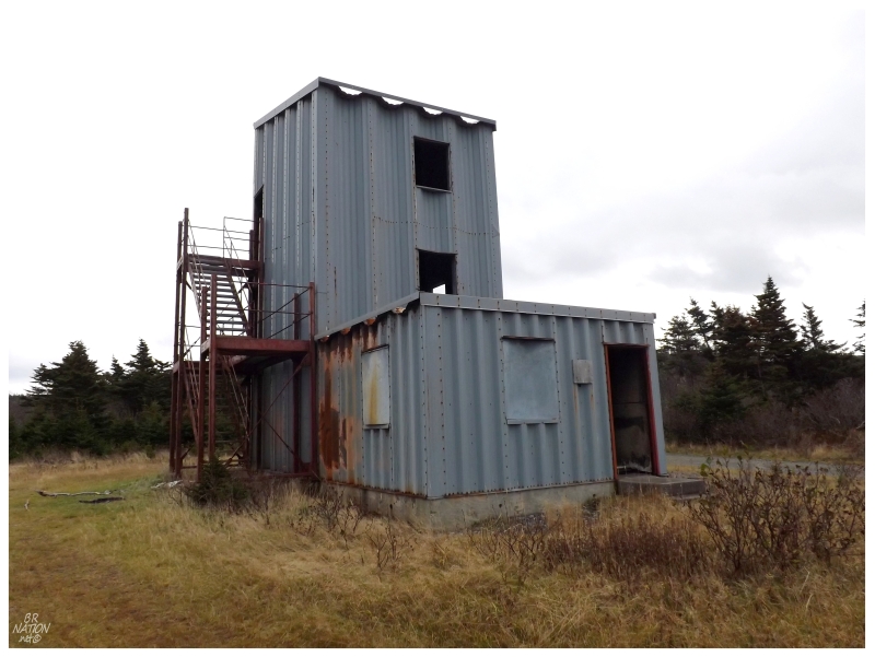
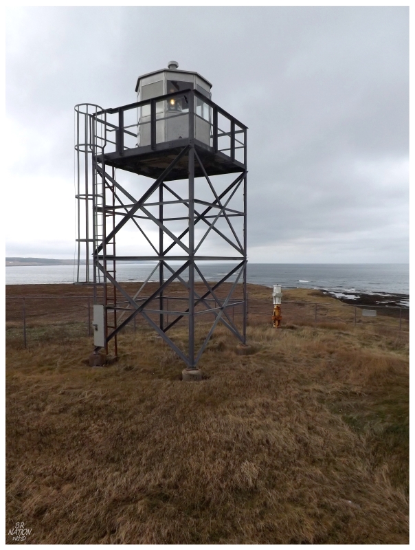
The guns and underground support structure were on a higher point of land, where I could see a corrugated metal structure up ahead.
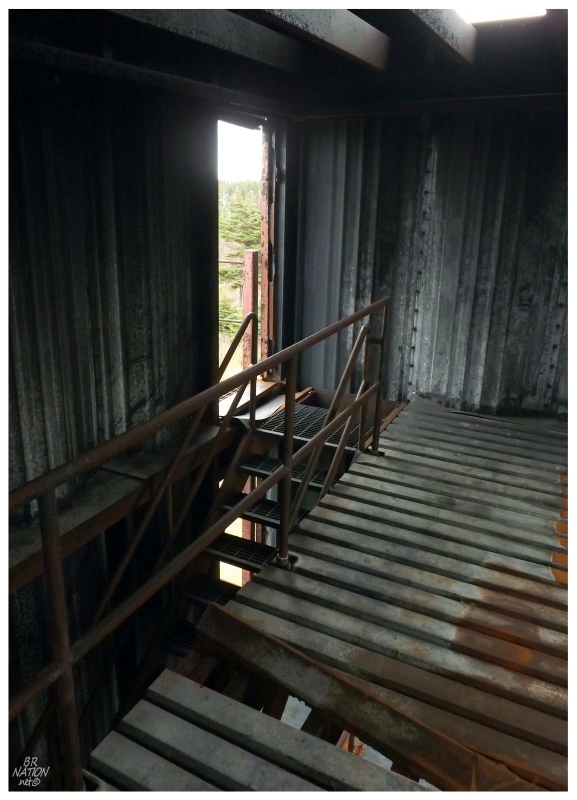
If not for the reduced visibility on this dreary morning, I'm sure this observation tower would provide great views.
There was one more building past the observation tower, but the rectangular structure provided no clues towards its former life, and annoyingly, the American government doesn't seem to make many maps of their military installations.
Heading north from Placentia/Argentia, the NL-102 was one of the last highways I hadn't driven in this province, stretching 24 kilometers (15mi) to the community of Ship Harbour.
Ship Harbour has been around for a while, helped by its proximity to Placentia and the expansion of the fisheries. A Roman Catholic Church was built here all the way back in 1891 and most services needed to be in Ship Harbour before the road to Placentia was greatly improved in the 1960s.
Ship Harbour has one great historic footnote though, in that off of these shores in 1941, Winston Churchill and F.D.R. met on the U.S.S. Augusta to sign the Atlantic Charter. With Britain suffering embarrassing defeats in the Balkans, while having their trade routes threatened at Egypt's Suez Canal and facing the growing threats of Japan on their Southeast Asia holdings, the Brits met here with the Americans to sign a joint declaration of each nation's war aims.
Standing here on this ridge today with Fox Island off in the distance, the Augusta would have been docked out there, witnessing the signing of a treaty that tied America into the war, influenced global policy and led to free thought in British-held territories after the war.
Ship Harbour itself wasn't all that exciting in terms of structures (although I could easily be sold on going back for some of the intriguing hiking).
The better architecture was found along the way to Ship Harbour, back in Fox Harbour. Having walked around Placentia a few times by now, I could easily see myself driving the short distance to Fox Harbour for an evening walk next time.
I couldn't dawdle in Fox Harbour today as I knew I had a run of the Irish Loop ahead of me. Driving over 240km of the loop today, this isn't a freeway by any stretch of the imagination and I correctly predicted that part of it would end up being driven in the dark.
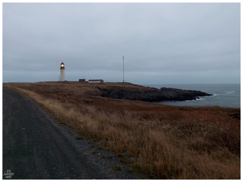
As I've covered the Irish Loop before, I'll keep this short. I still found time to stop for lighthouses obviously, as here's Point La Haye.
The coast indicated by Powles Head Lighthouse.
Cape Race. I was sad to see this one was developing a growing crack down the side, but thankfully it's a National Historic Site (knock on wood that that should mean anything).
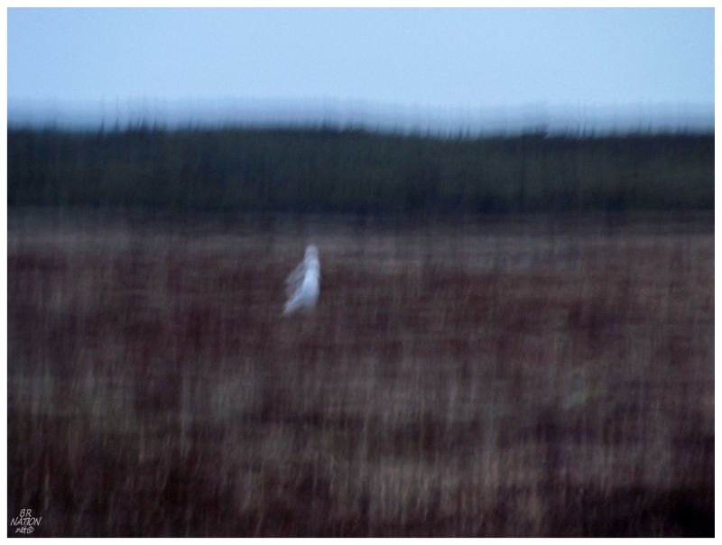
Part of the reasoning behind another Irish Loop and a return to lighthouses I had already seen, were reports of Snowy Owls.
Unfortunately, daylight was fading along with our time at Cape Race, making for tough photography conditions. If you add in the fact that I was infuriated by this dude who drove up on me and scared away a gyrfalcon before I could get a picture, it doesn't take much to understand that my patience was thinner than lake ice at first frost. I really didn't feel like taking the time to only make a slightly-less mediocre picture than you see above.

Finishing the Irish Loop leaves you near St. John's, where I'm going to have a pint or two, but this time I also made sure to finally do a better job of photographing their incredible courthouse.
The next morning it was time to head back, but with not having did that much just yet, I wasn't in any hurry & accepted that I would drive some of the return trip in the dark.
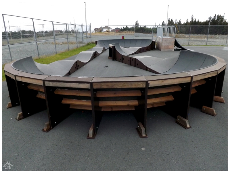
One of the places I wanted to go was to the hilarious new Bay Roberts Skatepark...
"Well, we have a budget of like $70000, but we must...MUST...have that elevated roller track!"
(Warning: skatepark rant)
I don't know anymore. Is it that 95% of youths try biking/skateboarding/scootering for 2 or 3 years, then quit? So they don't need things to grow and get better on? You simply need to build a "fun park" for beginners, who'll be really psyched to zip around a roller track, but grow out of it by the time they turn 16?
I had always looked at something like having a limited budget as a great reason for making the best adaptable skatepark with the amount of money you have. Make the rail a little longer, install another ledge, install a spine or a hip - give people the things that they can continue to enjoy and progress upon as their tricks evolve.
Then again, I saw another town pridefully say that they had only the second ever elevated roller track in all of Canada, and that all of the users love it. So maybe the point of a skatepark is to please as many beginners as possible? It's easy enough to please those 50 beginners, and as only 5 or 10 will ever become any good - that's a decent success rate when you're talking 80 or 90% of users being happy. The talented ones will be older and able to drive to Mt. Pearl/Mundy Pond/Marystown?
I guess.
I had fun riding the roller track and as it's not my town or anywhere close to my town, I can't really be angry, only a bit sad for those who stick with said activities in Bay Roberts.
Having another skatepark under my belt, I knew that my colleague would want to go get the Green Point Lighthouse, as I had been there before, but she hadn't ever taken the time to walk the kilometer from Hibbs Cove (just outside Bay Roberts). Along with nice weather and yellowing grass in anticipation of the upcoming winter, I was also excited to return to one of my favourite lighthouses on the island. I would never complain about walking this kilometer.
Driving up the NL-70 afterwards, I was told to pull off into a self-storage parking lot...
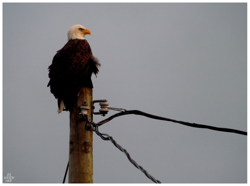
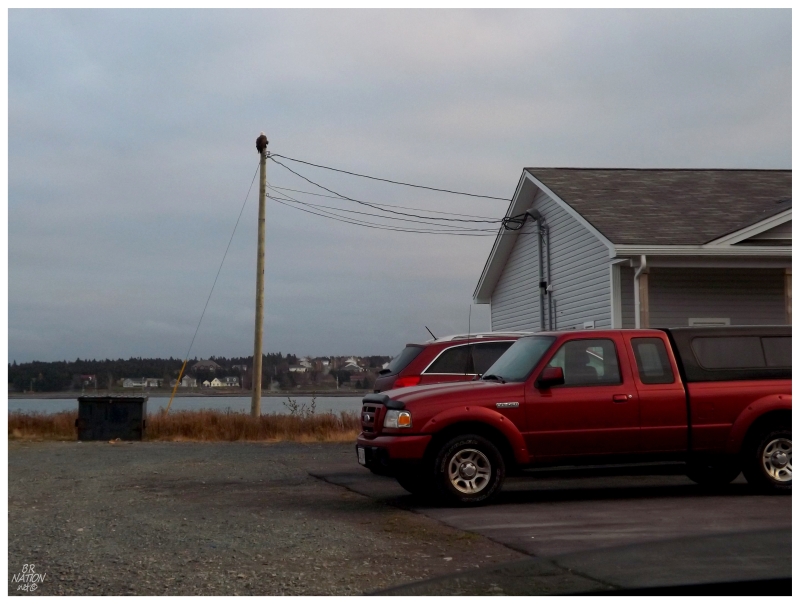
One of our American friends 50 feet from the road in Spaniard's Bay!
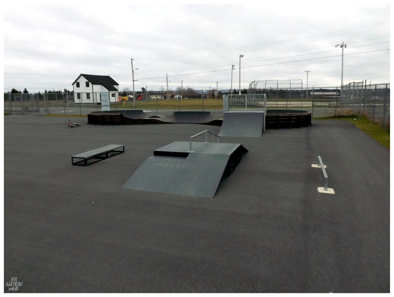
After going a bit further up the Bay de Verde Peninsula, we drove back to Mt Pearl (St. John's) to find their skatepark still wet and unrideable. Successfully spending over an hour doing that, it was finally time to go back to Corner Brook.
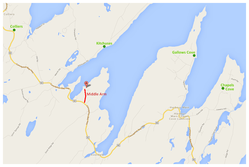
One last stop would be made to get Middle Arm - a tiny hamlet of a community with around 30 houses. Having got all of the other nearby peninsula villages like Bacon Cove, Gallows Cove, Kitchuses and Chapels Cove before; I missed the turnoff to visit Middle Arm during a trio of previous drives in this area.
Middle Arm would be the last new community of this trip.
As there are 798 communities by my loose definition, this leaves 7 more to go!
Although there were intermittent showers, it was still a nice day overall.
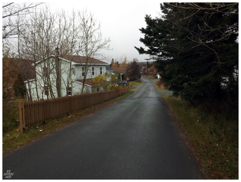
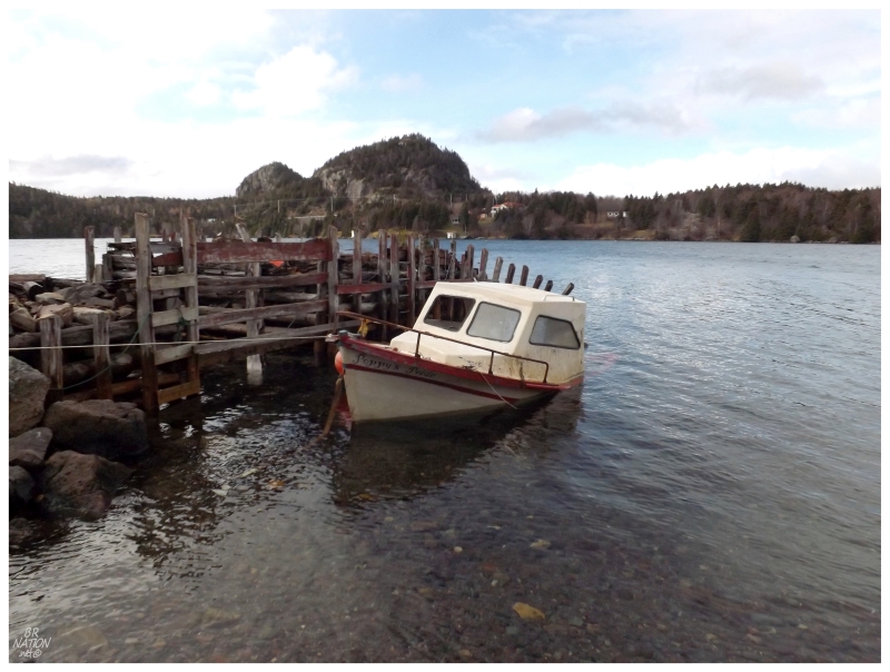
Unimpressed with my coverage of North Harbour, Garden Cove and Fox Harbour yesterday and the day before, I really sank my teeth into the two streets of tiny Middle Arm, parking my car at the end of town to see Poppy's Pride half sunk in Conception Bay (the Middle Arm of Conception Bay more specifically).
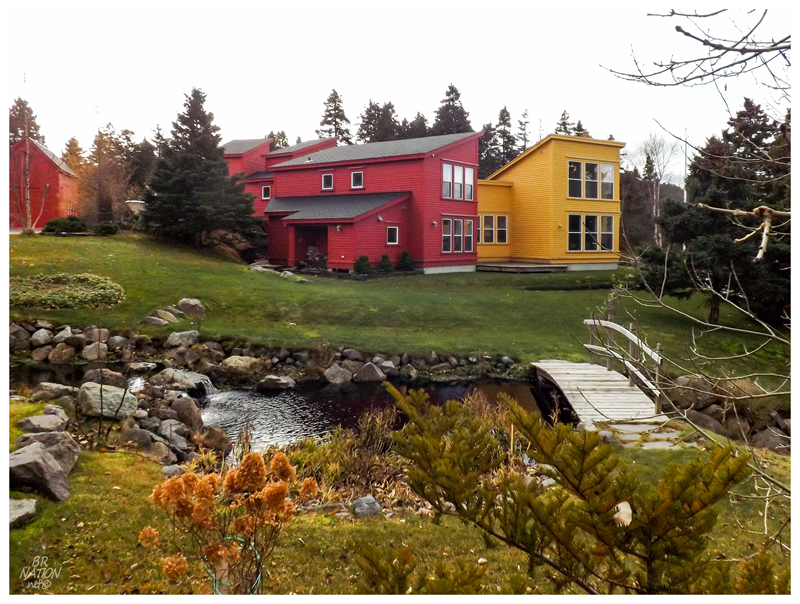
Other than that, I didn't see any older homes in Middle Arm, the most interesting house being this strange yellow & red thing with sharp lines, looking like it belonged more in Tromsø, Norway, than Middle Arm, Newfoundland.
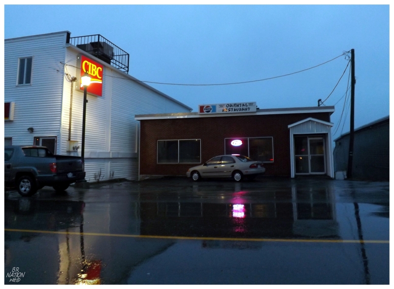
There would be one last stop as a messy snowstorm came upon us in Central Newfoundland, forcing the car off the Trans-Canada and into the racket that is spending $130/night for a dingy motel in Lewisporte.
The good thing about it is that yes, I scowl when I see that motel in Lewisporte nowadays, but the fond memories of Lewisporte's Oriental Restaurant have lingered in my mind to a greater extent.
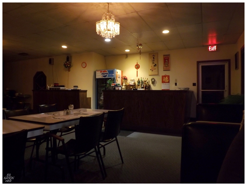
There was confusion upon first walking in, as the lights were mostly out and it was incredibly cold. The OPEN sign was beaming and the paint wasn't peeling, so...
Just as I stood and wondered, a tiny woman popped up from the back and turned on the lights, telling us to sit down in the corner, where she would turn on the heat and we'd be right in front of the source. Times were clearly tough and apparently as she doesn't see that many people, she must keep the heat down and the lights off.
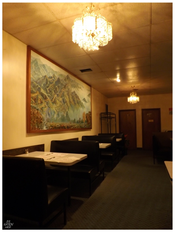
In addition to the uniqueness that is having a restaurant flare up upon your visit, the place was also a time capsule of the 1970s. I felt as if stationed soldiers who manned those earlier guns at Argentia, must've ate at places like this. Noticing a buffet sign, I wondered if the only time the heat is regularly turned on, was for said buffet. Then again, I've talked to someone from Lewisporte and it's been a long time since they've been here. Maybe it has been a long time for everyone.
Our food would eventually come out, maybe the freshest Chinese I've ever had, as it also took the longest. It was good enough, with the friendly lady making sure we had enough water, condiments and heat - and I'm not talking about Sriracha. We'd end up having a detailed conversation with her, but as she was a talker, I couldn't find out much about Lewisporte's Oriental Restaurant, only being able to answer her questions with what I knew about the Seven Seas Restaurant in Corner Brook.
And with that it was time to go back to the overpriced motel room, as rain fell outside, but the Trans-Canada was a slippery mess of blinding snow just 11km (7mi) away.
It would be fine in the morning.