Newfoundland (Island) Towns, Villages & Hamlets.
400-Series | 300-Series | 200-Series | 100-Series
200-Series Highways (Eastern Newfoundland)
Bonavista Peninsula
- Trans Canada Highway
- Route 2-1-24: Charlottetown Road (1.6 km/1 mi)
- Charlottetown: One time I left the TCH to drive into Charlottetown out of boredom. I've also been there to check on rates at the Clode Sound Motel. In September of 2019, I finally stayed at the Clode Sound Motel because I needed a motel in the area. It turned out to be a fanstastic time capsule.
- Route 233: Clode Sound Road
(31.6 km/19.6 mi)
- Route 233-14: Port Blandford Road
- Port Blandford is right here a couple hundred of meters off of the TCH. Despite it being a neat community with picture opportunities, I've never stopped to take any pictures during my 3 or 4 visits.
- Bloomfield: You drive right through Bloomfield when you drive from Port Blandford to Lethbridge along the NL-233. I've never stopped to take pictures or find adventure in Bloomfield.
- Route 233-10: Cannings Cove Main Road (7.3 km/4.5 mi)
- Musgravetown/Canning's Cove: I detoured to Canning's Cove during the first time I went to the Bonavista Peninsula back in April of 2010. To get there you go through Musgravetown, but I only took a picture of the farmland that came before Musgravetown. In Canning's Cove I snapped a picture of a blue house.
- Bunyan's Cove: You drive through Bunyan's Cove when you go from Port Blandford to Musgravetown. I stopped to photograph that graveyard right at the main crossroads of town, but never posted any of the pictures.
- Route 234: Winter Brook Road
(15.6 km/9.7 mi)
- Lethbridge: In my book it counts as just the bare minimum you need to see Lethbridge by driving on the NL-230, NL-233 & the NL-234. I should stop and drive the side streets of Lethbridge in the future.
- Brooklyn: Setting out to see the towns along the NL-234 in July of 2013, I loved the Archibald Bennett House, an abandoned house & St. Andrew's Anglican in Brooklyn. The community was even greater than its name.
- Portland: I stopped to photograph Carrie's convenience store & gas bar in July of 2013.
- Jamestown: In July of 2013 I stopped to photograph the exterior, interior and handrail of St. James Anglican Church in Jamestown.
- Winter Brook: Winter Brook felt more isolated because you went inland to other side of the bay on the NL-234. Appreciating this isolation, I stopped and photographed some birds in July of 2013, wandering about the sandbar where Winter Brook spilled into Sweet Bay.
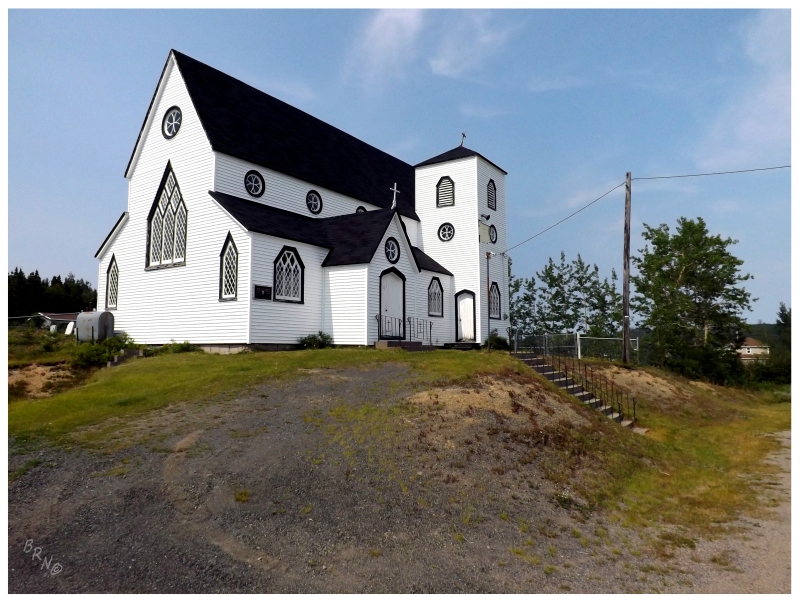
Jamestown, 2013.
- Route 230-14: Sweet Bay Road (10.3 km/6.4 mi)
- Charleston/Sweet Bay: I never counted Charleston because the main highway doesn't go through enough of the community. Thankfully I had to turn off 230 onto 230-14 if I wanted to get Sweet Bay. I did this and took in the nice conditions/scenic views of Sweet Bay in July of 2013.
- Route 235: Cabot Highway (63.2 km/39.3 mi)
- Southern Bay: Southern Bay is a small collection of homes, mostly right along the NL-235. I've never stopped to photograph any of the 10-15 homes in Southern Bay. I have stopped for ice cream at that Irving along the highway. In June of 2020 I stopped at the former Rattle Falls Provincial Park outside town.
- Princeton: The NL-235 cuts through Princeton enough for it to count, but I should stop and check it out better one day.
- Route 235-14: Summerville Road (2.1 km/1.3 mi)
- Summerville doesn't count if you don't leave Route 235. I turned in and drove to the end of the road in July of 2013. They have some nice old homes.
- Plate Cove West: I mentioned pulling into Plate Cove West and driving on its small road network in July of 2013, but didn't include a picture.
- Plate Cove East: I counted 'seeing' Plate Cove East by driving on the NL-235, but looking at Google Earth, Plate Cove East is probably worth more of a look. In June of 2020 I returned, using this page as an excuse to take a closer look and find a fantastic old home.
- Route 235-19: Red Cliff Road (7.8 km/4.8 mi)
- Open Hall: The church in Open Hall is beautiful and architecturally fascinating at the same time. I was impressed with it in June of 2012.
- Red Cliff: Red Cliff has some old homes amongst meadows that I wanted to explore, but I didn't allot much time for the NL-235-19. I need to go back. Visited once in June of 2012.
- Tickle Cove: I hiked the red sandstone/shale out to the Tickle Cove Sea Arch in June of 2012.
- Kings Cove: I hiked to the lighthouse in April of 2010. To get to the start of the lighthouse trail you need to drive through Kings Cove. There's nice old homes to shoot pictures of in Kings Cove, but I've never stopped for anything besides the lighthouse.
- Route 235-20: Duntara Road (7.8 km/4.8 mi)
- Keels: Keels is another place that made this goal worthwhile. A stunning community set on jagged, treeless cliffs with pretty old homes. Keels is easily on my top 10 favourite communities of NL list, and my top 10 most beautiful communities in NL list.
- Duntara: I drove around Duntara because I initially had Broad Cove also listed as a town, but exploring made me realize it's really only Duntara out there. This was in July of 2013, but I didn't include a picture from Duntara.
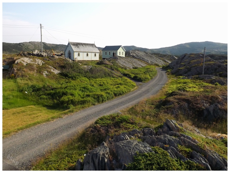
Keels, 2013.
- Stock Cove: I've driven through Stock Cove on the NL-235, but I've also explored more of Stock Cove because of my insistence to drive the NL-236 in June of 2012, where I popped out off of that gravel road into the back lanes of Stock Cove.
- Knights Cove: The NL-235 gives a nice enough overview and passes a few homes in Knights Cove, but like many Bonavista places, I'd love to go back and take a better look at some of the older homes and the coastline. It's enough to say I've been there, but not enough to say I'm satisfied with my visits to Knights Cove.
- Upper Amherst Cove: I've seen Upper Amherst Cove the same way that a lot of people do - by eating at the Bonavista Social Club. July of 2013. September of 2015 as well.
- Amherst Cove: The highway goes right by the 10 homes of Amherst Cove. I've never stopped to take pictures or find adventure in Amherst Cove.
- Newmans Cove: Newmans Cove stands out because of its size amongst all of the nearby villages. It has enticing houses and I've thought about stopping, but I never have. The road goes right along the shore & almost divides houses, so you see enough from the road, but Newmans Cove deserves better coverage than that regardless.
- Birchy Cove: Thankfully the highway is elevated before town or else I don't know if I could count this one. You can see most of the ~10 houses that make up Birchy Cove as you drive west to east, but I really should pull onto their main road and look around next time.
- Bonavista: In April of 2010, I stopped at the local pub during the playoffs to watch beloved local Michael Ryder score for the Bruins while having a Leffe and tomato mac & cheese. I also stopped at their lighthouse for the first time & appreciated the fancy gate to the Alexander Mortuary Chapel. In August of 2011 I attended the Boston Bruins Stanley Cup parade for Michael Ryder. In June of 2012 I visited the lighthouse, photographing a lazy fox, black guillemots & then the Orangemen's Lodge, JT Swyer's, the sad skatepark & my favourite house back in Bonavista. In July of 2013 I went to the lighthouse again, checking out the interior, along with whales and a Northern Mockingbird outside. Later that day, I went for an evening stroll amongst their beautiful houses, appreciated and hoped for their endangered Alexander Bridge House & caught a movie at the Garrick Theatre. In September of 2015 we wandered around a bit more and found a few new buildings I hadn't seen. In June of 2020, we ate dinner at Mifflin's Tea Room.
- Spillars Cove: I went out of my way in July of 2013 to see Spillars Cove, but didn't take a satisfactory picture.
- Route 238: Elliston Highway
(12.2 km/7.6 mi)
- Elliston: I stopped in Elliston to see the root cellar capital in the first Bonavista update of April 2010. Revisited in July of 2010 to see the puffins. Camped along Tower Road and visited the PineTree ruins in July of 2013. During the second part of that update from 2013, I revisited Bird Rock with a better camera. In that same update I camped at their municipal campground for the night, eating breakfast at their old Orange Lodge the next day. In September of 2015 my friends and I returned to Bird Rock. In June of 2020, I returned to push up the radar road to camp amongst the ruins up top.
- Maberly: Stopped in Elliston to see the root cellar capital in the first Bonavista update. Continued on the road to see Maberly, but didn't take any pictures.
- Route 230: Bonavista Peninsula Highway (108 km/67 mi)
- Little Catalina: Little Catalina is 1km off Route 230. Charmed by their quaint website, I made sure to hike one of their trails in April of 2010 & wasn't disappointed with Arch Rock.
- Catalina: In June of 2012 I went as east as possible in Catalina with hopes of camping within sight of Green Island Lighthouse, but it was too windy and cold to camp there. I had to camp on the NL-237 instead. The next visit in July of 2013, I stopped to size up how far it would be to swim to their Manuel Island Lighthouse. In September of 2015 I stayed at a friends' house there and drank Olde English on the wharf until sunrise. I ate some Hai Ping outport Chinese the next day and checked out St. Peter's Anglican the day after that.
- Port Union: Stopped in April of 2010 at the sight of abandoned houses. These were the workers' houses from when this was a union company town. Returned in September of 2015 to try and get a boat ride to a lighthouse, but failed.
- Melrose: Melrose doesn't count unless you actually turn off of Route 230 and into the community. I did this in July of 2013 and found their grassy harbour islands to be quite nice. I returned in September of 2015 to see if their offshore islands had a lighthouse, but not finding a lighthouse, I didn't post any pictures.
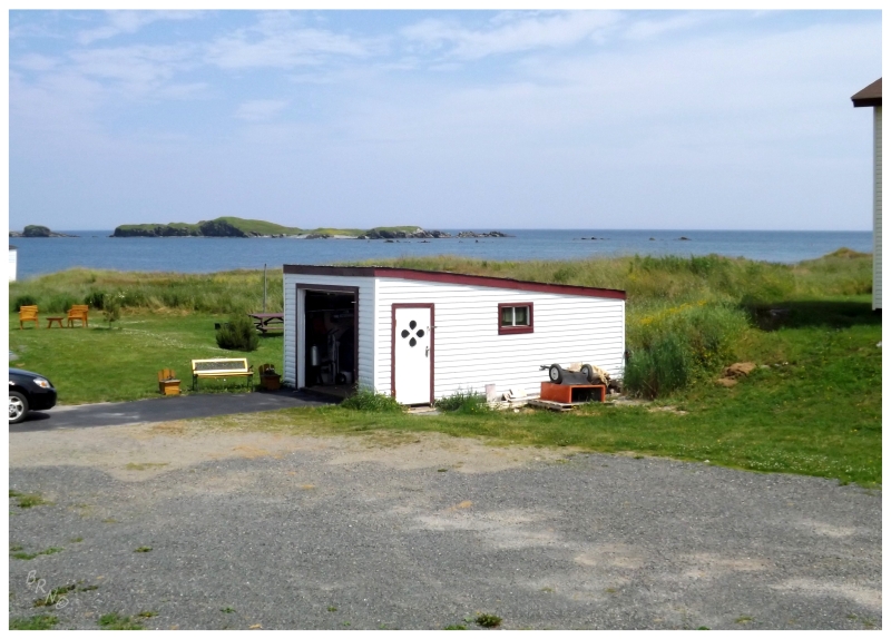
Melrose, 2013.
- Route 230-21: English Harbour Road (4.1 km/2.5 mi)
- English Harbour/Champney's: I didn't take a satisfactory picture of English Harbour or Champney's, but I drove through these communities to try and go see what remained at the Horse Chops Lightstation in July of 2013. In September of 2015 I returned with friends to camp on Horse Chops Road and photograph what was left behind at the lightstation.
- Champney's Arm: Checking out Champney's Arm in August of 2011, I snapped a picture of their causeway across the beach at Herring Cove.
- Champney's West: Instead of hiking to Horse Chops, I hiked Champney's West predominant Indian Head during that July of 2013 visit.
- Port Rexton: I've stopped at the convenience store about 5 times by now, but the photographic proof of Port Rexton comes from a shot of Christ Church Anglican from August of 2011. In June of 2020, I finally hiked the Skerwink Trail.
- Trinity East: I went for a spin through Trinity East and snapped a picture of the skyline in August of 2011.
- Route 239: New Bonaventure Road
(17.4 km/10.8 mi)
- Route 239-10: Trinity Road (1.8 km/1.1 mi)
- Trinity: You need to turn off of the NL-239 to see Trinity. I spent the night there at the beautifully maintained Morris Manor in April of 2010, photographing the house, the cemetery beside the house, St. Paul's Anglican church interior & graveyard. In September of 2015 I returned to go to an estate sale.
- Lockston/Goose Cove/Dunfield/Trouty/New Bonaventure: Drove to the end of this road in April of 2010. This brings you through all of these communities.
- Dunfield: You need to leave NL-239 to see enough of Dunfield to really count it. I never took a satisfactory picture in Dunfield, but I've been through the community to see the Trinity (Fort Point) Lighthouse in April of 2010 and June of 2012.
- Old Bonaventure: You need to turn off of the NL-239 to get Old Bonaventure. It was a foggy, moody day & I enjoyed photographing a house on its last legs there in April of 2010.
- Route 230: Bonavista Peninsula Highway (cont.)
- Morley's Siding: I've never stopped in Morley's Siding to take a picture. It's the type of place I like in that it's isolated, tiny & obscure, so I'm going to have to rectify this mistake in the future. The NL-230 goes right through Morley's Siding, so I've passed through about 5 by now.
- Route 232: Smith Sound Road
(24.9 km/15.5 mi)
- Gin Cove: Photographed the "NL-232 Gin Cove" sign while driving to Burgoynes Cove in June of 2009.
- Monroe: Photographed an a-frame house in Monroe while driving to Burgoynes Cove in June of 2009.
- Burgoynes Cove: Drove into the woods and found the trail at the end of Burgoynes Cove in June of 2009.
- Harcourt/Waterville/Clifton: Driving to Burgoynes Cove at the end of the NL-232, you go through all of these communities. This was in summer of June of 2009 and I've since been back 2 other times, although I didn't make updates for those visits.
- Barton: Stopped at their ruined bridge in June of 2020.
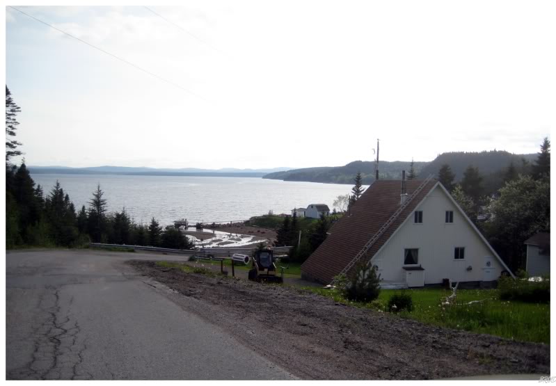
Monroe, 2009.
- Route 230A: Clarenville Road (13.7 km/8.5 mi)
- George's Brook: When driving through here for the first time in June of 2009, I saw one of my first bald eagles flying away. I'm not the type of person to have a camera ready at hand, so I didn't get a picture. A different time in George's Brook I stopped to photograph that really neat, 'jumbled' house along the shore to the south of town, but the pictures never made it into an update.
- Milton: I've stopped at the Irving and thought about going in the abandoned house across the street, but decided against it for silly reasons. I've never taken a picture in Milton.
- Shoal Harbour: I stopped in Shoal Harbour to ride the skatepark in June of 2012. It was a fun little spot that I often think of returning to. I would return in December of 2020.
- Clarenville: In April of 2014 I mentioned hiking the Bare Mountain Trail, but I didn't include a picture. I've ate at 6 or 7 Clarenville's restaurants, rode their skatepark, been in their mall and photographed their old arena-turned lumber warehouse. I simply haven't included any of this in updates. In November of 2015 I stopped to ride an abandoned school and found the "gehtto". In September of 2019, I stopped in for another skatepark session. In June of 2020 I stopped with Isy to eat breakfast by that river behind the Chinese restaurant. In December of 2020, I stopped in at Flannigan's Irish Pub to watch my Czechs and wondered if George's would have been better, before spending the night at the Clarenville Inn.
Random Island/Southeast Arm
- Route 231: Random Island Road
(29.2 km/18.1 mi)
- Route 231-10: Snooks Harbour Road (5.8 km/3.6 mi)
- Snooks Harbour/Aspey Brook: You need to turn at Elliott's Cove and drive 6km to get these two towns. I did this in 2011, but didn't take any satisfactory pictures.
- Lady Cove: Obviously I took a picture of the "Route 231 Lady Cove" sign in February of 2011.
- Route 231-16: Hickman's Harbour Road (1.7 km/1.1 mi)
- Hickman's Harbour: I sized up the hills behind the community while thinking about a distant lighthouse and also appreciated a nice, foreground maize colored house in February of 2011.
- Brittania: Snapped a picture of Brittania's pretty church set upon a winter scene in February of 2011.
- Route 231-19: Lower Lance Cove Road (1.5 km/0.9 mi)
- Lower Lance Cove : You might also be able to get to the distant lighthouse from Lower Lance Cove. I snapped a picture of a sloping house in February of 2011.
- Petley/Aspen: I drove right to the end of the NL-231 at Aspen in 2011, but didn't include any pictures in the Random Island update of February 2011.
- Elliott's Cove/Weybridge/Random Heights: You drive through all three of these to get to Hickman's Harbour. I didn't take any satisfactory pictures of Elliott's Cove, Weybridge or Random Heights in 2011.
- TCH-Deep Bight Road
(3.3 km/2.1 mi)
- Deep Bight: I finally stopped to photograph the obviously abandoned house of Deep Bight during April of 2014. I had previously craned my neck & thought about stopping maybe 50 times.
- Adeytown: I drove through Adeytown in April of 2014, loving an old red barn because it reminded me of home.
- Route 205: Hatchet Cove Road
(16.7 km/10.4 mi)
- St. Jones Within: Drove this 15km road in November of 2010, snapping a picture of a nice, mid-century house in St. Jones Within at the end of the road.
- Hatchet Cove: During my November of 2010 visit I posted a picture of an angry cat in Hatchet Cove. I also posted a picture of a teardrop door on Panoramio, where it was awesome because the owner of the Hatchet Cove teardrop door saw the picture and was "thrilled" :)
- Hillview: There are some nice old homes in all 3 of the communities along the NL-205, but I didn't stop for any further inspection. I might've taken a picture in Hillview, but I didn't include it in the update.
- TCH-Harbour Drive:
- Ivany's Cove: I skipped Ivany's Cove for many years because it's right along the highway. Finally in May of 2013 I found the Ivany Cove Motel to be reasonably priced, so I actually spent the night in the village upon my first visit. I mention all of this in the update, but never posted any pictures from Ivany's Cove.
- Route 204: Southwest Arm Road
(29.9 km/18.6 mi)
- Southport: Southport is a pretty, little, archetypal Newfoundland community that sort of gets lost in the shuffle. There's boat ribs in the harbour and I obviously took a picture of them. November of 2011.
- Butter Cove: Butter Cove is a tiny place of about 20 houses that you need to turn off of Route 204 to count. I snapped a picture from above town in November of 2011.
- Long Beach: Long Beach is an even smaller place of about 10 homes, where I took a picture of the welcome sign to make a rap reference joke in November of 2011.
- North West Brook/Queen's Cove/Hodge's Cove/Caplin Cove/Little Heart's Ease/Gooseberry Cove: The remainder of the towns on this road you "get" by driving through them, although Gooseberry Cove would deserve a picture with its beautiful buildings, Little Heart's Ease would deserve a picture because of its name & Hodge's Cove is big enough to warrant further exploration as well. I only drove through and turned off a road or two here and there in November of 2011.
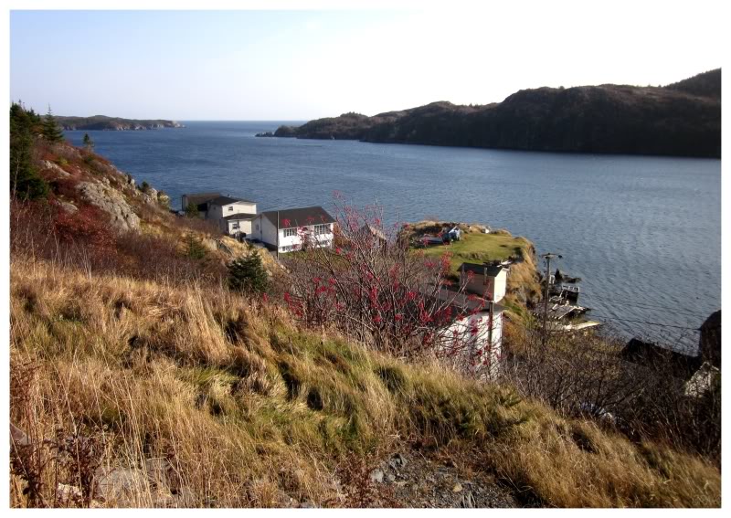
Butter Cove, 2011.
Burin Peninsula
- Route 210: Burin Peninsula Highway
(143 km/88.9 mi)
- Goobies: I've left the NL-210 and briefly looked around Goobies - you also bisect the place when you drive down to the Burin - but have never taken a picture.
- Route 210-11: North Harbour Road (6.8 km/4.2 mi)
- Garden Cove: I ended up including 3 pictures of North Harbour because I didn't realize where Garden Cove was in October of 2013. Now that I see it is attached to North Harbour, I would have to go back if I wanted photographic proof (well, outside of having further-down-the-road North Harbour pictures).
- North Harbour: I really could have went for a walk around North Harbour in October of 2013, but unfortunately I had a motel to get to before nightfall. It was one of those nice, moody October days that makes for great pictures and Newfoundland feelings.
- Route 210-13: Garden Cove Road (5.1 km/3.2 mi)
- Black River: One of the last villages I visited on the island, I wish I knew about the pulp mill ruins when I was there in October of 2013. I'll be back in the future.
- Garden Cove: Garden Cove was a nice enough little town with a handful of unaltered older houses. I visited in October of 2013.
- Swift Current: I stopped to photograph the interesting post office in Swift Current before, but never posted the picture. The closest I'd have to a posted picture from Swift Current would be the time I wrote about Pipers Hole River Provincial Park in June of 2014.
- Route 214: Monkstown Road (26.7 km/16.6 mi)
- Monkstown: This was the second-to-last community I had to visit on the island. I took a picture of a nice brookside home in Monkstown in June of 2014. In September of 2021, I climbed out of Monkstown and headed towards St. Kyran's - then returned four days later.
- Davis Cove: Davis Cove was the last community I had left to visit on the island of Newfoundland. Interesting, isolated place. I stopped to celebrate at a waterfall at the end of the community in June of 2014.
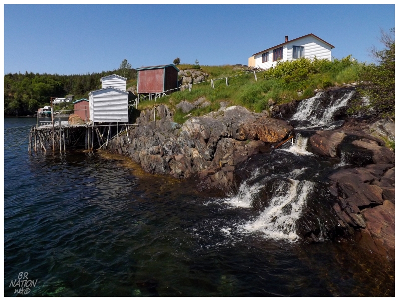
Davis Cove, 2014.
- Route 211: English Harbour East Road
(32.9 km/20.4 mi)
- English Harbour East: Terrenceville and Grand La Pierre were nice, but I ended up only posting 3 pictures from English Harbour East. Visited in November of 2012.
- Terrenceville/Grand La Pierre: See above. November of 2012.
- Route 212: Bay L'Argent Road
(30.2 km/18.8 mi)
- Harbour Mille: Harbour Mille was such a beautiful place, such a Newfoundland place of squeezing homes onto little pieces of land and it was such a nice day. I could have lounged about for hours. Top 10 NL community. Visited in November of 2012.
- Little Harbour East: Walked a bit of the Lighthouse Trail in Little Harbour East, but I lost the trail and I have my doubts it leads to an actual lighthouse. November of 2012.
- Little Bay East: A nice place, but I didn't take any satisfactory pictures between Little Harbour East & Jacques Fontaine during November of 2012.
- Bay L'Argent: Weird looking Newfoundland community because they actually have chain link fences. The streets gave the impression of being somewhere else. November of 2012.
- Saint Bernard's: Turned off the NL-212 in Jacques Fontaine to check out Saint Bernard's but didn't take a satisfactory picture. November of 2012.
- Jacques Fontaine: I thought I was going to get to explore an abandoned high school in Jacques Fontaine, but it was being used for RV storage. November of 2012.
- Route 215: Petite Forte Road
(26.4 km/16.4 mi)
- Boat Harbour/Brookside: I drove out to Petite Forte in June of 2011, but when I returned in June of 2014 I took the time to drive into more of Boat Harbour and Brookside. Included in the update is a picture of the shoreline near Will Smith's house. Not that Will Smith, but Brookside's Will Smith. I didn't post a picture from Boat Harbour.
- Petite Forte: I drove out to Petite Forte in June 2011 with aspirations of taking the ferry to South East Bight, but unfortunately a wave of crabbiness came over me & I decided against it. I stopped to take pictures of the Long Point Lighthouse lantern room in Petite Forte on the way out of town. In June of 2014 I returned, and with 3 hours to kill before the next ferry, I hung out in Petite Forte and took a fine picture of the village during the pleasant afternoon. Coming back from South East Bight the next day, the cove was like glass and another picture of Petite Forte was acceptable. In July of 2019, I returned and made time to check out a questionable lighthouse.
- Ferry: South East Bight (25 mins)
- South East Bight: The 3rd last place I had to go in Newfoundland was reached by the last ferry I needed to take. Carrying my camping gear onto the ferry, I spent the splendid evening walking about, before relaxing on a rock outcrop into the night. June of 2014. I returned in January of 2019 in order to hike to nearby Great Paradise.
- Route 210: Burin Peninsula Highway
(cont.)
- Route 210-18: Parker's Cove Road (3.0 km/1.9 mi)
- Parker's Cove: Turned off of the NL-210 to explore Parker's Cove in November of 2012. I simply checked out the town briefly & moved along.
- Route 210-19: Baine Harbour Road (4.9 km/3.0 mi)
- Baine Harbour: In November of 2012, while visiting all of the towns along this Placentia Bay shore of the Burin Peninsula, the sun finally came out in Baine Harbour and made the place shine more than Rushoon, Red Harbour or Jean de Baie. This meant a picture from Baine Harbour was included in the update.
- Route 210-21: Rushoon Road (2.5 km/1.6 mi)
- Rushoon: I mentioned visiting Rushoon in November of 2012 but I didn't include a picture in the update. I remember photographing their funky church, but I guess my picture didn't make the cut.
- Route 210-22: Red Harbour Road (1.2 km/0.7 mi)
- Red Harbour: I mentioned visiting Red Harbour in November of 2012 but I didn't include a picture in the update. It was an interesting place with that causeway and the few buildings shoehorned along the cliff.
- Route 210-23: Jean de Baie Road (2.6 km/1.6 mi)
- Jean de Baie: I mentioned visiting Jean de Baie in November of 2012 but I didn't include a picture in the update.
- Route 210-24: Spanish Cove Road (6.2 km/3.9 mi)
- Spanish Room: By the time I was visiting the Burin in November of 2012, I knew how many villages I had seen in Newfoundland and how many I had left. I was excited by the funny name of Spanish Room, but I messed up my math and it was #699 for the province, not #700 like I planned.
- Rock Harbour: The funny thing is that mundanely-named Rock Harbour was much more exciting than Spanish Room, with Rock Harbour having a beautiful bay, wandering cats & an impressive church. That's why you don't judge a
book Newfoundland village by its cover name I guess. Visited in November of 2012.
- Mooring Cove: The first time I went to the Burin Peninsula, I thought the oil rig plant near Marystown looked neat & going for a quick look, I mistakenly ended up in Mooring Cove while trying to go down to the shore and "cut back" to the plant. I was so wet behind the ears. So anyway, the only time I've been in Mooring Cove was June of 2009 and I didn't take a picture.
- Marystown: Went to & photographed their mall in June of 2009. Passed through again in June of 2011, snapping a picture of St. Gabriel's Hall. Stopped on my way back on the same trip to ride their excellent skatepark for the first time. In June of 2014 I ate at Wong's Palace. In July of 2019 I had breakfast at the Marystown Hotel in anticipation of a hike. In September of 2021, I visited a few of Marystown's finest establishments and rode their skatepark again.
- Route 220-10: Beau Bois Road (6.6 km/4.1 mi)
- Little Bay/Beau Bois: In November of 2012 I made reference to an evening/night drive out on the NL-220-10, but I decided against setting up the tripod for pictures. It was a shame really, because Beau Bois was definitely worthy of a picture. InSeptember of 2021, I went back and photographed Beau Bois (but only mentioned photographing Little Bay but not posting the picture).
- Creston: I would have driven through Creston after seeing a movie at the Burin Cinema than spending the night at the Ville Marie Motel in June of 2014. That's just one example but with using Marystown as a home base and going down all of these secondary highways, I've driven Creston Blvd and Ville Marie Dr many times. I don't think I've ever stopped to photograph anything in Creston.
- Route 222: Salt Pond-Winterland Road (10.2 km/6.3 mi)
- Salt Pond: I ate at the Lucky House Restaurant in the Salt Pond area of Marystown in November of 2012. What a funky little building.
- Winterland: I went out of my way to see Winterland in November of 2012. I ended up photographing a nice farming scene, but it never made it into the update.
- Route 213: Garnish Highway
(13.5 km/8.4 mi)
- Garnish: I stopped to photograph the Garnish Lighthouse in June of 2009. I pulled through town again during that November of 2012 Burin visit, but decided against getting my bike out to ride their homemade skatepark. In July of 2019, I left from Garnish to go visit the nearby resettled community of Point Rosie.
- Frenchman's Cove: After photographing the Garnish Lighthouse in June of 2009, we spent the night at Frenchman's Cove Provincial Park. I didn't take a picture of actual Frenchman's Cove. In July of 2019, I took a picture of the church in Frenchman's Cove, as it came from Point Rosie. In September of 2021, I photographed the cool channel that divides Frenchman's Cove.
- Route 210: Burin Peninsula Highway
(cont.)
- Grand Beach: Exploring in November of 2012, I included pictures of old houses instead of the grand beach. I liked Grand Beach though, and I would drive the 2 kilometers of road there again.
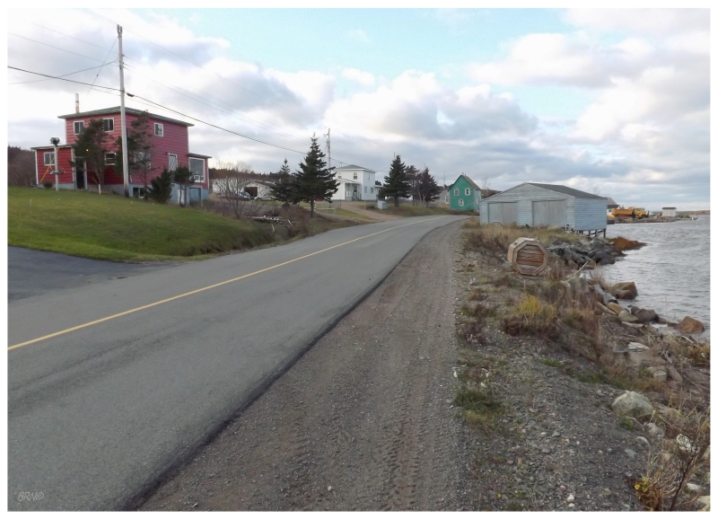
Grand Beach, 2012.
- Molliers: I mentioned going to Molliers in my November of 2012 update, but didn't include a picture. I instead included a picture from nearby Famine Point. In September of 2021, I went to the real Molliers.
- L'Anse-au-Loup: I count seeing L'Anse-au-Loup by driving along the NL-210, but I really should drive the old southern alignment of the highway sometime. The old bridge is probably worth checking out too. The start of plans for another Burin trip!
- Grand Bank: In June of 2011, I stopped to get the Grand Bank Lighthouse for my 50th Newfoundland lighthouse. In November of 2012, I went for a walk amongst the fine houses of Grand Bank, before filling up for dinner at an old building near the dock area. In June of 2014 I ate at the fine Thorndyke B&B, but only posted a picture of a Great Horned Owl outside town. In July of 2019, I went for a celebratory walk around town (after successfully visiting Point Rosie). In September of 2021, I said goodbye to the MV Atlantic Pursuit, then couldn't ride at the local church.
- Fortune: In June of 2009, I went to St. Pierre et Miquelon and the ferry leaves from Fortune. Upon my return, I noticed the abandoned Fair Isle Motel in Fortune & stopped there as well. In June of 2011, I stopped at their Fortune Ecological Reserve to see the Fortune Head Lighthouse. In July of 2019 I discovered their new skatepark, but it was raining. I'd return in September of 2021 to checkoff their skatepark.
- Lories: The highway goes right through Lories and both times I've did the loop around the Burin, I've been trying to stop at all the lighthouses. I haven't found the time to stop and take pictures of Lories.
- Point May: Point May would be in the same boat as Lories, except that its much bigger. Instead of a hamlet, it would be a village & it deserves better coverage than me counting it by driving through. There's a bit of town to Point May & I'm looking forward to stopping for a look around next time.
- Calmer: Calmer is the type of place where you want to stop to take pictures because of the name, but there's 5 houses. I might've stopped last time, but I thought it was funny that my friend who also likes seeing all communities had fallen asleep & she was going to sleep right through Calmer.
- Route 220: Burin Peninsula Highway (172 km/106.9 mi)
- Allan's Island: I drove onto Allan's Island to see & photograph the lighthouse in June of 2011. I returned there again in November of 2012, but didn't include any Allan's Island pictures in that second update.
- Lamaline: Drove through Lamaline in June 2011 in order to reach Allan's Island and the Allan's Island Lighthouse. I also stopped to photograph a swing set/birdhouse in Lamaline, but only to send the picture to my friend, not to include it in an update.
- Route 220-18: Point au Gaul Road (1.9 km/1.1 mi)
- Point au Gaul: I stopped in Point au Gaul long before I thought I could see every town here, only because I was simply tired of driving in June of 2011. I'm thankful I did as the 1.9 km drive to Point au Gaul couldn't be much further from my Newfoundland home. I took a picture of their town hall.
- Taylor's Bay: In the treeless landscape of the southern Burin you can see most of Taylor's Bay from the road, but I really should drive that bayside road as well. If you're going to criticize me here, realize there are Taylor's Bay houses along the NL-220 as well, it's just that the older, cooler stuff looks like it's down that grassy, 1/2 kilometer road.
- Lord's Cove: Driving the Burin loop road in November of 2012, I snapped a picture overlooking Lord's Cove. I really like a lot of these places right at the southern tip of the Burin Peninsula & I should stop making it a day trip to camp somewhere around the boot next time I'm in the area. I'd return in September of 2021, but I thought the area was bigger and I forgot I'd already photographed Lord's Cove.
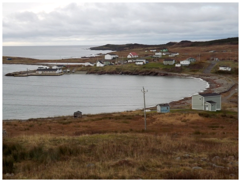
Lord's Cove, 2012.
- Route 220: Burin Peninsula Highway (cont.)
- Lawn: The highway goes right through Lawn, but I snapped a picture here in June of 2011 because of how high the road reaches before you drop into town. I also stopped at the convenience store in Lawn.
- St. Lawrence: Drove through St. Lawrence along the east side of the harbour in June of 2011 to reach the Middle Head Lighthouse. Afterwards, I hiked the Shipwreck Trail to see where two American ships wrecked along the coast and many sailors were saved by St. Lawrence (and Lawn) residents. I also looked around for mining detritus but didn't find much. In November of 2012 I returned to Middle Head, photographing the lighthouse and a Snow Bunting. In July of 2019, I camped at their municipal campground in the rain. In September of 2021, I came to town to watch Cowboys/Bucs via the two bars they have.
- Little St. Lawrence: I stopped to photograph the Little St. Lawrence dam in June of 2011.
- Route 220-11: Epworth Road (3.2 km/2 mi)
- Epworth: I've been to Epworth twice because of my desire to go to Corbin. In June of 2011 I drove down the road a bit, but it was so rough that I turned back. In November of 2012, I drove down the road slightly further, but there were 3 b'ys having a yarn on their ATVs and blocking the road, so not wanting to explain what I was up to, I simply turned around and I've yearned to go to Corbin ever since. A Burin trip is high up on the priority list because of my desire to go to the resettled community of Corbin. Lastly, I've never posted any pictures of Epworth because I was always waiting to write a Corbin update with the above tales. In September of 2021, I finally made it to Corbin, but forgot I was supposed to post a picture of Epworth.
- Salmonier: Salmonier is a tiny place at a cove with approximately 10 houses. I've never stopped to take any pictures in Salmonier, but the NL-220 drives right by the majority of the houses.
- Bayview/Lewin's Cove: Driving along the NL-220, homes start to line the road and you're in Bayview. The road continues and then follows the main road of Lewin's Cove. Lewin's Cove seems like the place where people in the area come to build their giant, modern homes; so maybe I need to go back and look on the side streets for the old beauties hanging on.
- Route 221: Burin Road
(18.6 km/11.6 mi)
- Burin Bay Arm: I've driven through here countless times, but never posted a picture. I can't remember if I've ever even stopped to take a picture in Burin Bay Arm.
- Little Salmonier: If I count Little Salmonier as a separate community, then going to the Burin Cinema would be something in Little Salmonier. June of 2014. I've also stopped at that Mina Swim Memorial Park to take a picture out over the bay, but this picture never made it into an update.
- Black Duck Cove: I counted Black Duck Cove by driving along the highway, but I really should check out those side streets one of these times. There's some decent old homes & the scenery is nice in Black Duck Cove, but I've never taken a picture there.
- Burin: On my June of 2011 tour of the Burin Peninsula, I was excited to finally see one of the big places I had left (the town of Burin). I loved their quaint Memorial Library.
- Ship Cove/Collins Cove: I stopped at a quarry between Whale Cove & Collins Cove to get a distant view of Little Burin Lighthouse. I then drove around in search of someone with a boat to go this lighthouse, but didn't find anyone during my time in June of 2011. During my November of 2012 trip, I stayed at the beautiful heritage home of Cook's Cottage in Collins Cove, but I didn't include anything about this in the update.
- Whale Cove: I returned to Whale Cove in June of 2014, finding a boat ride out to Little Burin Island Lightstation. In addition to Little Burin Island, we also visited the resettled community of Great Burin on Burin Island. One incredible afternoon.
- Mortier/Fox Cove: In June of 2011 I drove from Burin to go get Tides Cove Point Lighthouse. This brings you through these three communities, but I didn't take any satisfactory pictures. I returned in June of 2014, but only to return to Tides Cove Lighthouse and hike to the small resettled place of Duricle.
- Port au Bras: In November of 2012 I drove out from Collins Cove to the Tides Cove Point Lighthouse, going through Port au Bras. I stopped o photograph some great homes along the road in Port au Bras, but never included any of these pictures in the update.
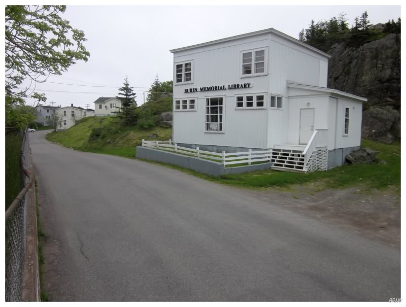
Town of Burin, 2011.
Isthmus
- Route 2-1-07: Sunnyside Road (7 km/4.3 mi)
- Sunnyside: Drove the 7km Sunnyside Road in May of 2013. I would have loved to hike their Centre Hill Trail, but it was foggy that day. I returned to hike the Centre Hill Trail in April of 2014, but a bridge had been washed out over the winter. In June of 2021 a bridge was out again, so we instead hiked the Truce Sound Coastal Trail.
- Route 2-1-06: Come By Chance Road (3.8 km/2.4 mi)
- Come By Chance : Checked out their refinery and grassy oceanside meadow in May of 2013.
- Route 2-1-03: Arnold's Cove Road (3.4 km/2.1 mi)
- Arnold's Cove: Drove around town in May of 2013, using their map to see a bunch of the old homes which came from resettled places all around Placentia Bay. I returned in April of 2014 to hike the Bordeaux Trail, but unfortunately I ran out of time. It was still a nice day where Arnold's Cove was blessed with nice scenery and the weather wasn't awful like back home.
- Arnold's Cove Station: Checked out the bridge and 13 homes in Arnold's Cove Station after Arnold's Cove, but didn't manage to take a picture I was happy with, May of 2013.
- Route 2-1-02 (3.5 km/2.2 mi)
- Southern Harbour: Drove to the end of town and photographed a kingfisher and the docks extending out into Placentia Bay. I only posted the docks/bay picture. May of 2013.
- Route 2-1-01
(5.3 km/3.3 mi)
- Little Harbour East: I really liked Little Harbour East because it seemed like the town was a bit forgotten and there were some nice old Newfoundland homes about. I checked it out during that May of 2013 trip, but I'll probably stop again in the future on a more sunny day.
- Route 203: Fair Haven Road
(12.6 km/7.8 mi)
- Fair Haven: Fair Haven might have only been a footnote, or another of these villages I only "claim" to have seen without internet proof, but there was a Little Egret there & of course I'm going to photograph a rare bird visitor from England. May of 2013 trip.
- Route 202: Long Harbour Road
(9.8 km/6.1 mi)
- Long Harbour: I was amazed at the abandoned houses there when you have a Nickel processing plant providing jobs and eating up vacancy anywhere within an hour. I didn't take a satisfactory picture though.
- Mount Arlington Heights: I posted a picture from Mount Arlington Heights, which is at the end of the road after Long Harbour. May of 2013 trip.
- Route 201: Chapel Arm-Bellevue Road
(28.8 km/17.9 mi)
- Chance Cove: I only drove the end portion of the NL-201 from the TCH back in November of 2011, producing a couple of pictures of Chance Cove (the only community I saw there that day).
- Bellevue: Driving Route 201 from the east, you drive through Bellevue. I didn't take any satisfactory pictures and only stopped to take a picture in the cemetery at the end of Bellevue. I also took a couple pictures at the former Bellevue Beach Provincial Park, but they weren't good enough either. In September of 2019 I once again returned to Bellevue, but only mentioned a car with too many Dildo stickers.
- Thornlea: After hiking the Seaview Trail in Norman's Cove, I stopped to explore an abandoned stage in Thornlea mostly because of this page. LOL. September 2019.
- Long Cove: I camped at the old barite mine outside Long Cove in September of 2019. If that doesn't count, I also hiked the Seaview Trail that overlooks the community (in the same Sept 2019 update).
- Norman's Cove: I hiked the pleasant Seaview Trail in September of 2019.
- Chapel Arm: Driving Route 201 from the east, you drive through Chapel Arm. I didn't stop to take any satisfactory pictures.
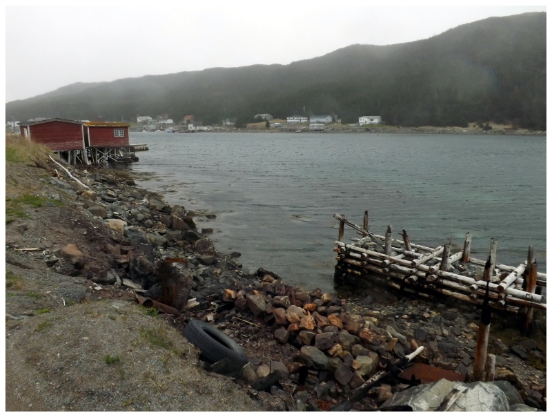
Little Harbour East, 2013.
Other Places: 400-Series | 300-Series | 200-Series | 100-Series
Or return to the Main Page of this Website.


