Continued from Part 1... There were a couple of times in the night where I stirred, but because of how deeply I sleep, it wasn't until morning that I looked down at my feet & realized my luck. This wasn't my normal tent and I was therefore unaware of its limitations. Normally I'm car camping, so I have a much larger tent because there aren't any weight or space concerns when you're camping 10 feet from your vehicle. The only other time I had ever used this tent was during my cycletour to Halifax, but it didn't rain heavily at night anytime throughout that whole trip. |
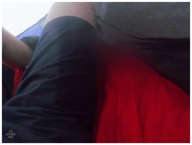
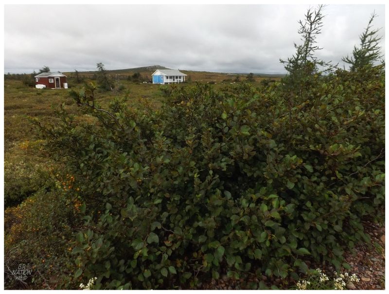
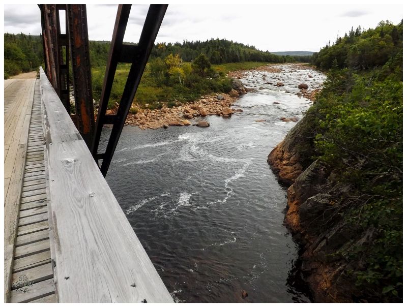
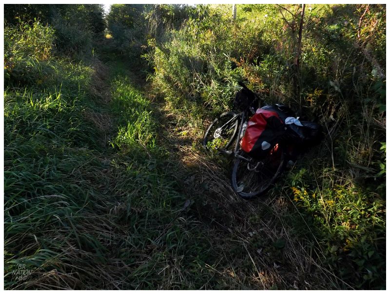
This morning I would discover that this tent isn't waterproof and it's terrible in the long, pooling grasses. Once there was enough morning light to come to my senses, I looked down & found my feet in a 3 or 4 inch pool of water. Checking all beneath me, my shorts were also wet from when I rolled over in the night and the water channeled towards the front end of the tent (that's not a shadow in the above picture, that's a dark blue water mark). Thankfully prior to this trip, while I was waiting for any weekend where the nighttime low was above 35°F (~2°C), I was awfully lucky that this unseasonably warm weekend happened to come along where it only got down to 50°F (10°C). |
The outside temperature was warm enough that I only woke up at 8 or 9, even while I didn't make the conscious decision to keep sleeping. Regardless, I have to thank my lucky stars that it wasn't so cold that I found myself scrambling at 4 or 5 in the morning, to get into new clothes and attempt to start a fire. Climbing out of my tent, I had a chill, but I didn't think I was hypothermic or anything. Knowing that you can't properly assess hypothermia in yourself, I still made sure to get under the dry overhang of the nearby shed, to take to consuming some warm coffee. Where last night I was too tired and not hungry enough to cook a warm dinner, this now meant that I stood frigid on this rainy morning, discovering that the outdoors store had sold me the wrong fuel even though I brought my camping stove into the store. I paused and sighed and looked out over everything. Anger didn't hit me like you would expect, but rather defeat. What I would have done for a boiling hot coffee here, but I couldn't do anything besides shake my head at the compressed canister of fuel in my hand. |
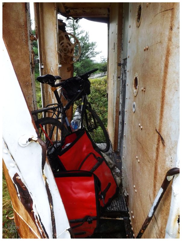
The shed's porch area was small and without anywhere to sit besides the ground, I undid the hook & nail holding the door shut. Checking out the inside of the shed, I then sat down to kill time until the rain stopped. I had brought a book and podcasts to pass the time, but I in no way felt like going back out in the rain to go retrieve either of those things from the train car's back porch. So I sat there and thought about life & where I found myself, also about how I would read instructions before setting off with freshly purchased camping stoves or other new things in the future. Some anger towards that dude who worked at the outdoors store brewed inside me (much like a pot of water for delicious coffee might brew). |

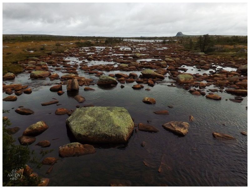
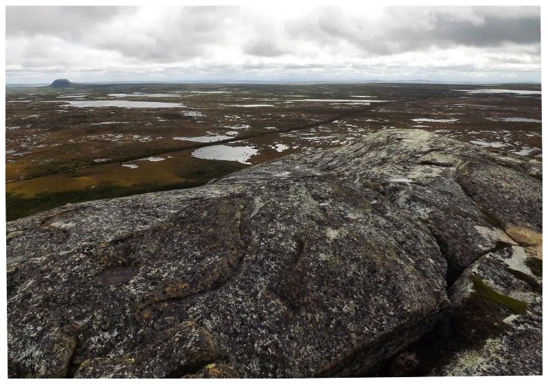
The rain was heavy at times & therefore worrisome, but thankfully it changed to a light rain or drizzle after a half hour. There was something to hike to nearby, so donning my rain jacket and wrapping my socks in garbage bags, I walked back up the old railway line to the Quarry side trail. "Granite Quarry for Newfoundland Railway. Established 1893 ->" read a half broken and leaning sign that pointed me into the above mess. |
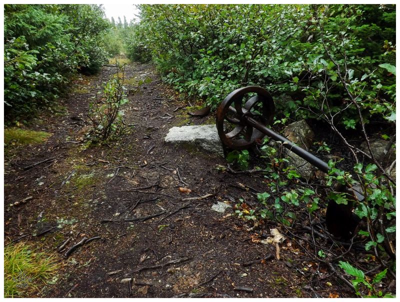
Quarry was another of the 3 or 4 places along this route for which I was really excited. It's here that a quarry was established that supplied most or all of the granite abutments to the bridges along the Newfoundland Railway. Yesterday I had stopped and dismounted my bike to stand atop the footings of the Patrick's Brook & Mary March Brook bridges, appreciating that I should soon see the historic source of this quarried stone. (Later in the day I would do the same thing at Barney's Brook Bridge, having seen where the granite supports came from earlier in my day.) |
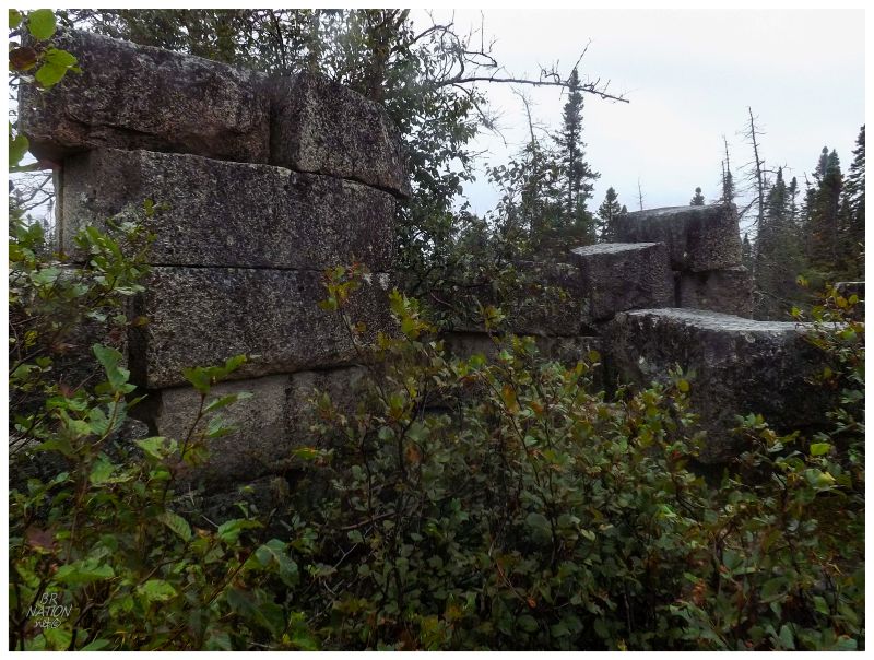
In addition to the footings of a collection of Newfoundland Railway bridges, this quarried stone was also used in the construction of the impressive St. John's Railway Station and the cobbles that used to make up the surface of Water Street in downtown St. John's. |
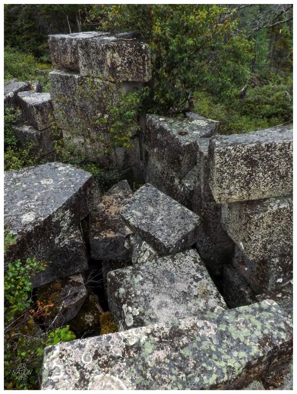
I'd have some nicer pictures of Quarry if it was sunny, but I had to be thankful for the trails worn by people and that the wet, muddy areas were only between Quarry and the railway, but not actually at Quarry. I wandered about for a bit, climbed some of the cut blocks, then headed back to my camp. |
The light rain had dissipated into a drizzle and with the day advancing & having 80 km (50mi) to cycle today, I figured I should get going and cycle west into the forecasted drier weather - even if I had to put up with some wet stuff to start. |
I must've remained pretty cold, tired & focused, because I apparently blew right past the sign marking the summit of the entire Newfoundland Railway. All yesterday I had been pedalling uphill - albeit at a very shallow angle - and I awoke today about 3km from "Summit, Newfoundland"; which used to be marked with a sign that has since either blew down or confirmed that I'm blind as a bat. |
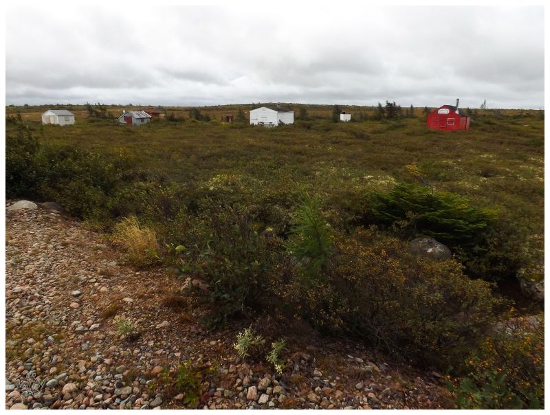
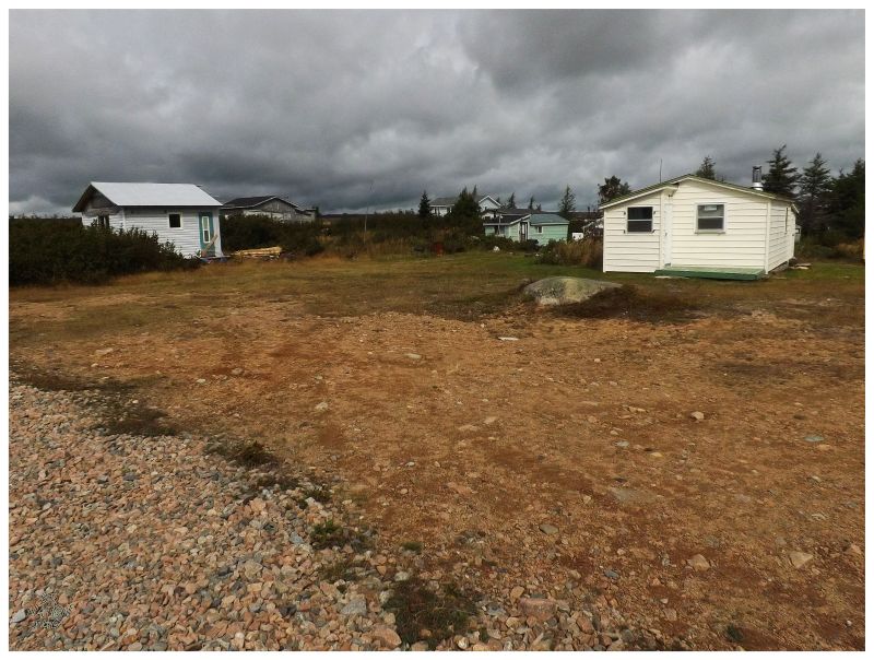
Continuing along, Gaff Topsail and the other surrounding topsails might have been the area I was most excited to see during this short cycletour. 38 km (23 mi) east from the road-connected settlement at Howley and 36 km (22 mi) from the road-connected Millertown Junction, it's not only that this place is distant from cars & trucks, but I was also excited that it's set upon an expansive windswept plateau, a treeless bog and barren of Newfoundland's interior. The settlement of Gaff Topsail once had 45 people during peak war times, but generally settled into the 15-20 range otherwise; the population composed entirely of railway workers and their families. Pieroway's Rails Across The Rock has a beautiful picture of their colourful sheds and homes, something that still lingers in the unique cabins that now stand out here (or remain standing out here). |
Barney's Brook & the Mizzen Topsail.
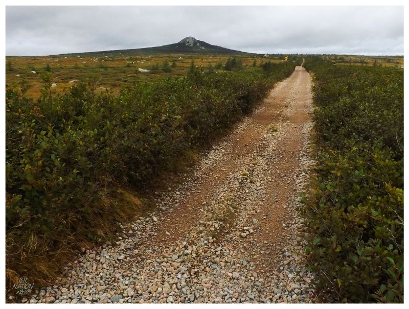
The Topsails describe four mounds of rock, that is, four monadnocks, which the original explorers thought resembled four ship sails above the flat plateau. You have such unique geography here because the four topsails are remnants from an earlier plateau, where everything else was eroded away and only four rocky, steep, smooth protrusions are left amongst these plains. In addition to being an old settlement amongst a unique geomorphological area, Gaff Topsail also holds a significant place in Newfoundland history. This is the place that was always criticized by engineers who questioned why the railway wasn't built more to the north or south, because of the great snow drifts that this plateau produces. People would get held up around here for days, trains were often cancelled in the winter and special equipment was needed to clear a path. And even when a path was cleared, you'd then have a ditch that would collect blowing snow, filling back up with ease. These conditions made the topsails and Gaff Topsail a household name in the days of the railway, as any snow time journey would have everyone involved wondering about the conditions at the topsails. The Virtual Museum of the Railway Coastal Museum has a great picture showing Gaff Topsail problems. |
The Gaff Topsail itself.
Having flown over the topsails & knowing that they're only ~1800-ft tall above a ~1500-ft plateau, my mind was set on taking a break from cycling and climbing one of them this day. As much as I wanted to walk along Barney's Brook to the obscure Mizzen Topsail, the Gaff Topsail would have to do, seeing as it almost touches the T'Railway and I was now slightly concerned about hours left in this Sunday. Cycling up a short pathway almost as good as the T'Railway, it wasn't long before I came upon a cement foundation which fascinated me amongst all of the wooden shacks and sheds I had otherwise been seeing throughout this trip. There were no further clues as to what the foundation was for, so simply hiding my bike, I started up the hill. In a matter of minutes, I was passed by a crew on ATVs, driving up the topsail path that I declined to bike. |
The T'Railway divides the view from the Gaff Topsail towards the Main Topsail.
I met the foursome of 50-year-olds almost at the top, where they had left their ATVs behind and were making good progress upwards. Talking to the one fellow, he asked me how I got here & when I mentioned 'bike', I realized that he thought dirt bike, before I added that I meant 'mountain bike'. It was at this point that he no longer thought I was mentally fit, much to my amusement. The idea of someone riding a mountain bike on the T'Railway blew him away. |
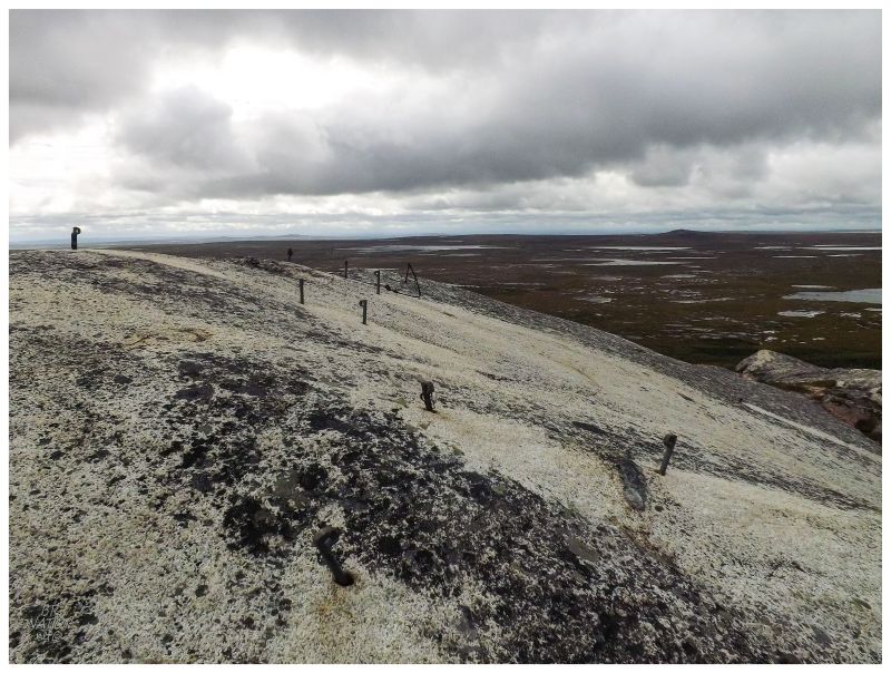
For how calm it was along the T'Railway, the winds whipped as I stood atop the Gaff Topsail, amazed and scared by the suddenly strong winds. Topographic maps show some type of communication tower being up here, but the same winds must've removed her long ago and left only the drilled anchors behind. As I stood here and crept towards the top to check out if the topsail was rounded or sharply dropped off, I was impressed to see the others climbing all over the rock as well. It was apparent that these other people knew how to live. |
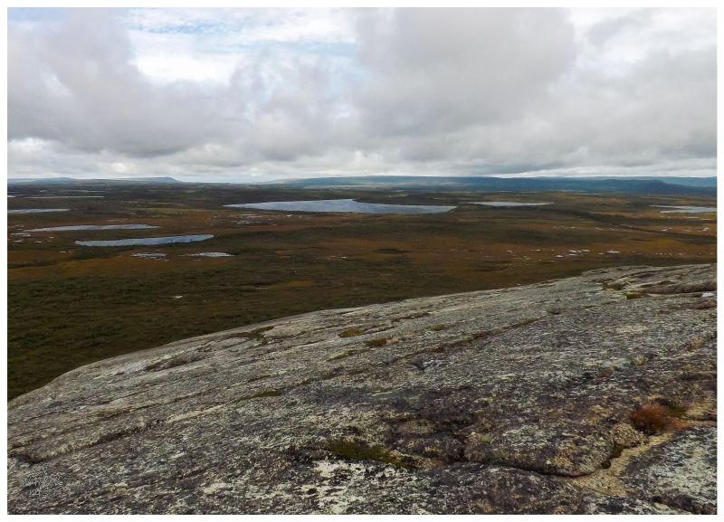
Atop the Gaff Topsail, I could see the T'Railway stretching west towards where I would need to go, the plateau splitting into two separate hills at the horizon, with Kitty's Brook splitting them down the middle & heading for Sandy Lake. |
Worried that I was now standing atop the Gaff Topsail at 11 o'clock and had cycled a grand total of 7km (4mi) on a day where I needed to cycle 80 km (50mi), I put my head down and pushed along to eat up a significant chunk of distance. The roadway was a bit better here & although the second day of cycling can always be tiring, I soon found myself in Pond Crossing. |
I can't find any information on Pond Crossing as a railway station or siding. There were more cabins here than any other non-road connected cabin community, but I'm not quite sure how Pond Crossing came to be - the beautiful Chain Lakes are nearby, so maybe this is a popular hunting and fishing area? For the 20 or 30 cabins at Pond Crossing, there wasn't a soul around to ask about the history. |
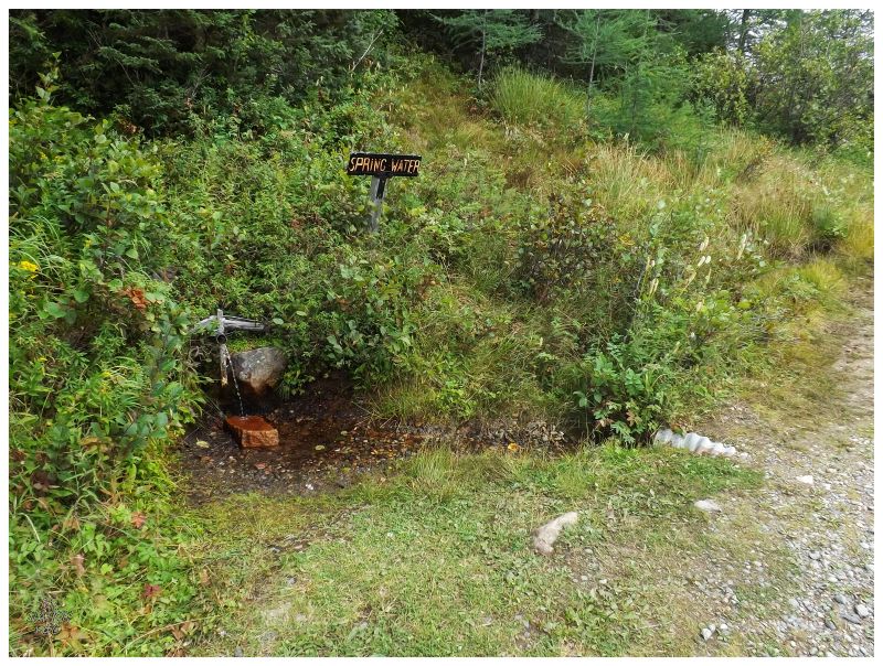
Leaving Pond Crossing behind, I would also leave behind the barren plateau. I rolled forward and found myself beside Kitty's Brook, the T'Railway meandering amongst a lush valley surrounded by short foothills on each side. Pulling up to a spring, Kitty's Brook spilled over a falls nearby, but sadly I wasn't feeling good to the extent of bushwhacking down to some waterfalls. Other than that defeat, the road here was more like a woods road & the cycling was good. I stood there chugging the cool spring water, pleased with my work so far. |
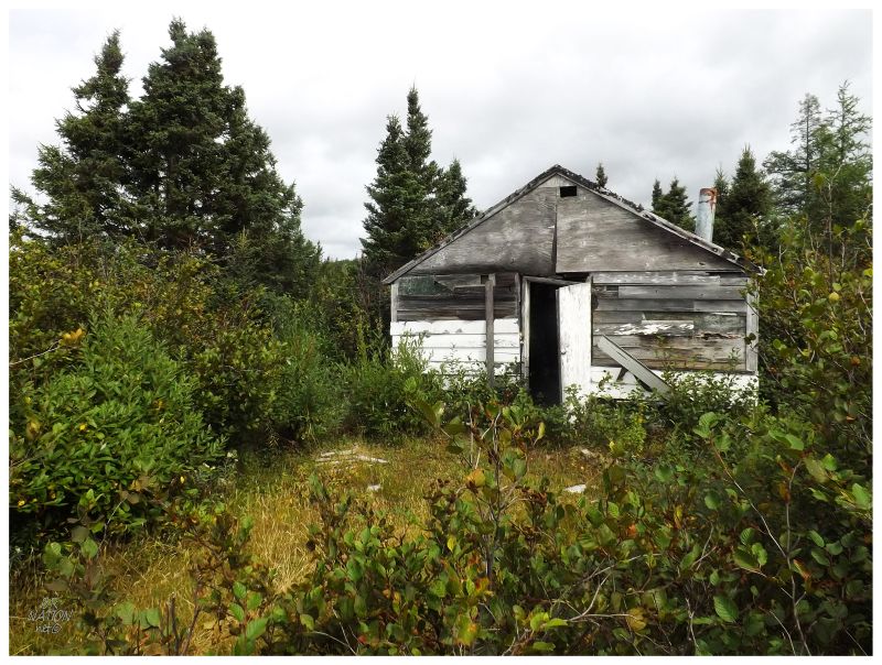
Where I will pass up a waterfall, I won't pass up an abandoned cabin (as long as it's not the 7th abandoned cabin of the day or something). Pulling over to the side and putting down my kickstand (my foot), a crew of four ATVs and seven people passed by, but they kept moving & I was happy for the time alone at the cabin. |
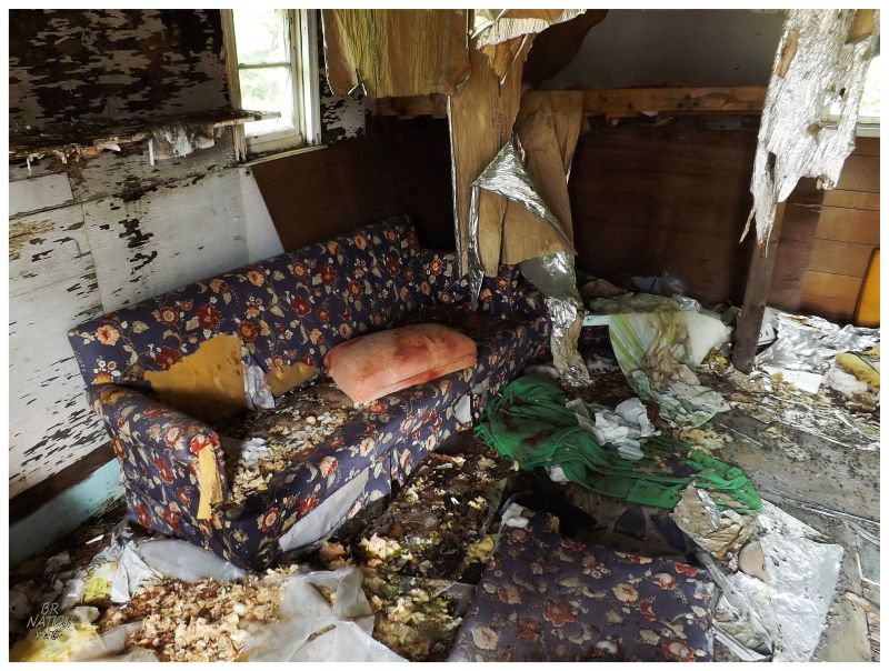
I poked my head inside and took in all the glory of exploring this marvelous couch. For how much others talk about "where people went" with houses and ghost towns, something like this cabin makes me wonder much more than other places. Is this cabin too remote for anyone else in the family? Maybe everyone left the Deer Lake/Howley area? I've also seen cabins like this where the owner simply thinks it's not worth the effort in selling & leaves the cabin out wherever, using it right up until it's derelict and uninhabitable. |
Kitty's Brook continued to grow and widen beside me, when I then noticed the biggest train bridge of the trip up ahead. Unfortunately it was still overcast, so my distant pictures didn't work out from the far away bog. Continuing along, I took the time to lean my bike against the railing of the Kitty's Brook Bridge, watching the now impressive river wash into a wide meander. The bridge was interesting and picturesque enough that I wish I would have previously put in the bridge research work to know that this is only 21.8 km (13.5 mi) from Howley. It's the type of bridge in a province lacking cool bridges, that I would certainly cycle 21.8 km from Howley to go check out. |
The road near Howley started to get thick with gravel again & because of that, it's hard to explain the joy in hitting blacktop side streets after cycling 101 km (60 mi) of too much gravel, too thin of tires and/or too much whining from this 'cyclist'. Although I wonder if the purist would have cycled the T'Railway through Howley, I know I turned right and savoured the 1200 meters (3/4 mile) of smooth, smooth pavement. |
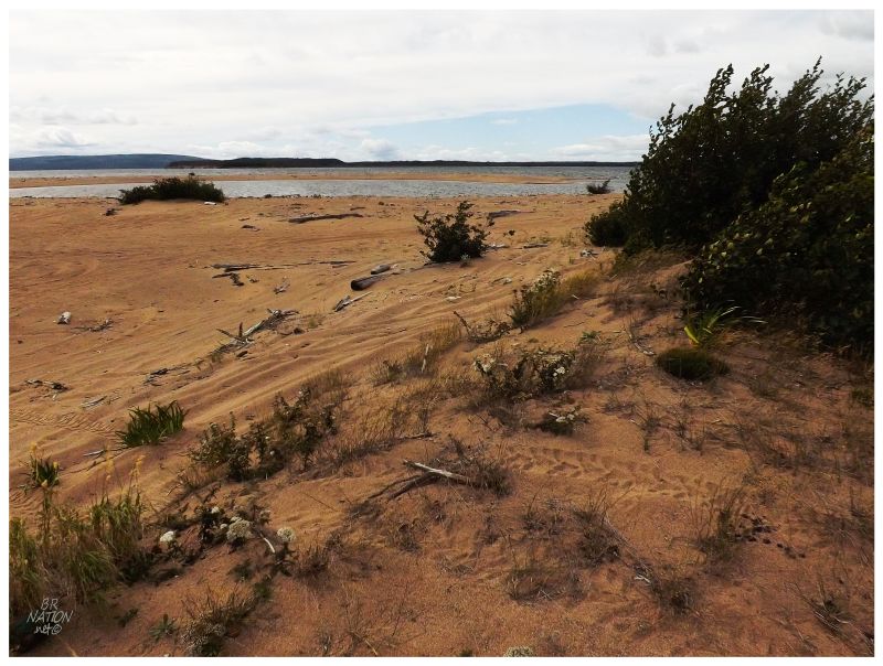
There was a sign just outside Howley that said I had 25km (15.5mi) left to Deer Lake. By now it was getting into the afternoon and I was exhausted. Very slowly pedalling along, I dreamed of doing this trip in 3 days/2 nights instead and being able to hike more of the topsails while camping along this pleasant Grand Lake beach just outside Howley. |
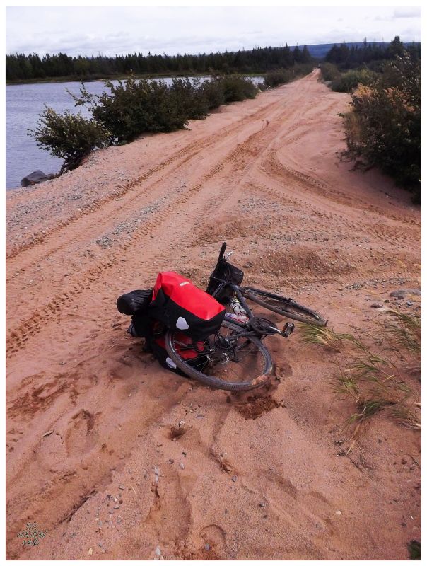
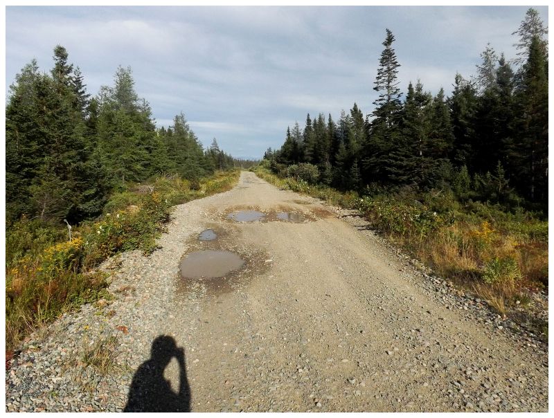
Today instead of lounging on the soft sand, it was cursing the damn sand, which left me pushing my bike instead of riding it. This sandy area would lead into an area with the deepest gravel of the trip, making for a very rough 5-10km zone outside Howley. It's in this 5-10 km zone that there was some walking and pushing of my bike, where I wondered what time I would get to Deer Lake at a 2km/hr pushing pace. Thankfully the road would get better about 8 or 9 km (~5mi) out of Howley, leading up to Main Dam. |
Almost halfway between Howley and Deer Lake is the monumental Main Dam on Grand Lake, which would be the last point of interest for me on this trip. |
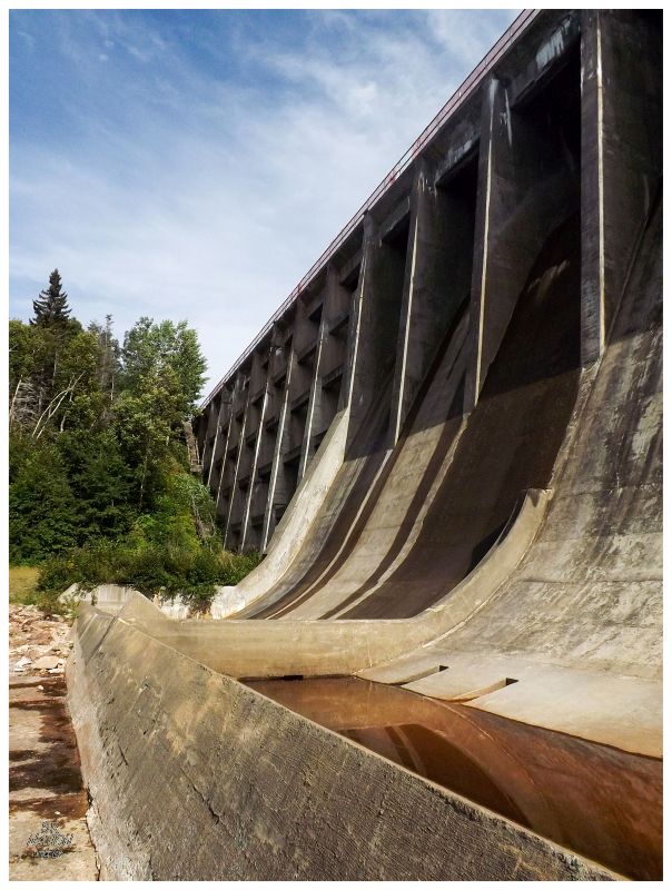
Surveys of hydroelectric and lumber possibilities in the Deer Lake and Humber Valley area started in 1915. By 1922, a hydroelectric plant was started at Deer Lake to provide energy for a paper mill at Corner Brook. This hydroelectric plant would generate electricity through this dam hindering Junction Brook and raising the level of Grand Lake 12 feet; along with the levels of connected Sandy Lake and Birchy Lake. At the same time as the dam construction, the Humber Canal was being dredged to connect Grand Lake with the Deer Lake Hydroelectric Plant. An 11-km (7-mi) canal, it was cleared out by man, horse & steam - steam doing the majority of the work when you consider that one of the steam-powered dragline excavators that worked on the Panama Canal, came up here and helped with the Humber Canal, before heading down to the Niagara Region to help with the Welland Canal. |
In total, approximately four million cubic meters of dirt and rock were removed to create the Humber Canal. This would empower the turbines at Deer Lake and send electricity to the mill at Corner Brook, the city of Corner Brook, the town of Deer Lake, along with Springdale, the Baie Verte Peninsula, Howley, Buchans & Little Bay (and presumably places like King's Point & Harry's Harbour too). The power point at Deer Lake that you see today, would continue to power these places until the demands of the Corner Brook Pulp & Paper Mill grew and the settlements would need to find another source. Lastly, one of the more interesting things is that because this was all built in the 1920s, the Corner Brook paper mill was almost built in Deer Lake instead, since they almost didn't have the technology back then to transfer the electricity over 50 km (30 mi) between the two towns. It is said that the mill was only placed at Corner Brook "in the eleventh hour" due to engineering progress in the 1920s. |
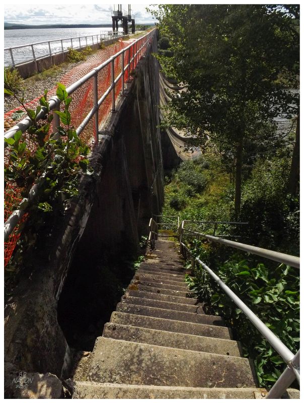
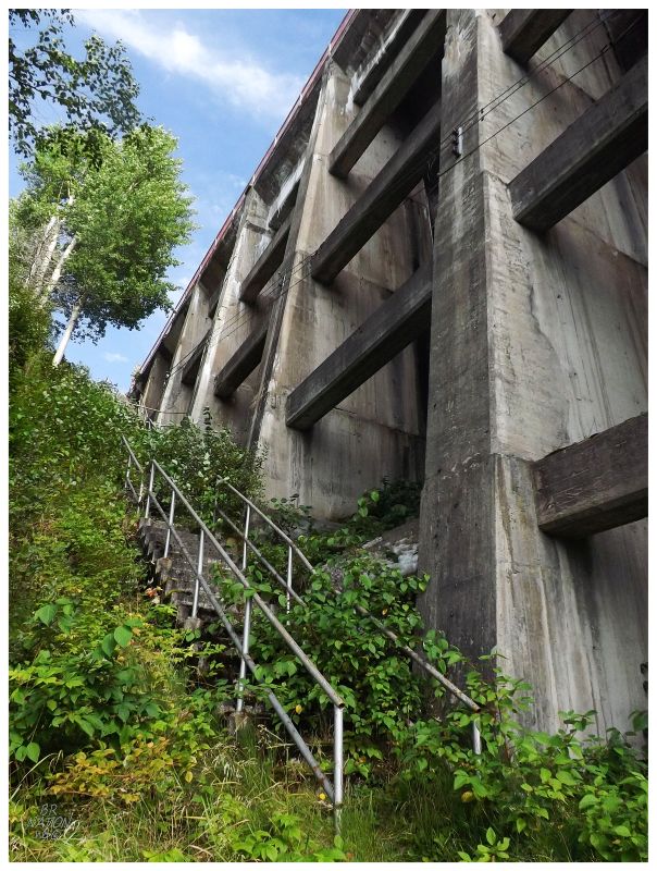
Main Dam was hard to fathom because you simply think something so big should be more well known. I had seen pictures of the dam online, but to stand at the bottom with Grand Lake being held back through a 76-ft high wall of concrete was a whole different story. I wandered below and up the handful of staircases I could find, then across the top with Grand Lake lapping 3-ft below me to my left, and a 76-ft drop to my right. After leaving Main Dam, the Deer Lake Hydro service road parallels the T'Railway for about half of the distance to Deer Lake. I would enjoy their smooth, although undulating, road for this portion following the Humber Canal, before merging back onto the T'Railway at the old siding of Northern. With this smooth service road, about the only time I was having trouble was with the small hills. By the time I was past Northern, it was getting into the evening, but knowing that I was close and with the warm temperatures, I was more than happy to continue tiredly plodding forward. |
Deer Lake's smooth road led me downhill back towards my beloved car parked at the Irving. One last bit of bushwhacking and bike pushing would happen as I tried to shortcut through an ATV path between Wights Rd and the Irving Parking Lot, but soon enough I popped out of the woods and exhaustedly jumped off my bike, leaning myself against my car and smiling at the tour's end. While it was a much harder cycle than I was expecting, it was so worth it. I would go with a 3-day/2-night trip if I were to do it again, but even at 2-day/1-night, it was worthwhile in hindsight. I'm so happy that I got to see Millertown Junction, Quarry and the Topsails. |