On our way out of Washington State, we needed to follow the Columbia River in order to get to our southbound exit in the middle of Oregon. Since I'd already seen the Oregon side of this mighty river and Isy had barely seen any Washington State, I decided we should stay on the Washington side until the very last bridge crossing into Oregon. Along the way, our Washington highway hugged the edge of the Columbia much more than the Oregon interstate. I was also amazed at how much drier this end of the Columbia River was than the lush gorge I'd previously seen near Hood River. |

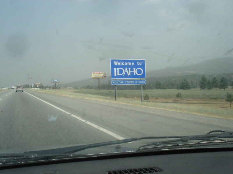
Crossing back into Oregon and gassing up at Biggs Junction, we followed I-84 for a few miles before carving directly up into Fulton Canyon, into the hills an out of the Columbia's massive river valley. |
Atop the Columbia Plateau, the land leveled out and up ahead was the Locust Grove United Brethren Church. This was easily the most prominent remnant left to the ghost town of Locust Grove, where only a handful of farms otherwise remain. Built in 1895, this church was last used for holy purposes for a 1914 funeral. Afterwards it was used as a barn for livestock and hay, although standing here it didn't even look like it served that purpose anymore. Standing behind a posted private property fence, we figured we were happy with our view from the road and moved on. |
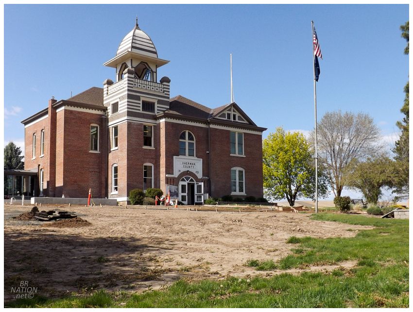
Up the road from Locust Grove, we passed through Moro and I slammed on the brakes when I realized we were passing the Sherman County Courthouse. Some dudes were working on a new accessibility ramp and sidewalk, but I was still able to appreciate the 1899 courthouse from a distance. |
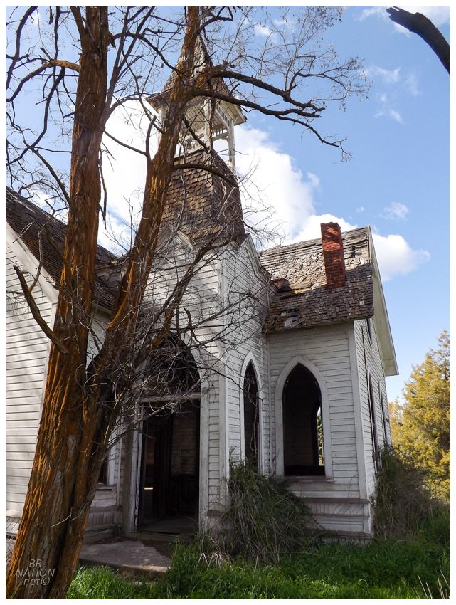
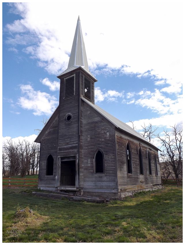
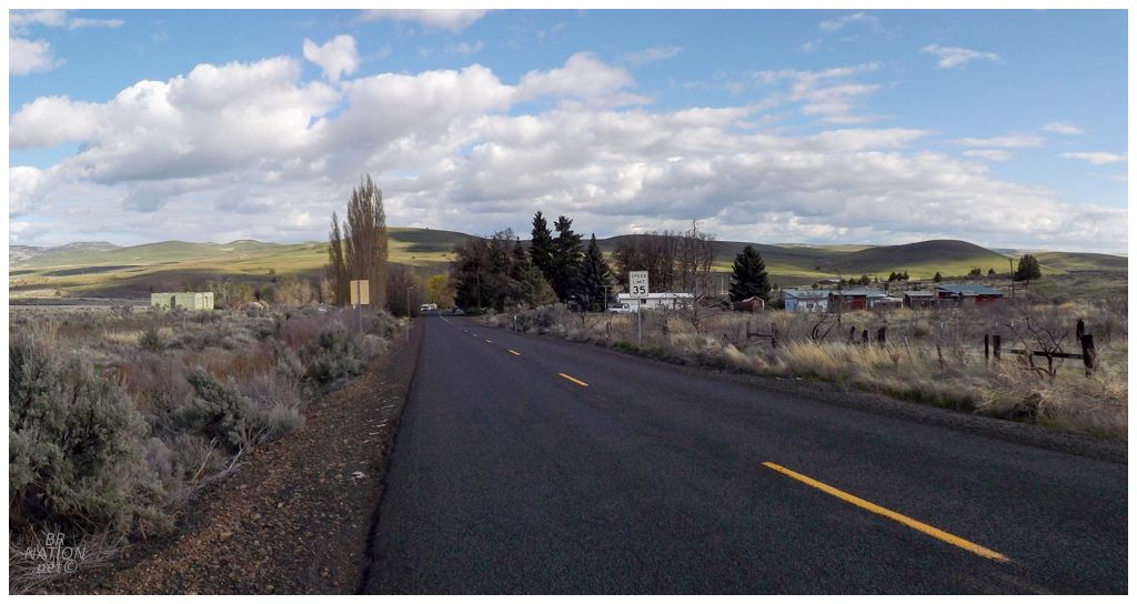
Things grew less rural as we turned on to the Sherman Highway in Moro, where our next stop was right in the next town we'd go through, Grass Valley. With breakfast, bike spokes and all of these churches, the day was starting to get away from us a bit. Still, we couldn't really skip picking our way through the grasses to check out Grass Valley's old methodist church. |

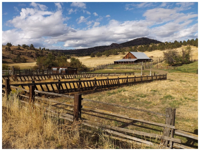
Sherman County is roughly bordered by the Deschutes, John Day & Buck Creek Rivers. These rivers were used by native peoples for thousands of years, as Tenino and Wyam peoples fished and travelled along them, sometimes cutting across the high country between. White man travelled westward along the Oregon Trail at the Columbia River in this area, while some instead used the Barlow Road to the south. If you took the Oregon Trail, you then had to board a ferry in The Dalles, as the remainder of the trip was completed by water, up to the city of Vancouver in Washington State. Hampered by the ferry cost or wanting to bring their wagons past Mt. Hood, others cut an emigrant trail from The Dalles down to the Barlow Road. About halfway down this road stood the area of Grass Valley. |

The first settlers came to Grass Valley in 1878. The area was known from its tall rye grasses that were said to be above a man's line-of-sight even on horseback. Dr. C.R. Rollins was amongst these first settlers and he was the first to cut down the native vegetation and produce a wheat crop. While Grass Valley is today home to a Baptist and a Roman Catholic church, this is the Methodist church, which has been abandoned so long that there isn't a clear answer to when it was built. Answers vary from the 1880s to the early 1900s. |

By 1910, Grass Valley had a population of 342, a number that's slowly fallen to 164 in the 2010 census. While driving through and also looking outward from the church, I found Grass Valley to be more of a town than a village. It was sleepy but didn't have the rundown wooden buildings like I've seen in other ghostly towns of central & eastern Oregon. |
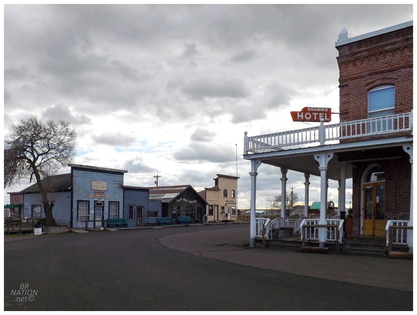
Although I enjoyed the churches we had visited today, I wasn't enjoying the towns and scenery as much as my last time through Mitchell and Hardman Oregon. As it turns out, we were in central Oregon here and I was in eastern Oregon that other time. Regardless, I was trying to hold on to this area of Oregon a little bit longer & resisting heading west to the Willamette Valley's busy interstate. Without prior preparation though, I had to hand the map to Isy as I drove, telling her to look for any places marked with a little gray dot (indicating villages and ghost towns). She'd read them out to me and I wracked my brain, "okay, do I remember anything about Bakeoven Oregon? Kent? Clarmo?" We just so happened to end up in Shaniko, which is a restored ghost town with lots of buildings still standing. I hadn't added Shaniko to our itinerary because I didn't think it seemed forgotten or remote enough, but Isy liked it & I thought the Columbia Southern Hotel was worth visiting. Sitting on the front porch of the hotel, I half expected Jeff Bridges to come rumbling down the road on horseback like in True Grit. |
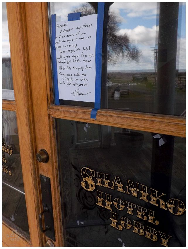
The hotel wasn't open, but I liked the personal note not meant for us on the window. |
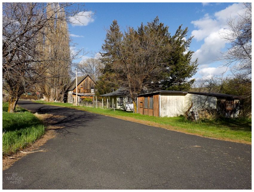
Following Shaniko, we went on a small detour through uplands and down through some foothills into the town of Antelope. I had a vague memory of this town looking cool in my research and sure enough it had its share of rundown wood stores and interesting homes, all plopped along a miniscule street network of nine streets. Unfortunately we were in a bit of a hurry to get to a campsite, so I have limited pictures of Antelope. |
Antelope, then with a population of 60, was the closest location to the Rajneesh religious community that made national news in the early 1980s. This religious compound was created by its leader Rajneesh, who left India and came to the US on a tourist visa, while telling his followers to sell all of their belongings and move to the nearby Big Muddy Ranch which he purchased. While the Rajneeshees tried to incorporate their ranch as a city to avoid the meddling of police in their matters, they were met with resistance and counter moves, and some of the followers then moved into and purchased land in nearby Antelope. By the time Antelope residents realized this and voted to dissolve their city, there were enough Rajneeshshees living their to block the motion. In fact, there were so many followers that they instead voted to rename the city of Antelope away from its Pronghorn origin, to the name of Rajneesh. Eventually the leader Rajneesh was pressured by the US to return to India, while it was also discovered that his group carried out the largest bioterror attack in U.S. history (infecting 10 salad bars in The Dalles with salmonella, thereby infecting 751 people and hospitalizing 45 of them.) They did this because there were elections the next day and the Rajneeshees hoped to hospitalize enough regular citizens that they could then outvote them. Anyway, Antelope would vote 34-0 to restore its name in 1985. Some Rajneeshshees remained in the area and even voted for the measure. |
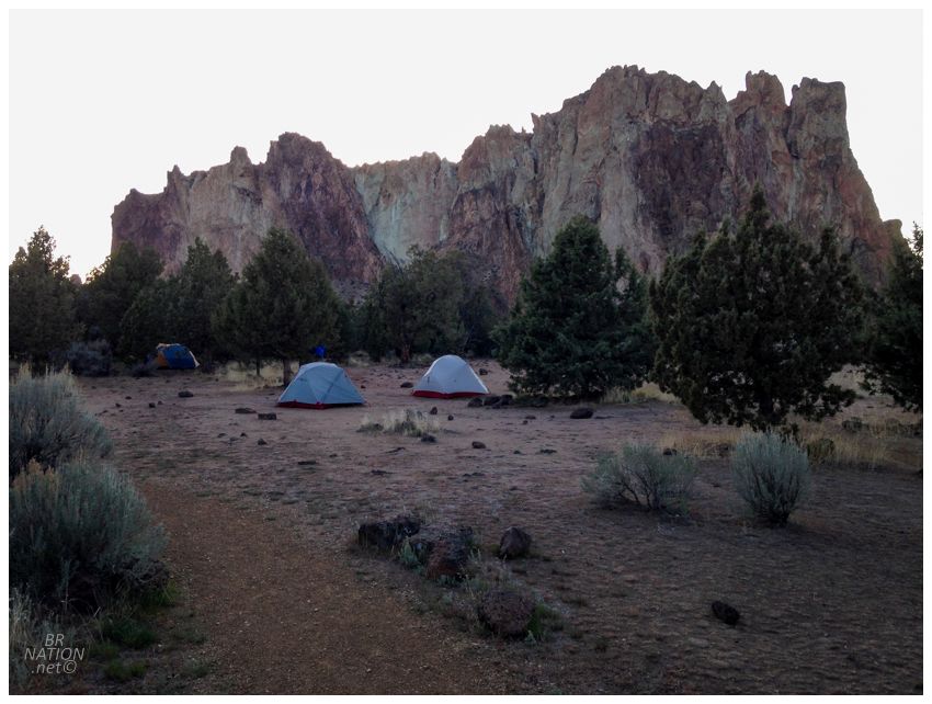
We now had an hour left of daylight and needed to make some progress towards a campsite. Using Isy's cell data, we found 'Smith Rock State Park', which seemed like a fine enough campground for $8. After driving for that hour, we learned that Smith Rock State Park is apparently a world-renowned climbing destination and considered to be the birthplace of sport climbing. A sea of expensive, earth-toned tents were everywhere in these woodlands next to the parking lot, with every person decked out in fine gear and mulling about in elaborate hiking shoes. The beauty of Smith Rock made us want to stay here, but we were suddenly feeling very uncomfortable with our big box store tent and plans to stay up drinking bourbon into the night. It was only 730pm and it looked like two-thirds of the tents had already packed it in. |
Checking the internet again, the map showed another campsite really close, except it was on the other side of Smith Rock. After another 15 minutes of racing to save daylight for setting up camp, we arrived at the ominous Skull Hollow Campground. |
I just assumed Skull Hollow was named for a rock feature on the nearby hills, but its name actually comes from a quaint discovery of human skulls in the area. In 1845, guide and wagon master Stephen Meek attempted to lead a caravan across the Cascade Mountains. Finding all of his normal watering holes dried up, he approached unfamiliar lands here and his whole company would then die in a skirmish with Native Americans of the area. It wasn't until 19 years later, that soldiers explored this area and found chinaware, 40 wagons, and 200 human skulls. Hence the name, Skull Hollow. |

Isy's picture.
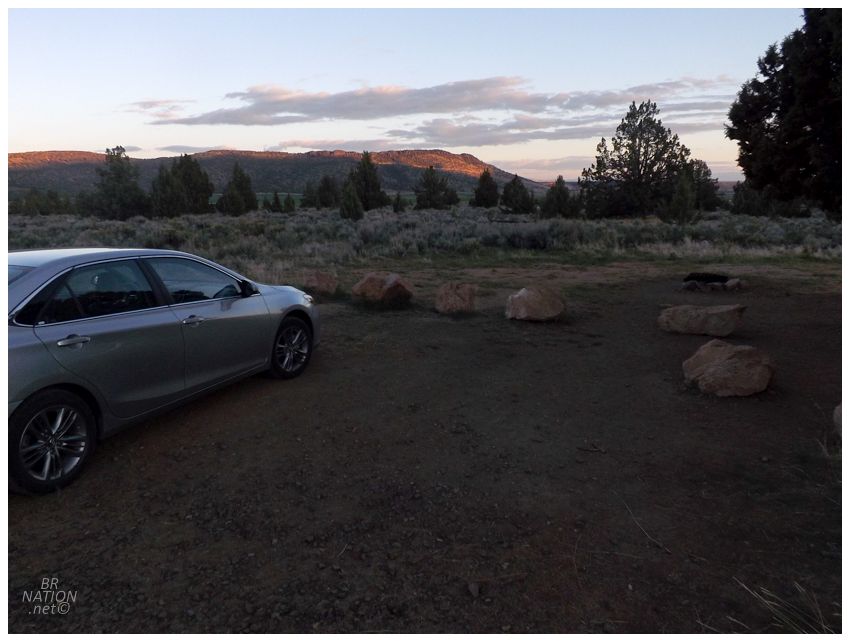
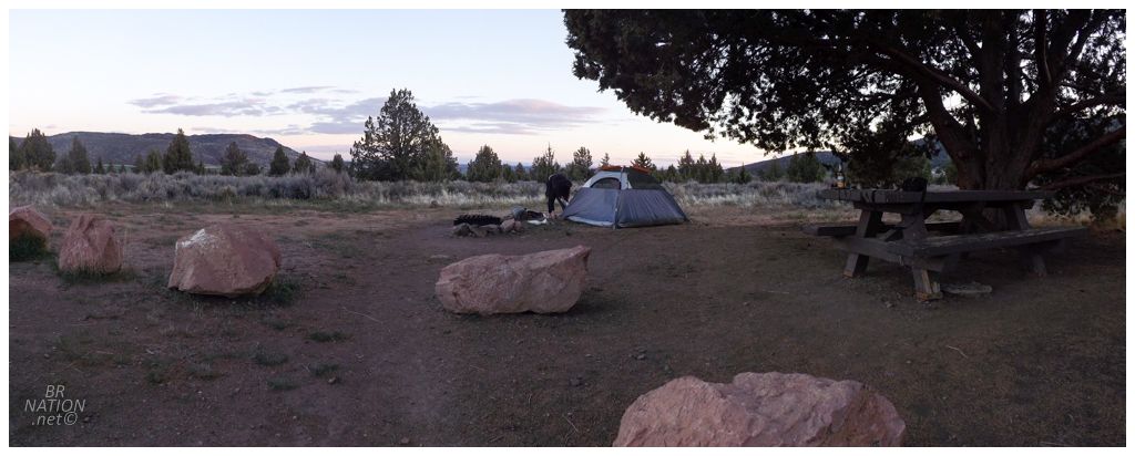
If those tormented souls still haunt this hollow then they took pity on us, because we made ourselves easy pickings and still weren't disturbed. Now that we weren't camped 6 feet away from someone in an expedition tent at Smith Rock, we instead lounged about as the nearest fellow tenter was about 5 sites away. Buying firewood from the cheery Skull Hollow manager, we poured up some of that Wyoming bourbon and kept warm by the toasty fire as the sky turned into a sea of stars. About the only complaint I had was when I pulled out my front wheel to repair it with the new Kennewick spokes. Sitting down, it wasn't long before I realized that the dingus back in Kennewick sold me spokes that were too long! And not too long that you could put dimes atop of them to protect the tube, but spokes that were about 5cm too long. Beautiful! Anyway, that wasn't enough to sour my memory of this place. It's funny how fortuitous the decision to leave Smith Rock ended up being. Isy and I still commonly remark on the fine campsite here at Skull Hollow - and all for $10! |

The next morning we stopped at the Peter Skene Ogden Scenic Viewpoint, where peering over a wall so short that they worn dog owners to keep their dog's leashed, there's a fantastic view over the Crooked River and the Crooked River Railroad Bridge. (This is the same river that stands between Smith Rock & Skull Hollow. You now understand why it took us a while to drive around it.) |
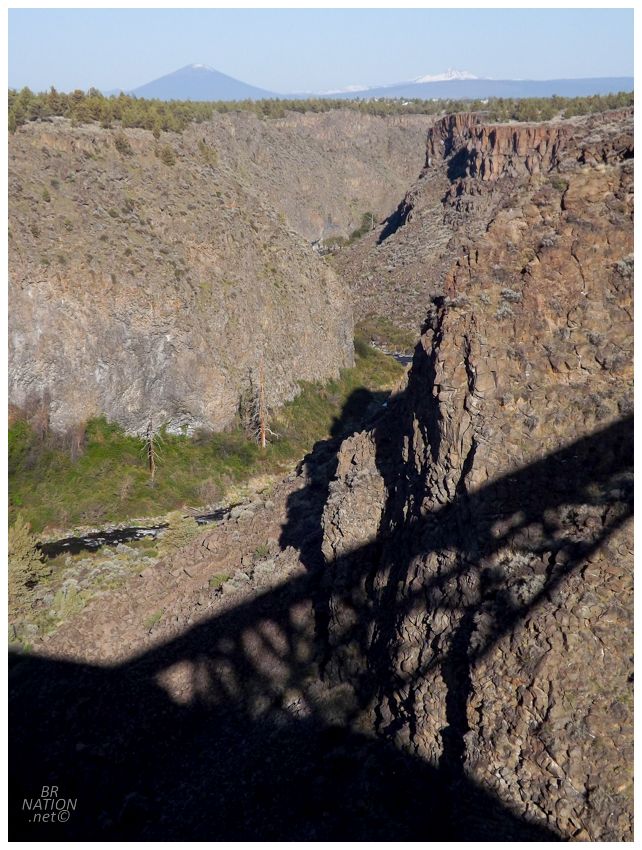
Mt. Jefferson stood off in the distance. It's the second highest mountain in Oregon (10,502 ft.) |
Isy's picture.
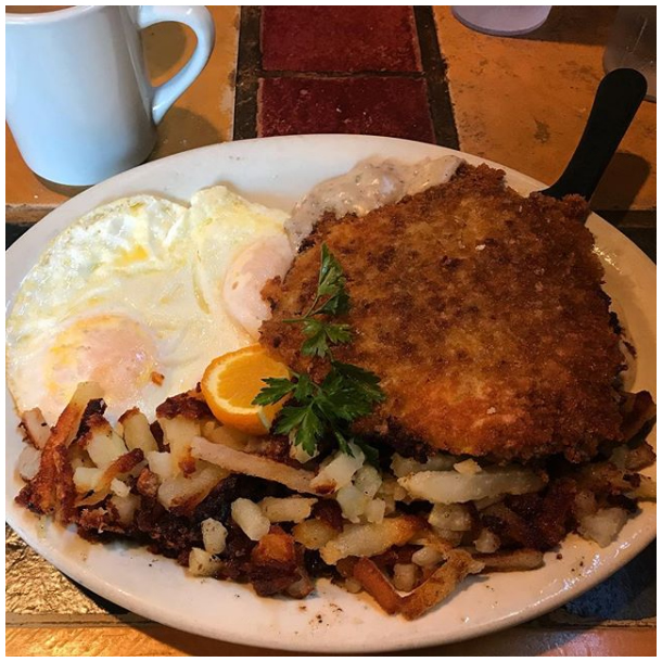
Following the Crooked River viewpoint, we were into the nearby city of Redmond in no time, where Isy couldn't help but join the country fried steak train after seeing mine in Kennewick. Her's was a bit better though, as Christie's Kitchen in Redmond was fancier and seemed to try harder than Little Randy's back in Kennewick. Redmond the city ended up being just okay. The owner Christie was nice at breakfast and the coffee shop had a pleasant barista too, but Redmond didn't leave me feeling like I missed something by camping last night. In fact, I struggle to keep the name straight in my head and keep wanting to call it Redbone, Oregon. ♬ Dayliiiiiight, I wake up feeling you won't play riiiiiiight ♬ Anyway, the coffee shop in Redmond was this new age, artisanal place and Isy was annoyed that I was driving around it, when in her mind, such a place couldn't possibly have a drive-thru. "Babe, this is 'Murca" I told her, as I rounded one last corner and pulled up to the drive-thru order window. "Now, what would you like?" |
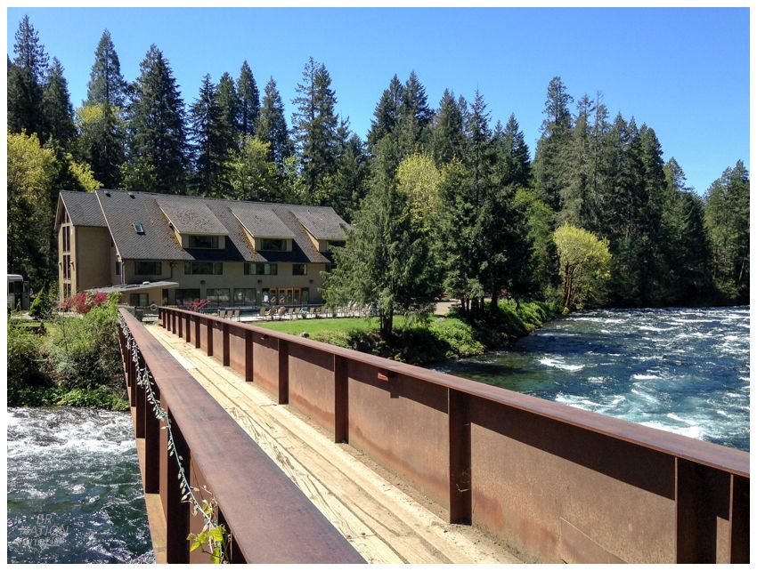
Leaving Redmond, we had a lot of ground to cover & it was going to take a while as we were headed across the Cascades, near the Three Sisters and Mt. Jefferson. By the time we reached Sisters Oregon, the trees had turned to pine and we could no longer see forever as those pines and other evergreens crowded the road. Sisters seemed like an uppity, mountain resort town, but I might've still had time for their skatepark cradle except for my lousy front wheel (and that dude in Kennewick). There would be no riding today. The next stop was another hour into the mountains, at our third set of hot springs for the trip, the Belknap Hot Springs. Now this place seemed a bit more bougie than Saratoga's free city hot spring or Heise's dated campground hot spring, and we were especially worried as our hair was dishevelled and we were still wearing sweats from sleeping outside last night. Isy sent me in to see what was the deal, and I really appreciated that the woman working didn't bat an eye at my appearance. For $8, we were free to take in these fine hot springs for an hour. We couldn't really complain about the setting either. |
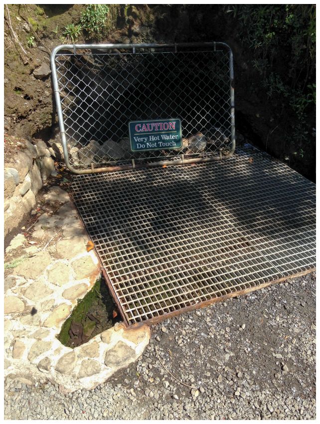
The source of the hot spring. My dumb ass was so tempted to touch this water.
Eventually leaving Belknap Springs refreshed and cleaned up, we headed into Eugene towards another bike shop. Hutch's Bicycles advertised that they were there "Since 1927" and I appreciated that they were able to pull out a big tub of spokes and get me set up. |

It was time to get going and head out of Oregon though. The only other stop we'd make was near Saginaw Oregon in the town of Cottage Grove; where grabbing lunchtime Taco Bell I was overjoyed with the fact of old timer after old timer, coming into the restaurant and being greeted with familiarity on a first name basis like a corny Tim Hortons back in Canada. Could I grow old and embrace this life in Cottage Grove Oregon? I'd say. Continue to the next episode... |