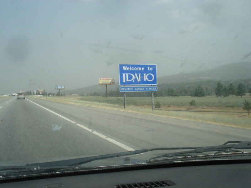
If you follow the direction of US-199, Crescent City California is only 45km0 as the crow flies from the Oregon border, but the curvaceous road stretches this to nearly 65km as it moves through the Klamath Mountains. Although it wasn't quick, it was an enjoyable 65km. The highway almost always followed a scenic river with associated flats and tiny villages. If it wasn't so early, I would have happily pulled over into any of the $15 National Forest campgrounds we were passing. |

Dinner was in Crescent City, in an area near the shore that I enjoyed because it had spread out buildings set upon wide, empty and flat streets in a grid system. It was like a Rust Belt city with coastal Californian weather. Although I suppose the source the emptiness was different, as these Crescent City areas are due to a 20-ft tsunami hitting the city in 1964 and levelling 289 businesses. One of the sparse buildings here was Seaquake Brewing, which looked like an excellent choice for food and maybe watching the Bruins game. Walking inside, I discovered that the B's had fallen into an early hole yet again, but at least the beer was so tasty that it left me thinking about staying at one of the seedy motels back on Crescent City's main drag. Instead, we stuck to our original plan and finished up dinner at SeaQuake just as the sun was setting; making for a great, although chilly stroll over to the Battery Point Lighthouse. |

We lucked out here because I didn't realize Battery Point was built on a tidal island. It really would have been something if we just missed coming out here because of the rising tide after an hour-long dinner. Anyway, California lighthouse #4! I'm back to averaging 1 lighthouse per visit! With daylight quickly fading, we needed to get going. Driving right through Del Norte Coast Redwoods State Park, I didn't think it was worth the $40 or $50 that the campsites must've cost. I say they "must've cost" because in planning this trip, I grew constantly frustrated with how websites hid their campsite prices like ancient secrets, seeing as they're too lazy to get their IT department to update the cost whenever it's changed. I've since learned that there are great websites that do the work for you, instead of having to call or enter in a thousand fields of personal information just to get to each individual campground's checkout page to see the price. |

The night fell as we drove thirty minutes until we finally came to another little village, where I made a right onto a bridge and then on to a dark county drive. We were heading towards a site I'd already looked up on freecampsites.net, trying to save us the exorbitant cost of Californian tent camping. Tall trees crowded the road, which was so narrow that we'd have to pull over if any oncoming traffic appeared. To our right was the ocean somewhere, down hundreds of feet below in the darkness and fog. Finally coming to a gravel pullout with a couple of other parked cars, Isy looked at the nearby ground and asked if this was where we were camping. "No, it's uh, it's uh up there" I meekly stated as I pointed at a wood sign indicating a quarter-mile hike up the hill into the bush. Neither of us were feeling this. Isy was fine with setting up camp right there in the gravel cul-de-sac, but these cars made me think it wasn't the best idea. Although it killed me to chicken out, I said we should go back down the road to the RV park we'd seen and check on camping there. |

The $40 for tent camping wasn't helping us make up our money spent on the camping gear back in Wyoming, but we both enjoyed unzipping the tent in the morning and taking in this fine view of the calm Klamath River. |

Breakfast the next morning was in the strange village of Orick, where vacant storefronts, junkyards and fenced-off gas bars are likely absent from California's North Coast tourist brochures. I obviously liked all of this though, especially the Palm Cafe with its funky old signage. |

Oh yeah, this was my type of place. Yellow plastic chairs and state flags. Pretty much what my man cave would be like! |

Also, the coffee was apparently terrible according to Isy. Which was great because I don't comment or note terrible coffee, as coffee is to be drank to jolt your system into gear for the day, not to obsess over like an expensive bourbon or a vehicle purchase. Away from the coffee, Isy said this was the best breakfast of the trip though. So there's no need to feel too bad for her this morning. |

The next town of note was Trinidad - a tiny and cute village with another head of land sticking out into the Pacific. Stopping at their faux lighthouse, we left the car at the popular Trinidad State Beach to take the less popular, uphill Trinidad Head Lighthouse climb. |

Now one of the things that always sours my time in California is the fact that their lighthouses are so hard to visit. For a state with around 70 lighthouses, so many of them are only open at some ridiculously specific time like, "the 5th Tuesday of the month, from 11:30-11:45." I've driven a lot of this coast and researched a lot of these lighthouses, often exclaiming, "damn! I'm going to be there on the 5th Wednesday of the month!" or "damn! I'm going to be there at 2 o'clock and the grounds close at 12:30!" It's quite frustrating. Trinidad Head Lighthouse was another one of these lights. It WAS between 10 a.m. and noon like the sign said, but sadly it wasn't the first Saturday of the month, it was the fourth Thursday. |

At least I saw some Pigeon Guillemots along the way. A new one for the life list! (We have the very similar Black Guillemots in Newfoundland, but my friend Shelloo always says to take pictures of birds like this when you're travelling, because they can be the southern, northern, or Pacific versions of what's back where you live. Thanks Shelloo!) |

Down in Eureka I would not be denied another California lighthouse, as they had a good ol', accessible lighthouse in the middle of a marina parking lot. That's because this lighthouse was moved here in 1987, from a bluff 4 miles to the south. |

Original Photo by Merle Shuster, Oct 16, 1947. Annotation adopted from Heidi Walters, Nov 2012
Humboldt Bay is the biggest protected bay between San Francisco and Coos Bay Oregon. Two long spits guard three separate bays that are home to the important cities of Eureka and Arcata, along with a host of other villages. An early lighthouse erected right on the spit was criticized as being too low and often obscured by fog. In 1892, the Lighthouse Service Board built a brand new lighthouse four miles to the south on a tall bluff, which even though it didn't directly mark the break in the sand spits, it could be used for navigation by referencing your location instead of going directly alongside the light. The Table Bluff Lighthouse you see today hasn't been gussied up for display at this local marina, as it was originally part of an entire Victorian home made of redwood. There was also a fog signal building, two wash houses, oil house and carpenter shop. |

In 1906, the Navy established a wireless station at Table Bluff, which was greatly expanded in World War II when the need for lookouts and beach patrols grew along this coast. Unfortunately this also meant that most of the original buildings were demolished at that time, save for the lighthouse itself & the fog signal building. Once the war was over, the complex was turned into the Lighthouse Ranch, a religious ministry that opened its arms to hippies who wanted to come and escape drugs, perform farm tasks, and learn about Jesus. The Table Bluff Lighthouse was occasionally visited by the Coast Guard during this time, but they eventually deactivated the light in 1971 when a new light was built right at Humboldt Harbor. The deactivated light wasn't used by the hippies very much and decayed into the 1980s, until local historian Ray Glavich stepped in to get it sawed in half and moved to where it stands today on Woodley Island. |

Although I thought Table Bluff Lighthouse was pretty swell, Eureka is probably best known for its incredible, breathtaking Victorian homes. The above one is the Carson Mansion, built by lumber baron and New Brunswicker William Carson. It's been a private club since 1950. |

And just across the street, we'd parked in front of "The Pink Lady", which William Carson had built for his son and daughter-in-law in 1920. This house has since become a B&B, which excited Isy, but thankfully she let me off with a promise of coming back here and staying some other day. Worried about the astronomical costs of a such a venture, it's good to see The Pink Lady has now been sold into private ownership in 2019. |

We only went through 3 counties on this portion of the trip. Yooj counties, the yoojest.
You might expect a place of wealth and resources like Eureka to have a fine courthouse, but unfortunately their imposing 1889 courthouse suffered greatly from a magnitude-6.5 earthquake that struck Eureka on December 21st, 1954. This led to the building being condemned and then destroyed in 1956. The above structure was built in the same year and I don't completely hate it. The multiple staircases and wide elevated porches made me think of California BMX videos I used to obsess over as a teenager. |

By now, we'd discovered that travelling this coast takes a bit longer than Google Maps will tell you. My friend Shelloo had also told me the same thing & as I drove along today, I wished I would have listened to her. I was struggling with admitting defeat though. I had a big plan to drive a rural road through the true heart of the Lost Coast up here in the King Range Mountains, along a crazy curving road that would spit us out at a tiny village and a 10k hike to a very remote lighthouse. And even though my brain was telling me that we didn't have the time, I still made the turnoff for Ferndale. It's in walking around Ferndale and grabbing coffee, that I accepted there was no way we were going to make this side trip and also get down to Oakland by tomorrow afternoon. It was clear that I hadn't even allotted enough time to do the main highway of this coast properly, forget about any side jaunts. The only lighthouse I'd be seeing near Ferndale was this one I spotted while waiting for Isy to be done at Foggy Bottom Yarns. |

We also went into a really expensive antique store, where I was feeling these doors rescued from a 16th century pub in England. The pub was torn down to build the M4 freeway and the American engineer working on the construction saved them to bring them back to the States. |

We'd been seeing redwoods here and there, but now we finally arrived at the actual stop where we planned to check them out. All through this part of California there are state and federal parks, along with private protected areas, that all offer up redwood trails, drive-thru trees and scenic pullouts. |

We exited for the Avenue of the Giants, a 31 mile (50 km) discontinued configuration of the US-101, which after being bypassed in 1960, it was renamed State Route 254 and maintained as a scenic highway. |

Isy's picture.
I'm normally a person who enjoys nature enough, rather than the person who is absolutely blown away by every last foothill and shrub. These redwoods were obviously different though, as my indifferent ass was shot out of a cannon by these imposing, 300-foot tall beauties. I had to keep reminding myself to keep an eye out for traffic as I gazed skyward, mouth agape at the gargantuan trees. As the climate continues to change, I really hope Californians start to sweep these forests like the Finns do. They have to preserve this magical place. |

Isy's picture.
Down a short trail, we climbed atop a fallen redwood and then some guy sort of ruined our zen by telling us it was engulfed in poison ivy. I find that I don't react to poison ivy much anymore, but Isy was worried with her sensitive skin. Anyway, I can't recommend seeing the redwoods enough. I was really sad we hadn't allotted the time to stay and camp in one of the groves we'd passed. The rest of the day was spent making progress down the coast. Following lunch in Myers Flat, we followed the Eel River until Leggett and then made a cut across the mountains. The road we found was so enclosed with trees that the car's automatic night time headlights came on and I was reminded of the Canary Islands' interior roadways. Exhaustedly popping out on the coast, we stopped for Old Crow Bourbon in Fort Bragg, a smallish, rough enclave along this coast that I liked. |

We'd get to Point Cabrillo near the end of the evening, but we hadn't really seen any campsites in a while. There was a short hike out to the lighthouse, but I decided against it since we needed to find somewhere to sleep (I regret this in hindsight). Isy was happy she saw a turkey on the grounds though, lol. Sick of missing things because of having to rush and find somewhere to camp, I simply pulled into Russian Gulch State Park and tried to accept the $50 fee, but just couldn't do it as we checked out the campsites. We continued south. After pulling off in Mendocino to see the Cape Mendocino Lighthouse - which we soon learned is actually located in the town of Shelter Cove, not the town of Mendocino - I was also getting stressed out by the extravagance of our surroundings and how they'd affect our prospects for camping. When we noted a sign for the Albion River Campground, we finally accepted the $50 cost of putting up a tent in California. The depressing thing about all this is that its usually way busier after Memorial Day along here. If we'd accepted the $50/site cost earlier, we'd have had a great choice of campsites that wouldn't normally be readily available. |

The Albion campground was beautifully tranquil with only 4 other sites being used, and we could even walk down with our beers to the deserted Albion Cove at the Pacific. I wasn't sure if we'd saved any money by buying camping gear back in Laramie Wyoming, but the memories of Skull Hollow, the North Platte River and Albion make up any difference, and then some. In addition, there was an argument to be made that this campsite was worth the cost. Paying for Albion was sticking in my craw far less than the time I spent $45 to camp in a sandy, crowded clearing in Delaware. Now THAT was the time I should have simply drove 20 minutes inland. |

The US-101 heading over us. Albion Cove beach.
The next morning we had a 3-hour drive according to Google, which I was thinking more like 5 hours with crazy California roads and the possibility of Bay Area traffic. Point Arena Lighthouse was close and we may have been able to go out of our way for it, but of course you're not allowed on the grounds before 10 a.m. Silly Californian lighthouses. At least they're sometimes open though, which is more than can be said for Point Judith Lighthouse in Rhode Island or Newburyport in Massachusetts. Anyway, we cut through another state park of redwoods, then entered into a fertile valley with fruit stands and vineyards. Isy was feeling this area & it also warranted exploring, but we had to keep moving. We stopped at an awesome, old school fruit stand, but after no one came out we drove along. |

Cam Neely waiting for the cab.
I'm trying to think of the right amount of time you'd need for an Oakland->Crescent City trip...5 days? A whole week? That's not to say we didn't see amazing scenery and love our time up here. After donating our tenting gear to a Goodwill in some town along the way, the traffic wasn't too bad at all with just your usual 8 lanes of heavy volume. We made it down to our hotel car rental drop off location with a half hour to spare and a billboard for the Oakland Athletics stood over the rental lot and I excitedly peered up at it. Following that, we asked the front desk to call us a taxi and I got that feeling where you don't embrace every new, dumb technological advancement and people get upset with you because they can't handle the monumental weight of calling a cab like they're a hotel concierge in 2016. Whatever. Some irritated pseudo-cabbie man came and huffed about my bike bag, but we eventually got over to the subway station and on our way up to Berkeley and our hotel. |