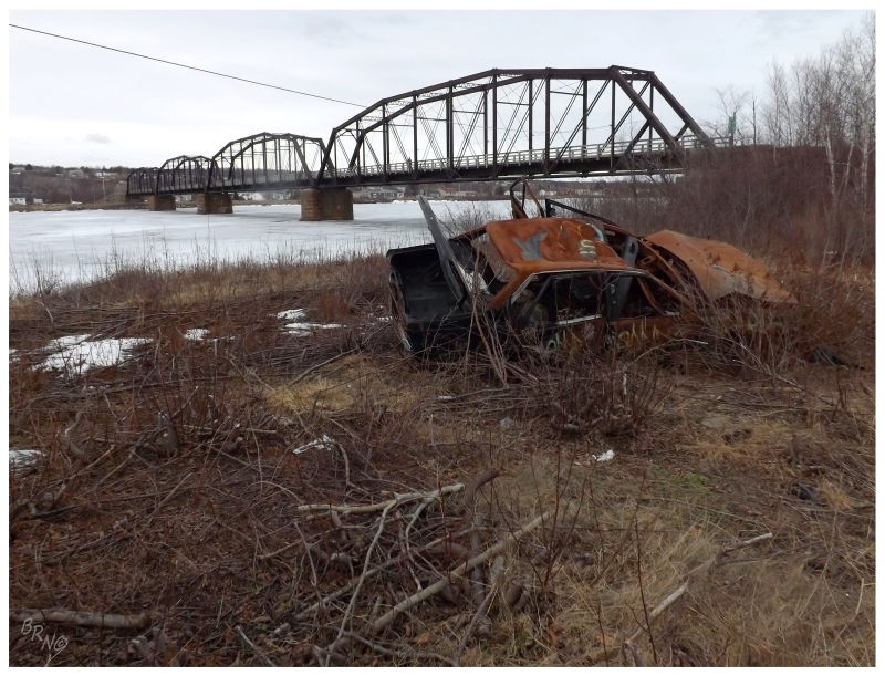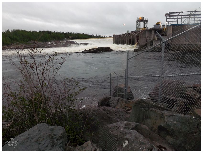
Heading across the island, I can usually get to Gander or Gambo if I leave right after work. One place I always wanted to camp was a little closer to Corner Brook, which would work today as it was raining and disorganization slowed our departure. In a province where it's so easy to tuck away on crown land or disused property, there are still some campsites that are appealing enough that I'll pay to stay there. Fallsview Municipal Park in Bishop's Falls was one of these campgrounds. It was right in town, located near our turnoff for the Bay d'Espoir Highway, and situated beside the impressive crashing waters of Bishop's Falls and its hydroelectric plant on the Exploits River. I figured this had to be a great place to camp and it had been on the radar for a while. |
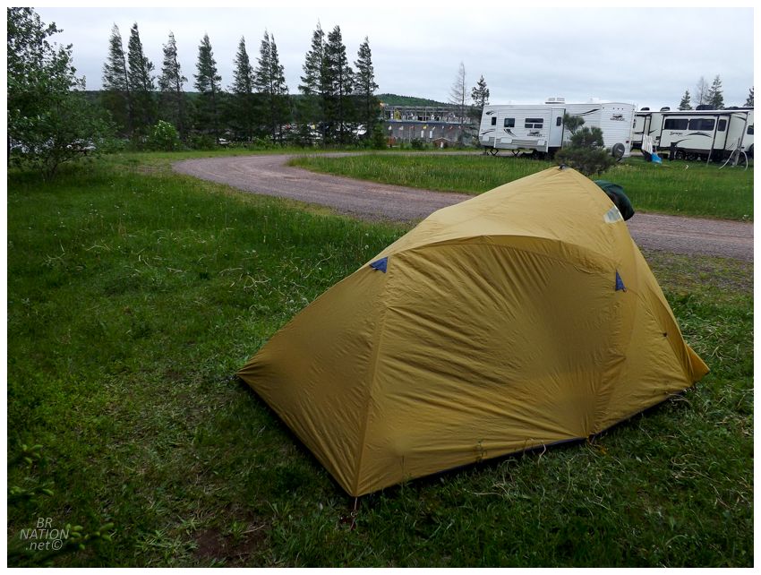
We soon found that it was one of those campgrounds absolutely jammed with people. Pulling up, the property was littered with RV's and not a single tent. Isy actually asked if I had any backup places and if we could get out of here, but I didn't have anything else previously researched. After trying to pay and not being able to find anyone working, we at least figured out that the tent sites were along a back fence by a line of trees and the backyard fences of Kennedy Place. After waiting in the car for a break in the rain, we eventually got the tent set up. With dreams of being able to crack beers by the falls and relax in the vicinity of the great cement powerhouse, we walked over there in the drizzle only to find a handful of dudes fishing and about 25 men watching them fish. The Exploits River was a veritable zoo. While I'm probably good on ever going back to Fallsview, at least as we walked back to the campground, the rain had kept everyone in their RV's and we had the campground gazebo to ourselves for a game of Cribbage. This part was much better than trying to play cards in our smallish tent. |
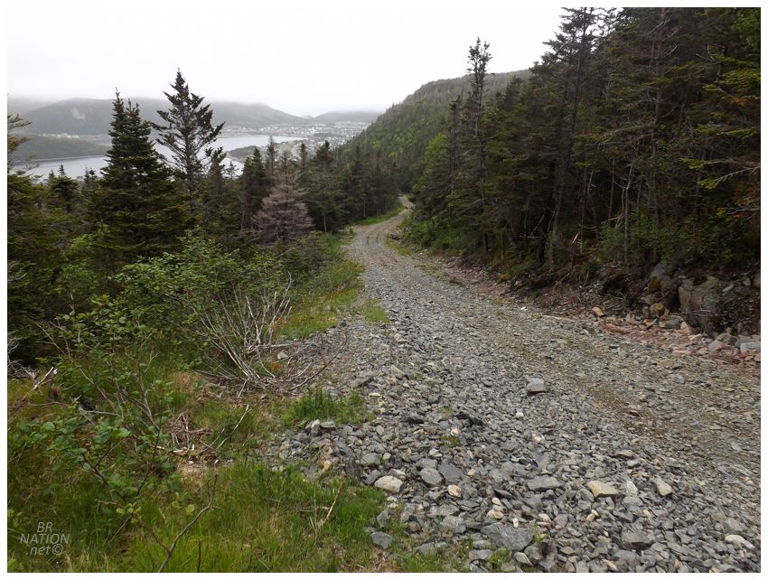
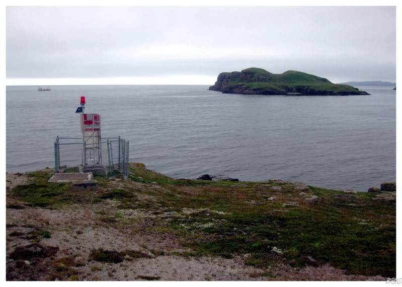
The next morning we made the long, uninhabited drive down through the central wilderness of the island, made even longer by going all the way down to Harbour Breton at the bottom of Bay d'Espoir's Connaigre Peninsula. There's a lighthouse here that my friend Mike was able to visit while working on his own art project and I'd called ahead to the harbour master in hopes of finding someone to bring us out to the same island. The harbour master said that if we were in town, he might be able to find us someone. Except that trying to get out in boat is made harder by government holidays. Since it was Canada Day, the harbour master was out of town, but he gave me the number of a guy who might be able to bring us out to the lighthouse instead - except that guy must've also been at his cabin because we couldn't reach him. We drove around looking for open stores, but even as the kind lady at the marine supply store tried various phone numbers, in the end we didn't have any luck finding someone left in town and not out at their cabin. Suddenly with a free afternoon in Harbour Breton, Isy and I then pulled over at some random trail and were rewarded with a pleasant, distant view over the town. |
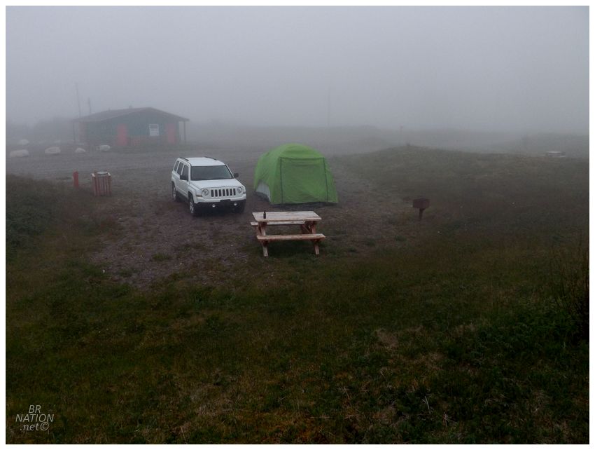
The weather was supposed to improve over the next few days & since I didn't have a ton of things left to do down here in Bay d'Espoir, we simply wrapped it up early and headed over to Harbour Breton's municipal campground. Pulling into a deserted clearing, we were happy not to be in Bishop's Falls anymore. Here at Deadman's Cove, there was only one RV and it was just left there parked without people. We had the entire, eerie campground to ourselves. Even the nearby road, which is usually heavily trafficked by residents driving down to stare at the ocean, was quiet due to the fog being thick as pea soup. |
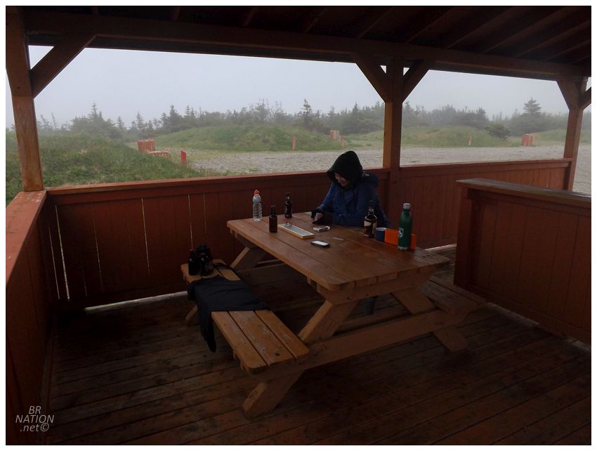
Settling down to more Cribbage, Isy was tiring of me as her social media blew up with posts from back in Corner Brook, where the west coast's 2018 spring of constant drizzle and 44°F/6°C weather had broken into a glorious Canada Day weekend with temps in the 70's and sunny skies. Everyone was posting about sitting out on decks, barbecues and cold pints - while Isy found herself on the Bay d'Espoir, wearing every last bit of clothing and trying to play cribbage while wearing winter gloves in July. Personally, I thought driving 1000km (621mi) this weekend for this weather was hilarious, but I was also smart enough to watch my back and hope she wouldn't kill me in tonight's foggy, frigid slumber. |

Click to enlarge
The next morning we woke to bright grey, an improvement over the fog and cold. Driving over to the eastern part of the Connaigre Peninsula, there was a trail over here that I'd recently discovered between English Harbour West and St. Jacques. The Blue Pinion Walking Trail led to a vacant harbour where the community of Blue Pinion used to stand. Blue Pinion ceased to exist in the 1870s though, so there isn't anything left standing today. It didn't really look like there was much good land for building structures here anyway. |
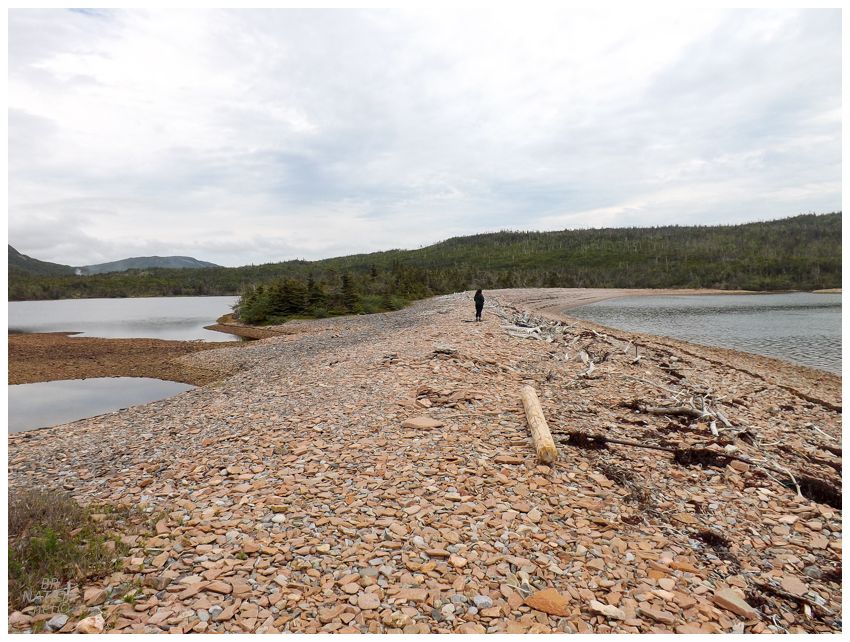
I initially thought we could carry our tent and gear to set up camp at Blue Pinion based on how the beach looks in satellite imagery. Hiking in today without our camping gear though, I was happy that we didn't do such a thing just to find this rocky mound of a beach. |
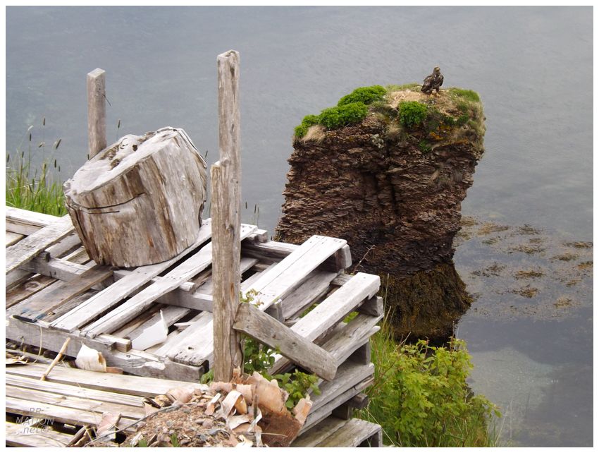
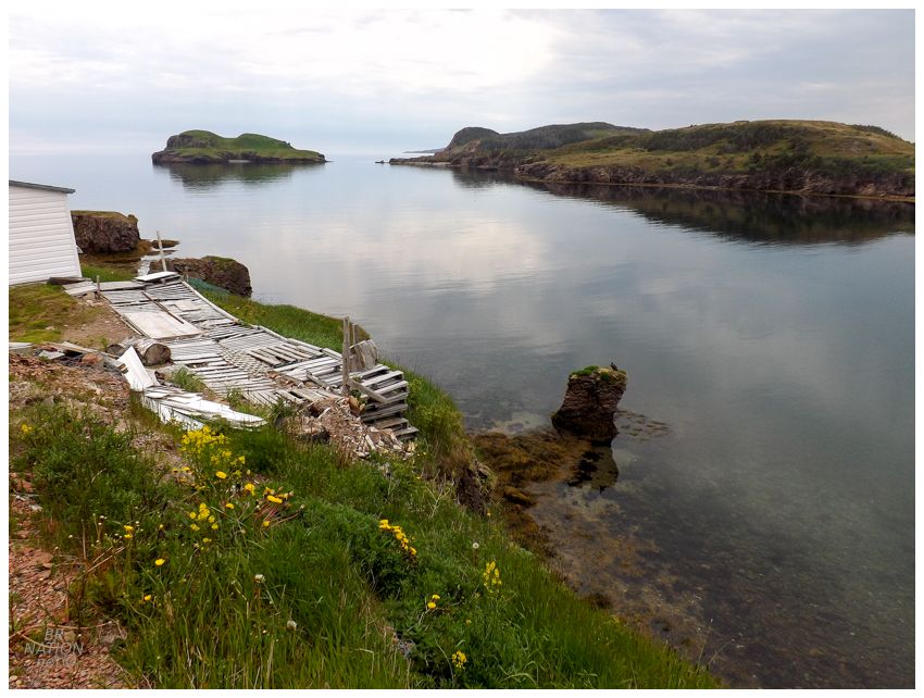
We popped over to English Harbour West next where there was a handrail that I was thinking of grinding. Except that I would have to make a 90-degree turn or use short runway to hit it, making me think it wasn't worth putting my bike together. Cruising through town to show Isy the old lighthouse point afterward, I noticed something out in the harbour on a sea stack. |
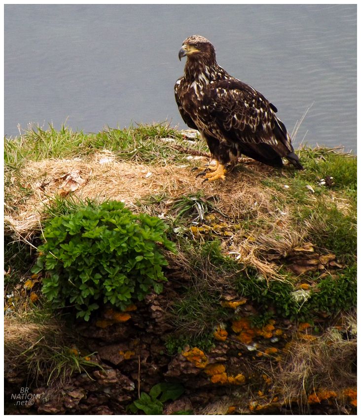
A juvenile bald eagle. |
We couldn't reach the boat guy yet again today and man was it killing me looking at the calmness of the sea. Anything remotely close to shore looked like you could just simply backstroke right out there. The arm of the Burin Peninsula was across from here and it didn't look like your boat would bob one bit if you headed off for the 17km to Point Rosie or 27km to Garnish. We would have had absolutely no problem getting out to that lighthouse if it weren't for the Newfoundland lifestyle of having a home as well a cabin. Bah. |
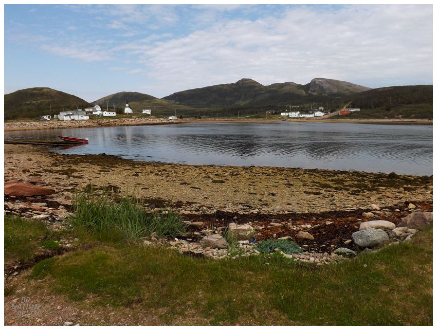
Next up was Mose Ambrose, a village I usually have to speed through because my common road trip friend has family here and a Newfoundlander can't go through a cousin's/uncle's/niece's community without stopping in for biscuits or a bit of tea. With Isy in the car though, I was free to finally pull down the one street of Mose Ambrose I'd never driven before! Exciting times! |
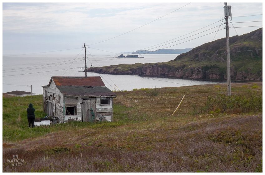
The coastline down here squeezes in headlands and harbours with incredible efficiency, so it was only 2.5km (1.5mi) after Mose Ambrose that we reached another little quad path down to a beach. Parking the car, the muddy path led us down to Little Ma Jambe Harbour to size up another possible camping opportunity. Little Ma Jambe was another rock beach though, so we returned to the NL-363 and headed all the way to the end at Coomb's Cove. Near the start of town I noticed a road going upwards above the town near this rundown shack, and figured that this land might work for putting up a tent and overlooking Coomb's Cove and the Atlantic tonight. |

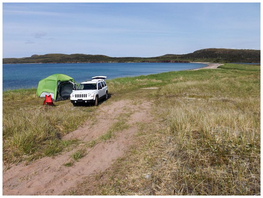
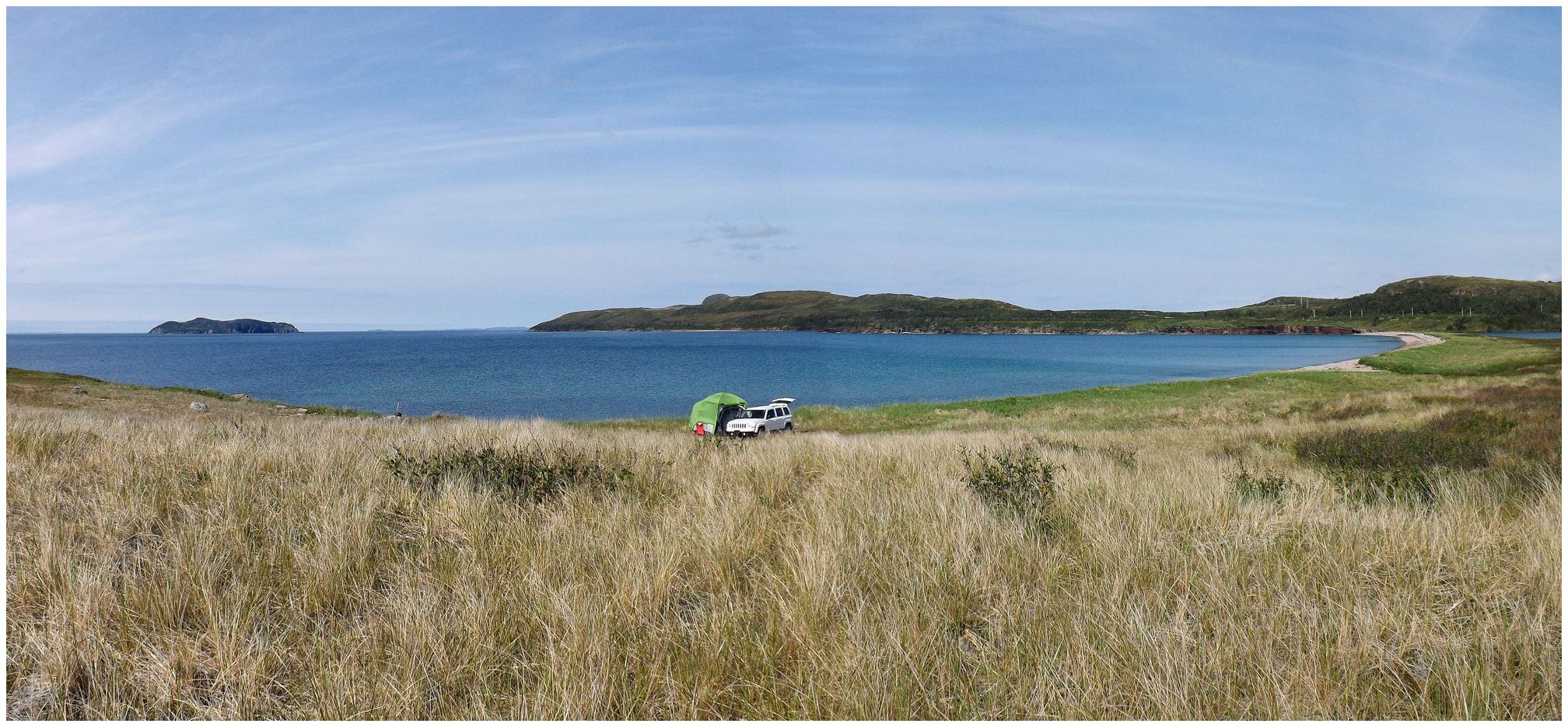
Except that we had found a prime piece of real estate earlier in the day, where we could park our car far away from everything and not have to worry at all about any visitors. |
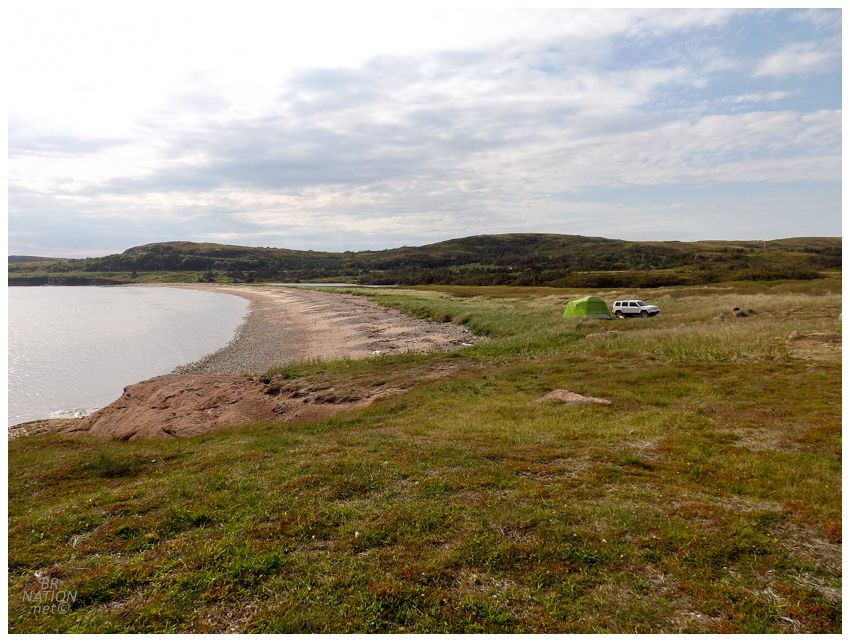
I mean, this would play. This would most certainly play. I couldn't help but think of how someone once told me that Bay d'Espoir is "the armpit of Newfoundland." It all makes the rewards that much sweeter when you know their ignorance is keeping them to the same three familiar campgrounds, while you find places like this to enjoy in solitude. |
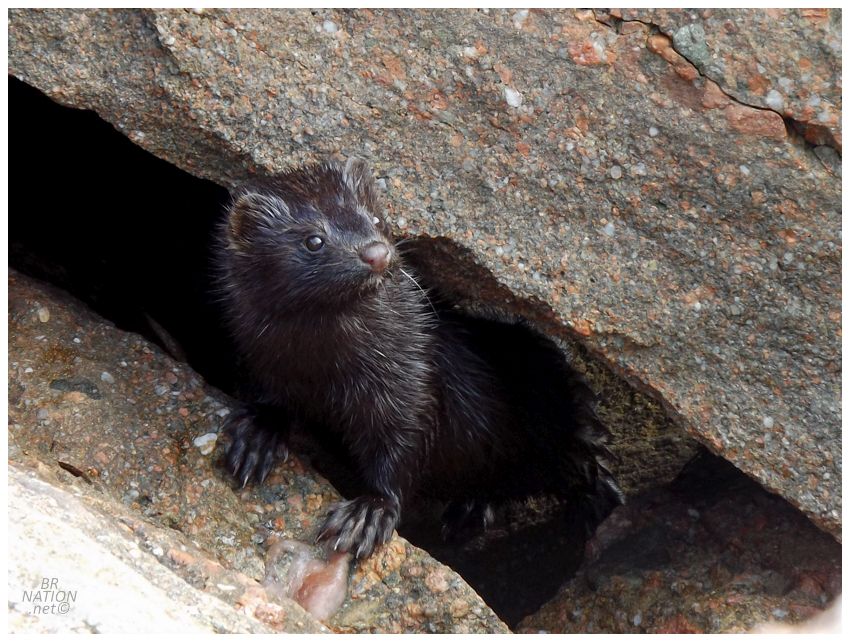
Walking down the shore, a mink scurried away from us into a rock crack & we were suddenly happy we didn't have the dog with us. I was reminded of one of my favourite Newfoundland videos...although Isy was confused when I yelled "WHAT'S DAT DERE? FUK'N MINK?!" LOL. |
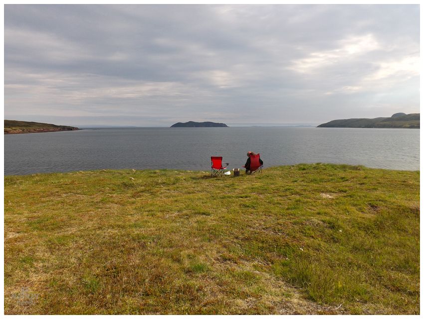
That mink couldn't have been more than a couple hundred metres from our camp and we didn't really go much further down the coast as the beach and rock shore turned to bog. With such a lovely campsite and a bit of sun breaking through, it was time to relax so very far away from other humans. |
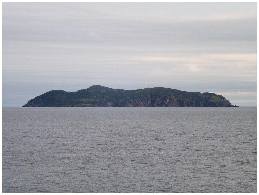
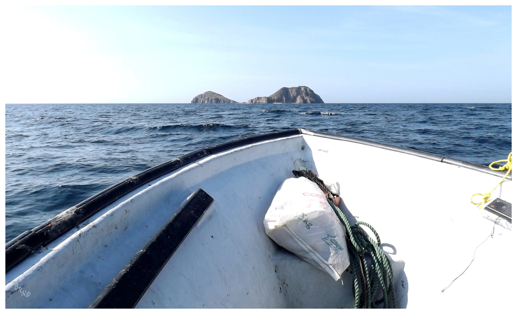
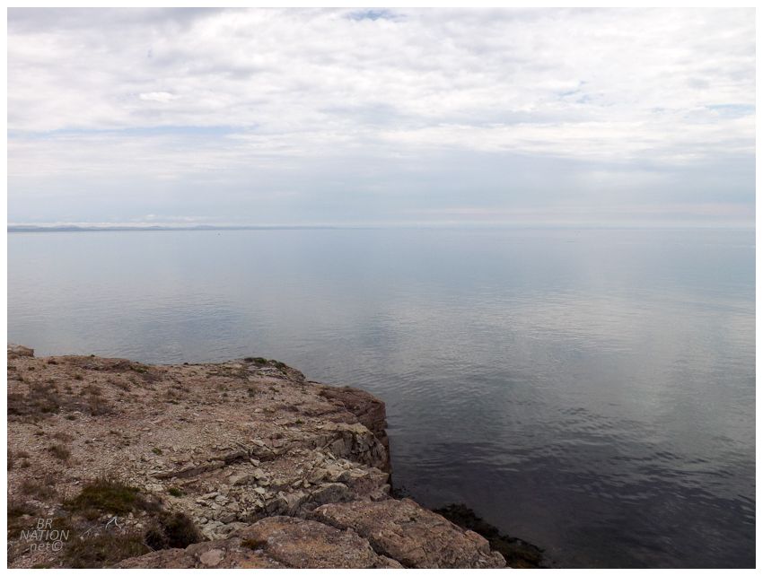
Of course I couldn't get over the calmness of the sea, leaving me sitting there fantasizing about sea kayaking out to St. John's Island, which dominated our view. |
Click to enlarge
The next morning we were no longer worried about fleeting sun rays or cloud cover when we woke up to a crystal clear sky and a quickly overheating tent. Taking off the tent fly, the onshore breeze was no longer bringing us fog, but rather warm, tropical winds. Of course this was the day we had to get back to Corner Brook, but it's not like we could really complain about the previous day with the sunny breaks, or the foggy day in the Harbour Breton gazebo either. Good times in Bay d'Espoir once again. |