I was growing tired of returning to Bonavista, Springdale, Baie Verte, and the Southwest Coast. Isy and I had an extended long weekend ahead of us and I really wanted to see something entirely knew, even if it meant putting in a sizable amount of driving. So we went forth with a plan to checkout new communities up in Labrador by driving four hours to St. Barbe, waiting an hour for the ferry, taking the 90 minute ferry across, then driving another 3 hours into The Big Land. With a morning ferry to catch, we broke up the drive's first portion by camping near Castors River up on the Northern Peninsula. |
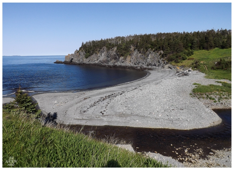
There's a good number of stealth camping opportunities along the sparsely populated and accessible Northern Peninsula coast. The one I had scouted out in Google Earth was where the gorgeous Squid Cove looked accessible via a short dirt path. |

The beach was sandy and dotted with shorebirds, the path provided exploring opportunities as it kept going out into the weeds, plus we found a big enough space to put up Isy's giant tent. This was perfect. The only thing that failed us came a number of hours later when the wind picked up off the highlands and flattened our windsail of a tent. Suddenly it was a mad dash to throw the mess of extended poles and sleeping gear into the car, wrangle the dog into the back seat, then take the front seats where we'd sleep for the night. Needless to say, we were a bit foggy the next morning. Thankfully Isy was able to grab a bit of sleep on the Labrador ferry. |
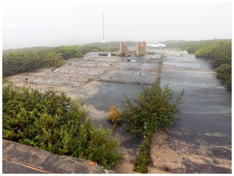
Amongst Southern Labrador, there were only two year-round communities I hadn't seen yet: the ferry-to village of Black Tickle and the remote community of St. Lewis. Instead of needing to take a ferry from Cartwright to reach Black Tickle, St. Lewis was a bit easier to reach. After the boat ride went smooth this morning, we drove nearly to Port Hope-Simpson before making a right on the NL-513 and covering the remaining 30km (18.6mi) to St. Lewis. One of the things you immediately notice when looking at St. Lewis on satellite imagery is the octagonal road network just north of town. This was the Fox Harbour (St. Lewis) Loran-C site, which was a giant radio tower used for navigation. The tower here would emit a signal and those out to sea would use receivers to listen and determine their location based on what they were hearing from the Loran-C stations here, in Comfort Cove, and in Cape Race (plus Caribou, Maine and Nantucket, Mass. if you were even further south). It didn't take long for GPS systems to make this technology obsolete. |

The tower here was the 2nd tallest tower in Newfoundland & Labrador at a height greater than 650 feet. There was nothing for me to climb today though, as the tower came down in 2011. I figured there might be some abandoned buildings or foundations still, but there was only one building left standing and it seemed to be in use. I'd later learn that a mining company doing exploration in the area is based out of this one building. |
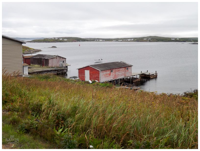
Driving into the village, 194 people live here in St. Lewis according to the 2016 census, with 25 of them being children or early teenagers. They lost about 10 people from the last census, but the number of young people and the amount of activity we saw made it seem like St. Lewis is a healthy enough community when you consider its isolation. |
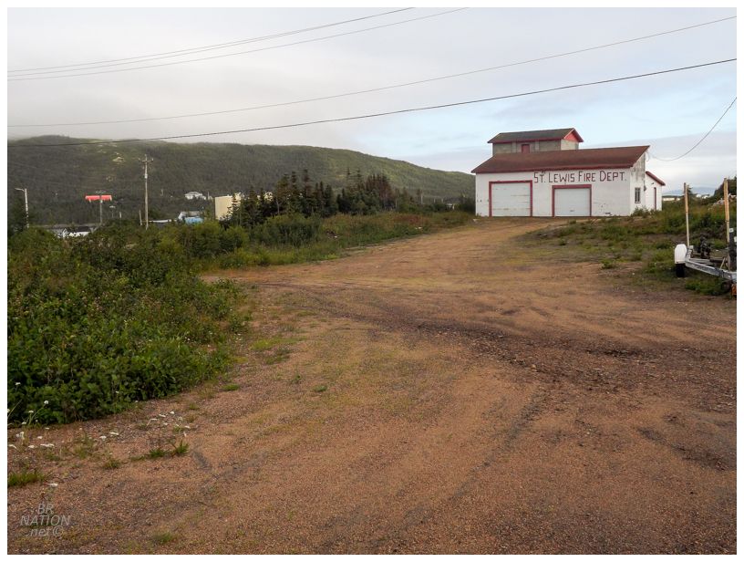
There were only four side streets to turn down, so we exhausted exploring this new metropolis pretty quickly. I enjoyed the haphazard, varying font of their fire department sign. |

I'd wanted to visit St. Lewis for almost a decade now, not because of a need to see every last community in Labrador, but because of the fact that a PineTree Gap Filler site used to exist here (well, and also so I could make St. Lewis/St. Louis Missouri jokes). I've talked about the Pine Tree Line before, but since it's been a while, the Pine Tree Line was a grouping of Cold War-era radar bases built mostly along the 50th parallel north, with additional sites along the coasts. There were main bases and then sites like the one here in St. Lewis, which was a "gap filler" between the stations of Cartwright and St. Anthony. The Americans financed and manned more of the Pine Tree Line than the Canadians, with the one here in St. Lewis being built by the Americans and then ran by the United States Air Force. The little blurb about St. Lewis' history on various Labrador websites explains the fact that these transplant Americans helped St. Lewis become less isolated and more exposed to the outside world. |
I didn't bring my bike on this trip since there are zero skateparks up here in Southern Labrador after they tore down Blanc-Sablon's a few years back. In addition, many towns don't even have paved side roads, while their locations in flat coves doesn't lead to building staircases or embankments. I quickly regretted that decision here in St. Lewis at the site of this foundation with varying platform heights. Got damn did I want to film an obscure clip here! |
Things would be okay though as we were about to camp up here! Except that Isy had seen the same signs I had, warning about wandering bears due to the town dump being only on the other side of the hill. Especially with the dog, she was probably right that it wasn't prudent to camp here. |
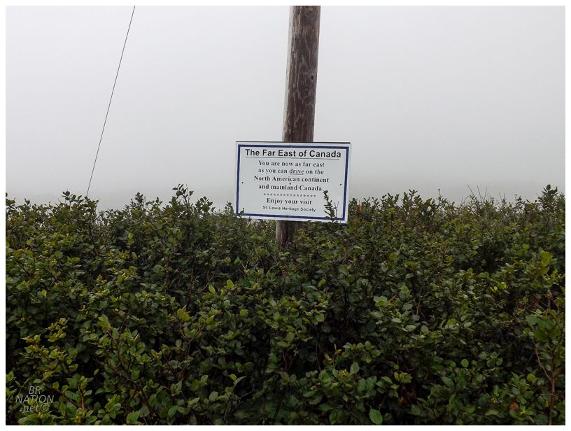
One thing we did accomplish was driving to the furthest eastward point on the mainland. |
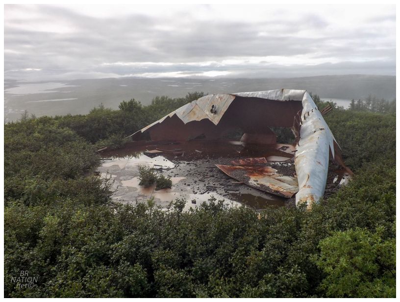
On the way up the hill to the Pine Tree site, there were these giant collapsed fuel tanks that made for a surreal scene. I had to climb a small rock outcrop in order to get a picture, although I'm not sure it even does the sight justice, in terms of the fog and the Canadian Shield spreading out in every surrounding direction from this strange giant beast. |
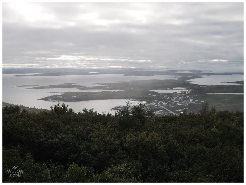
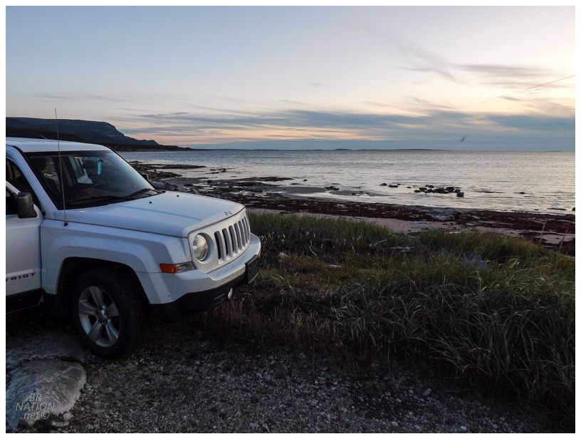
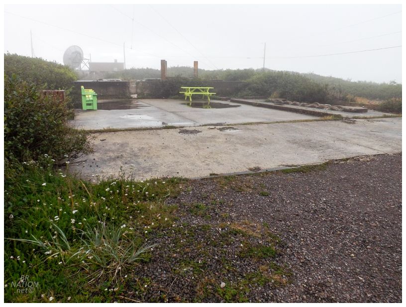
The rock outcrop also provided a decent view out over St. Lewis and the surrounding islands of St. Lewis Inlet. By now, we were thinking about where we were going to sleep. After not getting much rest in the front seats of my car last night, staying at a B&B or motel held some appeal. Especially in such a remote place, sometimes you can get a decent rate for really basic accommodations. Inquiring at the corner store, the friendly shopkeeper told us that unfortunately the woman who rents out rooms was away in Lab City. She then said we were free to camp at Picnic Park, right out on the furthest point of land where there was a little gazebo, seeing as the nearby house occupants were also away from town. The only problem was our tent. We'd spent a few questionable nights inside where it swayed and struggled in the wind, and we were truly reminded of its shortcomings just last night as it failed. There was no way we could camp out on this point of land unbuffered from the Labrador Sea. This was some bullshit, but we had to head back inland to find something more sheltered. |
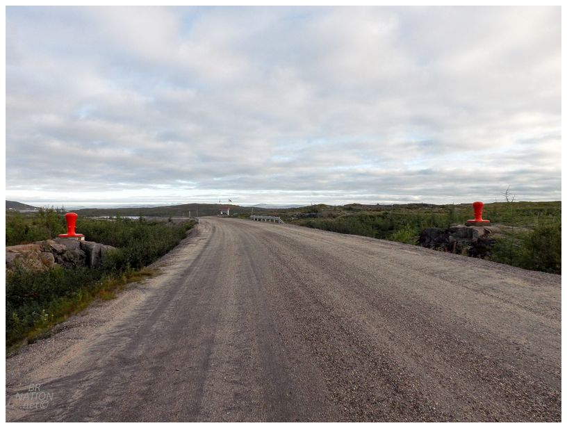
Leaving the village, a pair of bollards acted as a portal to St. Lewis. Stopping at the sight of a plaque on one of the bollards, I read that these were used from 1957 to 1961 to dock the US Navy tanker Chattahoochee when it delivered fuel to St. Lewis' Pine Tree Site. |
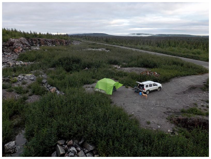
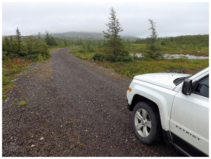
We hadn't seen many promising, sheltered camping spots along the way to St. Lewis, but managed to discover this gravel pit only a handful of kilometers outside of town. |
There were birds in the nearby trees, only maybe 2 cars passed all night, and we were able to go for a nice walk at dusk along the incredibly quiet NL-513 highway. I was bitter that we weren't camping at Picnic Point, but tried to make the best of it. We then cooked up some stew, played a few rounds of Cribbage, then hit the hay at a reasonable hour. |