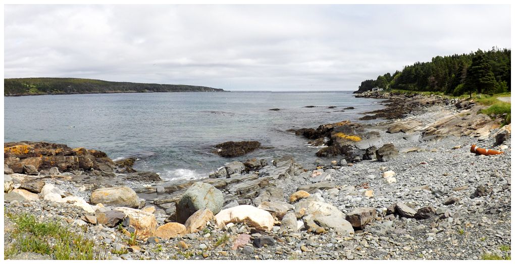
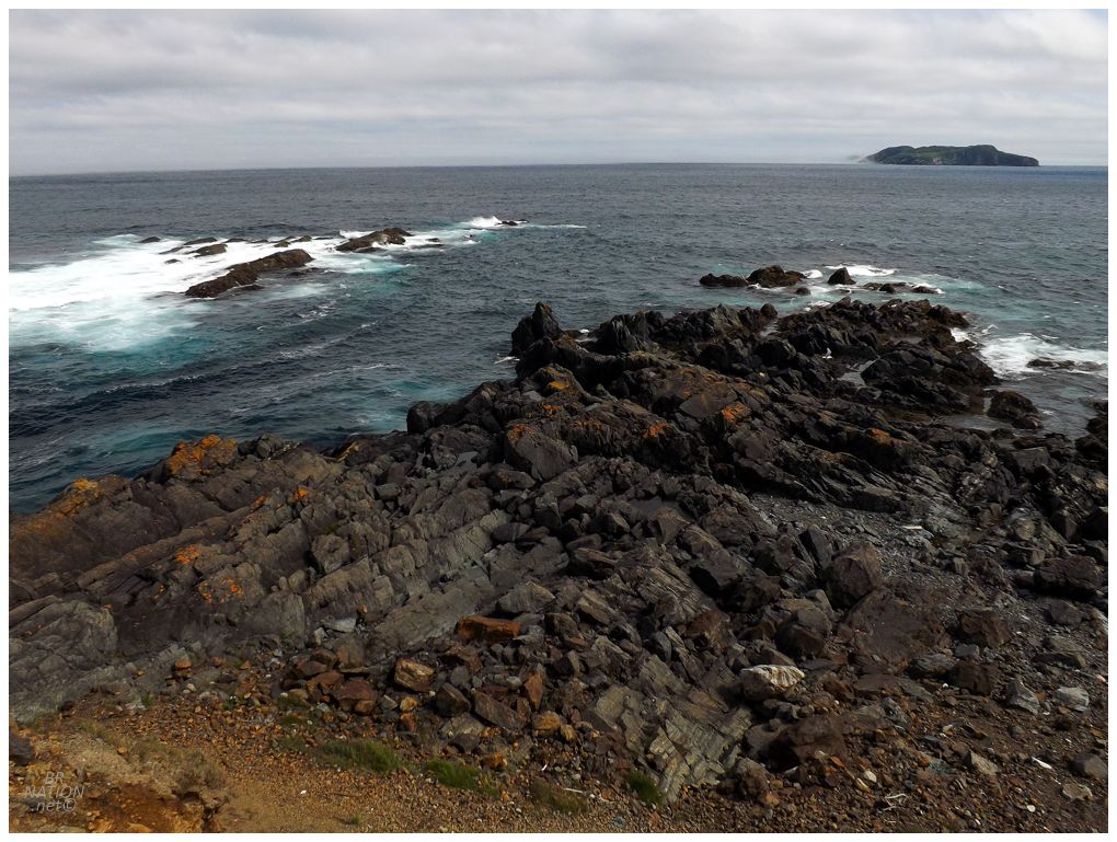
The cove in Mo-beel, Newfoundland
Staying on the Avalon Peninsula, we drove south for 30 minutes before reaching the village of Mobile. Being a geography nerd and having a love affair with certain place names, I've always meant to spend more time in Mobile, Newfoundland - just like I would if there was a Wichita, Duluth, or Saginaw, Newfoundland. Today we were in Mobile to hike another few kilometers of the East Coast Trail. |

The Tinkers Point Path from Mobile around the coast and over to Bay Bulls is 5.0km (3.0mi); which is just about the distance that we were good to go with Kingsley. I briefly entertained us hiking the entire trail and I would run back and go get the car for Isy and the dog, but in the end we decided to only hike half of the trail and all return to Mobile together. |
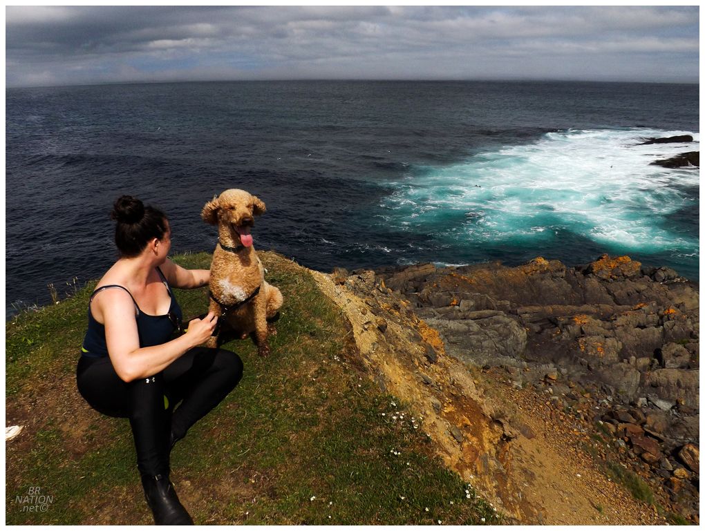
One content dog at Tinkers Point.
With this hike, I've now done 23.9km (14.9mi) of the 336km (208.8mi) East Coast Trail (7.1%), lol. |
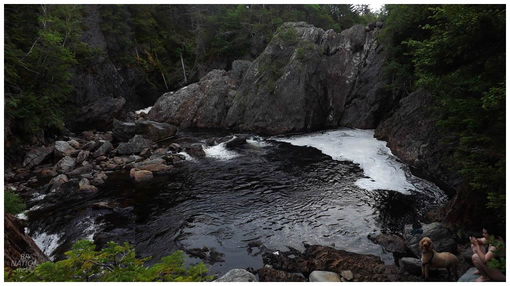
I messed up taking the pictures for this panoramic photo.
There are few things better than jumping into a swimming hole following a hike, especially one that's bathwater warm and not stop-your-heart frigid. This was also still Isy's birthday trip, and while that may not require wineries anymore, it most certainly still requires swimming. This stop would also check off my goal of "doing something more in Aquaforte". After successfully visiting every town in Newfoundland, I now enjoy filling in the gaps where I may not have done much on certain visits. Referencing my Newfoundland towns visited page, all I had for Aquaforte previously was, "Aquaforte: NL-10 goes through enough of Aquaforte for it to count. I've never stopped to take pictures or explore Aquaforte." This will now be pleasingly amended. |
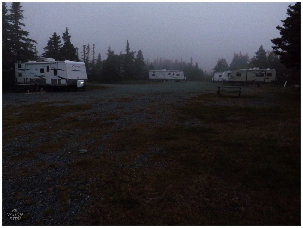
After a wild goose chase through Fermeuse, Renews, and Cappahayden that led us back to Cape Broyle for some camping beers, we were then running late as we headed back down to Chance Cove Provincial Park. Chance Cove is different from other provincial parks and closer to an American National Forest, in that there's no regular staff and you're free to no trace camp. Unfortunately, I'd heard that this has led to it being a bit of a hillbilly haven with giant RVs and campers blaring country music into the night; so as I rolled up now tired, I was slightly concerned with what I'd find. |
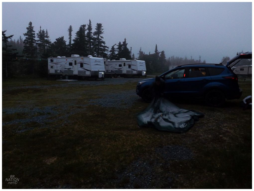
Except we found all of the RVs unattended and absolutely no one else here at this quiet section of the NL-10. Perfect. |
Having never been to Chance Cove before, I was excited for early morning wanderings and finding which of these paths led down to the Chance Cove. Following a bit of pleasant walking, I went back for Isy and the dog and Isy figured it was fine that Kingsley go off leash. Within minutes, the ruckus of a flushed grouse engulfed us as Kingsley darted after the bird. Up the path and away from us they went, but thankfully he just didn't have the speed or leaping ability to nab the grouse, as it kept going until it was out of the dog's reach. I soon had him in a I'm used to the grouse of Newfoundland flying off when I startle them on my walks, but they really can cover a great amount of ground when fleeing a dog. |

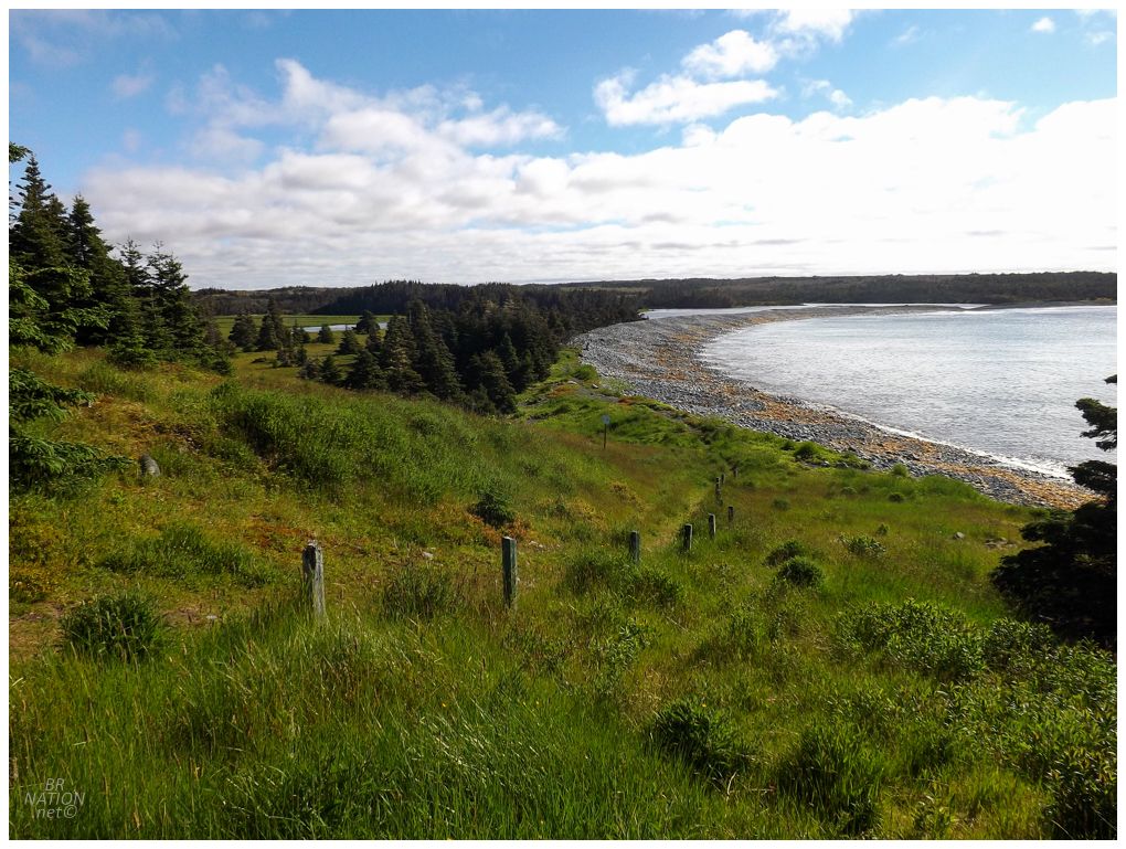
Walking out onto the rocky beach at Chance Cove, I was pleased with the views off over Cape Race. |
Continuing on the Avalon Peninsula's Irish Loop, I pulled off on Trepassey's short causeway and the island drive that brings you to Powles Head. This area of the province is some of the furthest lands away from me, so there's always an inclination to stop in places like Powles Head which I've only passed 3 times in my thirteen years here. |
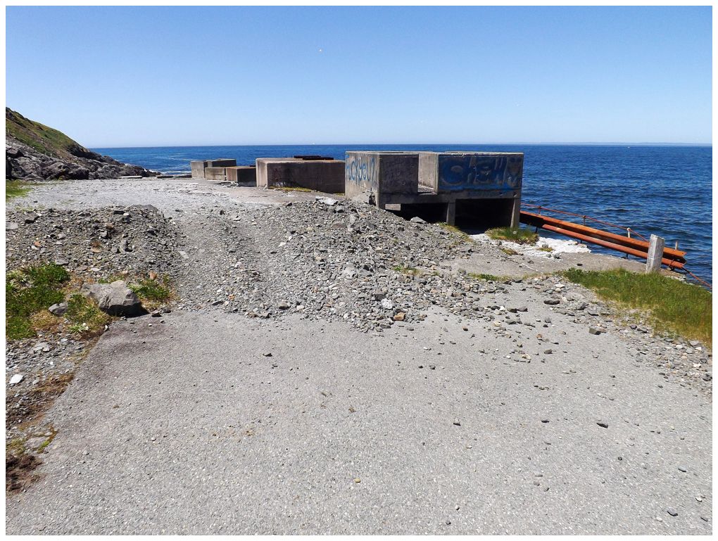
There's a beach in St. Vincent's that's renowned for its whale watching as the beach drops off precipitously and therefore whales are closer to the shore than almost any other beach. We tried stopping there to check "see a whale" off the birthday to-do list, but there was only one whale, wayyyyy off in the distance. I was psyched with our next stop over in Peter's River though - the ruins of their community wharf/dock. |
I thought about driving right out to these ruins, but figured a site like this falling into the ocean might be undercut. Turns out that was a good decision. |
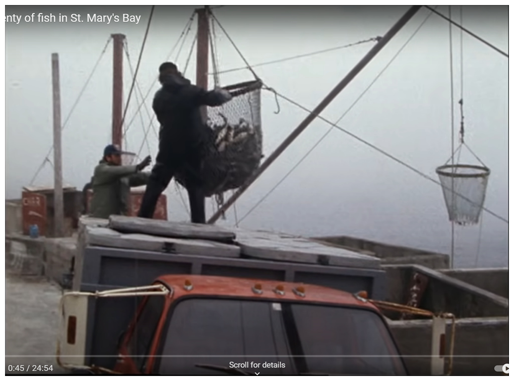
Screencap from Land & Sea: plenty of fish in St. Mary's Bay, 1986 (link).
It took me forever to find any reference to this place, which is especially surprising because it's on the popular tourist track (the Irish Loop) and it's not that far from St. John's. Even giving up on finding it via the usual abandoned building channels, I couldn't find any reference even in the local town Facebook groups. It was only in Peter's River coming up with a Land & Sea episode result, that I could see what these ruins used to be. I'm still not sure I'm using the right terminology though. The cod were being loaded into trucks and there wasn't a large building here, so it wasn't a fish plant, but would it just be an elaborate town wharf with multiple cranes? Anyway, Land & Sea states that this is how they had to unload fish in Peter's River becuase of the absence of a good harbour. The clip in the Land & Sea video is only the first minute or so, so it's worth checking out to see how these cement boxes tied into things. |
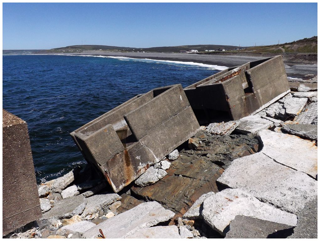

I can't imagine there's any plans for demolition here. The folks in Peter's River will simply continue to watch the sea retake this point of land. |
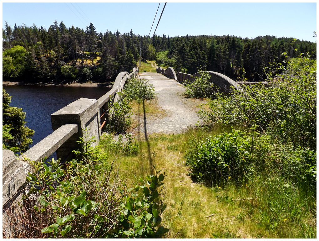
Today's swimming hole would be in New Bridge, where obviously the swimming hole was at an old bridge. New Bridge may be one of my favourite names in Newfoundland in its quaintness, "hey, we got a new bridge, let's rebrand as New Bridge!" The only thing I could love more is if there was a town called New Taco Bell. Anyway, the Encyclopedia of Newfoundland explains that once a concrete bridge replaced the old wooden bridge here in the early 1900s, the parish priest changed the name of the place from Kerwan's Point to New Bridge. |
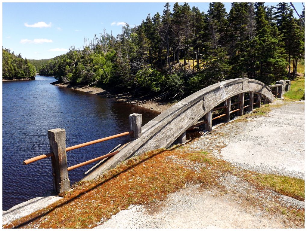
So yeah, we were swimming at the old bridge, which used to be the new bridge. The only problem was that we weren't swimming, as Isy didn't think it was a good idea to just jump in here without any local knowledge. I guess she was sort of right. "Where'd you learn about this swimming hole?" "There's this Swimming Holes of Newfoundland Google Maps map that anybody can edit!" "Ohhhhhh, okay. Yeah I don't know about this one." |
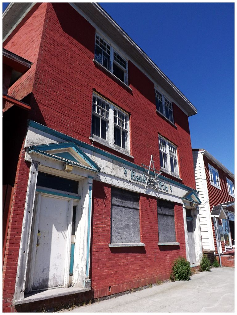
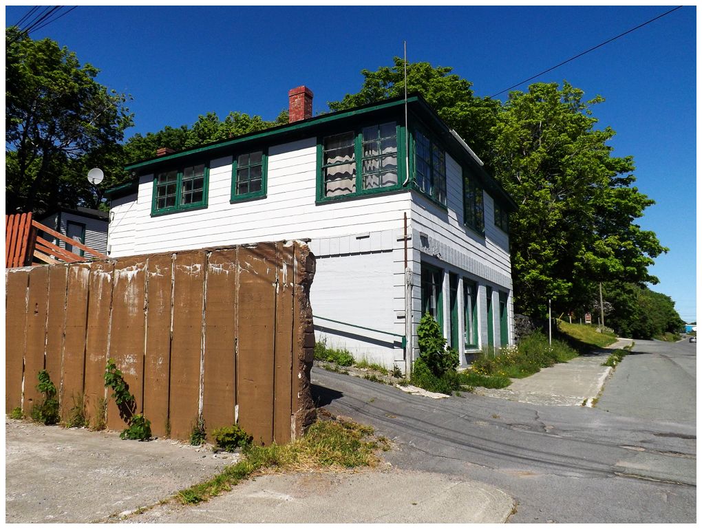
As you may have noticed from these updates, Isy isn't all that selfish with her birthday time and it doesn't have to be all whales, icebergs, and crummy fruit wine. This was great because it continued to allow me to check off stuff over here on the Avalon, where items linger because it's 7 hours away and we're usually visiting friends. Today I wanted to walk Carbonear's main street, which has a ton of both awesome old buildings and relics of old businesses. It's also a bit behind the time in the realization that they have a jewel down here, so there's always the threat of something getting knocked down for a park or suffering a fire. |
This Art Moderne building was home to the Green Door Bookstore at the time, but unfortunately it was closed. It has since closed permanently and you can see how things come and go here on Carbonear's Water Street. |

It was getting a bit hot for the dog just as we stumbled upon Carbonear's extensive cemetery with lots of historic and unique headstones. Kingsley would need to utilize the shade, because we were checking this out! |
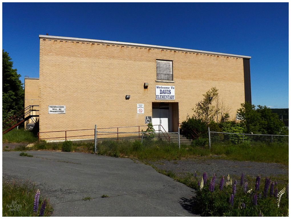
Right next to the cemetery was Davis Elementary, which I really wanted to check out because of Steve Davis, but I also wasn't about to risk my ass trying to get inside with all of these houses around. Sounds like that was a good decision on my part, as three vandals were previously caught due to the building being alarmed. The best part of the story being the vandals trying to run, but being confronted by a local. From the article: "Sheldon [Phair's friend] took the stick down and opened up the door and said, 'Good day, boys. You're all under arrest, stay where you're to.'" Oh boy, lol. |

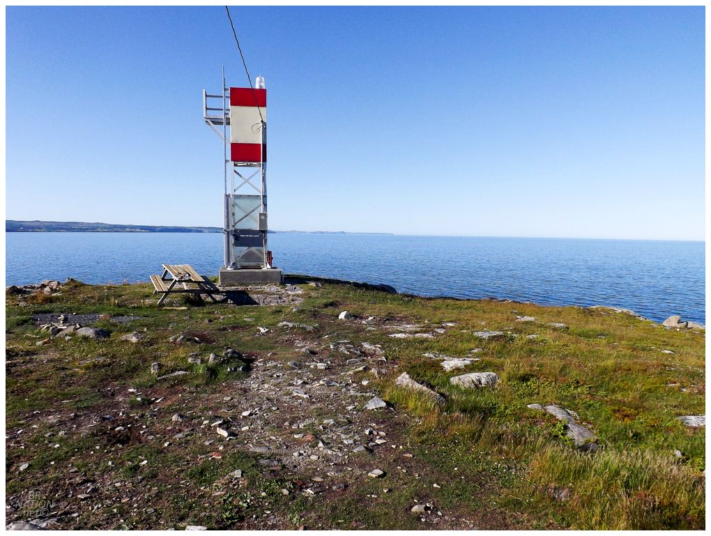
Another thing I was excited for up in this neck of the Avalon Peninsula, was how they've started or improved the trails leading out to their old lighthouse locations. While proper lighthouses don't stand at these sites anymore, I'm enough of a lighthouse nerd that I get excited about not just visiting lighthouses, but also the sites of former lighthouses! Here outside the settlement of Western Bay, the Western Bay Boardwalk leads out to a skeletal tower and the site where the Western Bay Lighthouse used to stand. (I'd be remiss not to mention the unique funding of this boardwalk, where businesses/individuals/whoever can buy replacement boards and then they're allowed to paint them with messages of their choosing. It was funny to walk along and see paintings of Carnation tinned milk, tiny businesses, silly names, etc.) |
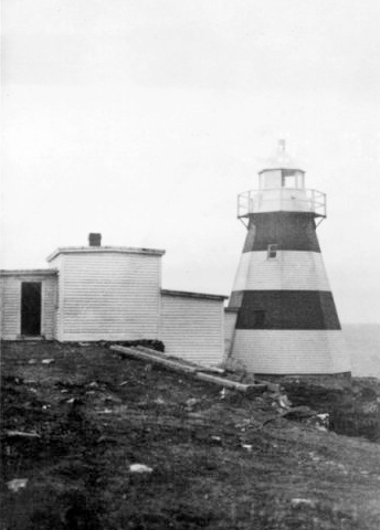
Coast Guard photo of the Western Bay Lighthouse.
There are some significant lighthouses on this finger of the Avalon Peninusla, but I've already got them (Green Point, Brigus), or they're located on remote offshore islands (Baccalieu Island). Western Bay would likely have joined these ranks, except its first lighthouse from Victoria Works was reassigned to Baccalieu Island, then the next one was reassigned to Random Head (off Hickman's Harbour). This was in 1894 and it wasn't until 1912 that a proper lighthouse was built at Western Bay Head. The problem is that this was one of the later, minor wooden lighthouses, that've all but disappeared from Newfoundland. Meanwhile, cast iron lighthouses like Random Head and Baccalieu Island have remained. The Western Bay Lighthouse was demolished in 1968. |
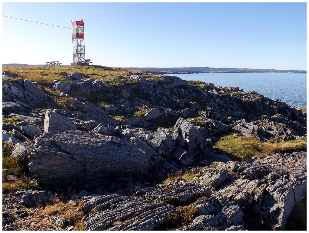
The folks in Western Bay have done a great job here with the trail and the work around the skeletal tower. Isy doesn't care too much about lighthouses, but the views here and the benches made the 20 minute walk easily worth it. We briefly considered carrying all of our camping gear out here, except that would have been a real pain, plus I had quite the camping spot lined up and the weather was absolutely cooperating. So instead we headed back to the crossover and kept it moving. |