Newfoundland (Island) Towns, Villages & Hamlets.
400-Series | 300-Series | 200-Series | 100-Series
100-Series Highways (The Avalon Peninsula)
The Cape Shore
- Route 102: Fox Harbour & Ship Harbour Road
(23.8 km/14.8 mi)
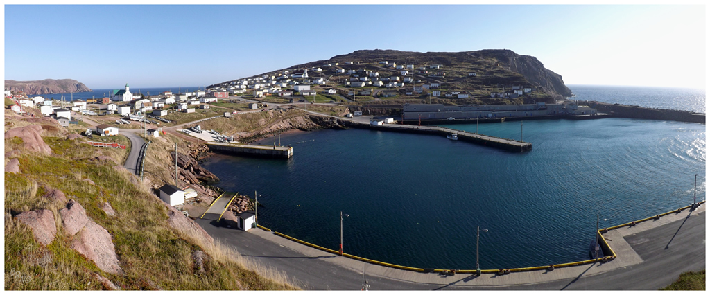
- Fox Harbour: Fox Harbour was a great little surprise. I'd happily go back so I could walk around and shoot more of the old homes. Visited in October of 2013.
- Ship Harbour: I liked the scenery and hills past Ship Harbour when I visited in October of 2013. It was amongst the last 10 villages I had to see on the island.
- Route 100: Cape Shore Highway
(111 km/69 mi)
- Dunville: You go through Dunville on Route 100. I've never stopped in Dunville to take pictures.
- Freshwater: You need to turn off Route 100 and drive the 2km Freshwater Crescent to get Freshwater. I did this & even took some photos of some interesting buildings, but never included them in an update.
- Jerseyside: I've visited Jerseyside in passing from Argentia to Placentia and back several times, but I've also went out of my way to see Castle Hill, only to find the closed gate as I'm never there in season.
- Placentia: Placentia is the old French capital and they have a fine collection of buildings, making a walk about town thoroughly worthwhile. I had dinner at The Three Sisters after visiting Cape St. Mary's in May of 2011, taking time to photograph their prominent Sacred Heart Church beforehand. In June of 2012 I ate breakfast at the Harold Hotel & explored a free house in nearby Southeast Placentia. In September of 2019, I again ate at the Three Sisters Pub, before exploring Castle Hill.
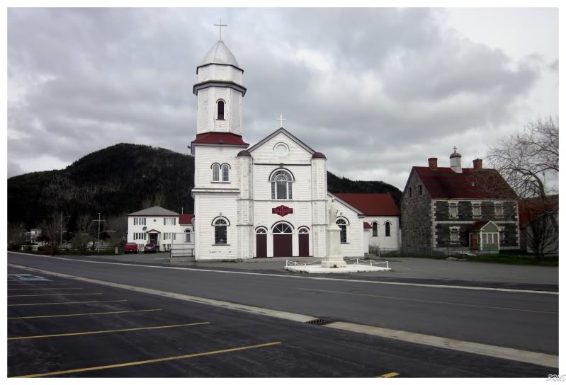
Placentia, 2011.
- Point Verde: I stopped to photograph the Point Verde Lighthouse In July of 2010. I found Point Verde to be a scenic little spot, one that I might've enjoyed more if it wasn't raining buckets. In November of 2015 I stopped and finally saw the lighthouse on a sunny day.
- Little Barasway/Great Barasway/Ship Cove/Gooseberry Cove/Patrick's Cove/Angels Cove/Cuslett: You drive through all of these towns on Route 100 by virtue of their small size and how the highway goes right down what would be the main street of these tiny villages. There's great scenery and some old homes, but I've only driven Route 100 once in 2010 really hungover on the way back from St. John's (an 11 hour drive when you detour to Cape St. Mary's) and one other time in spring of May of 2011, where I needed to get to my dinner and accommodations. One day I'll dawdle in Cuslett & Gooseberry Cove.
- St. Bride's: I stopped to take a picture of the Bird Island B&B, but never included the picture in an update.
- Route 100-17: Point Lance Road (10.5 km/6.5 mi)
- Point Lance: I have no idea why I decided to go down the road and see Point Lance in 2011, but boy am I glad I did. It would have been one of the last places I got otherwise, as it is very isolated and very far from me. I posted the only picture I took in Point Lance, one of the worst pictures ever, of a culvert before town. There's so much more to Point Lance and I dream of the day I'll be able to go back.
- Route 92: North Harbour- Branch Highway (51.7 km/32.1 mi)
- Branch: Branch is a scenic village with old homes where I've inexcusably never stopped to take a picture. I've obviously been through on both of my Cape Shore trips.
- North Harbour: You go right through North Harbour on Route 100, but I've never stopped to take a picture. I've obviously been through on both of my Cape Shore trips.
- Route 91: Old Placentia Highway
(48.6 km/30.2 mi)
- Southeast Placentia: I was driving along in June of 2012 when I noticed that a free Southeast Placentia house was being offered and I couldn't help but check it out.
- Colinet:
I went to Colinet after Cataracts Provincial Park in May of 2011, but didn't post any pictures. I posted a sunset picture from Colinet when I drove the NL-93 highway in April of 2013.
- Route 81: Markland Road (27.9 km/17.3 mi)
- Markland: Route 81 goes past Markland. It's a really close call here whether it goes through "enough" of Markland to count. I better stop and drive 10km off of the Trans-Canada to see more of Markland next time I'm on the east coast of the island.
- Whitbourne: I've driven around Whitbourne and took multiple pictures that I remember liking, but I guess I never posted them. I don't even have an update where I reference this. Hmmm.
The Irish Loop
- Route 93: Mount Carmel Road
(17.5 km/10.8 mi)
- Harricott/Mount Carmel: I went out of my way to finally drive the NL-93 in April of 2013. As it was nearing nightfall, I only stopped to take a picture of the sunset once past Harricott into Colinet.
- Mitchell's Brook: A 6.3km road goes from the NL-93 to the end of Mitchell's Brook. I stopped here and looked at some rundown boats, but when a car quickly came into the shipyard I got out of there. I didn't post any pictures from this visit in April of 2013.
- Route 94: Admiral's Beach Road
(18.5 km/11.5 mi)
- St. Joseph's: St. Joseph's had some nice old homes, but as it was at the start of the NL-94 and I was all jazzed up about getting to Admiral's Beach for sunset. Enough of the NL-94 goes through it to count. April of 2013.
- O'Donnells: I didn't stop to take any pictures in O'Donnells. You go through enough of the town on the NL-94 for it to count. April of 2013 trip.
- Admiral's Beach: I was going to stop at the fish plant to watch the sunset, but after some of the b'ys were down there I opted for some random beach at the start of town instead. April of 2013.
- Route 90: St. Mary's Bay Highway
(80.5 km/50 mi)
- St. Catherine's : You go through enough of St. Catherine's on the NL-90 and NL-91 for it to count. I've never stopped to explore or take a picture. I have stopped at the North Atlantic.
- Forest Field: You go through enough of Forest Field along the NL-90 for it to count. I've never stopped to take a picture in Forest Field.
- New Bridge : You go through enough of New Bridge on the NL-90 for it to count. There's an old bridge in New Bridge, which greatly amuses me, but I've never stopped to take a picture. In June of 2021 I finally stoped to take a picture of the old bridge in new bridge, but we skipped on the swimming hole.
- Route 90-15: Mall Bay Road (5.6 km/3.5 mi)
- Mall Bay: You need to drive 5km off of NL-90 at Riverhead to get Mall Bay. I did this in April of 2013 to go see Mall Bay. I really liked the gravel road over the highlands that led there, and the look of Mall Bay, but it frustrates me that I only produced really mediocre pictures. I'd like to go back.
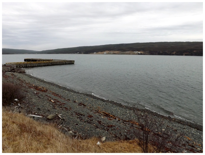
Mall Bay, 2013.
- Route 90: St. Mary's Bay Highway
(cont.)
- Riverhead: You probably drive through enough of Riverhead on NL-90 for it to count, but I've also driven through it to Mall Bay & on one of Riverhead's side streets to check out this old quonset hut building they used to have. I've never posted a picture from Riverhead.
- Saint Mary's : You need to drive through Saint Mary's to reach Point La Haye Lighthouse by car. I did this in November of 2009 and again in October of 2013. I also went through additional Saint Mary's roads when I went to get Path End in April of 2013. I've never posted a picture from Saint Mary's.
- Path End: You need to turn off of NL-90 and drive 3 km on Molloy's Hill Road to visit Path End. I did this in April of 2013. Path End was a funny little place that I'd NEVER have went to without this goal of seeing every place in NF. This was another example of being very happy that I came upon this goal.
- Point La Haye: I went through Point La Haye on the first attempt to see the Point La Haye Lighthouse in November of 2009; although I never posted any pictures of the actual town.
- Gaskiers: Enough of the NL-90 goes through Gaskiers for it to count. I've never stopped in Gaskiers.
- Saint Vincent's: Enough of the NL-90 goes through Saint Vincent's for it to count. I stopped at the start of their causeway in November of 2009 & on the Saint Stephen's side of the causeway in April of 2013. I mention stopping to watch the whales in June of 2021.
- Route 10: Southern Shore Highway
(174 km/108 mi)
- St Stephen's: The NL-10 goes right through St Stephen's. I didn't stop to take a picture in 2009 or 2013.
- Peter's River: I pulled off of the NL-10 to see Peter's River in April of 2013, but after being on the fence about the quality of my shots, one of my pictures of Peter's River was left on the cutting room floor.
In June of 2021 we walked out to the ruins of the fish plant(?).
- Route 10-52: St. Shott's Road (12.6 km/7.8 mi)
- St. Shott's: You need to drive 12.6km off of NL-10 to get St. Shott's. I mistakenly did this in November 2009 after I missed/was confused by the Cape Pine turnoff. In March of 2013 I returned to Cape Pine and wondered off into the barrens to the southwest, but I didn't return to St. Shott's.
- Trepassey: I went through Trepassey to get Powles Head Lighthouse in November of 2009 (and again to visit Powles Head in October of 2013). This brought me upon Trepassey Battery as well. I also stopped for gas and was amused by the attendant letting me use the washroom by getting up from his seat behind the register and opening a door to a 5ft x 5ft room behind him. In June of 2021 I stopped to check out Powles Head on a sunnier day.
- Biscay Bay: I stopped to shoot pictures of a Greater White-Fronted Goose at Biscay Bay in April of 2013. I also took some pictures of an old house in Biscay Bay, but they didn't make the cut.
- Portugal Cove South: I've stopped to take pictures of the "Trepassey/Cape Race" directional sign before PCS, but never any pictures of the homes in town. By virtue of going to Cape Race Lighthouse along its 20km gravel road, I've driven through Portugal Cove South in April of 2009 and again in October of 2013.
- Cappahayden: Driving the Irish Loop three times, I've therefore been through Cappahayden three times. I've never stopped to take a picture or explore. I'd like to walk that ATV trail to Path End one of these years.
- Renews: In July of 2010 I went back down the Irish Loop for the lighthouses I missed in 2009. This brought me into Renews to see the now-demolished Bear Cove Point. I liked the backroads of Renews as well, because they were narrow and felt like what I imagine Wales or Ireland to have.
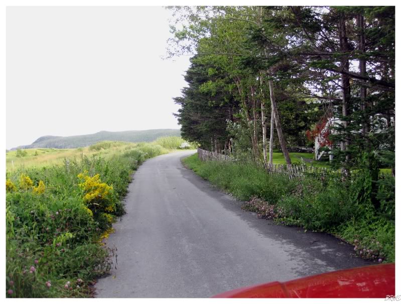
Renews, 2010.
- Route 10: Southern Shore Highway
(cont.)
- Kingman's: In April of 2013, I went back for several communities I missed in 2009. Although I didn't post a picture, I drove the 1.5km off of the road to check out Kingman's.
- Fermeuse: I stopped to take a picture of Fermeuse's Ryan Clowe welcome sign in July of 2010. In 2013 I went through much more of town in order to see Kingman's & Port Kirwan.
- Port Kirwan: In April of 2013 I went back for several communities I missed in 2009. Although I didn't post a picture, I drove the 4km off the NL-10 to check out Port Kirwan.
- Aquaforte: NL-10 goes through enough of Aquaforte for it to count. I've never stopped to take pictures or explore Aquaforte. In June of 2021, I stopped with Isy to hit a swimming hole in Aquaforte.
- Ferryland: Ferryland is my favourite Newfoundland lighthouse and maybe my favourite anywhere. I hiked there in July of 2010 after also admiring a fine stone church in Ferryland proper. I've since returned to Ferryland and might post interior pictures of this church in the future.
- Calvert: I drove into Calvert to see it in April of 2013. I liked the view across the bay to Ferryland Lighthouse and the nearby islands.
- Cape Broyle: NL-10 goes through enough of Cape Broyle for it to count. I've since went to their Riverside Restaurant, but we'll see if that makes it into a future update.
- Shore's Cove: Driving out of my way to see Admiral's Cove, I went through Shore's Cove. I've never taken a picture of Shore's Cove.
- Route 10-Admiral's Cove Road (2.2 km/1.4 mi)
- Admiral's Cove: In April of 2013 I drove the Irish Loop again to see some communities I had missed before. I went to Admiral's Cove, but didn't post any pictures. I've since been back to Admiral's Cove, so maybe some pictures of Admiral's Cove are coming in future updates.
- Brigus South: Went out of my way to see Brigus South during my April of 2013 trip. Unfortunately it was raining a bit, but Brigus South was still nice & had some old, photogenic homes. In July of 2019 we left out of Brigus South to do the Flamber Head Trail portion of the East Coast Trail.
- La Manche: I've never been to the provincial park/resettled site, but I drove the road into the cabin community of La Manche in April of 2013. I didn't post any pictures from the road in the woods with cabins flanking the road. In July of 2019, I finally went to the resettled site.
- Route 10-32-Burnt Cove Road (4 km/2.5 mi)
- Burnt Cove/Saint Michael's/Bauline East: I drove the 4km NL 10-32 in 2013 to see these 3 villages in April of 2013. As it was a dreary day I went light on the pictures, only posting one of Bauline East.
- Tors Cove: The NL-10 doesn't go through enough of Tors Cove to count & I'm happy that my April of 2013 trip made me go onto the side streets. It's a beautiful community with an opulent church, offshore grassy islands and old homes. Unfortunately it was dreary when I was there. I've since been back & it reinforced that Tors Cove would be top 10 on my list of favourite NL communities. In January of 2019 I returned to check out their doomed church.
- Mobile: I automatically love places with Alabama names, but I've never stopped in Mobile to take pictures or adventure. Enough of the NL-10 goes through Mobile to count it. Finally in June of 2021, I chose to stop in Mo-beel to hike some of the East Coast Trail.
- Witless Bay: I counted visiting Witless Bay by virtue of driving through 4 times, but I'm happy that a recent trip had spare time to dawdle about town. There's enough old homes and crazy church buildings, that Witless Bay pictures will come in a future update.
- Bay Bulls: In July of 2010 I tried to get to the Bay Bulls Lighthouse but ran out of daylight. I made it in November of 2011, also snapping pictures of the standoff house & the cannon church in the process. I stopped yet again in April of 2013 to check out an abandoned satellite dish, but resorted to taking pictures of Northern Flickers after a fence kept me out.
- the Goulds: The NL-10 makes up the main street of the Goulds. I didn't stop in 2009, 2010, 2011 or 2013, but I've since stopped at the Ruby Church and that should come in a future update.
- Kilbride: The NL-10 makes up the main street of Kilbride. I've never found much of a reason to stop in Kilbride, although they have one of those atrocious old school skateparks, so maybe I'll stop at that one of these days.
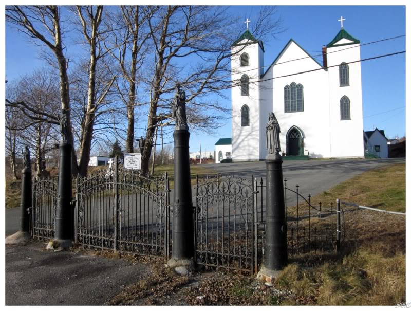
Bay Bulls, 2010.
The St. John's Area
- Route 11: Petty Harbour
Route
(6.0 km/3.7 mi)
- Petty Harbour: I went for a drive in April of 2013 while staying in the capital, driving almost all of the Petty Harbour Road. Petty Harbour was a pretty village with an old street network and homes that have been there for a while. Another nice discovery because of trying to see every Newfoundland town.
- Maddox Cove: I passed through Maddox Cove in April of 2013 while driving the Petty Harbour Road. I only included a picture of Petty Harbour in the update as Maddox Cove seems like the place where people go to build their McMansions (which isn't really my thing, no offense).
- Blackhead Road
- Shea Heights : I've driven through Shea Heights a handful of times to reach Cape Spear, but never posted a picture from there.
- Blackhead: I've driven through Blackhead a handful of times to reach Cape Spear, but never posted a picture. I visited Cape Spear in November of 2008, June 2009, July 2009 and July 2011.
- Capital
Area
- St. John's: The first time I went to St. John's in November of 2008 I photographed the Grace Hospital nursing residence, Hamilton Ave, Holloway St, Halliday's Meat Market, Signal Hill, the cathedral, the Battery, the old Nurses' quarters by the penitentiary and then most of these again in the rain. I brought my friend Kristen here in June of 2009 to briefly see the town and photograph Signal Hill. I went to Fort Amherst in July of 2009. In November of 2009, I found myself in an amazing old home on King's Bridge Road before leaving for the Irish Loop. In February of 2011 I included a harbour shot from the Quality Inn. In July of 2011, my friends came to visit me for a weekend of golf, George Street and Fort Amherst. In November of 2011 I photographed the St. John's Courthouse interior and went to an Ice Caps (AHL) hockey game. In October of 2013 I returned to photograph the St. John's Courthouse exterior at night. In November of 2017, I photographed the Belvedere Orphanage and went to Fiddlers Pub afterwards. In September of 2018, I rode Quidi Vidi, Southland, Kilbride, and Bowring Park skateparks, partied on Bonaventure Avenue, and grinded the rail at Booth Memorial - all while staying in Airport Heights. In January of 2019, I finally had Moo-Moo's while also in town to celebrate Rosie's bday. In January of 2020, I visited a day after they lifted the Snowmageddon order. In December of 2020, I visited my friend and we ate at No.4 Cathedral and drank at the Trinity Pub, mere days before the end of the year. In June of 2021, I saw Matt Hornell play, some shitty kids heckled me, I checked out the new Kenmount Terrace skatepark, and missed out on the Vagina Monologues. In September of 2021, I came to town to check out Hurricane Larry and ride some good parks.
- Mt. Pearl: I've been to Mt. Pearl about 5 times to ride their impressive skatepark. I lamented it still having an ice layer on a November morning in 2011. In October of 2013 I drove back from Bay Roberts just to ride the skatepark, only to find it still wet before driving 7 hours back to Corner Brook. Mt. Pearl would be my favourite skatepark here although that isn't saying much. What's impressive is that a 24000-person town in Newfoundland can build such a park. It's significantly better than everything else in Newfoundland.
- Route 30: Logy Bay Road (11.9 km/7.4 mi)
- Outer Cove/Middle Cove: I went to the ruins at Red Cliff in November of 2009, but that didn't even get me to Middle Cove. I've since driven this road while heading out to Cape St. Francis, but I've never taken a picture in either of these three communities. Returned to Cape St. Francis in June of 2021, but again, no pictures, although I stopped at Middle Cove Beach to check out the rolling caplin.
- Torbay: I went to ride the Torbay skatepark in September of 2018, but they were replacing it. In June of 2021, I found it replaced and it was decent.
- Route 20: Torbay Road (31.6 km/19.6 mi)
- Flatrock: I mistakenly drove into Flatrock while trying to get to Cape St. Francis in March of 2010. I didn't stop to take any pictures. In September of 2018 I walked through town and walked to Red Head Cove on the East Coast Trail.
- Pouch Cove: Drove through and around Pouch Cove on my way to Cape St. Francis in March of 2010. I didn't post any pictures from Pouch Cove in the update though.
- Route 21: Bauline Road (10.8 km/6.7 mi)
- Bauline: Bauline was amongst the last 100 towns that I had left to visit. Going out of my way to see it in May of 2013, I found a beautiful little village. I'd love to go back on a nicer day.
- Route 40: Portugal Cove Road
(12.3 km/7.6 mi)
- Portugal Cove: The ferry to Bell Island leaves from Portugal Cove, so I had to have been there in July of 2010 and in November of 2011. In September of 2018 I returned to ride their skatepark. In January of 2019 I returned to explore their abandoned pig farm.
- Ferry: Bell Island Ferry
- Wabana: I went to the lighthouse, the underground mine tour & the No. 4 mine entrance on a visit to Bell Island in July of 2010. In November of 2011 I went back to the lighthouse, to Jackson Memorial School and to their decent skatepark.
- Freshwater/Lance Cove: I drove the circular route of Bell Island in July of 2010 and again in November of 2011, even if I didn't post any pictures from Freshwater or Lance Cove.
- St. Phillip's: I went to St. Phillip's on a random drive one day, one where I didn't make an update. I remember appreciating that church they eventually tore down in 2015. I always meant to go back for pictures, but I guess it's too late now. In September of 2018 I went back for their skatepark.
- Route 50: Thorburn Road (11.6 km/7.2 mi)
- St. Thomas: I drove through here on a random drive to St. Phillip's, but never stopped to take any pictures.
- Paradise: I drove through Paradise on that random drive to St. Phillip's, but never stopped to take any pictures.
- Route 60: Conception Bay Highway (72.9 km/45.3 mi)
- Topsail/Chamberlains/Manuels/Foxtrap/Upper Gullies/Lance Cove: I would have these towns from other drives, but I went through again as I went from St. John's to follow the Conception Bay Highway in search of Seal Cove & Indian Pond in May of 2013.
- Kelligrews: I would have Kelligrews from other drives, but in 2013 I went through again as I went from St. John's to go up the Conception Bay Highway in search of Seal Cove & Indian Pond in May of 2013. I've also stopped to photograph the Orangeman's Lodge in Kelligrews, although I never included this picture in an update.
- Route 60-Seal Cove Road
- Seal Cove/Indian Pond: I drove out of my way to get these two communities in May of 2013. I didn't count them without driving at least 2km of Seal Cove Road.
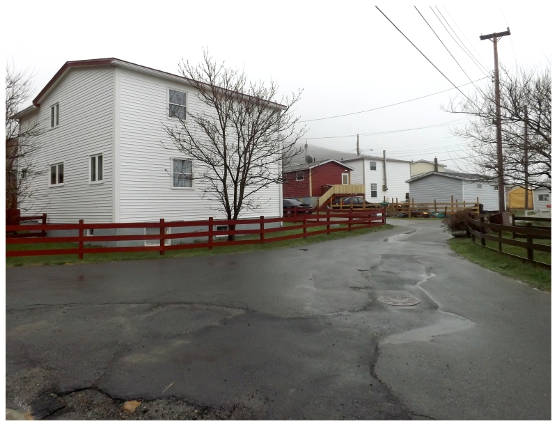
Bauline, 2013.
The Baccalieu Trail
- Route 60: Conception Bay Highway
(cont.)
- Holyrood: I've stopped in Holyrood a couple of times, but I was waiting to go into their abandoned factory to ever make an update. They tore down that factory this year & now I don't know if I'll ever post a picture from Holyrood.
- Woodford's: I drove this stretch of the C.B. Highway in February of 2011 and May of 2013, but didn't stop to take any pictures in miniscule Woodford's.
- Lakeview: I drove this stretch of the C.B. Highway in February of 2011 and May of 2013, but didn't stop to take any pictures in Lakeview.
- Harbour Main: I drove this stretch of the C.B. Highway in February of 2011 and May of 2013, but didn't stop to take any pictures in Harbour Main.
- Route 60-Point Road
- Chapel's Cove: Chapel's Cove is about 1km off of the highway. I drove up here and photographed sheep in front of a handsome barn in February of 2011.
- Route 60-Harbour Drive
- Gallows Cove: Gallows Cove is about 1.5km off of the main highway. I drove up here in May of 2013 while out seeing some of the communities I had missed. There's a picture of a handsome old Gallows Cove house in the update.
- Avondale: Avondale is a lovely little place where I should have a picture from by now. I drove through in May of 2013.
- Middle Arm: The boob that I am, I missed tiny Middle Arm on my trip specifically to get Conception Bay towns in early 2013. So I went back in October of 2013 and really sunk my teeth into all 650 metres/2100 feet of road that makes up Middle Arm. Included is a street scene picture, a boat sinking in the Middle Arm of Conception Bay, and a house that looks like it belongs in Tromsø (but don't get me wrong, this house is 1000x better than all brown siding McMansions.)
- Route 60-Kitchuses Road
(6.6 km/4.1 mi)
- Kitchuses: I visited Kitchuses on my May of 2013 trip to Conception Bay for towns I hadn't yet seen. I admired an old cat house at the end of the road.
- Bacon Cove: I visited Bacon Cove on my May of 2013 trip to Conception Bay for towns I hadn't yet seen. I pretty much only took a picture of the seashore solely because it was called Bacon Cove.
- Conception Harbour: I think the wreck of the SS Charcot would be considered "in" Conception Harbour. Regardless, the road you take to the wreck brings you right through Conception Harbour. They also have a beautiful church, but it was a dreary day so my picture didn't make it into the update from May of 2013.
- Colliers: Colliers is a close call whether it should count by only driving on the Conception Bay Highway. If you want to criticize me Colliers might be a good spot, as I only have it from driving by in February of 2011 and May of 2013.
- Marysvale: Marysvale could use some extra exploration, including the Turks Gut House, but I've never stopped to take a picture. More criticism please!
- Georgetown: I haven't stopped to take a picture in Georgetown either. The Conception Bay Highway goes through more of Georgetown though.
- Brigus: Brigus is one of the jewels of the island. I stopped there to walk around the old homes, churches and through the Brigus Tunnel in April of 2010. In February of 2011 I went back for a falling down house, winter scenery, bohemian waxwings and a vacant school. I went back to hike to the lighthouse in June of 2012. Sadly, Brigus was my last lighthouse I could reach without the help of fishermen.
- Cupids: I drove into Cupids and snapped pictures on trip in 2012. Although it was a great stop and I liked Cupids, I never posted any of these pictures.
- Cupids Crossing: Cupids Crossing is right on the Conception Bay Highway & I've also turned down Seaforest Dr to get to Cupids from here. I've never stopped to take a picture.
- Trans-Canada Highway:
- Brigus Junction: I set out to see the three cabin communities of Brigus Junction, Mahers & Ocean Pond in May of 2013. Brigus Junction was by far the coolest of the bunch, so of course I didn't take a picture for some reason. I'll be stopping by again in the future.
- Mahers/Ocean Pond: Mahers and Ocean Pond were very similar cabin communities of setback abodes along wooded roads. I took a picture of Mahers when I visited these two in May of 2013.
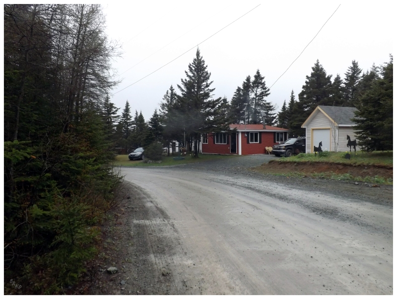
Mahers, 2013.
- Route 70: Conception Bay North Highway (113 km/70 mi)
- Makinsons: I drove through Makinsons when I was making sure I had seen Emerald Vale & Springfield in May of 2013. I didn't stop to take any pictures or find adventure in Makinsons.
- Emerald Vale: I drove out of my way to get Emerald Vale in May of 2013, but I didn't take any pictures there. I only included a picture of Juniper Stump Road which leads to Emerald Vale.
- Springfield: I happened to drive through Springfield while looking for Emerald Vale in May of 2013. I didn't include a picture of Springfield in the update.
- South River: South River is a nice place right along the Conception Bay North Highway, but I've never stopped to take a picture. Passed through in April of 2010 and May of 2013.
- Route 70-Clarke's Beach Road (1.8 km/1.1 mi)
- The Motion: How I waited until town #767 to get "The Motion, Newfoundland and Labrador" is beyond me. I snapped a picture of a nice farm with sizable background hills in The Motion. May of 2013.
- Clarke's Beach: Clarke's Beach is another place that you "get" by simply driving along the Conception Bay North Highway; but where I'd like to take a better look. I passed through in April of 2010 and May of 2013, but never posted a picture from Clarke's Beach.
- Route 70-North River Road (3.3 km/2.1 mi)
- Halls Town: Halls Town was another place that I set out to see in May of 2013. I loved their old general store along N River Rd right through town.
- North River: North River Road leads off of NL-70 through North River & Halls Town. I drove this road to see these two communities in May of 2013, but didn't post a picture from North River.
- Country Road: I enjoyed that I had spent hours in that sleepy Tim Horton's drive-thru in Bay Roberts, but never realized one of the towns I had left to see was just on the street behind me. I drove Country Road to Country Road in May of 2013.
- Route 70-Shearstown Road (4.3 km/2.7 mi)
- Butlerville: In May of 2013 I enjoyed Butlerville for #763, where the forest disappeared and there was this standalone community inland next to some sizable hills.
- Shearstown: After seeing Butlerville, I took Shearstown Road back to the Conception Bay Highway in May of 2013. This brought me through Shearstown, where I was amused by a funny patriotic house.
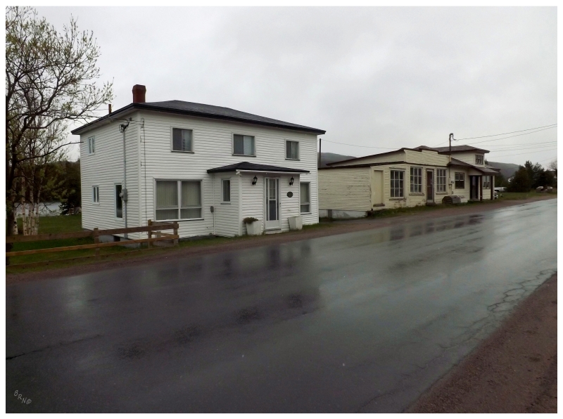
Halls Town, 2013.
- Route 72: Port de Grave Road
(9.9 km/6.2 mi)
- Black Duck Pond: I've driven the NL-72 to see Green Point Lighthouse in April 2010 and in October of 2013. You drive right through Black Duck Pond on the NL-72.
- Bareneed/Port de Grave/Hibbs Cove: In October of 2013 I took my time to photograph the rocky cove of Hibbs Cove, the old buildings of Port de Grave & the fantastic St. Mark's Anglican in Bareneed (the last one, while a dog barked at me from 10 feet away). Unfortunately as I already had an update with Green Point Lighthouse from April of 2010, I didn't end up saying very much about the area or including many pictures from my second visit.
- Route 73: New Harbour Road
(17.5 km/10.9)
- Tilton: I drove through Tilton while leisurely traveling from Dildo to Brigus in 2012. I didn't stop to take any pictures in Tilton.
- Route 70: Conception Bay North Highway (cont.)
- Coley's Point: I just realized that the picture I included in my May 2013 update (44 Water Street) actually shows Bay Roberts instead of Coley's Point. Regardless, this was all in an effort to see Coley's Point where I drove about five different roads wondering if I was "in Coley's Point". I was in Coley's Point, but I didn't take a picture in Coley's Point.
- Bay Roberts: I went through Bay Roberts and ate at their Quiznos in April 2010 and in May of 2013. I also rode their new skatepark in October of 2013. Kids, please stop with the pump tracks.
- Route 70-Water Street (6.1 km/3.8 mi)
- Frenchs Cove/Mercers Cove: I accidentally drove the 6km down this peninsula in April of 2010 while looking for the Green Point Lighthouse. Heck, I even went into a restaurant asking for directions in Frenchs Cove. I don't remember taking any pictures in Frenchs Cove or Mercers Cove.
- Spaniard's Bay: I drove through Spaniard's Bay on my 2010 and 2013 trips, only stopping to take a picture of a bald eagle in a self-storage parking lot in October of 2013.
- Bishop's Cove: I've driven from Upper Island Cove to Bishop's Cove during a 2011 visit where I didn't make an update. I didn't take any pictures or find any adventure.
- Upper Island Cove: I drove through Upper Island Cove in 2011, but didn't make the time to explore or take pictures. It's a beautiful place & I look forward to going back. In November of 2015 I returned and photographed a couple of gorgeous abandoned houses, one of which was torn down shortly after.
- Spoon Cove: Briefly driving around Upper Island Cove & Spoon Cove in 2011, I didn't make the time for exploration or pictures. In November of 2015 I parked the car and walked out on the seaside trail at the end of Spoon Cove.
- Bryant's Cove: I went through Bryant's Cove by driving from Harbour Grace to Upper Island Cove in 2011. I didn't make the time for exploration or pictures. In November of 2015 I parked the car and walked out to the start of the horse pasture at the end of Bryant's Cove.
- Harbour Grace South: I woke up early one September 2011 morning to go see Harbour Grace South's majestic lighthouse.
- Riverhead: Went out of my way in May of 2013 to go see Riverhead, about a 20 minute drive past the other towns I was visiting around Bay Roberts. I included a picture of their 1886 church.
- Harbour Grace: I woke up early one morning in September of 2011 to go check out Harbour Grace and found their awesome, historic stone courthouse. I was very impressed & had toutons at the Hotel Harbour Grace afterward as a result. In November of 2012 I rushed to Harbour Grace to photograph Ridley Hall, as the local town council approved demolition for whoever brought the property. Although to date it hasn't been knocked down (knock on wood x 1000). In November of 2015 I visited Harbour Grace for my birthday, seeing their arena before it was vacated, staying at the Hotel Harbour Grace, walking around town in the morning, and photographing the Ridley Offices and the cathedral. In December of 2020 I finally returned to Harbour Grace to properly check out Ridley Hall.
- Bristol's Hope: To get Bristol's Hope you need to drive 5km off of NL-70 and take the back way into Carbonear. I did this in 2011, but never made an update or took a picture in Bristol's Hope.
- Carbonear: Carbonear is a sizable, historic Newfoundland town, but I've only ever posted a picture of their mid-century movie theatre in September of 2011. Carbonear deserves a proper walkabout. In June of 2021, Isy and I went for a quick walkabout that included downtown plus their historic cemetery and Davis Elementary. Also in June of 2021, I rode the newish Carbonear Skatepark and appreciated their antiquated Wal-Mart.
- Freshwater: I happened to drive into Freshwater when I drove through Carbonear the first time & kept going. This was during that April of 2010 time, even though it isn't mentioned in the update. In November of 2015, my friends and I stopped here and walked out to the point of land near the Davis House.
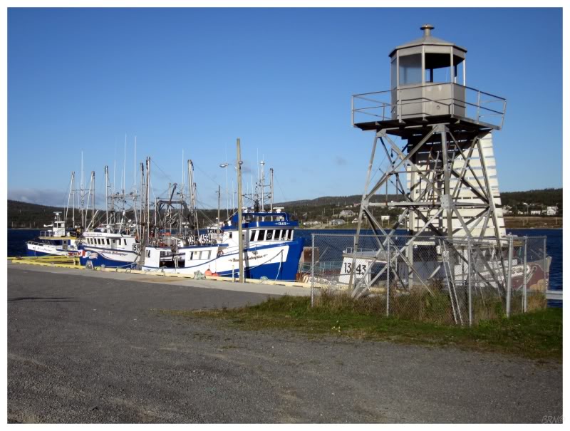
Harbour Grace South, 2011.
- Victoria: I've had ice cream at Victoria's Irving gas station a couple of times, but never took a macro shot of the ice cream.
- Salmon Cove: I travelled out to Salmon Cove to spend time with a friend, but never made an update from the visit. We went to the Salmon Cove Sands and I took a picture of the Orangeman's Lodge.
- Perry's Cove: During this visit to Salmon Cove, we went on a drive and came back through Perry's Cove from the north. Again, no pictures posted (I believe I stopped to take some in Perry's Cove though).
- Kingston/ - GAP - /Broad Cove/Blackhead/ - GAP - /Ochre Pit Cove/Smooth Cove/Northern Bay/Long Beach/Gull Island/Job's Cove/Lower Island Cove: In 2010, my girlfriend was sick and I couldn't in good faith stop at every enticing house/view I found. In 2012, I was running out of daylight & wanted to see something in Harbour Grace. Driving the NL-70 you go right through these towns, but boy could I ever easily spend a weekend in this area.
- Small Point: In June of 2021, I included a picture of some cool old store(?) or business(?) while going through the area. Surprised I couldn't figure out the history of the Small Point building.
- Western Bay: In June of 2021, I hiked out to the skeletal tower where the Western Bay Lighthouse used to stand.
- Adams Cove: I took a picture of the "NL-70 Adams Cove" sign in 2010, but didn't include it in the update.
- Burnt Point: I stopped to take a picture of their sea arch in 2012, but didn't include it in the update because the picture was junk.
- Caplin Cove: I stopped at a stunning old house in Caplin Cove in November of 2012.
- Route 70-54: Low Point Road (3.3 km/2.1 mi)
- Low Point: I drove the 3km off of the NL-70 to go see Low Point in November of 2012. There was a lovely mansard roof at the end of the road and a few abandoned buildings around. I loved the scenery and the stark landscape; I'd love to camp near the shore at Low Point. I included 3 pictures because of how much I loved this village.
- Route 70-56: Red Head Cove Road (3.7 km/2.3 mi)
- Red Head Cove: Visited Red Head Cove in November of 2012, walking down to the daunting red rocks of their cove so I could photograph the distant Baccalieu Island Lighthouse. I also photographed an old house with a calico cat hanging out on the windowsill.
- Route 70-61: Grates Cove Road (7.5 km/4.7 mi)
- Grates Cove: I visited Grates Cove in April of 2010 while going past other places because I knew it was a National Historic Site. It was a foggy & drizzly day, but I still got out to photograph the rock walls. I visited again during my 2012 trip, but didn't include any new pictures. In June of 2021, I camped along the cove in Grates Cove on a glorious early summer evening.
- Bay de Verde: About 2.5 km from the fork to Red Head Cove, I was blown away by Bay de Verde in November of 2012. I spent the better part of an hour driving the town's roads, taking in and photographing as much as possible. Bay de Verde is easily top 10 on the Newfoundland pretty town list.
Bay de Verde, 2012.
- Route 80: Trinity Road (104 km/64 mi)
- Route 80-39: Daniel's Cove Road (4.4 km/2.7mi)
- Daniel's Cove: I went out of my way to see Daniel's Cove in November of 2012 after I missed it in 2010. It was a nice little cabin community along the ocean.
- Old Perlican: I saw Old Perlican in 2010, but went through more of it in November of 2012. I was impressed by its size. I would have to go back and/or have spent additional time in Old Perlican, but sadly the Coast Guard tore down their lighthouse in the early 2000s.
- Lead Cove/Sibley's Cove/Brownsdale/New Melbourne/New Chelsea: I went through these five places in April of 2010 and November of 2012 without including pictures in the updates. They deserve better coverage.
- Hant's Harbour: I went to the Hant's Harbour lighthouse in April of 2010 and again in 2012. It's a neat, wooden relic.
- Winterton/Turks Cove/New Perlican: You drive through enough of these places along the NL-80 for it to count, but Winterton & New Perlican are both great, historic Newfoundland villages with winding lanes and old homes. I need more time on the Bay de Verde Peninsula.
- Heart's Content: I ended my day of lighthousing at the well-maintained Heart's Content Lighthouse in April of 2010. It was awesome because it was starting to get dark, but going south on the NL-80 I could see Heart's Content Lighthouse up ahead guiding me towards the beacon. I also visited in 2012, but without including any pictures in the update.
- Heart's Desire/Heart's Delight: With my love of special town names, I'm surprised I never stopped here. Passed through both in 2010 and in 2012.
- Islington/Cavendish/Whiteway: I went through all of these places in April of 2010 and in November of 2012 without including pictures in the updates. They deserve better coverage.
- Green's Harbour: I thought it was funny that their pharmacy is in their Home Hardware. I remarked on this in 2010 & included a picture in November of 2012.
- New Harbour: I stopped to photograph New Harbour's Anglican church and an abandoned house in December of 2020.
- Hopeall: I drove through Hopefall a bit on that 2012 trip to help my friend see the village, but I didn't include a picture.
- Dildo: As I knew my friend Steve would love it, I had to stop in Dildo and take a picture of their post office in June of 2012. I also biked the handrail at the post office a bit. In December of 2020, I stopped to ride their skatepark - I couldn't believe there wasn't a polejam or a fun box in Dildo.
- South Dildo: I turned in South Dildo to go to Spread Eagle in June of 2012. I didn't take a picture of South Dildo.
- Route 80-10: Spread Eagle Road (5.3 km/3.3 mi)
- Old Shop: I went through Old Shop to get to Spread Eagle in June of 2012. I didn't take any pictures or find any adventure in Old Shop.
- Spread Eagle: As I knew my friend Steve would love it, I had to wander into Spread Eagle in June of 2012.
- Blaketown: You drive through Blaketown on the NL-80. I did this in 2010 and twice in 2012 without stopping to take a picture. I thought about stopping to grind this handrail in Blaketown, but the car was clogged with camping supplies and I was feeling lazy.

Daniel's Cove, 2012.
Other Places: 400-Series | 300-Series | 200-Series | 100-Series
Or return to the Main Page of this Website.


