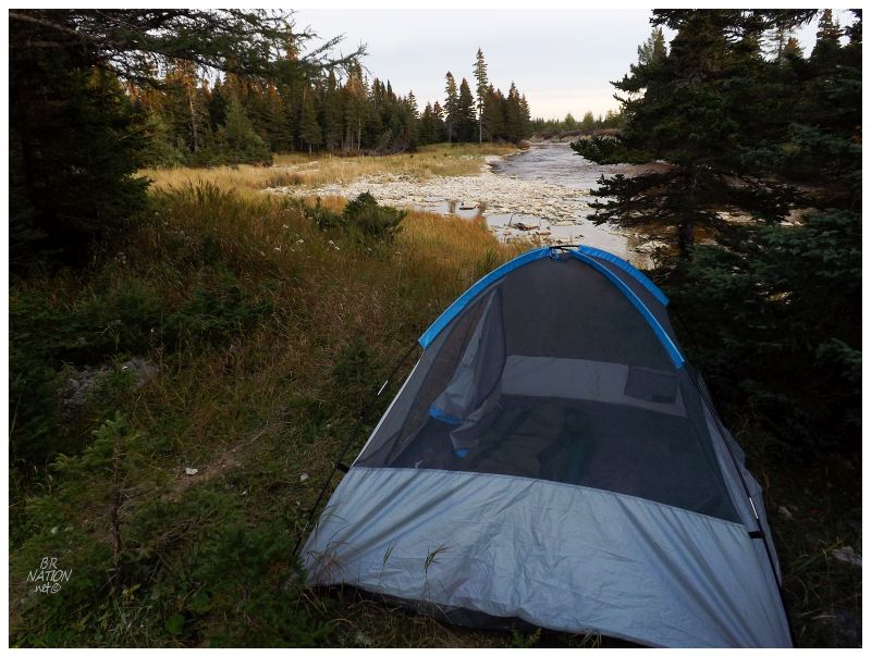
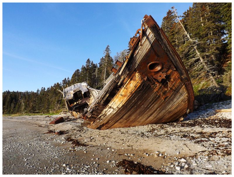
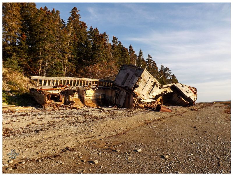
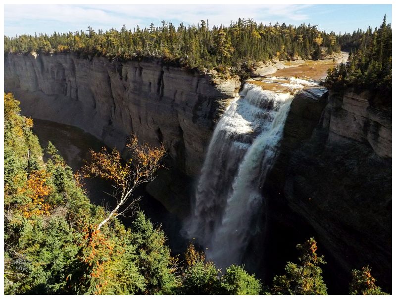
The campground where I spent last night & woke up this morning is known as the Wilcox Campground. This name comes from the fact that amongst the 20-site area, one campsite has a well-maintained staircase behind it, leading down to the wreck of the Wilcox on the beach below. |
Committing to coming down here this morning anyway, I focused on failing to light my camp stove instead of checking out the Wilcox last night. On the brink of complete darkness I took a gander over the edge down towards the ship, but as shipwrecks have always creeped me out, I was content with my glimpse from up on the hill. Awakening this morning & feeling today's light starting to heat up my tent, I scurried out and down the staircase, to take advantage of a fine morning to explore this relic. |
The Wilcox was born and spent its early years about as far away across Canada as one can get from Anticosti. Built in Nanaimo B.C. as the HMCS Coquitlam, this vessel was constructed in a shipbuilding yard near where the Nanaimo Civic Arena used to stand, just about where the ferry to Newcastle Island leaves today. The HMCS Coquitlam was built at the Newcastle Shipbuilding Company to join the Llewellyn minesweeping class of WWII. Wooden ships such as the Coquitlam would go out in search of mines to destroy them in a safe fashion; a preventative measure before these mines could stick to & destroy the common metal ships. |
Once WWII ended, the HMCS Coquitlam was sold into private service and brought from British Columbia, down through the Panama Canal, and up to Anticosti Island. At Anticosti this ship was rebranded the Wilcox, for Frank Wilcox, a manager who was in charge of Anticosti's forest operations from 1945 to 1956. It strikes me as odd that Wilcox would have a boat named after him in the year he became forest manager, but in the end, it was appropriate. Wilcox was responsible for increasing output dramatically by deciding to lay down a gravel road over the 61 kilometers of pulled up railroad that existed on Anticosti Island. Transporting logs to Port-Menier by this gravel road, this meant that the logs could be sent together and ship more efficiently on freighters docked at Port-Menier, instead of trying to use the rivers of Anticosti to send the logs to bays and coves (which was commonplace throughout Atlantic Canada and Quebec at the time). |
Here on Anticosti, the Wilcox ferried people and brought supplies to the lightstations, river wardens and lumbermen. Such a boat was necessary because the main Trans-Anticosti Route and most lighthouse roads weren't yet in place in the late 1940s/early 1950s (there was only Wilcox's 61km (38mi) gravel road and a few short roads that served isolated forest operations). The Wilcox would only serve in this role for 8 years though. In June of 1954, a violent storm brewed up and pushed the Wilcox into this bay and wrecked the ship upon this shore. Those in charge tried to power the boat back to sea once the storm passed and high tide came, but the Wilcox wouldn't budge. The 'Cemetery of the Gulf' had claimed another victim. |
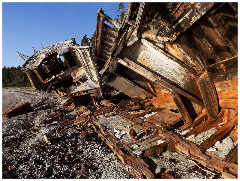
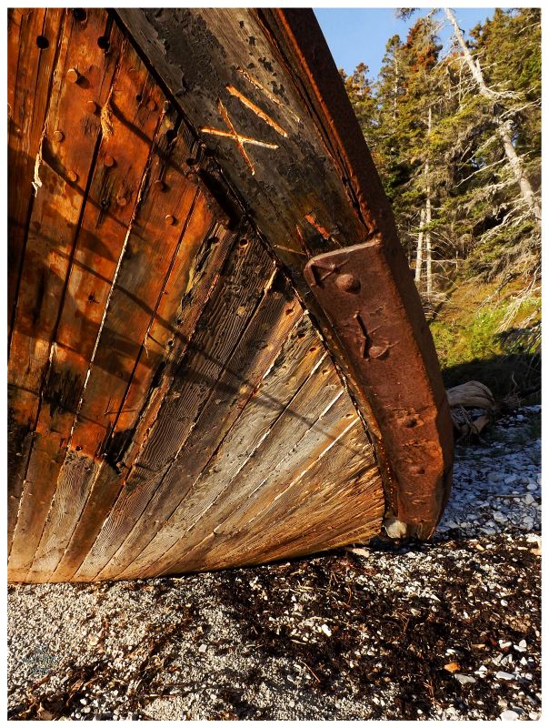
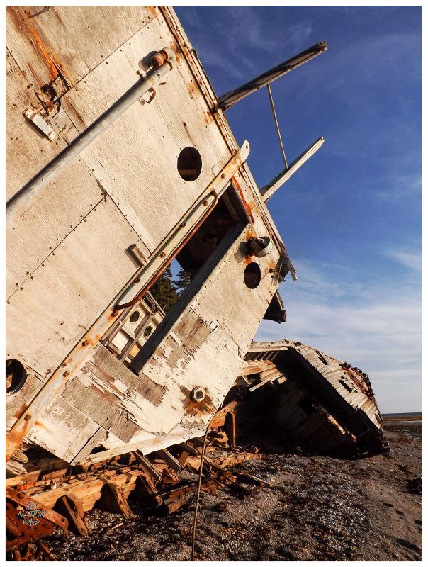
The Wilcox was quickly looted & has now sat here for the last 60 years. The Thorold Niagara News has a picture from 1997 still showing the Wilcox's smokestack and main deck in place, which should give an idea how much longer this boat will last into the future. Looking out at the water, the bay was rounded and seemingly protected to my untrained eye, but I'm sure certain storms batter this shore, while ice buildup scrapes and chews into the water's edge as well. |
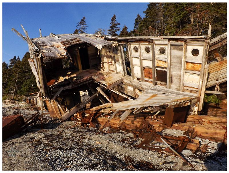
While The Potato Cave & Kalamazoo Falls were cool yesterday, this was the first daunting sight of Anticosti Island. This was the first time where I stood flabbergasted and blown away by what I was seeing. The effort to get here was worthwhile & that there isn't a huge list of other places with sights like the Wilcox. It felt great to get into the meat & potatoes of this journey and I had a skip in my step as I started climbing the stairs back towards my campsite. |
(Crappy cell phone picture)
I decided to give my stove another try since I was in no hurry this morning. As one who loves a cup of coffee to start the day, I really wanted to get this thing working. Miraculously, my Whisperlite managed to stay lit and my pot of water was soon approaching a boil. With Jenga-like tact, I carefully poured the Kraft Dinner into the pot ever so gently, then delicately stirred as to not to disturb the temperamental stove. In disbelief that it was staying lit, I tested to see if the pasta was done way too early, finding that it was good enough long before it was even al dente. |
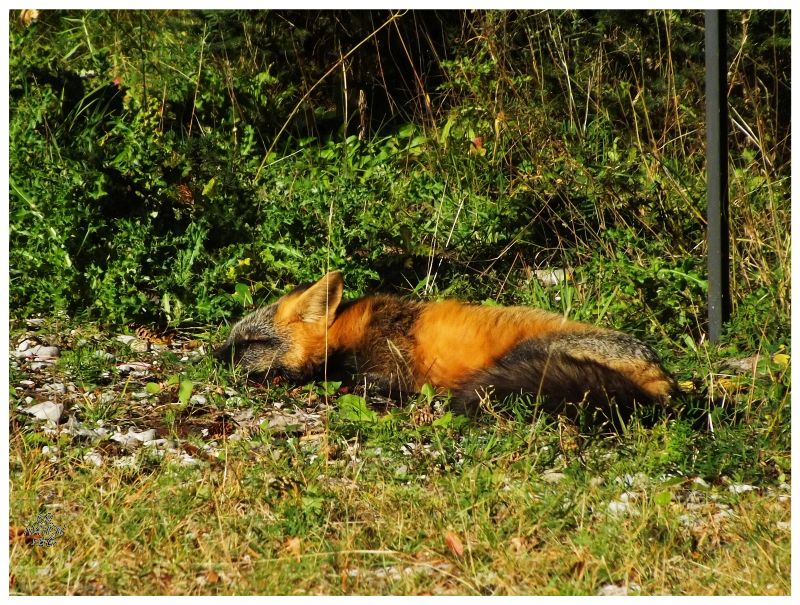
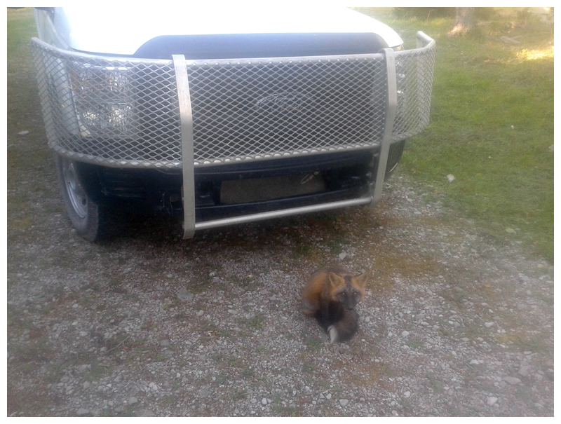
Draining the pasta and hurriedly putting it aside, it was as if I was on a cooking show where I sped to get more water into the pot, this time for coffee. Of course as technology always does, the stove would peter out, but the second pot of water was close enough to boiling that I was able to make a cup of warm water-instant coffee mix. Mmmm! Throughout all of this, the same fox from last night observed & moved around me. I know it's only a fox, but while I was feeling the Gordon Ramsay-like pressure, I wasn't all that happy that this wild animal was sitting behind me in my blind spot. Once I had my coffee and pasta, I rotated around the picnic table & put my head about 8 inches from the mound of mac n'cheese, eying the fox as I ferociously shovelled the warm meal into my gaping maw. In the end the only thing the fox got was a mostly empty bag of salt n' vinegar chips that I forgot outside last night. (I found the torn shreds this morning.) As I was leaving the campsite, he decided to take a nap in the midday sun, seemingly worn out from his morning of pestering. |
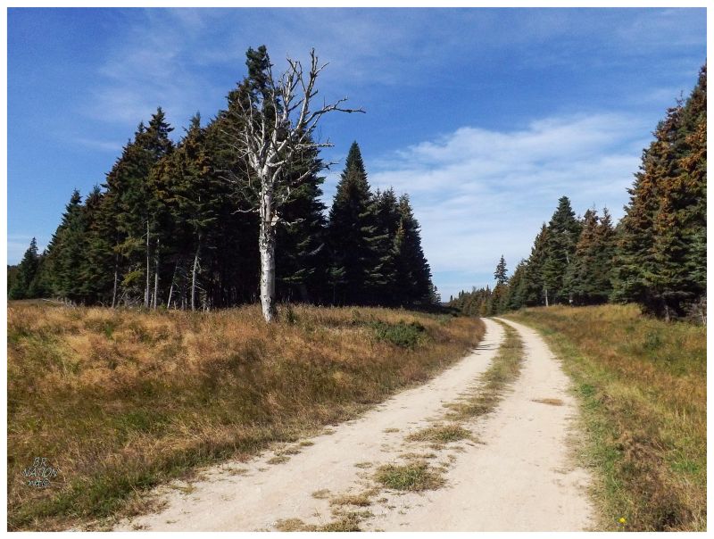
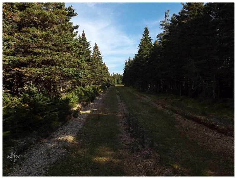
Today I was headed to the south side of the island, to a point almost at the eastern end as well. Leaving behind the north shore & its occasional view of the sea, the Trans-Anticostienne felt more like a woods road now, where there wasn't much besides the occasional small bridge. One bit of excitement would come as I blew through a 4-way intersection, my path turning into more of a campground road than a main gravel thoroughfare. Up to this point I had been impressed & surprised by the quality of the Trans-Anticostienne - seemingly improved because of the recent shale oil developments on this insular gem, resulting in guardrails and improved road quality. I knew that the Trans-Anticostienne wasn't going to switch over to a rough two-track just because I was at km 147.5. It was clear that I missed a turn at the 4-way intersection. This little misstep led me to take a minute and get out of the truck, into the windswept silence and the possibility of being able to see where these other roads go. I fantasized for a while about cycling up these smooth tracks, before getting back to business. |
3 km up the road and what do we have here? A waterfall taller than Niagara Falls? This island has everything! Parking at a roadside lot, I walked some comically short distance to a wooden platform overlooking the Vaureal Falls; the water here cascading and falling 249 feet (Niagara is 167 ft.). |
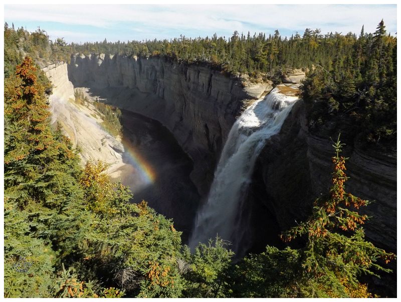
There's a trail into this canyon and to the base of these falls, but it's a long hike & I decided to leave it until I was driving back to make sure I had enough time. Unfortunately, on my way back in 36 hours, I didn't think I had enough time. I based this decision on one website I read where they said this hike takes 4-5 hours. But just now I found the Michelin Travel listing stating that it only takes an hour? The thought of this hike taking 4-5 hours certainly played a role in deciding against it, so yet again I should have did better research. If you go to Anticosti & want to show me up, also realize that you can swim in the pool at the base of these Vaureal Falls. That's right, you can swim in the pool at the bottom of falls taller than Niagara. (Thankfully, swimming wasn't in the equation for me at this time of year.) |
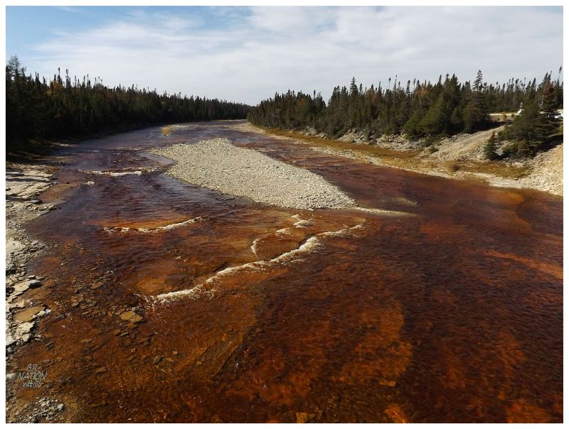
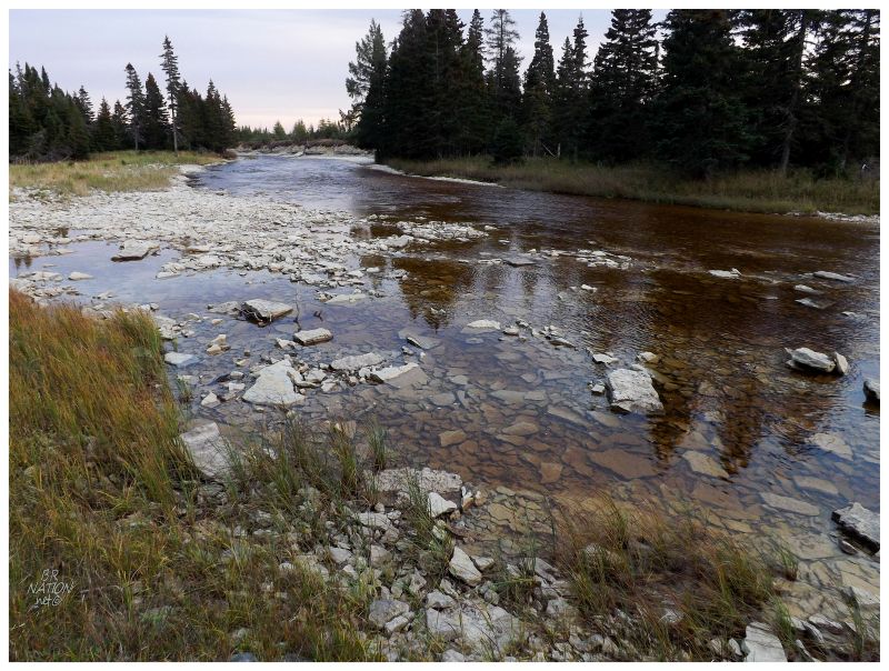
With the Wilcox Campground at Trans-Anticostienne km 120 and Vaureal Falls at km 150, I now had a bit of driving ahead of me to get to the turnoff at km 210. The good thing was that as I moved south & east, the landscape opened up with fewer trees and the the odd bog, along with some pleasant rivers like Rivière aux Saumons (above). Away from a work crew repairing the road right after Vaureal Falls, I encountered no one else so far today, which led me to stop my truck right in the middle of the 1-lane bridge over Rivière aux Saumons. Stepping out, I leaned over the wooden railing to appreciate the wide and vibrant river. By the end of this trip I ended up with a lot of pictures like the one above, for every river I drove over seemed to be wide, shallow & alluring. The underlying limestone slabs making for captivating rivers, where I wanted to sit all day and watch the clear water slowly head towards the sea. |
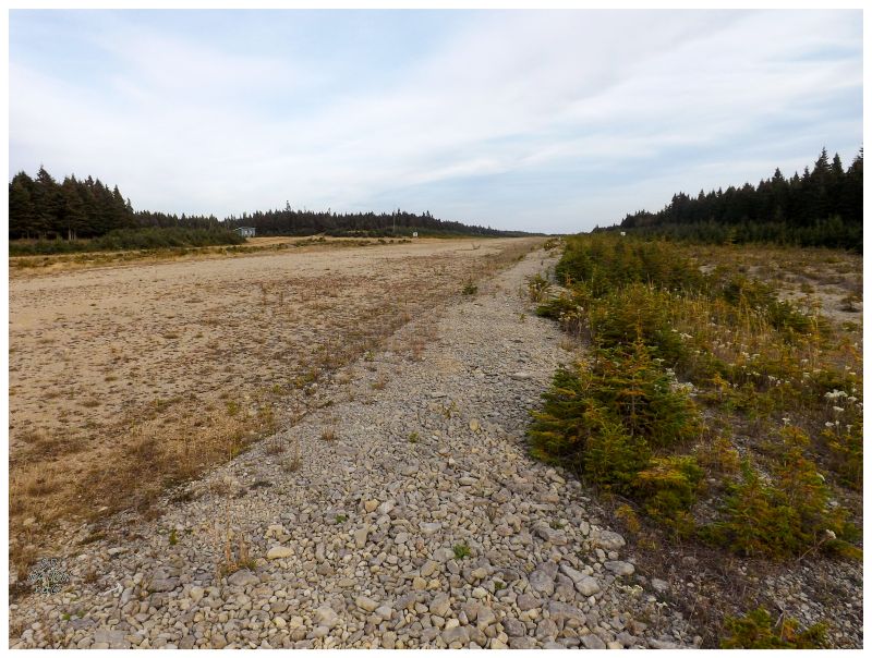
Aeroport Bell
At km 210 I needed to turn due south towards one of the major goals of this trip. Now where I was already concerned with gas levels, there was no way to squeeze in a 54 km (33mi) detour each way to Cap Sandtop here as well, even though the end of the Trans-Anticostienne and peering out towards Newfoundland would be right up my alley. The thing was that I never had Cap Sandtop in my initial plans, so I couldn't be too upset about gas mismanagement here. The Cap only drew my attention when the hills cleared themselves of tall vegetation and it seemed like you could then see halfway to Cap Sandtop from km 210. It was an empty, enticing land that I sadly couldn't continue towards. Instead, I had a 25km (15mi) drive ahead of me which served as my introduction to the secondary roads of Anticosti Island. These roads certainly vary, but the only complaint I had was that the trees could have been trimmed back a bit more. I was worried about deer darting out, but thankfully none were to be seen. At the end of this road was Aeroport Bell, where I had the option of driving across the airstrip and into the southern woods, but finally, this portion of the secondary highway - after the airstrip and 3km (1.8mi) from the ocean - looked rough enough to leave the truck behind. |
Along the road to Aeroport Bell I passed a lodge without any people, the service building at Aeroport Bell didn't have anyone around and there was no one anywhere in sight of the airstrip. Pulling my truck off to the side & out of the way, I slowly put together my water and snacks for the upcoming hike. Still quiet, still no one around, I closed the door and walked across the airstrip all alone out in this faraway wilderness. Once on the other side of the airstrip, the road was flat and well-maintained and because of this, I almost went back for the truck. There was an intersection of these decent roads, but going straight wouldn't bring me any closer to my target lighthouse, while the road to my right was in even better shape and went in a more useful direction. Having studied these roads on Google prior to this trip, I grew surprised by the quality of roadway here since I was expecting muddy quad trails at best, not something you could drive a luxury sedan down1. Scaring a couple of deer off into the woods, I continued down the westward road. |
GPS in hand, I watched as the direction of my destination changed from SW, to SSW, to S - indicating that I was moving closer by the time it was just 'S' South, but that it now wouldn't help me to go any further towards wherever this laneway went. I diligently walked slightly further, just to be safe in terms of choosing a good spot to dive into the woods. Within a very short distance, I found red flagging tape on bushes next to the road and on a few tree branches further into the bush. This seemed like as good as spot as any, so I figured why not see if this flagging tape denotes good way to the Escarpement Bagot Lighthouse. |
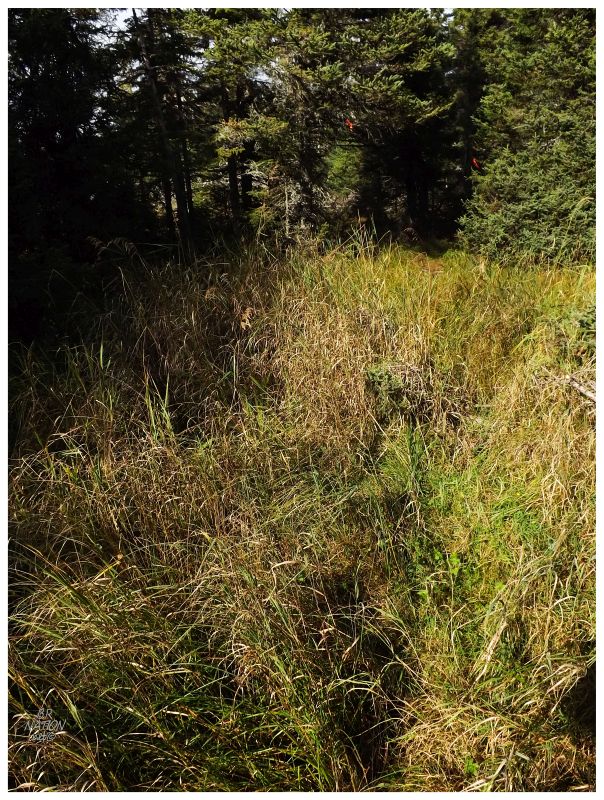
One piece of red flagging tape would lead to another & even where it was missing, I'd go the logical way & eventually find more flagging tape. I certainly wasn't on a worn path and I had a hard time imagining anything but deer walking here, but the ground was dry & there were hardly any thick shrubs to trip over. Having had a few rough Newfoundland bushwhacking experiences of late, here I was then doubly happy with the pace and ease of movement. |
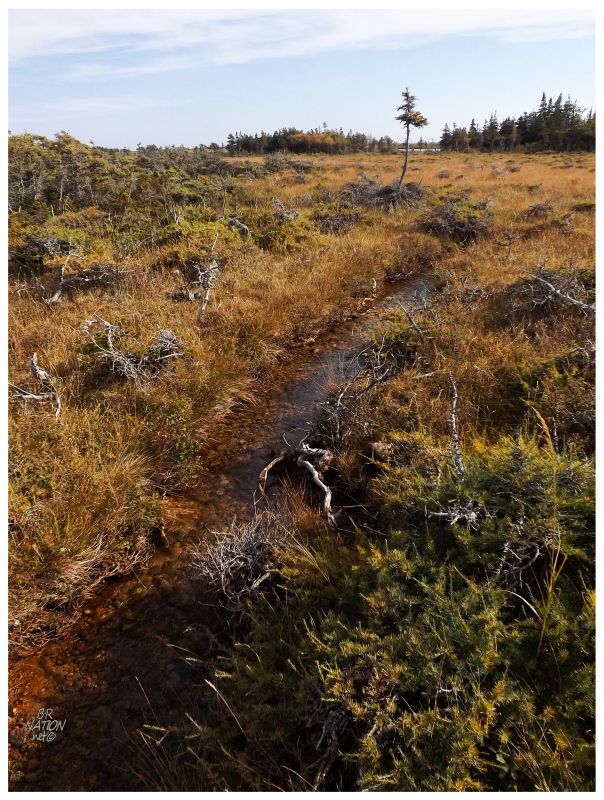
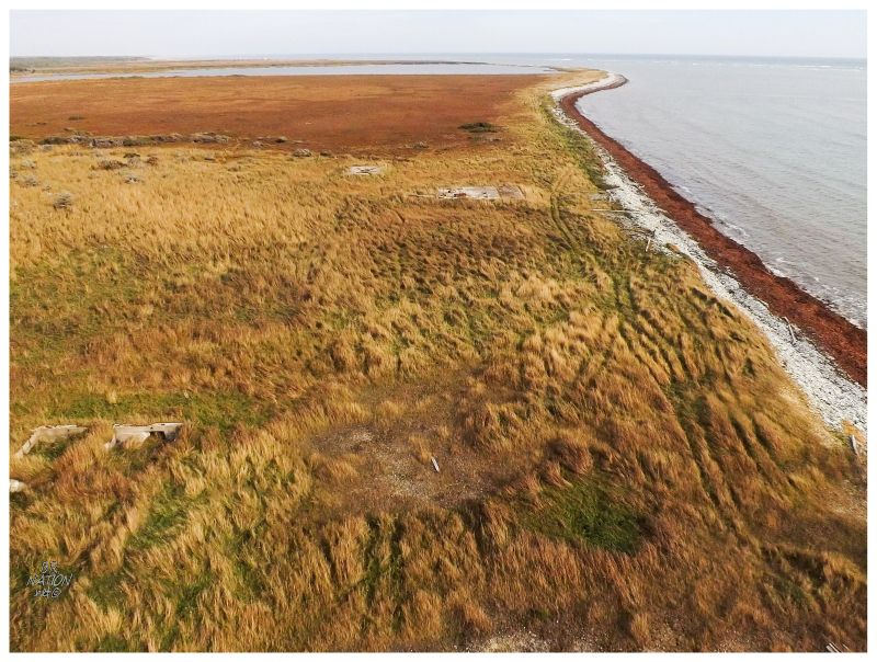
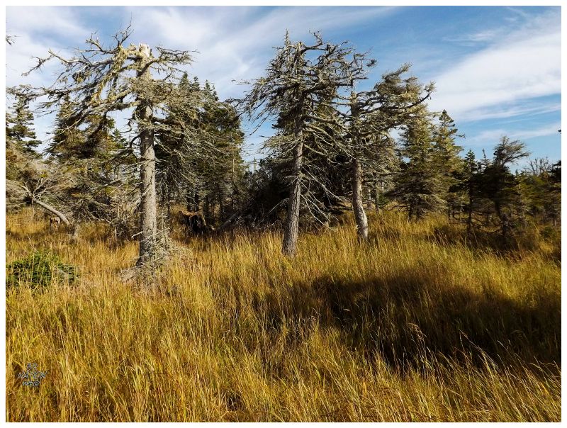
There's a road drawn here in Google Maps, but looking at topographic maps absent of this road, I'm not quite sure where Google got this road outline. The Google road seems to follow a faint path in the imagery, but although it seems like I followed this path for the first half, if I found the path I didn't know it. Around the midway point of this hike, there were fewer trees in front of me & the landscape opened up into a bog to the east. I could continue to follow the red flagging tape on what looked like a circuitous route towards my destination, but instead I opted for the straight line path through what could be a wet & swampy area. Thankful for a whole summer of sun & heat having passed, I didn't squish down anywhere in the dry bog; my porous, worn hiking boots only letting in a minor amount of water. It was around here that I could see the cement structure up ahead, peering over the trees. The height of the lighthouse exciting me & pushing me towards a record time for crossing this bog. |
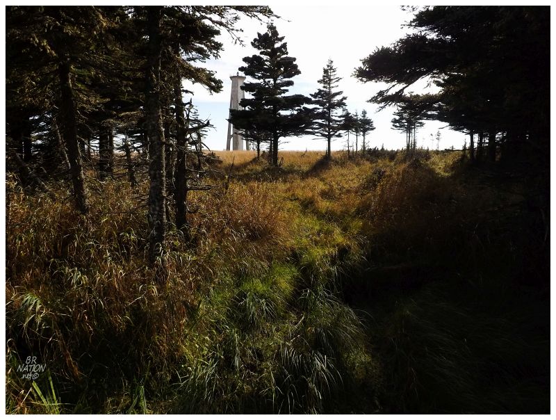
Nearing the bog's edge, there was still this one narrow stand of trees between myself and the sea. At the trees, I finally started to see through them as individuals instead of a wall. Having looked at pictures of this lighthouse for a while, I walked wide-eyed and enamored - that is until I scared off another deer and was startled back to reality. |
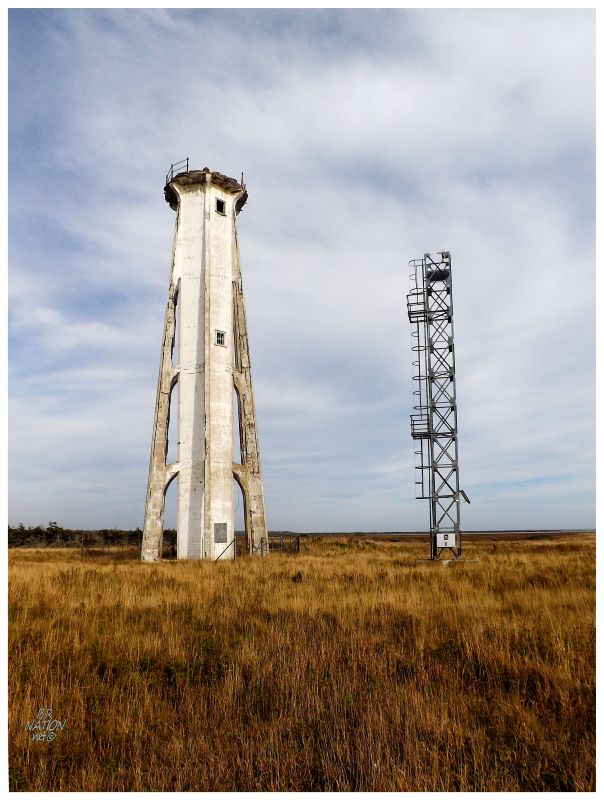
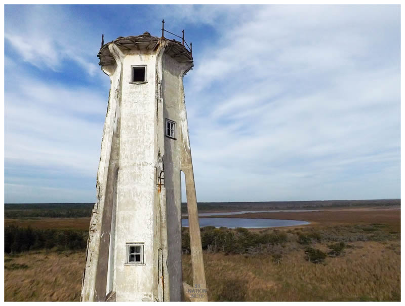
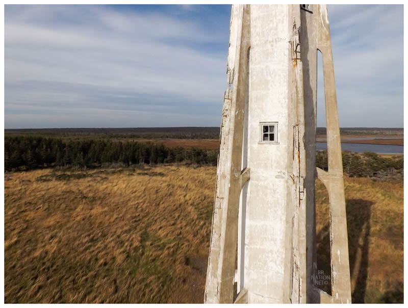
There were only two places where I had seen pictures of this lighthouse on the internet. One of them was a picture from the sea on Panoramio & the other was on this great lighthouse website, where Kraig only made it to the original road I walked down from Aeroport Bell. I think part of standing here and being overwhelmed with the lighthouse's size and stature is that these distant photos don't show that the nearby trees are 30 or 40 feet tall. You look at the online pictures & assume the lighthouse is not that tall because the nearby trees must be stunted. Standing here in this field, its 82 foot height was much more apparent. |
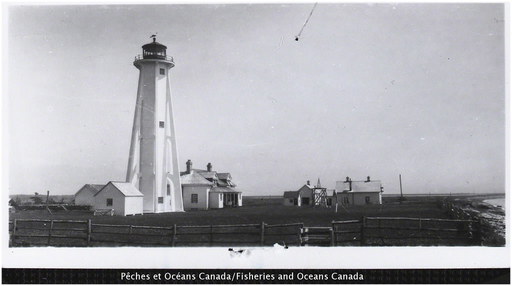
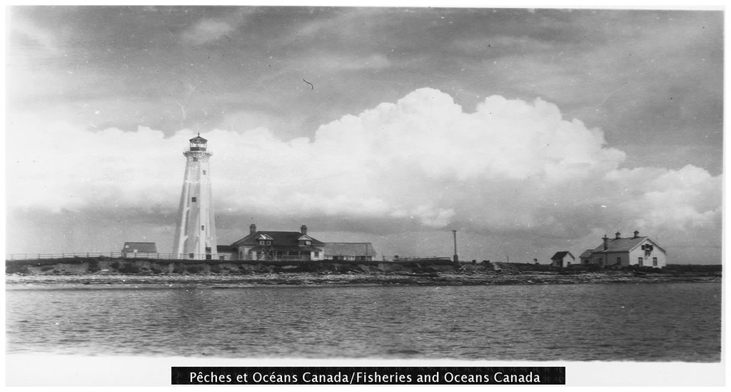
^Courtesy of DFO Quebec. Taken in 1930.
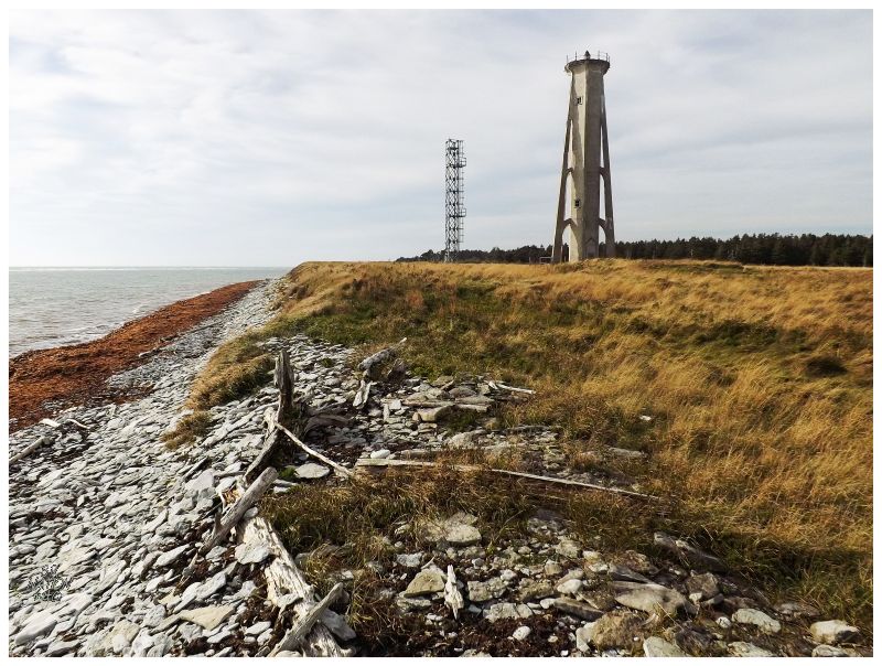
Escarpement Bagot marks the southern point of Anticosti Island & therefore is also known as the South Point Lighthouse. I didn't realize I was at the south point of Anticosti when I was walking along this slippery shore or in the grassy plateau. Later on, I referred to the light as Escarpement Bagot, which was confusing when others asked if I had been to Pointe-Sud. The good thing was that yes, I spent a good amount of time excited about the actual cement lighthouse structure, but I incidentally also savoured the varying, low coast of the southern side of Anticosti while here. The fact that this landscape was different from everything else I had seen on the island made it noteworthy. |
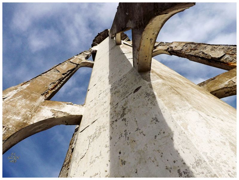
Escarpement Bagot is one of six flying buttress lighthouses left in Canada, a unique design that I was ecstatic to finally behold. William Anderson was born in 1851, educated at Bishop's College and entered civil service as a draughtsman for the Department of Marine and Fisheries in 1874. He quickly shot up the ranks all the way to Chief Engineer of the Department in 1880, designing and building more than 500 lighthouses and 50 foghorn stations until his retirement in 1919. He is best known for his flying buttress lighthouses where tall, concrete-encased cast iron towers were supported by external buttresses connected to the main tower at three points. These buttresses provided stability for the tall towers in particularly windswept locations. The first flying buttress lighthouse was at Cape Norman in Newfoundland in 1907 and eight more would be built over the next handful of years. Escarpement Bagot was built in 1912, making it one of the last ones. |
|
|||||||
|