I didn't stick around my riverside campsite very long this morning. Packing up my stuff, I then spent 10 half-assed minutes trying to brew a small cup of coffee with my camp stove, before growing tired with its continued failure. |
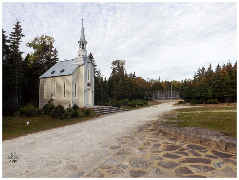
By virtue of being unable to find a good campsite until late yesterday evening, I now only had 5 km of the Trans-Anticostienne to drive until my desired road along the south side of the Rivière-Aux-Saumons. Along here, my road map only showed two roads off to the east, but it was a different story on the ground. Now looking at Google Earth, I see that what I thought were roads, are actually glorified driveways providing access to the Rivière-aux-Saumons. The reason for all of these access points is obvious once you find the impressive game lodge at the end of this road. Missing my turnoff, I accidentally popped in at the lodge, with its Escalade-inhabited driveway, lodge chapel & tennis courts. I had seen the $4k, $5k & $6k costs of these lodge trips prior to coming & these visitors apparently weren't roughing it out here. I decided to skedaddle before anyone came out to check on what I wanted. |
The turnoff for Cap de la Table was clear once leaving the lodge, as the directional sign faced those coming from the lodge instead of the Trans-Anticostienne. Up this road, I finally encountered hunters as I noticed a truck up ahead, half blocking the road. Maybe I could have squeezed by, but with the soft shoulder, I thought it would be as simple as the guy pulling forward slightly and letting me pass. The truck didn't move though. Was it left here? Was the driver napping? Thinking they didn't notice me, I pulled even closer while the driver got out of the truck. Oddly, he didn't acknowledge me, but instead went about his business. Did I have more than enough room? It didn't seem like it, but these dudes had me questioning myself. |
Eventually the driver would finish what he was doing as I crept even closer and even started to get out of my truck. Coming over, the driver asked what I was doing on the road, where I responded and looked around confused, since I didn't think I was on some kind of limited access road. I assumed that very few people drove out to the ho-hum Cap de la Table Lighthouse, but meanwhile, I was almost certain that I wasn't on private property. I had it explained to me that driving on the road scares off the deer, the same deer which these men were sitting here trying to hunt. I didn't have much of a response for this. I paused and looked at the guy, all the while thinking that I'm likely the only person in weeks who's going to drive this road for the lighthouse. And while I didn't pay as much as the person still sitting in the truck on a guided hunt, I had spent enough of my time & money to feel entitled to this road as well. The hunting guide huffed at my silence and shook his head at me, before going back to the truck and pulling it over ever so slightly, seemingly unimpressed with how important it was for me to reach the lighthouse. I gave a raised eyebrow half wave as I passed them and continued down the road. From there it was a struggle with whether to drive fast to get away from their authority, or to drive slow and help them out by not scaring off so many deer. |
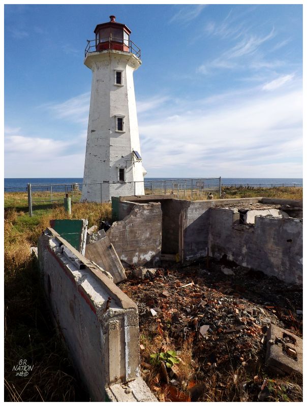
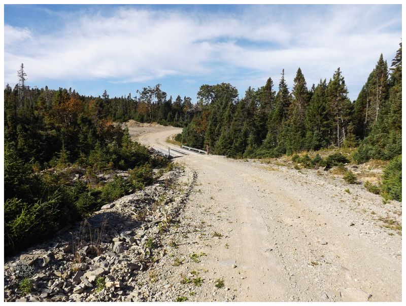
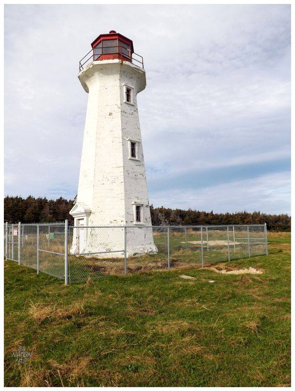
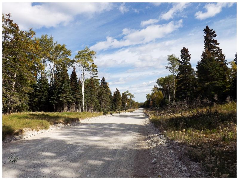
The encounter with the hunters was somewhere near the start of the 39km (24 mi) secondary road out to Cap de la Table. Thankfully there'd be no more confrontations all the way to the lighthouse, even as I passed over a land with plenty of rivers and worn pull outs. I appreciated that over the remainder of the drive the most remarkable thing was that the tiny tertiary road to the lighthouse had to be the roughest of the trip, producing the one time I heard my beefy truck clang against a pothole. The road was also quite downhill, so on the other hand, maybe I was simply going too fast. Anyway, Cap de la Table is the eastern lighthouse of the three I mentioned earlier as marking the north shore of Anticosti. While it may look like your average 1960s Canadian lighthouse, it's actually a 1919 lighthouse that was encased in concrete in the 1960s. As for the burned foundation in the foreground, there was a full lightstation here until the late 2000s, where artists could come and make art in exchange for board. Walking around the grounds, there were still artwork of metal cormorants and erected rocks here and there. In addition to the artists residency, there was a campground and inn here, but the operation mustn't have been profitable. The buildings were destroyed by fire to dispose of them, leaving behind only the lighthouse. |
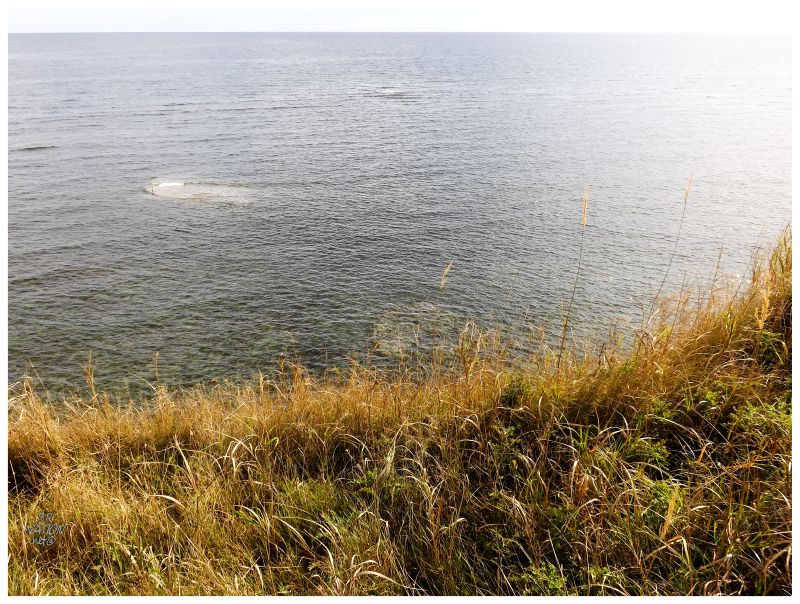
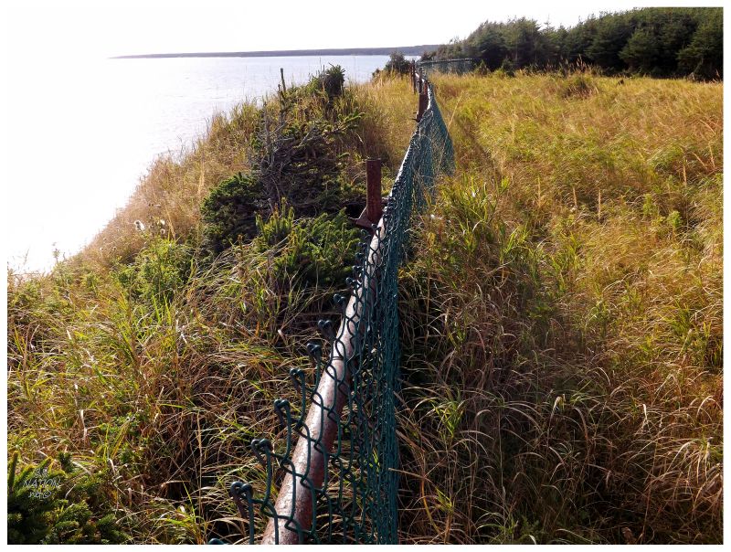
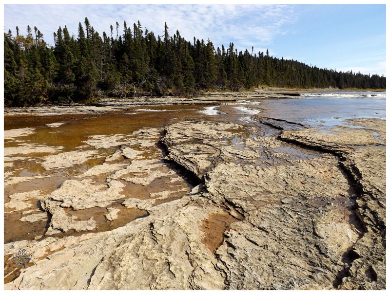
The grounds here were expansive and still indicative of a full lightstation's worth of land rather than just a lighthouse. Wandering around, it was that old Anticosti quiet and sense of peacefulness in being alone again, especially as I doubted anyone was coming down that rough lighthouse road. I wandered over to the cliffs and observed seagulls resting on one of those rocky shelves that makes Anticosti so dangerous. Suddenly I was interrupted. My phone started buzzing and receiving text messages, as finally I had come to a point on the island with cell phone coverage! This was day 3 & ever since I lost cell phone coverage while napping somewhere between Sept-Iles and Anticosti Island, I hadn't had one bar worth of coverage the entire insular time. We're so often in cell phone areas today that the possibility of this didn't even occur to me prior to this trip, but I suppose why would they install a cell tower on Anticosti for 300 people? |
I walked towards the eastern end of the property and looked out towards Fox Bay (Baie Renard) as well. While there's nothing remarkable out there today, Fox Bay is one of only three good harbours on the entire island, and so, it has its place in Anticosti history as home to two noteworthy events. The first was the wrecking of the Granicus along this coast between East Point and Fox Bay on October 29, 1828. Once the 20 men, 3 lady passengers and 2 children ran out of food rescued from their ship, they went north to the Fox Bay government provision shelter, but found it empty as the last government worker had left the season before & took the food with him. From here it's a bit of a mystery as to what happened, but eventually a ship by the name of Victory had to dock in this harbour and found a small boat pulled up and in good shape.The crew of the Victory yelled out and some came ashore, but hearing no one & seeing no activity, they went to investigate the government shelter. What they found was recorded in an affidavit they provided upon safe return to their Magdalen Islands, "...found the door shut and tied inside with a rope, that on forcing the door they perceived the carcasses of four human beings with the heads, legs and arms cut off and the bowels extracted, hanging by the thighs in the room, and two others on the floor cut up in the same manner, that they found a human body in the hammock who appeared to have died there, the body was habited like a sailor; that there were two trunks in the room with human flesh in them cut up in small pieces, there was also a pot with human flesh in it, and round the houses pieces of human flesh and bones strewn about."1 The crew found 12 or 13 men in that main building, along with the 3 women ferry passengers and two children. In a secondary building, they found 5 more of the men. The captain would later elaborate that they found barrels filled with salt and human flesh, "each piece seven by eight inches square, and salted as carefully as if it had been a barrel of pork." They went into a third room and found a man who they thought was asleep in a hammock. Drawing their guns at this sight, some poor sap had to go over to the large, muscular man and touch his hand, his heart and listen to his mouth to see if he was breathing - he was not. The man had died within the past few days, with only a small cut on his hand and no other signs of struggle. Two more men, assumed to be from the Granicus, were found a couple of miles down the shore in June, near where the ship initially wrecked. Nearby was a board scrawled with "What sadness! What pity!" Whether murder occurred at Fox Bay or the survivors simply cannibalized the dead was never determined. The logbook found (and subsequently lost) gave no clues & there's no further mention of any other scrawls. The men from the Victory buried the bodies they found at Fox Bay, using axes to chop into the frozen ground, in order to make a hole for a mass grave. |
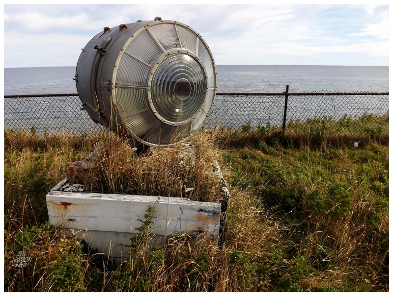
What I believe to be an old lantern on the grounds.
About 50 years later, in the 1870s, the Forsyth Corporation who owned Anticosti at the time had big plans and made promises of three separate towns on Anticosti, with great fishing grounds, lumbering woods & provided services. Advertisements of these promises was enough to get some settlers to travel to Anticosti from downtrodden Shippagan Island in New Brunswick, as well as Port-aux-Basques and Petites Newfoundland. While the New Brunswickers would settle at Anse aux Fraises, the Newfoundlanders stayed together and settled at Fox Bay. All of these promises evaporated almost immediately in mismanagement. For example, where there were supposed to be stores and warehouses, the Forsyth money was used in a bankruptcy sale to supply these stores, so Anticosti had things like 6 barrels of violin strings instead of actually useful things like farm implements. The starving Newfoundlanders tried to sail to Gaspé for help, but 3 men drowned before they eventually broke open that old Fox Bay food cache designated for shipwrecks. The Anticosti Corp of the time would go bankrupt in two more years & the government then offered to save the Newfoundlanders and ship them back to Newfoundland. Amazingly they decided against this, and after the violin strings and English saddles were sold to a merchant in Charlottetown, the Newfoundlanders were given 300 lbs of potatoes to get through the winter, along with seeds for the next spring. The hearty Newfoundlanders would last here until they became a problem for Henri Menier and his buddy Martin-Zede. Sailing around the island, Martin-Zede was bringing metal signs declaring the new laws and regulations that Menier had come up with for the island - for instance, that you needed to get Menier permission for all alcohol, firearms, hunting or fishing. The Newfoundlanders watched as Martin-Zede came ashore and nailed these metal regulations on the lobster cannery, a few homes and the telegraph office. Happy with himself for having delivered the new rules, Martin-Zede returned to his ship and pulled up anchor, where he then already heard the firing of rifles at the metal regulation signs, the Newfoundlanders hilariously showing Martin-Zede and Menier what they thought of these new French chocolate baron regulations. Martin-Zede soon after declared that "these squatters had become undesirables from all points of view" and vowed to have them moved out with force since they were so uncooperative and disobedient. The Methodist church would become involved and take up the case of the Newfoundlanders, saying it was unfair and maybe religious persecution, while Menier and Martin-Zede simply said the Newfoundlanders didn't own the land. This garnered national & international attention, to the point that Martin-Zede was invited to Ottawa to meet with Prime Minister Sir Wilfrid Laurier. Laurier begged Martin-Zede to simply leave the Newfoundlanders alone since an election was coming up & this looked bad, while Martin-Zede reiterated the need for their eviction. In 1899, the Fox Bay Newfoundlanders lost their court case and subsequent appeal in regards to the land. They would continue to resist eviction, but within a half year, a government ship came and convinced them to board with promises of free farmland in, of all places, Manitoba. So the Newfoundlanders finally left Fox Bay, Menier burned all of their buildings down & then renamed the place to the french Baie Renard. Unfortunately for the Newfoundlanders, they were fisherman first & only rudimentary farmers. Many of them died off in Manitoba, due to their inexperience at farming and their lack of preparation for the brutally cold winters not along the ocean. A fraction of the remaining Newfoundlanders would even move back to Quebec, settling along the north shore across from & sometimes within sight of their Fox Bay. Although I didn't find this name in either of my Anticosti books, I like that Fox Bay is today marked as Les Squatters on Google Maps. |
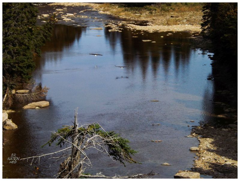
Having spent about 20 minutes walking around Cap de la Table, I poured up a bowl of Froot Loops and canned milk to spend a little more time at Table Cape; especially considering all of the time it took to drive out here (1 hour to the Riviere-aux-Saumons lodge, another ~hour along the Cap de la Table road). Driving back, the road goes over a handful of rivers, this road seeming to be close enough to the sea that you need bridges to go over all of the wide, wild rivers. Of course I stopped at two or three of them again, savouring their beauty and remoteness. While stopped at either Rivière Prinsta or Rivière Velleda, I spotted a pair of bald eagles in a tree, who took off immediately as I noticed them. Oh the wilderness out here. |
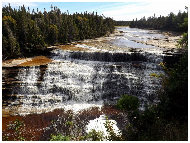
Driving out to Cap de la Table would also bring me along the road necessary to visit Chute Schmitt. Only a 5 minute hike off the road, I had more than enough time to visit even as I thought they were just some average falls. |
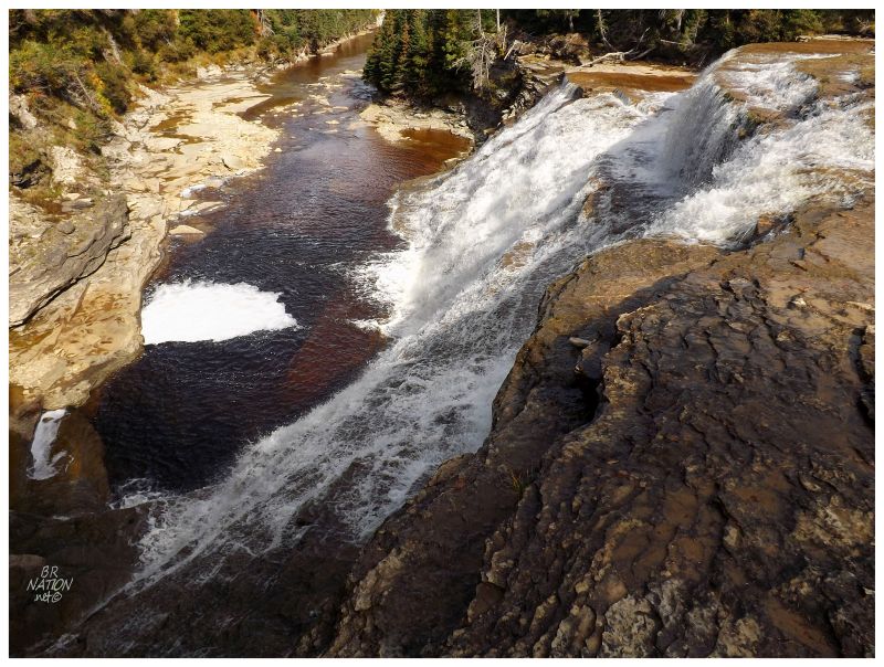
Even with my sky-high expectations for Anticosti overall, these 'secondary' sights continued to blow me away. Here was a little trail out onto a tabular river, where I could stand with a wide, mighty waterfall washing 40 feet down just about 5 feet away from my shoes. Chute Schmitt went from a "well I'll be over there anyway" to "boy am I happy I happened to be over there." Sometimes the unplanned surprises of a trip can be more memorable than the ones you study & fantasize about for months. |
I didn't see anyone on the way back from Cap de la Table to the Riviere-aux-Saumons road, as well as back to the Trans-Anticosti (although I didn't return to the lodge). I have to imagine if hunting from the road is preferred, that the guides then avoid the midday heat where the deer go relax in the shade. This would be especially true during an unseasonably warm late September. |
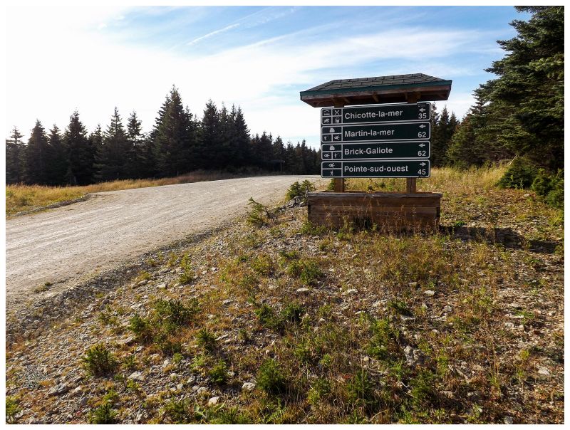
Once back at the Trans-Anticosti - while Google doesn't have the exact route I took - a similar route says I travelled about 170 km (106 mi) over to the southwest point of the island (rough map). This makes sense as the Riviere-aux-Saumons turn off was at km 186, where I then had to backtrack past Vaureal Falls, the McDonald Lodge & to a left-hand turn at km 91. The Trans-Anticosti driving was only the half of it though, as the McDonald Lodge is on the northern coast & I had to cut across the whole island down to the south coast. I know Anticosti is only 50km (30mi) at its widest, but this was a lot of gravel road driving and navigating. In addition, my destination at Pointe-sud-Ouest was surrounded by a few other main destinations, meaning there were enough questionable direction signs that I managed to get myself turned around. I wanted to camp at Pointe-sud-Ouest and here it was 5 o'clock and the number of km was going up because of a wrong turn. I pulled out the GPS and retrieved my coordinates, seeing exactly where I was on this map of Anticosti, since following these direction signs was failing me. In all of this stress, I considered taking a break at one of the weird roadside outhouses I kept seeing, but in the end decided against stopping. This was good when I later learned they were hunting blinds, not port-a-potties. |
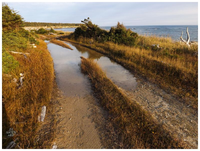
As much as I was interested in nearby Chicotte-la-Mer and Galiotte-la-Mer, I had to keep focused because of worries about gas levels, kilometer limits on the rental and fading evening light. I eventually found the tertiary road, marked by a black line on my map, which led out to Southwest Point. A narrow track down a closing-in forest, I pushed forward because of my desires not only to get out to Southwest Point, but to camp there. I'd drive forward about 20 feet, then another branch would be sticking out too much, where I'd then step out and break the branch to avoid scraping it all along the truck. Of course I paid for the rental insurance here, but the woman also said something French about the fact that I'd still have some responsibility. Also, of course, she stuck me with a truck that had only 900 km on it. Why couldn't I have some 30000-km truck where I could look at the paint for previous branch scratches? I made it through that forest section, but while tired and hungry, next up was a seaside path of deep muddy holes and mossy wet rock beside the ocean. I had that jittery wired factor of being flustered with the decision to keep going or not, exasperated with hunger and weariness. Coming to an indent in the forest suitable for my tent & up ahead a slippery rock section right next to the ocean, I decided this was enough. What the heck was I going to do if I screwed up this far from civilization? I decided I couldn't drive the rental truck any further. |
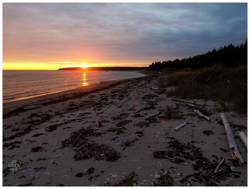
Quickly setting up my tent and shoveling food into my mouth, I abruptly decided to head towards Southwest Point for sunset, where even as I rushed I wasn't going to make it. |
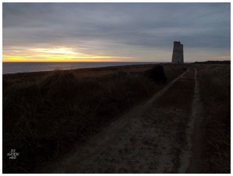
Thankfully the sunset wasn't some unbelievable sight that I messed up. I would have liked to have been camping out here, but standing at the opening to Southwest Point, I would be back tomorrow morning soon enough. Walking back, it didn't take long before it was dark and I was scaring seaweed-munching foxes and deer away as we startled each other into quicker movement along the beach. As happy as I was to behold Southwest Point, I was just as happy when the dark walk back to my belongings ended. I'd sit awake like all of the other nights, initially leaving my wooded campsite behind to sit on a small cliff at the edge of Gibbons Cove. As I sat there, I told myself who needs Southwest Point - I mean, how many people have camped at Gibbons Cove in their lives?! Haha, sigh. More to come. |