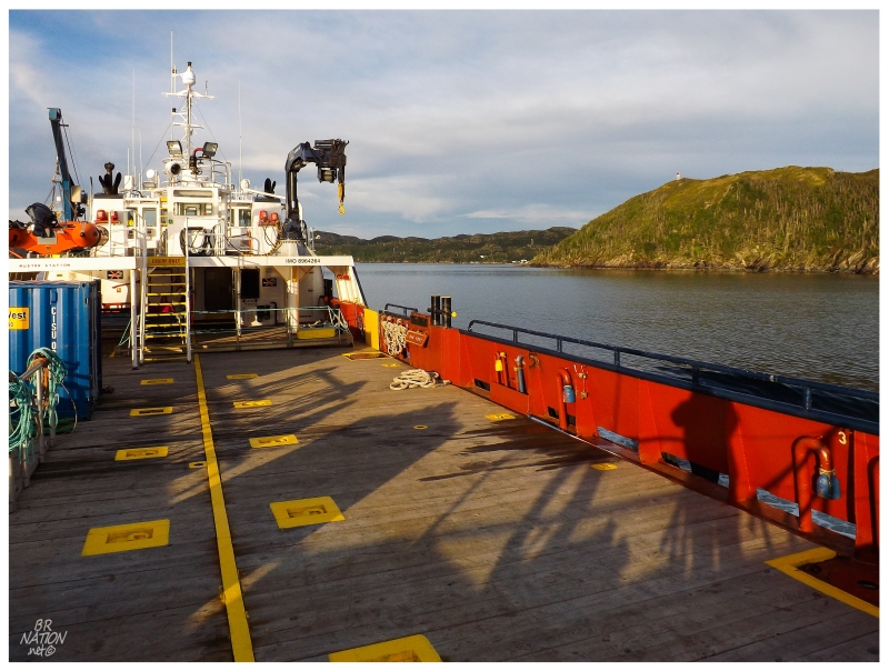
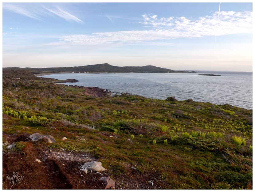
After my ferry landed in Petite Forte, I had a 90-minute drive ahead of me over to Garnish on the western side of the Burin Peninsula. Stopping to restock on groceries and a hot lunch in the regional centre of Marystown, the day was now getting into the afternoon, but I had to move if I was going to bike the 48-km (30-mi) ATV trail to the resettled community of Point Rosie. |
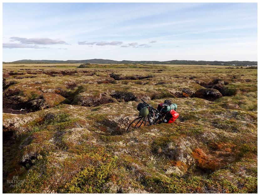
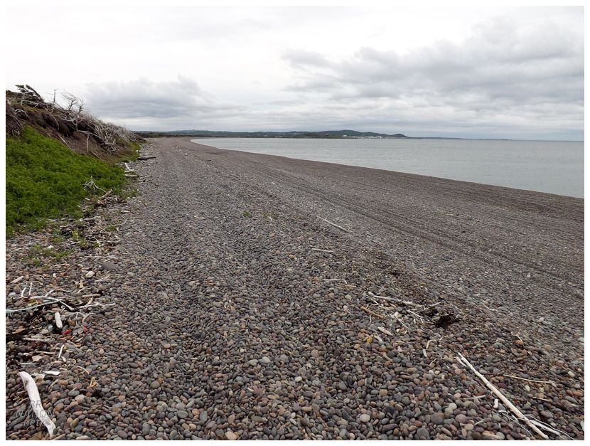
Finally deciding I had everything I needed strapped on to my mountain bike, I passed a donation box that I'd deal with tomorrow, before going over an impressive bridge considering that this path only services the small cabin community of Point Rosie north of here. From there, it was a decent, although rolling trail along the shoreline across from the town of Garnish. This emptied out to a beach where the going was slow, but with a rocky headland up ahead I knew I had to climb up into the bog to continue. It's up in those bogs that I couldn't believe the depth of some of the muddy portions. I would walk high atop everything when on the crunchy, mossy ground, but crossing or travelling along any of the mud channels meant that my bike was easily a foot below me. |
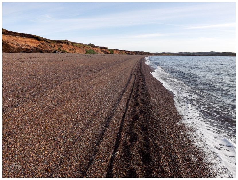
Happily finding a newish dirt road down to Doughball Cove, things didn't get any easier like I envisioned. I wasn't doing any ultralight bikepacking here and that didn't help as I muscled my bike forward in the sinking rocks. It didn't matter if I went up the beach or as close to the ocean as possible, I was still moving along with the speed and efficiency of a nesting sea turtle (not the cute hatchlings, the mother sea turtle). In addition, I'd never met a beach that was so skilled at delivering rocks to the inside of my shoes. As someone who will leave a rock in his shoe for a week out of apathy, I had to stop here every couple of minutes because of the pain and annoyance of 5-10 rocks wedged between my ankles and sneakers. |
The hill up out of Doughball Cove, finally, thankfully.
The 2km (1.25mi) beach I couldn't help but think about maybe being washed up or that my bike with thin tires and only a back rack was the wrong tool. And while I may be washed up, I would rather take 15 days to reach Point Rosie than admit I should have stayed home until I saved up enough money to start a mountain bike collection. Using an imperfect bike for the task is simply a matter of needing to put in a bit more effort - it's not a reason to remortgage your house to buy another mountain bike with tires that are 0.2 inches wider. Hilariously enough, I learned about this trail from a local blog where the guy has a fat bike. His post describes the Point Rosie journey as a 48km trip that takes about 6 hours at "an easy pace". The two men in the update rode their fat bikes on this beach with what seemed like relative ease. |
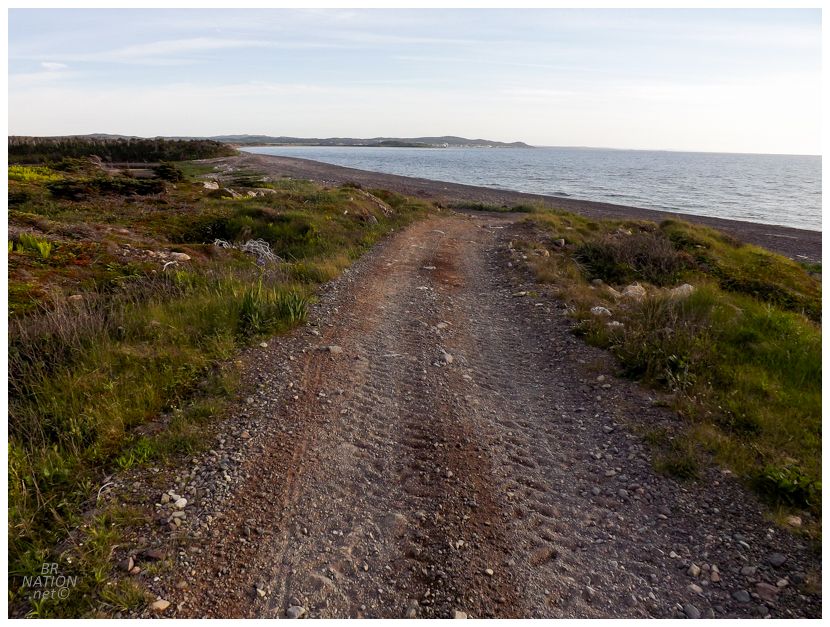
It was lovely to leave Doughball Cove behind, but the quad trail still featured lots of washboarding, loose gravel, and sizeable rocks. I appreciated that the local residents had built this so I could enjoy the fine scenery and the little communities here, but I still wasn't crushing anywhere near 15 or even 10km/hr. |
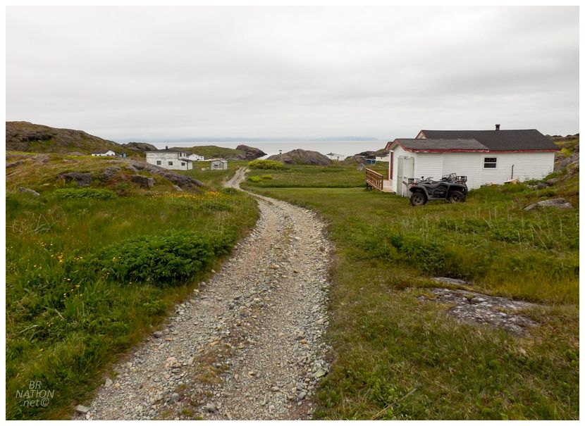
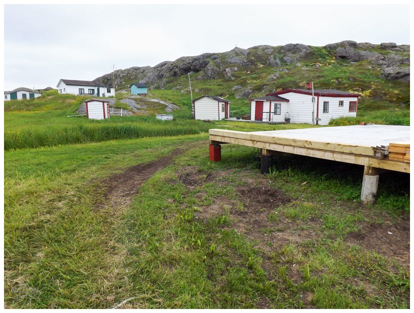
Another thing that was surprising was the size of the cabin communities out here. This wasn't a case where it's empty coastline all the way to Point Rosie. I had been seeing cabins and driveways all along the way, with a whole little collection of 10 or 15 cabins here at Browns Harbour. I wish I had the time to stop and walk the shorelines to explore more than I did, but my slow speed was already challenging my Point Rosie aspirations. I needed to keep moving since I didn't have an extra day to camp two nights out here & I didn't pack enough food or water for two nights either. |
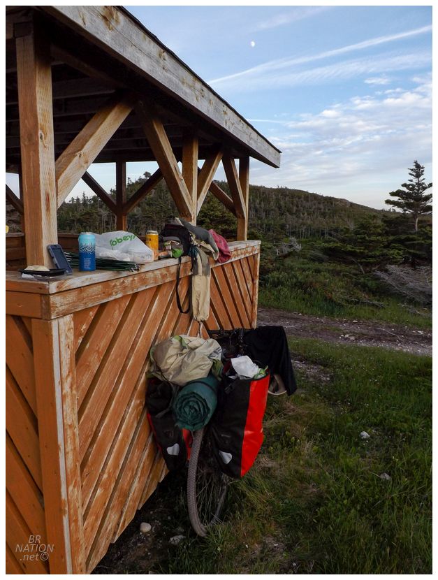
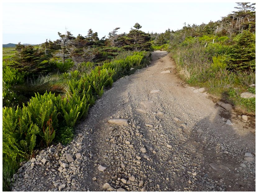
Crossing the small and winding Devil Brook, I came to a big uphill where beside the brook was a fine gazebo, rocky promontory, and a outhouse all along the road. I checked my GPS and had only made it a paltry 1/3rd of the way to Point Rosie, but this was too good of a camping spot to pass up. It's not like I was going to make it to Point Rosie tonight anyway. |
The next morning woke gray with yesterday's sunny skies long gone. I suppose I should be thankful that at least it wasn't windy. Things weren't terrible this morning either, really, although there were parts of the quad path that were more rocky beach than anything, slowing me down to speeds like 5km/hr. A lot of the trail was okay though, it was simply a matter of putting my head down and continuing to push and balance, although this was also getting a bit tough as my food and water were running low. |
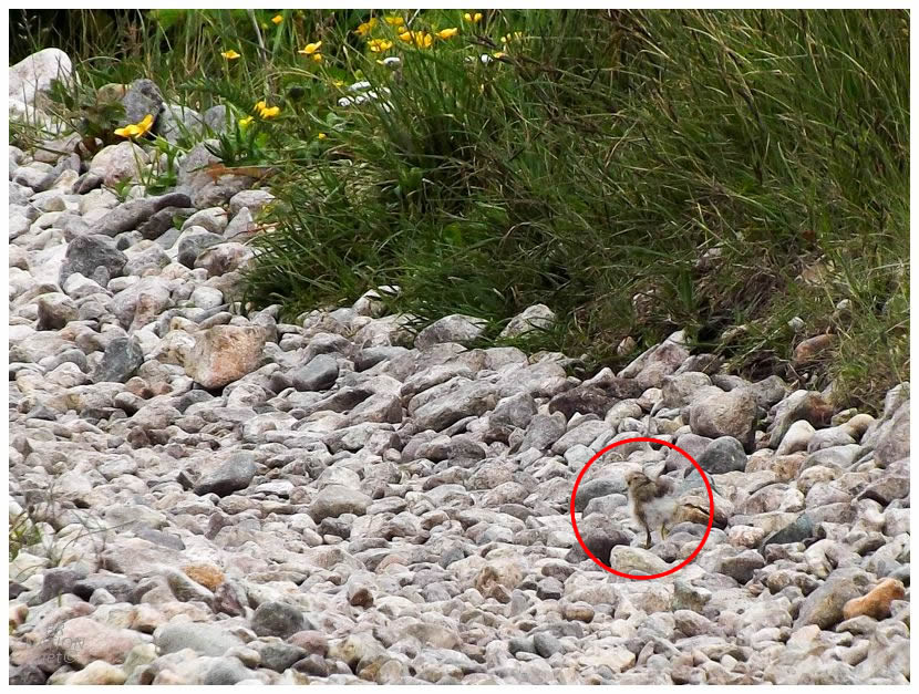
Continuing my long slog, I was happy to slam on the brakes as I noticed 5 puffballs running away in the rocks up ahead, while their Spotted Sandpiper mother got up on a log and squawked out alarm calls. The little chicks were gone within 15 seconds and I kept it moving with a smile on my face. |
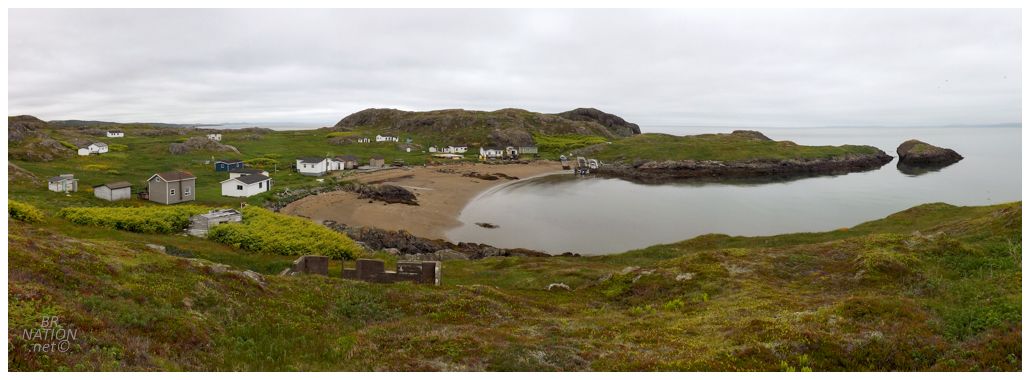
Pedalling up down and around, over bridges and past coves that would make great camping spots, I was starting to wonder how much longer it could be to Point Rosie when I finally came around a turn and found a collection of houses up ahead. Who knows if I'd make it back to Garnish, but I'd make it to Point Rosie! |
Point Rosie is another case where the original French name has been corrupted over time as it was originally known as Point Enragée (Enraged Point). I've always wondered why Google Maps shows both names, but it's likely because the provincial government's nomenclature board changed the official name back to Point Enragée, while everyone continues to call it Point Rosie. |
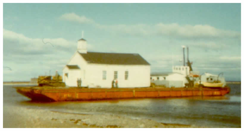
Anglican Church on the barge being moved to Frenchman's Cove, Fortune Bay, Newfoundland, ca. 1972.
From the Resettlement Digital Photograph Collection, PF-317.613. Copyright held by Ralph Billard.
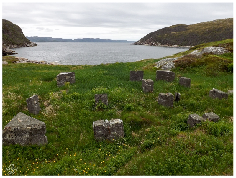
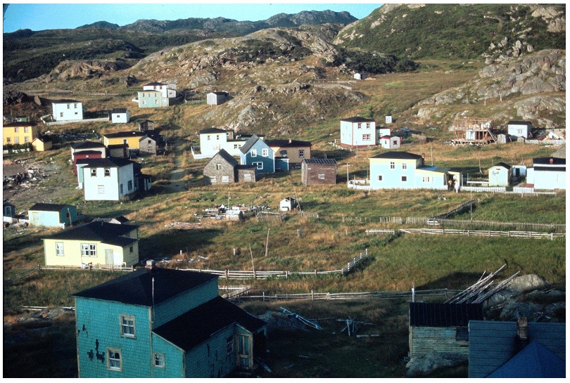
The residents of Point Rosie worked the inshore fishery for codfish and then later lobster. With the price of lobster being high after Confederation, the folks in Point Rosie did alright and the population was about 150 in 1920. Not too many people could farm because of the lack of good topsoil, but there was livestock around. By the 1960s, Point Rosie was another place where some of the residents thought resettlement made sense. There were only 8 families left by 1964 and two years later, Point Rosie emptied out as they took the government money and used the government barge to move some of their houses down the shore. Most residents went to nearby Garnish, but some also went to Grand Bank and across the bay to English Harbour West. |
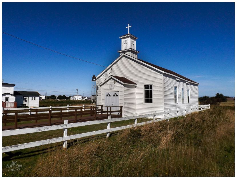
The old Point Rosie church in Frenchman's Cove, 2021.
Just to the south of Garnish is the community of Frenchman's Cove, and seeing as their church burnt down in 1973, they happily accepted the relocation of Point Rosie's church as a replacement. It is still in use today. |
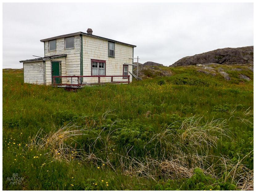
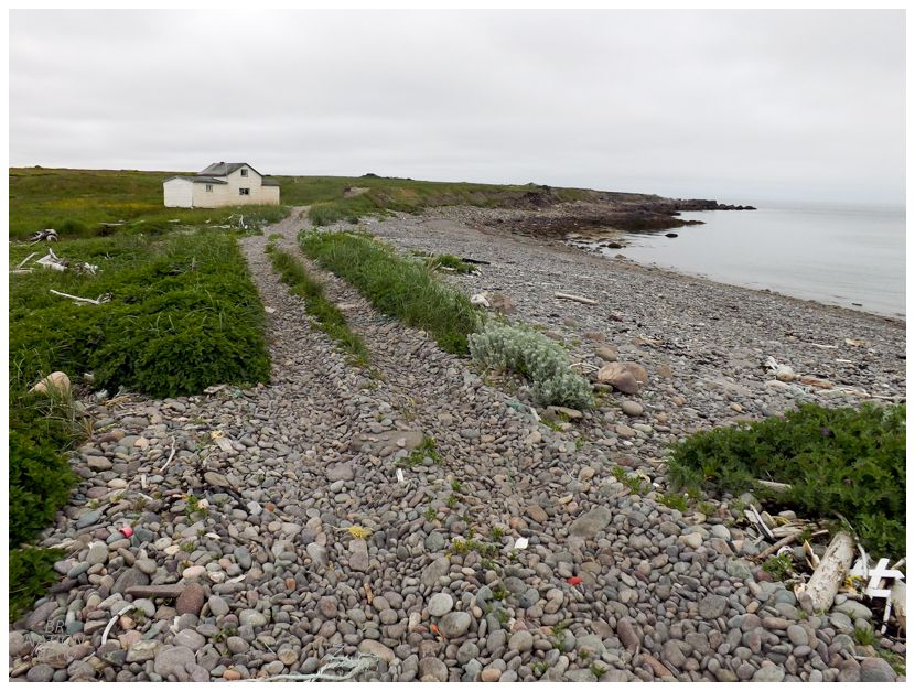
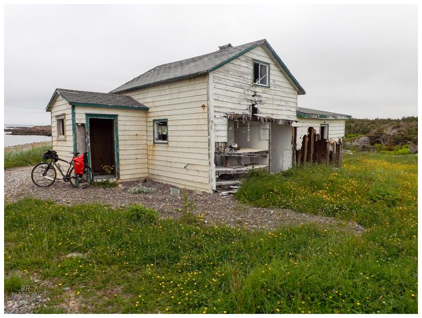
As Point Rosie is a popular cabin community, only one original house remains, that of Eli Caines. |
Harold Grandy photograph, August of 1970. From the Friends of Point Rosie facebook group.
Looking at the Point Rosie facebook group, there's an old picture which shows 10-15 old houses in Point Rosie during the early 70s with one of the residents lamenting that they wish they knew how popular cabins would have become in Newfoundland, because they might've put more work into keeping their old home around. Someone then countered that they used to come out to their old Point Rosie home and use it as a cabin, but vandals would consistently come along and break out the windows and damage the old homes. |
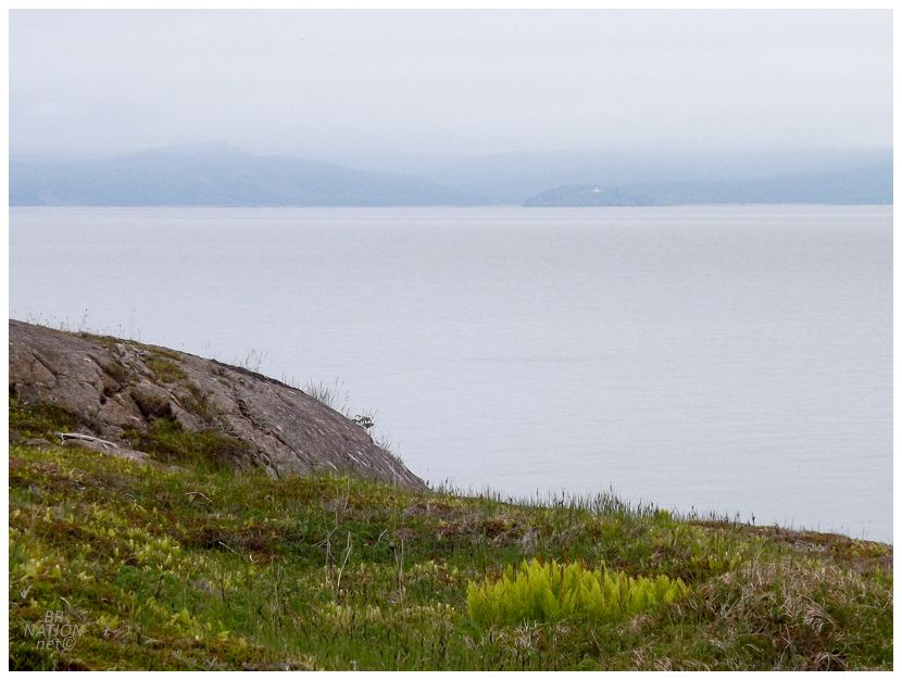
Peering out from a hill above town, I could just barely make out St. Jacques Island and its lighthouse across the bay. This was one of the reasons I was excited to camp at or near Point Rosie, as I wanted to be able to see the lights of Belleoram and St. Jacques Island as night fell. As I've visited Belleoram numerous times and my trip to St. Jacques Island was incredible, I liked the tie-in and being able to see them, but camping here obviously wasn't meant to be. |
I climbed another hill on the eastern side of the harbour and the town's only activity was some b'ys with a fresh catch cleaning their fish down on the beach. I was running pretty low on food and water by this point, so I sort of selfishly wandered around more than usual in the hopes of being invited inside somewhere for tea and baked goods, but I still am who I am, and timid me wasn't going down on that beach to actually initiate a conversation. Saying goodbye to Point Rosie, I noticed my back pannier rack had broke one its allen key bolts for a third time now, so I got myself out of the village's view before rummaging through my bag for a solution. Thankfully I had some duct tape and a hose clamp, which I managed to jimmy-rig well enough that I thought it would hold for the 24km ride back. While fixing it, a dude went by on a quad and didn't even slow down to see if I needed any help. I thought about how I've grown so used to the friendliness and helpfulness of Newfoundlanders, that I'm actually confused when someone has something better to do than help some unprepared schmuck without enough water or extra allen key bolts, lol. |
After about an hour of cycling back, it was time for a break as I came to the above scene at Venison Cove. I couldn't help but think about how many great spots there are to camp along this coast. And the distances aren't even that bad either, you could even backpack it without the bike. |
There was never a community here at Venison Cove, so I didn't know what was going on with this house. It was definitely an old Newfoundland-style home, but where did it come from? Was it a case of someone building their family home away from any community, or maybe a case where someone only wanted their house floated a bit down the coast from Point Rosie? Who knows. |
Going back to my bike, I also noticed that the sidewall on my back tire was starting to deteriorate. Oh jeez, I was going to have to go even slower and more carefully around the football-sized rocks on the way back. |
There was no part of me that was looking forward to how this trail concludes with swimming in stones while pushing my bike along the beach at Doughball Cove. To add insult to injury, a convoy of quads and side-by-sides rolled up as I was about 70% of the way across. Pulling alongside me, they let me know that there's actually a quad path up behind the beach that I'd probably find a bit easier than pushing my bike along the beach. Son of a ! |
Anyway, I long wanted to see Point Rosie and now I had that ticked off the to-do list. It was time to celebrate with a walk around one of my favourite Newfoundland towns, Grand Bank. |

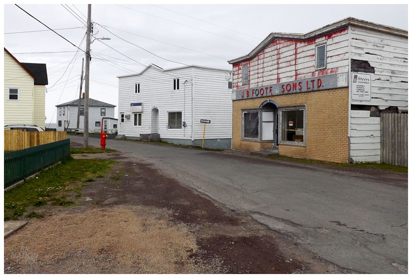
Grand Bank is home to many old and weathered buildings - and that's even with how they've taken down their Orangemen's Lodge, Cottage Hospital and a historic fish merchant premises all in the last 10 years. Therefore with how hard it is for historic buildings to survive in Grand Bank, I'm always happy to take some time and explore their complex maze of streets, sniffing out any additional great buildings like the above Al's Specialty Store. |
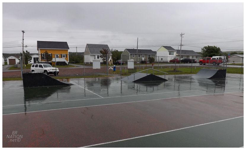
I couldn't spend as much time as I'd like in Grand Bank since I needed to get moving, grab food, and find somewhere to camp. The rain picked up too, which meant after being surprised by the new Town of Fortune Skatepark, that I'd have to come back someday if I'm ever going to ride every skatepark in Newfoundland. |
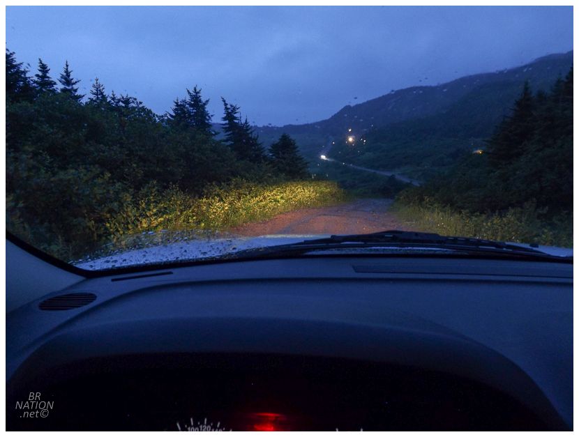
I was pretty excited to camp in some random place around the bottom of the Burin Peninsula, but the rain was now closer to a torrential downpour. I had a couple of backup places marked in the GPS in case I couldn't just stumble upon somewhere good to put up the tent, and now that I couldn't see out of the windows because it was raining so hard, I headed for these stealth campsites I'd previously researched. Except that the roads to these beaches and coves were some of the worst roads I've driven in this province; and when I'd get to the point where I wasn't comfortable going any further, there'd be like a Honda Accord sitting there at some cabin, wtf! I'm not one who is particularly hesitant with the gravel roads I'll drive down but Burin residents put me to shame. Especially when you consider that there's another resettled place down here reachable by road and twice now, I've driven down a few kilometers of said road and then given up. |
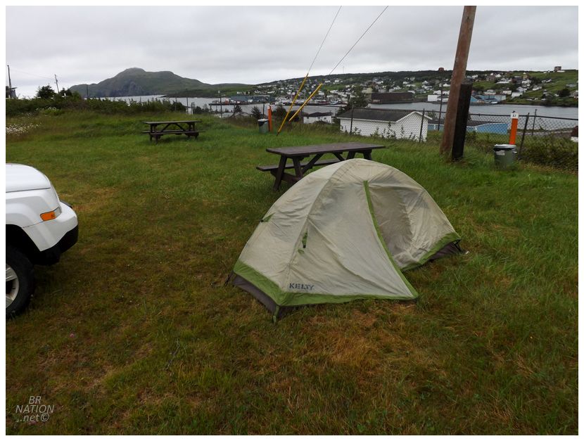
So I kept going through the rain until the last community before the hike I planned to do tomorrow. Thankfully the Town of St. Lawrence has a municipal campground and rolling up the hill, it was completely deserted. I briefly considered the local Ocean View Motel, but it's a dated rundown thing that still charges $129+tax for their smallest, single occupancy room. Fuck that. Instead I pulled up to one of the spots overlooking town, then put on some podcasts while dozing in and out of sleep sitting in the driver's seat. Around 1am, I got tired of sleeping upright, so I waited for the rain to lessen just a bit, then raced to put together my one man tent for a few hours of sleep. |