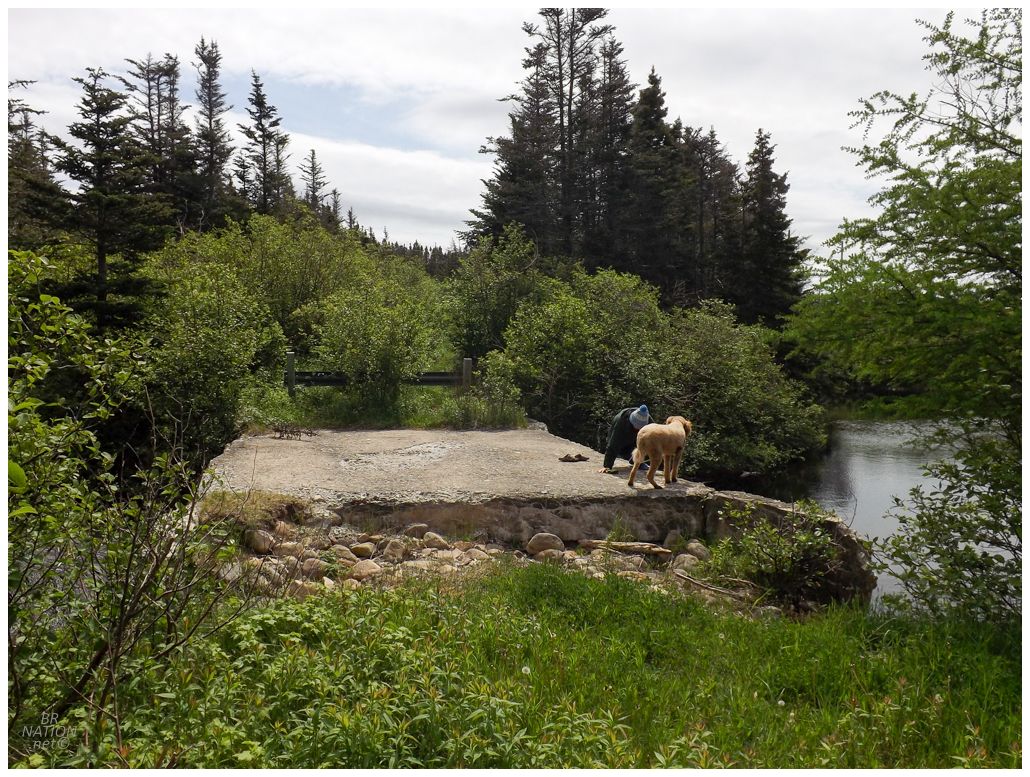
Eventually moving on from the slate mine and now en route to breakfast in Clarenville, a short detour brought us to this ruined bridge I'd always wanted to check out, located in the tiny hamlet of Barton. As Barton's location would challenge even my decent Newfoundland geographic knowledge, I'll state here that this collection of ~18 houses is located up by George's Brook, about 10km north of Clarenville. |
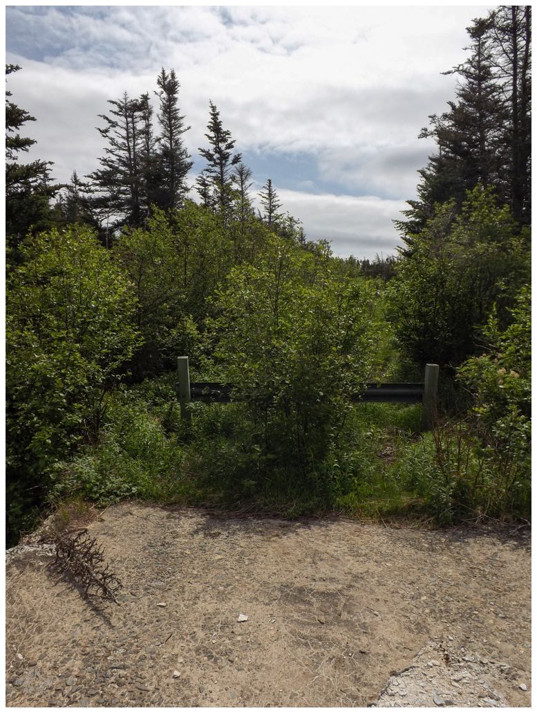
There's a fair number of little abandoned bridges like this in Newfoundland, where the old highway curved inland and they built a short bridge crossing at a narrower portion of the brook or river. Eventually when it came time to replace the old bridge, the province would now build a longer bridge further down the brook so the road didn't need to curve so far inland - allowing for safer and quicker travel over straight highways. And since the province wasn't building the bridge in the same exact spot as the old bridge, it made sense to simply leave the old bridge standing but blocked with barricades or barriers. |
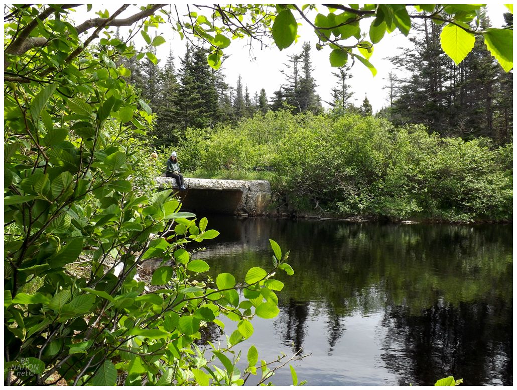
With both of us wondering if this was a good swimming hole, I'll note that it isn't on the indispensable and comprehensive map of Newfoundland swimming holes. |
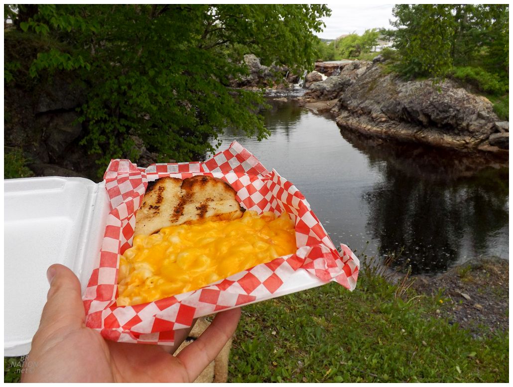
We were getting hungry now and that meant leaving Barton and heading for the big smoke...Clarenville (pop. 6300). It's in Clarenville that we were too late for breakfast anywhere and I was flabbergasted that Isy couldn't believe restaurants here wouldn't have all-day breakfast. It's almost as if she hasn't lived in rural Newfoundland for six years, lol. Eventually we figured out that Rod's Restaurant actually serves all-day breakfast, while I instead went with the mac n' cheese from the Clarenville Inn. In addition, with Clarenville having a pleasant riverside park, I was happy that we had to-go food and could hang out with the domestic ducks and waterfalls while we ate. |
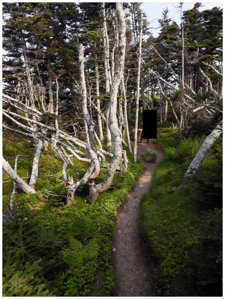
Our main objective today was to hike one of Isy's favourite trails and one which I hadn't hiked before, the Skerwink Trail. Located in both Trinity East & Port Rexton, this trail is only 5.3km (3.3mi) in length, but we parked in the village of Port Rexton and effectively added a couple of kilometers to each end of the trail. |
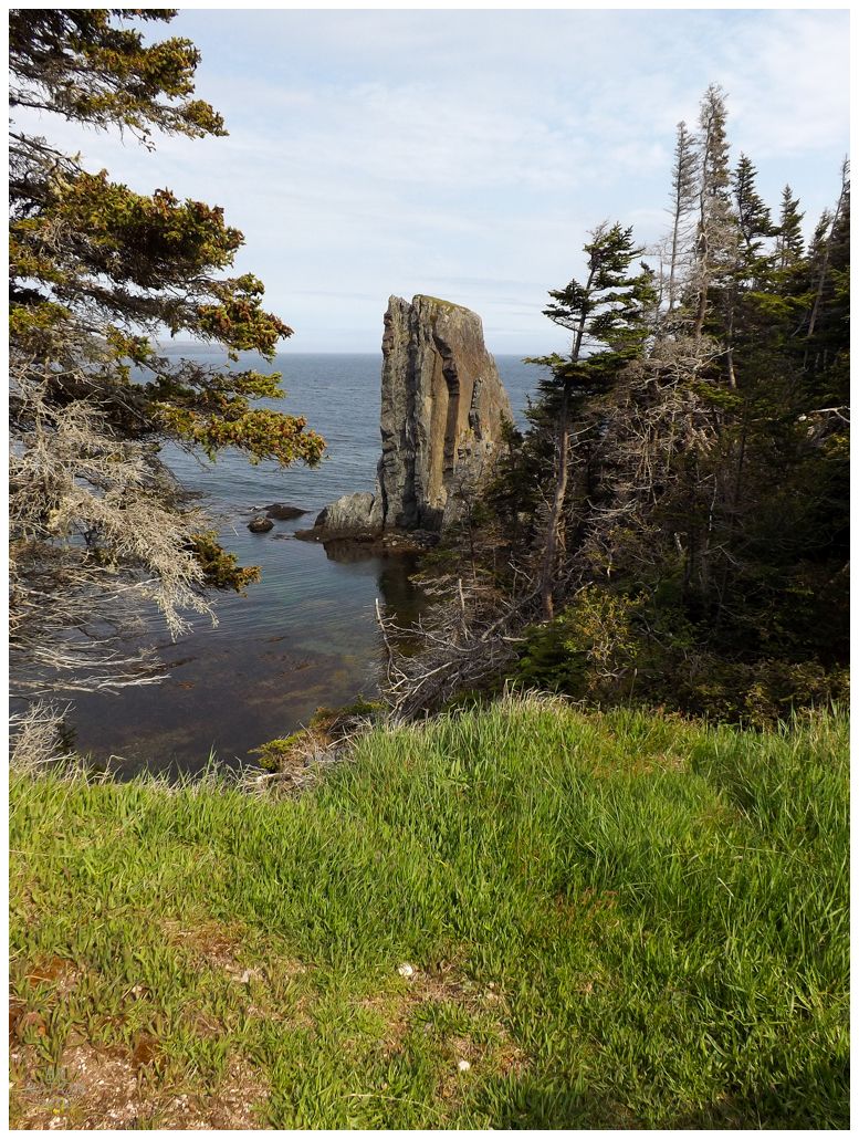
The Skerwink Trail is one of the most famous trails in Newfoundland and one that is almost always recommended to tourists, especially with its location on the heavily-trafficked Bonavista Peninsula. The whole reason I hadn't done Skerwink before was because for years, I had things mixed up and thought this other trail that's 15km (9.3mi) end-to-end and requires hitchhiking back to your car, was the Skerwink Trail. It always sort of surprised me how many people went thru with hiking such a trail, lol. |
It was only when both Shelloo and her boyfriend hiked this trail multiple times, plus Isy and her father hiked it, that I asked about specifics and was laughed at, for thinking it was any type of challenging undertaking. The Skerwink Trail is a nice piece of moderate exercise, but as it turns out, it is in no way strenuous. |
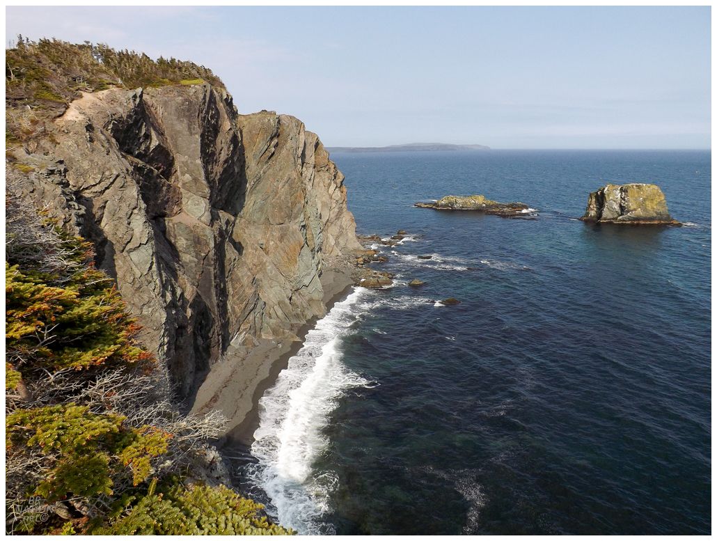
One thing it is though is breathtaking. In fact, it's Isy's answer to the best trail on the island, and while I waited for her to finish up with her foolishness of laying belly down on the cliff's edge because she liked the vertigo, I pondered what trail beats the Skerwink for the Island of Newfoundland. It's a matter of the immensity of the landscape for me. I immediately thought of Pacquet's community trail on the Baie Verte, preferring it to the Skerwink since it's just on another scale of massiveness from these cliffs. I'd also lean towards Northern Peninsula trails like the Cape Raven Trail in Hay Cove, or Treena's Trail in Cape Onion, since I love trails with treeless portions that allow you to take in all of the islets, coastline, and views around you. |
You might suspect that I'd give additional points to any trail with lighthouse views and if that's the case, then Skerwink gets some extra points with Fort Point (Trinity) Lighthouse visible during large portions of the trail. Fort Point Lighthouse was my 28th Newfoundland lighthouse. I got it back in April of 2010. |
Dining at Mifflin's Tea Room.
I wanted to camp in the vicinity of Trinity with a view of Fort Point Lighthouse, but we didn't have anything on us for dinner and there was nowhere with takeout available anywhere closer than Bonavista. At least in Bonavista, we could dine outside and hang out with Kingsley instead of leaving him in the car. |
Although chilly, it was a fine evening in Bonavista. I was starting to come around on the fact that this may be better than finding some greasy takeout in Trinity. |
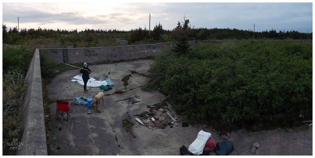
We were running out of daylight though, especially after a wait for dinner. I was left wracking my brain for nearby stealth campsites. The Trinity spot was now too far away to reach before nightfall (and I hadn't scouted it out beforehand). I knew of another site really close to Bonavista, but with a pasture close by, I figured that wouldn't work too well with the dog. So I went ahead with driving down to Elliston, where I figured we could push up the rough road and camp at the old radar ruins atop. The new tent would come in handy if there were any hilltop winds. |
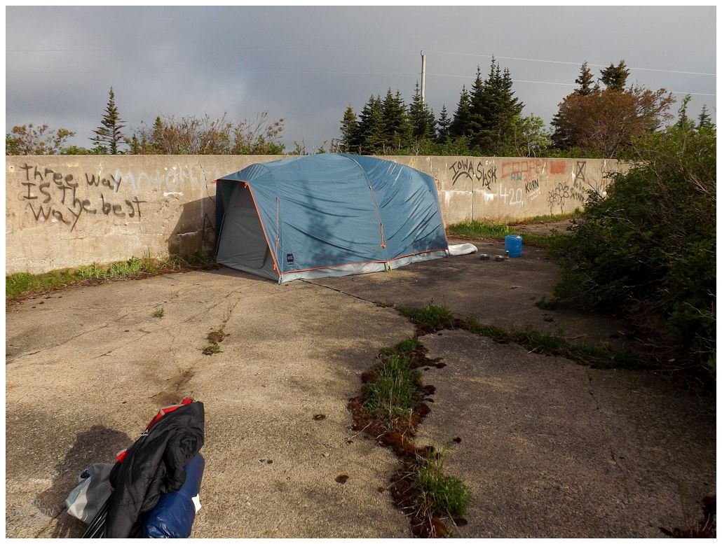
Speaking of the new tent, holy shit was it overkill. I had went overboard with the fact that it needed to be bomb proof while also spacious, and this new 6-person tent had us laughing at the thickness and weight of the poles, plus the whole separate room even after we had our queen air mattress inflated and inside the tent. Sure, it was nice that we were able to play cribbage at night without having to be right up against the mattress, but it also took us close on 30 minutes to put up the tent. Not to mention, even with this giant concrete wall beside us, the tent still shook in the night due to the wind. I wasn't sure that this 6-person MEC monster was the way forward camping-wise. |
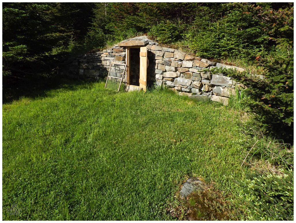
Anyway, the next day we were trying to get home somewhat early, but we were also right next to the town that billed itself as the root cellar capital of the world in recent years! Elliston even had little parks like this one, with root cellars that you can wander right into instead of worrying about private property. |
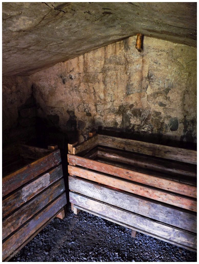
I was somewhat excited for this cellar because a woman I know who works with bats, brought up one day how I like "abandoned mines and houses and things " and how "root cellars are just like that, right?" and how I should start my thing of checking off seeing every one (ex. lighthouses, skateparks), but with root cellars. LOL. It was a good try on her part, but I'm not about to check out every root cellar in the province. This was one was easy enough to check out and report back though (zero bats). |
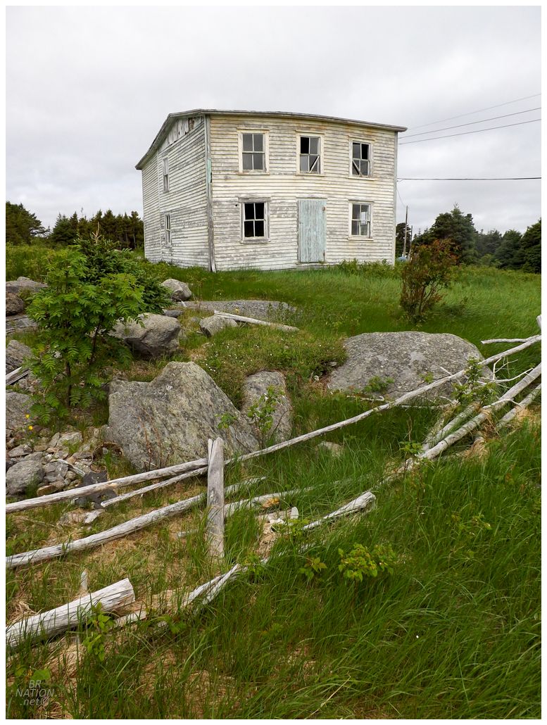
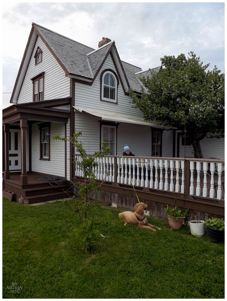
Nowadays I enjoy checking my Newfoundland towns visited list before I go to an area, so I can spend extra time checking out any village which I may have only given a cursory glance in the past. Down here that was Plate Cove East, where I previously noted, "I counted 'seeing' Plate Cove East by driving on the NL-235, but looking at Google Earth, Plate Cove East is probably worth more of a look." Sure enough, this Plate Cove East house was clearly worth more of a look. |
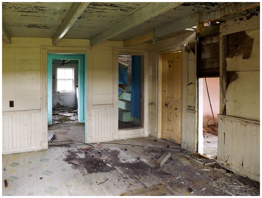
There were a couple of old timers nearby, so I reserved myself to not being sneaky and just walking about taking exteriors. This shot comes from a missing front window. What a fine, classic Newfoundland home. |
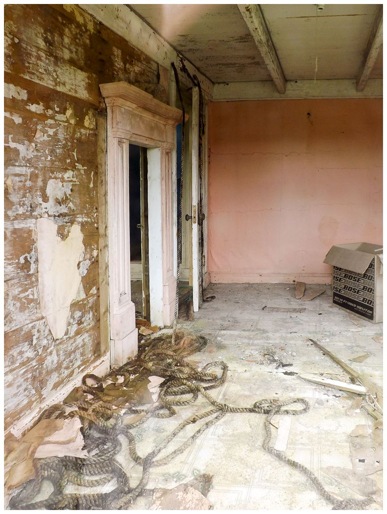
The old timers got in their truck and went away almost instantly though, which was funny now that I wasn't being slick and trying to go inside. Oh well. It was still great to see something cool in Plate Cove East and add to my Newfoundland resume. |
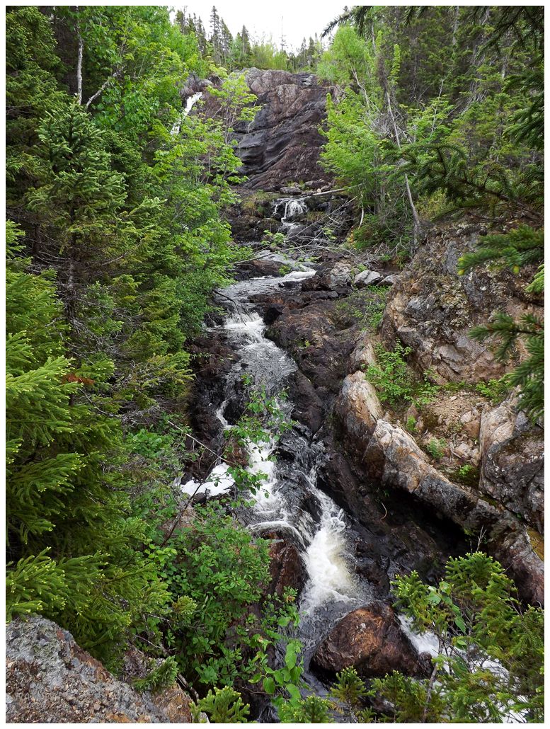
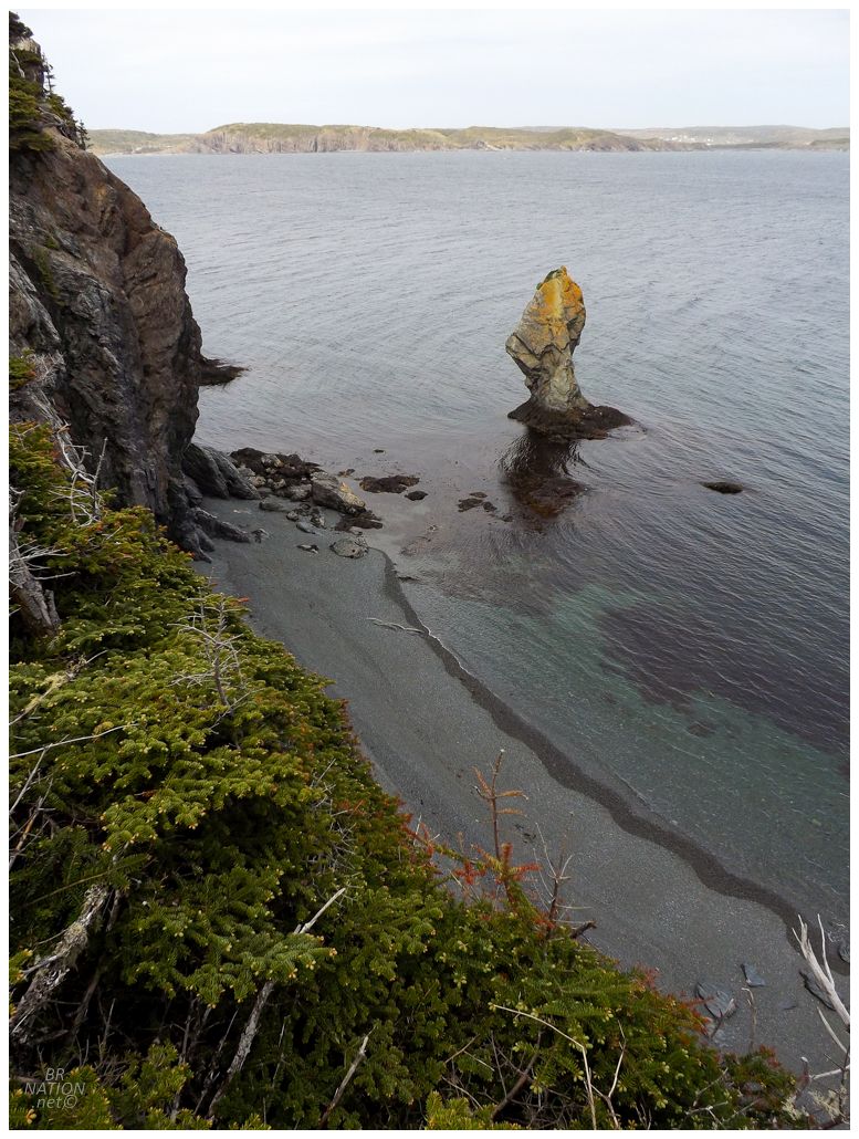
It had now warmed up enough for the last stop of the trip: a swimming hole just outside of Southern Bay. This used to be Rattle Falls Provincial Park, but now it's just another casualty of the cuts in the 1990s, where the provincial government slashed 48 provincial parks and scenic attractions. Today all that's left is a dirt lot where many people wander up a short path to Rattle Falls. |
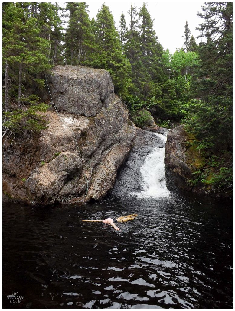
I swam for a little bit, but really appreciated how long Isy wanted to stay, since it allowed me to photograph flowers along both sides of the falls. We tried to coax Kingsley into enjoying the water too, but he wouldn't go past his dog ankles, lol. Savouring the fact that at this early hour we had this fine swimming hole all to ourselves, eventually it was time to accept the 5.5-hour drive back to Corner Brook, happy with a fine weekend on the other side of the island. |