Just up from the McCandless Cabin was another cabin, but this one was more recently occupied. Not wanting anyone to come out and tell me it was foolish to hike to St. Kyran's, I skirted around the property and kept it moving. I continued parallel to the shore in hopes of seeing the actual part of Clattice Harbour that's more remarkable with a dock and a welcome sign, but the path was headed northeast towards a peninsula when I needed to head southeast and off said peninsula. I made a turn towards the southeast and started climbing up into the bush. |
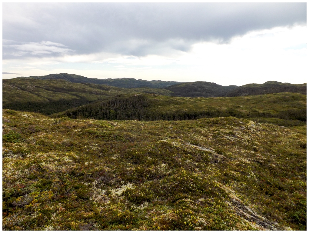
The top of the hills was a welcome barren of crumbly rock and short vegetation, leaving me to focus on avoiding the valleys and ponds I could see on my map and in the landscape. Taking a couple steps forward, I blurted out a "Jesus!" It was another moose trotting away, this time a mother and her young - two of the eleven moose I saw throughout the hike. This was the closest moose of them all, and as I was trying to keep my cool and keep going towards St. Kyran's, maybe the least welcome. |
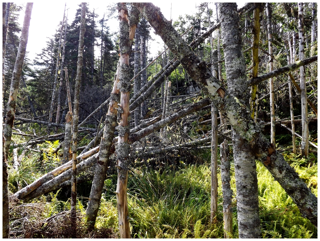
These hills were now the biggest of the hike and I strived to avoid any unnecessary climbs down into the valleys between them. I climbed up and down smaller parts of the hills, trying to pick a route where I only had to deal with one or two large descents. The hilltops continued to head perpendicular from the direction I wanted to go, so at least my hilltop scouting allowed me to size up the landscape to try and save myself some grief. Looking at my topo map, I could see a wide valley up ahead that I had to go through. It was time to abandon scouting and dive into this downslope of fallen trees and soil barely clinging to the steep hillside. |
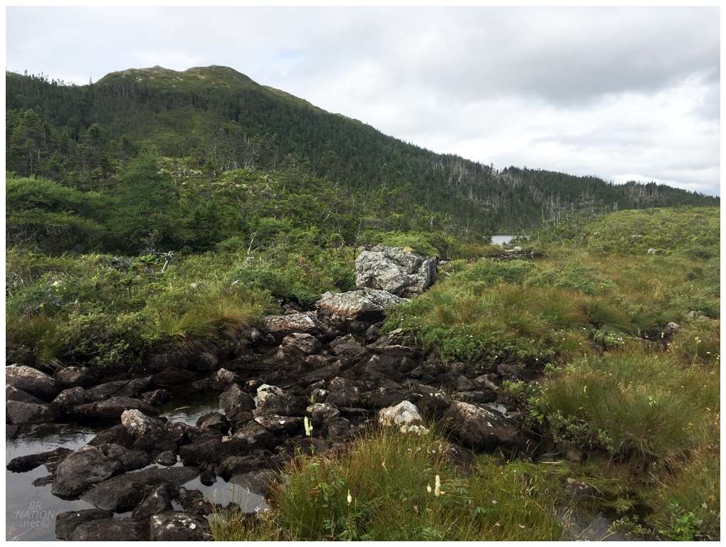
There were two ponds down in the valley, connected by a small stream and emptying out into the Southwest Arm of Clattice Harbour. Reaching the first pond, I could see a bit of sand on the shore, but sure enough it was easier to walk in the fern forest a couple feet away. The rocky stream at these ponds provided a great place to plop down my pack and size things up. Hiking was definitely easier thanks to my LifeStraw water filter, where normally I would have a 4L water jug from the local gas bar, refilled with boiled water from these ponds. Keeping my water amounts down to only my 20 oz. LifeStraw bottle reduced a lot of weight and subsequent strain on my knees and hips. As I sat here, a big hill stood between me and St. Kyran's. It was steep and lacked areas with spread out, dead trees like the other nearby hills. It was going to be a grueling bushwhack that had a good chance of putting an end to my hopes of reaching the resettled community. I thought back to the Facebook post regarding this hike and the "old community trails" the poster noted - trails which I'd left behind and hadn't seen in a handful of hours. My topomap showed an old trail here though, from Clattice Harbour Southwest towards St. Kyran's, which gave me the motivation to shoulder my pack once again. "Jesus!" I blurted out the Lord's name once again. I'd scared up a snipe almost immediately after jumping to my feet with all my newfound gusto. |
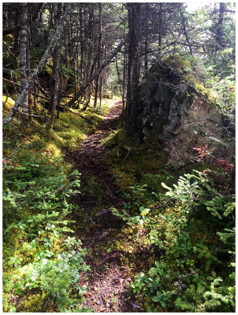
Oh man, oh yes. Deciding the open bog looked like better walking than going up into the hillside forest, it was only when I pushed upwards alongside the hill to get around some water, that I was birthed out of the woods and on to this glorious path. I only had three kilometers to go now and I could feel it. I couldn't think of any other reason this path would exist except as a path for visitors between the old communities. Now it was simply a matter of happily trotting over this cushy floor and around standing rock walls. |
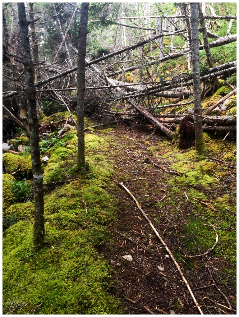
Hanging on a tree as I swung around next to one of the valley ponds, it was evident how little soil was playing home to the roots of these trees. It would become even more evident as tree after fallen tree came along that I'd have to pick my way around, or squeeze down towards the Earth, or break in half - until eventually I got tired enough in a couple spots that I just got on all fours and crawled underneath. At the same time, the trees didn't matter as I was both excited to be moving along relatively easy towards my goal; plus in finding myself here on this obscure and lovely path. |
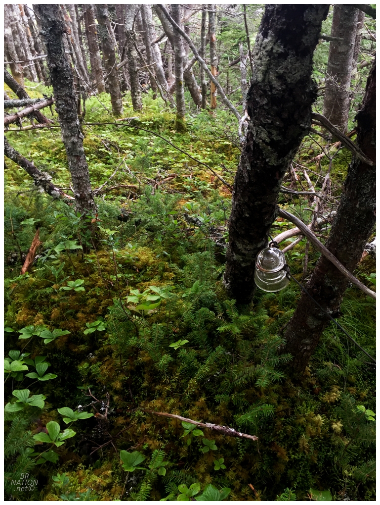
The trail curved uphill as it reached the end of the second lake. Numerous trees were blown down here to the point that it was probably three fallen trees for every one left standing. The majority of them were rotten or thin though, so it was easy enough to move up the hill and remain on the path, until I reached the rounded hilltop where the path was as good as a maintained national park trail. It was amazing to be on such a clear and wide open path while also so far from civilization. Along the way, I spotted this glass insulator for a line that must've connected the old communities of St.Kyran's, Clattice Harbour and/or Murphy's Cove. |
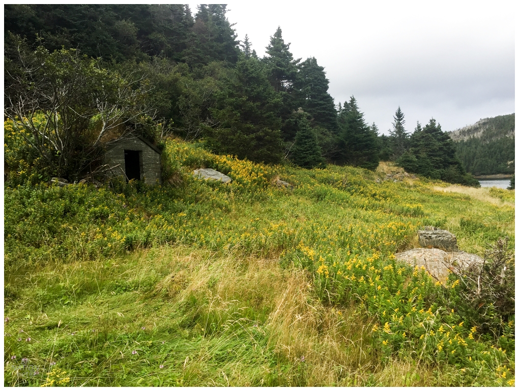
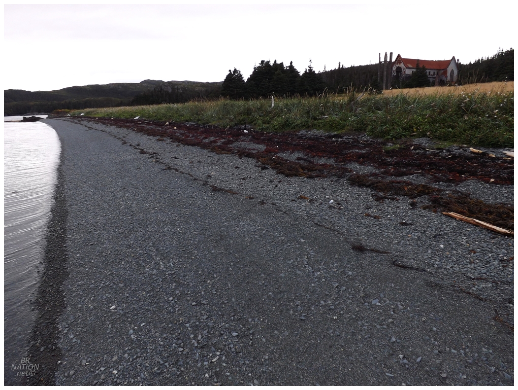
Coming down the backside of the trail, I was finally at the waters of St. Kyran's Harbour. There was a medium-sized cove to my right, but I didn't even investigate it because I was so excited and this Top 5 Location was about to be mine. The same held true for a second cove that even had an abandoned root cellar. Keeping it moving, I laughed at how a location like this would normally warrant a 2500-word, 30-photo BRN update. Not today folks! My forward movement was also because I could finally see the looming, incredible abandoned church across the harbour. This was a long, convuluted harbour which meant I wasn't that close, but still, to have studied and plotted and pictured coming upon this church for so many years now, it was surreal to look across and there it was. The trail continued and even got a bit better as I rounded the harbour. |
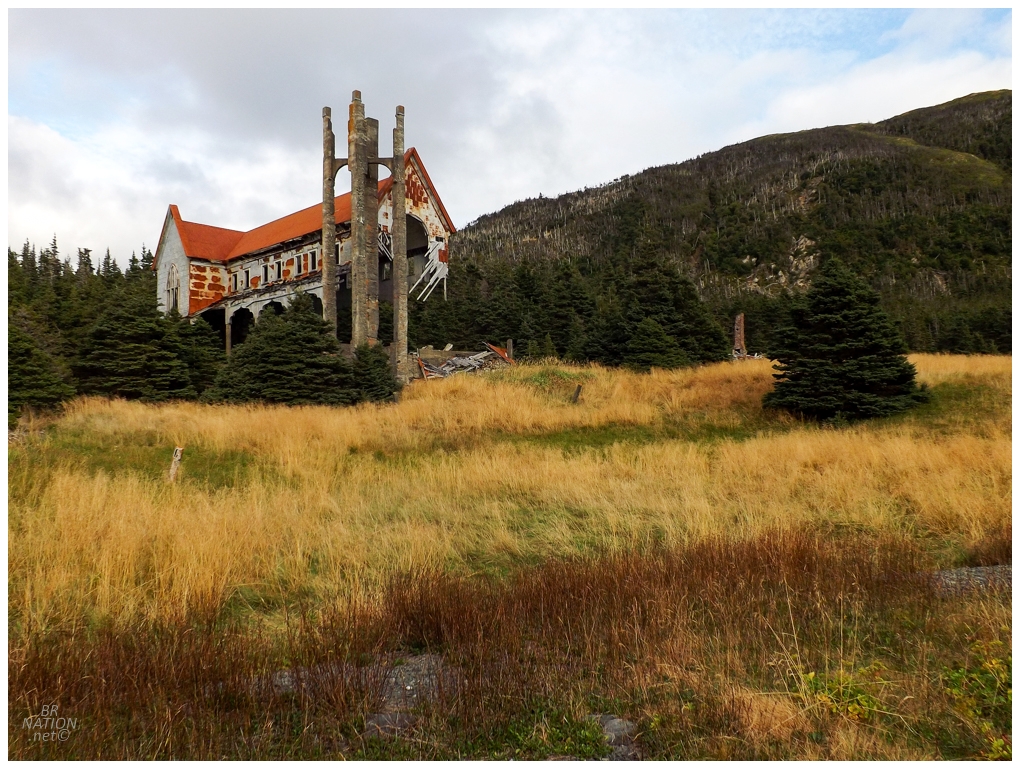
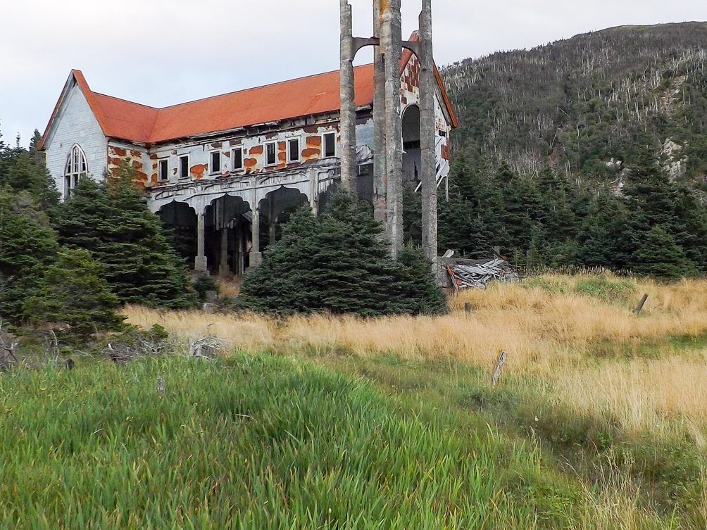
The church soon disappeared behind a finger of land that stuck out into the harbour. I kept moving, finding sites that looked like they use to have homes, then through clearings that stretched up the hillside, then on to one last narrow path between clearings. Popping out of the trail, all of a sudden there it was: St. Kyran's spectacular Mary of the Assumption Church. I threw down my pack and took a celebratory deep breathe full of relief and joy. The worry of getting here was over. The physical exertion of the day was over. The worry about whether I could follow in that Hiking NL guy's footsteps was over. I'd made it. I was here in Placentia Bay, standing before one of the most magnificent sights in the province of Newfoundland and Labrador. |
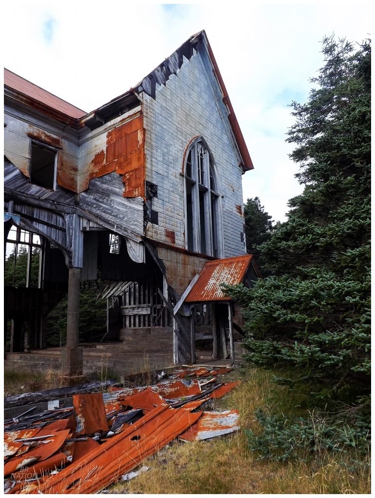
When I was home a few months later, I made a passing reference to "hiking four days to see an abandoned church" and Donnie insisted "there's no way that could have been worth it." While there certainly is a difference in what I'd spend four days hiking to see and what Donnie would spend four days hiking to see1, for me this was so worth it. |
(Use the white slider in the middle to go between the two photos.)
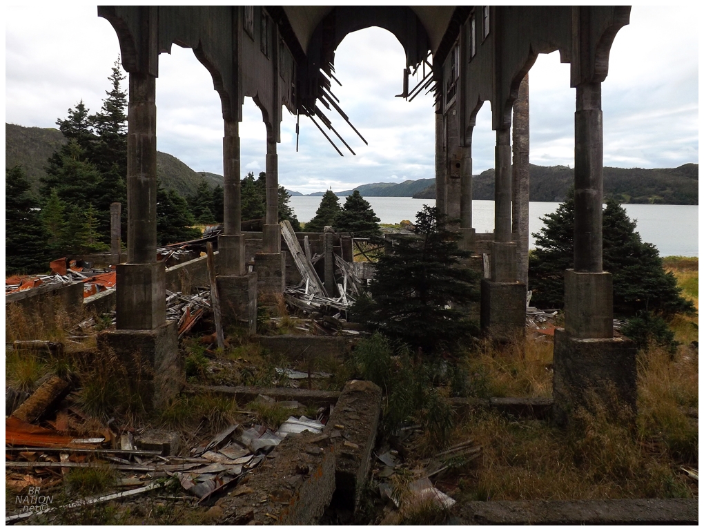
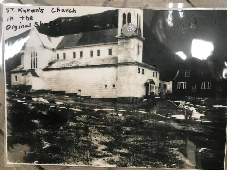
The village of St. Kyran's was once known by the eloquent name of Northeast Arm of Presque (since it's located in the NE corner of Presque Harbour). Around 1872, Father Williams Doutney renamed the community, possibly in honour of Father Kyran Walsh, a popular priest who had recently died. Rewinding back to 1857, the census only lists 12 people residing at Northeast Arm of Presque (St. Kyran's). Despite the low population, both a Roman Catholic Church and school existed for the residents. This is likely because of the 101 people who lived in nearby St. Leonard's, but one wonders why they wouldn't have just built the church and school there instead. Reasonably, a larger church was built halfway between the two communities in 1859. By 1871, St. Kyran's was up to 30 people, but it wasn't until the lobster fishery growth around the turn of the century, that St. Kyran's finally had a noteworthy number of people as the 1911 census said that 116 people resided here. |
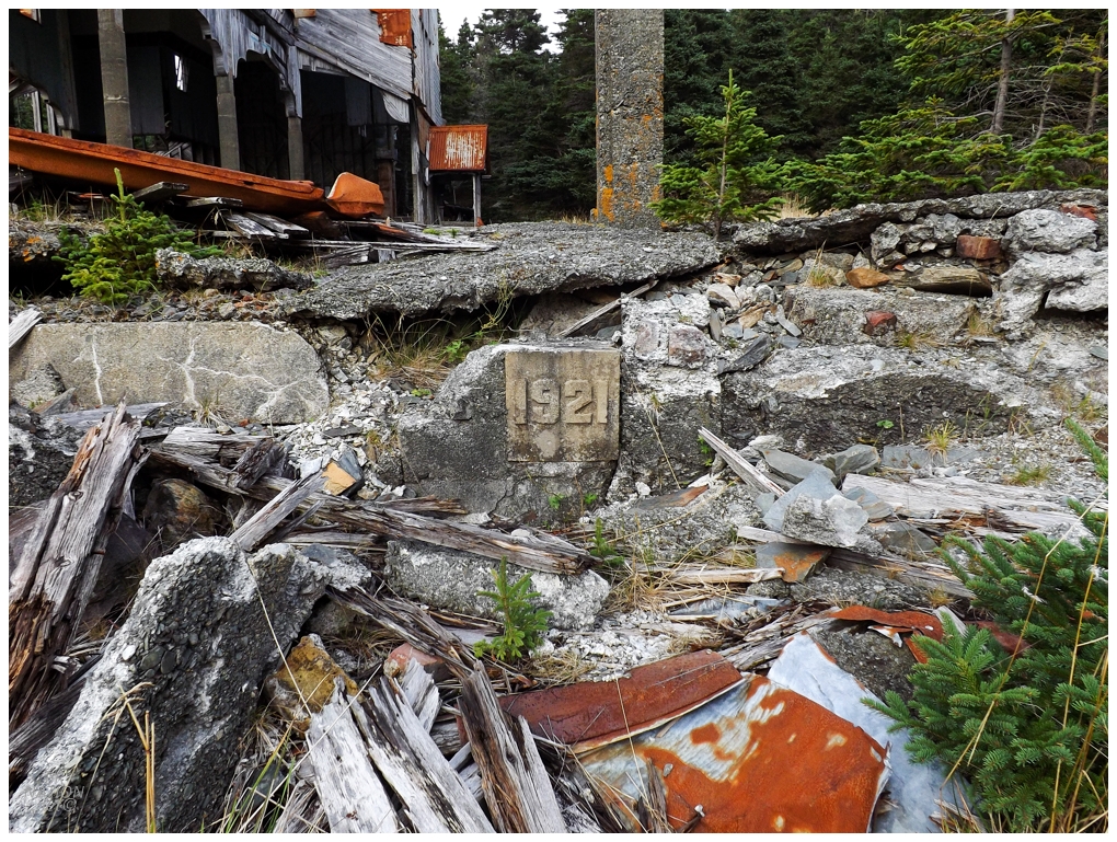
It remains a mystery why a church built in 1922 following a 1922 church fire, has a 1921 cornerstone.
The population numbers steadily declined after that, but there were still enough people in 1922, and definitely enough willpower, to build the impressive church you see in ruins today. People from Clattice Harbour would also have attended, which would have helped out the parishioner numbers. Interestingly enough, it's said that the people coming from Clattice Harbour North West - which is where I stopped at that abandoned cabin - took approximately three hours each way to hike to church every Sunday. |
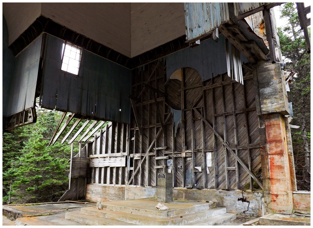
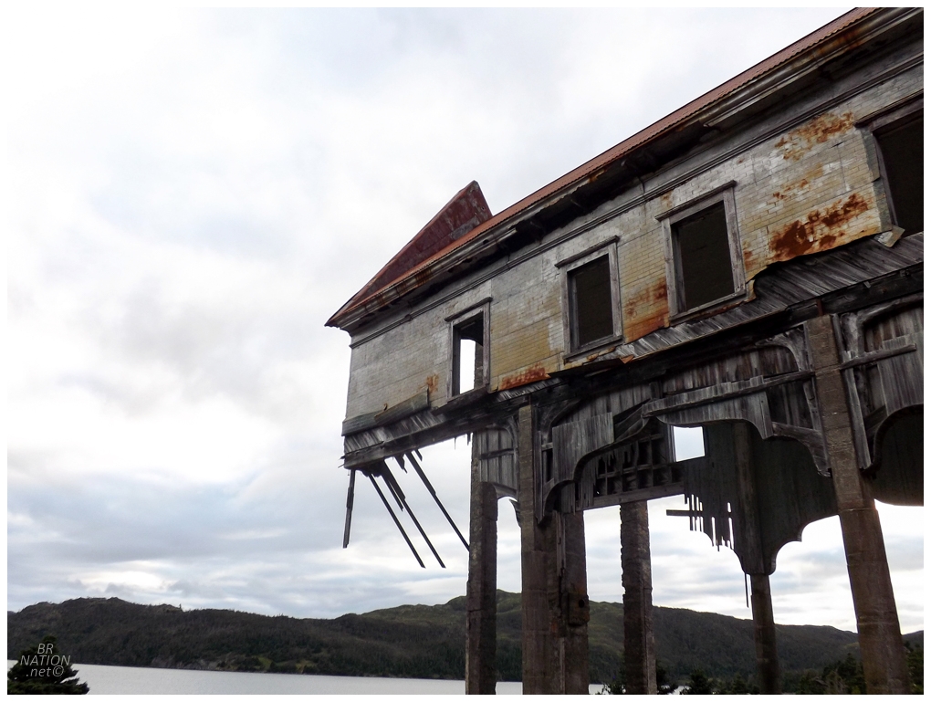
St. Kyran's was resettled in the wave of 1966 resettlement. At the time, only the Billings, Connors, Fitzgerald, and Lake families remained and they left for Dunville, Freshwater, and Southern Harbour. St. Leonard's was already mostly deserted by 1966, but the last two families (Leonard & Roger) took the offered package and left soon after. Nearby St. Ann's may have took an earlier resettlement package, while Clattice Harbour residents took what was offered in 1966. With the nearest surviving communities being all the way over in Monkstown and South East Bight; the St. Kyran's church was left to fall into ruin. |
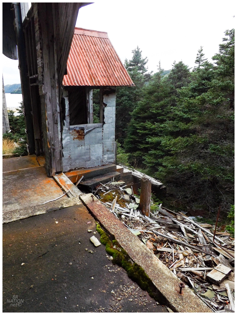
One thing that struck me was how perfectly Newfoundland worked as a location for this magnitude of a ruin. There's very few places where you'd get a structure this size and this appealing to visitors, but it would still be remote enough that you wouldn't have to worry about it becoming a hazard or an eyesore and requiring demolition. (That being said, I suppose you also have the option of removing the need for remoteness if you have a town like Gary Indiana.) |
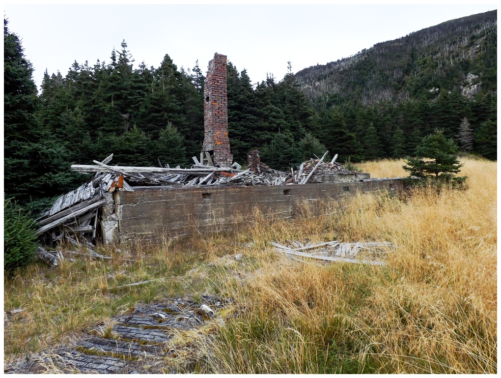
In addition to the main church ruin, there was also the chimneys and foundation of the old rectory. |
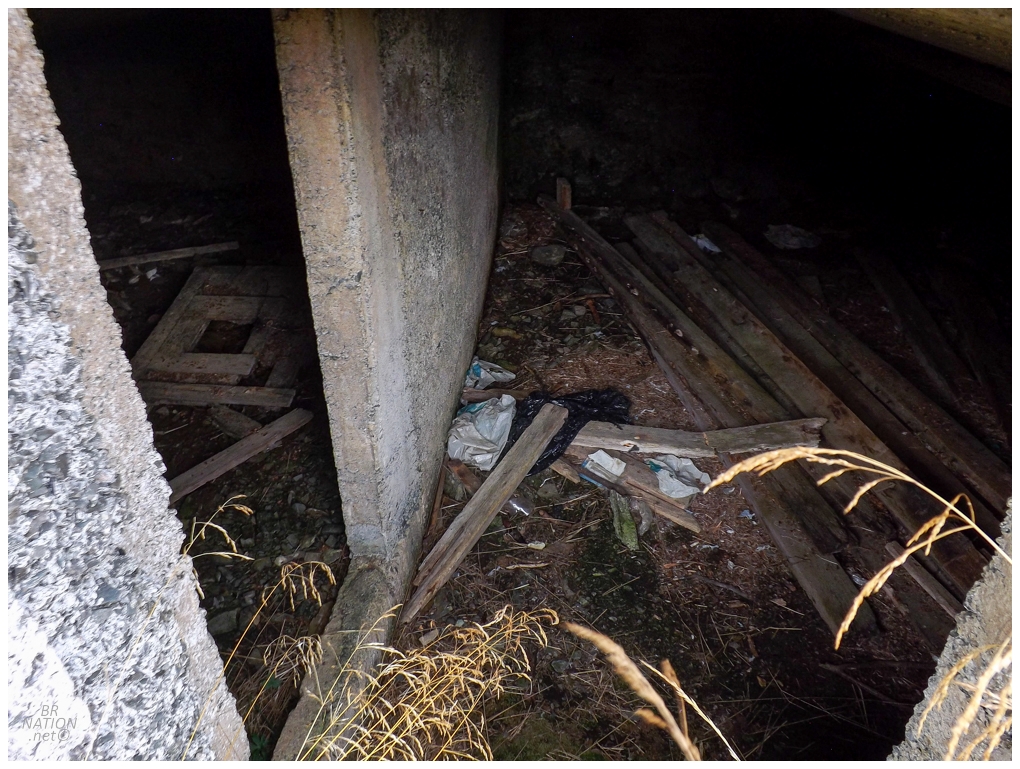
Across the marshy field where homes used to stand, I spotted a root cellar and made sure to check it out instead of skipping it like the one on the way out here. (I would end up briefly peeking in that other one on my way back tomorrow.) |
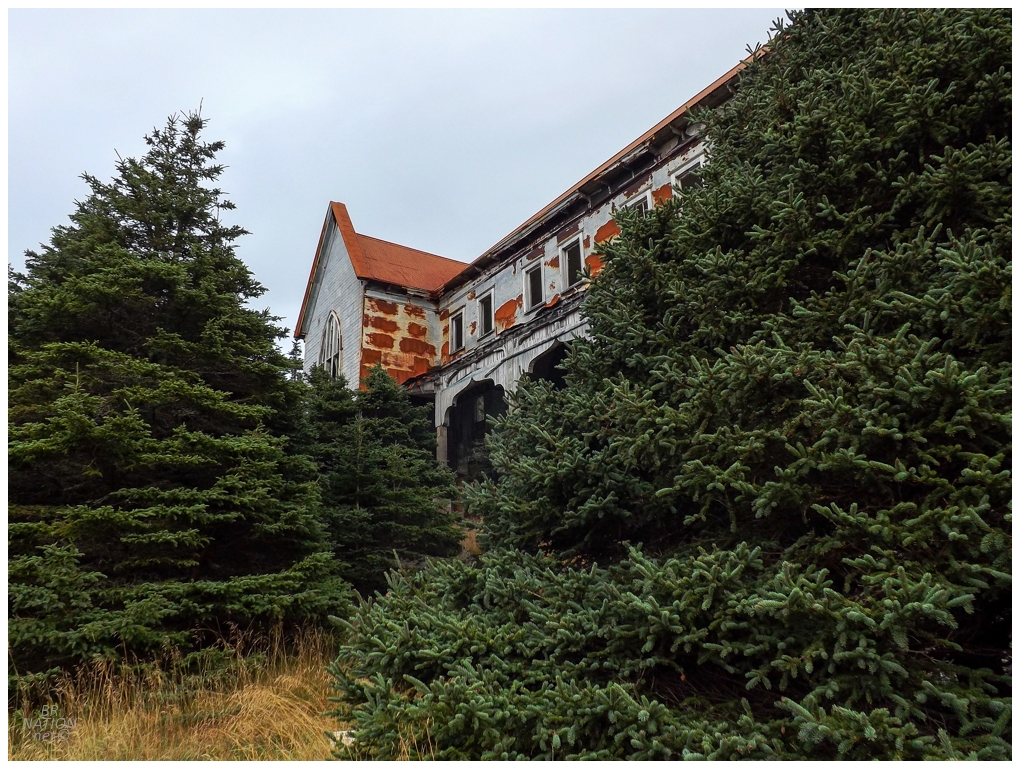
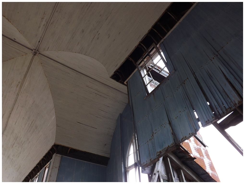
Setting up my tent was in the back of my mind throughout these first few hours, but now it was time to focus and actually get it set up. I entertained the idea of camping in the church, but some squirrels were getting pissy whenever I'd get too close, but more importantly, I pictured the wind picking up and a 2x4 or a window frame crashing down on me in the night. Imagining the headlines if I met my maker in such a fashion, I decided against camping inside. In hindsight, it was a calm evening and they were calling for perfect weather again tomorrow morning. This church and each of its individual boards and window frames have withstood decades of nasty Newfoundland winter storms and hurricane remnants - what were the odds that some gentle, 5 km/h overnight winds would break a piece loose and send it down on my glorified sleeping bag of a 7ft x 2ft tent? |
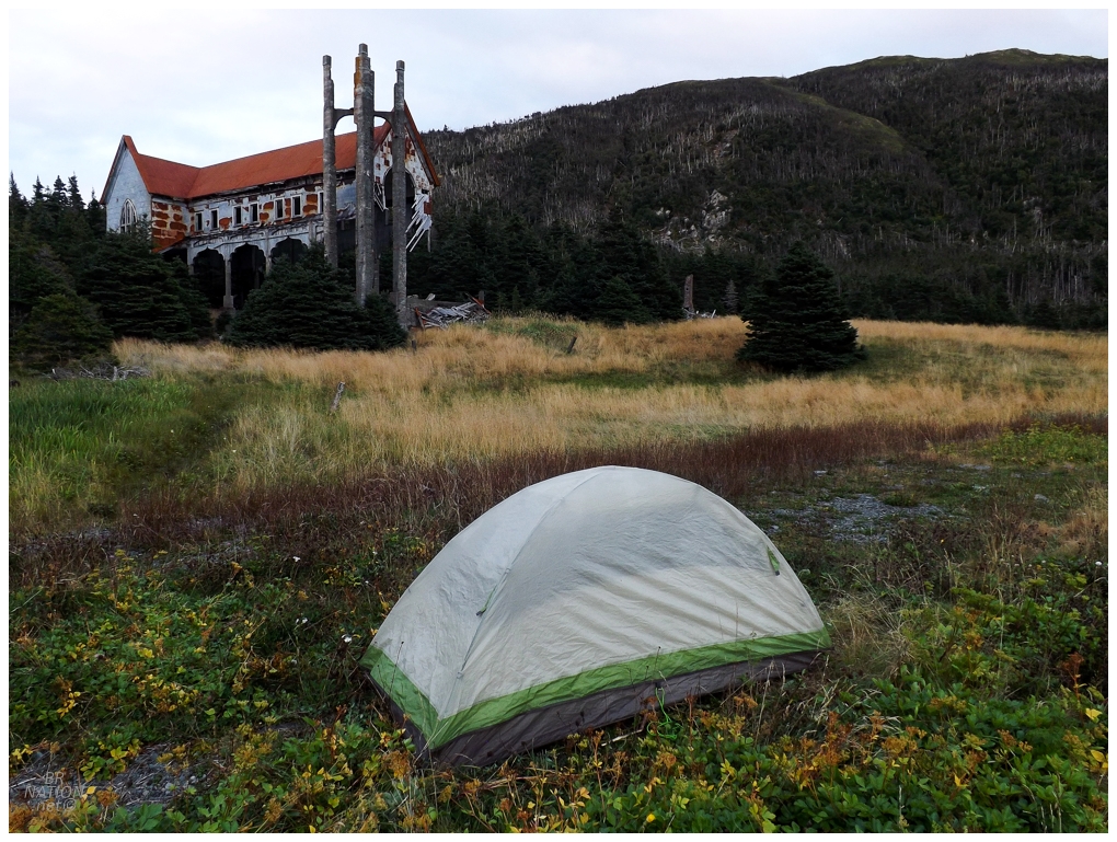
As mentioned, the fields around the church were marshy and wouldn't have made for the best camping location. I actually found the best location to be a little clearing right by the path that spit me out when I first got here. And so, I barely moved my pack from the initial spot when I first threw it down to take a celebratory silly selfie in front of the church to send off to Shelloo and Isy (which Isy then forwarded said ridiculous, peace sign, cheesing selfie off to her father when he asked what I was up to this weekend, LOL). |
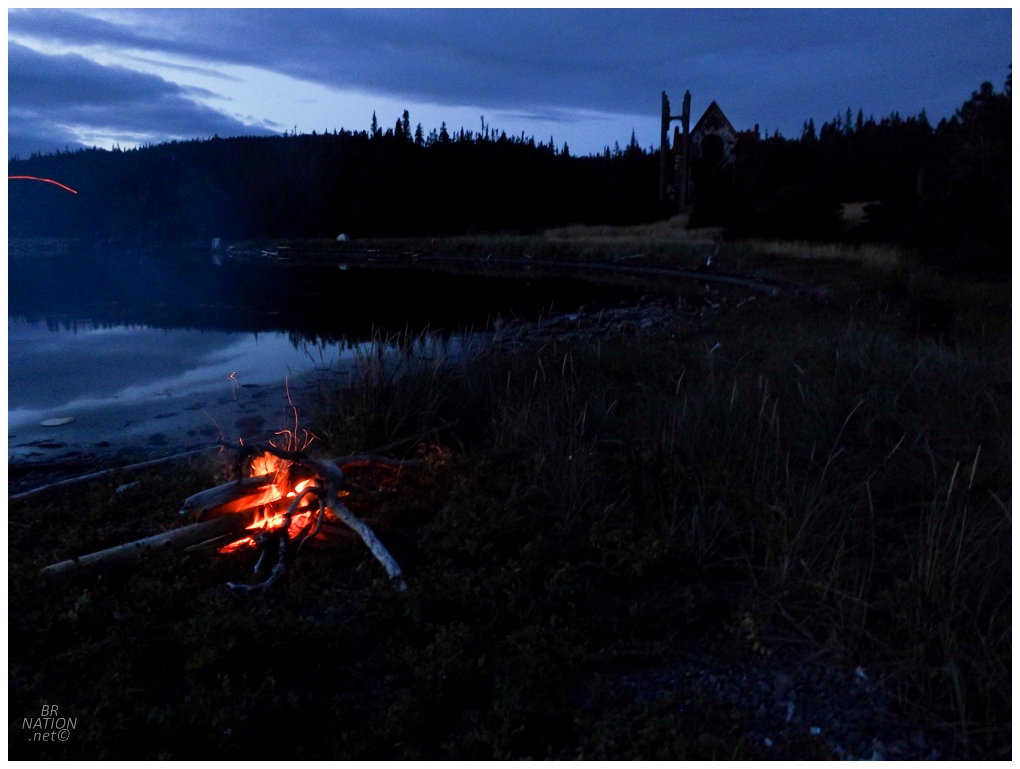
Pretty tired and after a ho-hum sunset, I remained commited to having a small bonfire out here and savouring the outline of the church ruin disappearing as dusk turned into darkness. Once darkness came though, I didn't care much for being out here alone at night, so I retreated to my tent and forced myself into sleeping away the hours until daybreak. It was then that I heard a rustle of something in a nearby bush. "Navi, you know how tents amplify noise. It was probably just a squirrel or a grouse. It's fine. Even if it was something bigger, you don't have food in your tent. Put the podcast back on, calm down, breathe, get to bed." The noise then rumbled past like a human passing my tent. It wasn't a rabbit or a fox, this was something big. And then, some grunting. "Okay! That's enough of this!" I jumped up and out of the tent, sockless and shirtless, cursing the fact that my cell phone flashlight only illuminated about ten feet in front of my eyes. All these damn 300-lumen, "urbex" flashlights at home and I didn't think I'd need one since I had my old trusty cell phone flashlight.1 Picking up the entire tent, I shuffled it back out to the point of land where I'd had my fire only 30 minutes prior. Thinking about how people keep fires going all night to keep away polar bears - and even knowing this wasn't a polar bear - I commited to keeping a fire going to scare away whatever was out there in the night. I also went about building the fire up a bit, comforting myself as its glow illuminated more and more of the darkness. (Add another fire picture here? Maybe a cell phone one?) So it went, that I laid down with the fire going, dozing off while waking up occassionally to throw on another log or comfort myself in not finding any animal eyes peering back at me. In addition to my worry about this animal, the night got down to 44°F/6°C, so I was also continuing to maintain the fire for greater warmth. It was a long and uncomfortable night as my hips dug into the rocky ground of this little point of land. Managing to sleep an hour into daylight through all my exhaustion, I finally clambered out of the tent for my morning duties, when I then looked up at the field of grasses and discovered what must've been causing all that commotion and stress last night... |
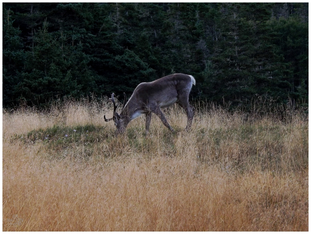
One lousy, harmless Caribou. You have to be kidding me. |
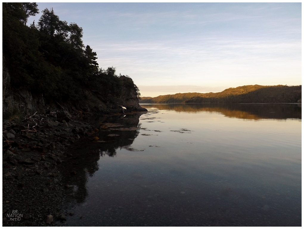
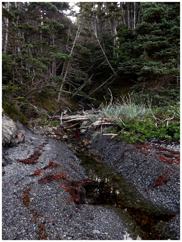
The idea of wandering down the shore and exploring even further obscure places excited me, but at the same time I had a full itinerary already, with plans to head down a path behind the church this morning, plus I needed to make it a decent chunk of the way back to Monkstown today. So I only went a few hundred meters and was pleased with standing before this little unnamed creek that emptied out into the ocean. |
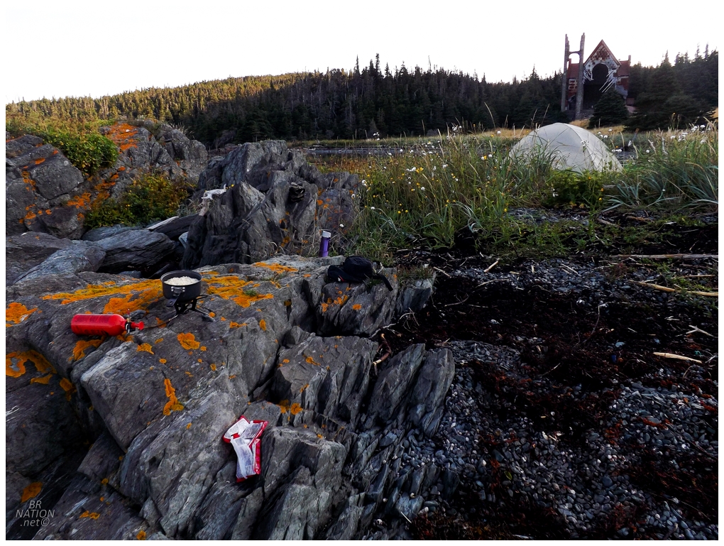
Knowing I would need calories for the day, I went about making a solid breakfast, but strangely found myself not as famished as I would have thought. It's during breakfast that I heard a boat motor as a little 15-foot vessel came around the corner and headed into St. Kyran's Harbour. I quickly realized I needed to decide whether I would accept any offered ride back with them to South East Bight or Petite Forte or Davis Cove or wherever they came from. Except that they simply pulled up out front close to the beach, and stared off at the church. There was the captain, a 50-year-old skipper who looked like so many others that have brought me out to lighthouses, along with an older woman who was clearly the reason they were here. She remarked at how little the church had decayed in the years since she'd been here last, took a few moments for reflection, and before I knew it they were motoring right back out, without anything but the slightest wave. I really thought a lone hiker out here would have at least garnered some questions. |
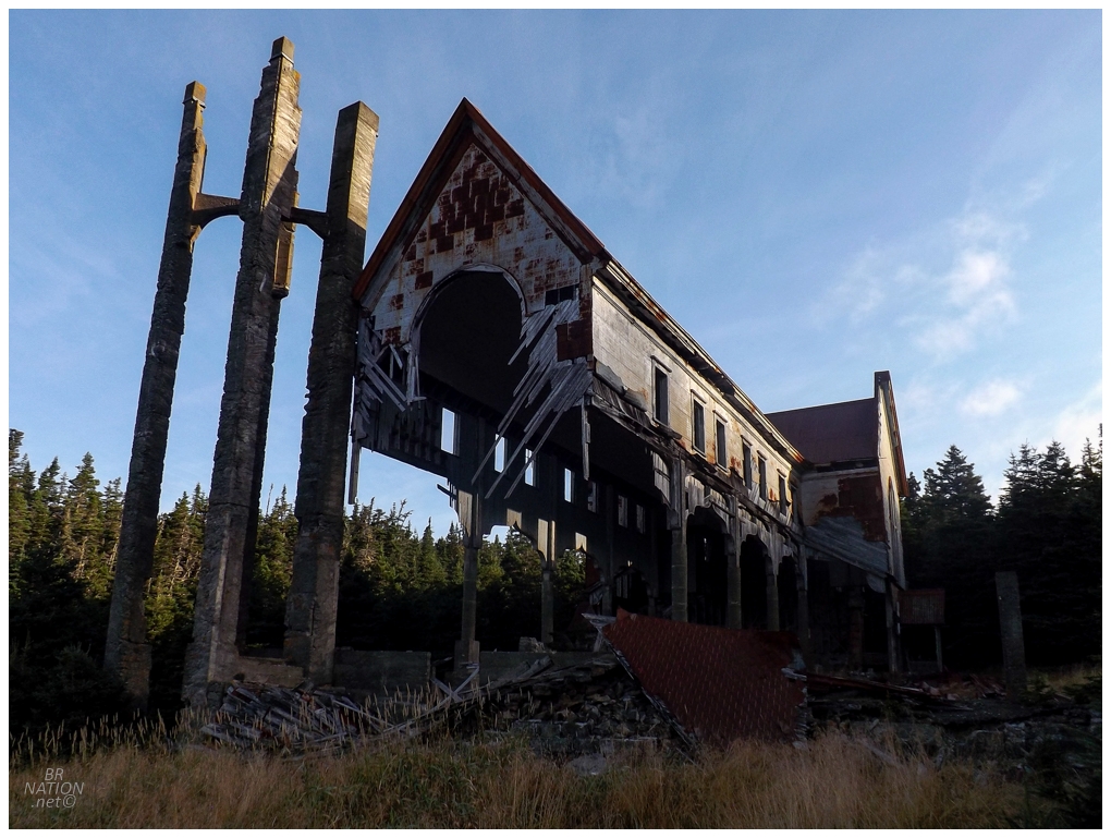
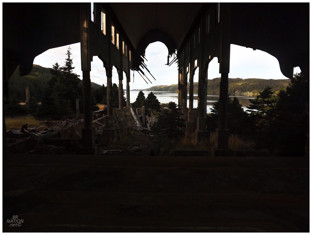
Having the place to myself once again, I poured my unfinished breakfast into the harbour and headed up the hill with my morning coffee to stand inside the church and appreciate this fine morning. |
