MacKenzie State Park sure made for a nice, reliable camping spot, but it was too far out of the way to sleep there again. Not quite wanting to go to bed just yet, I drove to Hawai'i Volcanoes National Park, where it's best to visit the volcano overlook at either dusk, night or dawn.
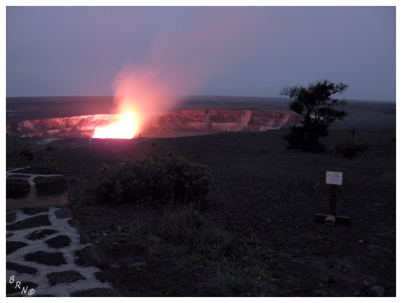
I didn't drive very far into the park before reaching the parking lot for the Jaggar Museum. It is from their large porch that you stand remarkably close to the Halema'uma'u Crater, which has been continuously erupting since March of 2008.
Returning to my car, I would drive further into the park in hopes of finding a stealth car camping spot. It was incredibly dark out here & while I hoped to see a Hawaiian Goose on this trip, I didn't exactly want to swerve around one at night.
I soon found a big, promising parking lot, but it also had signs about checking with park rangers for updates on deadly volcanic gas that can suffocate large areas. While I didn't think this would happen in next 8 hours, I also didn't think the park rangers would be all that impressed with my wanton disregard for their warnings.
Back at the headquarters building, with a parking lot bigger than some QMJHL arenas, it seemed that everyone but the janitor had went home for the night. Perfect. I pulled into a far, dark corner of the lot and made my clothes bed in the back of the SUV, then hopped onto it.
Finally it had grew late enough that I was asleep in no time.
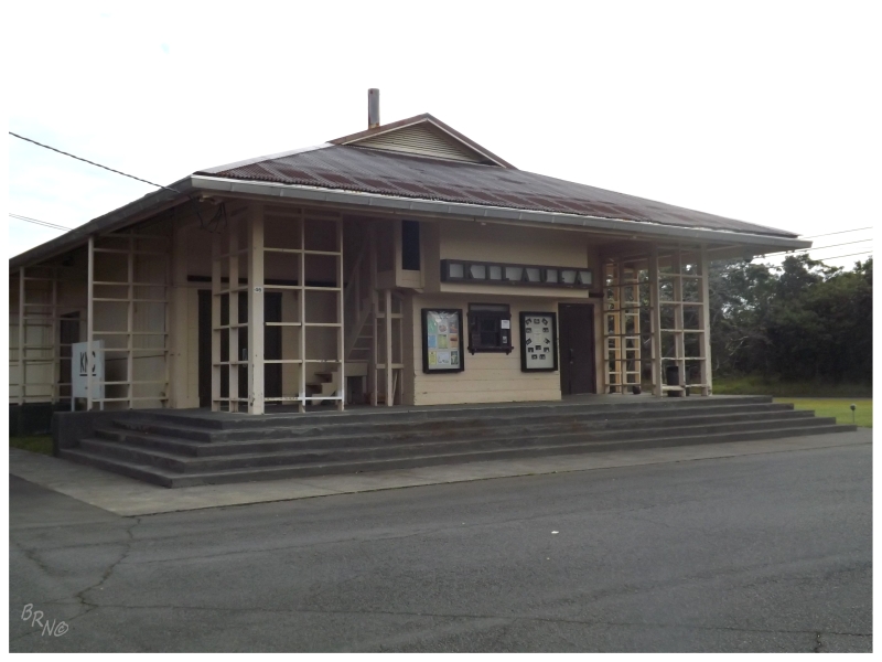
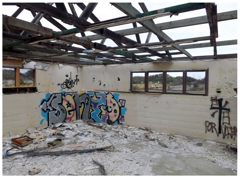
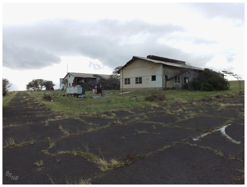
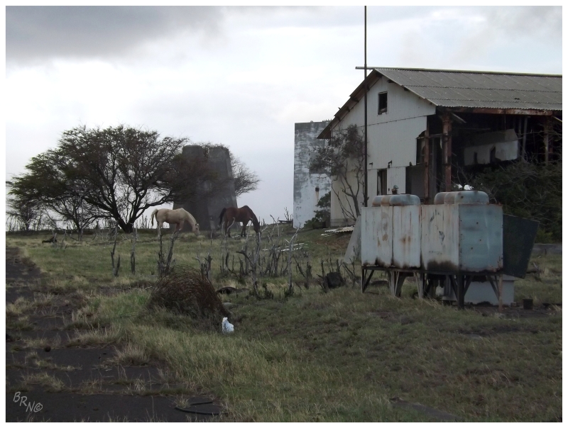
Going into this trip & last night as well, I was very curious about the Kilauea Military Camp just inside the park boundary.
Not necessarily a military camp anymore, its been preserved and anyone with military ties can stay there. I loved the look of the old cottages, the base theatre and hangar buildings; but after looking & looking & looking, I couldn't seem to find any way to finagle a stay there.
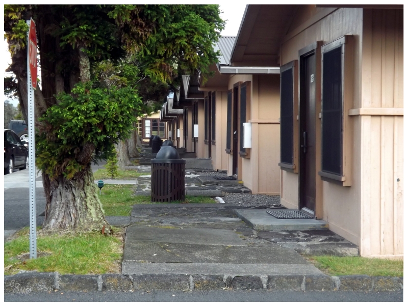
The consolation was a cruise around the camp this morning.
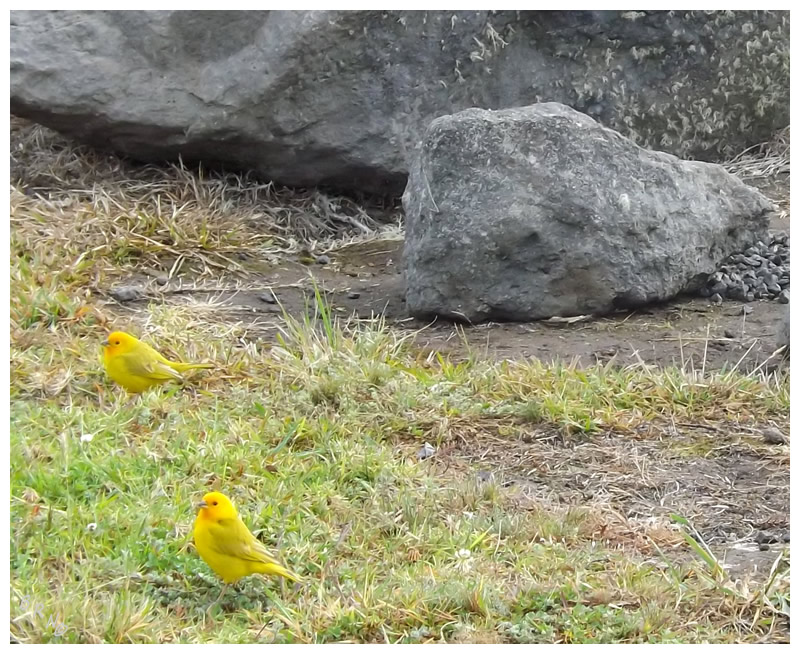
Saffron Finches at the Kilauea Military Camp.
Returning to the park headquarters, although I generally dislike stopping to ask questions, when there are closures related to deadly gasses I'll go against that rule.
The two park rangers were incredibly helpful and friendly, not condescending in the least bit (as I always seem to forecast in my mind). In fact, the one park ranger was so beautiful, smiley, friendly and warm, that it reminded me of my Mom telling me about how the people of Hawaii are "sooooo beautifulllll, like soooo beautiful" - which made me really uncomfortable, as there seemed to be a hitch in her thought process and she came to Hawaii back in her early 20's.
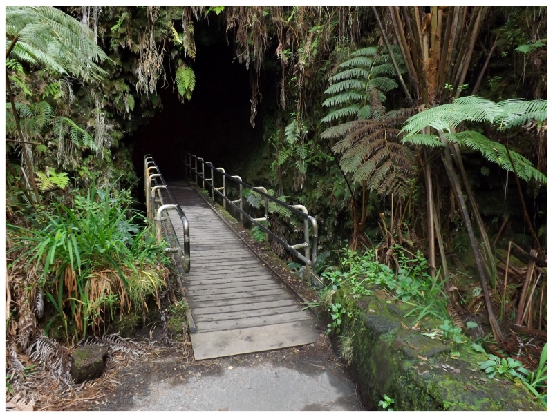
I didn't want to think anymore about that...it was off to the Thurston Lava Tube!
(Lava forms tubes because of a low-viscosity crust which will harden at the top of a moving lava flow, eventually forming a ceiling, while the lava below continues to flow through a created tube.)
Of course, I lugged my tripod the 1/3 mile to the lava tube only to notice that I forgot the base. In addition, my flashlight was dying, so trying to take a picture of the black tube was entirely out of the question.
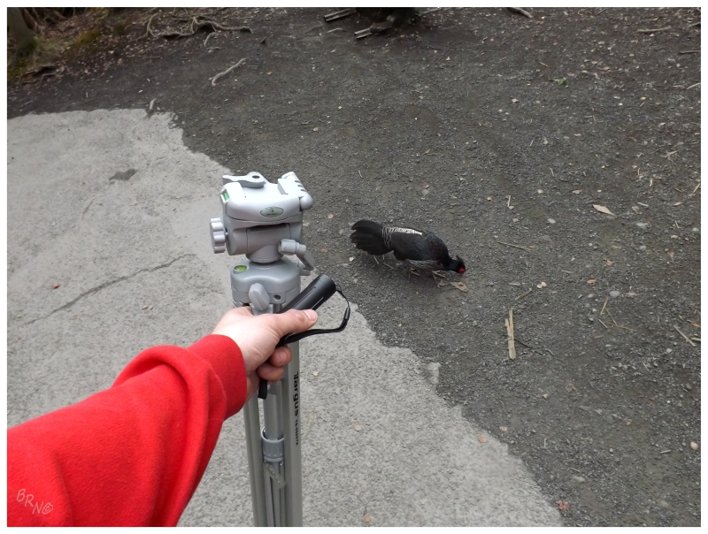
I did get this easy picture of a Kalij Pheasant though, as he couldn't have cared less about my presence. As an introduced species to Hawaii, it's pretty neat to see a bird which is normally found in the foothills of the Himalayas.
For how many mongooses I saw on the island, I'm surprised with how many Kalij Pheasants I also saw.
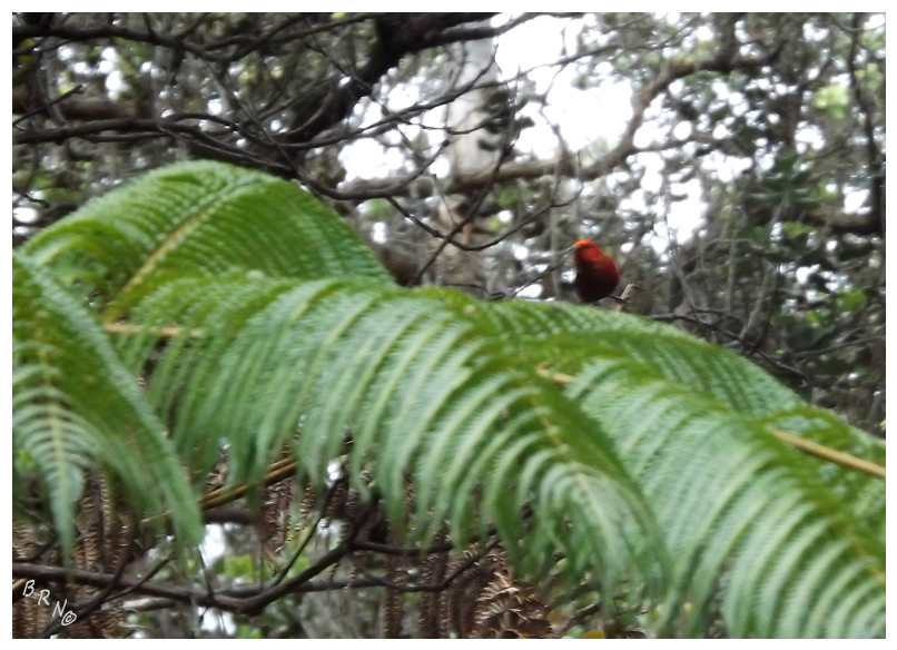
Almost all of the birds I've been posting are invasive species not endemic to Hawaii; so even though this is an awful picture, I was really happy with seeing a native Apapane, a species of Hawaiian honeycreeper.
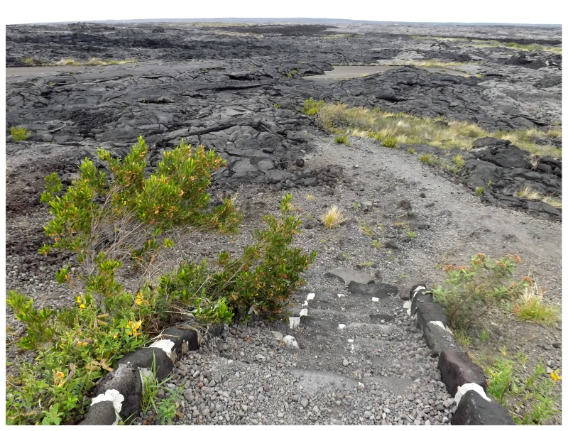
In addition to the lava tube, I planned to drive the 19 mile Chain of Craters Road while here at Hawai'i Volcanoes National Park.
Continuing along, there were pit craters with steaming vents, along with areas where signs stated the year as to when the roadside lava flow had once again consumed this road.
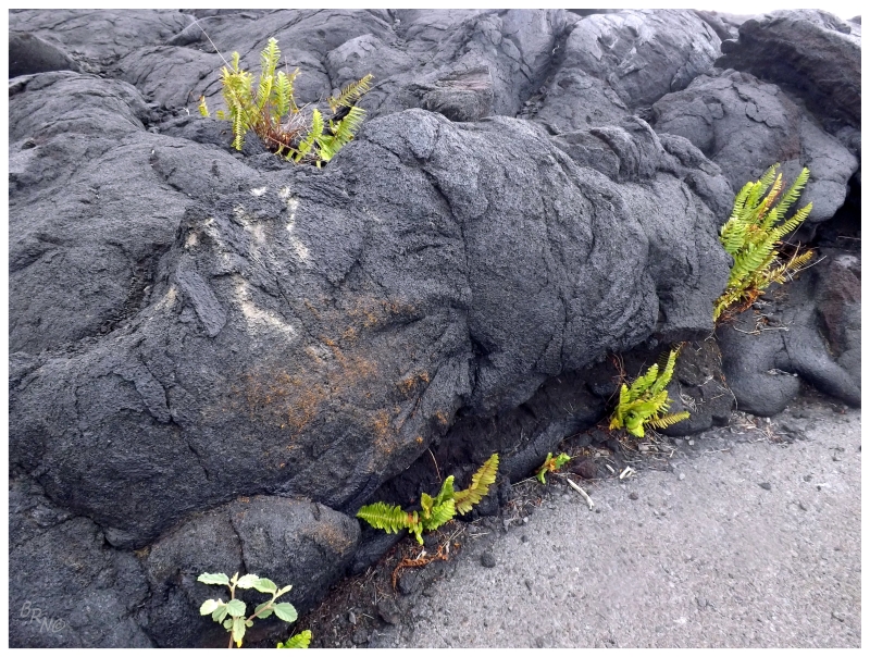
Once pass a small forest of 1000 year old trees with interspersed lava, I would round a curve over a hill and finally see the ocean with a sea of hardened lava below. This is the area that was closed by a 1969 lava flow; only to be reopened come 1979.
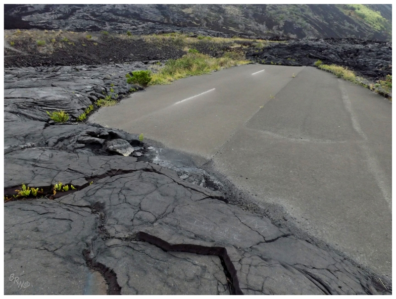
I braked as I first noticed, exiting the car and hurrying over to a section of exposed highway which escaped the advancing pahoehoe flows.
Mauna Kea ranked first on this trip's priority list, but seeing one of these destroyed roads was also pretty high up there.
Even though it was a nice day - although overcast - there weren't all that many other cars joining me on this road. The isolation in regards to people definitely added to the desolation in regards to the feeling of the landscape.
Once that winding road came down from the hills, it eventually grew parallel to the ocean and headed east.
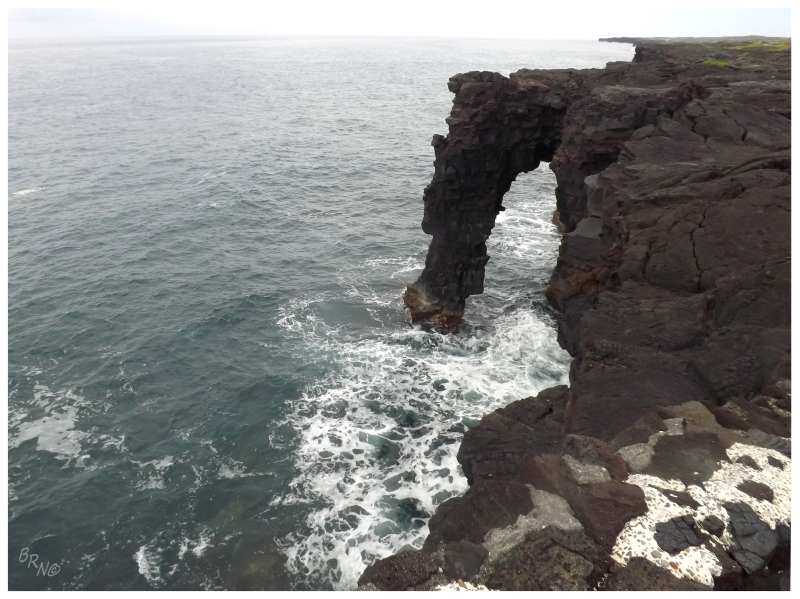
A sign indicated a short hike to the Hōlei Sea Arch, a trail which I couldn't pass up.
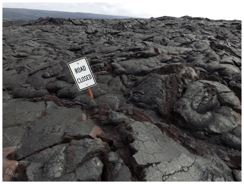
From here, it wasn't very long until I reached the end of the road, blocked by the advancement of lava in April 2003. I pulled out the bike and pedaled along the closed road, happily covering this area quicker than I would on foot.
I was at the truly closed section before I knew it (to the point where I was embarrassed for flying by people walking; who surely wondered why I had a bicycle).
At least I was at my car and driving back up the Chain of Craters road in no time.
I may have stopped and feeble grinded some lava, or I may have not, as that would surely shred the sidewalls of your orange tire to bits.
The drive back to the highway, even though I was now familiar with this road, still took the better part of an hour. From here I would go south to work on rounding the island, but with stopping to see the Volcano Skatepark (which had no biking signs and a farmer's market going on) as well as exploring small towns along the way, this would take another couple of hours.
One of the more memorable experiences was going into one store and having them ask if I was from Kansas (because of my t-shirt). Once I explained that I was from Canada and where exactly, they then asked about the snow. Telling them about shoveling 4 times a day and 166 inches of annual snowfall, the Hawaiians all grew very quiet and wide-eyed in fear. I of course, found this very amusing and sweet.
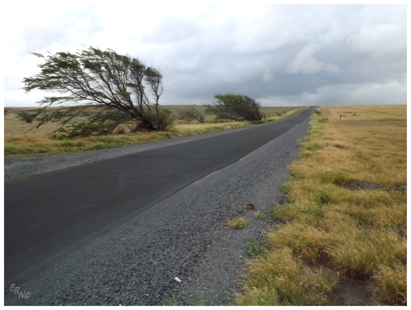
The start of this drive was heavily forested with thick vegetation, but especially as I neared the end at the southern point of Hawaii, the trees grew sparse and the land was mostly rolling farmland into the steep, high cliffs.
And while it wasn't very windy on this day, you can see those trees get a bit of wind. There's also a second stage worth of wind turbines here, another testament to the reliably strong wind.
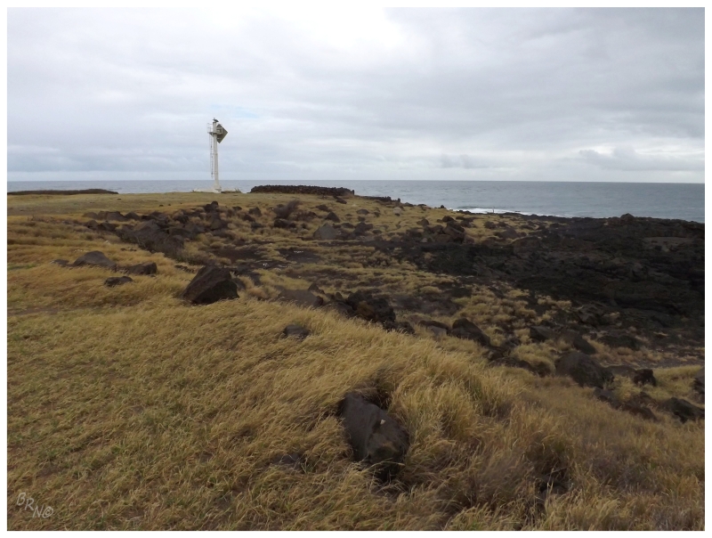
One of the reasons I came here was to see the southernmost lighthouse of America's 50 states.
Desolation, gimmicky lighthouse claims, rolling farmland - how could I pass up South Point?
There was a whole different feeling of desolation here, although here it was a feeling of desolation mixed with beauty as you gazed out over the hills.
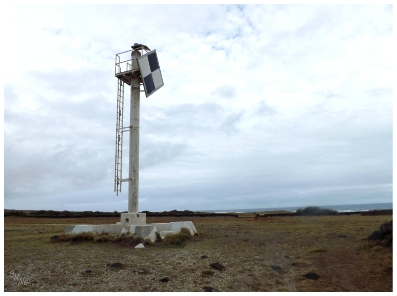
The Ka Lae Light is another one of those 'minor' Hawaiian lights, where a lighthouse was originally built here in 1906, then a steel tower in 1929 and the current concrete pole in 1972.
Wait a second though, that ladder doesn't look very far off the ground...
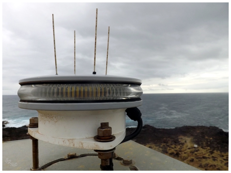
Oh hai Ka Lae light! Oh hai southernmost point of the 50 states!
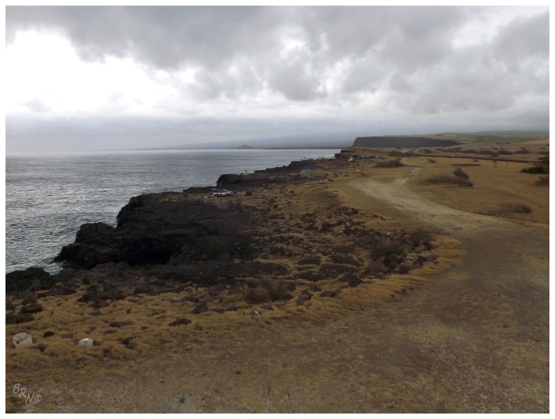
This may especially make it seem like this was some desolate point, but there were actually 30-50 people fishing and swimming in a nearby cove; although since it's Hawaii, I assumed none of them would really care.
People here seemed to be concerned with logic instead of cellular phoning the nearest wet blanket.
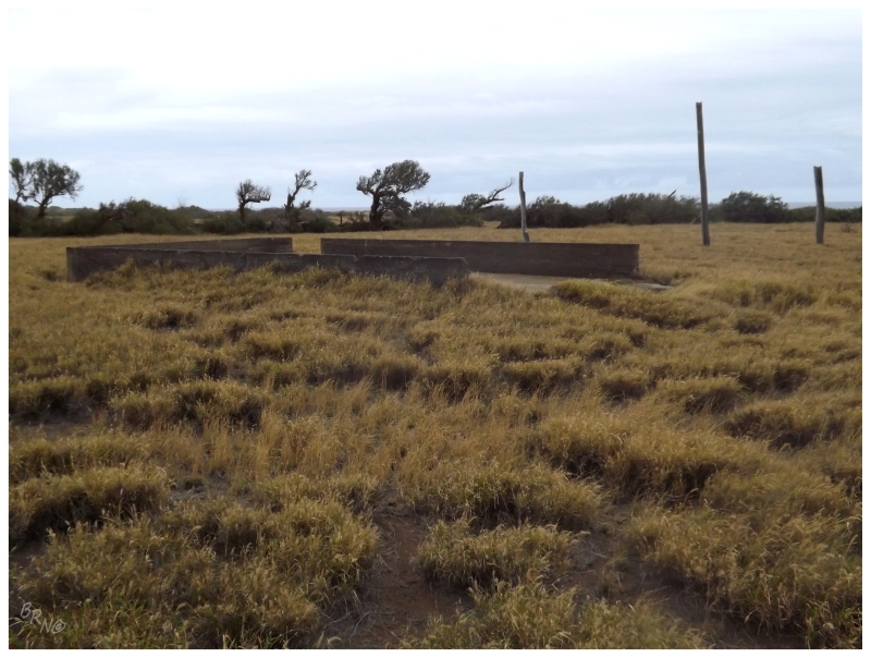
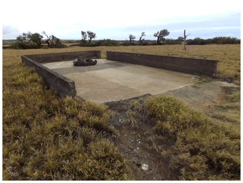
Climbing down from the southernmost lighthouse of the 50 states, I found ruins in the field just before the light. I would guess that these are from the lightkeeper's dwellings, but I haven't seen anything online to confirm this.
The lack of online confirmation is especially odd as some lighthouse websites are impressively thorough.
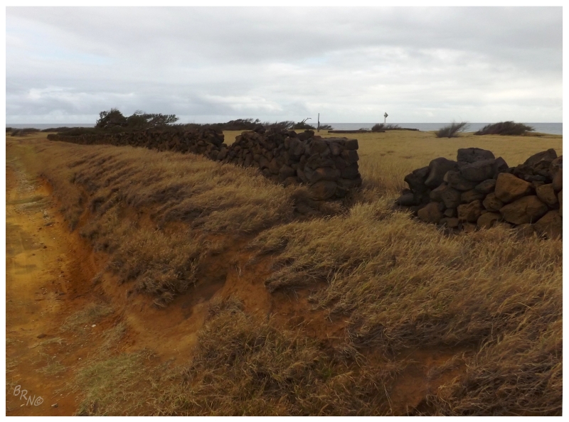
A stone wall borders the field of ruins with various entrances.
Judging by a dated aerial photo, I'd guess that these were the handiwork of the lightkeeper? (Again, I can't find anything online about the Ka Lae keeper.)
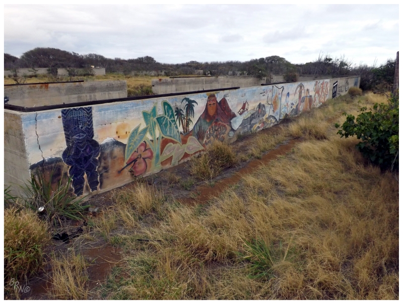
This location was also the site of the U.S. Army's Morse Field. The airfield itself was only 500 yards from the Ka Lae Light, while these additional ruins were another 2000 ft to the north.
Morse Field was never finished though, being suspended after the attacks on Pearl Harbor. Mobilization buildings and gas storage structures were still deemed necessary for completion and they would be used at this point until 1948, when the site was then declared surplus by the Army. The field would see some more use in the 1960s and 1970s, as it was an ideal site for ballistic missile testing.
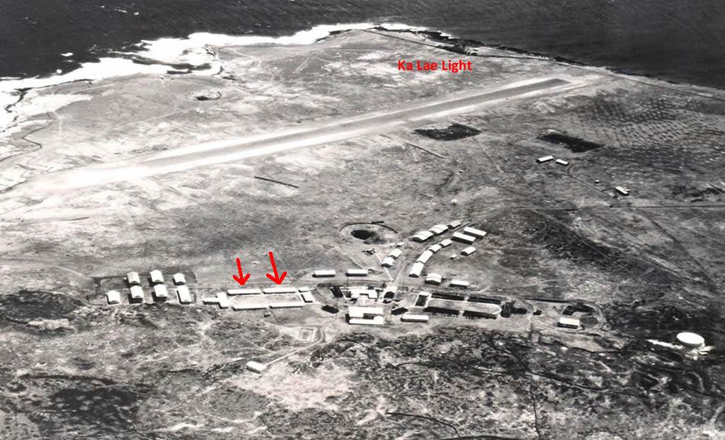
^Morse Field in 1945, courtesy of Hawaii.gov
The red arrows indicate the concrete walls from the last two pictures. You'll also notice Ka Lae Lightstation marked at the top.
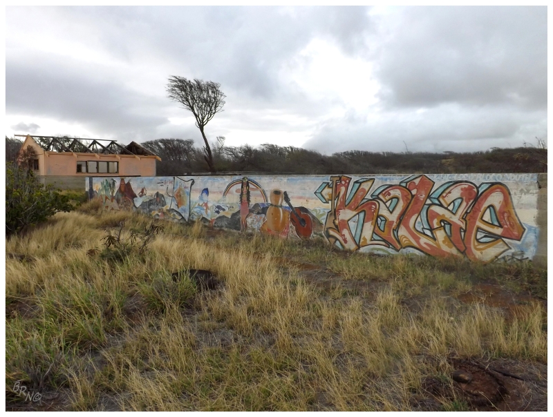
There are obviously more ruins than just the concrete structures where I have a red arrow, but some girls were changing into bikinis in the other section, so I stayed over on my side.
The only other people who noticed me were the odd tourists, who would throw strange looks for exploring amongst concrete pads, while only a few miles lay a green sand beach.
Speaking of that green sand beach, that was another reason I came to South Point. The problem was that the day was advancing into the evening & I had a decent hike ahead of me, with warnings not to leave anything of value in my car. I needed to make it back to Kailua-Kona today, hoping to leave enough time to go to this restaurant that I promised a friend I would visit.
I'm sure olivine, green sand beaches are great, but waking up with the sun in the Hawaii Volcanoes National Park visitor center parking lot, I'm not sure how I could have squeezed more into this day. (I'm sure some would criticize the time spent watching KU games, har har.)
I walked to the nearby, rocky cove and waded up to my knees, but the cobble below my feet just wasn't that exciting (as I'm sure green sand would be.)
Beginning my departure from South Point, I stopped at even more ruined buildings I noticed on the way in.
Unfortunately these were on fenced farmland, and since I don't know how they react to that type of thing around here, I respected the fence and kept to the road.
It would have been interesting to explore buildings with horses I must say.
Oh well. C'est la vie.
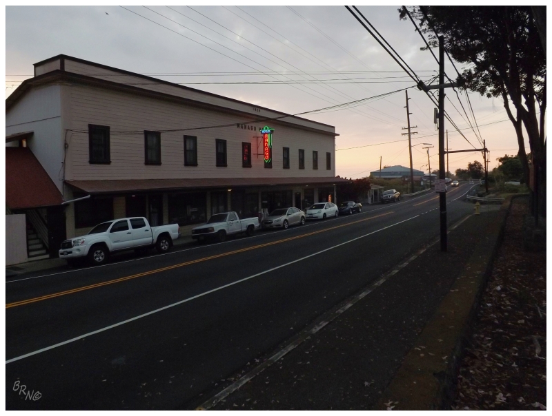
While looking up the restaurant's address, I noticed a strange place in my Hawaii guidebook which had a ¢ symbol next to the accommodation, instead of all the others who had $$, $$$ or $$$$ symbols.
Calling into the Wanago Hotel, they indeed had $37 rooms, which I was certainly skeptical about, but I would reserve judgment until I saw them.
The place looked more than fine from the outside and there were more than enough visitors, how bad could this be?
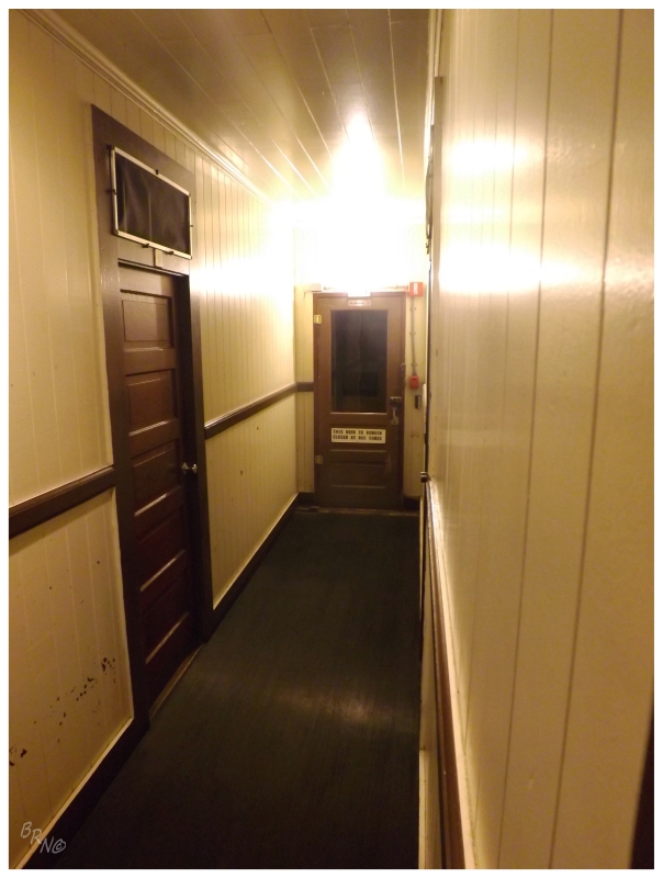
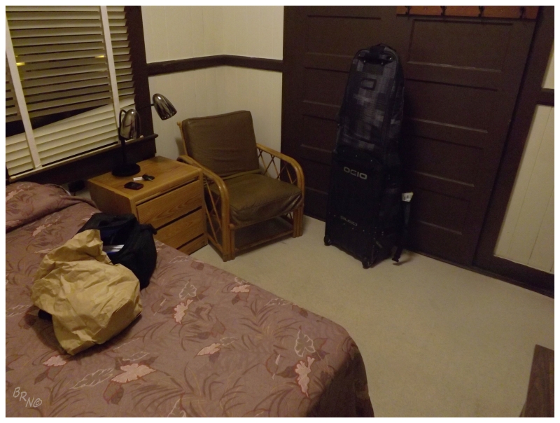
The catch to it all was that they had an old hotel section with individual, common air rooms; as well as a somewhat modern motel section. Most people take the motel section and won't consider the shared bathroom main hotel, but I personally loved it. I would actually pay a lot more than $37 to have such an interesting, old-time'y experience.
Dropping off my stuff and pausing for a moment in my room, I noticed the push button light switches, the gates for circulated air above the door and the building creaking with each gust of wind or passing car.
What fantastic, memorable accommodations!
It didn't hurt that it truly reminded me of the motel where Chigurh comes looking for Llewellyn and they chase each other down the stairs and into the street, with Chigurh soon shooting out Llewellyn's truck window.
Thankfully Chigurh never came looking for me, even as I didn't hide myself by going back into town and then photographing the hallways later.
I went back into town on the promise that I told Christian I would get a highly-touted marlin reuben. Unfortunately the place was closed on Tuesdays or whatever happenstance day I found myself here; so there were no tales of marlin reubens for my friend back home.
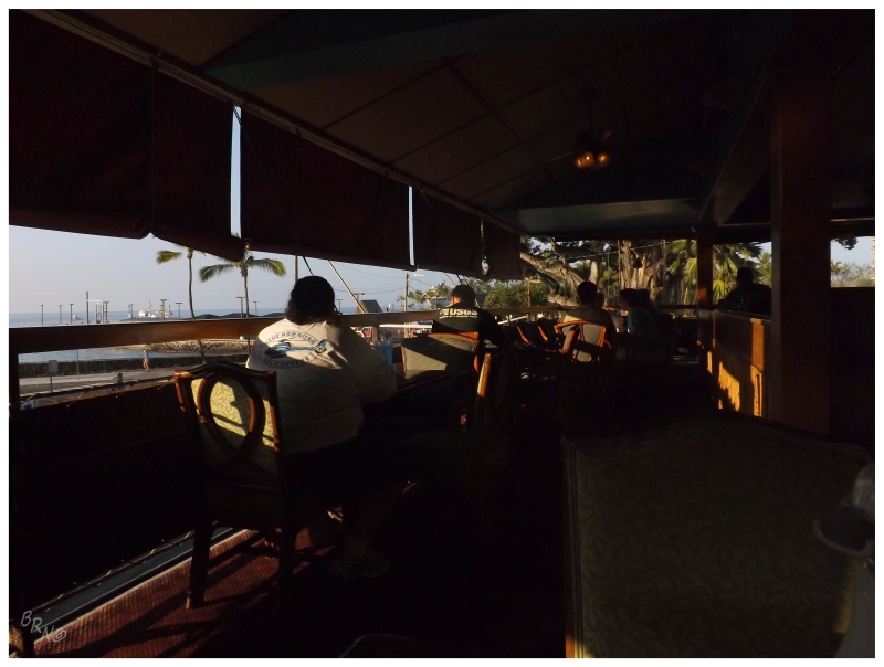
I instead went to a place called Splasher's, an open air, 2nd-story bar overlooking the Pacific, which was showing the Orioles/Red Sawx preseason game.
I don't remember what I had for dinner, but it must have been good enough as I ended up back at Splasher's the next day. Maybe it had to do with familiarity though, as after taking apart my bike and cleaning the rental car, I didn't have that much time left before my flight this morning...
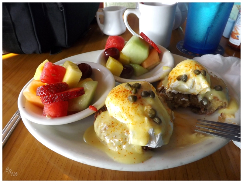
I do remember my breakfast at Splasher's though, as it was a stupendous crab cakes eggs benedict. I would carry on about this meal this day, the upcoming days and all the way until I was back home. The funny thing being that I found the exact same meal in St. John's months later, but simply hadn't noticed previously.
I would fill up the rental, return it and then smoothly take the bus to the terminal for my early morning flight out of Kailua-Kona...
Continue to Part 5...