I woke up & was ready before U.J. was even out of bed, so I went for a morning walk around Oxnard.
A few of the buildings were attractive, but I was also surprised at the convenience store which reminded me of the one in Mexico - parts of Oxnard were apparently grimy as well.
Port Hueneme is a medium-sized community between the City of Oxnard and the Pacific Ocean.
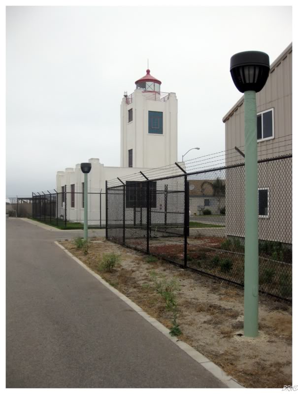
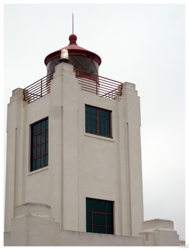
The reason we hadn't went any further last night was so that we could visit the Port Hueneme Lighthouse this morning.
Port Hueneme is the only deepwater port between Los Angeles & San Francisco - an appropriate place to have a lighthouse since 1874.
The lighthouse we saw was constructed in 1941, but since I enjoy Art Deco architecture, I couldn't complain that it wasn't 140 years old.
Unfortunately, it wasn't the 3rd Saturday of the month, so we couldn't get inside the fence (that's when they offer tours). I still count this one though, as you can get awfully close by walking along the fence.
(U.J.'s photo)
The morning was brisk, but it was an enjoyable 1/2 mile walk from the condo-lined street to the lighthouse.
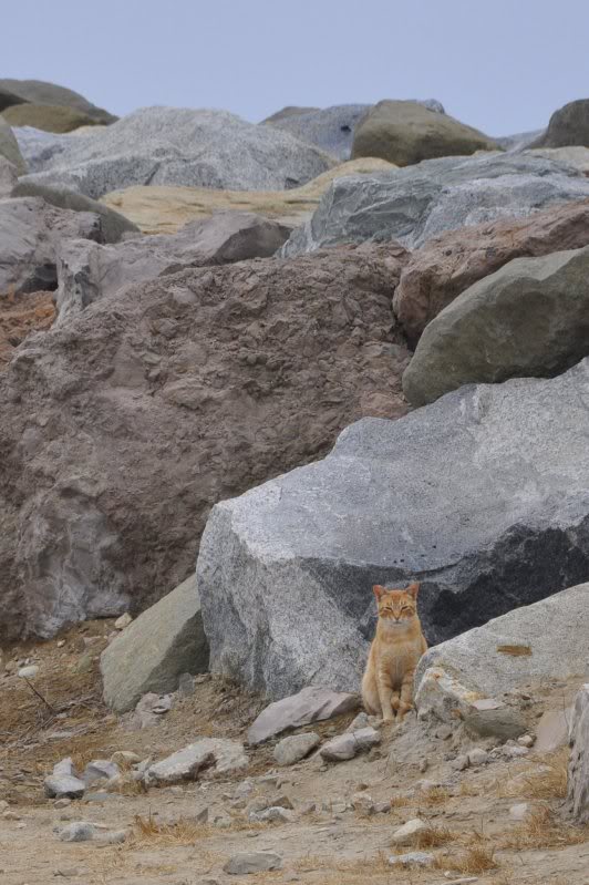
Wild rock cats added to the experience. There were about 5 kittens too, but I prefer grown cats.
Leaving Port Hueneme, Ventura seemed like a good place to find something to eat.
The attractive downtown was home to a 50s diner and U.J. was in heaven. I couldn't have cared less, but they did earn my love by serving cottage cheese with breakfast.
Walking back to the car, I remembered how my friend explained that West Coast people don't put screens in their windows - which seems crazy to a spider-fearing man like myself. I would be having some screens shipped in from Ontario to protect myself from all the left coast creepy crawlies.
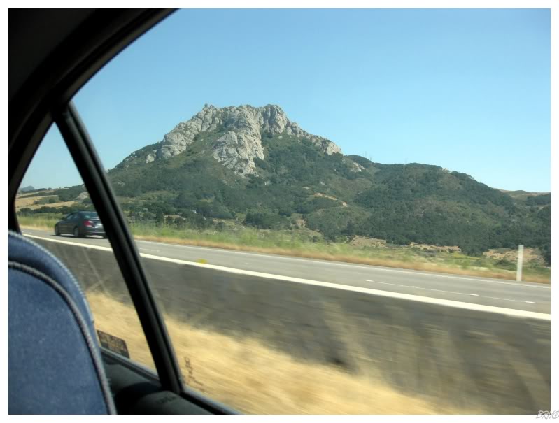
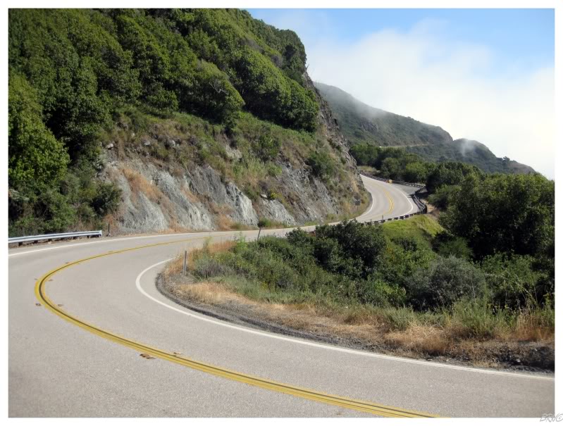
Today's goal was to drive Big Sur - a highway renowned for its beauty.
The drive was advertised to have coastal beauty, but it was hard to complain about the valley we had to traverse to reach Big Sur. Surrounding hills rolled with golden farms; these hills interspersed with forests and mountain peaks providing occasional variety.
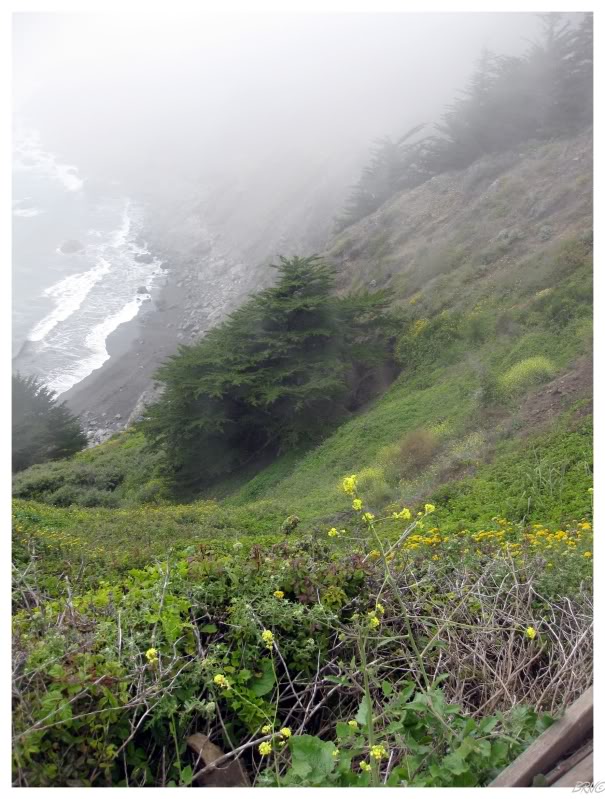

We were moving somewhat early this morning, which unfortunately meant that we would encounter fog at the start of the Big Sur drive. We had both read that the second part is better, but it was still a bummer to feel as if we were missing stunning vistas because of this fog that had blew in from the Pacific.
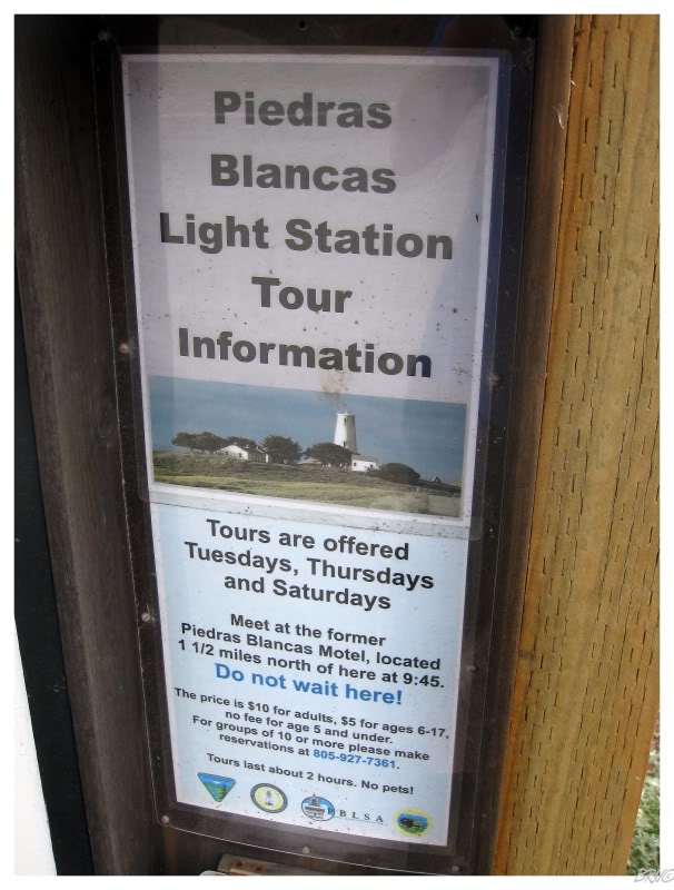
In addition, all of the coastal lighthouses were inaccessible!
I had read about the tour times online, but I hoped that you would be able to simply go see the lighthouses without the tour - which was most certainly not the case.
Although I appreciate how California seemingly preserves their lighthouses, I disliked the strict times & wished it was like Newfoundland, where you can go to any lighthouse & feel like you're the only person who's been there in months.
The fog started to lift as the rising temperatures burned off the moisture. While I'm not sure what we missed, this portion seemed to have more traffic pull offs and hopefully this was indeed the more scenic portion.
This stretch of land was only made accessible to lazy drivers in 1937. After an astonishing 18 years of construction, Big Sur Highway finally made one of contiguous America's most remote places accessible to all.
The drive's scenic properties are completely maintained today because of considerate land owners who haven't sold off their property for development. Only 3 small villages exist for the 90 miles of Big Sur - these villages being basic rest areas superimposed upon the cliffs.
In addition, beauty was maintained by a 1962 court decision banning billboards along the highway.
There's a point along this coast where the land spikes from the sea to a mile-high mountain in just 3 miles of horizontal travel. It is the type of location where you want to scurry up the mountainside to get an ever greater view.
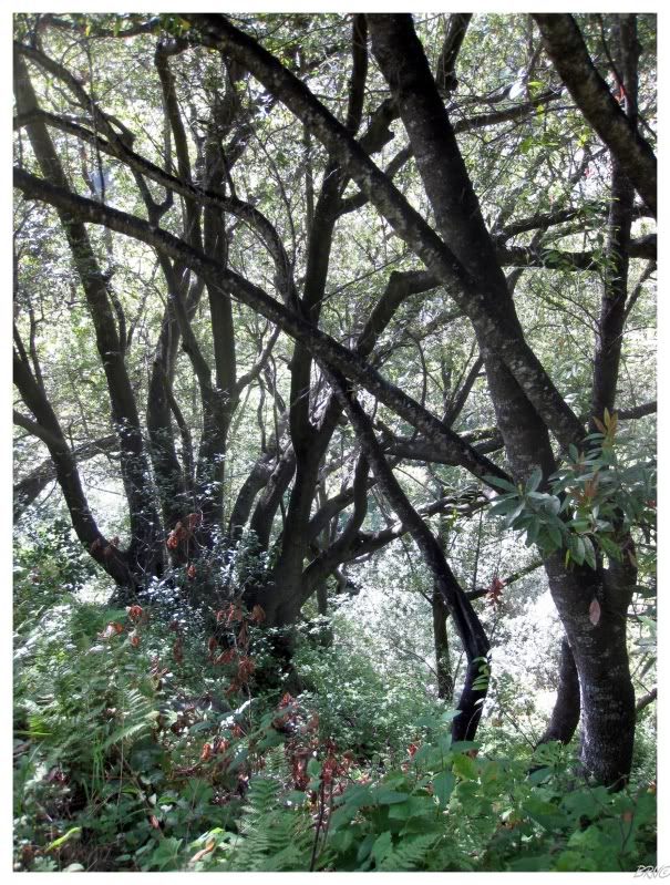
I had this thought as we pulled over at a 5-space gravel parking lot. I told U.J. to hold steady while I scurried through the woods; but all I found was lush vegetation blocking my view.
Reason #460 that I wish I had more time on this trip: to climb up one of these trails and see these lands from the summit of a mountain.
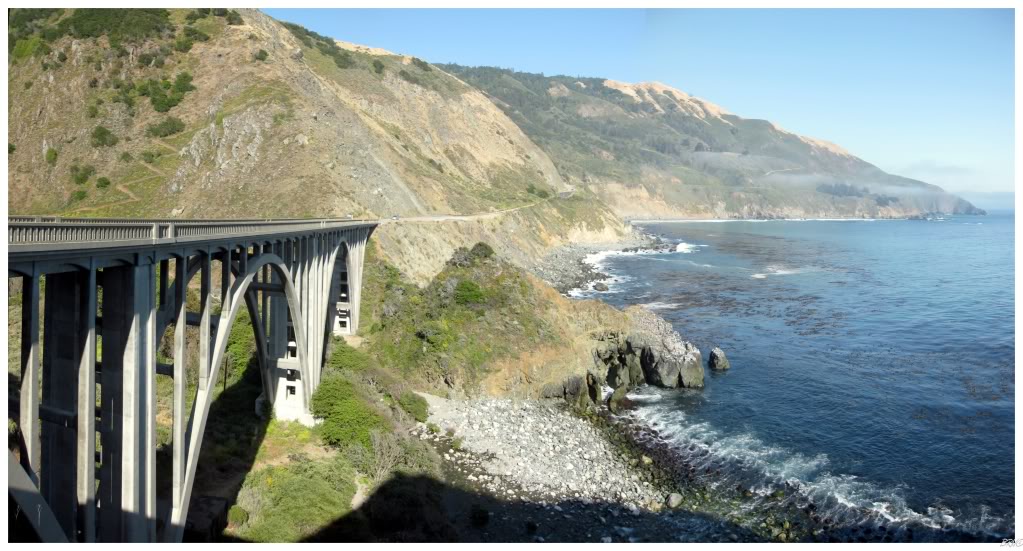
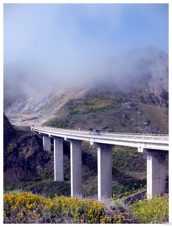
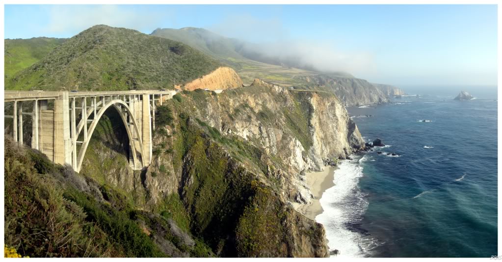
I was the most excited for the Bixby Canyon Bridge & it turned out to be the most impressive portion of the entire drive.
The concrete open-spandrel arch Bixby Canyon Bridge was opened on November 27th, 1932. It is 714 ft long & has a height of 280 feet (85m).
(Skip this part if you don't know the song "Bixby Canyon Bridge")
Death Cab's Bixby Canyon Bridge is certainly on my top 10 list of favourite songs, so there's your reason why I had extra excitement to see this bridge.
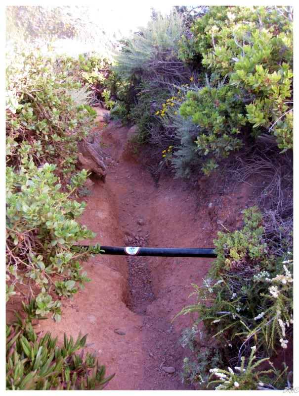
Although there are signs warning against it, I obviously "descended a dusty gravel ridge beneath the Bixby Canyon Bridge" - the difference being that I found the dusty gravel ridge a lot steeper and treacherous than it is made to seem in the song.
I went down about 30 feet, before abandoning the plan as the slope became too steep. There was no going "barefoot in the shallow creek, picking up stones from underneath..."
There was a couple of photographers taking pictures nearby & U.J. was waiting at the top - I doubt I was going to find the inspiration Ben was searching for anyway; it felt more touristy than profound.
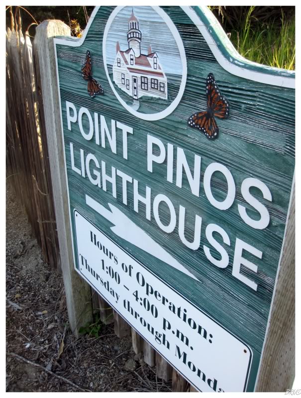
It was not long after Bixby Canyon Bridge that we entered populated places again. Passing Pebble Beach Golf Club, we went out of our way to the Point Pinos Lighthouse, but found more tour restrictions & a fence preventing us from seeing the lighthouse from any closer than 40 feet.
By this time, the sun was falling lower in the sky & we didn't have much time before nightfall. This was a shame because we still needed to find somewhere to sleep and therefore couldn't stop in the city of Monterey. As we drove along the Monterey Bay, almost every house was photo worthy, along with a waterfront pretty enough to warrant exploration as well.
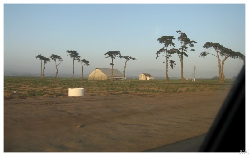
The land outside of Monterey quickly changed from the lush valleys of Big Sur, to vast farmlands with the occasional Monterey Cypress.
We tried two campgrounds but found no vacancy. We tried another place in our guide, but apparently it was only a series of trails through some marshland. We drove around for a bit, but the area was too densely populated to find any kind of stealth camping location. We tried a KOA, but they wanted $140.
We weren't having any luck.
Point of advice: if you're going to California, try to either book cheap accommodations in advance, give up trying to 'find' cheap accommodations or allot a couple of hours to find a stealth camping spot every night.
We continued onto Santa Cruz, where there was another campground according to our AAA guidebook.
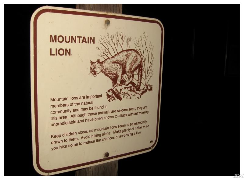
This 'campground' was desolate. We turned onto a dark road and found no one around, just a wooden bucket with a slot for our money. Neither of us would have minded this, but where were we supposed to camp? It wasn't as if there were camping spots and we just had to leave money - this place only had trails and signs warning of Mountain Lions.
I know that were both pansies for this, but we left the Mountain Lion Campgrounds.
We continued onto another campground, but this one ended up being a day-use oceanside trail. WTF? By this time I was hungry, so we went into the attractive downtown of Santa Cruz & found an awesome pizza place with a personable chef & cold beer on tap - time to forget our accommodation troubles for an hour.
Afterward we decided to drive to San Jose, where we went to a Super 8 we found in a RoomSaver coupon booklet.
I should have been more organized & walked around Monterrey instead of looking for accommodations - but I didn't know it was next to impossible to get a California campsite without a reservation.
Live and learn.
Onto Day 12.