The Mother Road, Route 66: Day 2 (Map)
Mooseheart, Illinois to St. Clair, Missouri (via Pontiac, IL, St. Louis, MO) - 546 km
Summer 2010.
The two of us woke at 9 o'clock and both Whitfield & his wife were already gone. Atop the counter was a lovely note from Vicky, expressing her regret that they didn't have more food & to help ourselves to some granola bars and whatever else we could find!
I was happy enough to see Whitfield & have a clean place to sleep; this was above and beyond anything I expected!
After showering & eating some provided breakfast, we were on our way.
Here seems as good as any place to explain that UJ actually wanted to drive the old Route 66. Not the Interstate next to the route, but the actual route. She passed me a 300-page binder, complete with step-by-step directions and items highlighted that she wanted to see. The step-by-step directions were divided by different yearly road alignments & explained where to turn left & where to squeeze right to remain on the Old Route all the way from Chicago to Los Angeles!
For example, here's a section of the Illinois directions.
UJ seemed to ease off driving the old back roads while we were near Chicago; and therefore we were on Interstate 55 headed southwest this morning.
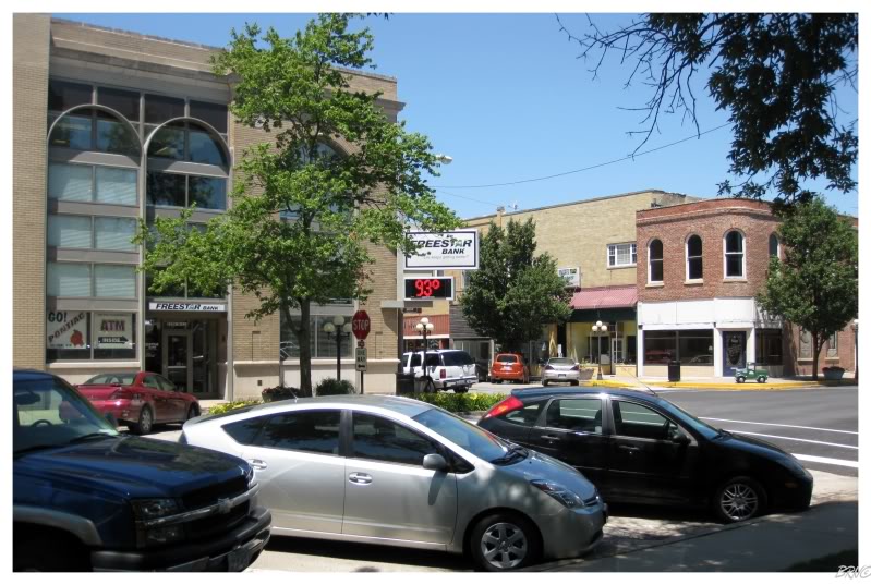
Driving along and passing an exit sign for Pontiac Illinois, I recalled item #1 from her bucket list: "See Every Pontiac In America." Instead of listening to her say it was okay & that she'll see it some other day, I hastily jerked the car off the interstate & into the Central Illinois City.
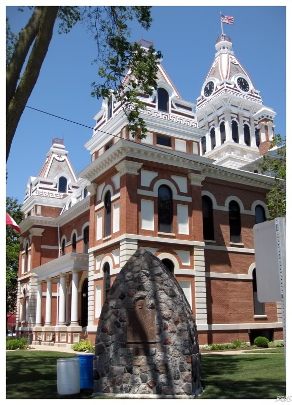
After stopping for gas & laughing at a white girl wearing a "Free Weezy" shirt, we noticed the Livingston County Courthouse & took some pictures - including a shot where I'm posing with an Abe Lincoln statue & UJ affectionately noted the "foreign relations meeting."
Eventually we would drive through the southwest on this trip & UJ expressed her concern over the heat in June & July. I took this & ran with it, constantly pointing out every digital temperature sign & fist pumping at the climbing numbers.
We were only in Illinois & it was already 93° this day!
She would get me back though, when she asked why we stopped in Pontiac, Illinois. When I reminded her of the bucket list item, she reminded me that she grew up in Plymouth and wanted to see every Plymouth, not every Pontiac!
D'oh!
Back on the freeway & reading the Route 66 directions, there are points of interest noted along with the roads & turns. UJ had some of these highlight as 'must do's' and some as 'would like to do's'.
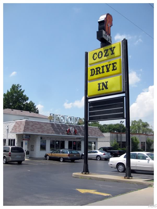
One of them that was a must for her was the "Cozy Drive In" - a restaurant originally opened by the guy who invented corn dogs.
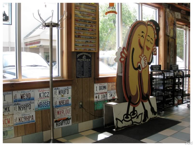
I'm pretty sure she wanted to go to Cozy Drive In simply because of the snuggling corn dog cutout.
This was our first touristy Route 66 stop and the trip suddenly felt a lot more like a Route 66 trip. Old maps of the nine Route 66 states covered the walls, we sat in diner seats and classic car & gas station memorabilia was all around.
This was a lot more like Route 66 than the Starbucks UJ stopped at this morning.
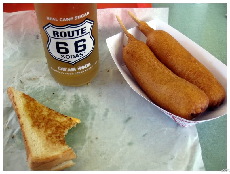
After our corn dogs in Springfield, we committed to driving the old Route 66 once we were outside of the city. Therefore our directions changed from "follow I-55" to:
"...Follow left onto Bentup Rd. Flow right onto Route 16 Rd. (large bend). Follow right onto Henry St. (=west). Follow left onto Route 16 Rd. (=southwest). Turn left onto Madison St. (=south). Continue as Madison St. turns into Sievers Rd. Turn right (west) onto Williamson Rd...."
These new directions were a heck of a lot more exciting. Although Illinois can be empty at times, it was still more interesting than the always-empty Interstate.
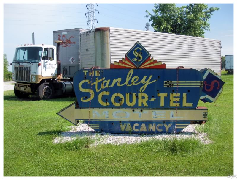
Traveling along, we passed Henry's Rabbit Ranch & UJ squealed as this was apparently a place she 'had to stop'. She enjoyed the rabbit slide, the old cars & the rabbits running around; while I enjoyed the old-school route signs (like this above one saved from a St. Louis Airport expansion demolition in 2004).
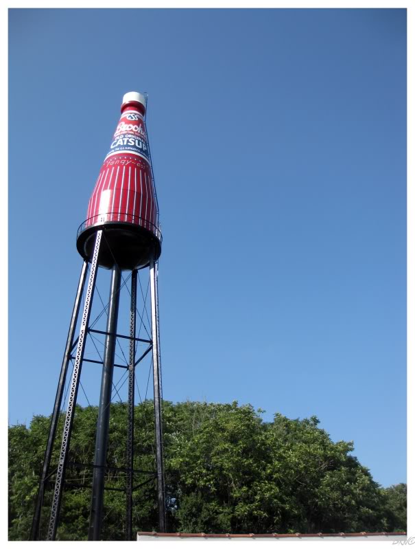
Continuing along, we made a side-trip through Collinsville to see the world's largest ketchup bottle!
Instead of backtracking to Route 66, we simply drove from Collinsville into St. Louis - mostly because I knew it would go through East St. Louis & I wanted U.J. to see how rugged East St. Louis is.
Why am I telling you this? Well people have asked why we didn't do much building exploring on this trip & here's one of the reasons - sure there are opportunities in East St. Louis, but would you leave your car parked in sketchy East St. Louis with everything inside? It was only 4 or 5 by this time, so it wasn't as if we were going to stay in St. Louis (and could drop off our valuables at a hotel); so therefore we thought better of leaving our jam-packed car parked in a desolate & sketchy area of East St. Louis.
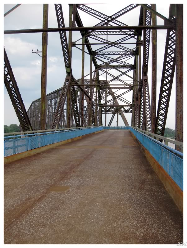
We went to the Chain of Rocks Bridge instead of stopping in East St. Louis. A part of Route 66 until 1967, the bridge is unique because of a 22° turn to allow ships to avoid the 'Chain of Rocks' in the Mississippi River below.
Even though the bridge didn't seem particularly dangerous on this day, I was a bit concerned with our safety as this was the location of a murder that led to a State of Missouri execution. Then again, here I am worried because of a murder that happened 20 years ago; yet I was mocking the warnings about skipping the East St. Louis portion of Route 66. Maybe I should have used the same skepticism when evaluating the dangers of the Chain of Rocks Bridge.
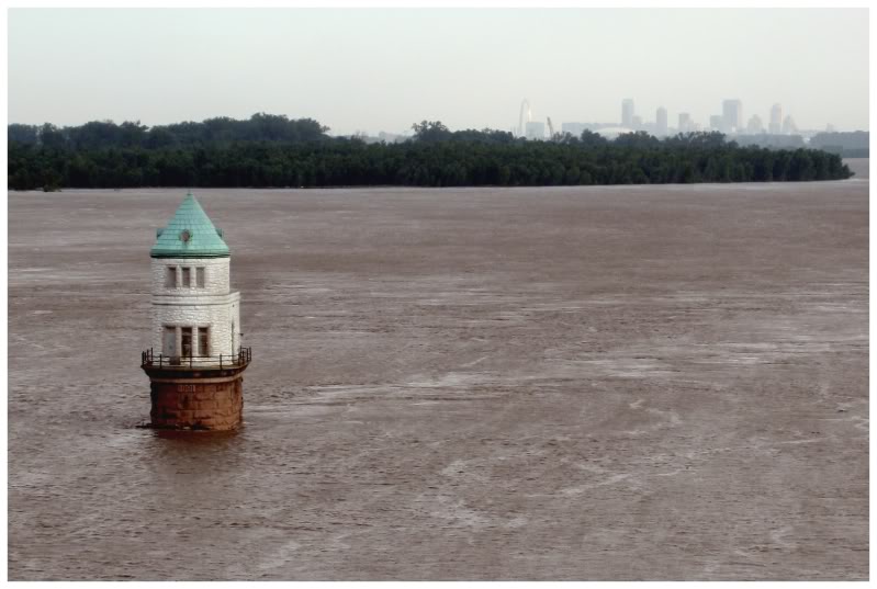
In addition to the uniqueness of the bridge, the St. Louis Waterworks has two interesting water intakes located beneath and beside the Chain of Rocks Bridge.
This is Water Intake Tower #1, built in 1894 and still in use today (a water plant sits on the edge of the Mississippi to the right of this picture).
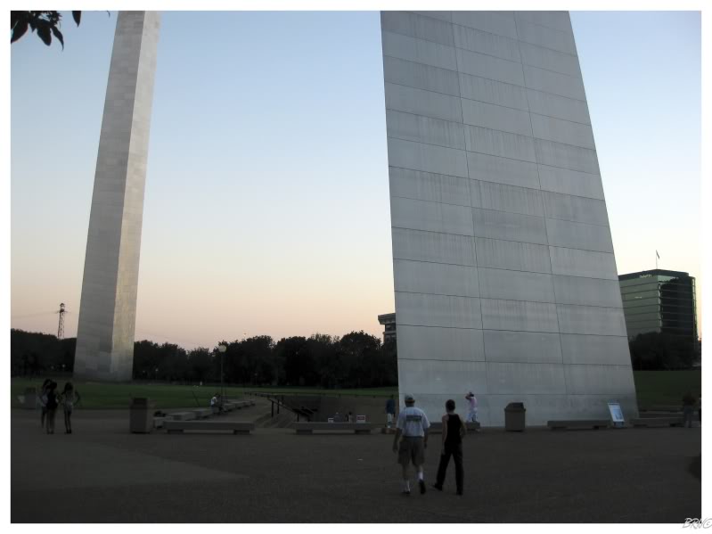
After the Chain of Rocks, UJ asked if I wanted to go see the Gateway Arch. I had already been there, but she hadn't, so I was completely fine with returning.
Once we were there, UJ asked if we were going to the top.
Huh?
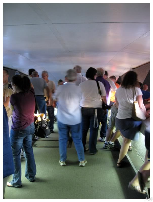
As I would learn, you can reach the top of The Gateway Arch by using one of the eight egg-shaped, 5-seat tramcars. The Arch is 630 feet tall and the thought of traveling to this height in 4 minutes - while rocking because the cars are described as "half elevator, half ferris wheel" - made me a bit nervous.
We would be herded into a car with a father and his 3 children. The cars must fit 5 adults on a good day, because it was definitely an intimate space. I could tell the kids didn't want to sit so close to the giant strange man, but no one really had any say in the situation.
The ride wasn't 1/2 as bad as I was imagining. The above picture is from the observation deck at the top of the Arch.
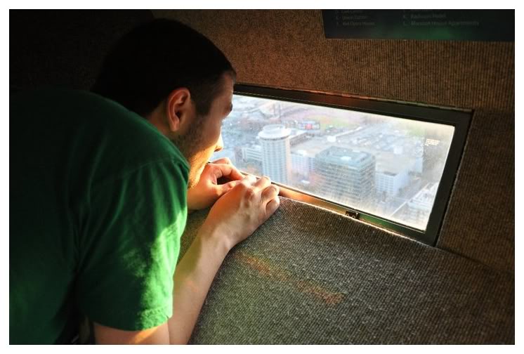
The view of my beloved St. Louis is spectacular, even though they only give you a 7 inch window to enjoy it.
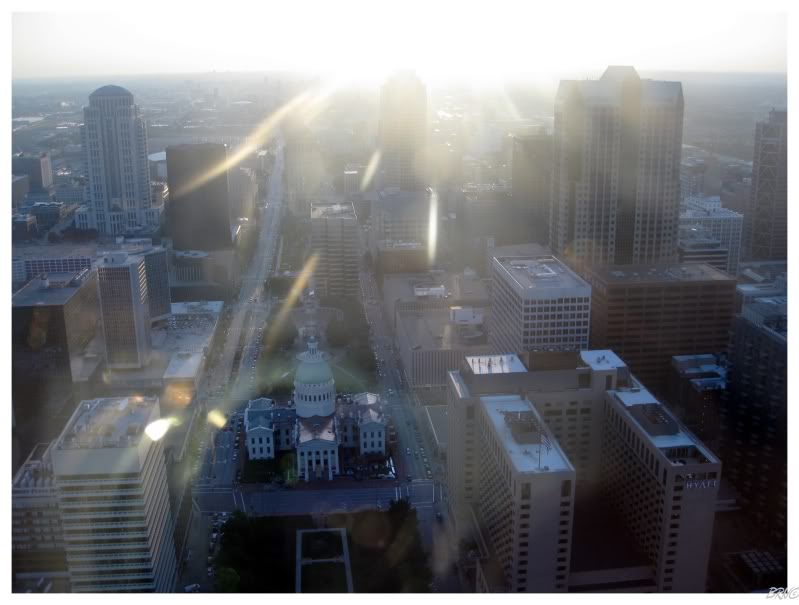
Our pictures westward towards St. Louis were less than spectacular because of the evening sun.
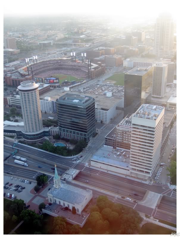
We could also see a baseball game going on over at Busch Stadium.
It was killing me that we had to stay on schedule & couldn't go over to scalp some tickets.
It wasn't that we grew tired of the view, it was that we great tired of the congested observation deck.
On the way down we had three 300lb adults in the tramcar with us & it was even more stuffy. Thankfully the one man was pretty funny, so it wasn't an awkward ride down.
When we reached the ground, I obviously noticed three stunning, mini-skirt wearing, black teen females giggling and taking pictures of one another below The Arch. To add to the hilarity of the scene, one of the girls came up to me & asked if I could take the group's picture..."Oh for sure I can! How's this one?" I said with a smile.
I think UJ was rolling her eyes so hard that they detached from their optic nerves and rolled completely around.
I was thoroughly amused. God I love St. Louis.
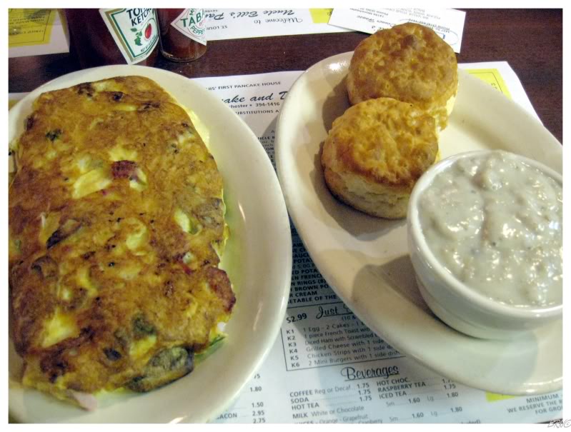
The night was falling & we wanted to eat in St. Louis, but we didn't want to pay for a St. Louis hotel after having a few beers with dinner.
Instead, U.J. drove about 45 minutes while I enjoyed some delicious Olympias. We grew concerned as it looked like we were moving further and further into rural Missouri & away from open restaurants at this hour. Eventually we settled on Uncle Bill's Pancake & Dinner House, which had good biscuits/gravy & mediocre everything else.
Another 45 minutes of driving and we were spending the night at some overpriced place in St. Clair, Missouri (about 20% across Missouri).
Onto Day 3.
| Day 1 Windsor,ON to Mooseheart,IL via. Michigan City,IN |
Day 2 |
Day 3 St.Clair,MO to Bentonville,AR via. Cuba,MO & Mt.Magazine,AR |
||||
Day 4 |
Day 5 |
Day 6 Conway,TX to Albuquerque,NM via. Armadillo,TX & Tucumcari,NM |
Day 7 Albuquerque,NM to Williams,AZ via. Flagstaff,AZ & Winslow,AZ |
Day 8 Williams,AZ to Rialto,CA via. Oatman,AZ & Needles,CA |
Day 9 Rialto,CA to Pasadena,CA via. Salton Sea,CA & Mexicali,Mexico |
Day 10 |
| Day 11 Oxnard,CA to San Jose,CA via. Big Sur,CA & Monterey,CA |
Day 12 San Jose,CA to San Francisco,CA via. Lick Observatory,CA |
Day 13 San Francisco,CA to Hickison Petroglyphs, NV via. Sacramento,CA & Carson City,NV |
Day 14 Hickison Petroglyphs,NV to Casper,WY via. Leamington, UT |
Day 15 Casper,WY to Winner,SD via. Keystone,SD & Oral,SD |
Day 16 |
Day 17 |
Sources: 1 - Built St. Louis | Intake Towers
Go Back to the Main Page of this Website