The Mother Road, Route 66: Day 4 (Map)
Booneville, AR to Bristow, OK (via Fort Smith's AFB, AR & Picher, OK) - 554 km (344 mi)
Summer 2010.
After criticizing the Holiday Capri Motel the night before, I'm happy to say we had a bedbug and other insect-free night & morning! I don't know if I'd go ahead and recommend the Holiday Capri to others, but it's hard to complain when it did its job.
I wanted to successfully avoid McDonald's, but after driving around in search of something else, I eventually gave in & ordered some breakfast burritos; before finally leaving Booneville, Arkansas.
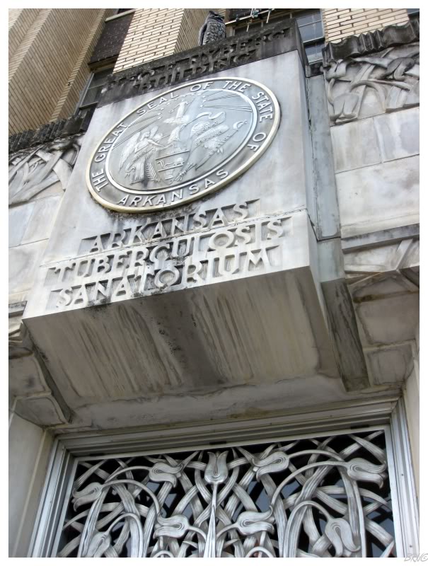
The Arkansas Tuberculosis Sanitarium was the sole reason we drove down to Booneville & slept there.
About 3 months before this trip, I found pictures online of the major building on campus. This led me to Googling Arkansas' high point & working on a side journey off of Route 66.
Now that we were on the sanitarium campus, we were confused as to how those kids got into the building and took those pictures. Walking around, you could see in the windows & see how nice the first floor was & the fact that the electricity was still on. Analyzing this, we figured that it was simply a case of going inside when it was open & wandering off to the unused floors.
Eventually we would try our luck with a groundskeeper, who got our hopes up with a "sure you can go inside that building", before letting us down with "but not today, it's Sunday!" (Then the customary "you bet" that Arkansawyers say instead of "you're welcome.")
We ended up driving around the rest of the campus since we were there and that was enjoyable enough. Many buildings remain, so it was neat as it always is, to drive around and see the campus chapel, theatre, garage, cottages, etc., etc..
The campus is still in use for people with development disorders & mental handicaps, so we also enjoyed the patients' excitement to see outsiders as we drove around the campus.
One of the patients sitting in front of his cottage had a Boston Bruins coat on & UJ proceeded to crack jokes about me going over to hang out with 'my boy'.
U.J. was adamant about returning to a point very near where we left Route 66, so now we were going directly north to meet the Route back in Joplin, Missouri.
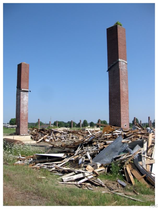
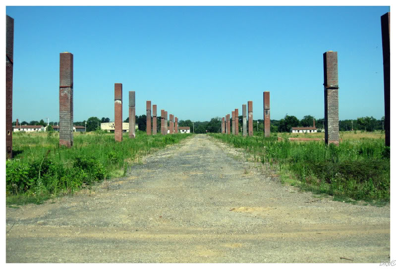
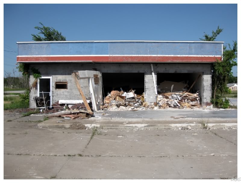
To break up the interstate drive through Arkansas, I searched the internet and found interesting ruins just outside the city of Fort Smith, at the former Fort Chaffee.
Fort Chaffee was built in 1941 and declared surplus in 1995. The approximately 200 leftover barracks had light occupation with a few businesses, but many of them were vacant and heavily decaying.
January 29, 2008 would bring a spectacular fire where two source fires were observed and the 50mph winds would spread the fire like, well, wildfire. The wooden barracks quickly became engulfed & the only way the fire department could fight the fires was to bulldoze sections to prevent further spreading.
In total, 150 buildings were damaged or destroyed that day. When you drive on the property there's a good 5 block segment of standalone chimneys (the only thing that survived the fires).
It may have not been the most explorable location, but the chimney forest was a unique sight.
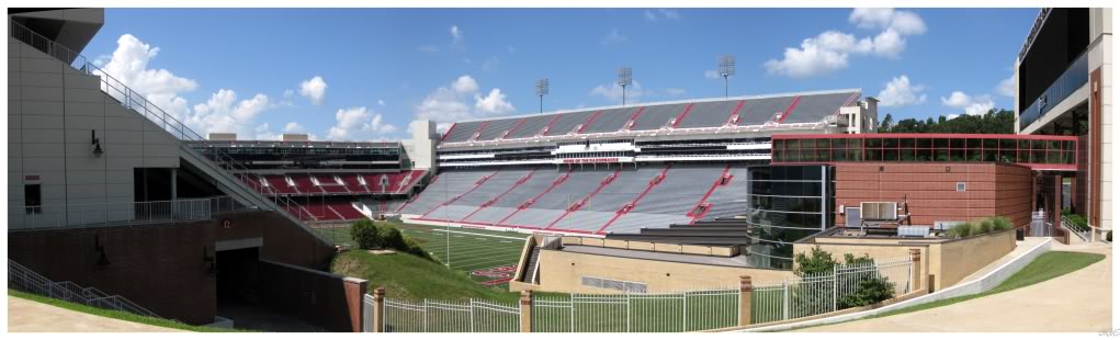
Since Arkansas still held notoriety, I wanted to stop for lunch before entering Missouri. As I looked at the map, I figured Fayetteville, home to the University of Arkansas, was our best bet to find somewhere worthwhile to sit down & enjoy a meal (university town -> decent eats).
As we pulled into the city, I noticed the Razorbacks Stadium & yelled at U.J. to pull over so I could check 'er out.
As I stood there, I thought the stadium was modern and new because of how it looked, but apparently it was built in 1938 as a Works Progress Administration project.
They have done a nice job with the upkeep.
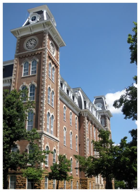
Not knowing the next time I'd be in Fayetteville Arkansas, I convinced U.J. to endure the mid-90s heat and walk around campus.
There were many attractive buildings, but the 1879 Old Main took the cake. In reading up on the building, I learned that because the University was so far from train lines or waterways, that timber was actually carted by ox & brick kilns were built right on campus during the building's construction.
As U.J. & I walked around the building, we noticed a girl sitting on a bench reading, and both pondered who goes outside during mid-90s heat to enjoy themselves. Then again, maybe she enjoys the arboretum in front of Old Main so much, because the University went out of their way to plant 1 of every type of tree found in Arkansas on the lawn.
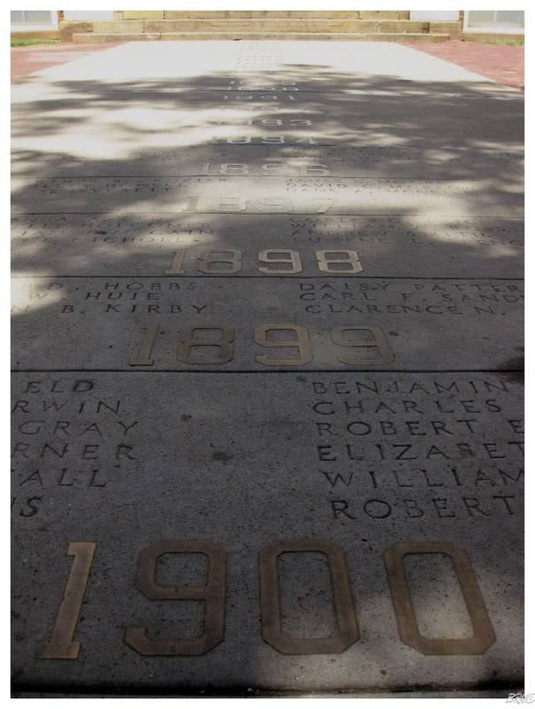
Continuing around the building, the Senior Walk was pretty neat as well: starting in 1905, every graduating class installed the graduating year & the graduates into a walkway which leads to Old Main. The University took over the tradition in 1915 and added all of the graduates, dating back to 1876.
Of course the newer years now have thousands of names, but the University actually built a machine for this purpose, a machine which can engrave all of these names into stone very quickly.
I know I'd like to see my name engraved in stone at my alma mater.
Anyway, after enduring the heat, it was nice to get back to the air conditioned car. We ate at some average brewery near the campus, before rejoining the interstate and heading north towards Missouri.
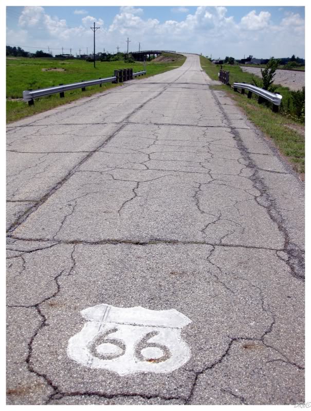
After driving a couple of hours, we were back onto Route 66...
...and into Kansas!
Route 66 only travels through Kansas for 13 miles, but with painted road symbols, neat communities & interesting roadside attractions; Kansas makes the most of its 13 miles.
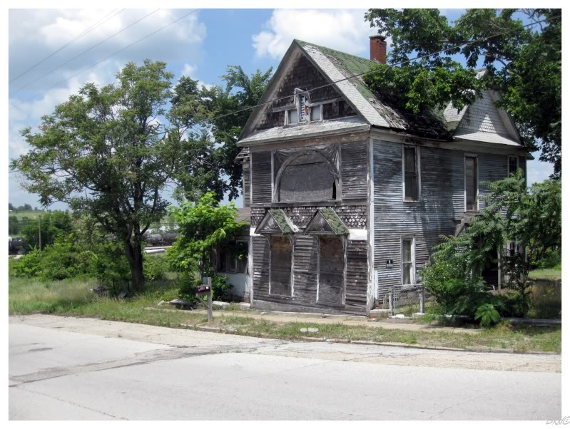
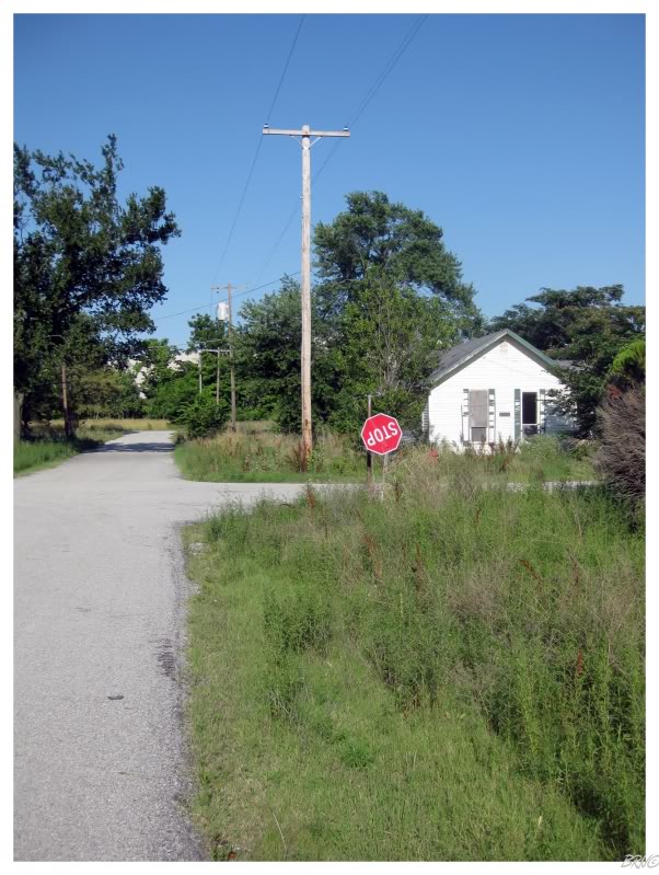
The first Kansas turn had this abandoned house on the corner.
U.J. told me about how it used to be a whorehouse where the owner lured men into the back & killed them - afterwards hiding their money & dumping their bodies in abandoned mine shafts around the area.
I was skeptical of the story, but I did find a NY Times article where they were searching for at least 3 people in an abandoned mine shaft...so maybe the story isn't complete balderdash.
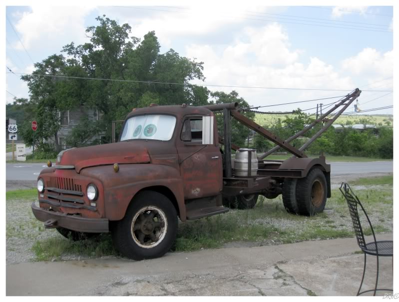
This truck was across the street and apparently the inspiration for some animated film?
Beats me, U.J. was excited.

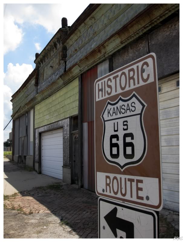
I've been to Kansas before, but a walk into a Galena store made me reassess the pros and cons of The Sunflower State.
Unfortunately I didn't have the mac & cheese pizza because the pizza snack bar in the gas station wasn't open yet :(
I still like Kansas though. My American cities destination wish list is littered with cities such as Topeka, Lawrence & Wichita.
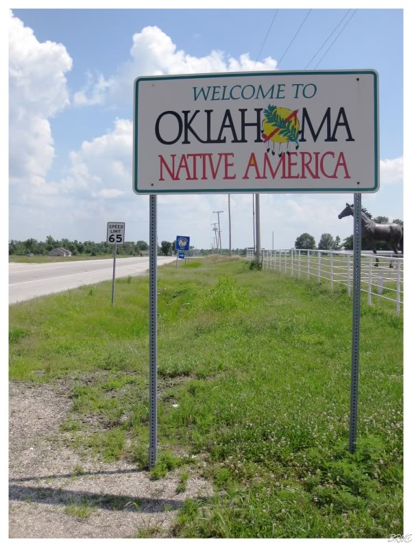
Route 66 only runs for 13 miles in Kansas, so before we knew it, we were in Oklahoma!
State #38 for me...the Sooner State!
Oklahoma is the U.S.A.'s 20th-largest & 28th-most populous state. It was admitted to the Union in 1907 - the 46th state to join America.
As I had never been to Oklahoma before, I excitedly researched somewhere for us to stop & form memories.
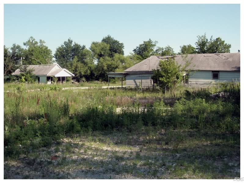
Just as I was having trouble finding an Oklahoma destination within a hundred miles of Route 66; I remembered the town of Picher - a downtrodden town all of 10 miles into Oklahoma & all of 3 miles north of Route 66.
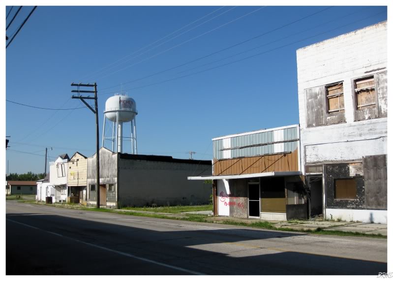
Picher is located within the Tri-State Mining District - aptly named because it is where Northeast Oklahoma meets Southwestern Missouri & Southeastern Kansas. Mining started here in the 1870s with lead, but zinc was soon after discovered and within a few decades the mines were extracting six times more zinc than lead.
The early mines were primitive and shallow, but with larger ore bodies discovered, later mines were more complex & deeper. These newer mines used the room-and-pillar method, where rooms were carved out & pillars were erected to keep the ceiling from falling to the floor.
These mines produced a peak volume of 15 tons of ore in 1926. They would start to decline after WWII and most of the large mines had closed by the 1960s. The last mine closed in 1970.
Once these mines were abandoned, water eventually infiltrated the mining rooms and mixed with the available sulfide minerals to produce underground acid. In 1979, Tar Creek was contaminated when the underground acid began to mix with the creek through open mine shafts & boreholes - changing the creek to the road sign orange colour that it is today.
The streams and groundwater remain highly contaminated with lead, cadmium & zinc. The acid leakage into Tar Creek led to the creation of the Tar Creek Superfund Site in 1980.
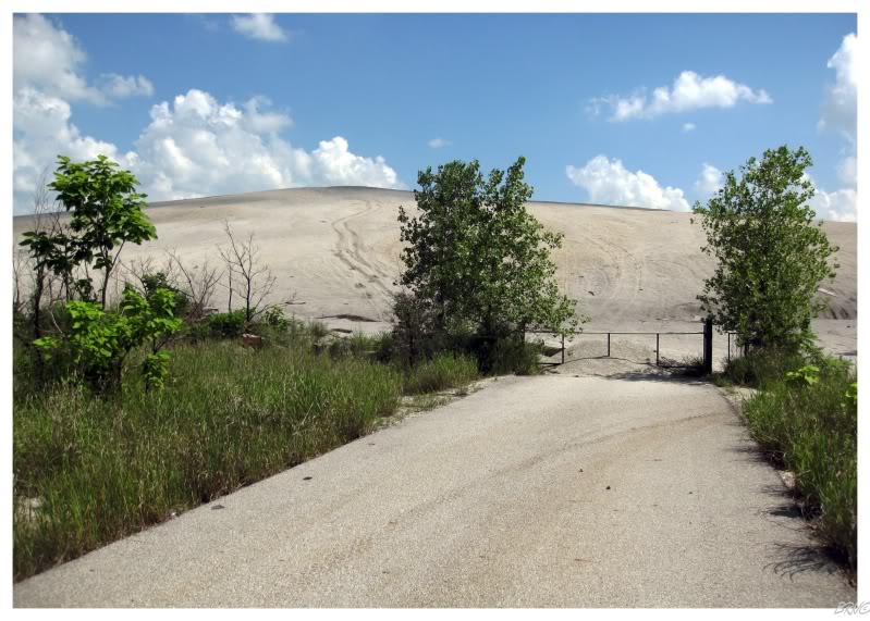
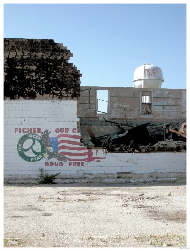
In addition to the problems created by underground seepage, large quantities of waste rock were produced with the extraction of lead & the extraction of zinc. Since no pollution regulations existed at the time, the mining companies simply dumped the waste rock on the surface in huge piles (called chat piles, example above).
Most of the adults in Picher grew up playing on these chat piles, even though the piles have a high concentration of heavy metals. Any quick internet search will turn up pictures of the chat piles & comments by old residents of Picher saying they used to dirt bike, bmx bike or simply play on the piles - a likely reason why 30% of the children in Picher had elevated lead levels in their systems.
In addition, even those who chose not to play on the chat piles were affected as dry weather & high winds would make the chat dust airborne & blanket the town with the lead-rich mixture.
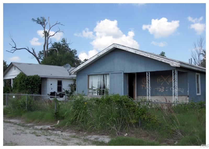
It wouldn't be such a problem if certain chat piles weren't so close to houses (see above, which is not even the worst example (chat is at the end of the road traveling away from the picture))
In April of 2006, Reuters reported that the town of Picher was to close and all residents were to move.
By July of 2009, all Picher residents were given federal cheques so that they could leave Picher forever, as the federal government viewed the area as too toxic to be habitable.
The city's post office was scheduled to close in July of 2009 & the municipality ceased to exist in September of 2009.
As far as I knew, there were still a few holdouts living in Picher.
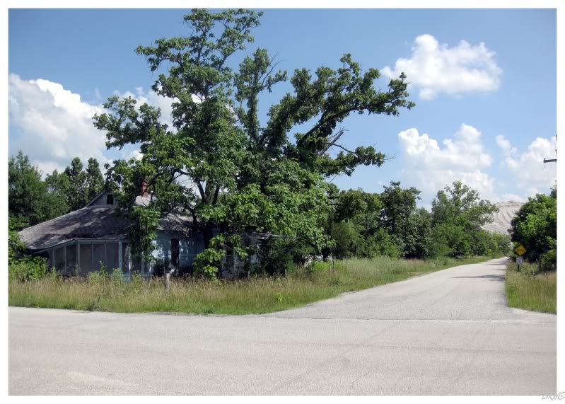
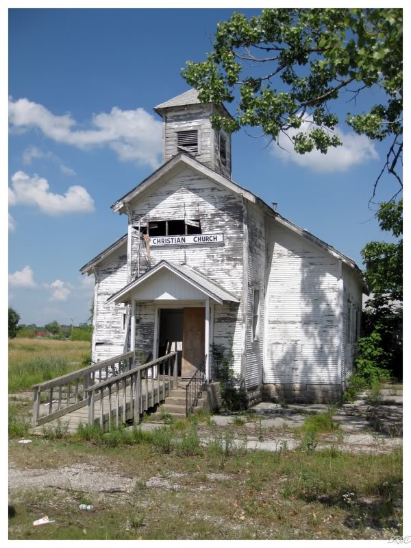
During our visit I expected them to be hostile, but we seemingly had the entire town to ourselves. Picher is located along a highway, so there was traffic, but no one paid us any attention & we had free rein.
I should say though, that I was still worried about snakes & spiders as I haven't been in the South very much during my lifetime. Therefore, I did things like shoot pictures from the road & get trees in my shot, instead of wandering into the grass for the proper framing.
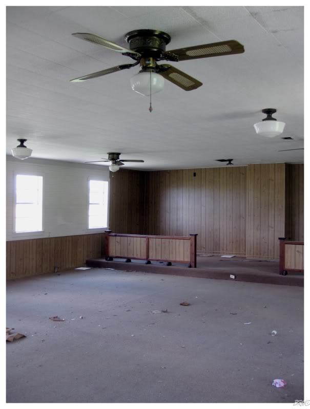
The interior of the church left much to be desired.
I went back outside and let the wasps have it back.
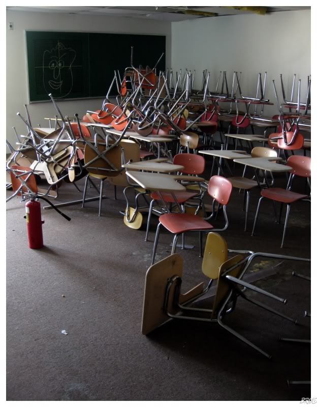
Since I wasn't going in any houses for fear of snakes & spiders, I was excited to go over to the school so we could actually check out the interior of something enticing.
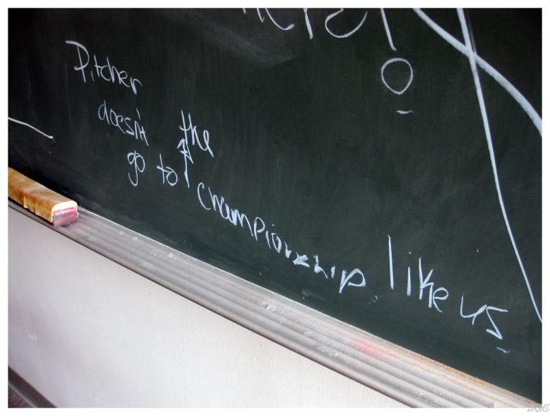
The chalkboards had lots of sign-ins & the nearby rival towns must have come & visited their fallen competitor.
At least you'd hope Picher residents could spell their rivals properly (in addition to being able to formulate a proper sentence).
The school was a plain 1970s structure that ended up not being all that fulfilling.
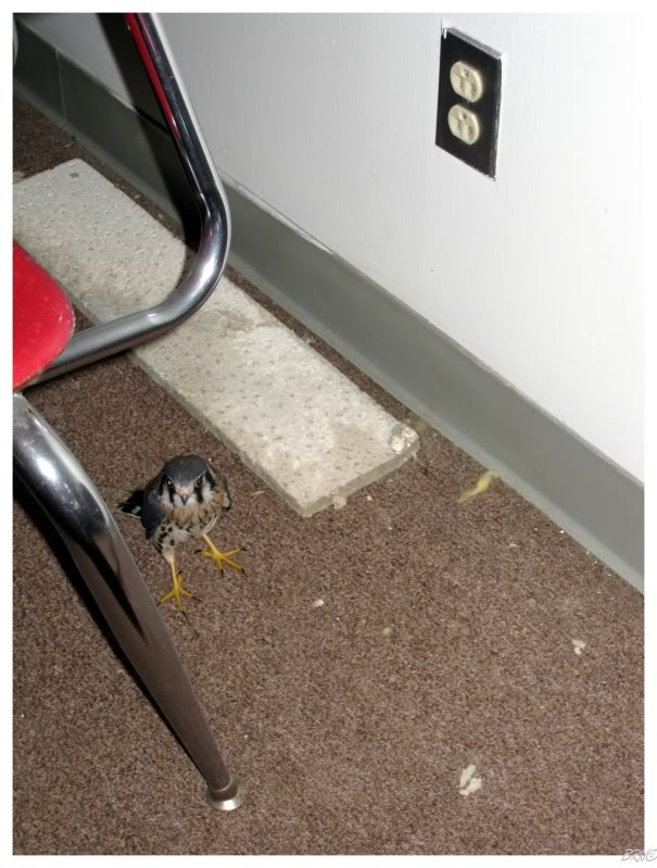
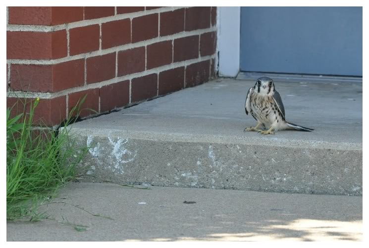
Excitement was brought forth when we found one of these little guys in one of the classrooms!
Trying to help the kestrel out of the room and to freedom, we opened the door and tried to coax him into going outside. The problem was that he seemed to be really groggy & unwilling. He would sit in place and simply look at us as we tried to push him with styrofoam and ceiling tiles - until finally growing tired of us & flying back behind a giant pile of desks (which were a pain in the ass to get beneath and towards him again).
After about 20 minutes of moving him from one corner to the other, he finally moved towards the door & left the classroom.
He had another buddy that we thought was dead, but who moved his head like a zombie once we tried to photograph him. That kestrel was a lot easier to get outside because he was a 1000x more sedated than the 'lively' kestrel.
U.J.'s photo
He was waiting about 5 feet from the door when we eventually finished with the school 30 minutes later.
I don't know why he wasn't gone in search of food or water by the time we got outside. My friend wondered if maybe it had to do with his diet which is certainly high in lead, zinc & cadmium...
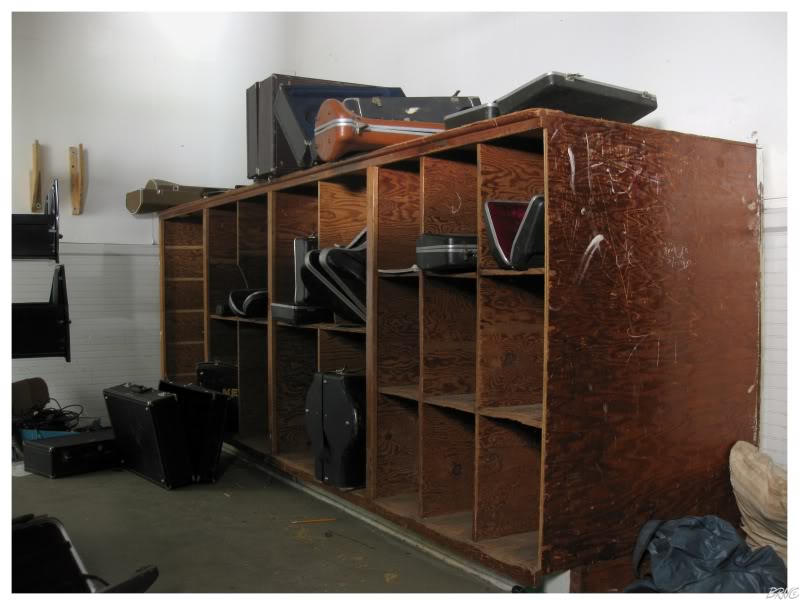
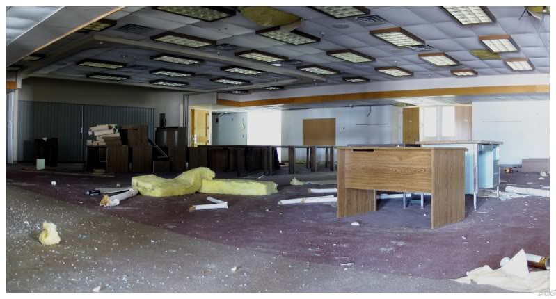
Leaving the school, we briefly checked out a modern administration building & then the music building.
Unfortunately all of the instrument cases were empty & U.J. didn't have to listen to saxophone solos for the remainder of the trip...
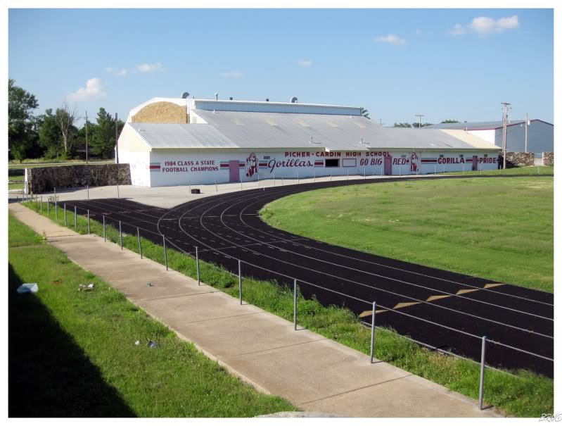
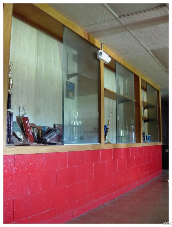
The tastiest looking building of the school complex had to be the Picher-Cardin field house.
We saved the best for last.
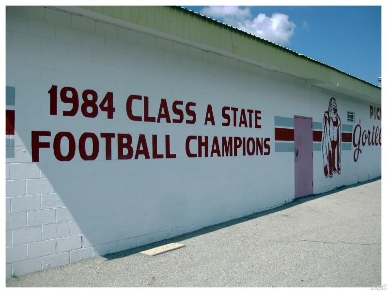
Some might argue that high school sports never matter, but I'm sure it was a big deal for Picher in 1984.
It will be unique for someone to look at a list of football state champions and find towns which don't exist anymore.
All forgotten in time.
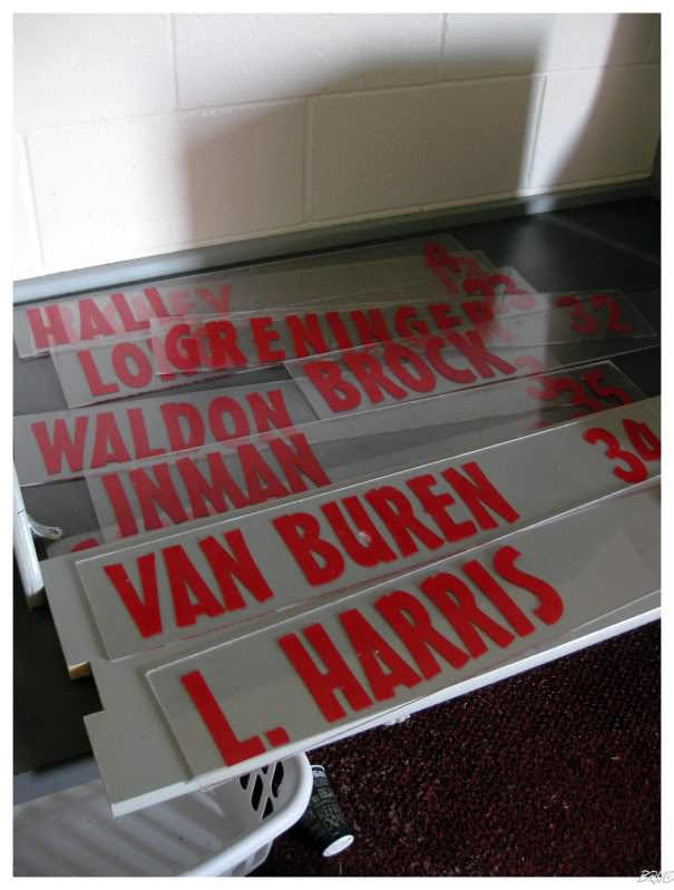
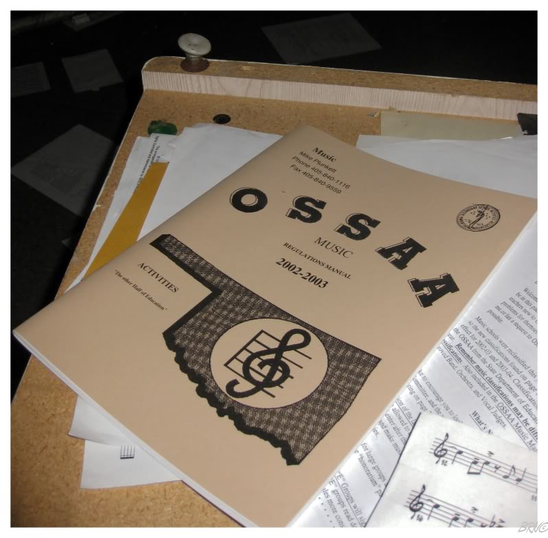
When we actually went in the field house, I was surprised that these name plates were still there.
You'd have to think some former resident would have checked this out and lifted these.
I know if I was on the high school team & my town was abandoned, that I'd go back & these would be in my garage...
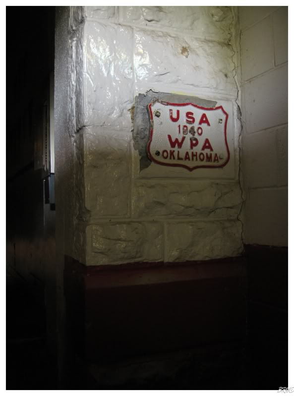
We learned that the field house must have been a WPA project.
(WPA, Works Project Administration, was a public project that employed millions of individuals between 1937 and 1945 to work on parks, buildings, sculptures & murals nearly everywhere in the U.S.A.)
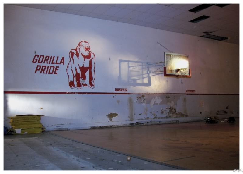
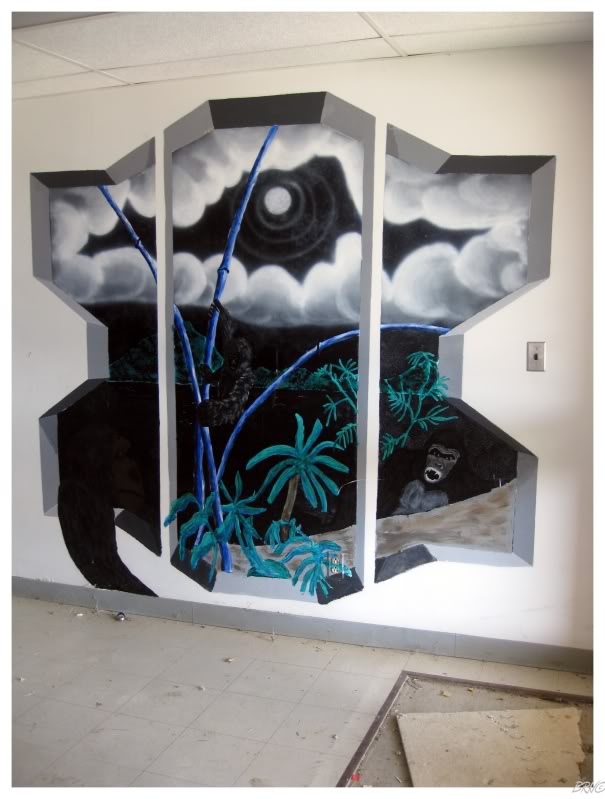
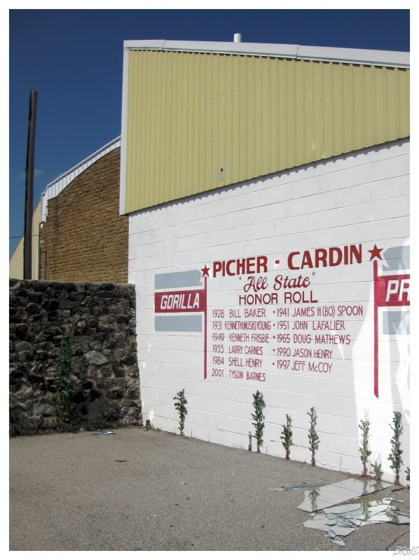
Walking into the basketball court, there's your explanation for the gorilla mural in the school.
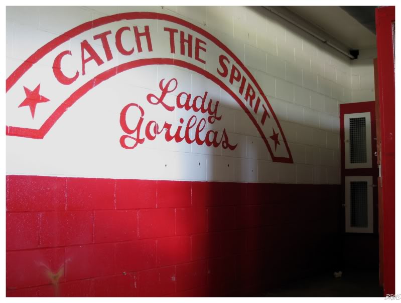
U.J. & I had a good laugh at this - "hey, we have a masculine sounding mascot? Well, just throw 'lady' in front of the name for the girls!".
Woo! Go Lady Gorillas!
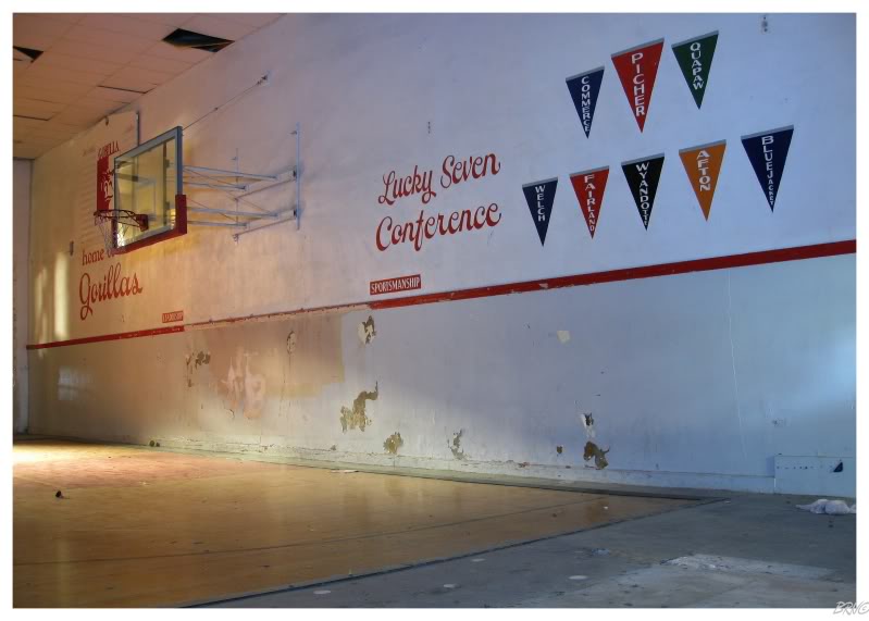
One wall of the basketball court was home to painted flags of the 8 communities which used to be in 'the Lucky Seven Conference'.
I guess without Picher, they're back to having seven in the Lucky Seven Conference.
We had already drove through Quapaw and would drive through Afton & Commerce later; as they are all along Route 66.
Finishing up with the field house and returning to the main street, I was amazed at how run down the town looked for only a couple years of abandonment.
As it turns out, an F4 tornado directly hit Picher on May 10, 2008. The tornado killed 8 people in total, with 150 Picher residents suffering injuries. It would devastate a 20-block section of Picher (a place which can't be more than 30 blocks in total).
No money was provided for home repairs by the government; simply more encouragement to leave Picher.
We dawdled around for a bit longer as I could have spent all day wandering the Picher streets.
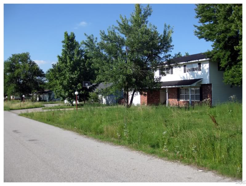
Finding a home with a clear driveway & path to the front door, we went inside & found it to be modern & boring. I imagine the houses overgrown with tall grasses would be the best, but I personally wasn't wandering atop any ground which I couldn't clearly see.
Eventually we realized that we had spent about 4 hours in Picher and needed to get going, because we still had to make greater westward progress for the day.
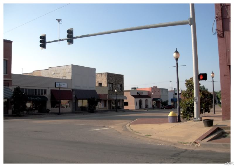
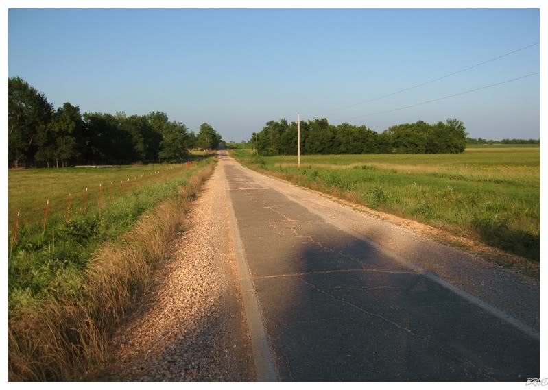
We passed through the bustling town of Miami Oklahoma (with its fantastic restored theatre0), before the Route turned into what you see above - the "sidewalk highway".
Apparently Oklahoma didn't really think the car thing would catch on & only paved an 8-foot wide section, since laying so much pavement was expensive. Our guide told us to avoid this route if it was raining (because of the sloppy mess the sides would turn into).
Thankfully there was no precipitation to be found and the sandstone-rich Oklahoma soil glistened a bright red as the setting sun bounced off of it at shallow angles. We would only pass 1 other car during the entire 8-foot-wide section, so the width didn't bother us at all - it was actually welcomed as it provided a sense of nostalgia & it wasn't half-bad looking either.
As we were traveling along, I noticed birds with giant tails sitting atop the roadside power lines - I would later learn that these were Scissor-tailed Flycatchers: the State Bird of Oklahoma.
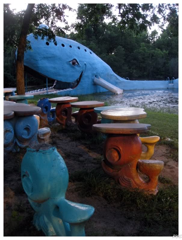
We would have to eventually speed a bit as U.J. wanted to see Catoosa Oklahoma's Blue Whale before dark.
The Blue Whale of Catoosa was built in 1970 as an engagement gift from a husband to a whale figurine-collecting wife. It was meant for private use, but it soon became a popular swimming hole & attraction along Route 66.
U.J. would clamber inside and atop the whale, snapping some pictures from the top. I sat near the concrete whale benches & waited.
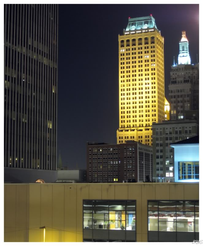
Once in Catoosa, we were only 20 minutes away from Oklahoma's 2nd largest (and America's 47th largest) city - Tulsa!
The two of us drove downtown and into some parking garage so we could watch the last vestiges of the sunset & snap some pictures of the Tulsa skyline.
Overall, while there were plenty of modern skyscrapers, there were also some beauties, like the Mid-Continent Tower (see above).
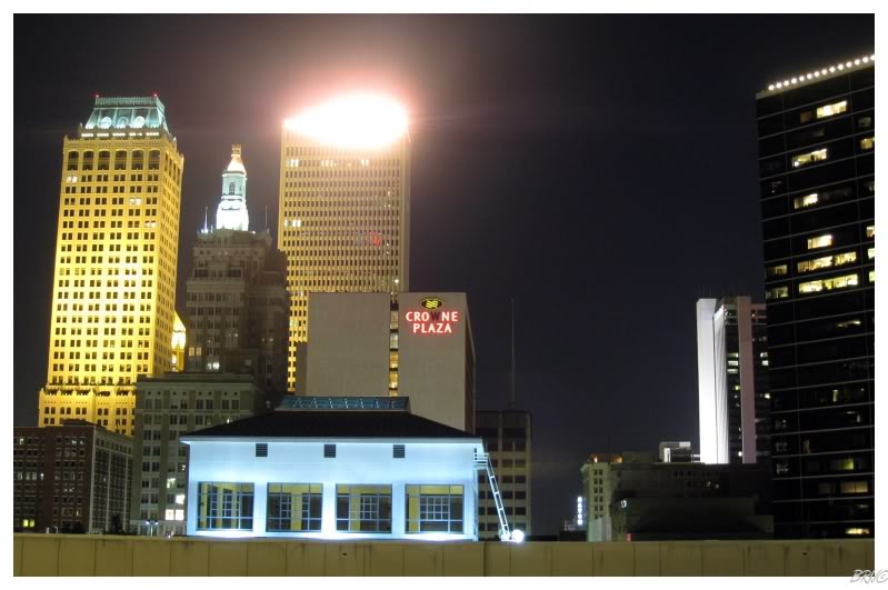
There was also some building with the harshest, brightest nighttime light I've ever seen - wreaking havoc on our attempts to take entire city skyline pictures.
We eventually gave up & returned to street level. Tulsa was awfully dead as we set up our tripods in the middle of some downtown road and snapped more pictures. As we were taking pictures, we noticed 2 shadowy figures atop a skyscraper and laughed at the fact that we noticed some people exploring something abandoned.
We would try ourselves to check out the building, but the fence they climbed to get into the building proved to be problematic.
Eventually we returned to journeying west, this time along the interstate (since it was nighttime). We would travel about another half-hour before stopping for the night in some forgettable place in Bristow, Oklahoma.
Onto Day 5.
| Day 1 Windsor,ON to Mooseheart,IL via. Michigan City,IN |
Day 2 |
Day 3 St.Clair,MO to Bentonville,AR via. Cuba,MO & Mt.Magazine,AR |
||||
Day 4 |
Day 5 |
Day 6 Conway,TX to Albuquerque,NM via. Armadillo,TX & Tucumcari,NM |
Day 7 Albuquerque,NM to Williams,AZ via. Flagstaff,AZ & Winslow,AZ |
Day 8 Williams,AZ to Rialto,CA via. Oatman,AZ & Needles,CA |
Day 9 Rialto,CA to Pasadena,CA via. Salton Sea,CA & Mexicali,Mexico |
Day 10 |
| Day 11 Oxnard,CA to San Jose,CA via. Big Sur,CA & Monterey,CA |
Day 12 San Jose,CA to San Francisco,CA via. Lick Observatory,CA |
Day 13 San Francisco,CA to Hickison Petroglyphs, NV via. Sacramento,CA & Carson City,NV |
Day 14 Hickison Petroglyphs,NV to Casper,WY via. Leamington, UT |
Day 15 Casper,WY to Winner,SD via. Keystone,SD & Oral,SD |
Day 16 |
Day 17 |
Sources:
2 - University of Arkansas - Wikipedia
3 - Old Main (University of Arkansas) - Wikipedia
4 - Blue Whale of Catoosa - Wikipedia
6 - Scissor-tailed Flycatcher - Wikipedia
Go Back to the Main Page of this Website