On day 13 it was finally time to return east.
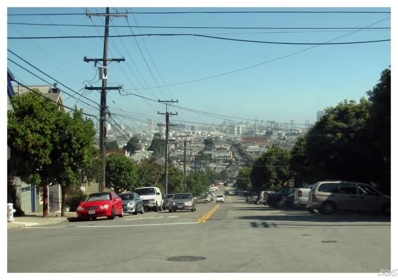
Leaving San Francisco, the traffic wasn't bad as we drove through Oakland and stopped at the Berkeley Jack-In-The-Box. While waiting for our breakfast, a middle-aged man struck up a conversation with me. He asked a collection of Michigan questions because of our license plates - which I did my best to answer while avoiding use of the word 'eh'.
He asked a lot of fast food questions, so I was actually knowledgeable enough to field his inquisitions.
Our first stop today came after another 90 minutes - the California capital of Sacramento.
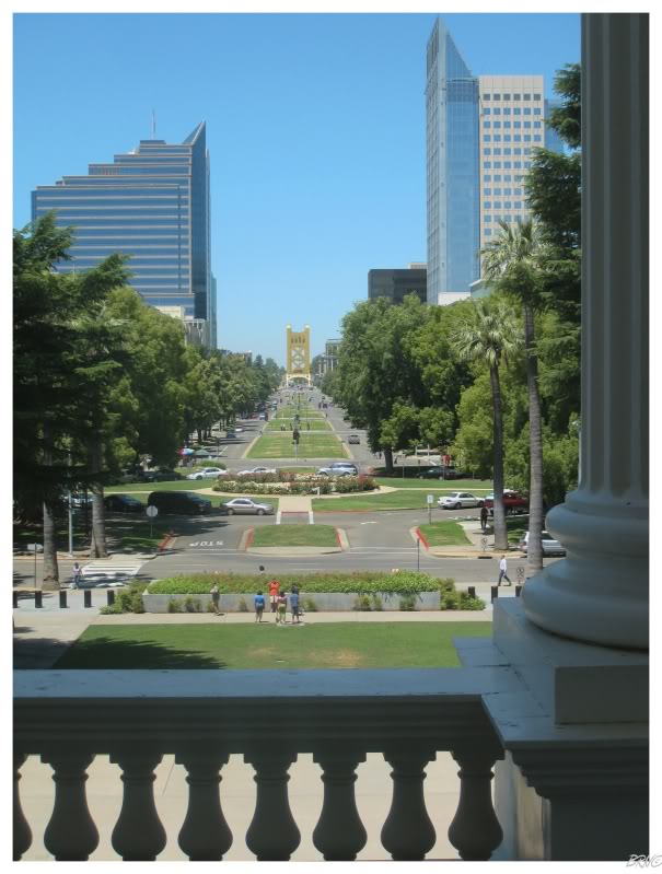
Leaving the freeway, we crossed a yellow bridge that I'd swear Sacramento must have stolen from Pittsburgh. Once across that bridge, there was a wide boulevard lined with glass towers - Sacramento wasn't looking like my type of city.
Even though we had already seen Oklahoma's capitol on this trip (and we planned on seeing Nevada's), I couldn't find much else to do in Sacramento after some brief research. The only type of abandoned buildings I could find on the internet were boring motels in rough ghettos (i.e. not worth it).
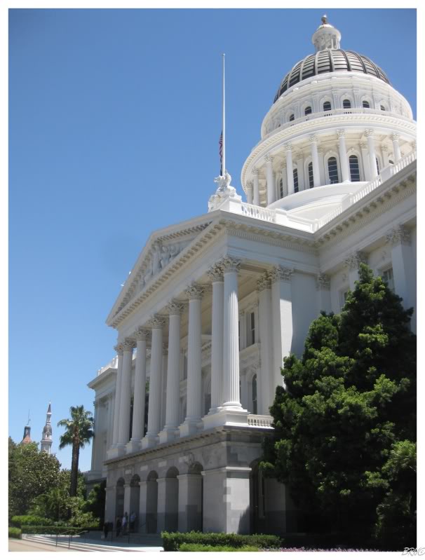
Parking on a palm tree lined street, U.J. walked away to take a picture as I stood there observing my surroundings. There was an awful lot of policemen and general law around, all of them looking very serious about their business. A random citizen was walking his dog & got the dog to jump into a tree (there was a thick branch only 2 feet off the ground); this drew the attention of the police who ran over, yelled as loud as possible & kicked the guy off the state capitol grounds while telling him how much of a moron he was.
When U.J. returned, she said she asked one of the lawmen what the problem was, and was only told, "there was an incident today."
I rolled my eyes before we made our way over to the side entrance. Security seemed to be equal to the Oklahoma state capitol & the security guard enjoyed making fun of how much change I had.
We entered the capitol.
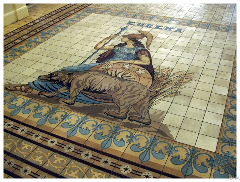
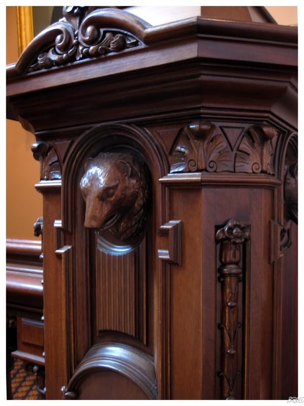
On the first floor, there were four of these tile groupings featuring the Roman goddess Minerva, a grizzly bear and California's state motto of Eureka - all three coming from the State Seal of California.
(California used Minerva in their seal because they became a state without ever growing as a territory - Minerva was born fully grown and was never a child according to Roman Mythology).
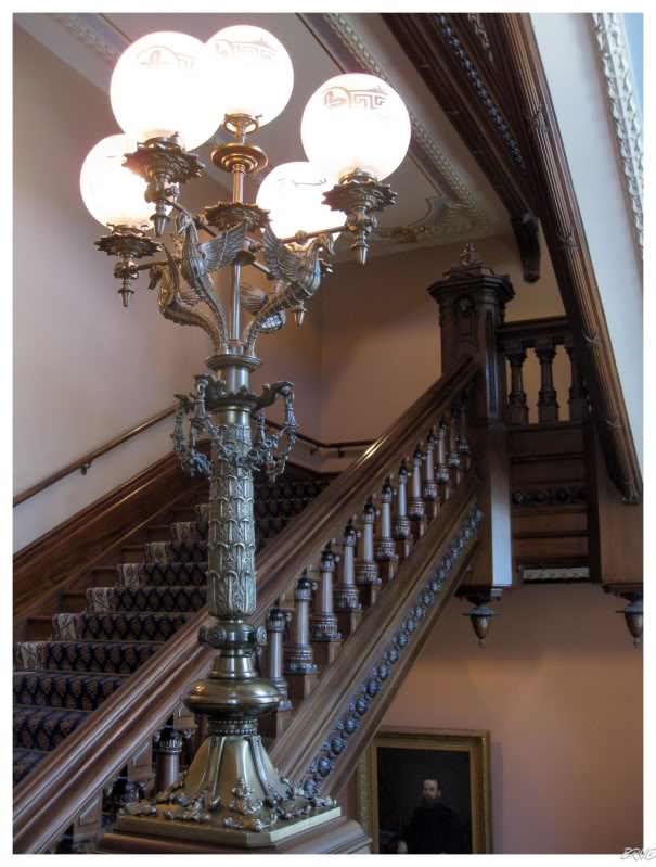
I only took one picture of the dome area because I was too busy admiring the incredible carved redwood handrails, which decorated the capitol's grand staircase.
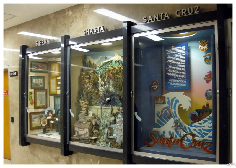
I also loved the county display cases in the basement. Throughout a long hallway, there were three counties displayed between each room, in display cases surely from the 1970s.
Each display was very informative & it would have taken us all day to thoroughly inspect them all. I looked at some of the more interesting named counties like Siskiyou & Stanislaus, before leaving the capitol.
Walking the beautiful grounds of the capitol, you could see non-glass buildings in the distance. As we left town, we drove a different way & it was apparent that Sacramento wasn't all glass towers.
I left Sacramento without much of an opinion - overall it seemed like a nice enough place. I'd enjoy a few days there in the future to allow for a more proper inspection.
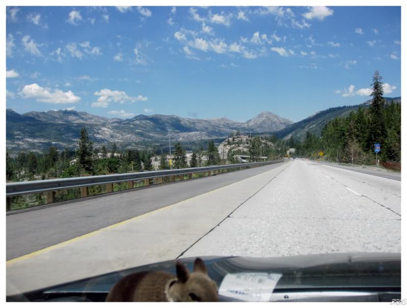
U.J. fell asleep shortly after Sacramento, which was a shame because our last California drive was through the Sierra Nevada Mountains and Tahoe National Forest.
I thought about waking her up at the impressive sight, but when I stopped at a turnoff to snap pictures, she woke up, looked around & went back to bed - so I guess it was only impressive to me.
I don't remember seeing the state sign, but somewhere along the way we entered my 45th state - Nevada.
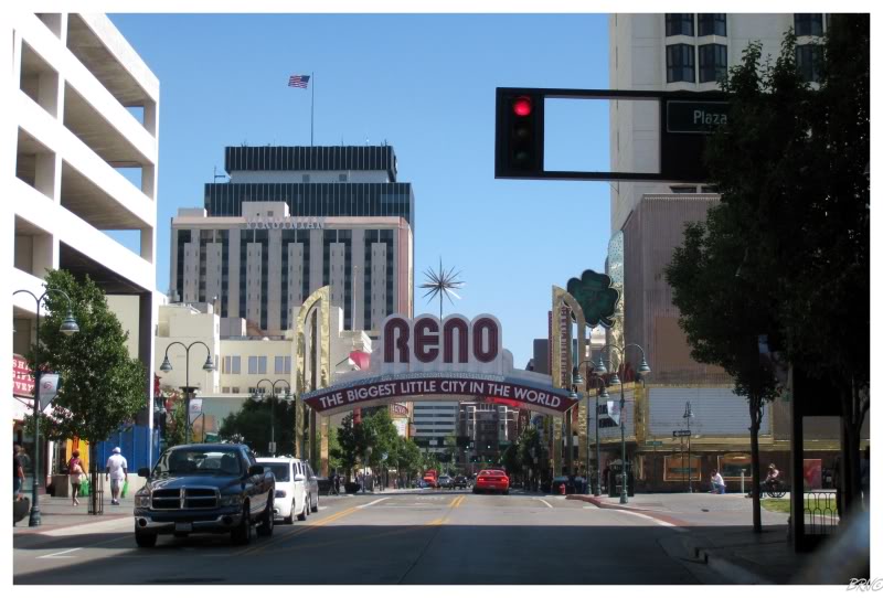
Almost immediately after the border was the town of Reno, which U.J. wanted to see.
Personally, the towns I want to see are more obscure & have stranger names than Reno.
I can guarantee it would have been more interesting to drive through Reno at 10pm instead of 11am.
Now Carson City...Carson City was the type of place I got excited about! Look at the main street!
We had been inside Nevada for only an hour & we had already seen the two places we wanted to see!
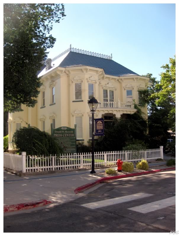
My selfish self asked U.J. if she was satisfied after one drive down the main strip in Reno; while I insisted that we get out of the car and inspect Carson City on foot.
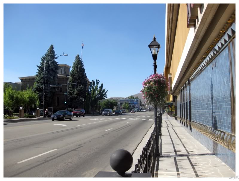
We walked the streets slightly to the west of the main street in Carson City. There was a collection of houses not breathtaking, but attractive.
The above structure is the 1876 Rinckle Mansion. Mathias Rinckle was a German immigrant who made his fortune in the gold fields of the Feather River.
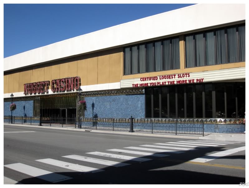
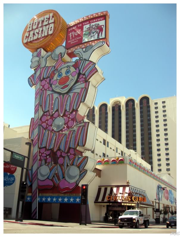
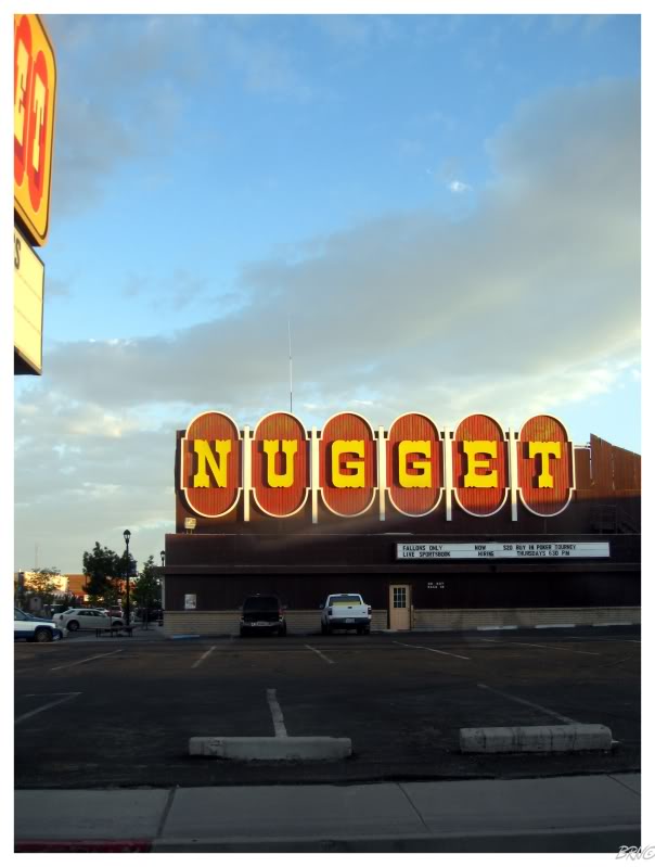
When we curved onto the main street, U.J. was amused with the Nugget Casino.
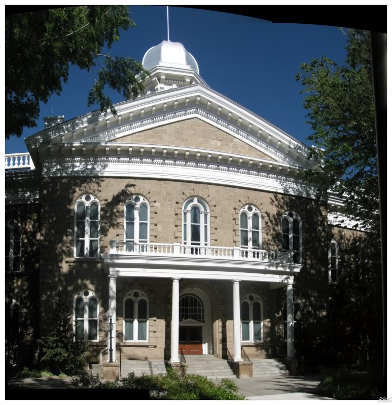
We finally sidled over to the Nevada State Capitol, only to find a woman locking the front doors as it was apparently 5 o'clock! Oh no!
She even informed us that they barely saw any people this day & that she really hoped we could return the next day, but that wasn't happening, we were already running behind.
So we had to settle for an outside view of Nevada's state capitol. I'll have to pop in next time I'm in Carson City.
We ate at an English-style pub located in a historic hotel, before making one last stop at Jack-In-The-Box for iced coffee. Who knows when we'd see another one of those...
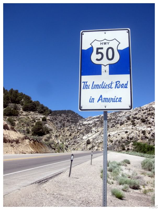
...because it was time for The Loneliest Road in America!
In 1986, Life Magazine published an article about Route 50 in Nevada, billing it as the loneliest road in America because of the stark landscape and lack of communities. They even had a quote from a AAA spokesperson saying, "we warn all motorists not to drive there unless they're confident in their survival skills."
Nevada seized the opportunity and embraced the loneliest title given to it's highway.
For me, it seemed a hell of a better option than taking Interstate 80 across all of Nevada. I was excited to see the state & I didn't want to do it while surrounded by guardrails and McDonald's (plus U.J. had already driven that portion of I-80 with her parents in the past).
If you think we should have been able to find a better option than The Loneliest Highway in America, please look at Nevada on Google & note the lack of highways.
I was already pleased with my decision to avoid the interstate when we merged onto Route 50. This was because it was the golden hour of the day, with the sun illuminating and shadowing everything, much more enjoyable than that severe mid day sun.
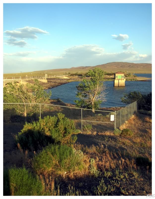
We stopped to take pictures of the Lahontan Dam, but giant federal fences informed us that the U.S. Government didn't want us checking out their dam.
The first portion of the Loneliest Highway was somewhat lonely, but still had quite a few communities and we even passed the infamous Bunny Ranch!
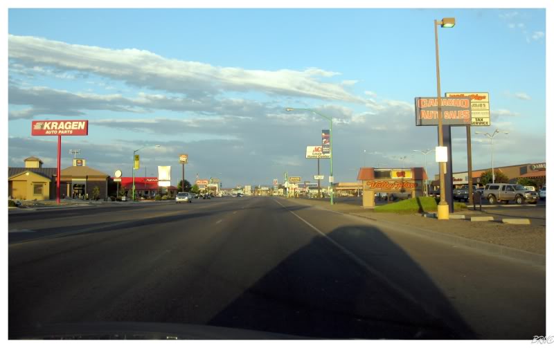
The above picture is of Fallon, Nevada. You may remember the Home Improvement episode where Al Borland says he joined the army to see the world, but didn't see anywhere as he ended up stationed in Fallon Nevada - well now you know what Fallon Nevada looks like.
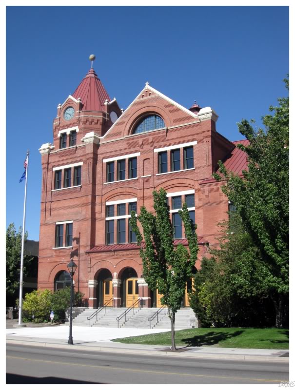
Fallon wasn't as bad as that previous picture portrays as it actually had a very attractive town hall.
It also had one of those Nugget Casinos that U.J. was so amused with.
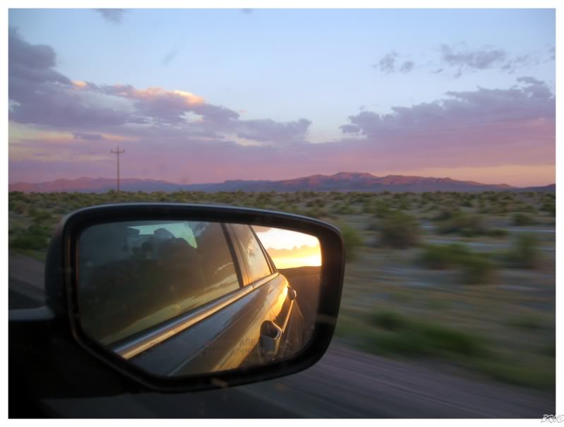
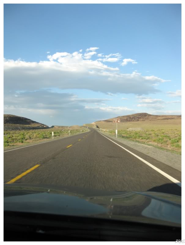
Civilization ends almost immediately after Fallon. Suddenly we were in desert valleys with distant mountains and no structures in sight.
The sun was setting and although we were driving east, we craned our necks to admire the setting sun in the west.
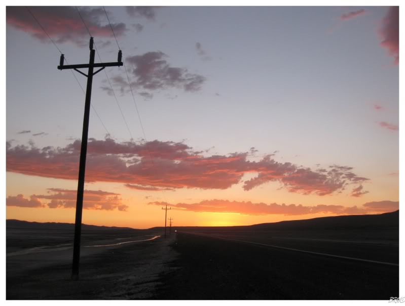
It was so nice that U.J. decided it was worth stopping the car.
The two of us were both spellbound by the scene of the empty desert, pink sky & deafening silence - so I certainly owe U.J. a hat tip for making the decision to stop.
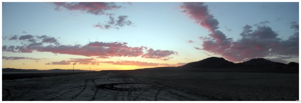
I wandered off the highway a bit & onto the salt flats. Over here I couldn't even hear the faint sounds of the car & I had no worries about critters since I was nowhere near any vegetation.
It's hard to describe the feeling of standing there with the wind ruffling your shorts while you try to take in the sunset. I'm not trying to sound emo here, it was simply a moving moment to experience.
It grew dark soon enough & we still had a large portion of our 180km (110mi) to cover between Fallon and the next town on the highway (Austin).
When we reached Austin, we planned to camp at a nearby campground, so we went into a gas station for some snacks and beers. The campground didn't look very far from town and we were back at the road shortly; a road which apparently was supposed to lead us to this campground?
Now I don't know if it's the lack of light pollution or what, but Nevada is dark. We drove the campground road and it looked like it led nowhere; there were no more signs, no structures, no anything.
U.J. was feeling refreshed after the gas station stop, so we decided to continue east instead of further searching for this campground on dirt/rock roads outside Austin, Nevada.
Speaking of outside Austin, it wasn't long after leaving there, that we both noticed a glow behind a distant mountain. Our maps didn't show anything ahead as the next town was another 180km away...so what was glowing out in the desert? Some type of military installation? Was this the desert fucking with our minds?
Every second turned into minutes as we got closer & closer to that mountain & therefore closer to solving this desert mystery...
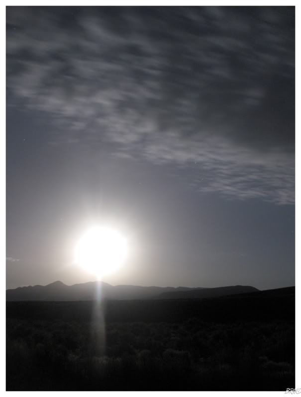
We both felt like boobs when we finally rounded the mountain after another 10km(6mi) and discovered....the Moon! A very bright moon over a dark desert...but yes, no military installation, only the Moon.
How did we not think of that? We're retarded.
After such a ridiculous experience, we decided to get out of the car so we could get a picture of the Moon.
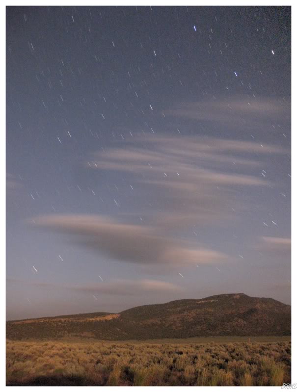
I decided to take a picture of the foothill behind us as well. I tried a 30 second exposure and got a black screen...so I shot an 8 minute exposure and it still wasn't bright enough.
Two cars passed during those 8 minutes.
We had just passed the Hickison Petroglyphs Recreation Area before stopping to take pictures of the Moon. We weighed going back & camping there, but we were concerned with showing up at 11pm, thinking it might be best to carry on to Eureka (the next town).
Thankfully we decided to check out the Recreation Area and found not one other person around! We were thinking this would be like camping areas in Michigan or Ontario, but here in Nevada we found an empty recreation area for ourselves in the middle of the desert.
Without research, this was a huge score.
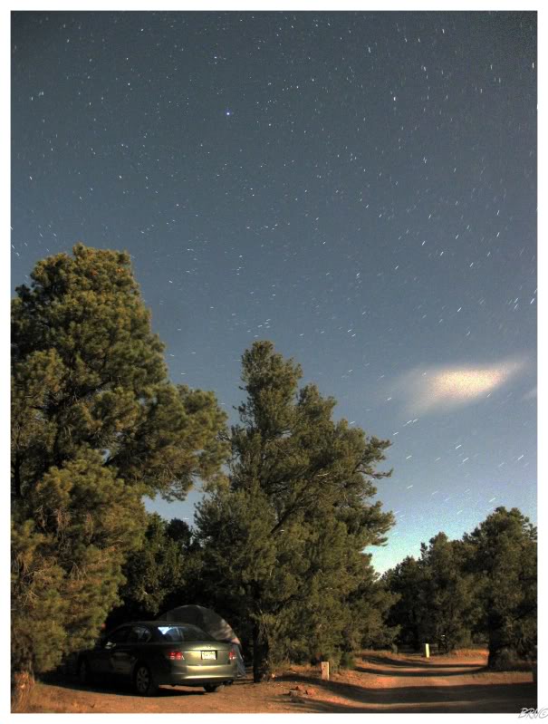
Our campsite is in the above picture. The light in the bottom right is from our headlights as U.J. set up the tent.
After the tent was set up, we cracked our beers and played some She & Him from the car stereo. I was suddenly happy that I decided to get a beer in Austin as I was leaning against purchasing any.
To sit out here and look up at the stars on a comfortable night with a cold 211? This was the most memorable and enjoyable experience of the trip. We both agreed that we should have been camping more instead of staying in uninspiring motels.
I continued to get up periodically to rotate my camera & fire off another 10 minute exposure.
Eventually my camera would die, my 211 would empty and we had to get some sleep. I could have sat on that picnic table until sunrise, but like every day on this trip, we had to continue traveling tomorrow.
Onto Day 14.
Total Distance Covered To Date: 7125km (4427mi)