It was incredible how quickly the traffic volumes dropped off outside Minneapolis.
As I drove east through the night, I was happy that I had gulped down a liter of coffee at Applebee's. I was nervous about deer & therefore wanted to be wide awake and alert. My alertness also gave me hope for making Wisconsin's highpoint by the time the GPS said - a time shortly before sunrise.
Wisconsin's highpoint is the only one located in a county park and as you'd guess, the park is small. Arriving in total darkness, we drove whatever roads we found, but didn't see any signs for the highpoint.
We drove along a narrow road in the silent night, not sure if we were supposed to be here after hours & with that nervous air you always find whenever you're in a strange forest at night.
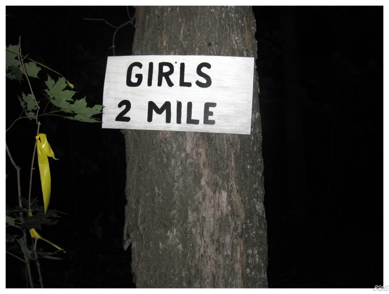
We eventually settled on a path which looked promising and went into the forest with our flashlights. When I stumbled upon the above sign I thought it was a fine consolation, but U.J. not so much.
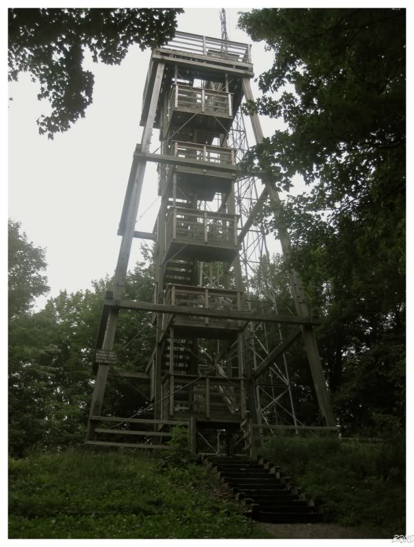
We left the girls path and quickly discovered the correct road for the Wisconsin highpoint. Parking at the highpoint lot, the path through the woods was hardly memorable and we were at the summit of Wisconsin before we knew it.
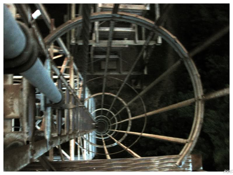
Once at the peak, there were two options: a 45 foot, safe & maintained wood lookout tower or an old, 66 foot, rickety steel radio tower.
It was fun to climb the steel radio tower with my energy drink shakes and U.J.'s nervous concern. It was a windy morning and the tower was shaking in the wind - something which I made sure to yell over to U.J. as she climbed the safe wooden tower (I also mention the wind here, in case you're wondering why the picture is blurry).
I can act tough all I want on my website, but I was nervous in person. I didn't know the last time this thing had seen any maintenance, and it wasn't comforting to feel it shake in my hands. Of course my mind started to contemplate the tower collapsing & my innards impaling on the steel beams - but I somehow think it wasn't all that hardcore to climb up here.
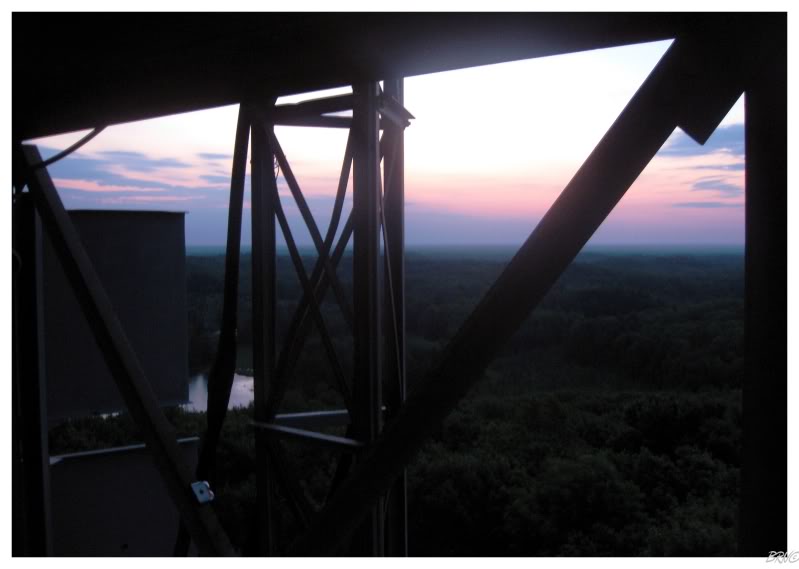
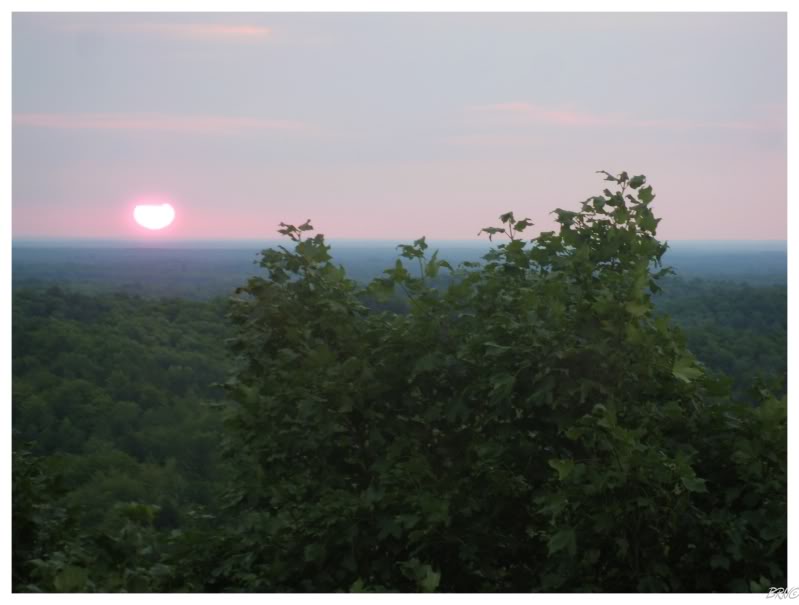
Even though the sun still hadn't emerged from the horizon, the pre-dawn view over the treetops was still very enjoyable.
Unfortunately I was too much of a vagina to stay up there and enjoy myself, so down to the ground I went...
...and back up to the safer wood tower where I could relax.
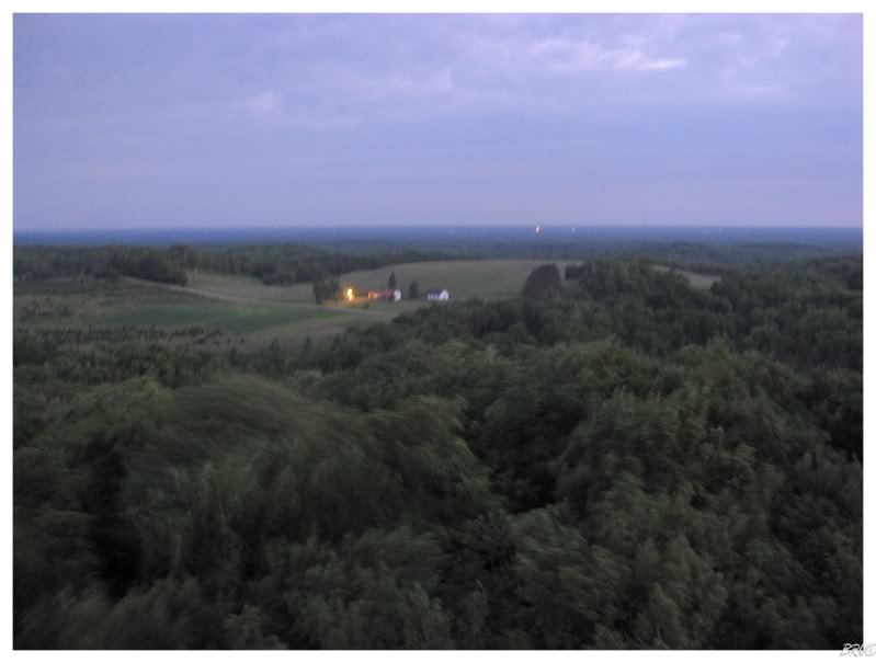
The sunrise ended up being the saddest sunrise I've ever seen. What you see above is what we saw, as the sun poked out and within 15 seconds moved behind a cloud (which you can start to see happening).
We descended Timms Hill & went on our way. I made sure to put some money in the donation box as Timms Hill was well maintained & enjoyable. It would rank high on my favourite list, even though I was in an early morning fog.
We stopped in Tomahawk, Wisconsin for black Halls lozenges and even more energy drinks. It was that time of the morning where it is hard to fight through the all-nighter, but we made it.
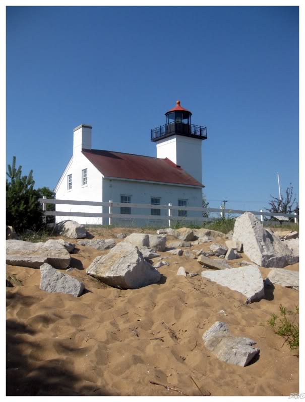
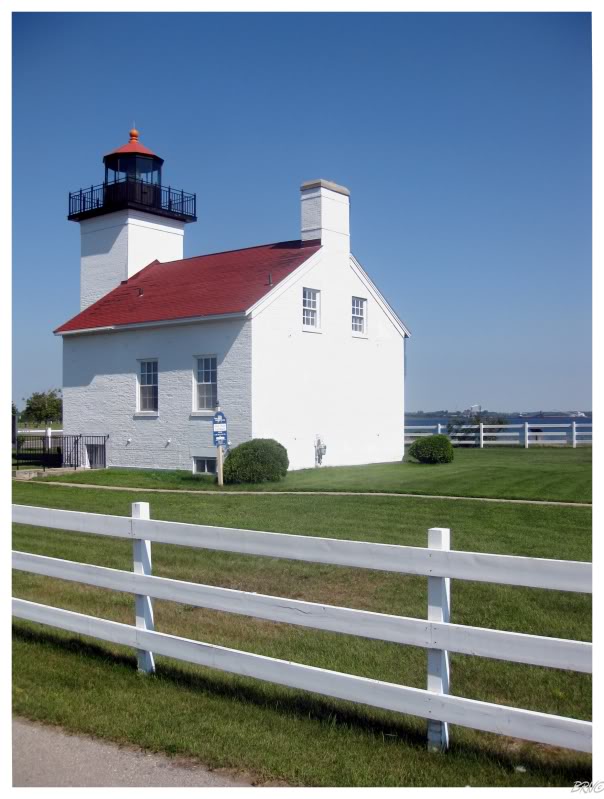
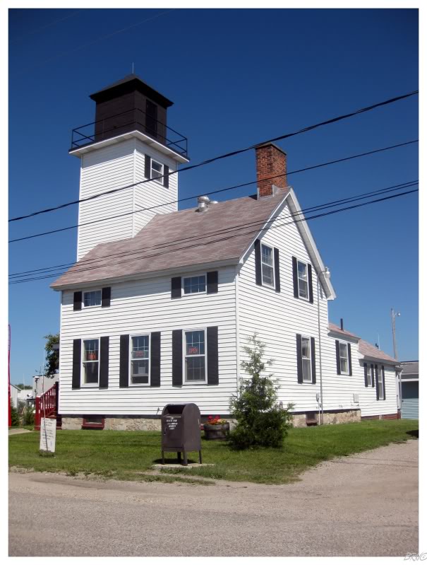
It wasn't long before we crossed back into our original state of Michigan. We drove directly east to the shore of Lake Michigan and the community of Escanaba - home of the Sand Point Lighthouse0.
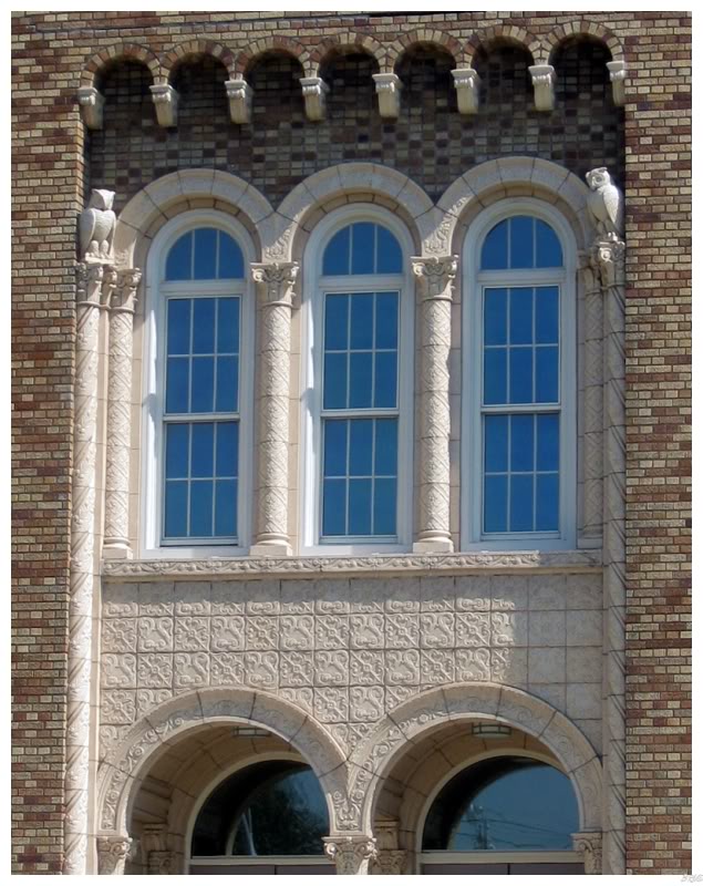

The town of Escanaba was interesting in itself; it had a beach-town feel like Sauble Beach back home, but with a few impressive buildings thrown into the mix.
The Carnegie library (not shown) was looking really rough, but this church seemed to be in great shape & the owl detail close-up is from the local middle school, which was renovated recently instead of constructing a new school.
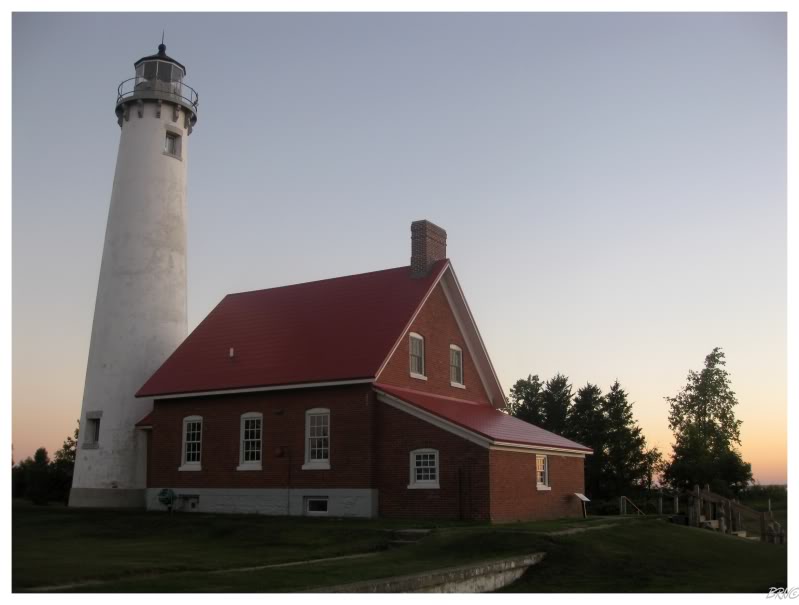
After a brief stop in Manistique so I could get some coffee from Hardee's & so U.J. could see the Manistique Lighthouse which I've already seen, it was onward to Seul Choix Point!
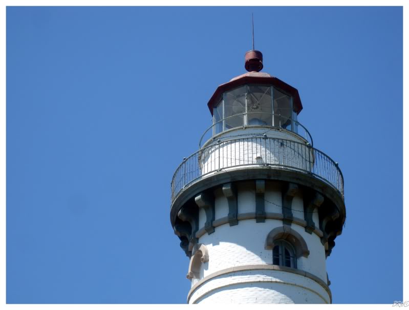
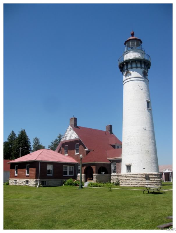
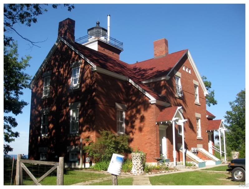
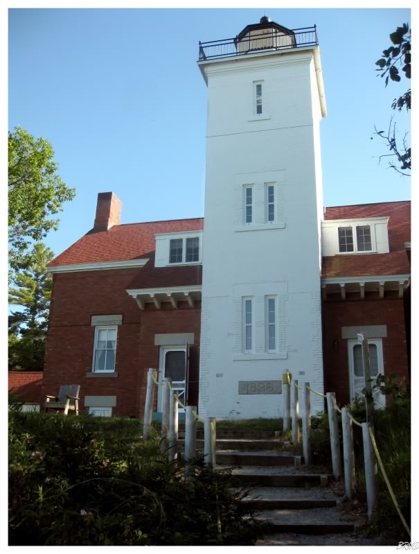
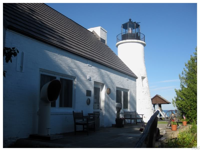
Seul Choix Point was built between 1892 & 1895, stands 78.75 feet tall & has had its Fresnel lens replaced with an airport beacon with 17 mile visibility. The name Seul Choix means only choice, because this is the only harbour of refuge at this segment of Lake Michigan.
Seeing as I enjoy lighthouses, I spend a fair amount of time on lighthouse websites & therefore had seen pictures of Seul Choix Point prior to this day.
I was very much looking forward to seeing this one in person. It was an ideal morning for a visit.
We were in Escanaba before the lighthouse was open for tourists, but Seul Choix Point was open by the time we landed there.
Seul Choix Point is a complete lightstation with keeper's housing, sheds and garages, and the Gulliver Historical Society has converted & restored these buildings into museums. The keeper's house was the highlight, with so much to look at that it was hard to walk at times.
The above poster resulted in minutes of my admiration and salivation.
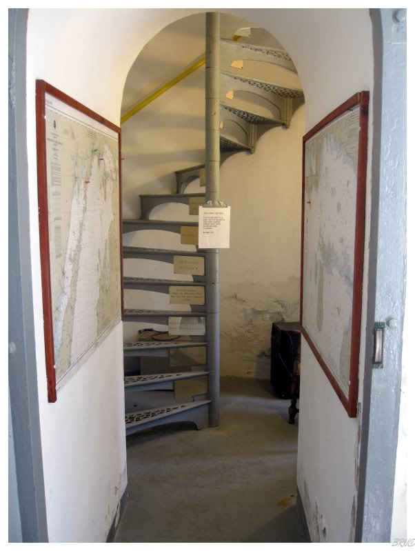
An aboveground tunnel connects the keeper's house to the lighthouse.
Decorated cast iron stairs spiraled beside the metal wall towards the top. I made U.J. stop multiple times for pictures of the stairs themselves, impressed enough with them alone.
We eventually climbed through a small floor opening & entered the lantern room.
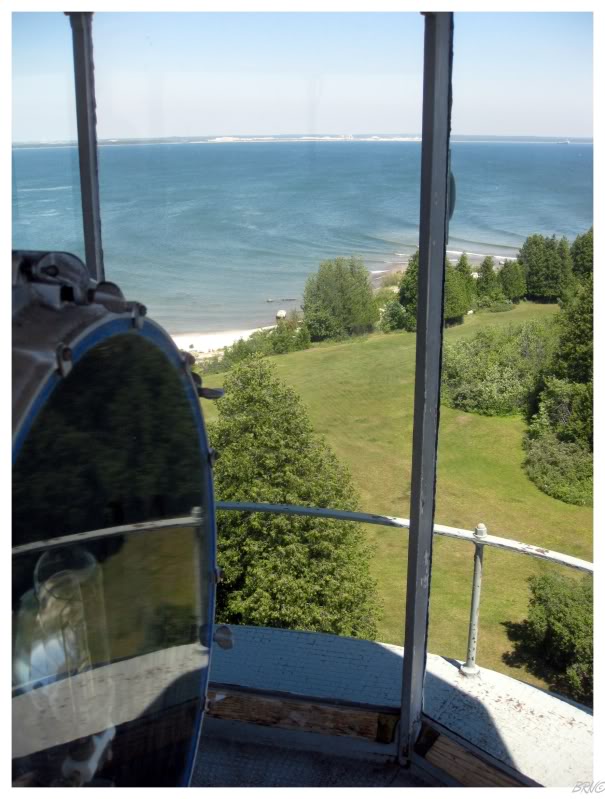
At the top of the stairs, it was awesome to suddenly be able to look over the trees.
All around our little point of green land, the indigo waters of Lake Michigan surrounded us.
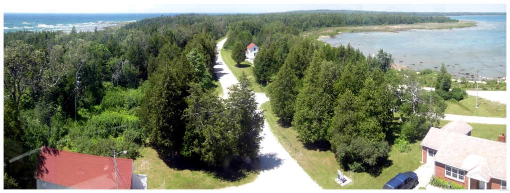
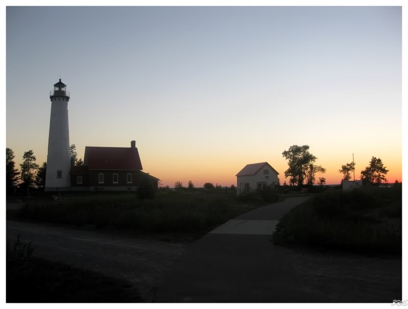
We didn't dawdle in the lantern room as it's very small and there were others who wanted to come up. There was another building which featured more tools and physical labour instruments, so after checking that out, we were back onto Seul Choix Point Road leaving the great lighthouse behind.
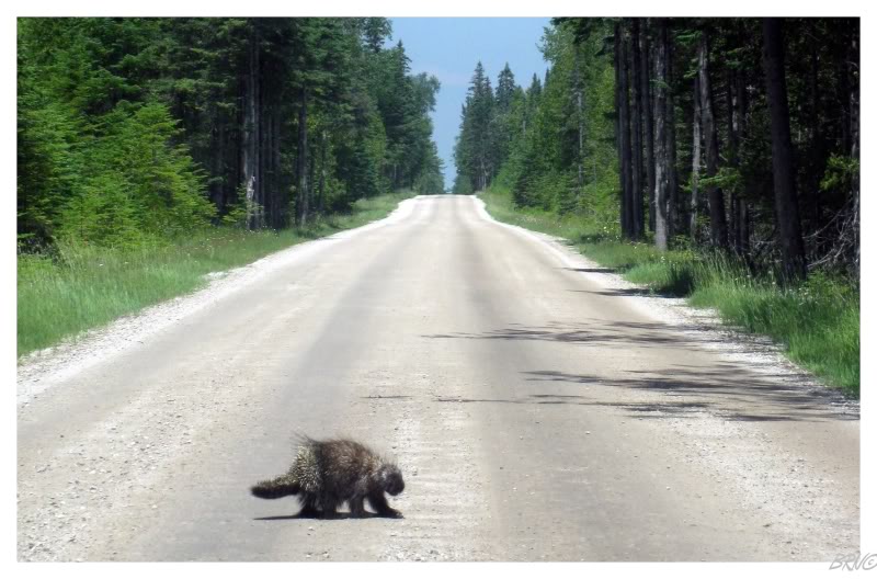
We weren't on the road very long before I let off the gas pedal, curious as to what was in the road ahead.
As I'm more accustomed to the habits of other animals, I hurriedly tried to get a picture before the animal scurried off. This wasn't necessary as I quickly figured out it was a porcupine and discovered for myself, how slow and seemingly clumsy they are.
The porcupine was clearly upset with our presence, but still couldn't escape very quickly. I realized why a Labrador woman once told my friend to find a porcupine if she was ever lost in a forest & hungry.
I wasn't going to eat him though, he was safe for today.
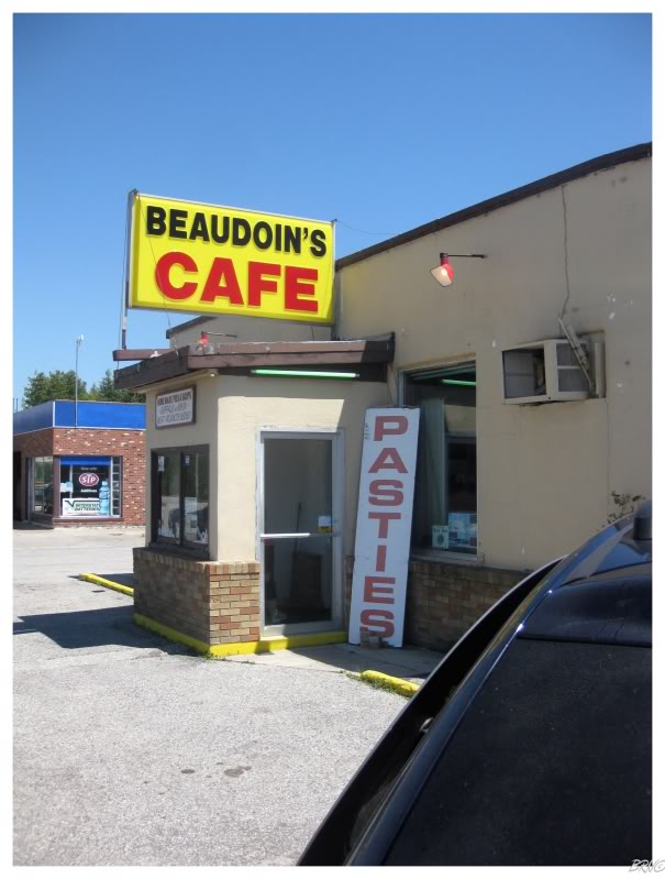
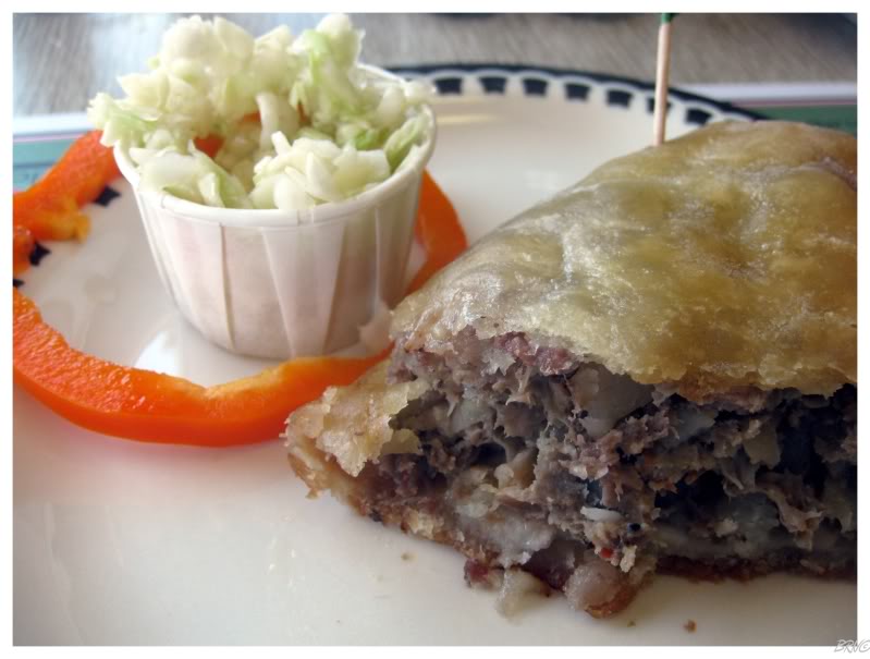
Safe mostly because of delicious pasties!
Pasties are pockets full of meat, potatoes and other vegetables. They were brought to the area by Cornish in the 1800s and became popular with the miners of the area who could heat them up in the morning and put them in their pockets for lunch.
Delicious & filling, it was hard not to take a nap after. Another coffee was consumed.

The menu at Beaudoin's Cafe surprisingly had "New England Clam Chowder", which I thought would be funny to get, but I couldn't pass up the pasties.
(I didn't even notice that they specified "French Fries or American Fries" until I was editing this picture last night.)
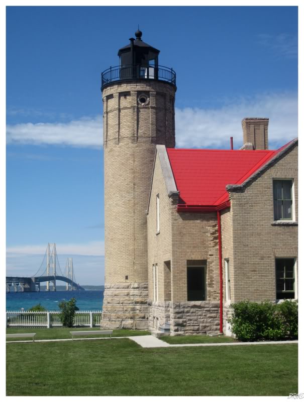
Once over the Mackinac Bridge, we would follow Route 23 along Lake Huron to see more lighthouses and to see something different from I-75 South.
We stopped at Mackinac Point Lighthouse briefly, but as we would have had to wait an hour for a tour, we didn't see it & it doesn't count (we had to stay behind a fence).
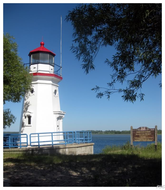
The City of Cheboygan is only 15 miles from the start of US Route 23 and we would stop there to see a pair of lighthouses.
First up was the 1880 Cheboygan Range Rear. As I walked around the lighthouse to take pictures, I found a woman reading on the back porch and was invited inside. She & her husband had driven the 5 hours from Kalamazoo to volunteer to show people the interior of the lighthouse for the weekend. They were amazingly knowledgeable and did a really good job showing off what had been restored inside the lighthouse so far (the Great Lakes Lighthouses Assoc. has been working for years to restore the interior).

As we walked around the lighthouse, I was amused that they kept explaining everything to U.J. - it seemed as if they assumed she was the one interested in lighthouses & that she was simply dragging me along.
The husband of the Kalamazoo Lighthouse Couple asked if we had seen the 1884 Cheboygan Crib Lighthouse yet.
When he found out that we had not driven to Cheboygan's lakefront to see the crib light yet, he offered to show us the interior.
We followed his gray Aerostar and soon enough keys were out & lighthouse doors were opened.
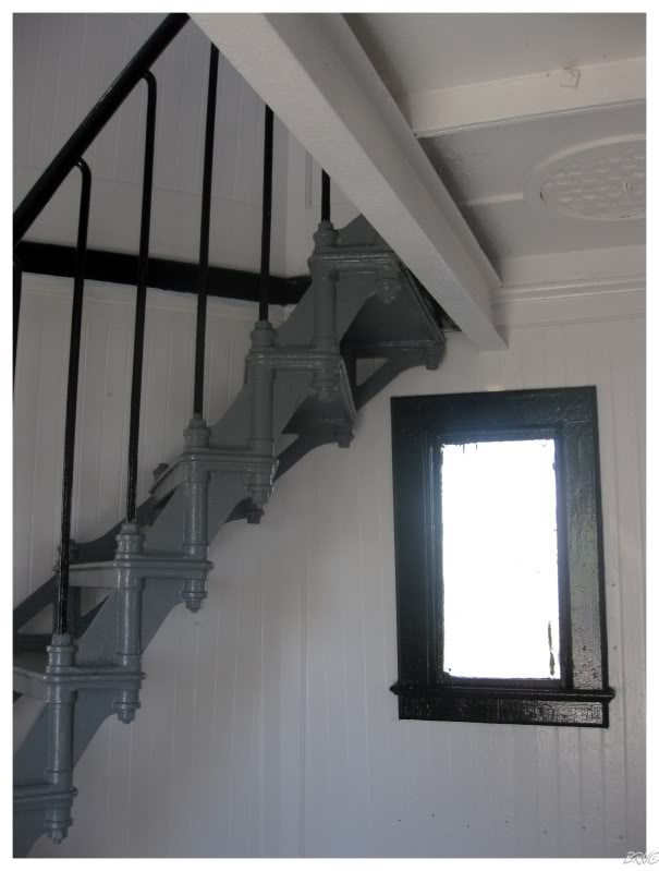
As you can see, the crib lighthouse isn't very tall; so in addition to having spider web covered windows, I'll spare you the unexceptional view from the lantern room (instead sharing an interior picture of the fantastic cast iron stairs).
Our tour guide shared more interesting info when he showed us two holes in opposing sides of the lighthouse - this was where the Coast Guard had put a steel cable through the lighthouse to move it from its decaying crib & onto the pier here at Turner Park.
As we left Cheboygan, the road passed cottages and forests. 50 kilometres (30mi) would pass and we noticed a sign for the 40 Mile Point Lighthouse, with a short driveway and quick entrance.
The afternoon was continuing to pass & we just missed this lighthouse's 4pm closing. While I typically like desolation & showing myself around lighthouses, I couldn't help but dream of the view from the 66 ft. 40 Mile Point tower over Lake Huron.
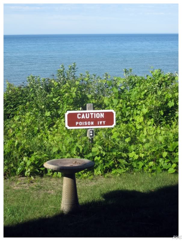
Poison Ivy as far as the eye can see I suppose.
For a closed lighthouse with poison ivy to spare, I spent a long time at 40 Mile Point, as it instantly became one of my favourites - it was as if someone took a redbrick Kent County farmhouse & affixed a lighthouse to its lakefront side.
The next community with a lighthouse was Presque Isle with its 1840 structure.
There was a short path from a parking lot out to this light & U.J. sat it out...so I hurriedly jogged down the path as we had places to be and structures to see.
What's that water-well looking thing to the right of the lighthouse though?
What the ?
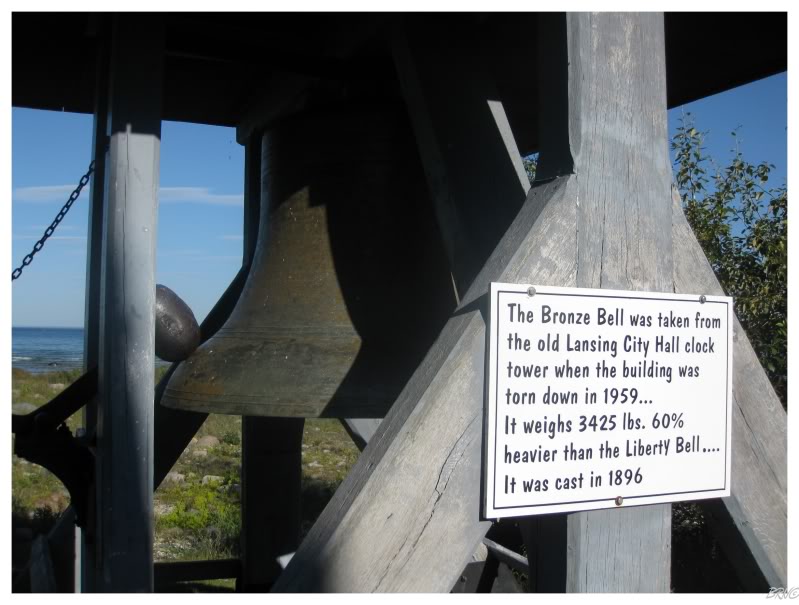
Apparently, a Lansing businessman by the name of Stebbins bought the lighthouse area to use as a picnic area for his nearby hotel in the 1910s. Stebbins was wealthy from his position as manager of the Lansing Wheelbarrow Company & also because he was one of the 8 founders of the Oldsmobile Automobile Company.
During his ownership, Stebbins also built a new keeper's cottage which included floor pieces from the demolished Lansing Post Office. I didn't have a chance to see these floor pieces or any of the museum as the lighthouse was deserted.
Also of note: apparently they used to hire college girls to give tours (not my words, from here), but the college girls (shockingly) attracted college boys & eventually a retired couple was hired to watch the light instead.
All of y'all are laughing at the thought of me showing up a some Michigan lighthouse and being greeted by a Lake Superior State Laker, Central Michigan Chippewa or Michigan State Spartan hottie...I, uh, yeah...that might have made my day.
Moving right along...
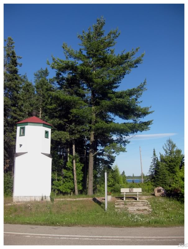
Instead of remembering the very impressive 1870 New Presque Isle Light, I remembered the not so impressive 17 ft. Presque Isle Range Front Light.
Oh well it's on the list, so if I ever start my Michigan checklist, I'll be happy to have seen it.

We began to round the Michigan shore of Lake Huron and head more south than east. The daylight was fading and people were congregated at cottages to celebrate America's independence (this was July 3rd). U.J. & I were both amused by the number of times we heard Lee Greenwood's God Bless the U.S.A..
As we showed up at Sturgeon Point Lighthouse, I thought the people having a beach party were maybe of a better mind than us, as this was a horrible time to try and shoot pictures of the tree-shaded lighthouse.
She's normally one of Michigan's most attractive and even has its original French 1887 Fresnel lens still.
Anyway, the mosquitoes at Sturgeon Point were ridiculous & they killed any thoughts we had of adding to the Independence Day beach party. We rushed back to the car.
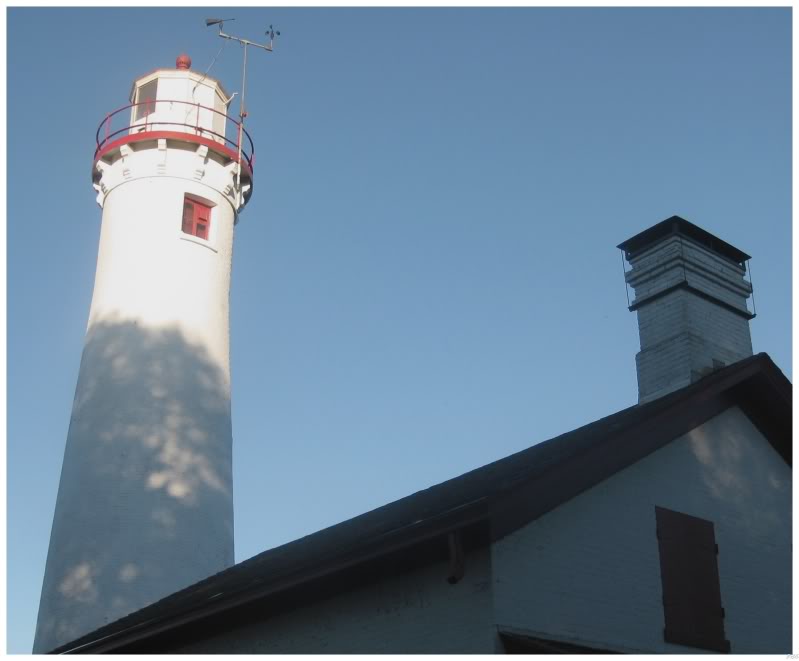
We had one last lighthouse to get at Tawas Point, as we tried to see as many as possible along this Route 23.
Rushing to see a lighthouse at sunset is never a bad idea. Tawas Point Lighthouse has stood in my mind from this trip because of the red glow in which it was cast since we made it there at about 9:30p.m..
We decided to wander into Tawas Bay in front of the lighthouse. I've wanted to swim in every Great Lake for a few years now, so I was happy to check off Lake Huron & to simply wade on the silky smooth sand bottom as warm water washed over my feet, ankles and knees.
I walked a fair distance into Lake Huron. The water never reached higher than my knees & the mosquitoes were just as plentiful. I enjoyed the lighthouse, fireworks & sunset for a bit, but I was getting annoyed with lying flat on my back to keep my body away from the damned mosquitoes. U.J. seemed to enjoy the insects while I was so irate that they were more than enough to force me back to the car.
Life was idyllic in Lake Huron at first, but the bugs seemed to be growing worse & worse. Eventually U.J. came to her senses and we stopped letting the mosquitoes feed.
We stopped for dinner at a pilgrim hat A&W in Standish, before completing the last 3 hours of our journey. We were so tired that there wasn't much reflection on the trip or thoughts at all - mostly zombie-mode driving.
Somehow U.J. drove back to Michigan afterward and I collapsed into my bed after about 3 minutes.
I would wake, pack my luggage, eat lunch & get onto a plane the next day.
Total Distance Covered To Date: 12901km (8014mi)