Newfoundland (Island) Towns, Villages & Hamlets.
400-Series | 300-Series | 200-Series | 100-Series
300-Series Highways (Central Newfoundland)
West to East from Springdale:
- Route 391: Harry's Harbour Road
(37.3 km/23.2 mi)
- Route 391-10: King's Point Road (7.2 km/4.5 mi)
- King's Point: Photographed a handsome old home in King's Point my first run through in November of 2010. Returned in August of 2016 to hike their Alexander Murray Trail.
- Rattling Brook: Of course I hiked up to Rattling Brook's namesake waterfall during my first visit in November of 2010.
- Harry's Harbour: In November of 2010 I liked the look of their hiking trail, but since it was raining, I only photographed a sea stack & left. I finally returned in September of 2020 to hike said trail.
- Nickey's Nose Cove: Passing through in November of 2010, I photographed the NL-391 Nickey's Nose Cove sign.
- Langdon's Cove: I didn't stop in Langdon's Cove on my first run through in November of 2010, then I skipped taking a picture again, when I was there recently. Sigh. I've been to Langdon's Cove.
- Jackson's Cove: How could you pass through Jackson's Cove and not photograph their fine old church? I did so in November of 2010.
- Silverdale: I believe I took a picture of Silverdale on my last trip over there, so a picture of Silverdale should come in a future update. I've been through here previously on that November of 2010 trip.
- Route 392: Beachside Road
(23.1 km/14.4 mi)
- St. Patricks: In February of 2013 I pulled into St. Patricks and snapped a skyline picture from frozen Little Bay. In November of 2020, I went for another look and found a gorgeous old home, but some lady came out and told me they don't like people taking pictures of that old St. Patricks "eyesore".
- Coffee Cove: I would have skipped going to Coffee Cove in November of 2010, if not for finding the 1870s house B&B website the night before. A pleasant little cove & it's fantastic that the owners came along and preserved the old home. I returned in February of 2013 to scare myself somewhat to death by sliding on an ice patch towards Coffee Cove.
- Shoal Arm: Missing Shoal Arm on my first trip to the area, I set out to find Shoal Arm in February of 2013. This was another example of why this see-every-village goal is so great, because I worked hard to find Shoal Arm and it ended up being a neat little community with company houses (!) from the old mine that used to operate there. In November of 2020, I returned to take a closer look at the old mining area.
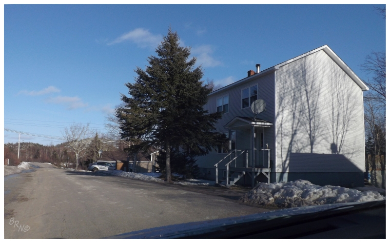
Shoal Arm, 2013.
- Route 392: Beachside Road
(cont.)
- Ferry: Little Bay Islands
- Little Bay Islands: Explored this nearby ferry-to place on a beautiful morning in November of 2011. They're eventually going to resettle Little Bay Islands in the next 5 years; you should get going.
- Little Bay: Checked this one off for my birthday in November of 2010. Nice old homes set upon a flat plateau - I liked Little Bay! I returned in February of 2013 to appreciate Little Bay yet again, photographing a lovely old home they have along the main street. In March of 2014 I would come back yet again, photographing the same old house, but with a scary amount of snow out front. In November of 2020, I stopped at a shed north of town because I needed to explore something abandoned for my birthday.
- Beachside: Photographed some of the funky, mid-century homes in Beachside. I'm not sure why they have so many weird 50s and 60s-style houses. Anyway, we went through town and as well up to Southern Harbour in November of 2010. In March of 2014 I went for another spin up here, stopping at the ocean view area and dreaming of everything in liquid form.
- Route 390: Springdale Road
(17 km/10.6 mi)
- Springdale: Having previously been to Springdale but stopping before the end of town, I went back in February of 2013 to drive the last kilometer of the Springdale road. I've also ate Chinese in Springdale, stayed at the Pelley Inn & went to an adult skate at the arena. In August of 2016, I returned because of their new skatepark. I have to say, well done Springdale! In November of 2020, I headed to Springdale to celebrate my birthday at their skatepark and with a wander around. In December of 2020 I returned to cycle past town on the Ward Harbour Resource Road. In May of 2021 I explored the mine outside town, found a top 5 Newfoundland biking spot outside St. John's, found a new building I hadn't seen within 3 hours of my house, plus hiked to this cool little overlook over Springdale. May 2-4 in Springdale for the win.
- Route 381: Miles Cove Road
(14.9 km/9.3 mi)
- Miles Cove: Nicole & I drove this road as part of my birthday weekend in November of 2010. Included is a foggy picture at dusk of Miles Cove. I've since went back to Miles Cove because I wanted to drive/hike to nearby Wellmans Cove, but there were a bunch of people on the road staring at me, so I left it for another day.
- Port Anson: You drive through Port Anson to get to Miles Cove. I didn't take a picture of Port Anson. In August of 2016 I returned and photographed their skatepark, but decided against taking out all the camping gear just to get my bike out.
- Route 382: Long Island Tickle Road (9.1 km/5.7 mi)
- Lushes Bight: Walked through someone's yard to check out a minor navigation marker in October of 2010. In March of 2014 I got out of the car to photograph frozen stages on a bluebird winter's day.
- Beaumont: Checked out the swimming pond outside Beaumont in October of 2010. I didn't post any pictures from the actual town.
- Beaumont North: Photographed some old Intrepids outside an old house, a view over Beaumont North's Ward Harbour & a few of the headstones up in their Anglican Cemetery; which I wouldn't have found except for wanting to get a distant view of the then-demolished Long Island East End Lighthouse. October of 2010. I returned in March of 2014 with aspirations to take better pictures of this great old house in Beaumont North, but the waist-deep snow and having to cut through a family's backyard kept me on the road.
- Route 380: Beothuk Trail
(52.8 km/32.8 mi)
- Brighton: Driving to check out Brighton for my birthday in November of 2010, I made a point to check out an abandoned house because I like abandoned houses. Someone chewed me out for depicting Brighton in a bad light because of this, so please close my website and add every nice Brighton picture you have to tumblr, Flickr, Panoramio and Wikipedia pages. K thx. Anyway, I went back to Brighton in March of 2013, climbing the lookout trail, photographing an Ivory Gull, photographing my then-missing abandoned house & going to a neat store that was located in a neighbourhood since it used to serve boats, not cars.
- Triton: Stopped in hopes of riding their skatepark in November of 2010, but unfortunately it was wet out and the ramps were made of fibreglass.
- Card's Harbour: I made a point to drive over to Card's Harbour in Triton, but didn't post any pictures.
- Head Harbour: I count Head Harbour by driving along the NL-380, but looking at a map, I should pull onto the Head Harbour road next time.
- Pilley's Island: I stopped to take some picture of the old pyrite mine in November of 2011.
- Robert's Arm: Snapped a picture of the Robert's Arm "loch ness" in November of 2010. Stopping in March of 2014, I snowshoed their Copper Mine Trail, photographed a hare & then snowshoed on frozen Crescent Lake. In September of 2020, I discovered there were streets in Robert's Arm that I never knew were there & took a trip to GFW as an excuse to explore.
- South Brook: I've obviously been through South Brook on the highway & along the NL-380. I've also stopped at the school to check out the stairs and handrail for BMXing, but I've never taken any pictures of South Brook. In July of 2015 I would stop on the TCH to photograph a sunset from South Brook.
- Route 371: Millertown Road
(7 km/4.3 mi)
- Millertown Junction is now a cabin community along the old railway line. It doesn't count as a town in my book, but I've been there regardless. It's coming in an 2015 update later.
- Route 370: Buchans Road
(73.4 km/45.6 mi)
- Buchans Junction: I've been through Buchans Junction to get to Buchans & I've stopped to check out a bit of Buchans Junction, but I never included any of this in an update. I also have always wanted to see the old reindeer corral they have in Buchans Junction. I'll stop there again some day.
- Buchans: I went out of my way to see Buchans in August of 2009 & found it to be awesome. The difference of this mining town versus the ~780 fishing villages of Newfoundland was refreshing. In November of 2011 I went back to my beloved Buchans for my birthday, disappointed to learn I was one week too early to rent the ice, but the consolation was exploring an old dam and some railway remnants. I returned when I drove the Buchans Woods Road in June of 2013. Then again I returned to rent the arena for winter hockey in March of 2014.
- Route 370-11: Millertown Road (6 km/3.7 mi)
- Millertown: I first explored Millertown in November of 2011, loving the setting upon Red Indian Lake, the old lumber mill, hockey arena and company housing. Millertown is a neat little place & I was sad to hear of the local mine closing soon after. In June of 2013 I returned to Millertown to pass through and onto the woods roads past town, going down to Lake Ambrose.
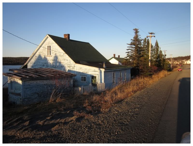
Millertown, 2011.
- TCH:
- Badger: In my 2013 November birthday update I mention going to the Badger Diner, but that's just about all the coverage that Badger has ever received on my site. In September of 2014, I mentioned getting off the bus and setting off to cycle the T'Railway from Badger - but didn't include any Badger pictures yet again. In June of 2017, I photographed their new pump track. In September of 2021, I stayed at a groaty motel in Badger en route to the Burin Peninsula.
- Grand Falls-Windsor: I ate Donnini's at their old location in June of 2009, also stopping to photograph the Roman Catholic church and the exterior of the abandoned, old Grand Falls Academy High. In August of 2009, I managed to photograph the school's interior before it was demolished in early 2012. In July of 2010, I photographed the exterior of their old Ford dealership, before it was torn down in 2014. In October of 2010, I wandered around the courthouse area looking for the Czech pavilion building from the '67 Expo, leaving confused after taking a picture of the courthouse (...and the awesome town hall, plus GF Academy High again). In February of 2011, I drove to GFW to see the Goo Goo Dolls at the Joe Byrne Arena. M'God is the Joe Byrne Arena amazing! Drove back to GFW in February of 2011, staying at the cheap, clean & unique Trailside Inn, while going to a Cataracts playoff game at the Joe Byrne Arena. In November of 2011, I walked around the Grand Falls House and also GF Academy High, the latter having death fences around it by that time. In February of 2013 I spent the night in GFW, attending a Cataracts game and buying a Cataracts shirt, going inside the Catholic church & taking a picture of the mill from the bridge. In November of 2013 I went to GFW to spend my birthday there, riding the slightly slippery but still rideable skatepark & bringing my friend to see his great grandfather's gravesite. In March of 2014 I spent the night in GFW again, waking up early to photograph the great, old buildings of the Windsor side of town. This would be the last time I'd see the old theatre/Riff's occupied. I should have went inside before it closed. In May of 2014 I stopped at Thunder Brook outside town. In October of 2015 I photographed the new townhouses/seniors residences that stand where GFW Academy High used to stand and also an abandoned house that used to stand by the Ford Dealership. In June of 2017 I stopped at the old Pearson's Peak site outside town. In September of 2020, I went for a walk around Grand Falls, played 9, then rode a sweet block in the Windsor section of town.
- Wooddale: One time my friend was going to Carly Rae Jepsen in Grand Falls and I was free to take her car during the concert. A free ride out of Corner Brook & the opportunity to explore?!? Yes please! (This is when I went to Wooddale, but I never made an update for this day. Wooddale is a funny little place of farms and about 10 houses total.)
- Bishop's Falls: Photographed Sacred Heart RC Church after exploring Bishop's Falls for the first time in August of 2009. In March of 2013 I walked their bridge across the Exploits River, finding the small village of Bishop's Falls South to be really interesting. In October of 2015 I stopped to ride their skatepark, but it was too wet (I still posted pictures). In July of 2018 I finally stayed at their municipal campground, and it was cool to be near the falls, but there were still too many people for me.
Bay d'Espoir:
- Route 360: Bay d'Espoir Road (205 km/127.4 mi)
- Harbour Breton: Of course I went to Harbour Breton's Rocky Point Lighthouse during my first Bay d'Espoir visit in July of 2010. I also stopped at their fantastic Sunny Cottage. In May of 2012 I returned to photograph their funky church, sunny harbour and a Wilson's Warbler at the Rocky Point Lighthouse. In June of 2013 I returned to Harbour Breton because their expensive motel is the only motel in the area, where I then spent the evening walking around Dead Man's Cove & visiting Rocky Point Lighthouse (again). In June of 2014 I smartened up and camped at beautiful and relaxing Deadman's Cove, waking up in the morning to walk amongst the rolling caplin and rush up Gun Hill Trail before needing to go home. In June of 2016, I finally checked out the interior of their Sunny Cottage. In July of 2018, I headed down once again trying to get out to Sagona Island, but couldn't find a boat and ended up playing cards in the town gazebo is chilly, foggy weather.
- Route 361: St. Alban's Road
(29.3 km/18.2 mi)
- Head of Bay d'Espoir: I've driven through Head of Bay d'Espoir four or five times now, but never stopped to take a picture or find adventure.
- St. Veronica's: I turned off the road in St. Veronica's when I toured the Bay d'Espoir Hydro Generating Station in July of 2010.
- St. Joseph's Cove: I've went through St. Joseph's Cove four or five times now, but never stopped to take a picture.
- Swanger Cove: I would have went through Swanger Cove in July of 2010. Passed through in 2012 as well, but again didn't post any pictures.
- St. Alban's: Unable to go to the Bay d'Espoir Hydro Generating Station in July of 2010, we drove to the end of the NL-361 and I took a picture of St. Alban's funky grocery store. In May of 2012 I was back in the area and took a picture of St. Ignatius Roman Catholic.
- Route 361-10: Milltown Road (9.6 km/6.0 mi)
- Milltown: I drove down the NL 361-10 to see Milltown & Morrisville in 2012, but didn't include anything about this in the update.
- Morrisville: Morrisville is nice enough to deserve a picture, but I guess I wasn't happy with any of the ones I took there in 2012.
- Route 365: Conne River Road
(17.1 km/10.6 mi)
- Conne River: I have no clue why I didn't drive down this road the first time down in Bay d'Espoir. I got it on my 2nd trip to the area, in May of 2012, snapping a picture of an abandoned geodesic dome house.
- Route 364: Hermitage River Road (37.4 km/23.2 mi)
- Furby's Cove: Missing Furby's Cove in 2010, I returned in May of 2012 and made sure to stop. What a neat little village. I loved the restricted load bridge & some of the old homes.
- Hermitage: After trying to go to Grole in July of 2010, I stopped in Hermitage for chili cheese dogs. In May of 2012, I stopped there for a chicken poutine wrap. In June of 2013 I celebrated finally reaching Grole by eating at Sophie's again, then spending more time in Hermitage by camping at their town park.
- Sandyville-Dawson's Cove: Of course a place called Sandyville is nice for obvious reasons & worthy of exploration time. I've been through here 3 times in 3 different years trying to go to Grole down the road. I tried to spend the night in Sandyville-Dawson's Cove at their 'motel' one of these years, but not planning ahead, I tried to call the number on the door and got no answer.. I could see staying at the Sandyville Inn next time I'm in the area. I stayed at the Sandyville Inn in June of 2016, also going for a little walk around town.
- Seal Cove: I drove through Seal Cove to try and reach the resettled community of Grole in 2010. Unprepared, I turned back after 30 minutes or so. In May of 2012 I returned to try and see Grole, but failed again. Regardless of failure, I had maybe my favourite time camping ever, setting up at an abandoned campground, then watching the sun paint the shore red across from Pass Island. In June of 2013 I finally made it to Grole, going all-out on an update from there. On the way back I finally took a photo in Seal Cove - of a Greater Yellowlegs standing atop a hydro pole. In June of 2016, I passed through again to go check out the scene across from Pass Island again.
- Ferry
- McCallum: In May of 2012, I made my pilgrimage to the beautiful and scenic relic of McCallum. I went on the first boat on a Sunday and spent 6 hours there before returning. A great use of time & effort to see a place that you're not going to be able to see for much longer.
- Gaultois: After going to McCallum in May of 2012, the ferry schedule lined up to give us 90 minutes in Gaultois if we wanted it. So it was a mad dash of picture taking and exploring, where everything looked great in the late day sun. Gaultois was interesting in how seemingly healthy it was even though you can only reach the community by boat. I returned in June of 2014 to hike to Piccaire, a nearby resettled place. Trying to dig up what history I could, I returned to a sunny Gaultois and was impressed with the steps they've taken towards restoring some of their historic buildings.
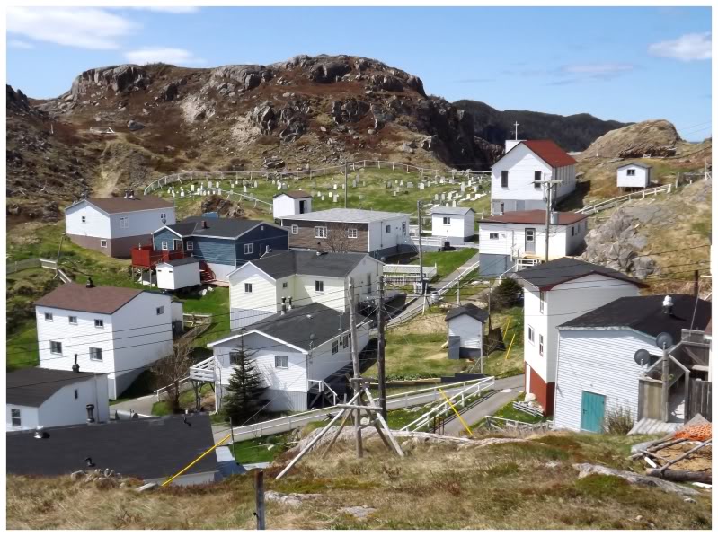
McCallum, 2012.
- Route 362: Belleoram
Road (27.5 km/17.1 mi)
- Route 362-10: Pool's Cove Road (7.9 km/4.9 mi)
- Pool's Cove: Arriving early in June of 2013, I sat on the deck of the ferry and breathed in Pool's Cove for a good 15 minutes.
- Ferry: Rencontre East
(1hr15min)
- Rencontre East: In June of 2013 I spent 5 hours in Rencontre East, walking Dowden's Pond boardwalk, exploring all of the churches and back coves.
- St. Jacques: I included a picture of the church in St. Jacques on my first pass through in July of 2010.
- Belleoram: Even on a dreary July afternoon, I declared Belleoram the most scenic Bay d'Espoir town in 2010. The narrow roads, old church and ability to see St. Jacques Island Lighthouse outside town didn't hurt. In May of 2012 I went inside Belleoram's church and was invited into an old blacksmith shop, where I made a Belleoram friend. In June of 2013 I returned to Belleoram and hiked their Back Cove Trail to see St. Jacques Island from afar, before returning the next day to take a boat out to St. Jacques Island! In addition, we also went for a spin around Chapel Island. In June of 2014 I returned to Belleoram for a fourth time to seek out the old lighthouse pieces dropped off in the barrens.
- Route 363: Coomb's Cove Road
(18.4 km/11.4 mi)
- English Harbour West: I stopped in English Harbour West to walk out to where the lighthouse used to be, then drove around town appreciating the scenery and old homes. July 2010. Hiked the Blue Pinion Walking Trail in July of 2018, as well as noticed a bald eagle on a seastack in English Harbour West, while also commenting on the calm conditions..
- Mose Ambrose: Finally went down the one street I hadn't gone down in Mose Ambrose in July of 2018.
- Boxey/St. John Harbour: I've never included a picture of St. John Harbour or Boxey from Route 363, but to get to Coomb's Cove, you must go through all three.
- Coomb's Cove: I only put a picture from English Harbour West in this update from 2010, but Nicole & I drove to the end of this highway. If you don't believe me then it's a good thing I included a Coomb's Cove picture from when I visited again in May of 2012. Coomb's Cove is a scenic, isolated little community at the end of the Earth - in the end, I'm happy I took the time to get out of the car and explore it. In July of 2018, I went back and checked out a shack above town.
- Route 363-15 Wreck Cove Road (4.5 km/2.8 mi)
- Wreck Cove: You have to turn off of Route 363 onto Route 363-15 to get Wreck Cove here. I did this in May of 2012, one of the first times where I started thinking about seeing every place in Newfoundland. Wreck Cove was beautiful and a testament to the virtue of this endeavour. It was actually so nice that to this day it bothers me that I forgot my camera on ISO800.
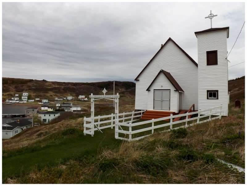
Coomb's Cove, 2012.
Notre Dame Bay (Cont.):
- Route 350: Botwood Road
- Botwood: I stopped in Botwood during November of 2009 to visit Killick Island, an island connected by a causeway where the Americans used to have ammunition bunkers. I drove around Botwood afterward, but failed to have Chinese in their Chinese restaurant/general store, as they keep the sign up but don't serve food anymore. In March of 2013 I spent the night in Botwood at the Dockside Inn, going for an evening walk & photographing pillars out in the harbour, lighthouse road, Killick Island and the exterior of the Harry Ivany Arena. In October of 2015 I stumbled upon their new skatepark and hopped a fire hydraint. In June of 2017 I discovered that they added a mooring cleat to said skatepark.
- Route 350-Peterview Road (2.8 km/1.7 mi)
- Peterview: During that 2009 visit to Botwood, I turned into Peterview and happened to see the town, but didn't post any pictures. I really enjoyed that the local convenience store is in an old school. I liked it enough to go inside an buy a freezee or something.
- Route 350-17: Pleasantview Road (7.9 km/4.9 mi)
- Bobby's Cove: I went out of my way to see Plesantview/Bobby's Cove in March of 2013. As Bobby's Cove was one of the last ~80 villages I had left, I made a point to stop at an abandoned home with an old bus out front.
- Pleasantview: I drove up to Pleasantview from Botwood on a beautiful Sunday in March of 2013, finding a pleasant view over Paradise Cove.
- Point Leamington: I went through enough of Point Leamington on my 2009 trip, but I actually pulled into town and photographed a boat turned into land in March of 2013. I returned in June of 2017 to take a closer look at said boat.
- Route 350-21: Glovers Harbour Road (2.1 km/1.3 mi)
- Glovers Harbour: Finding myself spending the night in Grand Falls-Windsor, I drove up here and discovered their giant squid. (2009) In June of 2018 I hiked the ATV trail over to the resettled community of Lock's Harbour.
- Leading Tickles: Leaving Glovers Harbour in 2009, I drove the remaining 8km up to see Leading Tickles. I got out of the car to take a picture of the sharp cliffs and dogberry bushes of Culls Island. November of 2009. In June of 2017, I stayed at their fine Oceanview Campground and hiked the Nature Trail past the Rowsell's Island Cemetery in the morning.
- Route 352: Fortune Harbour Road
(50.3 km/31.3 mi)
- Phillips Head: I visited the Phillips Head WWII battery ruins in November of 2009. In November of 2013 I returned to Phillips Head to go inside something abandoned for my birthday, happy that my friends also enjoyed their visit.
- Charles Brook/Point of Bay: I drove through both Charles Brook & Point of Bay to get to Fortune Harbour in 2009, but didn't stop to take any pictures.
- Cottrell's Cove: You drive through Cottrell's Cove when you visit Fortune Harbour. I didn't post any pictures from Cottrell's Cove. I took the time to take some more pictures recently and we'll see if those pictures make it into an update.
- Route 352-Moore's Cove Road (2.0 km/1.2 mi)
- Moore's Cove: Seeing a sign for only 2km to Moore's Cove, I obviously drove there, even if I didn't post any pictures. I returned in October of 2015 and posted a picture from the end of the road in Moore's Cove.
- Fortune Harbour: I was blown away by Fortune Harbour's beautiful church when I visited in November of 2009. I finally returned in October of 2015, exploring the forest road past the town & the exterior of a few abandoned houses.
- Route 351: Rattling Brook Road
(11.6 km/7.2 mi)
- Rattling Brook: On Victoria Day Weekend in 2014 I camped in a quarry almost right in Rattling Brook, discovering the steep canyon hiding Rattling Brook in the morning.
- Norris Arm: I dropped a friend off in GFW to see Carly Rae Jepsen, then took her car to explore & conquer Norris Arm in 2012. This is a strange water tower a little bit before the town.
- Route 3-1-09: Alderburn Road
- Alderburn: I exited the highway to see Alderburn on a 2012 day of exploring on the way between Gander & Grand Falls-Windsor. I never made an update with pictures from Alderburn.
- Route 341: Laurenceton Road
(23.2 km/14.4 mi)
- Lewisporte: I've always enjoyed the sheet metal and striped buildings of Newfoundland because they make me feel like I'm in the Northwest Territories or Nunavut. Lewisporte has enough of these buildings that I stopped to photograph their Shoppers and St. Matthew's Church in August of 2009. I also rode my 'peddle' bike at their mediocre skatepark and checked out some old headstones. In July of 2010 I stopped to ride their skatepark again, but grew upset at forgetting how mediocre it was. In November of 2011, I again went through town to see their funky buildings, photographing their fantastic old fire hall. In October of 2013 I was forced into Lewisporte by a snowstorm, taken to the cleaners at the Brittany Inn, but then enjoyed a great meal at the fantastic holdover that is the Oriental Restaurant. In June of 2015, I stopped to ride their new skatepark. In July of 2015 I stopped to finally sample the poutine at Norma's.
- Route 341-10: Stanhope Road (1.4 km/0.9 mi)
- Stanhope: I drove through Stanhope on that day in November of 2011, but didn't take any pictures.
- Porterville/Brown's Arm: I went through and looked around these places en route to Laurenceton, but didn't include a picture.
- Laurenceton: Laurenceton was a fantastic town with old, unique homes. I was happy to go there in November of 2011, photographing the one old home where sheep graze in the front yard. I also drove a dirt road out of town to Sandy Point, to see the modern navigational marker there. In July of 2015 I would return to camp at Sandy Point and explore an abandoned house across the street from the now-missing abandoned house I appreciated in 2011. In July of 2017, I bushwhacked out to some ruins north of town.
- Burnt Arm: I remember searching for the road to the village of Burnt Arm and making sure to take a picture, but I guess I didn't include it in my November of 2011 in the end.
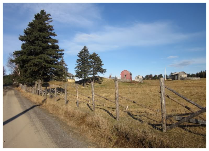
Little Burnt Bay, 2011.
- Route 342: Embree Road
(16.4 km/10.2 mi)
- Little Burnt Bay: Checking out the NL-342 in November of 2011, I photographed some farmland in Little Burnt Bay because it warmed my midwestern heart.
- Masons Cove: I went through Masons Cove heading to Little Burnt Bay from Embree, but didn't stop to take a picture or find any adventure.
- Embree: I obviously snapped a picture of the two ships in Embree in November of 2011. In September of 2016, we camped outside Embree after having to leave Exploits Island early.
- Route 340: Road To The Isles (108 km/67.1 mi)
- Michael's Harbour: I almost hit a moose in Michael's Harbour in August of 2009. I was too busy skirting death to take a picture.
- Campbellton: Stopped to photograph the mill ruins in October of 2011. Returned in June of 2021 to check out the dam ruins further upstream.
- Route 343: Comfort Cove Road
(15.4 km/9.6 mi)
- Comfort Cove-Newstead: Visiting in October of 2011, I photographed a garbage can painted like a can of evaporated milk & the community pasture I found while looking for the abandoned provincial park outside town.
- Loon Bay: I've went for a spin on the eastern side street of Loon Bay, but I never stopped to take any pictures.
- Baytona: I stopped in Baytona in February of 2011, finding it amusing that they changed the name because the mayor's granddaughter liked Daytona, Florida.
- Birchy Bay: I stopped to ride their 'skatepark' in April of 2012. It's nice that they let the kids build a mini ramp as a summer camp project, but boy was it funky. In June of 2018, I camped along the Birchy Bay Resource Road.
- Boyd's Cove: The NL-340 goes right through Boyd's Cove & half of the time you're going slow because you just turned off of the highway to Fogo. In June of 2017 I stopped to take a photo and fail at seeing the interior of an abandoned house I've observed since I moved here.
- Route 344: Cottlesville Road
(8 km/5 mi)
- Summerford: I photographed the dismantling of the local high school for a small engine shop in October of 2011.
- Cottlesville: I drove the length of the NL-344 on my first trip through Twillingate, but back then I didn't think to take a picture of each and every town. This is the only time I've ever been to Cottlesville.
- Virgin Arm: I stopped to explore and photograph their half torn down school, where they oddly kept the two ends intact and in use. August of 2009. In June of 2017 I stopped for a poutine at their Dildo Run Snack Shack before staying at Dildo Run Provincial Park to check out the old tramway.
- Route 345: Moreton's Harbour Road
(10.3 km/6.4 mi)
- Carter's Cove/Chanceport: I drove through both of these communities en route to Moreton's Harbour, but didn't stop to take a picture or find any adventure.
- Bridgeport: I drove the short road to go check out Bridgeport in October of 2011, but didn't include a picture.
- Moreton's Harbour: Visiting for my second time in May of 2014, I loved the totally unique & lingering relic of a homestead with all of the outbuildings. Unfortunately in a state of decay, I'm not sure how much longer each building will last. While worrying about having to talk to the neighbours, I noticed a handsome church up on the hill & went up there to photograph St. Phillip's Church instead. I'd then finally return in June of 2021, but not to check on the homestead, but rather the awesome general store at the centre of town.
- Route 345-20: Valley Pond Road (3.8 km/2.4 mi)
- Valley Pond: I explored all of the communities along the NL-345 in October of 2011, including a picture of the tiny post office in Valley Pond. Returning in May of 2014, I snapped a picture of Valley Pond's beautiful cove.
- Tizzard's Harbour: I drove to Tizzard's Harbour both times I've been on the NL-345, but didn't include a picture from either visit. Usually I appreciate 'end of the world' type places to a greater extent. Odd. Anyway, I'd remedy this in June of 2021, by driving past town and on to the trail that led to Webber's Bight.
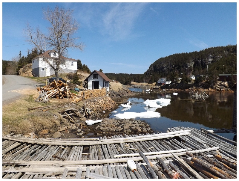
Valley Pond, 2014.
- Route 340: Road To The Isles (Cont.)
- Route 340-Fairbanks Road (3 km/1.9 mi)
- Tilt Cove/Fairbank: I drove down the entirety of this road & included a picture of a personalized, painted mailbox - the problem is that I can't remember if the mailbox was in Tilt Cove or Fairbank. October of 2011
- Hillgrade: I photographed the Hillgrade United Church next to the lobster shack in 2009. In October of 2011 I drove into the actual town, photographing a nice old, mustard-coloured house.
- Newville: In October of 2011 I mentioned taking my time heading back and visiting places like Newville, although I didn't take any pictures of Newville.
- Route 346: Too Good Arm Road
(13.1 km/8.1 mi)
- Pikes Arm: In February of 2011 while scouting out the Bacalhao Island Lighthouse, we found the lookout trail at the end of Pikes Arm and hiked up there for a look. In June of 2017 I'd return and get an even better picture, but yet again fail to find anyone to bring us out to the lighthouse.
- Green Cove/Toogood Arm: On that February 2011 trip to Pikes Arm, I also checked out all of the nearby coves while on the NL-346; but focused the pictures I included to be those from Pikes Arm. (For instance, I remember taking a picture of the NL-346 'Toogood Arm' sign, but didn't include it). I returned to this area in 2014, but as I had already been here & I was in a sour mood, I didn't take any pictures.
- Cobbs Arm: Driving around in June of 2017, I happened upon a ruin from the limestone quarry that used to exist in Cobbs Arm. It's now a shed.
- Route 340-37: Herring Neck Road (6.9 km/4.3 mi)
- Hatchet Harbour: Looking around in hopes of catching a boat to Bacalhao Island Lighthouse, I failed, but spotted a Northern Wheatear on a stone fence in Hatchet Harbour. May of 2014.
- Merritt's Harbour: Typically when I'm looking for a ride out to a lighthouse, I drive around much more than I need, nervously passing on opportunities and choosing to keep driving. While I only included pictures from Hatchet Harbour & Salt Harbour, I also drove all over Merritt's Harbour while looking for the perfect person to ask for a boat ride out to Bacalhao Island Lighthouse.
- Herring Neck: The above explanation also applies to Herring Neck, but I actually have a Herring Neck picture of their Orangeman's Lodge from a previous trip. I apparently didn't make an update for this trip & I can't even remember when it was (sometime in 2010?). Looking on my external hard drive for the last 30 minutes, I can't find this "phantom" trip to the Twillingate area.
- Salt Harbour: Looking around in hopes of catching a lighthouse boat in May of 2014, I only managed to find a nice shot over Salt Harbour. In June of 2021 I returned to check out their Anglican church and hike (part of) Callahan's Cove Trail.
- Indian Cove: I hiked down to Lobster Harbour in May of 2014, but Lobster Harbour is on the other side of the peninsula. I've driven down to Indian Cove, but didn't take any pictures.
- Black Duck Cove: I photographed a decaying boat in Black Duck Cove in October of 2011. Another example of why it's great to visit all towns, as I didn't know about this boat beforehand.
- Route 340-46: Bayview Road
(8.4 km/5.2 mi)
- Kettle Cove: I snapped a picture of 'Kettle Cove South' from Kettle Cove, while exploring the area in October of 2011.
- Manuels Cove/Bayview/Gillard's Cove/Bluff Head Cove: I drove up this road when going to Twillingate on February 2011 winter trip, where I think I photographed an old car in one of these towns. If I didn't come up the NL-340-46 that time, then I came south along it in October of 2011, where I only included a picture from Kettle Cove. I didn't stop to find much adventure or photo opportunities along here.
- Purcell's Harbour: Turned down Purcell's Harbour Road and off of the NL-340, to see the modest homes of Purcell's Harbour and the roosters running about. I didn't include anything about this in my October 2011 update where I was taking time to see the towns of South Twillingate Island.
- Little Harbour: Little Harbour was another town of redemption, where turning off of the road and taking the time to see this seemingly tiny village, paid off with old homes, churches and even an iceberg. Little Harbour is one of my favourites in this area and you'd have no idea from the NL-340. Visited in October of 2011. In June of 2017 I'd return to check out yet another iceberg.
- Twillingate: I first visited Twillingate in 2009, impressed with their nice architecture and a cat being able to climb down a two-story ladder. I returned in February of 2011 for a winter vacation, going inside their George Hawkins Memorial Arena, but not much else. We spent the afternoon/evening in the Anchor Inn after having Twillingate Chinese food and surrendering to the conditions. In October of 2011, I climbed a small hill in the Back Harbour area, along with photographing an old house. In April of 2012 I spent the night in Twillingate trying to take advantage of their cheap motel, but I sadly discovered it was now $40/night more and changed to provide accommodation for tourists - I walked around and photographed their Orangeman's Lodge to cheer myself up. In June of 2017 I discovered they were also hoodwinked into buying a pump track instead of a skatepark. In June of 2018, Isy and I drove up to Twillingate but it was too cold to camp. In June of 2021, I discovered and loved their artisinal coffee drive-thru that was straight out of the Pacific Northwest - plus we went to the boat museum and the local winery.
- Durrell Road
(3.0 km/1.9 mi)
- Gillesport: Trying to figure out where Durrell was in October of 2011, we drove around Gillesport a bit but didn't take any pictures. (I didn't really talk about looking for Durrell in that update, but we drove down Main Street and tried to make sense of the jumble of communities while in Twillingate.)
- Durrell: I briefly drove in Durrell in February of 2011, before retreating because of the horrible conditions and proximity of the road to the ocean. I'd return and see the area in October of 2011, although I didn't include any Durrell pictures in the update.
- Crow Head: I visited Long Point Lighthouse in August of 2009, where you need to drive through Crow Head to get there. I didn't post any pictures from Crow Head. In May of 2014 I passed through Crow Head yet again, camping close-by at Sleepy Cove. In June of 2017, I'd pass through Crow Head to visit Long Point Lighthouse for a third time. In June of 2021, I returned to hike to Nanny's Hole below the lighthouse.
Hamilton Sound:
- Route 335: Farewell Road
(20.1 km/12.5 mi)
- Stoneville: I drove through Stoneville to go to the Change Islands and Fogo Island at various times through the years. Only recently did I stop in Stoneville and take a look at that ship hull out in the bay and this should come in a future update.
- Route 335-14: Change Islands Road (12.1 km/7.5 mi)
- Change Island: I visited the Change Islands in 2009. Quite the underrated and beautiful place. I loved the old buildings and spectacular, barren landscape. I checked out the United Church and the lighthouse, which I sadly learned was demolished when I returned in May of 2014. The May of 2014 trip wasn't a total wash though, as it was nice to be back in the Change Islands, with additional icebergs along the scenic, rocky coast.
- Port Albert: I've went for the short drive to Port Albert every time I've went to the Change Islands, but I never posted a picture of Port Albert. I was in the area again recently, so maybe I'll finally post something from Port Albert in the future.
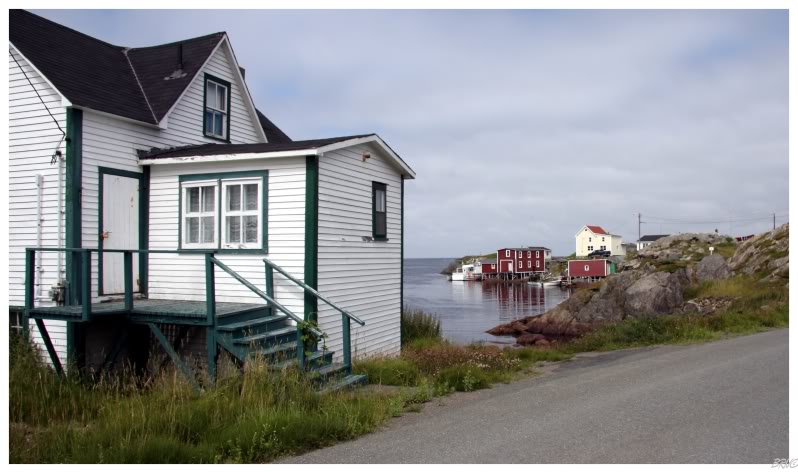
Change Islands, 2009.
- Route 333: Fogo Island Road
(23.7 km/14.7 mi)
- Stag Harbour: When I visited the Change Islands the first time, I had to take the Change-Fogo ferry back, so I got to drive around Stag Harbour for 10 minutes in July of 2009.
- Little Seldom: During my winter trip in January of 2010, I pulled into Little Seldom to briefly check out the scene, but didn't take any photos.
- Seldom: I was very excited to get a new lighthouse in winter by driving into Seldom and right up to Burnt Point Lighthouse in January of 2010. I also took a picture of a nice church in Seldom on this January 2010 trip. In April of 2012, I snapped a picture of their awesome F.U. Trading Co Ltd building and went back to their lighthouse.
- Route 333-18 Deep Bay Road (5.5 km/3.4 mi)
- Deep Bay: I hiked to the Kinden's Hill Lookout in January of 2010. In April of 2012 I hiked up there again to take a spring versus winter photo. I also went further into the Deep Bay barrens now that there was a new (since 2010) artist's retreat back there.
- Route 333-21 Island Harbour Road (6.3 km/3.9 mi)
- Island Harbour: We drove to Island Harbour after Deep Bay in January of 2010, but I didn't include any pictures. In April of 2012 I went for another drive to Island Harbour, this time snapping a picture of their miniscule post office.
- Fogo: I spent the night in the town of Fogo during my January of 2010 winter trip. I climbed Brimstone Head and Fogo Head, while also photographing the Anglican church, BJ's General Store and Kwang Tung during morning walks and afternoon drives. In April of 2012 I stayed the night in Fogo again, photographing churches and mansard roofs, as well as the interior of Kwang Tung. In July of 2015 I returned to photograph a beautiful home, camp at Brimstone Head and climb Brimstone Head at sunset.
- Route 334: Joe Batt's Road
(19.3 km/12 mi)
- Shoal Bay: I went through Shoal Bay to reach Tilting, Joe Batt's Arm & Barr'd Islands. I didn't take a picture of Shoal Bay.
- Barr'd Islands: In January of 2010, I stopped at Mercer Memorial Church to take a picture because there are so very few stone churches in Newfoundland. In April of 2012, I was happy to see that Mercer Memorial was seeing some renovation work. I drove right into Barr'd Island recently, so maybe a picture of something besides Mercer Memorial is in the future. In July of 2015, I photographed Mercer Memorial once again.
- Joe Batt's Arm: I stopped to take a picture of the Brett House in January of 2010.
- Tilting: Visited Tilting during my trip in January of 2010, posting 2 pictures because I loved the old homes and scenery so much. In April of 2012 I included pictures of Snow Buntings and Tilting's fine beach weather in early spring. In July of 2015 I might've climbed a modern navigational marker at the end of town & visited the Lane House Museum. The next day I took a boat tour out the Little Fogo Islands.
- Route 331: Boyd's Cove Highway
(27.3 km/17 mi)
- Route 331-10: Horwood Road (5.7 km/3.5 mi)
- Horwood: I drove down Horwood Road to see Horwood in April of 2012. I included a photo of their modest united church.
- Rodgers Cove/Victoria Cove/Wings Point/Dormans Cove: To get from Twillingate to Fogo Island, I drove the NL-331 here in August of 2009. I drove it again in May of 2014, pulling onto Rodgers Cove Road to make sure I could say I visited all 4 of these communities - even though I didn't include any of this in the update. I've only stopped at the church in Victoria Cove along here, so I don't have many pictures or adventures to share.
- Clarke's Head: I stopped at Clarke's Head's photogenic old church while passing through in August of 2009.
- TCH:
- Glenwood: I went for a spin through Glenwood very early upon moving to Newfoundland & I've since went back and waded in Salmon Brook Falls. In August of 2020, I went to the abandoned camp south of town at Careless Cove.
- Appleton: I've been through Appleton just like everyone who has driven on the Trans Canada Highway,
but I've never stopped to take pictures or find adventure. In August of 2020, I finally stopped to check out the 9/11 beam in Appleton.
- Gander: I drove around Gander in the morning in 2009, appreciating all of their 1960s-style retail buildings. It was also nice to ride a modern skatepark there. In February of 2011, I woke up early to go walk around and appreciate these steel siding square buildings again - specifically the Public Building and St. Joseph's Roman Catholic. In November of 2011, I went to ride their superior-to-Corner-Brook's skatepark as a present to myself for being born. In May of 2014 I found a gravel pit close to town to avoid the hotel racket set up in Gander where you can't find a room cheaper than $140. In October of 2015 I photographed their arena and watched an AHL exhibition game there. In November of 2018, I rode my bike behind the Gander post office. In December of 2020 I explored the Smallwood Piggery, the old town site, and the basement of the old Gander Gardens.
- Route 330: Gander Bay Highway
(135 km/83.9 mi)
- Georges Point: I think I've stop at the Esso here almost every time I pass through. Recently I went onto that cemetery island, so I figure out it's Georges Point & not Clarke's Head, then I'll post pictures of that eventually.
- Harris Point: You need to turn off of NL-330 to see Harris Point, something I didn't do until it was the 4th last community I had left to see on this island. In May of 2014 I finally managed to check out a cool gambrel-roofed house there.
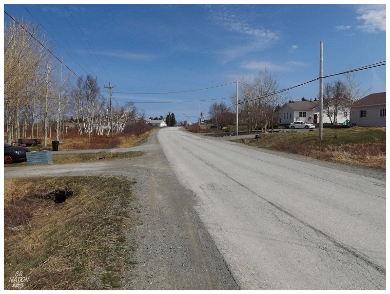
Harris Point, 2014.
- Route 332: Frederickton Road
(23.7 km/14.7 mi)
- Frederickton: I went out of my way to go see the wreck of the Ahern Trader in August of 2009. In November of 2018 I returned, discovering sadly that the north Atlantic hadn't been kind to the Ahern Trader.
- Carmanville/Noggin Cove: I came from Musgrave Harbour to see Frederickton in 2009. Coming from the east, I went through Carmanville & Noggin Cove, but didn't post a picture.
- Main Point/Mann Point/Beaver Cove: I left Frederickton by taking the rough, unpaved NL-332 south through these towns. I didn't post any pictures of Main Point, Mann Point or Beaver Cove.
- Route 330-14: Aspen Cove Road (12.4 km/7.7 mi)
- Ladle Cove/Aspen Cove: I initially went to Ladle & Aspen Cove on my first trip to the area in August of 2009. Not stopping to take many pictures, I didn't mention it in the update. I've recently been back to Ladle & Aspen Cove, so some coverage should come in the future.
- Route 330 Gander Bay Highway (cont.)
- Ragged Harbour/Musgrave Harbour: I've driven through Musgrave & Ragged Harbour while in the area on various trips, but never posted any pictures. In August of 2014 I failed, but in June of 2015 I made it to nearby Peckford Island. In November of 2018 I spent Canadian Thanksgiving in Musgrave Harbour, also posting a picture of a house over in the Ragged Harbour section of town. In June of 2021 we camped outside of town and gawked off at the nearby unconquered lighthouses.
- Deadman's Bay: I've turned into Deadman's Bay & went clear through to that dirt road along the ocean, while looking to get closer to an iceberg. I wasn't happy with the eventual picture, so I've never posted anything from Deadman's Bay.
- Lumsden: I've stayed at Windmill Bight Provincial Park and bought Faxe at the local store along the highway, but never posted a picture from actual Lumsden. August of 2009.
- Cape Freels: In 2012 I went for a quick spin in Cape Freels, barely stopping and not taking any pictures. I've since been back again & some pictures should come.
- Route 330-32: Newtown Road (2.2 km/1.4 mi)
- Newtown: I went for a spin around Newtown in April of 2012, photographing their often-photographed St. Luke's Anglican.
- Templeman/Pound's Cove: The NL-330 goes right through Templeman/Pound's Cove and what you don't drive by, you can see from the treeless road. There are small cove-side roads here to explore, but I've never made the time.
Bonavista Bay:
- Route 320-26: Wesleyville Road (14.7 km/9.1 mi)
- Wesleyville: I walked around their shipyard and took some pictures in August of 2009.
- Brookfield: I drove through Brookfield during my 2009 trip, but didn't stop to take any pictures.
- Badger's Quay: Climbed a ridge to get a shot of the fine St. Alban's Anglican Church in August of 2009.
- Pool's Island: In my August of 2009 update, I mention wandering the confusing roads of Pool's Island, but I didn't include any pictures.
- Valleyfield: Stopped to photograph the exterior of their handsome United Church in August of 2009.
- Route 320-33: Greenspond Road (14.9 km/9.3 mi)
- Greenspond: In April of 2012 I visited Greenspond and loved all of the old, opulent buildings. I thought about asking someone for a ride to their lighthouse, but then thought better of it. I would drive back in July of 2013 set on asking people and full of gusto, but this was back before I learned that it was dumb to go looking for boat rides at low tide.
I've tried some more & therefore additional Greenspond updates are coming. In November of 2016, my friends and I rented an amazing house in Greenspond, ate Marine Take-Out poutine, and listened to Rosie question why we couldn't swim out to Puffin Island Lighthouse. In November of 2018 I amazingly finally made it out to Puffin Island.
- Indian Bay: I was trying to delay driving up to Greenspond and annoying people with asking them to bring me out to the lighthouse. So I therefore turned into Indian Bay and drove down their main road to check out the scene in 2013. I didn't post any of the pictures I took that morning.
- Centreville/Wareham: Once I started thinking more about seeing every community in Newfoundland, I turned into Centreville/Wareham one morning to make sure I had seen enough of this town. I never ended up posting any pictures from this visit in 2013. In July of 2017, I sailed out of Wareham to go to the Fair Islands, Silver Fox Island and Sydney Cove.
- Trinity: I drove all the way out to Trinity from Corner Brook because I thought there was an abandoned amusement park there. This was in August of 2009, before I realized that Newfoundland doesn't force places to have unique names. I photographed the Harbourview Plaza where I went inside inquiring about the abandoned ferris wheel. In July of 2013 I camped in a quarry outside town, but didn't include a picture.
- Dover: You need to drive 2km off of Route 320 to see Dover. I did this in August of 2009 upon seeing a sign for their short lookout trail. I ended up more impressed with the B-18 Bomber wreckage than the fault view.
- Hare Bay: I stopped to take seaside pictures of Hare Bay on my first run around this peninsula in August of 2009. In April of 2012, I photographed the quaint Davis Electronics Ltd store.
- Middle Brook: Middle Brook seems to be the place where I was when I thought I was in Gambo. I've tried to stay at the former David Smallwood Provincial Campground in Middle Brook but it was full. I've also purchased goods at the LC and waited about 20 minutes for Cap'n Sub in Middle Brook - then I took my Cap'n Sub and ate it in the town park along the namesake water feature of Middle Brook. So what have I done in Gambo then?
- Gambo: I would have driven through Gambo at the start of this August 2009 update. In June of 2012 I checked off 'gravel pit camping' from the NL to-do list by camping on Mint Brook Road outside Gambo. In November of 2016, Shelloo and I drove around looking for something to ride, but a wooden 3-stair wasn't what I was looking for.
- Route 3-1-06: Benton Road
(1.7 km/1.1 mi)
- Benton: I first broke up the Terra Nova to Gander drive by stopping in Benton in 2010. I showed my friend Benton in 2013. I didn't make an update or post pictures from either of these trips.
- Route 310: Glovertown-Salvage Highway
(28.7 km/17.8 mi)
- Glovertown: Visited the old mill ruins of Glovertown in July of 2009. I then camped at them in August of 2011.
- Route 310-10: Glovertown Main Road (4 km/2.5 mi)
- Saunders Cove: Missing Saunders Cove on my 2012 trip to go see Culls Harbour/Eastport, I went back for Saunders Cove in May of 2013. I didn't post any pictures of Saunders Cove, although I remember there being some older homes where I would have liked to stop.
- Route 310-13: Culls Harbour Road (3.1 km/1.9 mi)
- Culls Harbour: I drove across the single lane bridge into Culls Harbour during my June 2012 visit. Culls Harbour was one of those neat little tucked away places that the geography nerd in me loved.
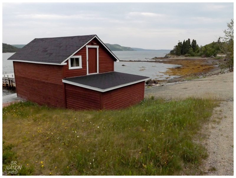
Culls Harbour, 2012.
- Route 310: Glovertown-Salvage Highway
(cont.)
- Traytown/Sandringham/Eastport: Driving from Culls Harbour to Burnside, I went through Traytown, Sandringham & Eastport. I only stopped in Eastport to photograph an old house, but this picture never made it into the June of 2012 update. I also drove around Traytown one night when I really didn't want to stealth camp in Glovertown, but unable to reach any of the cabin establishments, I returned to Glovertown.
- Happy Adventure: You need to turn off of Route 310 to visit Happy Adventure. I did this during my June 2012 visit, posting a picture of their welcome sign.
- Sandy Cove: You need to turn off of Route 310 to visit Sandy Cove. I obviously posted a picture of the beach during my June 2012 visit.
- Salvage: Salvage is stunning and would be in the conversation if someone asked me where they should go in Newfoundland. I was surprised by this beauty during my June 2012 visit.
- Route 310-32: Burnside Road
(7.5 km/4.7 mi)
- St. Chad's/Burnside: In June of 2012 I turned off of this road to check out tiny Clay Cove, so you can rest assured that I checked out St. Chad's & Burnside as well. I remember Burnside making me feel like I was in rural Newfoundland.
- Ferry: St. Brendan's
(1 hour)
- Dock Cove: In June of 2012 I took the ferry to Cottle Island & its 4 communities. Included is a picture of an abandoned house in Dock Cove, where the neighbours watched me like a hawk.
- Haywards Cove: In the June of 2012 St. Brendan's update, I included a coastline picture of Haywards Cove.
- Shalloway Cove/St. Brendan's: I visited Shalloway Cove & St. Brendan's in June of 2012, but only posted pictures from Dock Cove & Haywards Cove.
- Route 301: Terra Nova Road
(17.4 km/10.8 mi)
- Terra Nova: Within the national park there is a 17.4 km road to the town of Terra Nova. I had a whole afternoon to get back across the island one day so I finally drove here in 2013 and found a neat railway bridge and old store/warehouse buildings. Terra Nova was a fascinating little historic village that made me happy to go about seeing everywhere in Newfoundland.
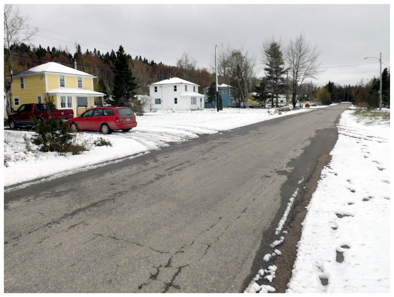
Terra Nova, May of 2013.
Other Places: 400-Series | 300-Series | 200-Series | 100-Series
Or Return to the Main Page of this Website.


